
Why Mamshit National Park stands out
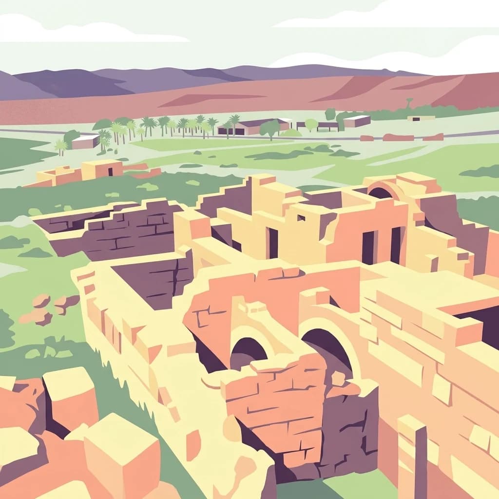
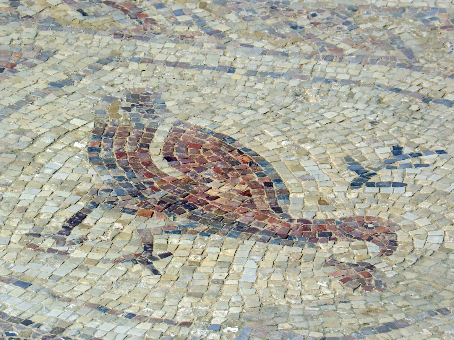
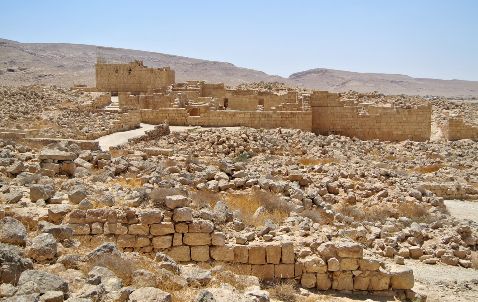
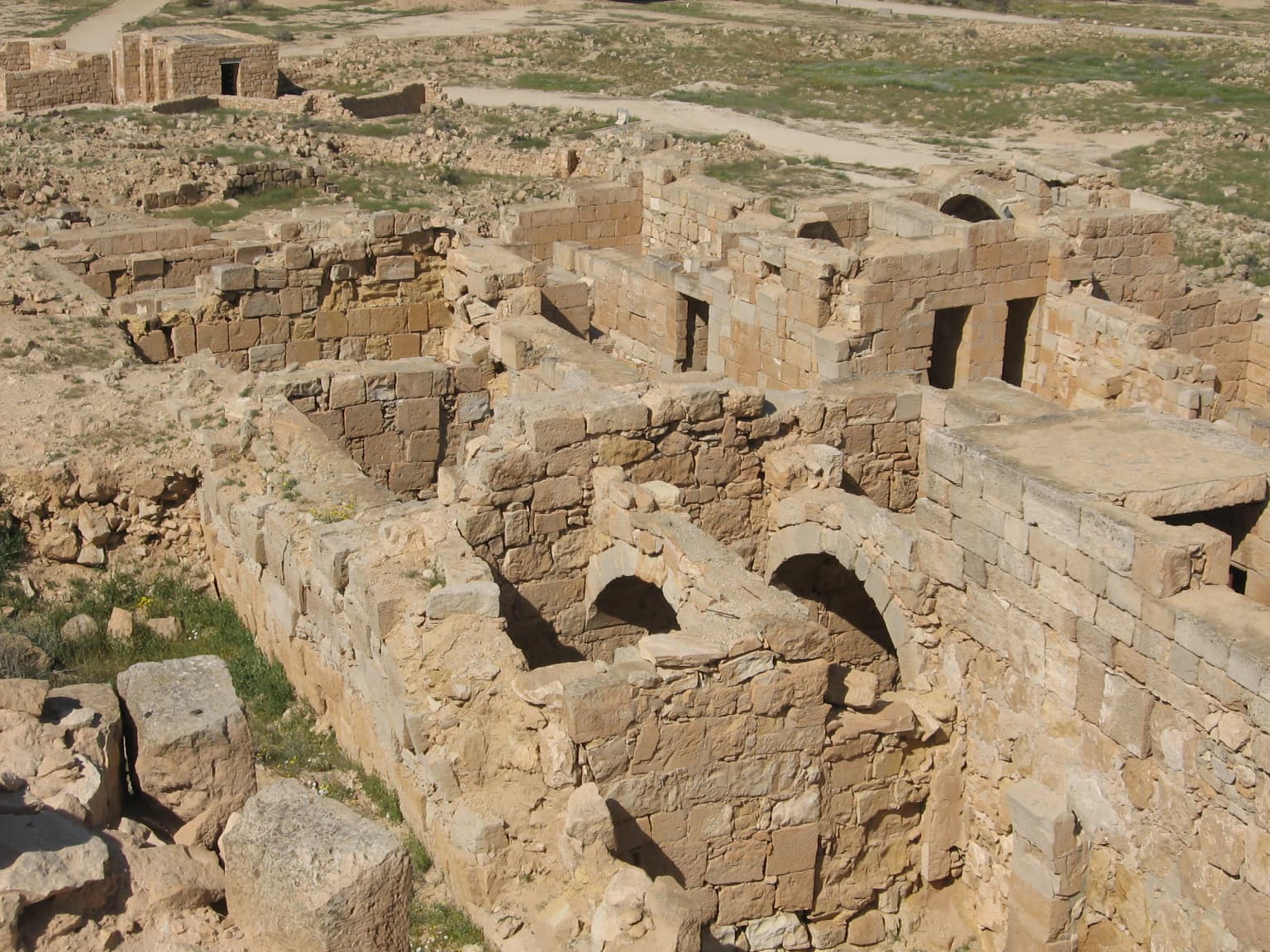
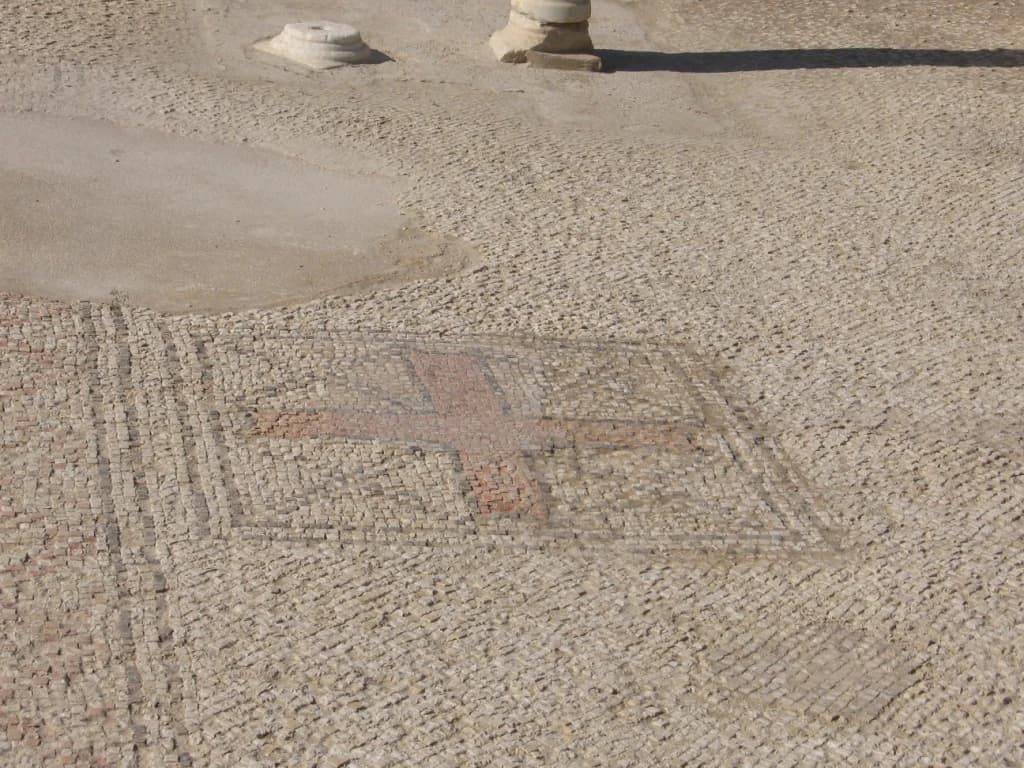
Mamshit is best known for its exceptional preservation of Nabataean urban architecture, featuring entire streets and residential complexes that remain largely intact. The city is distinguished by its luxurious private houses with unusual architectural elements not found in any other Nabataean settlement, including carefully chiseled stonework and remarkably well-constructed archways supporting ceilings. The two Byzantine churches, particularly the Western St. Nilus Church with its colorful mosaic floor depicting geometric patterns, birds, and fruit baskets, represent significant early Christian archaeological finds. The discovery of a massive hoard of 10,500 silver coins weighing 72 kilograms further underscores the city's historical wealth and importance.
Mamshit National Park history and protected-area timeline
The history of Mamshit spans several centuries and civilizations, beginning with its founding as a Nabataean trade post in the 1st century BCE connecting Petra with Gaza. The city's strategic position on the Incense Road made it a vital waystation for caravans carrying frankincense, myrrh, and other valuable commodities from Southern Arabia. Following the Roman annexation of the Nabataean Kingdom in 106 CE, the city transitioned from trade-focused commerce to developing a lucrative reputation for breeding Arabian horses, with a Roman garrison stationed to guard the southern imperial border. Large dams were constructed around the city during this period, two of which survive to the present day. The Byzantine period between the 3rd and 5th centuries CE marked a phase of official support as a frontier city, during which the two churches were constructed. Funding ceased under Emperor Justinian I, and the city went into decline, effectively ceasing to exist by the mid-6th century CE. Before the establishment of the State of Israel, Prime Minister David Ben-Gurion envisioned Mamshit as the capital of the future country, reflecting his dream of settling the Negev Desert. Archaeological investigation began in the 19th century, with thorough surveys conducted by Alois Musil in 1901 and the British Foundation in 1937, followed by systematic excavations between 1956-1957 by Hebrew University and the National Parks Authority.
Mamshit National Park landscape and geographic character
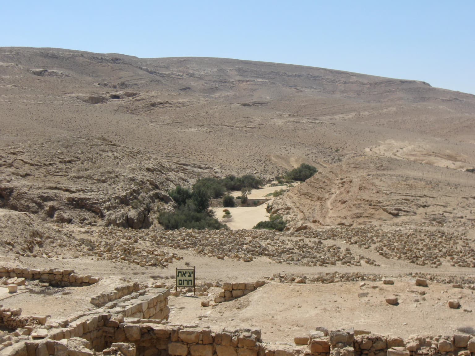
Mamshit is situated within the arid expanse of the Negev Desert, a region characterized by stark geological formations, wadis, and extreme environmental conditions that shaped both the natural and human history of the area. The city was built near a river valley, with the surrounding landscape dominated by desert plains and sandstone formations that provided both building materials and natural barriers for the settlement. Two ancient dams constructed south of the city along the Mampsis river demonstrate the sophisticated water management systems developed by inhabitants to harness rare flash floods and sustain agricultural activity in this challenging environment. The landscape reflects the harsh but visually striking terrain of the southern Israeli desert, where ancient travelers and traders navigated through pass routes like Ma'ale Akrabim to reach the oasis cities and trade routes connecting Arabia with the Mediterranean coast.
Mamshit National Park ecosystems, habitats, and plant life
The natural environment of Mamshit reflects the extreme conditions of the Negev Desert, one of the most arid regions in Israel with limited rainfall and sparse vegetation. The park's ecological significance lies not in biodiversity but in demonstrating how ancient civilizations adapted to and thrived in challenging desert environments through innovative water collection, agricultural techniques, and trade network participation. The surrounding desert landscape supports specialized drought-adapted flora and fauna capable of surviving in this harsh climate, though the primary ecological value of the site today lies in its preservation of the historical cultural landscape rather than active ecosystem protection.
Mamshit National Park wildlife and species highlights
Wildlife in the Mamshit area reflects the desert-adapted species typical of the Negev, including various reptiles, small mammals, and insects adapted to arid conditions. The region serves as an unlikely habitat for desert fox, various lizard species, and numerous bird species that migrate through the desert corridor. However, wildlife observation is not a primary feature of the park, whose significance lies primarily in its archaeological and historical value rather than ecological diversity or wildlife habitat.
Mamshit National Park conservation status and protection priorities
Mamshit National Park represents a significant conservation achievement in preserving the physical remains of ancient Nabataean and Byzantine urban civilization in the desert environment. The site's inclusion as a component of the UNESCO World Heritage-listed Incense Route - Desert Cities in the Negev provides international recognition and protection under the 1972 World Heritage Convention. The park is managed by the Israel Nature and Parks Authority, which has undertaken extensive restoration work to stabilize ruins and reconstruct key architectural elements that allow visitors to understand the city's original layout and appearance. Conservation challenges in the desert environment include erosion, weathering of stone structures, and managing visitor impact on the sensitive archaeological remains. The preservation approach balances archaeological integrity with public accessibility, enabling contemporary audiences to connect with ancient cultural heritage.
Mamshit National Park cultural meaning and human context
Mamshit embodies the cultural intersections of multiple civilizations that shaped the ancient Near East, from its origins as a Nabataean trading settlement through Roman administration and Byzantine Christian transformation. The city's Arabic name, Kurnub, derives from a traditional drink made from camel milk and date honey, reflecting the continued cultural relevance of the site in the region long after its urban occupation ended. The Hebrew name Mamshit was assigned by the Negev Naming Committee, which chose to Hebraize the ancient name, stating that leaving the original Greek name was impossible because it was a foreign name. The site illustrates the broader phenomenon of desert urbanism in the ancient world, where strategically positioned caravan stations evolved into permanent settlements that participated in regional trade networks, agricultural production, and cultural exchange across centuries.
Top sights and standout views in Mamshit National Park
The most compelling highlights of Mamshit National Park include the exceptionally well-preserved street layout and residential architecture that offers visitors an authentic sense of ancient Nabataean urban life, the two Byzantine churches with their distinctive mosaic floors featuring geometric patterns and symbolic imagery, and the impressive engineering of the ancient dams still visible at the site. The discovery of the largest coin hoard ever found in Israel, comprising 10,500 silver coins weighing 72 kilograms, provides tangible evidence of the city's wealth and commercial significance. The site's inclusion in the UNESCO World Heritage designation connects it to a broader cultural landscape that tells the story of ancient trade routes and desert civilization. The reconstruction work has created a visitable heritage landscape where visitors can trace the city's evolution from a desert trading post to a Roman frontier settlement to a Byzantine Christian community.
Best time to visit Mamshit National Park
The optimal time to visit Mamshit National Park is during the cooler months of spring and autumn, typically between March and May and September through November, when temperatures are more moderate for exploring the outdoor archaeological site. Summer temperatures in the Negev Desert can be extremely high, potentially making extended visits uncomfortable, while winter may bring brief but unpredictable rainfall that could affect access. The desert environment offers a dramatic backdrop during sunset hours, when the sandstone ruins take on warm hues that enhance the atmospheric quality of the site. Early morning visits allow for comfortable exploration before the day's heat intensifies and provide opportunities for photography in softer light.