Why Mananara Nord National Park stands out
Mananara Nord National Park is particularly notable for its remarkable plant endemism and unique primate populations. The park is home to Dypsis antanambensis, a critically endangered palm species found nowhere else on Earth, and Voanioala gerardii, an extremely rare coconut species. Perhaps most significantly, the park contains the only known population of Allocebus trichotis, commonly known as the hairy-eared dwarf lemur, which is found only along the Mananara River corridor. The marine component with its three offshore islands provides important nesting habitat and supports coastal marine ecosystems that complement the terrestrial protected area.
Mananara Nord National Park history and protected-area timeline
The establishment of Mananara Nord National Park reflects Madagascar's broader commitment to protecting its exceptional biodiversity through formal protected area designation. While the specific year of establishment is not detailed in the available source material, the park was created as part of Madagascar's national park system administered by the Madagascar National Parks Association, the primary governmental body responsible for managing the country's protected areas. The inclusion of a marine component in the park's designation represents an integrated approach to coastal zone management that recognizes the ecological connections between terrestrial and marine environments. The park's boundaries were delineated to encompass the Mananara River watershed and associated coastal ecosystems, incorporating both existing forest cover and areas requiring conservation intervention.
Mananara Nord National Park landscape and geographic character
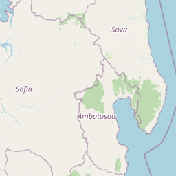
The landscape of Mananara Nord National Park spans a dramatic transition from inland forest environments to coastal and marine settings. The terrestrial portion features a terrain shaped by the Mananara River and its tributaries, including the Sandrakatsy and Fotsialanana rivers, which have carved valleys through the coastal plain. The land rises gently from the coastal zone toward the interior, with elevations supporting diverse forest types. The marine component extends the protected area offshore to three islands situated approximately 3.5 kilometers from the village of Sahasoa: Nosy Antafana, Nosy Hely, and Nosy Rangontsy. These islands feature coastal vegetation and beach environments, with Nosy Antafana containing a campground near natural springs. The park's eastern boundary along the Indian Ocean incorporates coastal ecosystems including beach habitats and near-shore waters that support marine biodiversity.
Mananara Nord National Park ecosystems, habitats, and plant life
The ecological character of Mananara Nord National Park is defined by its position in northeastern Madagascar's humid forest zone and its integration of marine coastal environments. The park supports lowland forest ecosystems that, while subject to historical disturbance, retain significant biological value including populations of endemic species. The riparian corridors provided by the Mananara River and its tributaries serve as important pathways for species movement between inland and coastal habitats. The marine component protects coastal waters that support coral reef communities and associated fish populations, while the offshore islands provide nesting habitat for seabirds. The combination of terrestrial forest protection with marine conservation creates an integrated ecosystem approach that recognizes the connections between land and sea in this coastal region.
Mananara Nord National Park wildlife and species highlights
Mananara Nord National Park is distinguished by exceptional species endemism, particularly among flora. The park contains two particularly notable plant species: Dypsis antanambensis, a palm species endemic to this region of Madagascar and considered threatened due to its restricted range, and Voanioala gerardii, a rare coconut species representing an evolutionary lineage of significant botanical interest. Among fauna, the park is critical habitat for Allocebus trichotis, the hairy-eared dwarf lemur, which represents one of Madagascar's most range-restricted primate species and is found only in the Mananara River area. The marine islands provide habitat for seabird species and potential nesting sites for marine turtles, while coastal waters support reef-associated fish species and other marine organisms.
Mananara Nord National Park conservation status and protection priorities
The significance of Mananara Nord National Park lies in its protection of species with extremely limited distributions and ecosystems that face mounting pressure across Madagascar's eastern coast. The presence of Dypsis antanambensis and Voanioala gerardii, both with highly restricted ranges, makes the park globally important for plant conservation. The Allocebus trichotis population represents a conservation priority given the species' extremely limited geographic distribution. The integrated terrestrial and marine protected area approach demonstrates recognition of coastal ecosystem connectivity and provides protection for both forest-dwelling species and marine environments. Management by Madagascar National Parks Association connects the park to the nation's broader protected area network while addressing site-specific conservation needs.
Mananara Nord National Park cultural meaning and human context
Mananara Nord National Park is situated in a region where local communities maintain connections to the landscape through traditional land use practices. The park includes coastal areas near the village of Sahasoa, where fishing and other coastal activities form part of local livelihoods. The presence of campground facilities on Nosy Antafana indicates that visitor use is incorporated into the park's management framework, with infrastructure supporting access to the island environment. The park's proximity to Mananara Nord town provides a regional center with historical connections to the surrounding landscape.
Top sights and standout views in Mananara Nord National Park
Mananara Nord National Park offers a rare combination of endemic species protection and coastal-marine diversity within a single protected area. The park protects globally significant plant species including one of the world's rarest palms and a critically endangered coconut relative. The presence of Allocebus trichotis, found nowhere else on Earth, establishes the park as a critical site for lemur conservation. The marine component with three offshore islands provides ecosystem diversity uncommon among Madagascar's protected areas, supporting both marine biodiversity and visitor recreation opportunities. The park's location along the Mananara River creates scenic and ecological connections between inland forest and ocean environments.
Best time to visit Mananara Nord National Park
The optimal period for visiting Mananara Nord National Park corresponds to Madagascar's dry season from approximately April through October, when precipitation is reduced and trail conditions are more favorable for exploration. The cooler months of June through September typically offer more comfortable conditions for hiking and wildlife observation. Visitors interested in marine activities such as snorkeling around the offshore islands may find the period from September through November particularly suitable when ocean conditions are generally calm and visibility improves. The wet season from November through March brings higher rainfall that can affect access to some park areas and make forest trails more difficult to navigate, though this period also supports lusher vegetation throughout the protected area.