

Mori Atlas logo
Natural monumentMilíčovský les a rybníky

A dense mosaic of oak woodland, wetland pond chains, and protected meadow habitats within an urban setting.

Milíčovský les a rybníky: Mapping the Protected Natural Monument Landscape in Southern Prague

(Přírodní památka Milíčovský les a rybníky)

Milíčovský les a rybníky stands as a significant natural monument on the southern outskirts of Prague, preserving a rare ecological enclave of mature oak-hornbeam forest and complex wetland systems. This protected area connects a series of ponds along the Milíčovský potok to create diverse habitats including alder carrs, reedbeds, and wet meadows. Understanding the geography of this site reveals a vital transition zone where natural terrain persists within an densely developed urban and industrial region.

urban nature reservenatural monumentoak-hornbeam forestlowland deciduous forestpond systemwetland mosaic
A flat-style vector illustration showing a waterfall cascading between large rock cliffs into a pond, framed by green trees and reeds.

Milíčovský les a rybníky

Natural monument

Park overview

Structured park overview, official facts, and landscape profile for Milíčovský les a rybníky

Milíčovský les a rybníky park facts, protected area profile, and essential visitor context

Review the core facts for Milíčovský les a rybníky, including designation, size, terrain, visitor scale, habitats, and operating context in one park-focused overview.

About Milíčovský les a rybníky

Milíčovský les a rybníky represents a notable case of a protected natural area embedded in a major European city. Stretching across roughly 82 hectares of forest and roughly 7 hectares of non-forested habitats, the natural monument sits between the large Jižní Město housing estate to the north and the D1 motorway corridor to the west, with the village territory of Újezd u Průhonic anchoring it to the south.

Ecologically, the site functions as a refuge for habitats that have largely disappeared from the Prague basin: stands of pedunculate and sessile oak with hornbeam, small areas of old spruce that are gradually being replaced by native broadleaves, alder-lined brooks, and a chain of ponds supplied by the Milíčovský potok. Wet meadows in the northern part of the protected area add a further layer of habitat complexity, supporting orchids, sedges, and a rich insect fauna.

The protected area also carries significant social importance. It serves as the closest substantial green space for tens of thousands of residents of Jižní Město, offering benches, children's playgrounds, and a 4.8-kilometer educational nature trail completed in 2011. That recreational role, while valued, also brings challenges, as heavy footfall, dog-walking, and cycling pressure have become key conservation concerns. Management efforts since the late 2000s have focused on restoring native broadleaf composition, reducing fish stocking pressures in the ponds, and protecting amphibian breeding sites, making the natural monument a working example of urban conservation in central Europe.

Quick facts and research context for Milíčovský les a rybníky

Milíčovský les a rybníky is a Czech natural monument (IUCN category III) located in the Prague 4 administrative district, within the municipal part of Praha-Újezd near the village of Újezd u Průhonic. The protected landscape lies within the Průhonická plošina foothills, with a gently rolling terrain at roughly 265 to 295 meters in elevation, sitting on Proterozoic shale bedrock under clay-rich soils.

The site was legally declared a natural monument on 30 December 1991, although protection efforts are documented from 1988, and it is owned and managed by the City of Prague through its Environmental Protection Department. It falls within the Botič-Milíčov natural park and within the European Natura 2000 network as the Milíčovský les Site of Community Importance, with the great capricorn beetle as a key protected species.

Protection and recognition

Examine the documented terrestrial protection scope and recognition history

Milíčovský les a rybníky Protection Status and Conservation Records

Milíčovský les a rybníky maintains a recorded terrestrial protection status within the regional conservation framework. Official records outline the baseline designation scope and management context without additional international recognition sources.

Protection details

Protection scope
Terrestrial
Transboundary protection
No
Park context

Deeper park guide and search-rich context for Milíčovský les a rybníky

Milíčovský les a rybníky history, landscape, wildlife, and travel context

Explore Milíčovský les a rybníky through its history, landscape character, ecosystems, wildlife, conservation priorities, cultural context, and seasonal travel timing in a structured park guide built for atlas discovery and search intent.

Why Milíčovský les a rybníky stands out

The site is best known for hosting one of the few known populations of the great capricorn beetle (Cerambyx cerdo) in the Czech Republic, a species for which the surrounding Natura 2000 area was proposed. It is equally recognized for its exceptionally rich amphibian fauna, with around 14 to 15 species recorded, making it the most amphibian-diverse locality in Prague. Beyond these headline species, the site is valued for the unusual combination of a mature lowland oak forest, a set of managed ponds, and extensive reedbeds and wet meadows persisting within an otherwise densely urban setting. Birdlife, dragonflies, and rare plants of the littoral zone give the area a strong wetland character despite its small size and city-edge location.
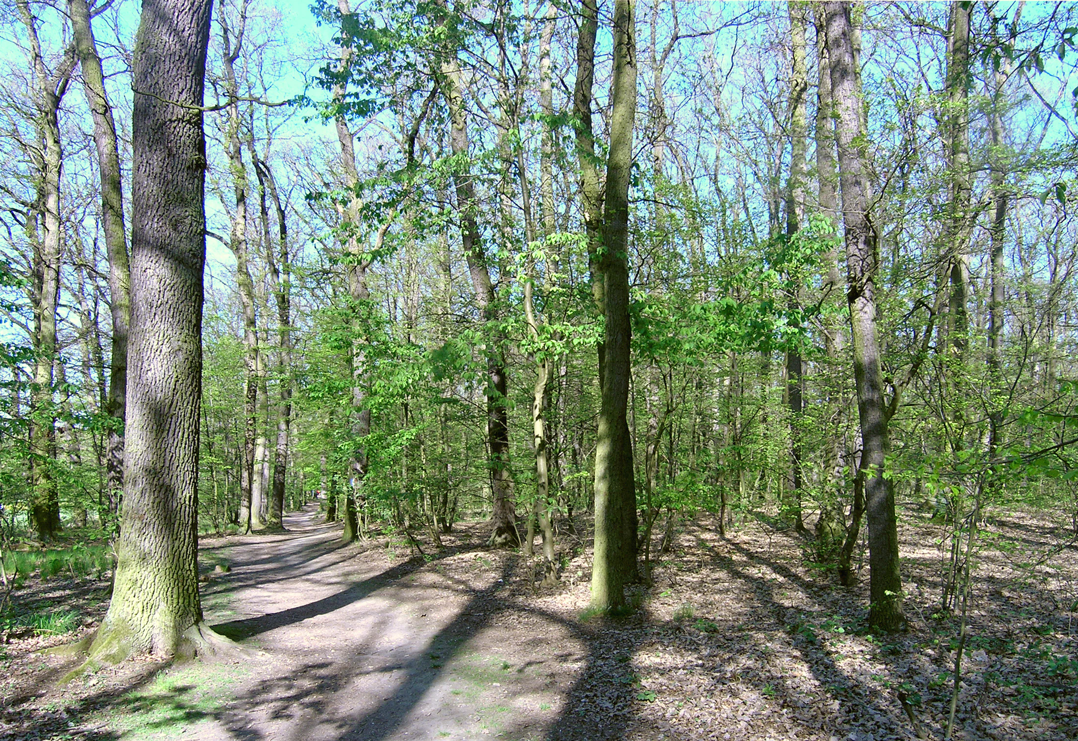
A dirt trail winds through a deciduous forest with tall trees and dappled sunlight on the ground.
A shaded walking trail through the Milíčovský Forest in Prague.

Milíčovský les a rybníky history and protected-area timeline

The forest at Milíčovský has older roots than its current protected status suggests. It was originally established in the 18th century as a game enclosure and pheasantry, becoming a well-known hunting ground in the 19th century under Arnošt Emanuel Silva-Tarouca, the same figure associated with the creation of the nearby Průhonice Park. During the 19th and early 20th centuries, the area was deliberately planted with species that later proved unsuitable for the site, including Norway spruce, Douglas fir, red oak, Canadian poplar, larch, and black locust, much of which still dominates parts of the canopy today.

The original ponds, lying northwest of the present-day main pond, gradually silted up and were replaced by wet meadows, reedbeds, and willow stands, while 1980s urban development brought significant drainage that altered the forest's hydrology for decades to come. The area's ecological importance was formally recognized in 1988, when it was declared a natural monument for the protection of forest and wetland communities of plants and animals; the current legal designation was confirmed on 30 December 1991.

In more recent history, the site has been shaped by active management rather than just passive protection. Since 2007, thinning of spruce stands has been underway, with replacement planting of oak, fir, lime, and beech. A formal management plan covering 2010 to 2019 introduced further recommendations on pond management, reedbed protection, invasive species control, and visitor pressure. The completion of the 4.8-kilometer educational trail on 31 October 2011 marked a new phase of public engagement, which has intensified both awareness and the conservation challenges that accompany it.

Milíčovský les a rybníky landscape and geographic character

The terrain of Milíčovský les a rybníky is gently undulating, characteristic of the Průhonická plošina plateau where it sits at the contact of the Prague, Průhonice, and Uhříněves plains. Elevations range narrowly between about 265 and 295 meters, producing a soft, lowland topography rather than dramatic relief.

The underlying geology consists of Proterozoic shales belonging to the Štěchovice-Zbraslavice group, overlain by clay-rich cambisols, with pseudogleys and gleys forming where the ground becomes waterlogged. These heavier, moisture-retaining soils are central to the site's character, supporting both the broadleaf forest and the extensive wetland mosaic that distinguishes the area from much of the surrounding landscape.

The visible landscape is defined by three interwoven elements. The forest forms a dense, mostly closed canopy dominated by oaks, with smaller proportions of lime, birch, spruce, alder, and hornbeam; broad forest edges frame the ponds and meadows. The pond system, fed by the Milíčovský potok, creates open water surfaces, including the largest Milíčovský (Nový) pond, the small Kančík, and Homolka. Reedbeds, sedge stands, and alder carrs surround the water, grading into wet meadows to the north, so the terrain shifts smoothly from woodland to marsh to open meadow within a relatively compact footprint.
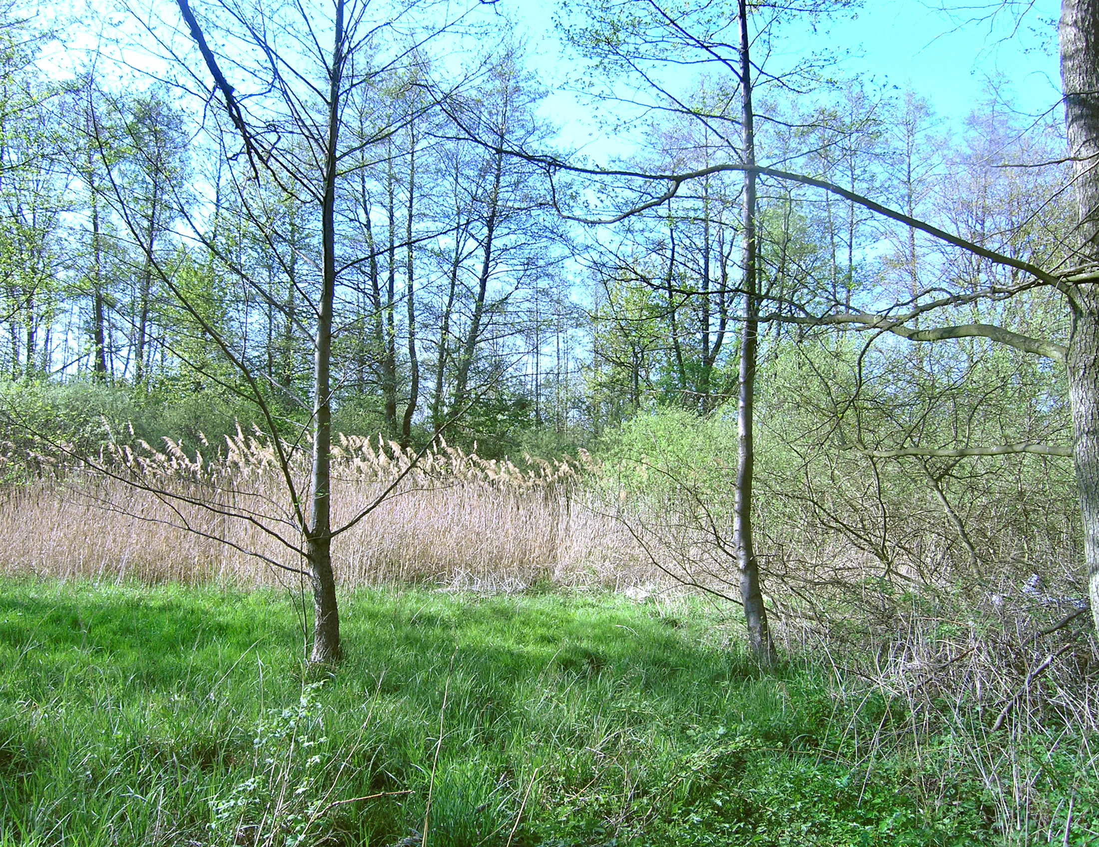
A green forest interior in spring with tall slender trees, a patch of tall dry reeds in the midground, and lush grass in the foreground.
A view of the woodland and marshy undergrowth in Milíčovský les.

Milíčovský les a rybníky ecosystems, habitats, and plant life

The natural monument encompasses a remarkably compressed mosaic of lowland habitats. The forest is the largest component, with oak species making up roughly two-thirds of the canopy, accompanied by small-leaved lime, silver birch, alder, scattered hornbeam, and a still-visible legacy of spruce, Douglas fir, red oak, Canadian poplar, larch, and black locust from 19th-century plantings. Beneath this canopy, the understory includes typical Central European woodland species such as wood anemone, hepatica, and greater stitchwort, while the herb layer in the dampest parts of the forest is unusually rich.

Wetland and aquatic habitats make up the rest of the character. The ponds host submerged and floating plant communities with several pondweed species, including the strongly threatened hair-like pondweed, along with strandwater crowfoot and hornwort. Around the shoreline, littoral reed communities of narrow-leaved cattail, common reed, reed canary grass, and lake bulrush give way to sedge-dominated marsh and, further out, to damp meadows on which protected species such as the marsh orchid (Dactylorhiza majalis) and the dioecious valerian still persist.

The site also preserves small but ecologically valuable stands of alder carr on waterlogged soils, where species like tufted sedge (Carex elata), dioecious valerian, and a range of mosses thrive. Together these habitats create a continuous gradient from open water through marsh and wet meadow to closed forest, sustaining an unusually high concentration of species within a small urban-edge reserve.
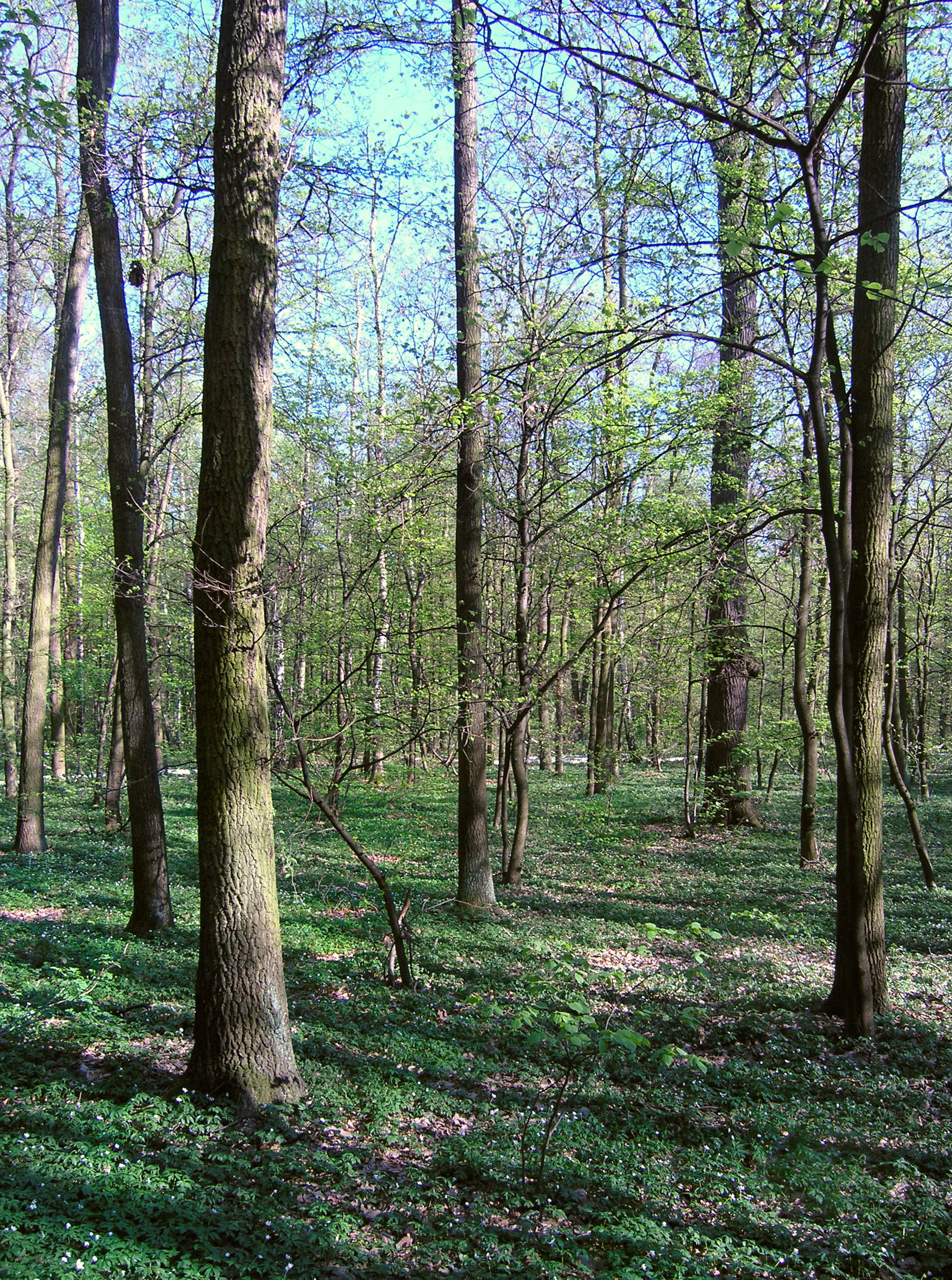
Sunlit forest scene with tall tree trunks and a ground cover of small white flowers in the Milíčovský les.
A tranquil view of the forest floor and canopy in Milíčovský les, Prague.

Milíčovský les a rybníky wildlife and species highlights

Wildlife is one of the defining strengths of the natural monument. The ponds and surrounding marshes support what is widely regarded as the richest amphibian fauna in Prague, with around 14 to 15 species recorded, including the strongly threatened smooth newt, great crested newt, common toad, and common spadefoot toad, alongside widespread species such as water frogs, agile frog, and European tree frog. Reptiles are less abundant but include the slow worm and sand lizard, both strongly threatened, along with the grass snake.

The dragonfly and butterfly fauna of the ponds and wet meadows is similarly diverse. Dragonflies, damselflies, ground beetles, butterflies, and moths tied to reedbeds, sedges, and willow stands are well represented; several species are considered indicators of high habitat quality. The forest harbors notable beetles as well, including the protected Calosoma inquisitor and the stag beetle, but the headline species is the great capricorn beetle, confirmed in sun-exposed oak stands on the Homolka pond dam and central to the site's Natura 2000 designation.

Birds are abundant across both forest and water. Pond-side species include the strongly threatened great egret, great reed warbler, common kingfisher, and water rail, alongside typical waterbirds such as little and great crested grebes, common pochard, tufted duck, mute swan, common moorhen, and coot. The forest supports the Eurasian sparrowhawk, little owl, golden oriole, and Eurasian hobby, while wet meadows host lapwing, common snipe (historically), and increasingly rare birds like the grey partridge and crested lark. Mammals include the typical small mammals, red deer, wild boar, roe deer, and several bat species that roost in old trees, reinforcing the value of retaining veteran and dead wood within the forest.
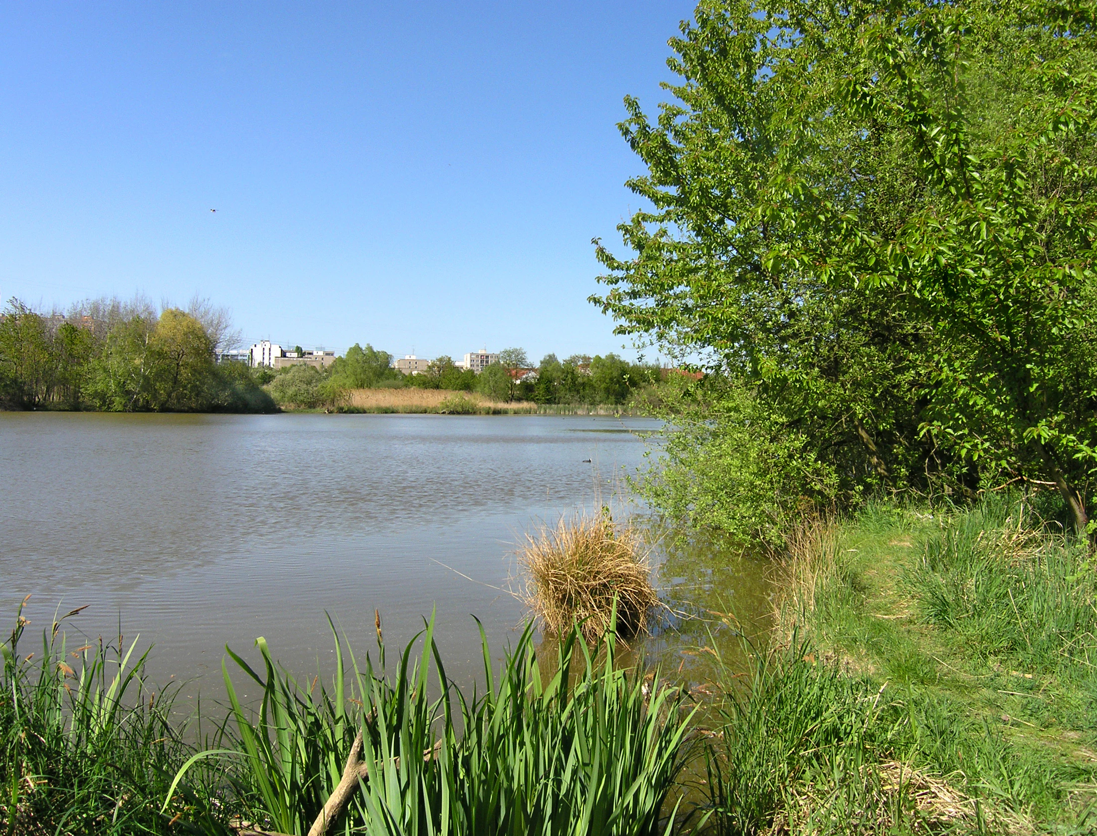
A calm, brown-toned pond surrounded by lush green trees and grasses under a clear blue sky, with buildings visible in the far background.
A view of a pond in the Milíčovský les area.

Milíčovský les a rybníky conservation status and protection priorities

Conservation at Milíčovský les a rybníky is shaped by the tension between legal protection and intense urban pressure. The site is a designated natural monument under Czech law, part of the Botič-Milíčov natural park, and a designated Site of Community Importance within the European Natura 2000 network, with the great capricorn beetle as a primary subject of protection.

The current management plan has prioritized species recovery alongside habitat improvement. Active thinning of spruce stands and replacement with native oak, fir, lime, and beech has been under way since 2007, addressing the legacy of historically inappropriate planting. Pond management plans call for reduced fish stocking, particularly of common carp in the main pond, because dense carp populations outcompete and prey on larvae of protected newts and worsen eutrophication. Recommendations also include limiting spring drainage of ponds, gentle sediment removal from the main pond, and the creation of a bird island, all of which are intended to be carried out outside the amphibian and bird breeding season.

The plan further addresses threats from the surrounding city. Concerns include trampling of rare plants, disturbance from free-roaming dogs and their impact on amphibian clutches and water quality, nutrient enrichment, and the potential contamination risk posed by the nearby Milíčovský háj housing development, which alters the historical water flow into the ponds. Control of invasive species, notably small-flowered touch-me-not and water fern, regular rotational mowing of meadows, retention of old stumps as insect habitat, and reducing new recreational infrastructure are all part of the ongoing strategy to keep this small urban-edge reserve ecologically viable.

Milíčovský les a rybníky cultural meaning and human context

Although the area is primarily valued for its natural features, it carries a distinct local identity shaped by its history as a 19th-century hunting estate and its enduring role as a neighborhood green for one of Prague's largest housing estates. The original wooded enclosure, once managed by Silva-Tarouca alongside Průhonice Park, gave the surrounding localities a sense of landscape continuity that survives despite the modern suburb that has grown around it.

The Milíč settlement and the older hunting lodge Český Milíčov root the area in the rural history of the southern Prague countryside. Today, the natural monument has become a cultural landmark in its own right for residents of Jižní Město, providing a familiar recreational setting with playgrounds, shelters, and an educational trail; in this sense its cultural importance lies as much in everyday community life as in any formal heritage designation.
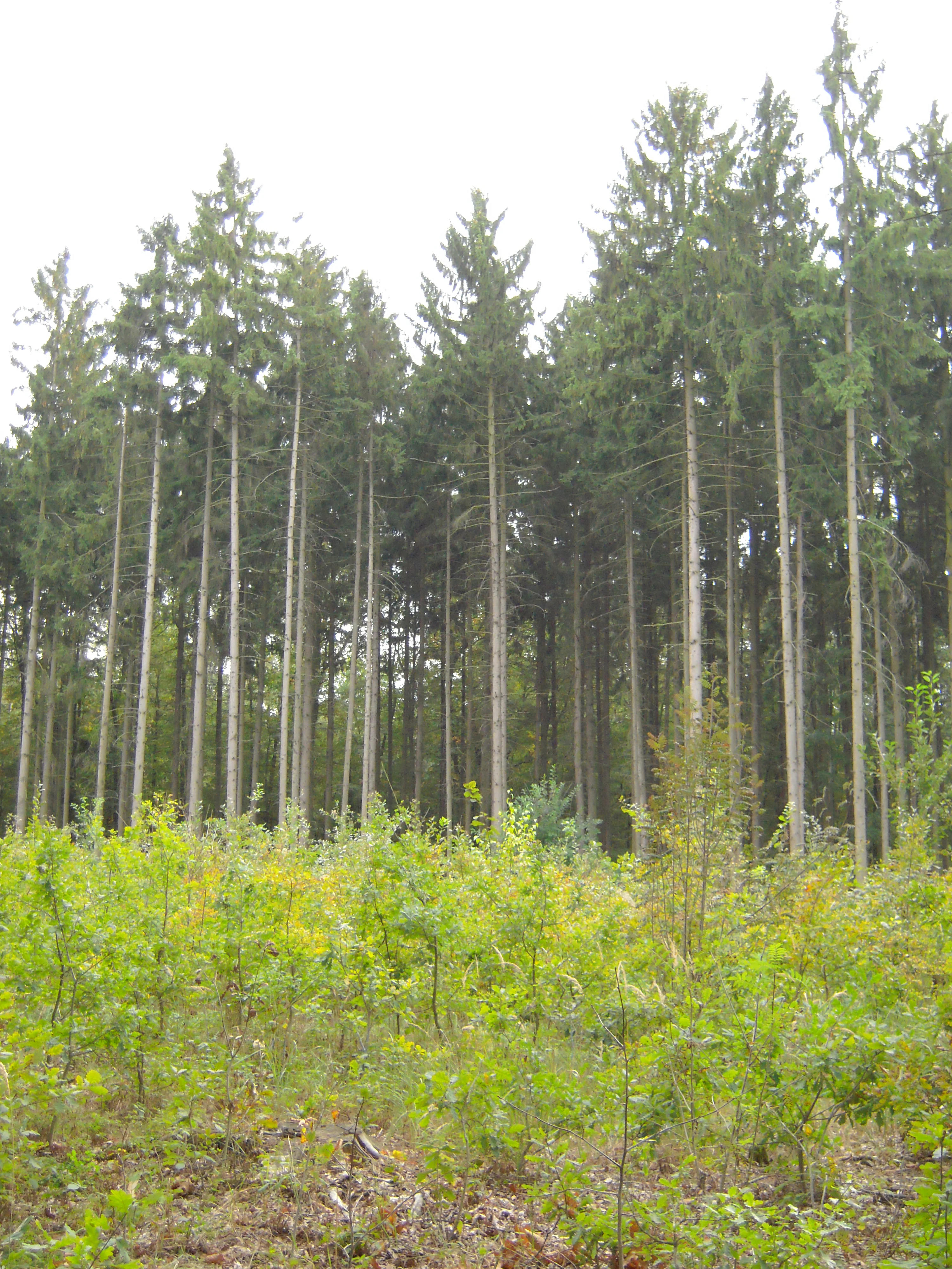
A view of a mature spruce forest with a foreground of young saplings and cleared undergrowth.
A spruce section of Milíčovský les undergoing forest thinning.

Top sights and standout views in Milíčovský les a rybníky

Among the strongest points of distinction for Milíčovský les a rybníky are the concentration of protected species within an urban-edge setting, the rare Prague population of the great capricorn beetle, and the amphibian-rich pond chain. The five-pond system on the Milíčovský potok forms a compact but ecologically complete wetland mosaic.

Equally striking is the contrast between the mature oak-hornbeam forest, the mosaic of wetland habitats, and the dense residential and infrastructural landscape that surrounds them. The site's combination of a Natura 2000 designation, an active management plan, and a well-used educational trail makes it a clear example of how small protected areas continue to function as both ecological refuges and community spaces within a major European city.
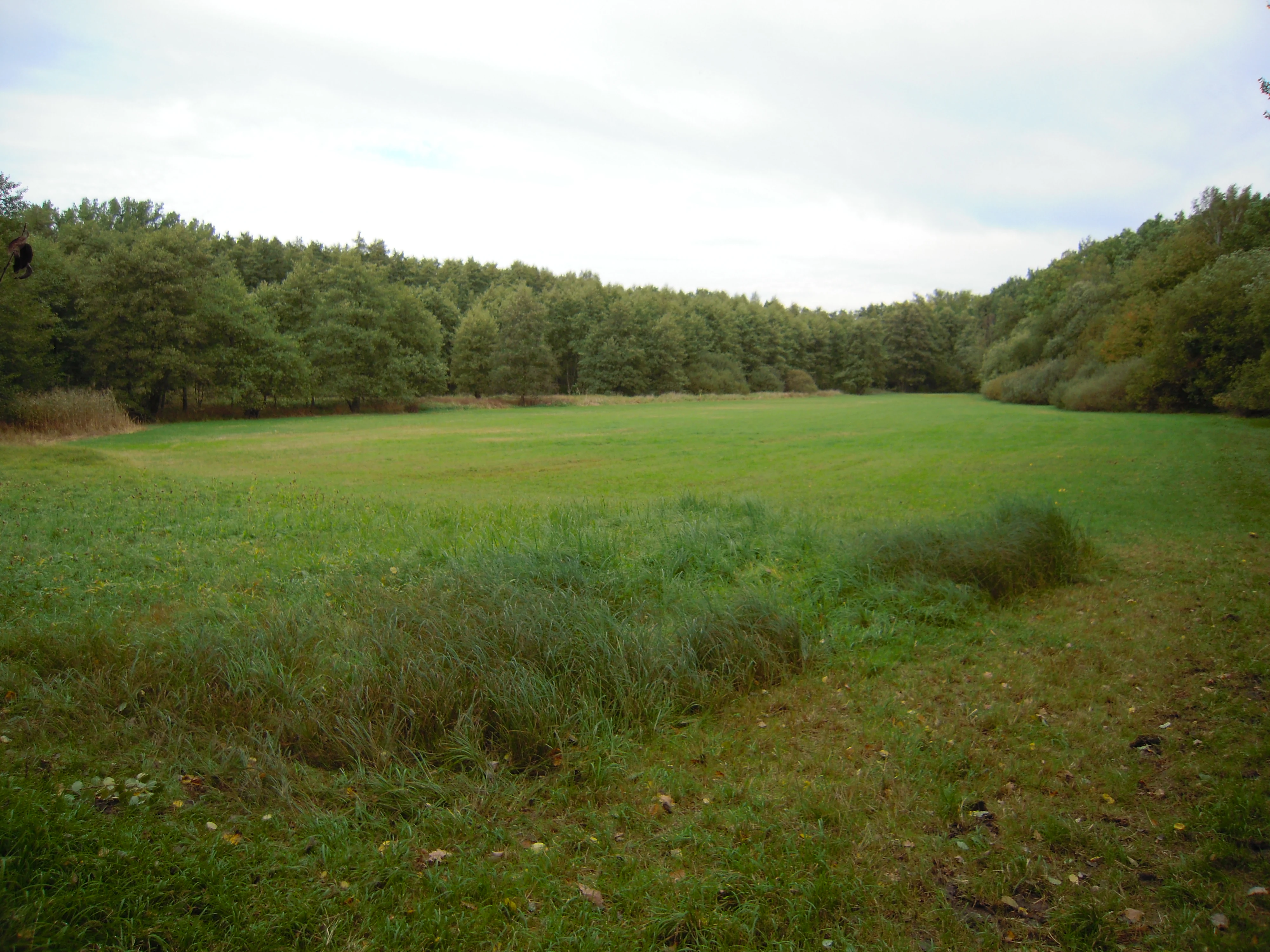
A wide, flat green meadow surrounded by a dense forest under an overcast sky.
A grassy meadow bordered by woodland in Milíčovský les a rybníky.

Best time to visit Milíčovský les a rybníky

The natural monument can be visited throughout the year, but spring and early summer offer the richest experience, when amphibian activity around the ponds peaks, reedbeds are in full growth, and woodland flowers emerge in the forest understory. These months also coincide with the period when management works are restricted in order to avoid disturbing breeding amphibians and nesting waterbirds, so the area naturally reflects this seasonal rhythm.

Late spring and early summer further bring out the dragonfly and butterfly activity that the wetlands support. Autumn highlights the canopy coloration of the dominant oaks, while winter visits allow quieter observation of waterbirds and easier visibility along the educational trail, making any season rewarding for visitors interested in the area's wildlife character.

Monthly climate preview

Long-term representative monthly temperature and precipitation patterns for Milíčovský les a rybníky

Milíčovský les a rybníky Climate Normals and Annual Weather Rhythm

Historical climatology records for Milíčovský les a rybníky reveal measured annual temperature swings from sub-zero winter minimums to warm summer maximums alongside steady precipitation rates. Reviewing the complete twelve-month dataset provides a detailed baseline of long-term weather normals across the protected landscape.
Annual mean9 °C
-2 °C20 °C
Jan-2°
Feb-1°
Mar
Apr
May13°
Jun17°
Jul20°
Aug19°
Sep14°
Oct
Nov
Dec-1°
Warmest month
July

19.7 °C

Coolest month
January

-2.2 °C

Wettest month
June

2.6 mm/day

Driest month
February

1.1 mm/day

Park location guide

Geography guide, regional context, and park location map for Milíčovský les a rybníky

Milíčovský les a rybníky park geography, regions, and map view in Czechia

Understand where Milíčovský les a rybníky sits in Czechia through a broader geographic reading of the surrounding landscape, nearby location context, and its mapped position within the national park landscape.

How Milíčovský les a rybníky fits into Czechia

Czech Republic is a landlocked Central European country with a population of approximately 10.9 million people. The nation was established as an independent state on January 1, 1993, following the dissolution of Czechoslovakia. Its capital and largest city is Prague, with other major urban centers including Brno, Ostrava, Plzeň, and Liberec.

Wider geography shaping Milíčovský les a rybníky in Czechia

The Czech Republic is a landlocked country in Central Europe. It is bordered by Germany to the west, Austria to the south, Poland to the northeast, and Slovakia to the southeast. The landscape is predominantly hilly, with the territory covering 78,871 square kilometers.

Map view of Milíčovský les a rybníky

Use this park location map to pinpoint Milíčovský les a rybníky in Czechia, understand its exact geographic position, and read its mapped placement within the surrounding landscape more clearly.

Pigeon | © OpenStreetMap contributors

Location context for Milíčovský les a rybníky

Prague

Visualizing the oak forests, pond chains, and wetland habitats of this protected natural monument.

Milíčovský les a rybníky Photos and Landscape Scenery

Visual documentation reveals the mature deciduous woodland, connected pond systems, and wet meadow mosaics that define the protected landscape. Examining these field photographs helps researchers and observers understand the distinctive terrain and habitat structure preserved within the urban periphery.

A dirt trail winds through a deciduous forest with tall trees and dappled sunlight on the ground.

A calm, still pond with a muddy, grassy bank in the foreground and a dense line of trees in the background under a clear sky.

A green forest interior in spring with tall slender trees, a patch of tall dry reeds in the midground, and lush grass in the foreground.

Sunlit forest scene with tall tree trunks and a ground cover of small white flowers in the Milíčovský les.

A calm, brown-toned pond surrounded by lush green trees and grasses under a clear blue sky, with buildings visible in the far background.

A calm, reflective pond surrounded by dense green deciduous trees and shrubs, with a fallen tree trunk partially submerged along the muddy shoreline.

A view of a mature spruce forest with a foreground of young saplings and cleared undergrowth.

A wide, flat green meadow surrounded by a dense forest under an overcast sky.

Park atlas

Compare surrounding regional geography and connected wetland habitats

Parks Near Milíčovský Les A Rybníky and Other Protected Landscapes

Continue exploring regional protected areas and wetland reserves connected to Milíčovský les a rybníky. Compare adjacent lowland forests and pond systems to understand the broader ecological network across the surrounding plateau.
A pale, soft-toned watercolor painting of a rolling landscape featuring a stream in the foreground, scattered trees in the midground, and faint mountains in the distant background.
Protected landscapePraha
About 0.2 km away#1 closest

Northeast

Přírodní park Botič-Milíčov: Protected Landscape, River Valley, and Forest Map

A preserved green refuge featuring meandering streams and pond networks near Praha.

Přírodní park Botič-Milíčov stands as a significant protected landscape in Praha, defined by the seasonal flooding of the Botič and Pitkovický streams. The park hosts alluvial forests, a series of historic ponds, and archaeological traces of ancient mills. Through map-based exploration, identify the diverse terrain that includes rocky outcrops at Pitkovická stráň and extensive broadleaf woodlands on the edge of urban housing developments.

Area
8.24 km²
Established
1984
Relief
Lowland
Climate
Temperate
A soft watercolor painting of a winding stream moving through green meadows with distant rolling hills and a light, misty atmosphere.
Natural monumentPrague
About 3.2 km away#2 closest

North

Meandry Botiče Natural Monument: Mapped Geography and Protected Stream Landscapes in Prague

Analyzing the ecological boundaries and riparian terrain of the Botič stream corridor

Meandry Botiče represents a significant natural monument in Prague, distinguished by its pronounced stream meanders and dense bankside vegetation. This site offers deep insights into urban conservation, documenting the delicate balance between native riparian flora and the pressures of encroaching residential districts within a managed protected environment.

Area
0.067 km²
Established
1968
IUCN
III
Relief
Lowland
A soft watercolor painting of a green landscape featuring a small body of water, rolling hills, and trees, painted in a minimalist style on a white background.
Protected landscapePrague
About 3.7 km away#3 closest

Northwest

Hostivař-Záběhlice Nature Park: Protected Landscape and Mapped Prague Geography

River valleys and reservoir terrain within the capital city.

Hostivař-Záběhlice Nature Park represents a vital natural zone in Prague, characterized by the mature forests and meandering river paths along the Botič stream. This record highlights the park's geographic composition, including its reservoirs, lowland forest patches, and its function as a preserved natural corridor within the city.

Area
4.23 km²
Established
1990
Relief
Lowland
Climate
Temperate
A watercolor painting showing a panoramic landscape with a rocky quarry ledge in the foreground, green hills in the midground, and soft, pastel colored rolling hills in the background.
Natural monumentPrague
About 5.1 km away#4 closest

Northeast

Rohožník, lom v Dubči: Geological Natural Monument and Protected Landscape in Prague

Analyzing the Ordovician quartzite and tectonic rock exposures of the Prague Plateau

Rohožník, lom v Dubči serves as a crucial natural monument in the Prague region, protecting abandoned quarries that showcase clear M-shaped tectonic folds and thick quartzite deposits. This site acts as a living laboratory for geological history, connecting archaeological finds with dry grassland communities in an otherwise suburban-agricultural landscape on the edge of the capital.

Area
0.034 km²
Established
1988
IUCN
III
Relief
Upland
A soft watercolor painting of a rural landscape with light green meadows and clusters of trees under a pale, washed-out sky.
Protected landscapePrague
About 5.9 km away#5 closest

Northeast

Přírodní park Říčanka: Protected Landscape and Geographic Map of Eastern Prague

An analysis of rural corridors, aquatic systems, and forest terrain.

Přírodní park Říčanka preserves an extensive rural ribbon of meadows, arable fields, and woodland patches on the eastern edge of Prague. This structured overview details the park's topography, its historic fishpond chain along the Říčanský potok, and the various natural monuments that characterize this protected Czech landscape.

Area
4 km²
Established
1984
Relief
Lowland
Climate
Temperate
Nature reservePrague
About 6.8 km away#6 closest

West

V hrobech Nature Reserve: A Protected Botanical Island within the Urban Landscape of Prague

Rare dry-grassland habitats in the Kamýk district

V hrobech is a designated nature reserve in Prague featuring 1.3 hectares of southeast-facing slopes and species-rich grassland. This site is home to rare thermophilic plants and represents an important example of intensive conservation management in an urban environment. Its protected boundaries connect with local forest fragments to maintain ecological value amidst the residential developments of Lhotka and Libuš.

Area
0.013 km²
Established
1988
IUCN
IV
Relief
Lowland
Nature reservePraha 5
About 9.9 km away#7 closest

West

Prokopské údolí Nature Reserve: Geological Mapping and Protected Area Discovery

A limestone karst landscape situated within the Praha 5 district

Prokopské údolí is an essential protected nature reserve in Praha 5, featuring a deep limestone valley that serves as a globally significant site for Paleozoic fossils and karst geography. This protected landscape encompasses a range of habitats including rock steppes, thermophilic woodlands, and volcanic outcrops, providing a unique look at urban-adjacent nature conservation and historical limestone quarrying within the Czech Republic.

Area
1.71 km²
Established
1978
IUCN
III
Relief
Upland
A watercolor illustration depicting a panoramic landscape with a golden meadow in the foreground and soft green hills in the distance.
Protected landscapeStředočeský kraj
About 13 km away#8 closest

Northeast

Přírodní park Škvorecká obora, Králičina: Protected Landscape and Regional Geography

Natural terrain and historic forest near the Prague boundary

Přírodní park Škvorecká obora, Králičina preserves a layered cultural and natural landscape characterized by the Výmola stream floodplain. The area functions as a vital forest habitat on the eastern edge of the Prague Plateau, integrating rare botanical sites with historical remnants of a centuries-old game enclosure.

Established
2009
Relief
Lowland
Climate
Temperate
Access
Easy access

Common questions about visiting, size, designation, and location context for Milíčovský les a rybníky

Milíčovský les a rybníky FAQs for park facts, access, geography, and protected area context

Find quick answers about Milíčovský les a rybníky, including protected-area facts, park geography, trail and visitor context, and how the park fits into its surrounding country and regional landscape.
MoriAtlas Explorer

Continue Your Protected Areas Search Across the Global Atlas

Deepen your exploration by continuing the structured search for national parks and protected areas worldwide. Utilize the comprehensive filtering capabilities to compare different conservation landscapes and refine your understanding of global park geography. Discover more about the distribution and characteristics of protected natural areas.

Global natural geography