
Mori Atlas logo
Nature reserveMittleres Rurtal mit den Felsbildungen der Perdsley und Wiselsley

Examining the Rur river valley terrain, steep forested slopes, and distinct rocky outcrop landscape

Mittleres Rurtal mit den Felsbildungen der Perdsley und Wiselsley Protected Nature Reserve Geography

(Naturschutzgebiet Mittleres Rurtal mit den Felsbildungen der Perdsley und Wiselsley)

The Mittleres Rurtal mit den Felsbildungen der Perdsley und Wiselsley nature reserve in Nordrhein-Westfalen represents a key protected segment of the Rur river valley. This geography-focused profile details the mosaic of riparian woodland, ancient beech and oak forests, and the characteristic Perdsley and Wiselsley cliff formations. Analyze the mapped boundaries and natural river dynamics that define this important Eifel region habitat.

river valleyriparian woodlandbeech forestoak forestrock formationsravine forest
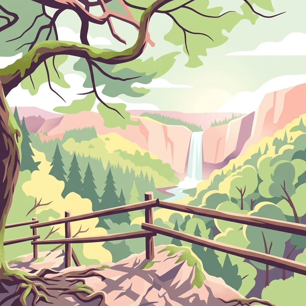
A stylized digital illustration of a mountain lookout point. In the foreground, there is a wooden post and rail fence on a rocky ledge. A gnarled tree branch arches overhead. In the distance, a valley with forest cover and a prominent waterfall on a cliff face are visible.

Mittleres Rurtal mit den Felsbildungen der Perdsley und Wiselsley

Nature reserve

Park overview

Structured park overview, official facts, and landscape profile for Mittleres Rurtal mit den Felsbildungen der Perdsley und Wiselsley

Mittleres Rurtal mit den Felsbildungen der Perdsley und Wiselsley park facts, protected area profile, and essential visitor context

Review the core facts for Mittleres Rurtal mit den Felsbildungen der Perdsley und Wiselsley, including designation, size, terrain, visitor scale, habitats, and operating context in one park-focused overview.

About Mittleres Rurtal mit den Felsbildungen der Perdsley und Wiselsley

Mittleres Rurtal mit den Felsbildungen der Perdsley und Wiselsley occupies a strategic position along the Rur river between the historic town of Monschau and the Rur Reservoir (Rurtalsperre). The protected landscape combines three distinct ecological zones: a narrower upper valley near Monschau, a wider grazed floodplain toward Grünenthal, and the forested, cliff-rich slopes of the Perdsley and Wiselsley area. Together they illustrate how a single river system can create sharply contrasting habitats within a small geographic area.

In the upper section near Monschau, the valley is narrow and the river occupies most of the valley floor. Steep slopes rise on both sides, occasionally broken by vertical rock faces. A nearly continuous strip of riparian woodland shades the water, and the high water quality is reflected in rich invertebrate life, including caddisfly and mayfly larvae. Below Grünenthal, the valley floor broadens to between roughly one hundred and two hundred and forty meters and is shaped by grassland use, including ryegrass pastures and oat-grass meadows on the drier areas, with wet grasslands and abandoned moist meadows toward Dedenborn.

The forested slopes around the Perdsley and Wiselsley rock formations form the core of the reserve's identity. These slopes carry coniferous plantations alongside older beech and oak forests. On the north-facing, steepest sections, the deciduous remnants take on a ravine-forest character, supporting moisture-loving species such as the perennial honesty (Lunaria). The cliffs themselves rise up to about ten meters and harbor specialized pioneer vegetation. A two-kilometer stretch of the left Rur valley near Grünenthal is dominated by multi-stemmed oaks that originated from coppice management, and a tributary that joins the Rur features alder downstream and a ravine forest of ash and sycamore maple upstream. This mosaic of habitats makes the site an unusually complete example of a central European hill-valley ecosystem.

Quick facts and research context for Mittleres Rurtal mit den Felsbildungen der Perdsley und Wiselsley

Mittleres Rurtal mit den Felsbildungen der Perdsley und Wiselsley is a designated nature reserve (Naturschutzgebiet) located in the city of Monschau in the Städteregion Aachen, North Rhine-Westphalia, Germany. It covers roughly 133 hectares and was established in 2003 and 2004 under the Monschau landscape plan. The reserve carries the official identifier ACK-051 (WDPA 318790) and is administered by the lower landscape authority of the Städteregion Aachen. It is classified as an IUCN Category IV protected landscape and is integrated into the European network of FFH sites. Its protection aims center on the river Rur, its riparian habitats, steep forested valley flanks, oak-dominated woodlands, and the Perdsley and Wiselsley rock formations.

Protection and recognition

Protected area designation records and official database registry entries

Mittleres Rurtal mit den Felsbildungen der Perdsley und Wiselsley Protection Status

Registry records compile official protection status details and database references for Mittleres Rurtal mit den Felsbildungen der Perdsley und Wiselsley. Structured documentation tracks assigned conservation designations and administrative identifiers without added management claims.

Protection details

WDPA ID
318790
Park context

Deeper park guide and search-rich context for Mittleres Rurtal mit den Felsbildungen der Perdsley und Wiselsley

Mittleres Rurtal mit den Felsbildungen der Perdsley und Wiselsley history, landscape, wildlife, and travel context

Explore Mittleres Rurtal mit den Felsbildungen der Perdsley und Wiselsley through its history, landscape character, ecosystems, wildlife, conservation priorities, cultural context, and seasonal travel timing in a structured park guide built for atlas discovery and search intent.

Why Mittleres Rurtal mit den Felsbildungen der Perdsley und Wiselsley stands out

The reserve is best known for protecting a characteristic segment of the Rur valley where a high-quality, near-natural river runs between narrow forested slopes and broader meadow stretches. The cliffs called Perdsley and Wiselsley, together with surrounding older oak and beech forests, define its visual identity. The combination of flowing river habitat, steep north-facing slopes, and isolated rock outcrops with pioneer vegetation makes this a compact but ecologically diverse protected landscape in the northern Eifel.
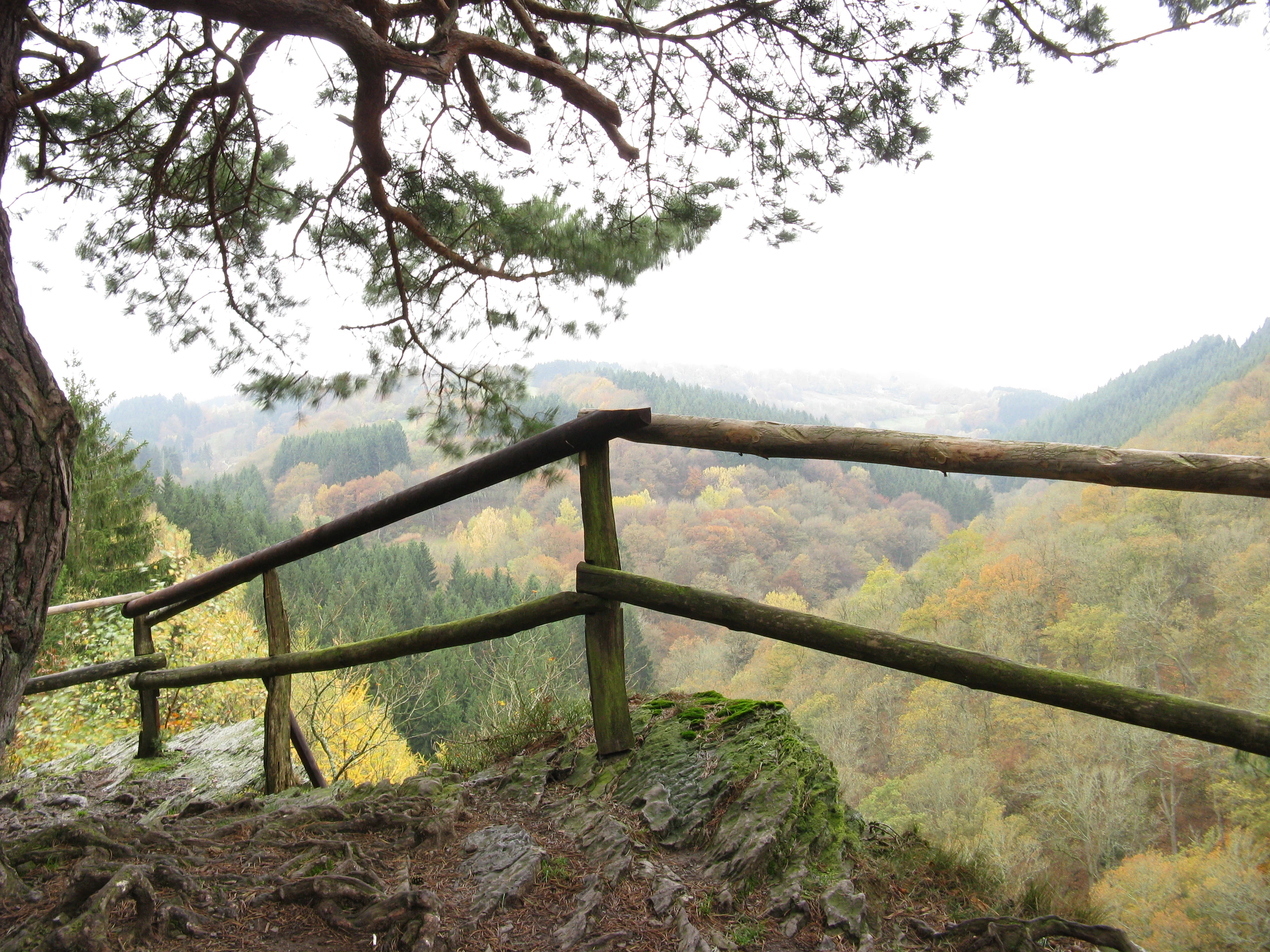
A rustic wooden railing at the edge of a rocky cliff looking out over a forested river valley in autumn.
A wooden railing overlooking the forested Rur valley at the Perdsley rock formation.

Mittleres Rurtal mit den Felsbildungen der Perdsley und Wiselsley history and protected-area timeline

The reserve was designated in stages in 2003 and 2004 under the landscape plan (Landschaftsplan) for the city of Monschau. Its creation responded to the need to safeguard habitats already affected by long agricultural use, historic woodland management, and the proximity of the Rur Reservoir downstream. The inclusion of older oak stands traces back to former coppice woodland, while the surviving beech and oak forests on the steep slopes represent remnants of longer-established woodland. Although the protected area itself is relatively recent in formal terms, the landscape it protects has been shaped over centuries by river dynamics, grazing, and selective forest use typical of the Monschau region.

Mittleres Rurtal mit den Felsbildungen der Perdsley und Wiselsley landscape and geographic character

The landscape is defined by the contrasting morphology of the Rur valley. Above Grünenthal the valley is tight, with the river dominating the floor and steep slopes rising sharply to the surrounding uplands. Below this point the valley opens out into a flat floodplain crossed by a network of drainage ditches. Slopes are cut by rocky cliffs and scattered outcrops, the most prominent of which give the reserve its name: the Perdsley and Wiselsley formations. North-facing slopes preserve the most ecologically valuable forest remnants, while south-facing and lower slopes carry a mix of conifer plantations and, in a few small patches, abandoned hay meadows. Small spring areas on the upper slopes feed into side valleys that descend toward the Rur, joining the main valley as steep, narrow ravines.

Mittleres Rurtal mit den Felsbildungen der Perdsley und Wiselsley ecosystems, habitats, and plant life

Ecologically, the reserve reflects the transition between the northern Eifel uplands and the valley landscapes of the Rur system. The river itself is a key habitat, with near-natural banks, high water quality, and rich invertebrate communities of caddisflies and mayflies. Riparian woodland forms a near-continuous gallery forest along the river, while the broader floodplain holds wet meadows, moist tall-herb vegetation, and willow scrub showing early signs of bush encroachment.

The slopes host a more complex woodland mosaic. Coniferous plantations dominate large areas, but they are interspersed with older beech forests and oak forests, including relict beech-oak stands classed as Luzulo-Fagetum (hainsimsen-beech forest) and Stellario-Carpinetum (anemone oak-hornbeam forest). Ravine forests of ash and sycamore maple with perennial honesty occupy the steepest, most sheltered positions. The cliffs and rocky outcrops provide specialized habitat for silicate rock pioneer vegetation, a community type prioritized under the EU Habitats Directive.

Mittleres Rurtal mit den Felsbildungen der Perdsley und Wiselsley wildlife and species highlights

Wildlife interest centers on the river, the cliffs, and the older deciduous forests. The clean, oxygen-rich Rur supports populations of the bullhead (Groppe), a small freshwater fish sensitive to habitat change. The riverbanks and riparian woodland are home to the dipper (Wasseramsel), a bird closely tied to fast, clear streams.

In the forest, woodpeckers are among the most characteristic species. The middle spotted woodpecker (Mittelspecht), black woodpecker (Schwarzspecht), and grey-headed woodpecker (Grauspecht) all use the older beech, oak, and mixed deciduous stands. The red kite (Rotmilan) is also highlighted as a species of particular significance, reflecting the importance of the wider valley landscape for raptors. Wet grassland and tall-herb vegetation provide additional habitats for invertebrates and small passerines associated with the meadow landscape.

Mittleres Rurtal mit den Felsbildungen der Perdsley und Wiselsley conservation status and protection priorities

The reserve is classified as an IUCN Category IV habitat and species management area and forms part of the European Natura 2000 network through its inclusion as an FFH site. Its overarching conservation goal is to safeguard habitats for numerous plant, fungal, and animal species listed on the Red List of North Rhine-Westphalia.

Six natural habitat types listed under Annex I of the EU Habitats Directive are explicitly targeted for maintenance and development: flowing waters with submerged vegetation, moist tall-herb fringes, silicate rock communities with pioneer vegetation, hainsimsen-beech forests, stellario oak-hornbeam forests, and ravine and slope-mixed forests. The biotope inventory includes wet and moist grassland, near-natural stream sections, nutrient-poor meadows, low shrub and heather communities, natural rock formations, ravine and slope-debris forests, spring areas, and floodplain forests. The reserve's value lies in the way these protected habitat types occur in close proximity and ecological connection along a single river corridor.

Mittleres Rurtal mit den Felsbildungen der Perdsley und Wiselsley cultural meaning and human context

The reserve sits within the traditional cultural landscape of the Monschau area, a region long defined by small-scale agriculture, forestry, and water-driven industry. The surviving oak stands on the valley flanks reflect historic coppice woodland management, and the meadow landscape in the broader floodplain continues a centuries-old pattern of grassland use. The presence of small tree lines dividing former meadows, including rows of hornbeam and spruce, is a visible expression of this long interaction between farming communities and the valley landscape.

Top sights and standout views in Mittleres Rurtal mit den Felsbildungen der Perdsley und Wiselsley

The combination of a free-flowing, high-quality Rur river stretch, near-natural riparian galleries, older beech-oak forests, and isolated cliff formations makes this reserve unusually rich for its size. The Perdsley and Wiselsley cliffs are the defining visual landmarks, while the broader habitat mosaic, from wet meadows and tall-herb fringes to ravine forests, illustrates a complete central European river-valley system in compressed form.

Best time to visit Mittleres Rurtal mit den Felsbildungen der Perdsley und Wiselsley

The reserve shows its character most clearly from late spring through early autumn, when the deciduous forests are in full leaf and the meadow vegetation along the broader floodplain reaches its peak. Spring is favorable for woodland birds and the flowering of characteristic forest-floor plants in the beech-oak slopes, while late spring and early summer offer the richest displays in the tall-herb and meadow communities around Dedenborn and Grünenthal. The river habitats and cliff communities are more stable across seasons, but forest atmosphere and overall accessibility are most rewarding in the warmer months.

Monthly climate preview

Long term temperature averages and monthly precipitation distributions for the protected area

Mittleres Rurtal mit den Felsbildungen der Perdsley und Wiselsley Climate and Annual Weather Patterns

Historical climate records from 1991 to 2020 document the measured monthly temperature range and precipitation totals for Mittleres Rurtal mit den Felsbildungen der Perdsley und Wiselsley. Detailed monthly normals provide a structured comparison of thermal rhythms across the representative coordinate.
Annual mean8 °C
0 °C17 °C
Jan
Feb
Mar
Apr
May11°
Jun15°
Jul17°
Aug17°
Sep13°
Oct
Nov
Dec
Warmest month
July

17 °C

Coolest month
January

-0 °C

Wettest month
December

3.1 mm/day

Driest month
April

1.9 mm/day

Park location guide

Geography guide, regional context, and park location map for Mittleres Rurtal mit den Felsbildungen der Perdsley und Wiselsley

Mittleres Rurtal mit den Felsbildungen der Perdsley und Wiselsley park geography, regions, and map view in Germany

Understand where Mittleres Rurtal mit den Felsbildungen der Perdsley und Wiselsley sits in Germany through a broader geographic reading of the surrounding landscape, nearby location context, and its mapped position within the national park landscape.

How Mittleres Rurtal mit den Felsbildungen der Perdsley und Wiselsley fits into Germany

Germany is a federal republic in Western and Central Europe with a population of over 83 million across sixteen constituent states. It is Europe's largest economy by nominal GDP and a major global exporter and importer. The capital is Berlin, and the country borders Denmark, Poland, Czech Republic, Austria, Switzerland, France, Luxembourg, Belgium, and the Netherlands.

Wider geography shaping Mittleres Rurtal mit den Felsbildungen der Perdsley und Wiselsley in Germany

Germany is located in Western and Central Europe, spanning 357,022 km². It borders Denmark to the north, Poland and the Czech Republic to the east, Austria and Switzerland to the south, and France, Luxembourg, Belgium, and the Netherlands to the west. The country has coastlines on the Baltic Sea and North Sea to the north, with the Alps located in the southern region.

Map view of Mittleres Rurtal mit den Felsbildungen der Perdsley und Wiselsley

Use this park location map to pinpoint Mittleres Rurtal mit den Felsbildungen der Perdsley und Wiselsley in Germany, understand its exact geographic position, and read its mapped placement within the surrounding landscape more clearly.

Pigeon | © OpenStreetMap contributors

Location context for Mittleres Rurtal mit den Felsbildungen der Perdsley und Wiselsley

Nordrhein-Westfalen

Visualizing river valleys, steep forested slopes, and distinct rock formations across the northern Eifel region

Mittleres Rurtal mit den Felsbildungen der Perdsley und Wiselsley Landscape Photography and Protected Area Views

Photographic documentation reveals the rugged topography, free-flowing river habitats, and steep rock cliffs defining the protected landscape. Visual exploration helps readers examine habitat mosaics, ancient woodland remnants, and river valley morphology in greater detail.

A rustic wooden railing at the edge of a rocky cliff looking out over a forested river valley in autumn.

A green meadow landscape framed by a large mossy tree trunk in the foreground and verdant trees in the background, enclosed by a simple wooden fence.

Park atlas

Compare adjacent river valleys and protected landscapes across the northern Eifel region

Parks Near Mittleres Rurtal mit den Felsbildungen der Perdsley und Wiselsley

Browse other protected areas near Mittleres Rurtal mit den Felsbildungen der Perdsley und Wiselsley to examine similar river valley ecosystems and forested upland terrain. Comparing nearby reserves provides a broader geographic perspective on the natural and cultural landscapes shaping western Germany.
A soft watercolor illustration of a rolling green landscape with flowering trees and distant forested hills, isolated on a white background.
Nature reserveNordrhein-Westfalen
About 1.6 km away#1 closest

Southwest

Kluckbachtal Nature Reserve: Geographic Atlas and Protected Stream Valley Overview

Mapped riparian forest and orchard meadow habitats in Nordrhein-Westfalen

Kluckbachtal protects a distinctive valley segment between Rohren and Höfen, featuring a complex of stream beds, wet grasslands, and old oak and alder woodland. This nature reserve is recognized for its significant role in preserving Red List species and traditional cultural landscapes, offering a detailed look at the ecology of the northern Eifel region through its varied habitats.

Area
1.13 km²
Established
1997
IUCN
IV
Relief
Upland
A pale, minimalist watercolor painting showing a soft-focus landscape with green trees in the foreground, rolling hills in the background, and hints of pink in the foreground foliage.
Protected areaGermany
About 2.2 km away#2 closest

Southeast

Holderbachtal, Dürholderbachtal: Protected Area Geography and Landscape Mapping in Germany

Integrated stream valley and wetland habitat analysis

Holderbachtal, Dürholderbachtal covers 187 hectares of diverse terrain in Germany, blending alder swamp forests with species-rich grasslands. This protected area offers deep insight into the valley-bound ecology and hydrological characteristics that define the Eifel region. Explore the connection between the primary stream systems, spring mires, and the surrounding woodland mosaic in this structured geographic overview.

Watercolor illustration of rolling green hills and meadows with patches of pink and yellow flowers
National parkNorth Rhine-Westphalia
About 3.4 km away#3 closest

Northeast

Eifel National Park: North Rhine-Westphalia Protected Area Atlas

Explore mapped boundaries and regional geography.

Gain a structured understanding of Eifel National Park, a key protected area within Germany's North Rhine-Westphalia region. This page focuses on its geographic identity, detailing mapped boundaries and offering context within the state's broader natural landscapes. MoriAtlas enhances your exploration by presenting Eifel National Park as a distinct entity within a larger geographic framework, ideal for atlas-based research and understanding protected land distribution.

Area
107 km²
Established
2004
IUCN
II
Relief
Upland
A watercolor painting depicting a soft, panoramic landscape of a meandering stream valley with rolling hills, meadows, and scattered patches of trees.
Nature reserveNordrhein-Westfalen
About 3.7 km away#4 closest

West

Kleines Laufenbachtal Nature Reserve: Geographic Atlas of an Eifel Stream Valley

Protected brook habitats and natural rock landscapes in North Rhine-Westphalia

Investigate the topographical features and habitat diversity of Kleines Laufenbachtal, an established nature reserve in the Eifel. This protected area showcases a dense assembly of wet grasslands, reed banks, and rocky slopes that anchor local ecological corridors within the Monschau landscape.

Area
0.13 km²
Established
1997
IUCN
IV
Watercolor illustration showing a soft-focus landscape with rolling green hills, a winding stream, and hints of red floral color against a light background.
Nature reserveNordrhein-Westfalen
About 3.8 km away#5 closest

Southwest

Naturschutzgebiet Perlenbach-Fuhrtsbachtal: Geographic Atlas and Protected Area Context

Mapped brook valleys and rare Eifel wetland habitats

The Naturschutzgebiet Perlenbach-Fuhrtsbachtal protects a distinctive valley system near the Eifel plateau. This area is recognized for its cold, humid microclimate and diverse habitats, ranging from spring-fed fens to ancient meadow systems. Beyond its rare floral displays, the reserve serves as a critical refuge for freshwater pearl mussels and ice-age butterfly relict species, illustrating the intersection of regional geography and conservation.

Area
3.4 km²
Established
1976
IUCN
IV
Relief
Upland
A soft watercolor illustration showing a hazy, green landscape with a winding stream, distant hills, and low-lying vegetation on a white background.
Nature reserveNordrhein-Westfalen
About 4.6 km away#6 closest

North

Kranzbach und Kranzbruchvenn: Protected Nature Reserve and Bog Landscape in Nordrhein-Westfalen

Wetland stream valleys and historic military relic landscapes

Investigate the specialized wetland ecosystems of Kranzbach und Kranzbruchvenn, a nature reserve in Nordrhein-Westfalen known for its bog and fen habitats. The site offers a detailed case study of small-stream hydrology and the transformation of former Westwall dragon teeth structures into unique marsh environments.

Area
0.328 km²
Established
2002
IUCN
IV
Watercolor painting of a soft, hazy landscape featuring rolling hills and marshy wetlands in muted green and yellow tones.
Nature reserveNorth Rhine-Westphalia
About 4.9 km away#7 closest

North

Kalltal Nature Reserve: Protected Stream Valley and Eifel Landscape in North Rhine-Westphalia

Ecological corridor with rare bog habitats and wet meadows.

Kalltal protects a stretch of the Kall stream, creating a haven for moisture-dependent plant species and wildlife within the Monschau municipality. Its terrain is defined by soft wet grasslands, peat-rich depressions, and small forest patches that form an intact ecological refuge within the broader German landscape.

Area
0.545 km²
Established
1998
IUCN
IV
Nature reserveNordrhein-Westfalen
About 6.3 km away#8 closest

Southeast

Wüstebachtal Nature Reserve: Protected Eifel Valley and Wetland Landscapes

Hydrological geography and upland meadow ecosystems in Nordrhein-Westfalen

Wüstebachtal represents a quintessential Eifel nature reserve where the convergence of flowing stream corridors and species-rich meadows creates a unique habitat for threatened flora. This protected area focuses on the conservation of the Wüstebach valley, maintaining vital connections between alpine-style meadow communities and forest-fringed wetlands within the North Rhine-Westphalia region.

Area
0.834 km²
Established
1997
IUCN
IV

Common questions about visiting, size, designation, and location context for Mittleres Rurtal mit den Felsbildungen der Perdsley und Wiselsley

Mittleres Rurtal mit den Felsbildungen der Perdsley und Wiselsley FAQs for park facts, access, geography, and protected area context

Find quick answers about Mittleres Rurtal mit den Felsbildungen der Perdsley und Wiselsley, including protected-area facts, park geography, trail and visitor context, and how the park fits into its surrounding country and regional landscape.
MoriAtlas Explorer

Continue Your Protected Areas Search Across the Global Atlas

Deepen your exploration by continuing the structured search for national parks and protected areas worldwide. Utilize the comprehensive filtering capabilities to compare different conservation landscapes and refine your understanding of global park geography. Discover more about the distribution and characteristics of protected natural areas.

Global natural geography