Why Mochima National Park stands out
Mochima National Park is best known for its dramatic combination of mountainous coastal terrain and rich Caribbean marine environments. The park's 32 islands, many with pristine beaches and diving sites, anchor a marine ecosystem teeming with cetaceans including humpback whales, Bryde's whales, sperm whales, pilot whales, and several dolphin species. The turtle grass meadows of Mochima Bay support diverse gastropods and mollusks. On land, the Turimiquire Range's montane forests descend through varied microclimates to meet dramatic cliffs that plunge into the Caribbean Sea.
Mochima National Park history and protected-area timeline
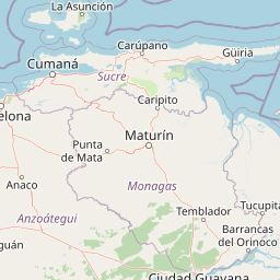
Mochima National Park was established on December 19, 1973, becoming only the second marine protected area in Venezuela following the creation of similar coastal parks in the preceding years. The park was named after the town of Mochima, a coastal settlement that has long served as a gateway to the region's natural treasures. Its creation reflected Venezuela's growing commitment in the early 1970s to protecting its Caribbean coastal and marine environments, recognizing that the country's northeastern shoreline represented a unique combination of terrestrial and aquatic ecosystems requiring coordinated conservation. The park's boundaries were drawn to encompass the entire shoreline between Puerto La Cruz and Cumaná, two major coastal cities, along with 32 islands distributed along this stretch of coastline. This comprehensive boundary design ensured protection of both the coastal marine environments and the terrestrial watersheds that flow into them.
Mochima National Park landscape and geographic character
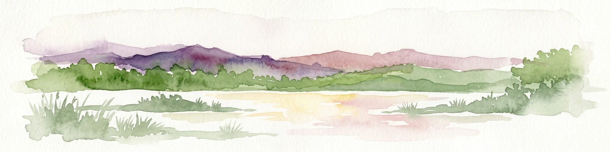
The landscape of Mochima National Park is defined by the dramatic intersection of the Turimiquire mountain range with the Caribbean Sea. This mountainous coastal zone features an extraordinary variety of terrain within a relatively compact area. Some stretches of coastline are characterized by gigantic cliffs that rise nearly vertically from the water's edge, their rock faces sparsely vegetated and dropping directly into deep marine waters. In contrast, other areas of the park feature lush jungle vegetation cascading down to sandy beaches tucked into sheltered coves and inlets. The Gulf of Santa Fé and Mochima Bay provide more protected marine environments, their waters contrasting with the exposed open coast elsewhere in the park. The 32 islands scattered along the coastline add further topographic diversity, ranging from small rocky islets to larger islands with their own beach systems. The Turimiquire Range's foothills descend toward the coast, with the watershed feeding the Turimiquire Dam providing an important hydrological connection between the park's mountain and marine sectors.
Mochima National Park ecosystems, habitats, and plant life
The ecological character of Mochima National Park spans two major domains. The marine environment encompasses both open coastal waters and the more protected waters of Mochima Bay, with extensive turtle grass meadows providing the foundation for a productive coastal ecosystem. The turtle grass beds, dominated by Thalassia testudinum, create essential habitat for numerous marine invertebrates including gastropods and bivalves. The marine waters are notable for their cetacean diversity, with multiple whale and dolphin species recorded in the park's waters. On land, the montane forests of the Turimiquire Range descend through elevation zones that create varied vegetation communities, from lower elevation tropical forest to higher elevation cloud forest in the upland sectors. These forests play a critical role in watershed protection, particularly for the Turimiquire Dam that supplies water to surrounding communities.
Mochima National Park wildlife and species highlights
Mochima National Park supports remarkable marine wildlife, particularly cetaceans that congregate in the productive Caribbean waters off its coast. Humpback whales migrate through these waters, along with Bryde's whales, sperm whales, and pilot whales. Several species of dolphins are also present, including the long-beaked common dolphin that is frequently observed near offshore islands. The marine ecosystem's productivity is underpinned by the turtle grass meadows of Mochima Bay, which support diverse invertebrate populations including the Eared ark clam, Tiger lucine, Buttonsnail, and Turkey wing clam. These species contribute to a complex food web that sustains the larger marine predators. The terrestrial wildlife, while less extensively documented in available sources, includes iguanas and other reptiles that can be observed basking on rocks along the coastline and in marine environments.
Mochima National Park conservation status and protection priorities
Mochima National Park represents a significant conservation achievement as one of Venezuela's earliest marine protected areas and the second marine park in the country. Its establishment in 1973 reflected a recognition that Venezuela's Caribbean coast required formal protection to preserve both marine biodiversity and the terrestrial ecosystems that support it. The park's dual terrestrial-marine design is particularly noteworthy, as it protects not just the coastal marine environment but also the mountainous watersheds, particularly the Turimiquire Range and its associated forest, that maintain the health of downstream marine areas. The protection of the entire shoreline between Puerto La Cruz and Cumaná ensures connectivity between marine habitats, while the 32 islands provide critical nesting and resting sites for marine species. Managing this accessible coastal park presents ongoing challenges related to balancing visitor access with conservation objectives.
Mochima National Park cultural meaning and human context
Mochima National Park is named after the town of Mochima, a traditional coastal settlement whose history is intertwined with the marine environment that now falls within the park's boundaries. The shoreline between Puerto La Cruz and Cumaná has been inhabited for centuries, with small towns and fishing communities developing along this attractive stretch of Caribbean coast. These communities have historically relied on the marine resources of the region, and their traditional relationship with the sea continues to shape the cultural landscape of the park area. The park's proximity to Cumaná, one of Venezuela's oldest colonial cities, adds historical depth to the region's cultural context. The Turimiquire region also holds significance for local communities whose water supply depends on the protected watersheds within the park.
Top sights and standout views in Mochima National Park
The dramatic cliffs plunging into Caribbean waters, the 32 offshore islands with their beaches and diving sites, the whale and dolphin populations visible from shore and boat, the turtle grass meadows of Mochima Bay supporting rich marine life, the montane forests of the Turimiquire Range providing watershed protection, and the accessible shoreline between two major Venezuelan cities make Mochima a distinctive coastal protected area.
Best time to visit Mochima National Park
Mochima National Park can be visited year-round given its tropical climate with temperatures consistently between 20 and 26 degrees Celsius. The period from November through May features warm temperatures and constant trade winds, creating pleasant conditions for beach activities and marine exploration. This dry season offers clearer skies and more predictable weather for island hopping and coastal excursions. From June to October, the park experiences higher humidity and somewhat cooler temperatures, with the increased moisture supporting lush vegetation in the park's terrestrial areas. This green season can offer a different but equally rewarding experience, particularly for those interested in the park's forest environments.