
Mori Atlas logo
Nature reserveMonach Islands

Discover the unique machair grasslands and coastal geomorphology of this isolated archipelago

Monach Islands Nature Reserve: Mapped Geography and Protected Landscape of the Outer Hebrides

The Monach Islands, known as Heisker, form a low-lying archipelago west of North Uist in the Outer Hebrides. This nature reserve is defined by interconnected sandy flats, undisturbed machair ecosystems, and an internationally significant grey seal colony. Through detailed mapping and landscape analysis, the area provides a window into the evolution of coastal terrain shaped by grazing, tidal erosion, and historical human settlement.

Outer Hebrideshebridesislandsmachaircoastal grasslandgrey seals
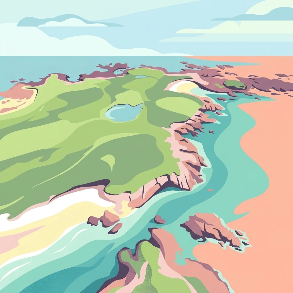
An aerial-style digital illustration showing a low-lying island with grassy fields, small pools of water, and rocky coastlines surrounded by blue ocean and sandy shores.

Monach Islands

Nature reserve

Park overview

Structured park overview, official facts, and landscape profile for Monach Islands

Monach Islands park facts, protected area profile, and essential visitor context

Review the core facts for Monach Islands, including designation, size, terrain, visitor scale, habitats, and operating context in one park-focused overview.

About Monach Islands

The Monach Islands form one of the more remote inhabited landscapes of the Outer Hebrides, sitting several miles west of North Uist and surrounded by the often-turbulent waters of the Atlantic. Despite a long history of human presence, the group remains strikingly quiet today. The combined area of roughly 600 hectares is shared between sand, machair, low rocky outcrops, freshwater lochans, and abandoned stone buildings whose walls are gradually yielding to wind and weather.

The three principal islands of Ceann Ear, Ceann Iar, and Shivinish are connected at low tide over broad tidal flats, echoing historic claims that the group may once have been linked directly to neighbouring Baleshare and even to North Uist itself. A 17th-century tidal wave is said to have washed this older route away, and continual coastal erosion has continued to shape the islands into the low, fragmented form seen today. Smaller islets such as Deasker, Shillay, and Stocaigh complete the archipelago, with Shillay hosting the famous Stevenson lighthouse.

Visitors encounter a landscape almost devoid of trees, dominated instead by open machair plains, dunes, and a network of small freshwater lochs. Grey herons nest in some of the abandoned cottages, while seabird colonies occupy the cliffs and rocky fringes of the smaller islands. The combination of restricted access, grazing pressure, and deeply ingrained conservation protection has allowed the Monach group to retain an unusually rich and undisturbed biological character within the Hebrides as a whole.

Quick facts and research context for Monach Islands

The Monach Islands are an island group west of North Uist in the Outer Hebrides, Scotland. They are governed by NatureScot and managed collectively under multiple overlapping conservation designations, including Site of Special Scientific Interest, Special Protection Area, Special Area of Conservation, and a Marine Protected Area covering the surrounding sea.

The islands are renowned for two internationally significant natural features: extensive machair habitat in remarkably undisturbed condition, and a large autumn grey seal breeding colony. With no trees and an exceptionally low-lying, sandy character, the Monach group is shaped more by wind, tide, and grazing pressure than by elevation or forest cover, making it a distinctive example of Hebridean coastal ecology.

Protection and recognition

Documented conservation measures and official Natura 2000 network listings

Monach Islands Protection Status and International Recognition Sources

Monach Islands maintains a mixed protection scope backed by official Natura 2000 network listings and recognized conservation boundaries. Documented records provide clear administrative context regarding international recognition sources and protected area designations.

International recognition

Protection details

Protection scope
Mixed
Transboundary protection
No
Park context

Deeper park guide and search-rich context for Monach Islands

Monach Islands history, landscape, wildlife, and travel context

Explore Monach Islands through its history, landscape character, ecosystems, wildlife, conservation priorities, cultural context, and seasonal travel timing in a structured park guide built for atlas discovery and search intent.

Why Monach Islands stands out

The Monach Islands are best known for two overlapping features that together define their ecological identity. The first is machair, the rare coastal grassland formed from blown sand and shell-rich soils, which here survives in an unusually undisturbed state and supports a rich coastal flora. The second defining feature is the grey seal colony. Around ten thousand seals come ashore each autumn to pup and mate, placing the Monach group among the largest grey seal breeding aggregations in the world. These two elements, machair on land and seals in the surrounding waters, are intertwined with large numbers of nesting seabirds and the absence of trees, giving the islands a stark, open character unique within the Outer Hebrides.
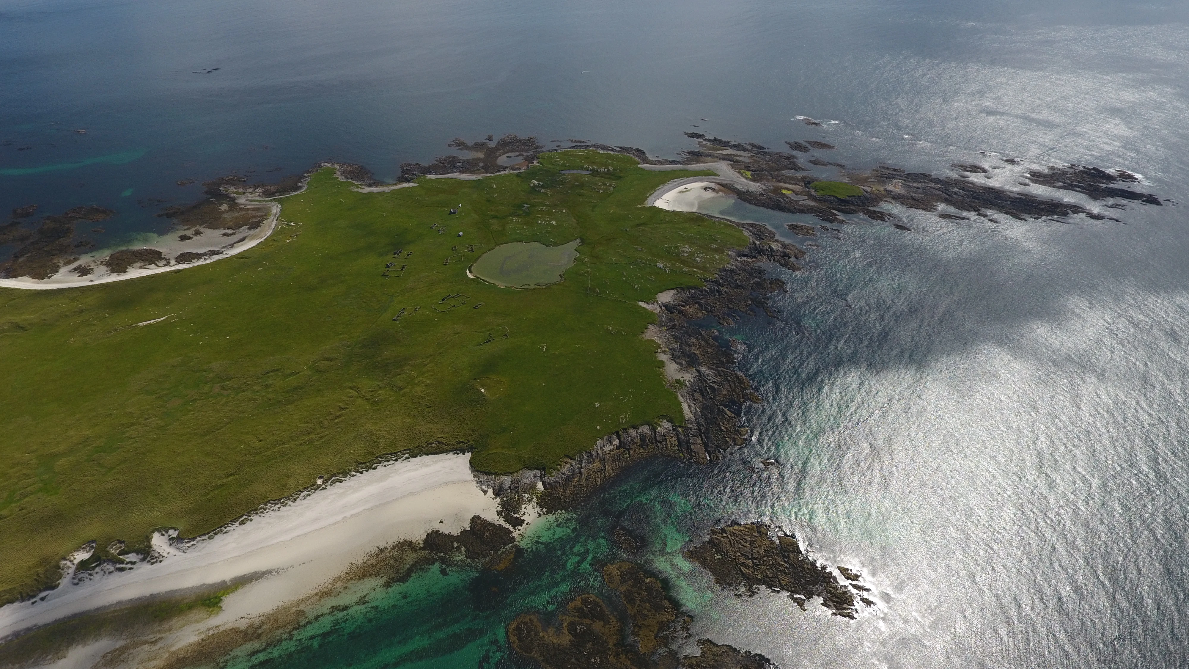
A high angle aerial drone view of the Monach Islands featuring a bright green, grassy island surrounded by blue sea, with visible white sand beaches, rocky shorelines, and a small circular inland pool.
An aerial view of the Monach Islands, showcasing the grassy machair landscape and sandy coastal fringes.

Monach Islands history and protected-area timeline

The Monach Islands were inhabited for centuries, possibly for a millennium or more, before the original community was abandoned due to long-term overgrazing. Resettlement occurred in the 19th century against the backdrop of the Highland Clearances, with census records documenting a population of 39 in 1841, fluctuating numbers across the decades, and a peak of around 140 residents in 1891. Despite this recolonisation, the islands were once again left uninhabited by 1942, when the last residents departed.

One of the more extraordinary episodes in the islands' history involves Rachel Chiesley, Lady Grange, a Jacobite sympathiser who was kidnapped on the orders of her estranged husband, James Erskine, Lord Grange. Between 1732 and 1734 she was held on the Monach Isles under harsh conditions, kept ignorant even of the name of the island where she was living, before being moved on to St Kilda and later Skye, where she eventually died.

A defining feature of the modern landscape is the lighthouse on Shillay, designed by David and Thomas Stevenson and first lit in 1864. Closed in 1942, it was recommissioned in modified form in the wake of the MV Braer oil tanker disaster of 1993. The newer light was deactivated in 2008 when it was judged insufficient in range, and the original lighthouse was reactivated with a modern optic. In 2007, renovation of the former schoolhouse on the islands enabled limited visitor stays, allowing people to experience both the cultural and natural heritage of this remote Hebridean outpost.

Monach Islands landscape and geographic character

The physical character of the Monach Islands is defined by long, low silhouettes, sandy connections, and an almost complete absence of vertical relief. Ceann Ear, Ceann Iar, and Shivinish are the three principal islands, all reached from each other over wide sandy flats at low tide. Smaller islets and rocks, including Deasker, Shillay, and Stocaigh, punctuate the surrounding sea and provide notable seabird nesting habitat.

The terrain is dominated by machair and dune systems backed by freshwater lochans and peat-influenced hollows. There are no trees on the islands, and the openness of the landscape is accentuated by the remnants of abandoned crofting settlement, including a ruined village on Ceann Ear and a network of old stone buildings slowly weathering back into the ground.

Coastal erosion has shaped, and continues to reshape, the group. It is plausible that the three main islands once formed a single contiguous landmass within historic memory, and centuries of grazing, storms, and sea inundation have progressively broken them apart. This volatility gives the Monach group a transient quality in which today's shoreline may not be tomorrow's.
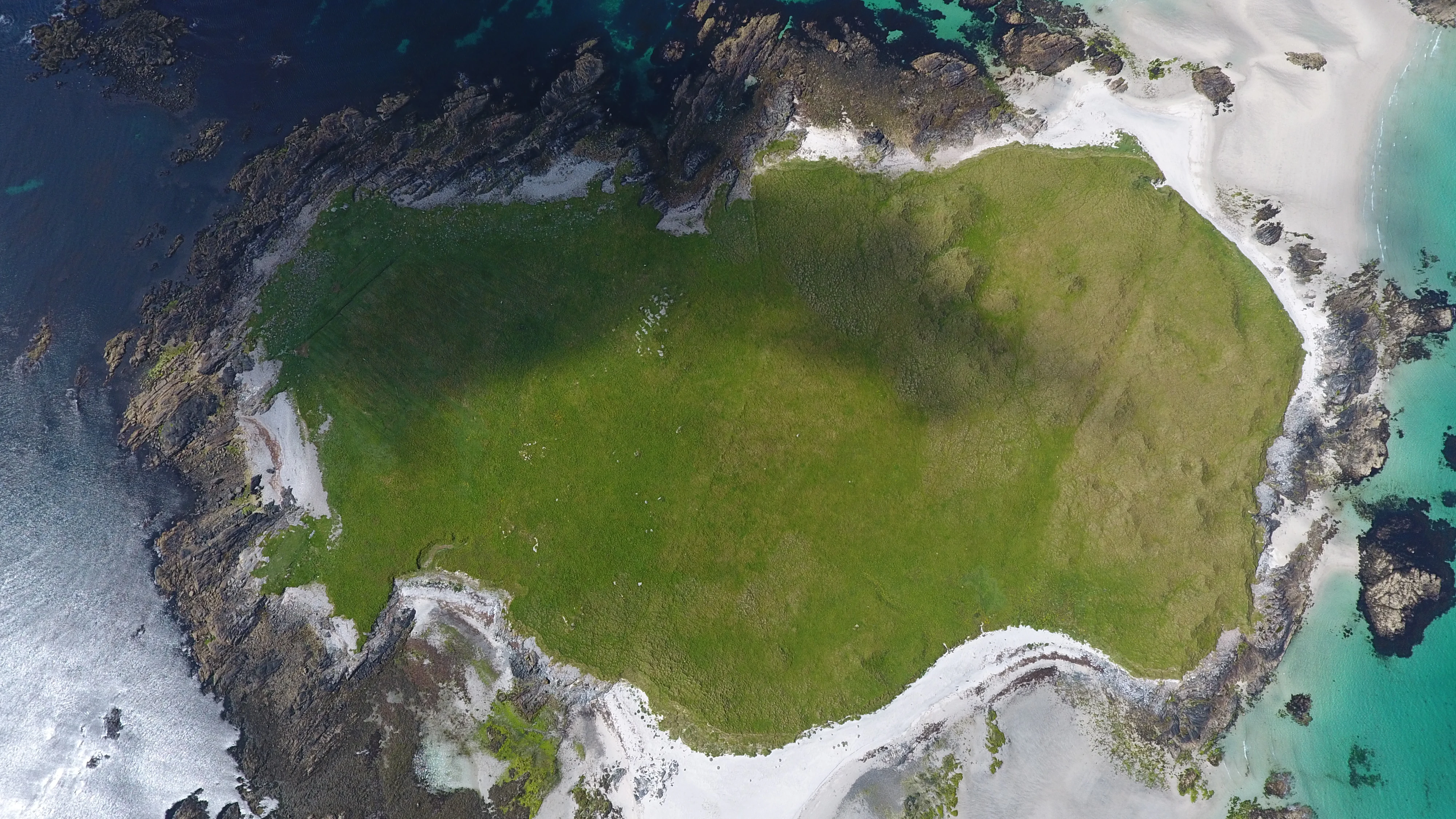
A top down drone view of a small island with green grassy terrain surrounded by white sandy beaches and turquoise and deep blue ocean water.
Aerial view of the Monach Islands featuring coastal machair and turquoise waters.

Monach Islands ecosystems, habitats, and plant life

Ecologically, the Monach Islands are dominated by the machair ecosystem, a rare and biodiverse coastal grassland created where sand mixes with broken shells and organic matter. The machair here is noted for its undisturbed state, producing colourful displays of wildflowers through the summer and supporting invertebrates that in turn feed seabirds and waders. Surrounding this machair core are dune systems, wet grassland, freshwater lochans, and low rocky shores.

Without any trees, the islands present an open, windswept habitat mosaic. Grey herons have adapted to nest in some of the abandoned buildings, while coastal cliffs and rocky islets host important seabird colonies. The sea surrounding the islands is recognised for its marine geomorphology, and a substantial marine zone has been protected to conserve both seabird feeding grounds and undersea landscape features.
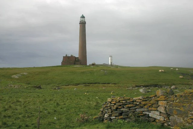
A tall, slender stone lighthouse stands on a grassy hill, with a small, modern white lighthouse tower nearby and a dry stone wall in the foreground.
The historic Monach Islands lighthouse on Shillay, surrounded by green machair grassland.

Monach Islands wildlife and species highlights

The Monach Islands' wildlife profile is led by one of the largest grey seal colonies in the world. Each autumn, roughly ten thousand seals come ashore to pup and mate, making the islands internationally important for this species and a cornerstone of marine mammal conservation in the Hebrides.

Seabirds are similarly prominent, with numerous nesting species using the cliffs and smaller islets around the main landmasses. Inland areas, though treeless, support grey herons nesting in abandoned buildings and a rich invertebrate fauna associated with the machair. Together, these populations illustrate how an island group with no woodland can nevertheless support an exceptionally diverse and internationally recognised assemblage of fauna.
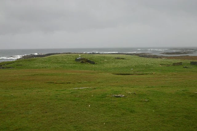
A wide, low-angle shot of a grassy, treeless coastal landscape under a gray, overcast sky, featuring a small, crumbling stone ruin in the midground and the ocean in the background.
The remains of a deserted cottage on the island of Shillay in the Monach Islands.

Monach Islands conservation status and protection priorities

The Monach Islands are protected through a layered suite of overlapping conservation designations. They are recognised as a Site of Special Scientific Interest, a Special Protection Area for birds, a Special Area of Conservation for habitats and species, and an IUCN Category IV protected area. A Nature Conservation Marine Protected Area covering roughly 6,200 hectares of surrounding sea was added in 2014 to safeguard seabird feeding grounds and seabed geomorphology.

These designations reflect the dual importance of the group: undisturbed machair on land and an exceptionally productive marine zone offshore. Although the islands were formerly a National Nature Reserve, that designation was withdrawn in May 2018; their current protection framework nonetheless delivers a robust level of safeguarding for both ecological and marine features. Conservation management under NatureScot continues to balance access, light-touch habitat protection, and the long-running influence of grazing on island vegetation.

Monach Islands cultural meaning and human context

The cultural memory of the Monach Islands is unusually rich for such a remote group. Centuries of Gaelic-speaking settlement left behind a network of ruined houses, the remains of a nunnery on Ceann Ear, and place names such as Ceann Ear, Ceann Iar, Shivinish, Shillay, and Heisker that still anchor the archipelago in its linguistic landscape. The islands' later depopulation in the 19th and 20th centuries ties them directly to the wider story of the Highland Clearances and the contraction of Hebridean crofting communities.

Perhaps the most striking cultural episode is the involuntary exile of Lady Grange in the 1730s, a story that links the islands to broader Jacobite-era politics and to later episodes of forced isolation on St Kilda. The Stevenson lighthouse on Shillay, rebuilt and reactivated across the 19th and 20th centuries, adds another layer of cultural and engineering heritage, while the restored Heisgeir mailboat preserved at Grimsay represents community efforts to keep the islands' working maritime history alive.

Top sights and standout views in Monach Islands

The islands' standout feature is the combination of internationally important machair and a world-class grey seal colony, set against a treeless, low-lying landscape shaped by grazing, erosion, and centuries of human habitation. Their accessibility is limited precisely because of their isolation, which has allowed both habitat and cultural archaeology to remain unusually well preserved.

The Shillay lighthouse, the ruined settlement on Ceann Ear, and the broader machair-blanketed terrain together offer a rare synthesis of natural and cultural heritage. The surrounding Marine Protected Area extends this significance offshore, making the Monach group an unusually complete example of integrated land-and-sea conservation in the Outer Hebrides.

Best time to visit Monach Islands

Because the islands are uninhabited, remote, and accessed only by special arrangement, the experience of a visit is shaped more by weather windows and tidal conditions than by traditional tourist seasons. Late spring and summer are typically the most rewarding for machair wildflowers, seabird colonies, and longer daylight hours, while the autumn brings the dramatic arrival of the grey seal breeding season. Winter weather can make access difficult and the exposed islands feel especially austere.
Monthly climate preview

Long-term representative temperature and precipitation patterns across the protected archipelago

Monach Islands Climate Normals and Measured Annual Weather by Month

Monach Islands exhibits measured monthly temperature and precipitation normals derived from long-term representative coordinate records. Examining the complete twelve-month profile provides detailed meteorological context for this protected island geography.
Annual mean10 °C
7 °C14 °C
Jan
Feb
Mar
Apr
May10°
Jun12°
Jul13°
Aug14°
Sep13°
Oct11°
Nov
Dec
Warmest month
August

13.8 °C

Coolest month
February

6.9 °C

Wettest month
January

4.9 mm/day

Driest month
May

2.3 mm/day

Park location guide

Geography guide, regional context, and park location map for Monach Islands

Monach Islands park geography, regions, and map view in United Kingdom

Understand where Monach Islands sits in United Kingdom through a broader geographic reading of the surrounding landscape, nearby location context, and its mapped position within the national park landscape.

How Monach Islands fits into United Kingdom

The United Kingdom is a parliamentary constitutional monarchy located in northwestern Europe, consisting of four constituent countries: England, Scotland, Wales, and Northern Ireland. As a major global power with over 69 million residents, it maintains significant international influence in politics, economics, and culture.

Wider geography shaping Monach Islands in United Kingdom

The United Kingdom is an island nation located in northwestern Europe, surrounded by the Atlantic Ocean, North Sea, English Channel, Celtic Sea, and Irish Sea. It shares a land border with the Republic of Ireland to the west. The territory includes the island of Great Britain, the northeastern portion of Ireland, and most of the smaller British Isles islands.

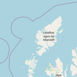
Map view of Monach Islands

Use this park location map to pinpoint Monach Islands in United Kingdom, understand its exact geographic position, and read its mapped placement within the surrounding landscape more clearly.

Pigeon | © OpenStreetMap contributors

Location context for Monach Islands

Outer HebridesScotland

Visual exploration of fragile machair grasslands, tidal sand flats, and wildlife habitats

Monach Islands Photos and Protected Landscape Scenery

Visual documentation reveals the low-lying terrain, open machair grasslands, and coastal habitats defining the protected islands. Photographic records illustrate the remote archipelago scenery, grey seal breeding grounds, and dynamic marine geography.

A high angle aerial drone view of the Monach Islands featuring a bright green, grassy island surrounded by blue sea, with visible white sand beaches, rocky shorelines, and a small circular inland pool.

An aerial drone view of the remote, green, and flat Monach Islands surrounded by clear turquoise and deep blue ocean waters.

A top down drone view of a small island with green grassy terrain surrounded by white sandy beaches and turquoise and deep blue ocean water.

A tall, slender stone lighthouse stands on a grassy hill, with a small, modern white lighthouse tower nearby and a dry stone wall in the foreground.

A wide, low-angle shot of a grassy, treeless coastal landscape under a gray, overcast sky, featuring a small, crumbling stone ruin in the midground and the ocean in the background.

Park atlas

Compare surrounding island reserves, coastal habitats, and regional protected landscapes.

Exploring Parks Near Monach Islands and Protected Areas in the Region

Browse nearby national parks and protected areas sharing similar coastal geography and marine conservation importance. Compare surrounding island ecosystems to understand the broader natural heritage of the Outer Hebrides region.
A soft watercolor illustration depicting a landscape of rolling green hills, a calm body of water, and sparse grassy vegetation.
Protected landscapeWestern Isles
About 34 km away#1 closest

Northeast

South Lewis, Harris and North Uist National Scenic Area Geography and Protected Lands

A diverse Scottish landscape of mountains and Atlantic coastline

Spanning from south-west Lewis through Harris to North Uist, this protected area features a striking blend of mountain glens, white sand machair beaches, and expansive peatlands. It serves as a flagship landscape for the Western Isles, characterized by its indented fjardic shorelines and remote maritime character that defines the northern Hebridean environment.

Area
2,024 km²
Established
1981
Relief
Mountain
Climate
Temperate
Protected landscapeHighland
About 79 km away#2 closest

East

Trotternish National Scenic Area: A Geographic Atlas of the Isle of Skye Protected Landscape

Basalt escarpments and geologic landmarks in the Scottish Highlands

Trotternish National Scenic Area features a long, continuous basalt escarpment that defines the spine of northern Skye. This protected landscape contains complex ridge formations, dramatic coastal cliffs, and a rich record of Jurassic geology. Learn about the physical geography, mapped extent, and natural terrain that make this region a key protected area within the Highland geography of Scotland.

Established
1981
Relief
Upland
Climate
Temperate
Access
Moderate access
A pale, minimalist watercolor painting showing gentle hills, a curved shoreline, and sparse grass against a white background.
Protected areaNa h-Eileanan Siar
About 93 km away#3 closest

Northeast

Isle of Lewis Protected Area: Geography, Coastal Landscapes, and Highland Terrain

Mapped regional geography of the Outer Hebrides

The Isle of Lewis represents a significant protected landscape defined by its ancient geological roots and diverse coastal ecosystems. From the lime-rich machair grasslands of the west to the deeply indented sea lochs of the east, this area offers a unique perspective on the physical geography and inland peatland networks of the North Atlantic.

Area
1,770 km²
Visitors
219K annual
Relief
Mixed relief
Climate
Temperate
Watercolor painting of a coastal landscape with distant mountains, a rocky shoreline, and light foreground vegetation on a white background.
Protected landscapeHighland
About 99 km away#4 closest

Southeast

Small Isles Protected Landscape: Atlas of the Highland Inner Hebrides Archipelago

Mapped terrain, volcanic geology, and coastal protected areas.

Delve into the geography of the Small Isles, a protected landscape encompassing Rùm, Eigg, Canna, and Muck. This atlas entry provides a structured look at the volcanic peaks, maritime skerries, and diverse land-stewardship boundaries that define this remote Scottish archipelago.

Area
472.35 km²
Established
1981
Relief
Mountain
Climate
Temperate
Marine protected areaScotland
108 km away#5 closest

Northwest

West of Scotland Marine Protected Area: Geographic Atlas and Seafloor Mapping

Extensive North Atlantic deep sea protected zone in Scotland

Spanning a immense area west of the Outer Hebrides, the West of Scotland Marine Protected Area is a critical offshore conservation zone defined by its varied benthic topography. From the steep continental slope to the sediment plains of the Rockall Trough, the area houses complex deep sea fish populations, cold water coral reefs, and sponge aggregations on isolated seamounts.

Area
107,773 km²
Established
2020
Scope
Marine
Water
Water-dominated
Marine protected areaHighland
About 118 km away#6 closest

East

Loch Alsh Nature Conservation Marine Protected Area: Geography and Protected Boundaries

A vital Highland marine landscape featuring rare underwater flame shell colonies.

Loch Alsh sits as a distinct marine boundary in the Northwest Highlands of Scotland. This protected area safeguards a vast seafloor ecosystem, most notably a massive flame shell colony that has transformed local understanding of marine biodiversity in the region. The loch landscape blends ancient metamorphic geology with the fjord-like waters separating Skye from the mainland, offering a unique perspective on protected coastal terrains.

Area
0.75 km²
Established
2014
Relief
Mountain
Climate
Temperate
A soft, impressionistic watercolor painting of a Scottish loch surrounded by rolling green hills and distant mountain silhouettes.
Marine protected areaRoss and Cromarty
About 124 km away#7 closest

East

Loch Carron Marine Protected Area: Coastal Geography and Protected Seabed Landscape Atlas

Exploring the tidal basins and underwater terrain of Ross and Cromarty.

Loch Carron stands as a landmark marine protected area defined by its dramatic underwater depth changes and robust tidal currents. This protected sea loch features the world's largest flame shell colony nestled beneath the cliffs at Strome Castle. The surrounding Highland geography of Ross and Cromarty creates a compressed, mountain-framed landscape that influences the rich ecological character of this essential coastal habitat.

Area
23 km²
Established
2019
Relief
Lowland
Climate
Temperate
Protected landscapeHighland
About 136 km away#8 closest

Southeast

Morar, Moidart and Ardnamurchan National Scenic Area: Coastal Geography and Protected Lands

A mapped overview of peninsulas, lochs, and Highland terrain

Investigate the protected landscape of Morar, Moidart and Ardnamurchan. This area combines dramatic basalt cliffs, silver sands, and significant historical sites within a remote maritime setting. Gain clarity on the overlapping conservation zones and the complex geography that shapes this distinctive Scottish coastal region.

Area
369.6 km²
Established
1981
Relief
Mixed relief
Access
Moderate access

Common questions about visiting, size, designation, and location context for Monach Islands

Monach Islands FAQs for park facts, access, geography, and protected area context

Find quick answers about Monach Islands, including protected-area facts, park geography, trail and visitor context, and how the park fits into its surrounding country and regional landscape.
MoriAtlas Explorer

Continue Your Protected Areas Search Across the Global Atlas

Deepen your exploration by continuing the structured search for national parks and protected areas worldwide. Utilize the comprehensive filtering capabilities to compare different conservation landscapes and refine your understanding of global park geography. Discover more about the distribution and characteristics of protected natural areas.

Global natural geography