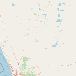
Why Moore River National Park stands out
The park is most notable for its extensive banksia heathland, a characteristically Australian Mediterranean-climate vegetation type that dominates much of the Swan Coastal Plain. The heathland here supports a diverse array of endemic plant species adapted to the nutrient-poor sandy soils of the region. The park's location along the Moore River corridor adds further ecological value, creating a riparian zone that contrasts with the surrounding heath and provides habitat for different species assemblages. The park represents one of the more significant protected areas of banksia heathland in the Wheatbelt region.
Moore River National Park history and protected-area timeline
Moore River National Park was established in 1969 through formal declaration under Western Australian legislation, creating a protected area that encompassed the banksia heathland and river corridor in the northern Wheatbelt. The establishment of the park reflected growing recognition during the 1960s of the need to preserve representative examples of Western Australia's unique Mediterranean-climate ecosystems. At the time of establishment, much of the surrounding Wheatbelt had already been cleared for agriculture, making the protection of remaining native vegetation patches increasingly important. The park was placed under the management of the Western Australian Department of Parks and Wildlife, which continues to administer the reserve as part of the state's protected area network. The park's boundaries encompass both the heathland uplands and the river corridor, though the park does not extend to the coast where the Moore River meets the Indian Ocean near Guilderton.
Moore River National Park landscape and geographic character
The park occupies a gently undulating landscape on the Swan Coastal Plain, characterised by low relief and sandy soils derived from ancient marine and alluvial deposits. The terrain is generally flat to subtly undulating, with the Moore River cutting a shallow valley as it makes its way toward the coast. The banksia heathland dominates the upland areas, forming a dense to open shrubland where banksia species are the dominant canopy plants. The understory typically includes various shrubs, grasses, and herbaceous species adapted to the acidic, low-nutrient soils. Along the river corridor, the vegetation changes to include more mesic species, with the presence of denser shrub layers and a different composition of ground cover plants where moisture is more available. The overall landscape presents as a relatively uniform heathland plain broken by the linear green corridor of the river.
Moore River National Park ecosystems, habitats, and plant life
The banksia heathland of Moore River National Park represents a distinctive Mediterranean-climate ecosystem characterised by low, sclerophyllous shrubs and an open canopy dominated by various Banksia species. This vegetation type is adapted to the long, dry summers and winter rainfall pattern of south-western Australia, with many species exhibiting drought-resistant features such as hard leaves and deep root systems. The heathland supports a characteristic suite of plant species including numerous endemics that are restricted to the Swan Coastal Plain region. The river corridor introduces additional ecological complexity, providing habitat for species that require permanent water or more moisture-laden environments. The park's position within the Wheatbelt, surrounded by cleared agricultural land, means it functions as a refuge for native species in a fragmented landscape.
Moore River National Park wildlife and species highlights
The banksia heathland and river corridor of Moore River National Park provide habitat for various native animal species, though the source material provides limited specific detail about particular wildlife present. The park would be expected to support populations of smaller mammals, reptiles, and invertebrates typical of the Swan Coastal Plain heathland, as well as bird species that inhabit sclerophyllous shrubland and riparian areas. The permanent water presence of the Moore River would attract waterfowl and other bird species that utilise riverine habitats. The fragmented nature of the surrounding landscape means the park likely serves as an important habitat refugium for native wildlife in the agricultural Wheatbelt region.
Moore River National Park conservation status and protection priorities
Moore River National Park represents a significant conservation value as a relatively intact example of banksia heathland in a region that has been extensively cleared for agriculture. The park protects representative examples of the Swan Coastal Plain's characteristic vegetation communities and provides habitat for native species in a landscape where native vegetation cover has been dramatically reduced. The protection of the Moore River corridor through the park adds further conservation value by preserving a natural drainage system and associated riparian vegetation. The park's IUCN Category II designation reflects its national significance as a protected area, though the source material does not detail specific conservation programs or management challenges.
Moore River National Park cultural meaning and human context
The park takes its name from the Moore River, which flows through the reserve. The river and surrounding region have been part of the traditional Country of Noongar peoples, who have inhabited the south-west of Western Australia for thousands of years. The park's proximity to Guilderton, a small coastal township at the mouth of the Moore River, reflects the historical relationship between the river system and human settlement in the region. While the source material does not provide detailed cultural context, the broader Wheatbelt region contains areas of indigenous significance, and the landscape would have supported traditional Noongar land use and cultural practices prior to European settlement.
Top sights and standout views in Moore River National Park
The park's primary highlight is its extensive banksia heathland, one of the more significant protected examples of this ecosystem in the Wheatbelt region. The Moore River corridor provides a contrasting landscape element, offering a natural watercourse that threads through the heathland before reaching the coast. The park's location approximately 95 kilometres north of Perth makes it accessible for day visits, though the absence of facilities means visitors should be prepared for a undeveloped experience. The combination of heathland and riverine habitats creates ecological diversity within a single protected area.
Best time to visit Moore River National Park
The park can be visited year-round, though the winter and spring months from June to November typically offer the most pleasant conditions for exploring the heathland landscapes. During this period, the cooler temperatures and any rainfall create greener, more vibrant conditions across the heathland, and wildflower displays may occur in spring. Summer months from December to February can be hot and dry, with the heathland appearing more muted and the risk of bushfire increased. The absence of facilities means visitors should bring all supplies and be self-sufficient. The park's proximity to Perth makes it suitable for day trips, though the lack of amenities means visitors should plan accordingly.