
Why Morper Bachtal stands out
Morper Bachtal is known for the remarkable habitat diversity packed into a very small low-mountain stream valley. Within just a few dozen hectares, visitors and ecologists can move from open water and Phragmites reedbeds into tall-herb floodplain vegetation, wet meadows, alder carr woodland (Erlenbruchwald), and stands of Hainsimsen beech forest on adjacent slopes. The reserve's defining ecological character comes from this layered mosaic of wetland and forest habitats strung along the Rotthäuser Bach, including the distinctive Morper Bruch, an extensive alder swamp with open water surfaces and rare specialist plants such as giant horsetail (Riesenschachtelhalm) and water violet (Wasserfeder). It is equally valued as a breeding and foraging area for characteristic wetland and forest species such as the Eurasian bittern-reed warbler Teichrohrsänger, kingfisher, black woodpecker, and honey buzzard.
Morper Bachtal history and protected-area timeline
The Morper Bachtal was placed under formal nature protection in 1984 under the key ME-006, when the then-current North Rhine-Westphalian framework for Naturschutzgebiete designated it as a protected biotope complex. The decision reflected growing recognition, in the late twentieth century, that stream-valley habitats along the western edge of the Bergisches Land were valuable refuges for wetland-dependent flora and fauna in a region otherwise dominated by urban and industrial land use.
In 2012, the reserve became part of the updated landscape plan (Landschaftsplan) for the Mettmann district, which revised and consolidated management objectives for the area. The same review process aligned its boundaries with the EU Natura 2000 framework, so that the area was registered as a Habitat/Species Management Area (FFH-Gebiet, site code DE-4707-301) and is internationally recognized in the World Database on Protected Areas under WDPA ID 164695.
The reserve's history is closely bound up with its neighbor to the north, the Düsseldorf Rotthäuser Bachtal (key D-002). Through deliberate ecological planning, the two reserves were integrated into a single contiguous 182-hectare Natura 2000 biotope complex. A similar linkage exists with the Düsselaue bei Gödinghoven reserve (ME-029) to the south, allowing habitat connectivity across administrative boundaries. This pattern of coordinated protection across city and district borders is itself a notable feature of the reserve's late-twentieth and early-twenty-first-century history.
Morper Bachtal landscape and geographic character
The landscape of Morper Bachtal is shaped by a single defining feature: the valley of the Rotthäuser Bach as it drops off the western edge of the Bergisches Land. Elevation in the protected area falls from about 120 metres on the higher wooded slopes down to around 54 metres in the valley floor, giving an average elevation of roughly 87 metres and creating a clear sense of enclosed, undulating terrain.
In the north, the course of the Rotthäuser Bach has been straightened and runs through an extensive zone of common reed (Phragmites) and tall reedbed. Further downstream, the stream is dammed to form two ponds in series, the so-called Papendell ponds near the southern end of the reserve. The upper pond has a well-developed shallow-water margin bordered by willow scrub, while both ponds are framed on their eastern side by open willow stands.
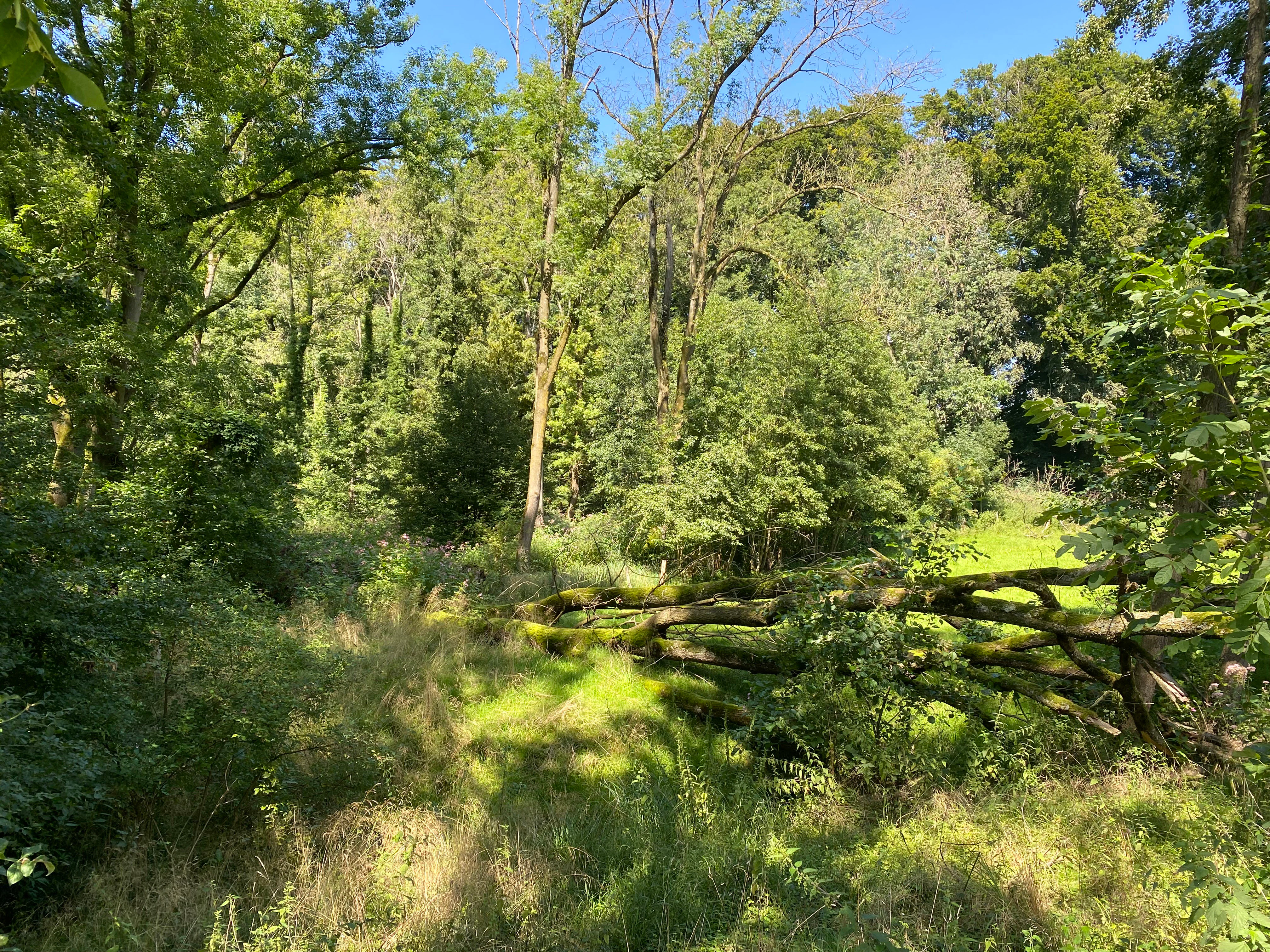
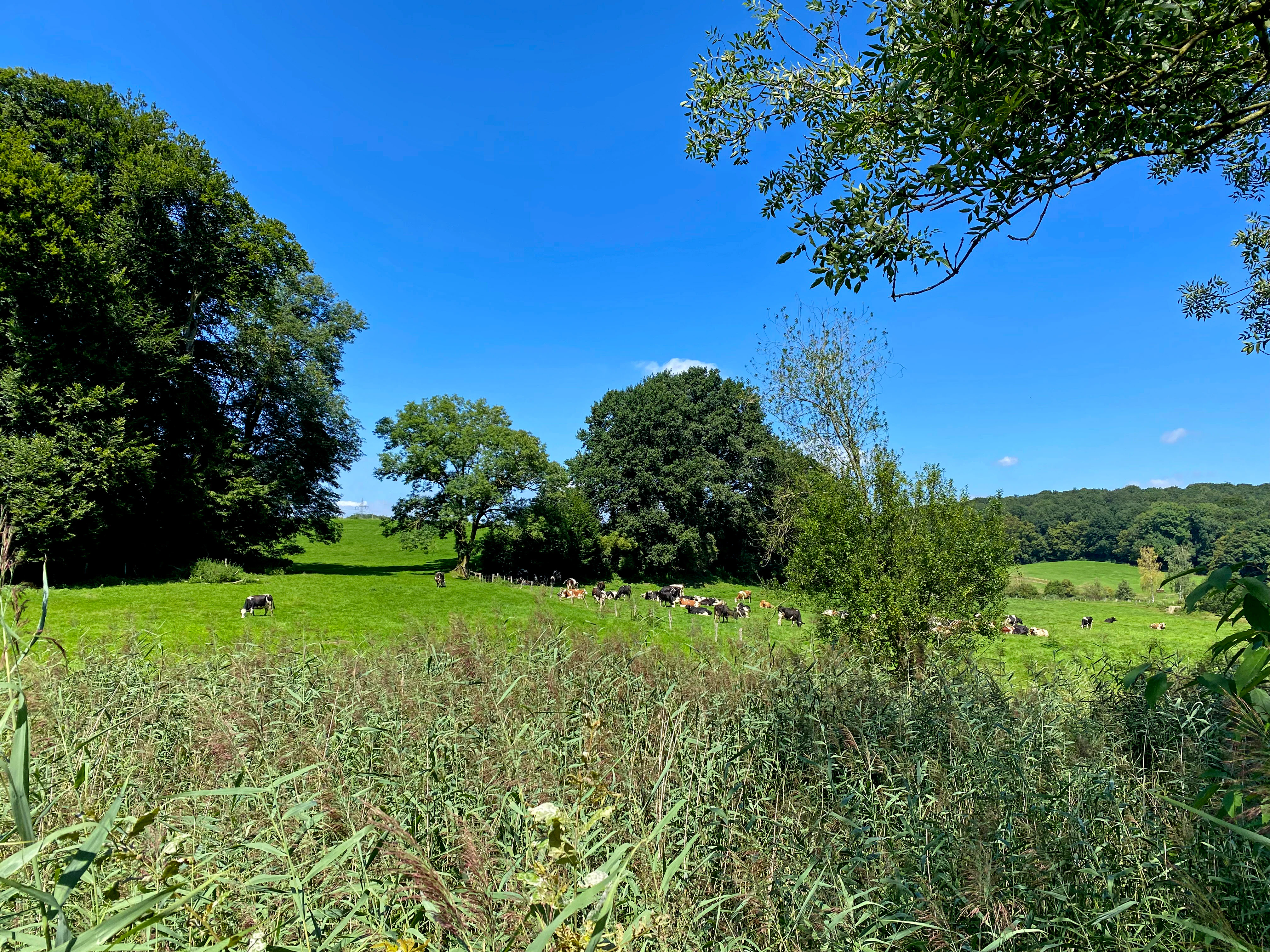
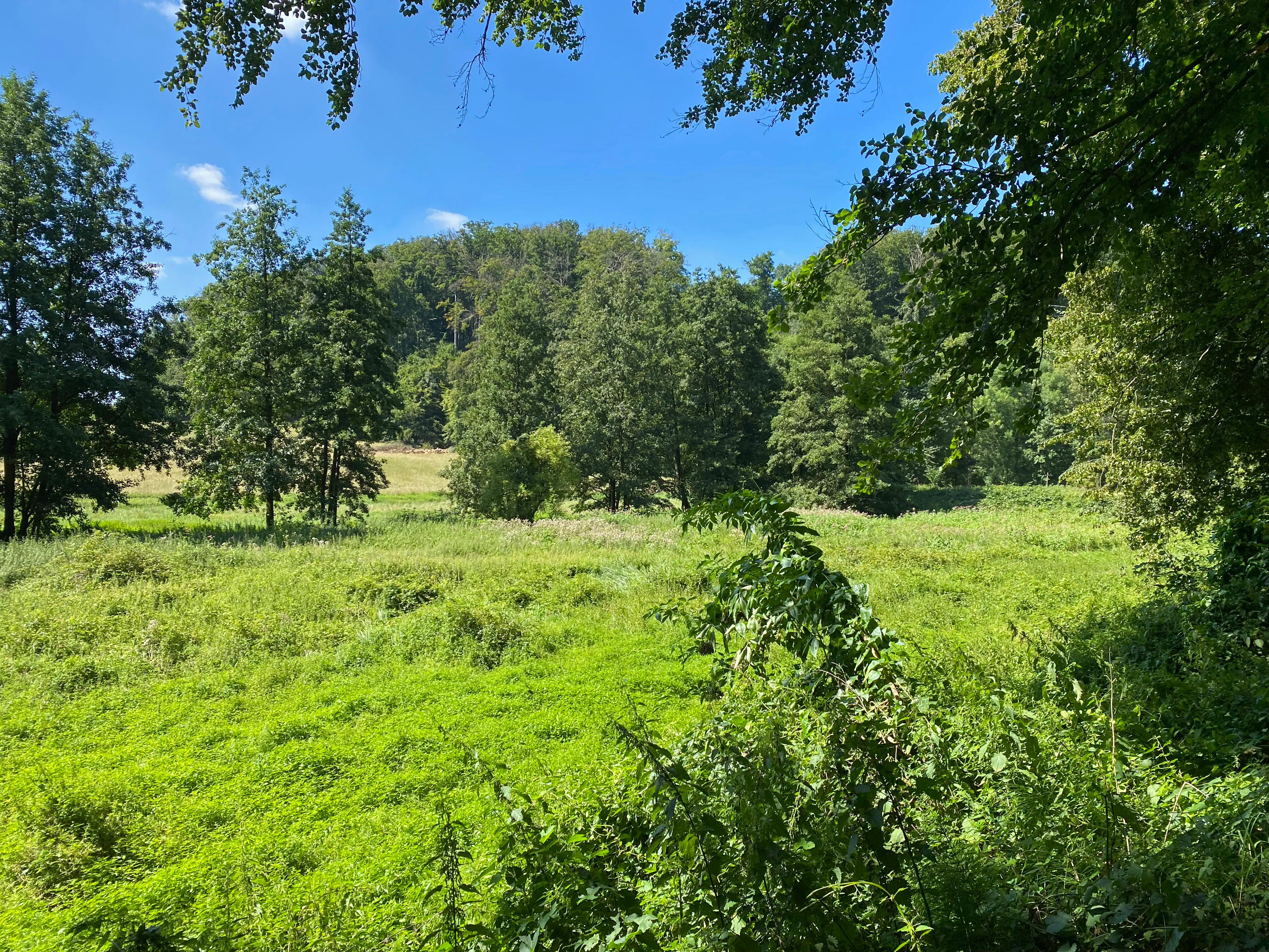
Between the stream and the steep wooded slopes, a strip of wet grassland has developed: a complex of wet meadows, abandoned moist grassland with extensive tall-herb vegetation, and further reed and sedge communities. A characteristic linear tall-herb community, recognized as an FFH habitat type, lines the banks of the Rotthäuser Bach.
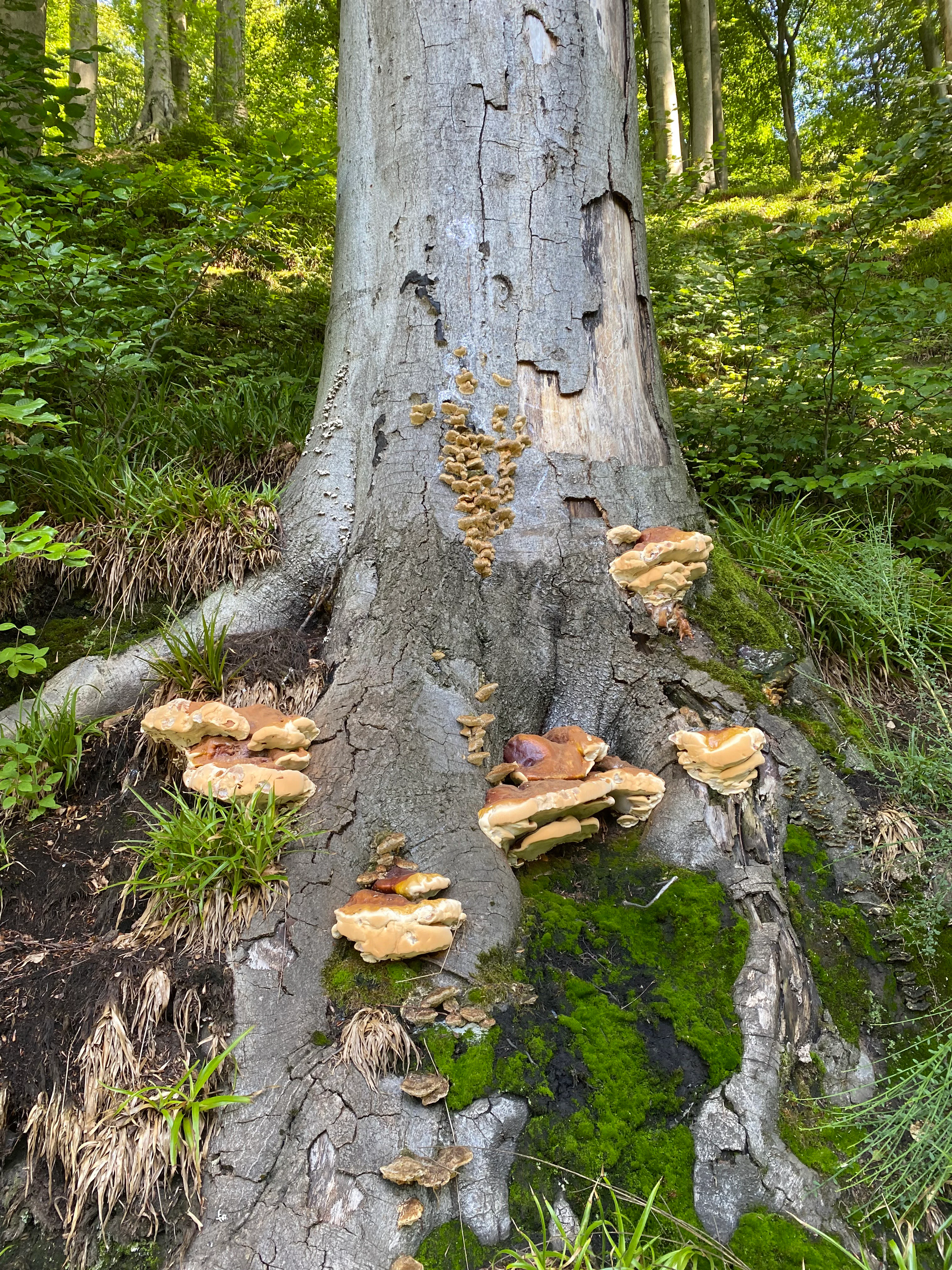
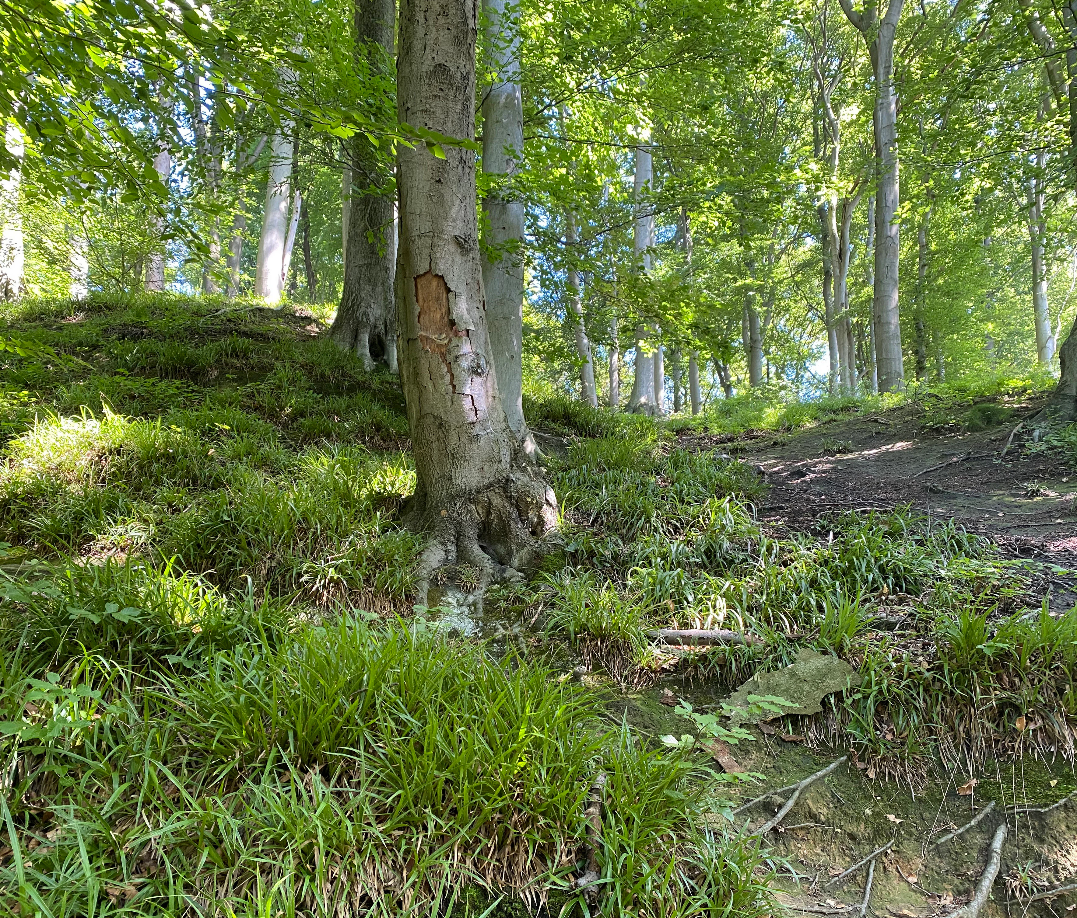
Further down the valley lies the Morper Bruch, a broad alder swamp dominated by alder carr (Erlenbruchwald) with open water surfaces, numerous small drainage ditches, and rare plant specialists. To the east, the slopes rise into stands of Hainsimsen beech forest, with beech root systems exposed along the steeper sections and a notable amount of dead wood and fungi. Together, these features create a layered valley landscape where open water, marsh, wet meadow, floodplain forest, and slope forest sit within a few hundred metres of one another.
Morper Bachtal ecosystems, habitats, and plant life
Ecologically, Morper Bachtal is a textbook example of a low-mountain Bachtal in transition between the uplands and the loess plain. Its nature is defined less by a single dominant habitat than by the close interplay between open water, reedbeds, tall-herb vegetation, wet meadows, alder-dominated floodplain woodland, and beech forest on the adjacent valley slopes.
The aquatic and semi-aquatic habitats include the straightened Rotthäuser Bach with its associated reed beds (Röhrichte) and the Papendell pond system, where shallow-water zones, willow scrub, and open water create important amphibian spawning habitat. Surrounding wet meadows, fallow moist grassland, and tall-herb communities (Hochstaudenfluren) enrich this aquatic core, and the overall mosaic of reed, wet meadow, sedge beds, and adjacent forest constitutes a well-developed stream-valley ecosystem, characteristic of valleys on the western edge of the Bergisches Land.
The forest habitats include extensive alder carr at the Morper Bruch, where drainage ditches cut through the system but the central waterlogged character remains intact, and Hainsimsen beech woodland (Luzulo-Fagetum) on the slopes. Both are noted as particular rarities: the beech forest is described as a particularly valuable, rare habitat on the reserve's slopes, while the alder swamp supports uncommon species adapted to permanently waterlogged conditions.
In a wider sense, the reserve acts as a hinge between the loess-dominated countryside of the lower Rhine terraces and the forest-dominated Bergisches Land Mittelgebirge. Within the larger landscape mosaic of the region, it is recognized as a binding element in the Rheinterrassen-Korridor and as an important link in the regional habitat network that connects to the Düsselaue protected areas further downstream, providing continuity for wetland species that otherwise struggle in the fragmented landscape between Düsseldorf, Mettmann, and Erkrath.
Morper Bachtal wildlife and species highlights
The wildlife of Morper Bachtal is closely tied to its habitat mosaic of ponds, reedbeds, wet meadows, and mixed woodland. The reserve's ponds and ditches serve as important amphibian breeding sites, and the open water, reed, and wet meadow complex provides rich habitat for many organisms dependent on standing or slowly flowing water.
Birdlife is one of the reserve's most prominent features. Within the Natura 2000 context, the area is recognized for Teichrohrsänger (the Eurasian reed warbler breeding in the reedbeds), Eisvogel (kingfisher, associated with the open water and slow-flowing stream), Schwarzspecht (black woodpecker, tied to mature deciduous forest with dead wood), and Wespenbussard (honey buzzard, associated with mixed woodland edges). Together, these species emphasize the value of both wetland and forest elements within the reserve.
The forests themselves, particularly the beech woodland on the slopes and the alder carr in the Morper Bruch, support a rich invertebrate and fungal community dependent on dead wood and old trees. Dead wood and fungi play a documented role in supporting the ecological structure of the reserve.
Among the fauna most closely tied to the wetland character of the reserve is a community of amphibians and other aquatic organisms that depends on the ponds and ditch systems as breeding and refuge habitat. These groups are supported by the protected status of the associated biotope types: reedbeds, wet tall-herb communities, wet meadows, sedge communities, and the moist forest types that fringe the valley floor.
Morper Bachtal conservation status and protection priorities
The conservation significance of Morper Bachtal comes from its role as a relatively undisturbed stream valley at the interface between two very different landscape regions: the loess lowlands of the Rhine terraces and the forest-dominated Bergisches Land uplands. In the broader landscape of the Rhine-Ruhr area, this position makes the reserve unusually important for habitat connectivity.
At the European level, the area is integrated into the Natura 2000 network as the FFH-Gebiet DE-4707-301 and classified as an IUCN Category IV Habitat/Species Management Area. Its protection emphasizes the maintenance of specific habitat types, including Hainsimsen beech forest, moist tall-herb communities, and alder-ash and softwood floodplain forests, alongside the species for which the site is recognized, including Teichrohrsänger, Eisvogel, Schwarzspecht, and Wespenbussard.
At the regional level, the reserve's conservation value is rooted in its function as a link between the loess landscape and the Mittelgebirge. Within the statewide habitat network (landesweiter Biotopverbund), it acts as a connective element along the Rheinterrassen-Korridor. At the more local level, it interacts directly with other protected areas along the Düsselaue, including the Düsselaue bei Gödinghoven (ME-029) to the south and the neighboring 108-hectare Rotthäuser Bachtal (D-004 / D-002) to the north, which together with Morper Bachtal form a 182-hectare Natura 2000 biotope network.
Day-to-day conservation management is led by the Untere Landschaftsbehörde (lower landscape authority) of the Mettmann district. The 2012 landscape plan consolidated objectives focused on maintaining the wetland mosaic, preserving dead wood structures in the forests, and sustaining the population of characteristic species. The CTI classification as a Habitat/Species Management Area implies active intervention to maintain habitat quality rather than a strict hands-off approach.
Morper Bachtal cultural meaning and human context
Culturally, Morper Bachtal sits within the broader historical landscape of the Bergisches Land, a region shaped for centuries by small-scale agriculture, forestry, and mill-based water power on its many streams. The morp of the valley name and the Papendell place name reflect a long history of pastoral and smallholder settlement typical of the western Bergisches fringes.
The reserve itself is not primarily a cultural-heritage site. However, the patterns of land use that produced the current habitat mosaic, including seasonal grazing of wet meadows, traditional hay-making on the valley flats, and the regulation of small streams such as the Rotthäuser Bach for mills and ponds, are part of the area's character. Today the cultural context is more about rural land-use history than about ongoing tradition: the area is, in effect, a small surviving piece of an older Bergisches Land cultural landscape embedded within the densely settled Rhine-Ruhr metropolitan region.
There is no significant indigenous or minority cultural narrative associated with the reserve itself, but the broader regional context of the Bergisches Land, with its scattered farmsteads, valley mills, and chapel villages, gives the surrounding area a recognizable cultural identity that the reserve's landscape still echoes.
Top sights and standout views in Morper Bachtal
Morper Bachtal's standout quality is the depth of habitat layering within a very compact area: open water, reedbeds, wet meadows, tall-herb communities, alder swamp, and beech forest all sit within the same small stream valley. The Morper Bruch alder swamp with its rare specialist flora, and the Papendell pond complex with its shallow-water margins, are the two most distinctive internal features.
Equally notable is the reserve's connectivity. As part of a 182-hectare Natura 2000 complex with the Rotthäuser Bachtal to the north and a direct ecological relationship to the Düsselaue areas further south, Morper Bachtal carries significance well beyond its 74 hectares, functioning as a critical link in the corridor between the loess plain and the Bergisches Land.
Best time to visit Morper Bachtal
Because Morper Bachtal is a small wetland and forest reserve at low elevation, its character shifts most with the seasons through the flowering and structural cycles of its habitats. Spring is when the pond margins, wet meadows, and tall-herb communities come into their own: reed warblers return to the reedbeds, amphibian activity in the ponds and ditches peaks, and the beech slopes are bright with fresh leaf cover.
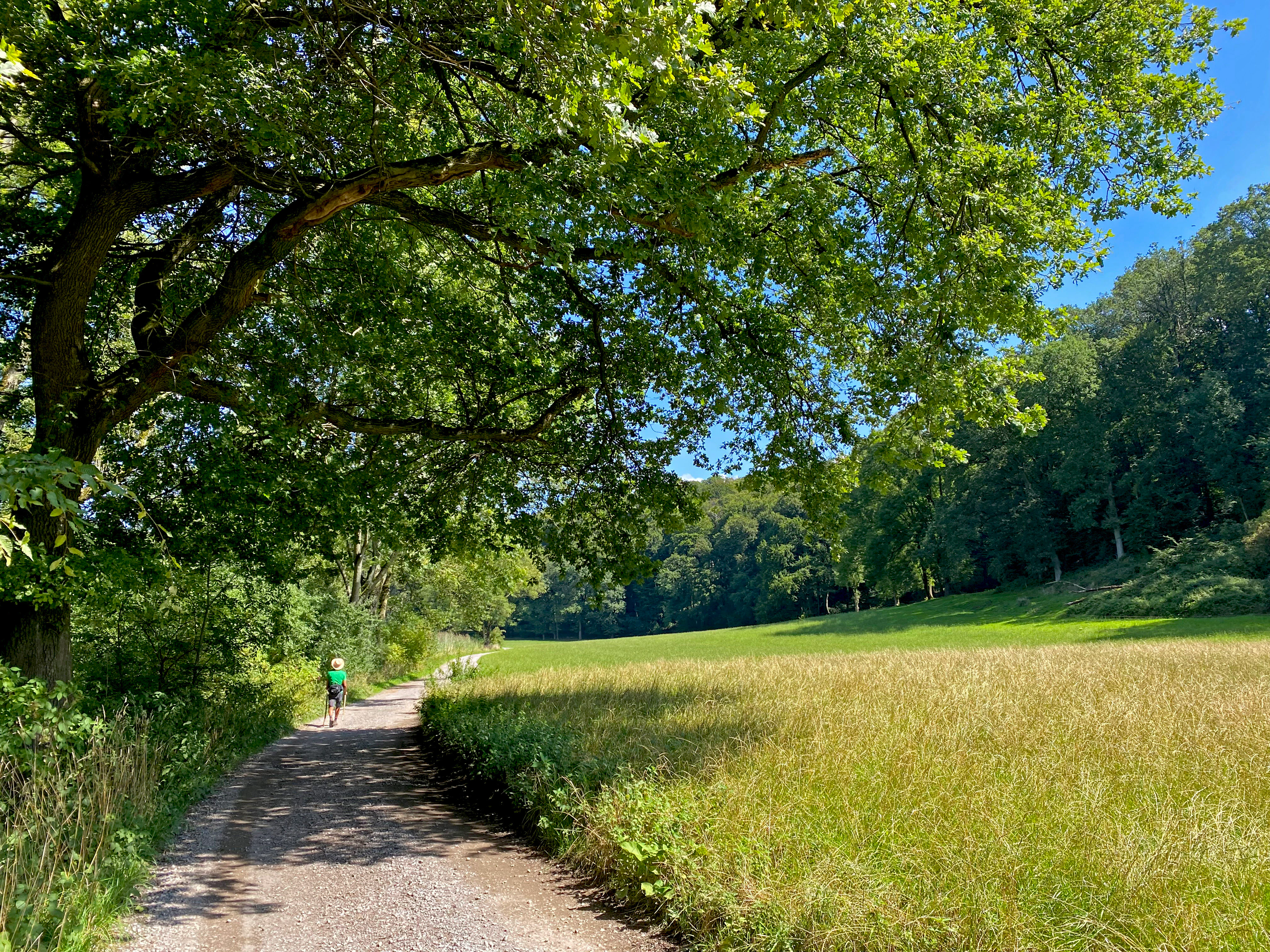
Summer brings the densest vegetation, with full reed stands, broad-leaved forest canopy, and active insect life supporting breeding birds such as the black woodpecker and honey buzzard. Visually, this is the time when the contrast between open water, marsh, and shaded alder carr is most pronounced.
Autumn and winter reveal the underlying structure of the reserve: the morphology of the dead wood in the beech and alder forests, the openness of the Papendell ponds once reed growth subsides, and the exposed beech-root systems on the steeper slopes. These seasons are also the most favorable for waterfowl and for spotting wetland birds in open areas without dense summer foliage. Year-round, the reserve's network of footpaths makes it accessible in any season, though wet-ground sections are best suited to drier spells.