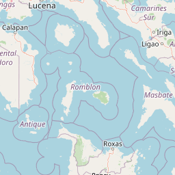
Why Mounts Iglit, Baco National Park stands out
Mounts Iglit, Baco National Park is internationally recognized as the most critical stronghold for the tamaraw, a small endemic buffalo that is one of the world's most seriously endangered mammals. The park contains the largest remaining population of this species, estimated at fewer than 600 individuals, representing over 80% of the global tamaraw population. Beyond this flagship species, the protected area harbors extraordinary biodiversity, including 25 known Mindoro-endemic species across multiple taxonomic groups, four designated Important Bird Areas, and remnants of lowland, montane, and cloud forests that support critically threatened wildlife. The park's dual peaks, Mount Baco and Mount Iglit, form the scenic and ecological heart of Mindoro's mountainous interior.
Mounts Iglit, Baco National Park history and protected-area timeline
The conservation history of Mounts Iglit–Baco traces to 1969, when the area was first established as a game refuge and bird sanctuary covering approximately 8,956 hectares. This initial protection focused specifically on safeguarding the tamaraw, which even then was recognized as facing severe threats from hunting and habitat loss. On November 9, 1970, the area was formally designated as a national park under Republic Act No. 6148, expanding the protected area to 75,445 hectares surrounding Mounts Iglit and Baco. In 2003, the Association of Southeast Asian Nations recognized the park's exceptional value by listing it as one of four ASEAN Heritage Parks in the Philippines. The most significant expansion occurred on June 22, 2018, when the protected area was redesignated as a Natural Park under Republic Act No. 11038, known as the Expanded National Integrated Protected Areas Systems Act, increasing the total area to 106,656 hectares. The Tamaraw Conservation Program, initiated in 1979, established the Tamaraw Gene Pool Farm in Manoot, Rizal within the park, marking the beginning of systematic efforts to prevent the species' extinction.
Mounts Iglit, Baco National Park landscape and geographic character
The physical landscape of Mounts Iglit–Baco National Park is defined by its dramatic mountain terrain rising from Mindoro's interior. The park's northern portion is dominated by Mount Baco, a volcanic peak reaching 2,488 meters, while Mount Iglit stands at 2,364 meters in the southern section. Between these twin peaks, the terrain consists of steep slopes, deep river gorges, and elevated plateaus creating a complex and varied topography. Ten major river systems traverse the protected area, including the Mongpong, Patrick, Mag-asawang tubig, Bongabong, Lamintao, Anahawin, and Busuanga Rivers, which drain toward both the Sibuyan Sea and the South China Sea. The park spans eight municipalities across the island, with the municipality of Sablayan containing the largest share of the protected landscape at 68% of the total area. The southern portion near the Lamintao River contains a distinctive 367-hectare block of introduced Acacia forest, while the Anahawin River corridor features Agoho forest communities within the Mindoro Biodiversity Rescue and Conservation Center.
Mounts Iglit, Baco National Park ecosystems, habitats, and plant life
The park's ecological character encompasses a remarkable diversity of habitats across its elevation gradient. The vegetation ranges from extensive grasslands in the lower elevations through lowland Dipterocarp forests to montane rainforests on the higher slopes. The most extensive forest cover remains in the remote northern region around Mount Baco, though primary forest now comprises less than 3% of the park's total area due to historical deforestation. The southern portion features a notable Acacia forest block near the Lamintao River, while the Anahawin River corridor contains Agoho forest communities within the Mindoro Biodiversity Rescue and Conservation Center. The park is designated as one of 228 Key Biodiversity Areas in the Philippines, with approximately 53% of its total area meeting KBA criteria. Four Important Bird Areas lie within the protected boundaries, supporting significant populations of endemic and threatened bird species.
Mounts Iglit, Baco National Park wildlife and species highlights
Mounts Iglit–Baco National Park serves as the critical habitat for the tamaraw, an endemic buffalo species found nowhere else on Earth. This small bovid, scientifically named Bubalus mindorensis, represents one of the most endangered large mammals in the world, with fewer than 600 individuals remaining in the wild. The park shelters the largest population, with over 80% of all tamaraws concentrated in a restricted area within the protected zone. Beyond the tamaraw, the park supports 25 known Mindoro-endemic species, including seven bird species, nine mammal species, three amphibian species, five invertebrate species, and one plant species. Notable wildlife includes the Mindoro imperial pigeon, Mindoro scops owl, black-hooded coucal, Mindoro hornbill, Mindoro bleeding-heart pigeon, Philippine deer, wild pigs, Mindoro climbing rat, and Mindoro stripe-faced fruit bat. The park also supports at least 25 threatened plant species, including the kalantas tree, tindalo, almaciga, kamagong, and the endangered jade vine.
Mounts Iglit, Baco National Park conservation status and protection priorities
The park's conservation significance stems primarily from its role as the last refuge for the critically endangered tamaraw. The species was declared one of the top 10 endangered species on Earth by the IUCN in 1996 and was classified as critically endangered in 2002, reflecting the severe threats it faces from habitat loss, hunting, and population fragmentation. Conservation programs include regular Biodiversity Monitoring System assessments, Annual Tamaraw Population Counts, and the Tamaraw Conservation Program established in 1979. The protected area management incorporates SMART (Spatial Monitoring and Reporting Tool) patrolling, ecosystem restoration initiatives, and enforcement of environmental laws. Collaboration with organizations including the ASEAN Centre for Biodiversity, Mindoro Biodiversity Conservation Foundation, World Wildlife Fund, and various academic institutions supports these efforts. The Tamaraw Conservation Program operates the Mindoro Biodiversity Rescue and Conservation Center, which has achieved the only successful captive breeding of a tamaraw to maturity. Despite population gains from 327 individuals in 2012 to 523 in 2018, threats from poaching and traditional land-use practices continue to endanger the species.
Mounts Iglit, Baco National Park cultural meaning and human context
Mounts Iglit–Baco National Park is home to at least six ethnic groups, including the Batangas, Tagalog, Mangyan, Bisaya, Bicolano, and Ilocano peoples. The park is particularly significant to various Mangyan groups, specifically the Bangon, Buhid, Hanunuo, Tadyawan, and TaoBuid communities, each maintaining distinct languages, cultures, and traditions. The protected area shares boundaries with ancestral domains of the Taobuid, Buhid, and Bangon peoples, whose traditional way of life is deeply connected to the park's landscapes. These indigenous communities practice traditional farming and hunting for subsistence, and maintain cultural ties to the land that span generations. The park holds sacred significance in Philippine mythology: for the Tao Buid of the northwest, the land is protected by their gigantic heroine-matriarch Rawtit, while for the Buhid of the southeast, the land was founded by their ancestors Manggat and Sayum-ay. The presence of these indigenous communities creates both cultural richness and complex conservation challenges requiring careful integration of traditional practices with protection objectives.
Top sights and standout views in Mounts Iglit, Baco National Park
The twin peaks of Mount Baco and Mount Iglit form the dramatic centerpiece of this vast mountain park, offering spectacular scenery and challenging climbing opportunities. The park's designation as an ASEAN Heritage Park and its UNESCO World Heritage Tentative List nomination reflect its exceptional global significance. The critical conservation mission to save the tamaraw from extinction represents one of the most urgent wildlife protection efforts in Southeast Asia. The presence of four Important Bird Areas makes the park a destination of particular interest for birdwatchers seeking Mindoro's endemic species. The cultural heritage of the Mangyan communities adds depth to the park's identity, connecting biological conservation with indigenous traditions. Ten major river systems originating in the park provide essential water resources for downstream communities across Mindoro Island.
Best time to visit Mounts Iglit, Baco National Park
The park can be visited throughout the year, though the dry season from November to May generally offers more comfortable conditions for trekking and wildlife observation. The wet season from June to October brings heavier rainfall that can affect trail conditions and visibility, particularly in the higher elevations. The cooler months from December to February typically provide the most pleasant temperatures for mountain activities. Wildlife viewing opportunities, particularly for the tamaraw, may vary seasonally as animals move between different habitat areas in response to vegetation patterns. Visitors should be prepared for variable mountain weather conditions and should consult with park management offices regarding current access conditions and any seasonal closures or restrictions.