
Mori Atlas logo
Protected landscapeNaturpark Hirschwald

Mapping the ecological diversity of dry limestone heathlands and the Lauterach valley habitat corridor

Naturpark Hirschwald: A Comprehensive Geographic Profile of this Protected Bavarian Landscape

Naturpark Hirschwald represents a vital protected landscape in the northern Upper Palatinate region of Bavaria. Spanning roughly 278 square kilometers, the park is characterized by a mosaic of Jurassic limestone hills and the east-west oriented Lauterach valley. This geographic setting supports rare dry calcareous grasslands and provides essential refuges for endangered bat populations within a diverse rural and forested landscape.

BavariaUpper PalatinateFranconian Albnature parkdry grasslandcalcareous grassland
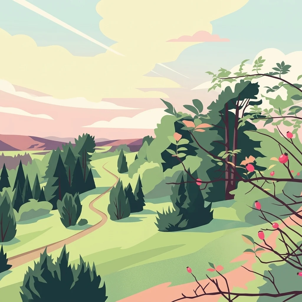
A digital illustration of a peaceful landscape with rolling green hills, a winding dirt path, scattered evergreen trees, and a branch with red berries in the foreground.

Naturpark Hirschwald

Protected landscape

Park overview

Structured park overview, official facts, and landscape profile for Naturpark Hirschwald

Naturpark Hirschwald park facts, protected area profile, and essential visitor context

Review the core facts for Naturpark Hirschwald, including designation, size, terrain, visitor scale, habitats, and operating context in one park-focused overview.

About Naturpark Hirschwald

Naturpark Hirschwald is a designated nature park in the Upper Palatinate region of Bavaria, in southeastern Germany. Spanning roughly 278 square kilometers, it ranks among the smaller Bavarian nature parks, yet it has an ecological profile that is unusually concentrated and ecologically significant for its size. It lies within the Landkreis Amberg-Sulzbach and includes the district town of Amberg, along with the municipalities of Ensdorf, Hohenburg, Kastl, Kümmersbruck, Rieden, Ursensollen, and Schmidmühlen.

The park's identity is shaped by its geographic position at the northern edge of the Mittlere Frankenalb, the middle section of the Franconian Alb. This is a landscape of gently folded Jurassic limestone, narrow valleys, and forested plateaus. Naturpark Hirschwald's most distinctive landscape feature is the Lauterach valley, which cuts east-west through the park. Because this valley orientation opens the slopes to long hours of direct sunshine and because the thin, calcium-rich soils cannot easily support closed forest, the slopes have historically been used as pasture, which has in turn allowed a network of Trockenrasen, calcareous dry grasslands, and juniper limestone heath to develop. The accompanying image of Wacholderheide (juniper heathland) near Kastl captures this habitat character well.

The park is managed by the supporting association Naturpark Hirschwald e. V., which is headquartered in Amberg. Its designation date of 18 December 2006 made it the 17th officially recognized nature park in Bavaria, fitting into a long-standing Bavarian tradition of using the Naturpark designation to link landscape conservation, regional identity, and sustainable land use.

Until 2015, the center of the park included a 19.6 square kilometer uninhabited gemeindefreies Gebiet Hirschwald, a special-status unincorporated area that completely surrounded the small village of Hirschwald in the municipality of Ensdorf as an enclave. That uninhabited area was dissolved with effect from 1 September 2015 and divided among Ensdorf, Hohenburg, Kümmersbruck, and Ursensollen, with the largest share going to Ensdorf.

Quick facts and research context for Naturpark Hirschwald

Naturpark Hirschwald is located in the Landkreis Amberg-Sulzbach in the Upper Palatinate region of Bavaria, Germany, with Amberg as its associated district town. It covers an area of approximately 278 square kilometers, making it one of the smaller designated nature parks in Bavaria. The park was officially established on 18 December 2006 and carries the designation NP-00017.

Geographically, it lies north of the center of the Mittlere Frankenalb natural region, extending slightly north into Amberg. Its core landscape is shaped by the east-west valley of the Lauterach and its tributaries, which support calcareous dry grasslands and juniper limestone heath. The park is also notable for hosting the last surviving Greater Horseshoe Bat maternity roost in Germany, a key element of its conservation importance.

Protection and recognition

Analysis of terrestrial protected area boundaries and international recognition records

Naturpark Hirschwald Protection Status and Documented Conservation Scope

Naturpark Hirschwald features a documented terrestrial protection scope governed by regional conservation frameworks. Detailed registry records outline the official protected area designation metrics and international recognition status.

Protection details

Protection scope
Terrestrial
Transboundary protection
No
Park context

Deeper park guide and search-rich context for Naturpark Hirschwald

Naturpark Hirschwald history, landscape, wildlife, and travel context

Explore Naturpark Hirschwald through its history, landscape character, ecosystems, wildlife, conservation priorities, cultural context, and seasonal travel timing in a structured park guide built for atlas discovery and search intent.

Why Naturpark Hirschwald stands out

Naturpark Hirschwald is best known for two tightly linked natural values: a network of calcareous dry grassland habitats, including juniper limestone heath, and one of the most important bat refuges in Germany. The Lauterach valley's west-to-east orientation creates the dry, sun-exposed slopes and shallow soils that allow these rare habitats to persist in a region otherwise dominated by forest. Where these grasslands survive, they support a threatened flora typical of the Franconian Alb. Equally distinctive is the park's role in conserving the Greater Horseshoe Bat. The last known colony of this species in Germany uses a building at the marketplace in Hohenburg as its maternity roost, a site that owes its survival to the relatively undisturbed hunting grounds provided by the nearby Hohenfels military training area.
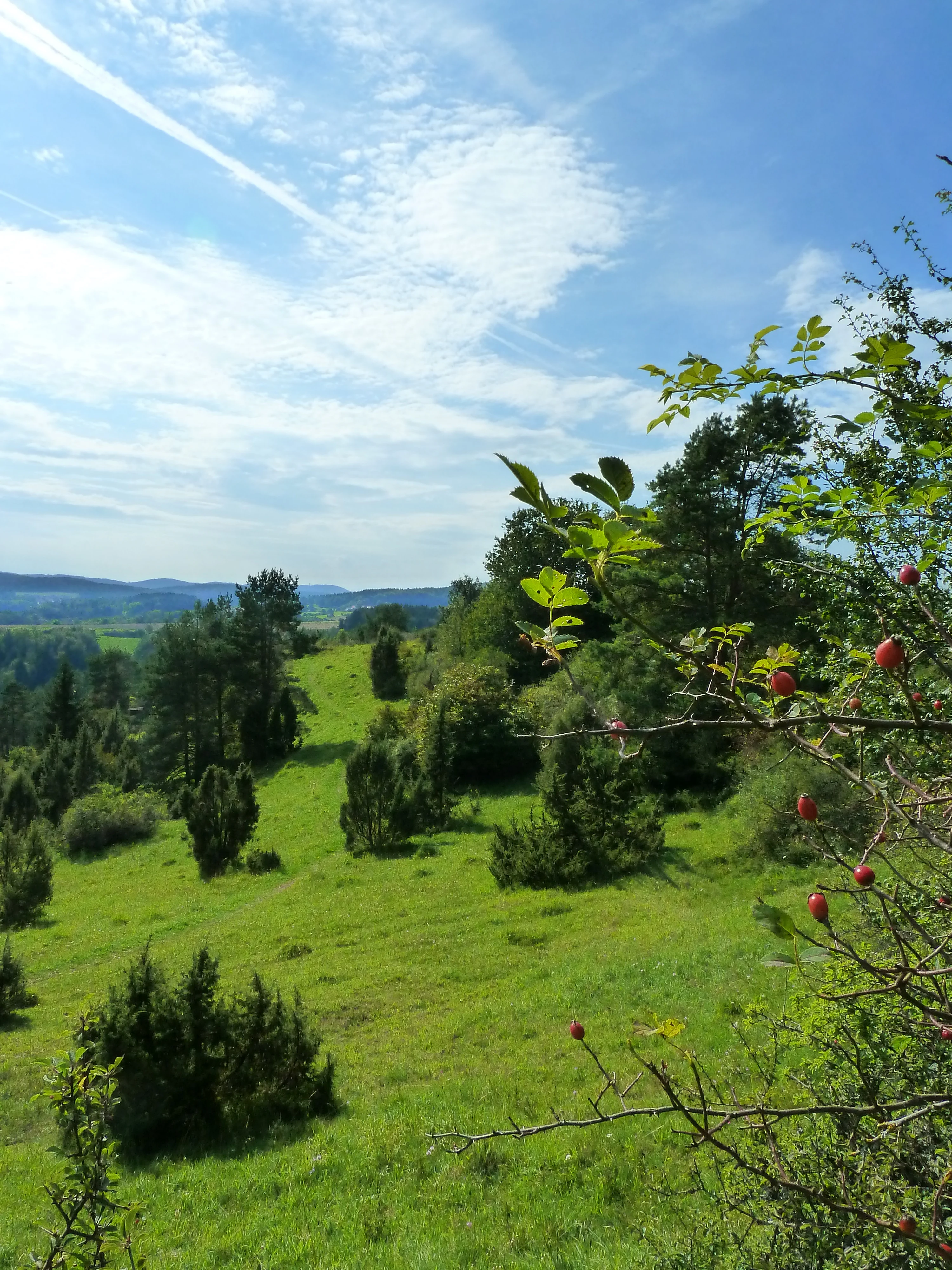
A sunny, hilly landscape featuring green grassy slopes dotted with juniper bushes, with a foreground focus on branches bearing red rose hips.
Limestone grassland with juniper and rose hips in the Kastl area of Naturpark Hirschwald.

Naturpark Hirschwald history and protected-area timeline

The history of Naturpark Hirschwald as a formally protected landscape begins in the early twenty-first century. It was officially designated on 18 December 2006 as the 17th Bavarian nature park, a recognition that placed it within the broader German Naturpark tradition, in which such designations combine landscape conservation, ecological management, regional development, and public outreach.

Management of the park is handled by a dedicated supporting association, Naturpark Hirschwald e. V., registered in Amberg. This association-based structure is typical of German nature parks and reflects the cooperative model in which municipalities, landowners, conservation groups, and regional stakeholders share responsibility for the protected landscape.

The underlying landscape, however, has a much longer ecological history. The dry grassland and juniper heath communities of the Lauterach valley are the result of centuries of traditional pastoral use on thin limestone soils. These open habitats only persist where grazing, mowing, or other land use prevents forest encroachment.

A notable recent administrative change occurred on 1 September 2015, when the previously unincorporated gemeindefreies Gebiet Hirschwald, an uninhabited 19.6 square kilometer area that once formed the heart of the park and surrounded the village of Hirschwald as an enclave, was dissolved and distributed among four surrounding municipalities. Ensdorf received by far the largest share, followed by Ursensollen, Hohenburg, and Kümmersbruck.

Naturpark Hirschwald landscape and geographic character

Naturpark Hirschwald lies at the transition between the forested uplands of the northern Upper Palatinate and the more open country of the Franconian Alb. Its terrain is shaped by Jurassic limestone bedrock, which produces thin, stony soils, gently rolling plateaus, and valleys that cut relatively deeply into the landscape. Elevations are modest, and the scenery is characterized less by dramatic relief than by quiet transitions between woodland, open valley floors, ridge-top fields, and exposed slopes.

The defining landscape feature of the park is the Lauterach valley, which runs in a general west-to-east direction across the park. This orientation matters ecologically, because south-facing slopes along the valley receive extended direct sunlight, while the shallow, base-rich soils on the valley sides cannot easily support dense forest cover. The result is a landscape mosaic in which dry calcareous grasslands and juniper-dominated limestone heathland cling to the slopes, while the broader uplands remain forested with mixed woodland typical of the region.

Near Kastl, classic Kalkmagerrasen mit Wacholder, juniper-rich limestone dry grassland, is locally characteristic of the park. The Lauterach itself is a modest lowland river that meanders across the valley floor and provides a contrasting linear element through an otherwise open, dry landscape. Together, these features give Naturpark Hirschwald a strongly mosaic-like character: small-scale, intimate, and rich in ecological transitions.
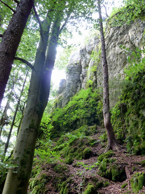
A low angle shot looking up at a grey limestone rock formation towering above a dense forest floor covered in moss and leaf litter.
A rocky limestone cliff face rising from a mossy forest floor in Naturpark Hirschwald.

Naturpark Hirschwald ecosystems, habitats, and plant life

The ecology of Naturpark Hirschwald is dominated by calcareous dry habitats and the juniper-rich limestone heath that depends on them. The Lauterach valley's west-to-east orientation creates the dry microclimate that these habitats require, and centuries of traditional grazing land use, on soils too thin and dry for intensive agriculture, have preserved an unusually coherent network of Trockenrasen. Where grazing pressure has declined, juniper (Wacholder) gradually colonizes the open grassland, leading to the characteristic Wacholderheide landscape that is locally iconic in the park, especially near the Hochholz area close to Kastl.

Beyond these dry open habitats, the park also includes larger expanses of typical Franconian Alb woodland, with mixed forest stands on the limestone plateaus. This forest matrix provides ecological contrast and contributes to the park's habitat diversity, even though the conservation spotlight falls firmly on the open dry habitats.

Wetland habitats are present along the Lauterach itself and in smaller tributary valleys, although these are not the dominant ecological theme of the park. The mosaic of dry grassland, juniper heath, woodland, and small-scale valley habitats makes the park unusually compact in ecological terms: a small area supports a high density of habitat types, which in turn sustains an unusual concentration of species.

Naturpark Hirschwald wildlife and species highlights

Naturpark Hirschwald's wildlife significance is dominated by a single, exceptionally important feature: the presence of the last known maternity roost of the Greater Horseshoe Bat (Rhinolophus ferrumequinum) in Germany. The species is classified as critically endangered nationally, and Hohenburg, within the park area, hosts the only remaining Wochenstube, the nursery colony, for the species in the country. This roost is located in a building on the marketplace of Hohenburg.

The continued survival of this colony is closely tied to the landscape around the park. The Greater Horseshoe Bat requires extensive, structurally rich, low-disturbance hunting grounds, and these conditions are provided by the large, relatively undeveloped area of the Hohenfels military training area to the south. The long-term coexistence of the bat colony and the military training area is one of the most striking examples in Germany of how a heavily managed, restricted landscape can serve as a de facto nature reserve for highly sensitive species.

Beyond the horseshoe bat, the park's mosaic of dry grassland, juniper heath, woodland edge, and small valley habitats supports a broader community of species typical of the Franconian Alb. Calcareous dry grasslands of this type are well known for hosting specialized invertebrates, reptiles, and a distinctive bird community, although the available source material does not provide detailed species lists. The park's wildlife character is best understood as the combination of one nationally critical mammal refuge with a regionally important network of dry-habitat species.

Naturpark Hirschwald conservation status and protection priorities

The conservation significance of Naturpark Hirschwald rests initially on its network of calcareous dry grasslands and juniper limestone heath, habitat types that have become rare across much of Germany because of agricultural intensification, fertilization, abandonment, and afforestation. The west-to-east Lauterach valley is a particularly valuable stronghold for these habitats within the Franconian Alb.

However, the park's national conservation importance comes from its role in protecting the Greater Horseshoe Bat. The last known maternity roost of this species in Germany is located in a building on the marketplace of Hohenburg, within the park area. The bat's survival is intimately linked to the nearby Hohenfels military training area, where large-scale land use restrictions create what is effectively a quiet, structurally rich hunting landscape. This relationship between restricted military land use and bat conservation is widely regarded as one of the most remarkable European examples of how non-conservation land management categories can incidentally deliver critical habitat for threatened species.

The park's broader conservation framework is the Bavarian Naturpark system itself, in which designation brings coordinated management through the supporting association Naturpark Hirschwald e. V., headquartered in Amberg. Within the park, additional formal protection layers include the Naturschutzgebiet Unteres Pfistertal nördlich von Vilshofen, which provides stricter, area-specific protection for at least one ecologically sensitive valley section.

Naturpark Hirschwald cultural meaning and human context

Naturpark Hirschwald is embedded in the cultural landscape of the Upper Palatinate (Oberpfalz), a region of Bavaria known for its small historic towns, rural land-use traditions, and centuries-long interaction with the limestone hills of the Franconian Alb. The municipalities that share in the park, including Ensdorf, Hohenburg, Kastl, Kümmersbruck, Rieden, Ursensollen, and Schmidmühlen, all carry this regional identity, and the town of Amberg, the historical district capital, provides a strong urban anchor for the protected landscape.

The dry grasslands and juniper heathland of the park are themselves a cultural artifact: they exist only because of sustained traditional pastoral use of slopes too thin and dry for crop farming. The persistence of these habitats therefore reflects an ongoing human-landscape relationship rather than a purely natural phenomenon, giving the park an additional cultural depth beyond its ecological function.

Within the park, the now-dissolved gemeindefreies Gebiet Hirschwald, once an unenclosed, uninhabited public area, was for decades a distinctive feature of Bavarian administrative geography, completely encircling the tiny village of Hirschwald as an enclave in the municipality of Ensdorf. Its dissolution in 2015 ended a long-standing local peculiarity and reflects broader regional reorganization of unincorporated areas in Bavaria.

Top sights and standout views in Naturpark Hirschwald

Among Naturpark Hirschwald's strongest distinguishing features, the Lauterach valley stands out as the ecological backbone of the park. Its east-west orientation and dry, sun-exposed slopes anchor an unusually intact network of calcareous dry grasslands and juniper limestone heath, habitats that have otherwise become scarce in the wider German landscape.

Equally distinctive is the park's role as the last refuge of the Greater Horseshoe Bat in Germany. The surviving maternity roost in a building on Hohenburg's marketplace makes the park a site of national, not just regional, conservation importance, and the supporting cast of the nearby Hohenfels military training area illustrates the unexpected ways conservation value can emerge in modern European landscapes.

A third stand-out quality is the park's compactness and habitat density. Although relatively small within the Bavarian system, Naturpark Hirschwald compresses forest, dry grassland, juniper heath, river valley, and traditional cultural landscape into a small, easily explored area, making it a particularly satisfying example of a working mixed-use nature park.

Best time to visit Naturpark Hirschwald

The seasons strongly affect the experience of Naturpark Hirschwald, largely because its open dry grassland and juniper heathland habitats respond visibly to weather and phenology. Late spring and early summer bring the strongest display of the calcareous grassland flora, when the Trockenrasen and juniper slopes near the Lauterach valley and around Kastl are in active growth and most colorful, and the Lauterach itself flows against a vibrant green mosaic of fields and forest edges.

Mid to late summer offers the classic dry, warm conditions that make the Wacholderheide feel most characteristic of the region, with juniper and grasses dominating the visual landscape and dry conditions reflecting the underlying climate that shapes the habitats. Autumn shifts the mood toward the forested parts of the park and the broader Mittlere Frankenalb scenery, when mixed woodland becomes a stronger visual element.

Winter generally emphasizes the topographic structure of the park: the contrast between open dry slopes and the wooded plateaus becomes sharper, and the Lauterach valley's shape becomes more readable against a quieter vegetation background. For visitors particularly interested in bat ecology or bat-friendly habitat, late spring and early summer also coincide with the active season of the Greater Horseshoe Bat maternity roost in nearby Hohenburg, though viewing is obviously constrained by the species' nocturnal habits.

Monthly climate preview

Examine measured long term monthly weather patterns and annual temperature ranges across Bavaria

Naturpark Hirschwald Climate Normals, Average Temperature and Precipitation Patterns

Representative coordinate records show average monthly temperatures ranging from sub-zero lows to warm summer maximums alongside consistent daily precipitation rates for Naturpark Hirschwald. Analyzing the complete twelve-month climatology dataset reveals deeper variations in temperature and precipitation rhythms across the protected landscape.
Annual mean8 °C
-2 °C19 °C
Jan-2°
Feb-1°
Mar
Apr
May13°
Jun17°
Jul19°
Aug19°
Sep14°
Oct
Nov
Dec-1°
Warmest month
July

19 °C

Coolest month
January

-2.2 °C

Wettest month
July

2.6 mm/day

Driest month
April

1.3 mm/day

Park location guide

Geography guide, regional context, and park location map for Naturpark Hirschwald

Naturpark Hirschwald park geography, regions, and map view in Germany

Understand where Naturpark Hirschwald sits in Germany through a broader geographic reading of the surrounding landscape, nearby location context, and its mapped position within the national park landscape.

How Naturpark Hirschwald fits into Germany

Germany is a federal republic in Western and Central Europe with a population of over 83 million across sixteen constituent states. It is Europe's largest economy by nominal GDP and a major global exporter and importer. The capital is Berlin, and the country borders Denmark, Poland, Czech Republic, Austria, Switzerland, France, Luxembourg, Belgium, and the Netherlands.

Wider geography shaping Naturpark Hirschwald in Germany

Germany is located in Western and Central Europe, spanning 357,022 km². It borders Denmark to the north, Poland and the Czech Republic to the east, Austria and Switzerland to the south, and France, Luxembourg, Belgium, and the Netherlands to the west. The country has coastlines on the Baltic Sea and North Sea to the north, with the Alps located in the southern region.

Map view of Naturpark Hirschwald

Use this park location map to pinpoint Naturpark Hirschwald in Germany, understand its exact geographic position, and read its mapped placement within the surrounding landscape more clearly.

Pigeon | © OpenStreetMap contributors

Location context for Naturpark Hirschwald

Bavaria

Explore protected habitats, limestone heathland, and the Lauterach valley terrain.

Naturpark Hirschwald Photos and Landscape Scenery Visual Guide

Visual records illustrate the mosaic of calcareous dry grasslands, juniper heath, and forested hills defining the terrain of Naturpark Hirschwald. Photographic documentation reveals the intimate protected-area environment and ecological transitions shaping the region.

A sunny, hilly landscape featuring green grassy slopes dotted with juniper bushes, with a foreground focus on branches bearing red rose hips.

High-angle view of a green valley with a winding river, bordered by dense forested hills under a bright sky.

A low angle shot looking up at a grey limestone rock formation towering above a dense forest floor covered in moss and leaf litter.

Park atlas

Compare surrounding regional geography and adjacent protected areas

Parks Near Naturpark Hirschwald and Connected Protected Landscapes

Browse other parks near Naturpark Hirschwald to examine matching limestone terrain and protected valley ecosystems. Continuing the geographical comparison reveals broader patterns across the regional protected landscape.
A soft watercolor painting of a winding river flowing through green rolling hills and meadows under a hazy, bright sky.
Protected landscapeBavaria
About 20 km away#1 closest

Northwest

Naturpark Fränkische Schweiz, Frankenjura: An Atlas of Bavarian Karst and Forested Landscapes

Protected landscape geography within the northern Franconian Jura.

Naturpark Fränkische Schweiz, Frankenjura is a landmark protected area covering over 2,300 square kilometers across Bavaria. Its terrain is defined by a rhythmic sequence of limestone plateaux, winding river valleys, and dolomite formations, balanced by the quieter, pine-dominated reaches of the Veldensteiner Forst. This atlas entry details the park's geological complexity and its significant role in regional conservation.

Area
2,335.44 km²
Established
1968
Relief
Upland
Climate
Temperate
Watercolor painting of a light and airy landscape featuring green rolling hills, a cluster of trees, and wildflowers in the foreground against a pale sky.
Nature reserveBavaria
About 25 km away#2 closest

Northwest

Schottental bei Heldmannsberg Nature Reserve: Mapped Geography and Protected Valley Landscapes

A diverse karst valley reserve in the Middle Franconia region of Bavaria.

Located in the Nürnberger Land district of Bavaria, Schottental bei Heldmannsberg is a nature reserve that protects a narrow, limestone-walled side valley. The site offers a detailed look at dolomite cliff faces, hydrologically active karst spring pools, and a mosaic of calcareous dry grasslands and beech-pine woodland. This atlas entry provides insight into its geological features, including the notable Bärenfels outcrop, and its role in preserving traditional Hutanger grazing habitats within the Hersbrucker Alb.

Area
0.415 km²
Established
1996
IUCN
IV
Relief
Upland
A horizontal watercolor painting depicting a soft, stylized landscape with rolling green hills, distant purple mountain ridges, and sparse clusters of trees against a light background.
Nature reserveBayern
About 25 km away#3 closest

West

Rinntal bei Alfeld Nature Reserve: Geographic Profile and Protected Valley Landscape

A preserved limestone dry valley in the Franconian Jura of Bayern

Rinntal bei Alfeld is a significant nature reserve covering 34 hectares of dry valley landscape. Its geography includes abandoned field terraces, juniper-framed slopes, and rocky dolomite outcrops. As part of the Natura 2000 Bachtäler der Hersbrucker Alb network, the reserve showcases the traditional grazing influence and limestone karst features of the Franconian Jura plateau.

Area
0.338 km²
Established
2000
IUCN
IV
Relief
Upland
Protected landscapeBavaria
About 26 km away#4 closest

Northeast

Naturpark Nördlicher Oberpfälzer Wald: Protected Landscape and Regional Geography Map

Forested upland terrain and volcanic geology in Bavaria

Explore the structured geography of Naturpark Nördlicher Oberpfälzer Wald, a massive protected region in Bavaria. This detailed profile highlights the park's characteristic ridge and valley terrain, volcanic basalt landmarks, and its role as a vital ecological belt along the international border.

Area
1,380 km²
Water
Minor water
Nature reserveBavaria
About 28 km away#5 closest

Northwest

Schergenbuck mit Schloss Neidstein: Nature Reserve and Protected Karst Landscape

Forestry and geological mapping of a historic Bavarian ridge

Located in the Amberg-Sulzbach district of Bavaria, this nature reserve integrates historic castle ruins with species-rich deciduous woodland and sensitive karst topography. It remains a key point of interest for understanding how small-scale protected areas preserve biodiversity, including native European yew, against the backdrop of the Franconian Jura landscape.

Area
0.177 km²
Established
1973
IUCN
IV
Relief
Upland
Protected landscapeBavaria
About 36 km away#6 closest

East

Naturpark Oberpfälzer Wald: Geographic Atlas and Protected Landscape Overview in Bavaria

Examining the terrain, forest ridges, and regional drainage patterns.

Naturpark Oberpfälzer Wald serves as a prominent protected landscape in Bavaria, Germany. This area encompasses a complex of Scots pine and Norway spruce forests, rugged rock outcrops, and the historic Charlottenhofer Weihergebiet. The region connects seamlessly to broader European mountain belts, offering a unique opportunity to study the intersection of traditional land use and natural conservation within the Oberpfalz administrative district.

Area
823 km²
Established
1994
Relief
Mountain
Climate
Temperate
A pale, soft-toned watercolor painting showing a wetland scene with grass, trees, and distant hills.
Nature reserveNürnberger Land
About 47 km away#7 closest

West

Schwarzenbrucker Moor Nature Reserve: Geography and Protected Wetland Boundaries

A rare peatland habitat in the Middle Franconian landscape.

Schwarzenbrucker Moor is a preserved wetland complex situated within a bowl shaped former river meander. This nature reserve sustains a dense mosaic of open water, reedbeds, and alder bog woodland. Examine the site geography, mapped boundaries, and environmental significance of this protected habitat within the Nürnberger Land district.

Area
0.1 km²
Established
1992
IUCN
IV
Relief
Lowland
A soft, light-toned watercolor illustration of a river landscape with rolling hills in the background and a lone tree in the foreground.
Nature reserveBavaria
About 48 km away#8 closest

West

Schwarzachschlucht Nature Reserve: Geographic Map and Protected Landscape Overview in Bavaria

A study of Franconian sandstone topography and riverine protected habitats

Schwarzachschlucht provides a focused example of geological erosion and forest conservation in Bavaria. This nature reserve features distinctive honeycomb-weathered cliffs, deep river-carved channels, and a significant moss-rich microclimate that has been protected since 1936. The site serves as a vital case for observing the transition between mixed forest slopes and alder-lined riverbanks within the Nürnberger Land district.

Area
0.38 km²
Established
1936
IUCN
IV
Relief
Upland

Common questions about visiting, size, designation, and location context for Naturpark Hirschwald

Naturpark Hirschwald FAQs for park facts, access, geography, and protected area context

Find quick answers about Naturpark Hirschwald, including protected-area facts, park geography, trail and visitor context, and how the park fits into its surrounding country and regional landscape.
MoriAtlas Explorer

Continue Your Protected Areas Search Across the Global Atlas

Deepen your exploration by continuing the structured search for national parks and protected areas worldwide. Utilize the comprehensive filtering capabilities to compare different conservation landscapes and refine your understanding of global park geography. Discover more about the distribution and characteristics of protected natural areas.

Global natural geography