
Mori Atlas logo
Nature reserveNeupotzer Altrhein

A preserved river landscape in Rheinland-Pfalz showcasing historical oxbows and alluvial forests.

Neupotzer Altrhein Nature Reserve: Exploring the Geography of a Rhine Floodplain Mosaic

(Vogelschutzgebiet Neupotzer Altrhein)

Neupotzer Altrhein represents a vital nature reserve and wetland refuge in the Rheinland-Pfalz region of Germany, illustrating the complex geography of the Upper Rhine Graben. Originally formed by nineteenth-century river straightening, the area now serves as a protected mosaic of oxbows, reedbeds, and alluvial forests that support diverse floodplain ecosystems. This geographic profile traces the mapped boundaries, natural water channels, and habitat structure that define this protected landscape within the broader Rhine valley network.

floodplainold rhine armNatura 2000bird protection areawetlandreedbeds
A flat vector-style illustration showing a winding river flowing through a forested valley with gentle mountains in the background under a setting sun.

Neupotzer Altrhein

Nature reserve

Park overview

Structured park overview, official facts, and landscape profile for Neupotzer Altrhein

Neupotzer Altrhein park facts, protected area profile, and essential visitor context

Review the core facts for Neupotzer Altrhein, including designation, size, terrain, visitor scale, habitats, and operating context in one park-focused overview.

About Neupotzer Altrhein

The Neupotzer Altrhein occupies a notable position in the Upper Rhine lowlands, where one of Europe's most intensively reengineered river systems has been allowed, in selected stretches, to return to a more natural floodplain character. The site is centered on an old arm of the Rhine near the community of Neupotz, formed when nineteenth-century channel straightening works cut off a long meander from the main river course. Over more than a century, this abandoned channel has filled with quiet backwaters, reed-fringed edges and encroaching softwood forest, producing one of the more ecologically valuable wetland complexes in Rhineland-Palatinate.

Administratively, the area falls within the Germersheim district of Rhineland-Palatinate, just south of the historic city of Speyer and not far from the town of Wörth am Rhein. Its position within the Upper Rhine Graben gives it a broad, flat character and a climate shaped by the protective ranges of the Palatinate and Black Forest, conditions that favor the development of species-rich floodplain habitats. The reserve is officially recognized as a Bird Protection Area under the European Birds Directive and is a component of the transboundary Natura 2000 network, reinforcing its importance for migratory and breeding birds across the wider Rhine corridor.

Ecologically, the Neupotzer Altrhein represents a textbook example of a recovering Auenlandschaft, with layers of habitat ranging from open water and reedbelts through wet meadows to softwood alluvial forest dominated by willows and alders. This structural variety supports a striking breadth of life, including birds, mammals, amphibians and insects, many of them of recognized conservation interest in Germany and the European Union.

The reserve is closely linked with neighboring designations, functioning as a complement to the Hördter Rheinaue bird protection area and overlapping with its associated Habitats Directive site. It is also embedded in the larger Pfälzische Rheinauen landscape protection area, which knits together floodplain habitats along the Upper Rhine in the Palatinate region. Together, these overlapping designations reflect both the ecological continuity of the floodplain system and the layered governance framework that supports its protection.

Quick facts and research context for Neupotzer Altrhein

Established in 2000, the Neupotzer Altrhein covers roughly 237.5 hectares within the Upper Rhine Graben, one of Europe's most significant lowland rift landscapes. It lies in the Germersheim district of Rhineland-Palatinate, south of Speyer and near the community of Neupotz.

The reserve is officially protected as both an EU Bird Protection Area under the Birds Directive and a component of the Natura 2000 ecological network, with the European site code DE6815401. It is also integrated into the Pfälzische Rheinauen landscape protection area, placing it within a broader regional framework for riparian conservation.

Protection and recognition

Documented terrestrial protection scope, management framework, and Natura 2000 records

Neupotzer Altrhein Protection Status and International Recognition Data

Terrestrial protection status, management scope, and official Natura 2000 recognition sources define the conservation record for Neupotzer Altrhein. Structured international designation data and administrative details outline the verified protected area framework for this location.

International recognition

Protection details

Protection scope
Terrestrial
Transboundary protection
No
WDPA ID
555537844
Park context

Deeper park guide and search-rich context for Neupotzer Altrhein

Neupotzer Altrhein history, landscape, wildlife, and travel context

Explore Neupotzer Altrhein through its history, landscape character, ecosystems, wildlife, conservation priorities, cultural context, and seasonal travel timing in a structured park guide built for atlas discovery and search intent.

Why Neupotzer Altrhein stands out

The reserve is best known for its dynamic floodplain character, shaped by the legacy of the Rhine straightening works of the nineteenth century. What was once an engineered cut-off river arm has matured into a near-natural mosaic of slow-moving waters, reedbeds and softwood floodplain forests, becoming a refuge for waterbirds and wetland wildlife. It is particularly recognized for breeding populations of white storks and kingfishers, alongside the presence of beavers and a diverse community of amphibians, dragonflies and wading birds. The combination of European Birds Directive status, Habitats Directive overlap and active renaturation efforts makes it a flagship example of floodplain recovery along the Upper Rhine.
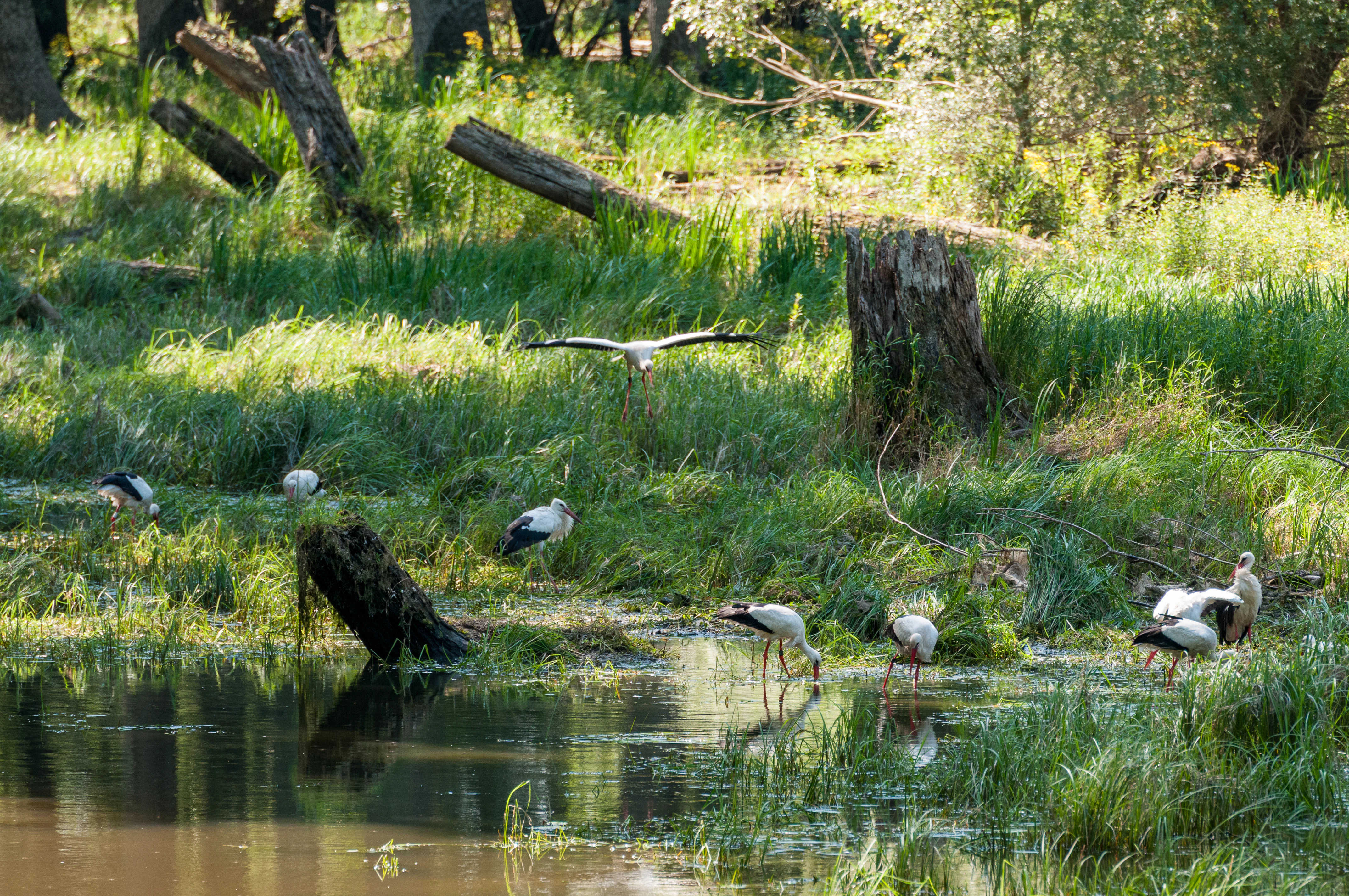
A group of white storks standing in and flying over a grassy, swampy riverbank with tree stumps.
A group of white storks foraging in the wetland habitat of the Neupotzer Altrhein.

Neupotzer Altrhein history and protected-area timeline

The origins of the Neupotzer Altrhein as a protected area lie in the large-scale transformation of the Upper Rhine during the nineteenth century. As part of the broader Rhine correction works, engineers straightened the river's course, leaving behind a network of former channels that gradually evolved into distinct wetland habitats. The Neupotz arm of this old river system became a particular focus for conservation interest because of the rich floodplain habitats that emerged along its banks.

Formal protection arrived relatively late in the site's ecological history, with the Vogelbschutzgebiet Neupotzer Altrhein officially established in the year 2000 as part of the European network of bird protection areas under the Birds Directive. Its designation reflected both the growing recognition of the Upper Rhine floodplains as internationally important bird habitat and Germany's broader commitment to the Natura 2000 framework.

Following designation, the area has been shaped by ongoing efforts to maintain and restore its near-natural character. Renaturation work, environmental education programs and cooperation with regional conservation groups such as BUND and NABU have all contributed to a gradual strengthening of the site's ecological function while introducing measures to manage recreational pressure.

Neupotzer Altrhein landscape and geographic character

The landscape of the Neupotzer Altrhein is defined by the gentle topography of the Upper Rhine Graben, where a broad, flat lowland is broken by the sinuous traces of former river channels. The reserve follows one such channel south of Neupotz and northeast of Wörth am Rhein, winding through a patchwork of still water, shallow embayments and reed-edged margins that visually echo the Rhine's historical course.

Landforms include shallow standing waters like the Setzfeldsee, slow-moving channels such as the Dohlgraben, and adjacent wet meadows and alluvial forest. Softwood floodplains dominated by willows and alders fringe the water bodies, giving way in places to hardwood elements and to the wet meadows that fill former flood basins. The result is a mosaic of open water, marsh and forest that strongly reflects the classic Rhine floodplain aesthetic.

The wider setting adds to the area's character. To the north, the landscape continues toward the Otterbach and the agricultural lands beyond, while views toward the surrounding Palatinate lowlands situate the reserve within a much larger floodplain continuum. Trails run along the former riverbanks, offering access to viewpoints where the interplay of water, reed and forest can be appreciated as a coherent landscape unit.
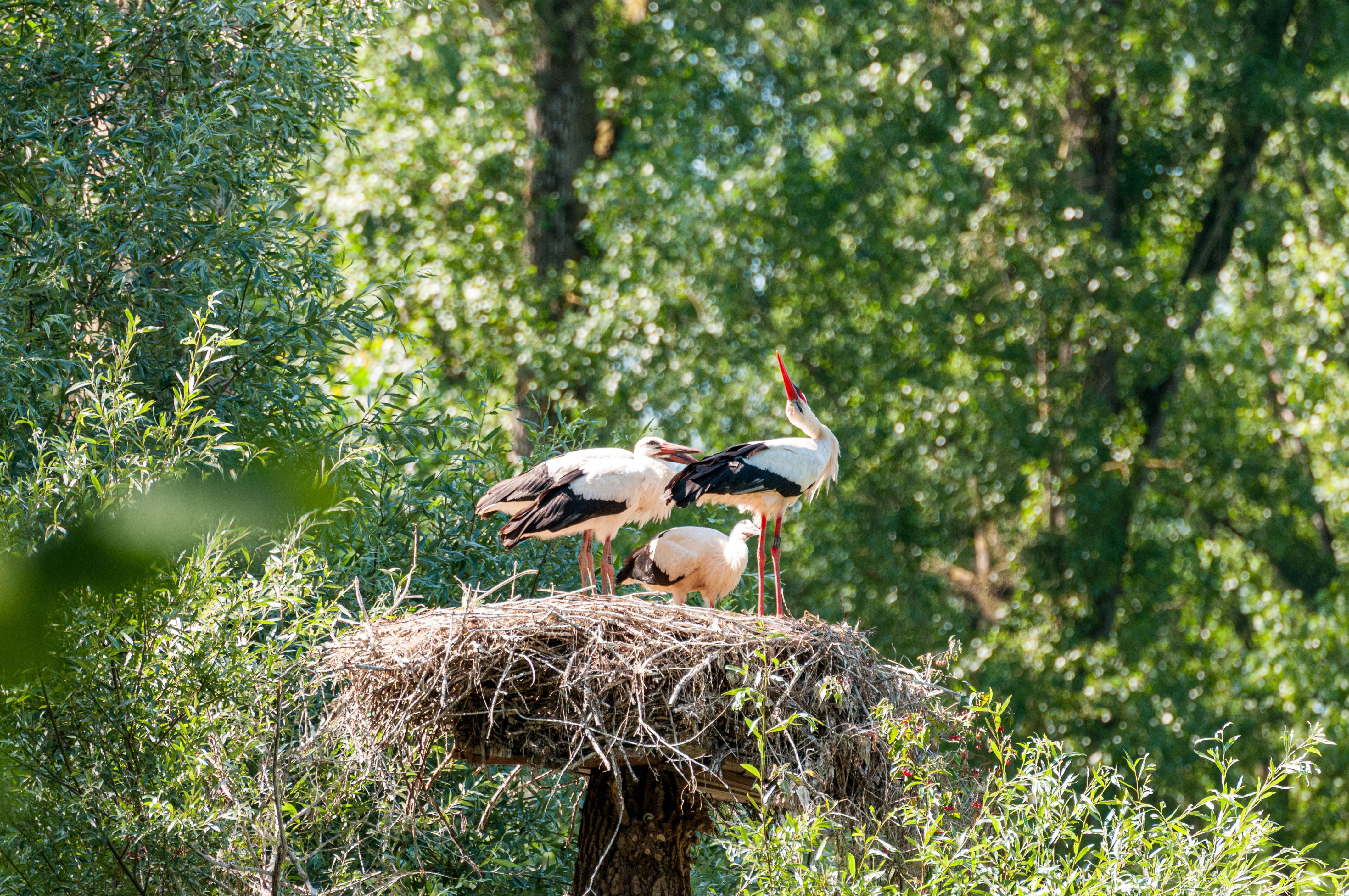
A group of three white storks standing and preening in a large stick nest built high in a tree, surrounded by lush green foliage.
White storks nesting in the Neupotzer Altrhein wetland habitat.

Neupotzer Altrhein ecosystems, habitats, and plant life

Ecologically, the Neupotzer Altrhein is a textbook Auenlandschaft, defined by the interplay of periodic flooding, slow-moving water and a mosaic of wetland habitats. The area combines open channels, shallow lake-like stretches, dense reedbelts and fragments of alluvial forest, providing a layered environment in which many specialized species can coexist.

The flora is characterized by typical floodplain species, including silver willow in the softwood zones, common alder along wetter edges, and rich stands of reeds and tall herb vegetation around the open water. Wet meadows and reed communities extend into seasonally flooded areas, creating transitional habitats that are among the most valuable for invertebrates and amphibians.

The habitat structure translates directly into ecological richness. Slow-moving and still waters support amphibian breeding and dragonfly populations, while reedbeds provide cover and nesting sites for wetland birds. The continuity of these habitats across the reserve, and their connection to neighboring floodplain areas along the Upper Rhine, gives the Neupotzer Altrhein particular significance as a refuge within an otherwise heavily managed landscape.
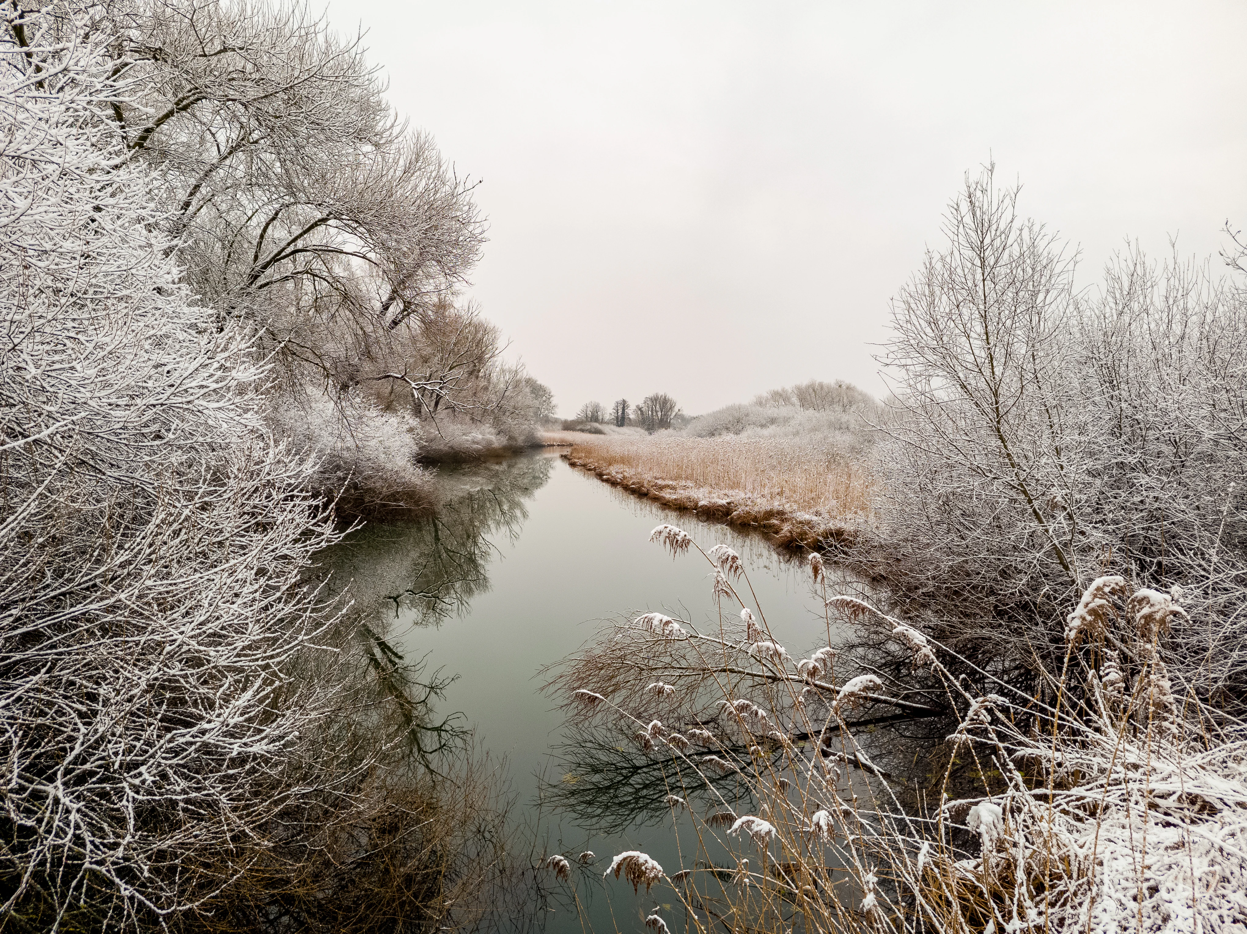
A calm, narrow river winds through a snowy, frost covered landscape with leafless trees and reeds along the banks under an overcast winter sky.
A winter morning view of the frost covered floodplain at Neupotzer Altrhein.

Neupotzer Altrhein wildlife and species highlights

The wildlife profile of the Neupotzer Altrhein is anchored by its birdlife, which was the principal reason for its designation as a European Bird Protection Area. White storks are a particularly visible presence during the breeding season, nesting at the water's edge and foraging across the wet meadows and shallows. Kingfishers, too, are closely associated with the reserve, using the steep earthen banks and overlooking branches along the channels as hunting perches.

Beyond birds, the reserve supports a notable mammal community. Eurasian beavers have established themselves along the slow-moving waters, using the wooded banks for shelter and the channels as travel routes. The mosaic of habitats also supports a wide range of amphibians, with frogs and newts breeding in the warmer, shallow waters of the oxbows and backchannels.

Invertebrate life is similarly rich, with dragonflies and damselflies among the more conspicuous groups thanks to their dependence on clean, well-vegetated standing and slow-flowing waters. Reedbeds and wet meadows in turn provide habitat for a variety of insects that support the broader food web, linking wetland productivity to the presence of birds and other vertebrate predators across the reserve.
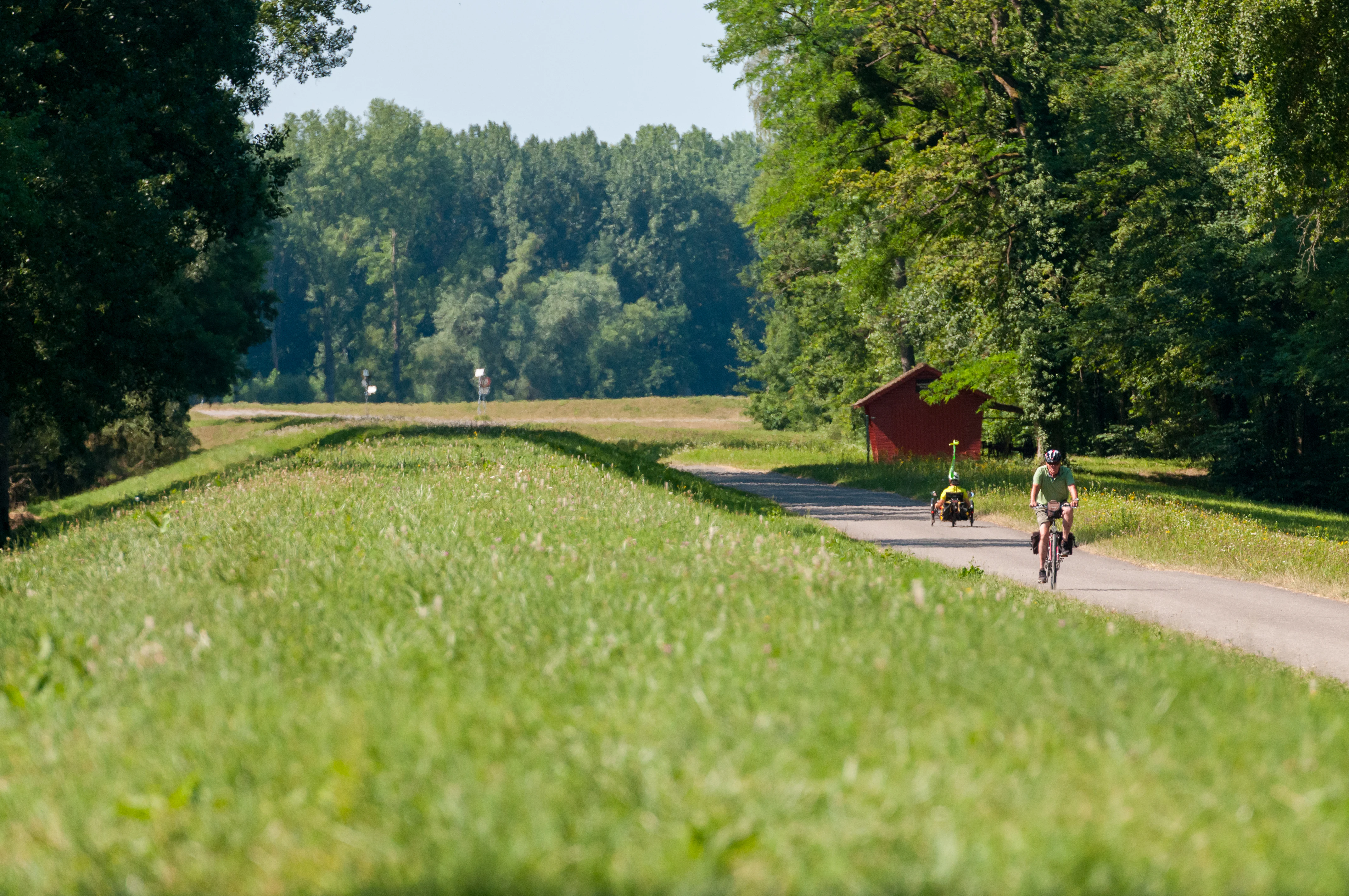
A paved path runs alongside a grassy embankment, with a person cycling and another person using a handbike in the distance near a small red wooden building surrounded by trees.
Cyclists riding along the PAMINA Rhine Meadows path, which follows the embankment near the Neupotzer Altrhein wetland.

Neupotzer Altrhein conservation status and protection priorities

The conservation importance of the Neupotzer Altrhein is reflected in its layered protection status. As a designated Bird Protection Area under the European Birds Directive, the site is part of the Natura 2000 network and contributes to the protection of threatened and migratory bird species across the European Union. Its designation ensures that damaging activities are regulated and that habitat quality is monitored under a common European framework.

In addition to its Birds Directive status, the reserve overlaps with the Hördter Rheinaue Habitats Directive site, extending species and habitat protection to non-avian wildlife and to habitat types such as alluvial forests and reed communities. The wider Pfälzische Rheinauen landscape protection area adds a regional layer, conserving the visual and ecological character of the Palatinate's Rhine floodplains.

Active conservation measures at the site include ongoing renaturation efforts aimed at restoring near-natural floodplain dynamics, alongside environmental education initiatives led by regional groups such as BUND and NABU. These activities aim to balance the site's ecological recovery with public engagement, recognizing that long-term protection depends not only on legal designation but also on local awareness.

Neupotzer Altrhein cultural meaning and human context

The Neupotzer Altrhein carries a distinctive cultural footprint that bridges engineering history, regional identity and recreational heritage. The very existence of the reserve is tied to nineteenth-century Rhine correction works, which reshaped the river and inadvertently created the wetland landscape that is now protected. This historical layer gives the area a particular narrative quality, where industrial-era infrastructure has been reclaimed by nature.

The region also enjoys a strong tradition of outdoor recreation, with walking, cycling, angling and canoeing deeply embedded in local life along the Upper Rhine floodplains. Reinforcing this cultural tie, a faithful reconstruction of a late Roman patrol boat, the Lusoria Rhenana, offers themed boat tours on the Setzfeldsee within the reserve, providing a tangible link to the long human history of travel and patrol along this stretch of the Rhine.

Environmental organizations such as BUND and NABU further anchor the area within a broader culture of citizen-led conservation and outdoor learning, contributing to a living regional identity in which the floodplain is both a place of leisure and a subject of collective ecological responsibility.
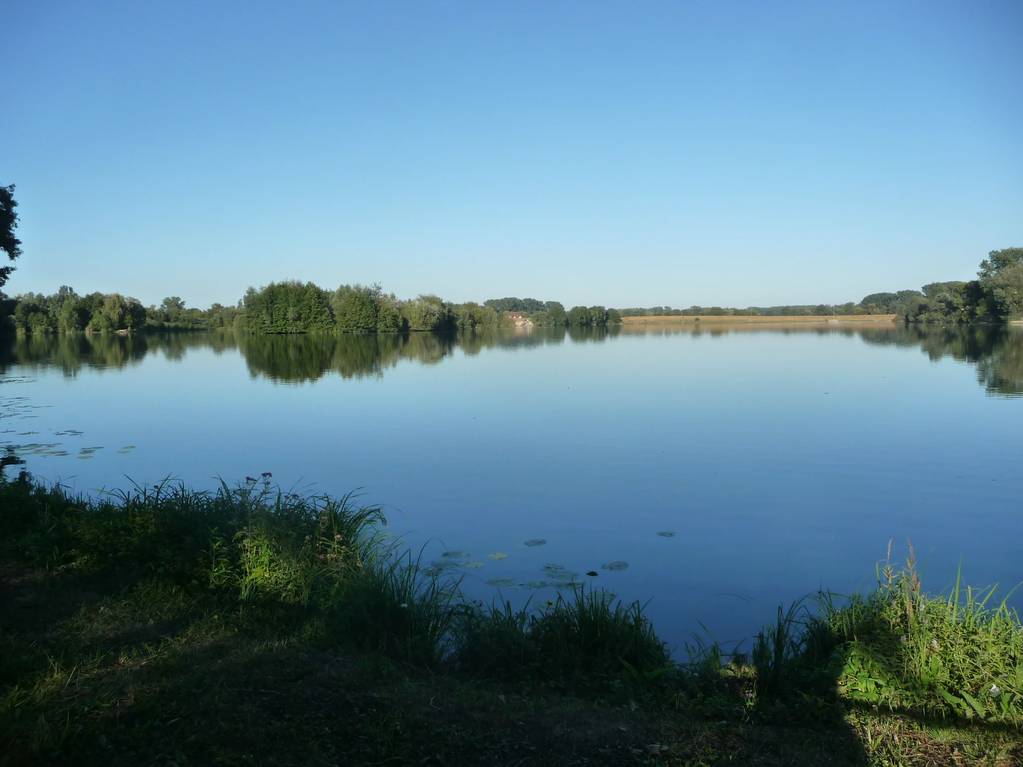
A wide view of a still, reflective pond surrounded by lush green trees and grassy banks under a clear blue sky.
A calm, reflective pond in the Neupotzer Altrhein area.

Top sights and standout views in Neupotzer Altrhein

A nineteenth-century relic of Rhine straightening now serving as one of the Palatinate's most important wetland refuges, the Neupotzer Altrhein offers a compact but ecologically dense slice of the Upper Rhine floodplain. Its overlapping Birds Directive, Habitats Directive and landscape protection status place it within both European and regional conservation frameworks, giving it unusual legal and ecological depth for an area of its size.

Visitors encounter a richly structured landscape of oxbows, reedbeds and softwood alluvial forest, alive with white storks, kingfishers, beavers and a diverse amphibian community. Marked cycling and walking routes, including a section of the PAMINA Rheinauen cycling path, connect the site to the wider Rhine floodplain network and make it readily accessible as both a nature destination and a cultural landscape shaped by centuries of interaction between people and the river.

Best time to visit Neupotzer Altrhein

The character of the Neupotzer Altrhein shifts meaningfully through the year, reflecting the rhythms of a near-natural floodplain. Spring and early summer are the most rewarding seasons for birdwatching, when reedbeds come alive with breeding activity and white storks are busy at their nests along the water's edge. Migratory species and territorial displays add to the sense of biological richness during these months.

Summer brings lush vegetation across the wet meadows and softwood forests, with dragonflies hovering over the warmer channels and amphibians most active along the margins. The shaded trails and cooling waters also make this a comfortable time for walking and cycling, although the area becomes busier with regional visitors.

Autumn and winter have their own appeal, with frost, mist and quieter conditions transforming the floodplain into a calmer but still atmospheric landscape. Lower visitor numbers, visible waterfowl congregations and the stark forms of leafless willows give the colder months a contemplative quality that rewards patient observation.


Monthly climate preview

Long-term representative monthly temperature and precipitation data measurements

Neupotzer Altrhein Annual Climate Normals and Temperature Rhythms

Representative coordinate records show measured monthly temperature averages ranging from near freezing to warm summer maximums alongside consistent precipitation rates. Detailed long-term climate normals offer a comprehensive month-by-month breakdown of temperature ranges and precipitation patterns across the protected landscape.
Annual mean10 °C
1 °C21 °C
Jan
Feb
Mar
Apr10°
May15°
Jun19°
Jul21°
Aug20°
Sep16°
Oct10°
Nov
Dec
Warmest month
July

20.9 °C

Coolest month
January

0.6 °C

Wettest month
May

2.3 mm/day

Driest month
April

1.5 mm/day

Park location guide

Geography guide, regional context, and park location map for Neupotzer Altrhein

Neupotzer Altrhein park geography, regions, and map view in Germany

Understand where Neupotzer Altrhein sits in Germany through a broader geographic reading of the surrounding landscape, nearby location context, and its mapped position within the national park landscape.

How Neupotzer Altrhein fits into Germany

Germany is a federal republic in Western and Central Europe with a population of over 83 million across sixteen constituent states. It is Europe's largest economy by nominal GDP and a major global exporter and importer. The capital is Berlin, and the country borders Denmark, Poland, Czech Republic, Austria, Switzerland, France, Luxembourg, Belgium, and the Netherlands.

Wider geography shaping Neupotzer Altrhein in Germany

Germany is located in Western and Central Europe, spanning 357,022 km². It borders Denmark to the north, Poland and the Czech Republic to the east, Austria and Switzerland to the south, and France, Luxembourg, Belgium, and the Netherlands to the west. The country has coastlines on the Baltic Sea and North Sea to the north, with the Alps located in the southern region.

Map view of Neupotzer Altrhein

Use this park location map to pinpoint Neupotzer Altrhein in Germany, understand its exact geographic position, and read its mapped placement within the surrounding landscape more clearly.

Pigeon | © OpenStreetMap contributors

Location context for Neupotzer Altrhein

Rheinland-Pfalz
Recorded earthquake history

Review the Historical Earthquake Catalogue for Neupotzer Altrhein

Consult the dedicated historical record of seismic activity documented in the vicinity of the Neupotzer Altrhein protected area. MoriAtlas provides this data as a curated, searchable list of epicentres and magnitudes to help users understand the regional seismic history of this unique floodplain geography.

Neupotzer Altrhein Earthquake Records

Catalogued events

12 events

Strongest magnitude

Magnitude 3.5

Most recent event

Feb 16, 2008

This history includes earthquakes recorded inside the park or within 50 km of its borders

Visual reference collection highlighting floodplain habitats, oxbow waters, and wetland terrain

Neupotzer Altrhein Landscape Photos and Protected Area Scenery

Neupotzer Altrhein landscape photography reveals the complex mosaic of old river arms, reedbeds, and alluvial forests defining the Upper Rhine Graben. Visual documentation of the protected wetland helps observers trace the changing terrain, slow-moving channels, and rich ecological character of the floodplain.

A group of white storks standing in and flying over a grassy, swampy riverbank with tree stumps.

A white stork standing in a large nest on top of a weathered tree stump, with a second stork partially visible in a smaller tree to the left, all set within a lush, green forest environment near water.

A group of three white storks standing and preening in a large stick nest built high in a tree, surrounded by lush green foliage.

A calm, narrow river winds through a snowy, frost covered landscape with leafless trees and reeds along the banks under an overcast winter sky.

A paved path runs alongside a grassy embankment, with a person cycling and another person using a handbike in the distance near a small red wooden building surrounded by trees.

A calm, narrow waterway reflects the blue, cloudy sky, flanked by dry grasses and deciduous trees on a bright day.

A wide view of a still, reflective pond surrounded by lush green trees and grassy banks under a clear blue sky.

Park atlas

Compare adjacent wetland reserves and connected Upper Rhine floodplain landscapes.

Parks Near Neupotzer Altrhein and Protected Areas in the Surrounding Region

Browse other parks near Neupotzer Altrhein to examine related wetland habitats, oxbow formations, and alluvial forest reserves across the surrounding region. Comparing adjacent protected areas reveals the broader geographic spread and ecological continuity of the Upper Rhine valley.
Watercolor painting of a tranquil wetland landscape with soft green vegetation and a calm water body, reflecting the floodplain environment of the Rhine river.
Nature reserveLandkreis Germersheim
Park boundaries overlap#1 closest

Northeast

Hördter Rheinaue Nature Reserve: Landscape and Geographic Context in Landkreis Germersheim

Examining the hydrology and floodplain forest of the German Rhine.

Hördter Rheinaue serves as a critical node in the Palatinate Rhine floodplains, preserving a vast mosaic of willow and poplar forests alongside stable hardwood stands. Analyze the mapped terrain shaped by centuries of river activity, including the meandering Michelsbach and associated oxbow systems that define this essential protected corridor in western Germany.

Area
8.18 km²
Established
1966
IUCN
IV
Relief
Lowland
A watercolor painting showing a soft, atmospheric landscape with a foreground of water and green grasses, a midground of trees, and purple mountains in the background under a pale yellow sky.
Nature reserveRhineland-Palatinate
1.6 km away#2 closest

Southwest

Rheinniederung Neuburg-Wörth: A Protected Floodplain Landscape in Rhineland-Palatinate

An analysis of river meanders, oxbows, and floodplain forest geography

This nature reserve encompasses a 14.5 square kilometer corridor of the Upper Rhine, featuring a distinct topography of hardwood forests, wet meadows, and aquatic habitats. The site remains a focal point for understanding Rhine river dynamics and the conservation of rare floodplain ecosystems like the Wörther Altrhein.

Area
14.48 km²
Established
2004
Relief
Lowland
Climate
Temperate
Nature reserveRheinland-Pfalz
About 2.1 km away#3 closest

Southwest

Wörther Altrhein Nature Reserve: Protected Wetland Atlas and Upper Rhine Landscape Context

Mapped conservation zones within the Rheinland-Pfalz floodplain

Investigate the protected landscape of Wörther Altrhein, an ecologically important former Rhine channel. This site offers a unique study in wetland geography, where controlled hydrology supports diverse reedbeds and alluvial forest habitats within the industrial backdrop of the southern Upper Rhine.

Area
2.4 km²
Established
2004
IUCN
IV
Relief
Lowland
Soft watercolor painting of an oxbow lake landscape with green riverbanks, trees, and distant rolling hills against a pale sky.
Nature reserveRhineland-Palatinate
About 3 km away#4 closest

Northeast

Leimersheimer Altrhein Nature Reserve: Mapped Geography and Protected Area Context

A preserved Rhine oxbow ecosystem in Rhineland-Palatinate

Leimersheimer Altrhein represents a rare, enduring fragment of the historical Rhine floodplain. This site hosts vital waterbird populations within an enclosed water landscape, providing essential habitat connectivity in a heavily regulated river region. Gain insights into the specific terrain, boundary configurations, and riparian mosaic that define this protected nature reserve.

Area
15 km²
Established
2004
IUCN
IV
Watercolor painting showing layers of rolling green hills, dense tree lines, and distant purple mountain silhouettes under a soft sunset sky.
Nature reserveGermany
About 9.7 km away#5 closest

Southwest

Riedried Nature Reserve: A Detailed Geographic Atlas of Bienwald Protected Wetlands

Wetland ecosystems and forest geography in Germany

Riedried is a specialized nature reserve in the Germersheim district of Germany, recognized for its black alder swamp forest and embedded lowland peat bog. This site serves as a crucial protected landscape within the Rhine plain, illustrating how small, managed wetlands function as a mosaic of rare habitat types in an otherwise drier forest region.

Area
0.25 km²
Established
1984
Relief
Lowland
Scope
Terrestrial
Nature reserveRhineland-Palatinate
About 11 km away#6 closest

North

Bellheimer Wald: Protected Alluvial Forest and Inland Dune Geography in Germany

Nature reserve landscapes in Rhineland-Palatinate

Bellheimer Wald offers a window into the unique geography of the Upper Rhine Plain. This protected forest is characterized by its sandy alluvial soils and rare inland dune systems, forming a core component of the alluvial-fan woodland chain that spans the southern Palatinate and supports complex habitats for specialized flora and fauna.

Area
46.79 km²
Established
2000
IUCN
IV
Relief
Lowland
A watercolor landscape illustration showing a gently winding water feature through low-lying marshy vegetation with distant rolling hills.
Protected landscapeBaden-Württemberg
About 11 km away#7 closest

Southeast

Füllbruch-Vokkenau Protected Landscape: Geographic Profile and Regional Map Context

Wetland mosaic and flood-retention geography in Baden-Württemberg

This protected landscape in Karlsruhe encompasses a distinct lowland floodplain forest, merging traditional orchard meadows with structured wet woodland terrain. The area is defined by its role in regional flood management for the Pfinz river, creating a unique intersection of protected natural habitat and active hydraulic infrastructure within the historical Kinzig-Murg lowland channel.

Area
4.313 km²
Established
1988
IUCN
V
Protected landscapeBaden-Württemberg
About 12 km away#8 closest

Southeast

Weingartener Wiesental Protected Landscape: Geography and Meadow Valley Overview

Historic irrigation heritage in the Baden-Württemberg region.

The Weingartener Wiesental provides a clear example of a managed meadow valley landscape, featuring an extensive network of historical irrigation ditches and a surviving aqueduct. Situated within the Hardtebenen natural region, this protected area serves as an ecological buffer and a window into the traditional land management practices characteristic of the Kinzig-Murg-Rinne river corridor.

Area
1.109 km²
Established
1991
IUCN
V
Relief
Lowland

Common questions about visiting, size, designation, and location context for Neupotzer Altrhein

Neupotzer Altrhein FAQs for park facts, access, geography, and protected area context

Find quick answers about Neupotzer Altrhein, including protected-area facts, park geography, trail and visitor context, and how the park fits into its surrounding country and regional landscape.
MoriAtlas Explorer

Continue Your Protected Areas Search Across the Global Atlas

Deepen your exploration by continuing the structured search for national parks and protected areas worldwide. Utilize the comprehensive filtering capabilities to compare different conservation landscapes and refine your understanding of global park geography. Discover more about the distribution and characteristics of protected natural areas.

Global natural geography