
Mori Atlas logo
Nature reserveNeuzenlache von Viernheim

Explore the hydrological history and diverse wetland habitats of this vital Upper Rhine Plain conservation site.

Neuzenlache von Viernheim Nature Reserve: Mapped Geography and Protected Landscapes in Hessen

(Naturschutzgebiet Neuzenlache von Viernheim)

Neuzenlache von Viernheim preserves a distinctive mosaic of open water, reedbeds, and shrubby thickets within the heavily modified landscape of the Upper Rhine Plain. Originating from an ancient branch of the Neckar River, this protected nature reserve serves as a crucial ecological refuge and historical site in the state of Hessen. Users can study the reserve's unique topography, trace the path of its remaining hydrological features, and examine how it integrates into the broader geography of the Geo-Naturpark Bergstraße-Odenwald.

nature reservewetlandformer river armreedbedshedgerowsUpper Rhine Plain
A graphic art illustration of a narrow valley with a river at the bottom, featuring a single prominent, tall, slender tree in the foreground and forested hillsides.

Neuzenlache von Viernheim

Nature reserve

Park overview

Structured park overview, official facts, and landscape profile for Neuzenlache von Viernheim

Neuzenlache von Viernheim park facts, protected area profile, and essential visitor context

Review the core facts for Neuzenlache von Viernheim, including designation, size, terrain, visitor scale, habitats, and operating context in one park-focused overview.

About Neuzenlache von Viernheim

Neuzenlache von Viernheim is one of many small designated nature reserves listed under the Kreis Bergstraße list of protected areas, but it stands out for its origin as a former Neckar river arm. The Upper Rhine Plain, where the reserve sits, was shaped by shifting river courses and wetland systems, and the Neuzenlache preserves a trace of that older landscape. Its hydrological past is what supplies it with its distinctive identity today.

The protected area lies south of the urban area of Viernheim and south of the A 659 motorway, within the Außensiedlung Neuzenlache of Viernheim. To the south it connects to the Heddesheim golf course Gut Neuzenhof across the Baden-Württemberg state line, illustrating how the natural area sits within a broader regional landscape matrix. The Bannholzgraben stream flows through the site, providing a small watercourse thread that ties the biotope together.

Ecologically, the reserve presents a varied mosaic. Until the end of the twentieth century, this stretch functioned as a wetland supporting rare plant and animal life. Groundwater lowering has led to significant silting up (Verlandung), reducing its wetland character but leaving behind a still-valuable complex of open water fragments, reedbeds (Röhricht), hedgerows, and shrub layers. The eastern edge features two bald cypresses (Sumpfzypressen), which reflect the legacy of Freiherr von Berckheim, the figure also responsible for the nearby Exotenwald near Weinheim.

Within the German conservation framework, the reserve is classified as a Naturschutzgebiet under the federal and state nature protection laws, corresponding to IUCN Category IV. It is hosted within the Geo-Naturpark Bergstraße-Odenwald, linking it to a wider regional network of protected sites and geotourism. Although small, the area is an important local refuge for biodiversity and an interesting example of how former river features can persist in an intensively used lowland landscape.

Quick facts and research context for Neuzenlache von Viernheim

Neuzenlache von Viernheim is a nature reserve of about 9.13 hectares in Hesse, Germany, located south of Viernheim in the Bergstraße district near the Baden-Württemberg border. It lies within the Upper Rhine Plain and within the larger Geo-Naturpark Bergstraße-Odenwald.

The site was placed under formal protection on 5 December 1990 and is managed under the German Naturschutzgesetz. Its biotope is classified as IUCN Category IV, recognizing it as a habitat and species management area. Ecologically, it represents a relict stretch of an old Neckar river arm, now characterized by a mosaic of open water, reeds, hedges, and shrubs that together form a small but valuable biotope complex.

Protection and recognition

Documented terrestrial protection scope and baseline conservation data

Neuzenlache von Viernheim Protection Status and International Recognition

Terrestrial protection status records provide concrete conservation data for Neuzenlache von Viernheim within the global protected area network. Official management scope and baseline geographic attributes offer structured insight into designated natural landscapes.

Protection details

Protection scope
Terrestrial
Transboundary protection
No
WDPA ID
164805
Park context

Deeper park guide and search-rich context for Neuzenlache von Viernheim

Neuzenlache von Viernheim history, landscape, wildlife, and travel context

Explore Neuzenlache von Viernheim through its history, landscape character, ecosystems, wildlife, conservation priorities, cultural context, and seasonal travel timing in a structured park guide built for atlas discovery and search intent.

Why Neuzenlache von Viernheim stands out

Neuzenlache von Viernheim is best known for being a protected remnant of an ancient Neckar river arm (Altneckararm) within the otherwise flat and heavily cultivated Upper Rhine Plain. Despite its small size, it preserves a layered biotope complex featuring open water, reed margins, hedgerows, and shrubby habitats that contrast with surrounding farmland. The reserve is also notable for two mature bald cypress trees (Taxodium) growing at its eastern edge. These trees are part of the broader tradition of exotic tree planting in the Bergstraße region, linked to the same historical figure, Freiherr von Berckheim, who inspired the famous Exotenwald near Weinheim. Together, these features give the site both ecological and landscape-cultural significance.
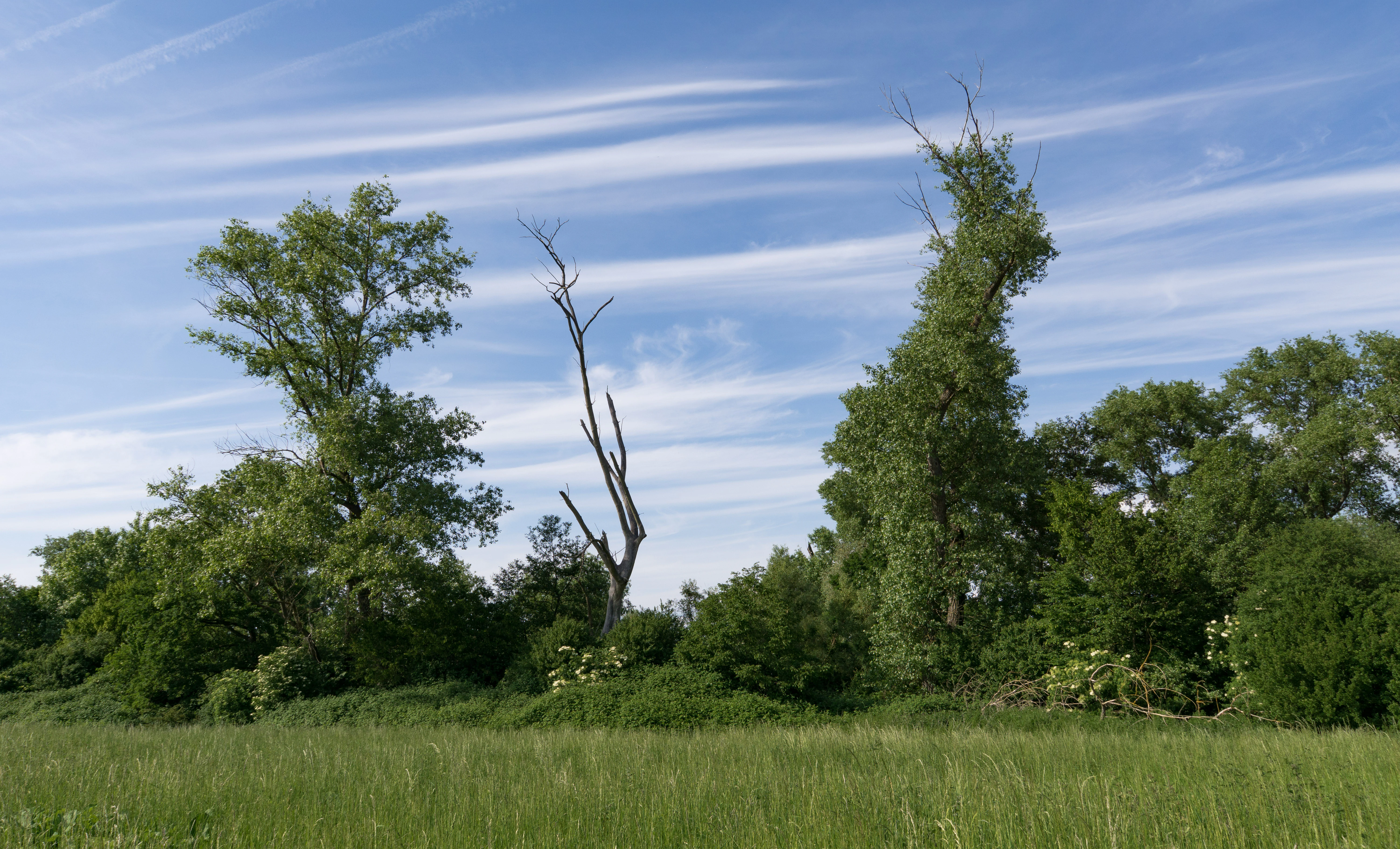
A green meadow in the foreground leads to a line of trees, including one dead, leafless tree standing in the center, under a blue sky with thin, wispy clouds.
A view of the Neuzenlache von Viernheim nature reserve, showing a grassy meadow bordered by trees.

Neuzenlache von Viernheim history and protected-area timeline

The origin of Neuzenlache von Viernheim is tied to the historical course changes of the River Neckar. The site occupies a section of an Altneckararm, an abandoned Neckar channel whose hydrological influence once supported a thriving wetland. Until the late twentieth century, this area was a productive wet habitat supporting rare flora and fauna.

In the late twentieth century, agricultural and infrastructural development in the Upper Rhine Plain led to groundwater lowering (Grundwasserabsenkung). Lowered groundwater levels caused the wetland to silt up heavily, fundamentally changing its ecological character. The site lost part of its open water and wetland value through this process, but it retained enough ecological complexity to still be regarded as a valuable biotope complex.

In response to its ecological significance, Neuzenlache von Viernheim was formally placed under protection as a Naturschutzgebiet on 5 December 1990. It was registered under identification number 1431020 and is also tracked in the World Database on Protected Areas. The site's current management framework reflects Germany's federal nature protection laws, and it has been integrated into the larger Geo-Naturpark Bergstraße-Odenwald, ensuring its place within a recognized regional conservation structure.

A separate cultural-natural feature of the site, the two bald cypress trees growing on the eastern edge, is also historically significant. They belong to the wave of exotic tree planting in the Bergstraße that traces back to Freiherr von Berckheim, whose influence is most famously seen in the Exotenwald near Weinheim.

Neuzenlache von Viernheim landscape and geographic character

The landscape of Neuzenlache von Viernheim reflects its position in the Upper Rhine Plain (Oberrheinische Tiefebene), one of the major lowland areas of southwestern Germany. Within this otherwise flat, agriculturally dominated plain, the reserve stands out as a small fragment of more naturalistic terrain shaped by water and former river activity.

Topographically, the site is gentle and low-lying, with the key landscape feature being the trace of an ancient Neckar arm. The Bannholzgraben, a small stream, flows through the reserve and contributes to its hydrological identity. Open water areas, increasingly narrow reedbeds, hedgerows, and shrubby thickets together create a varied and densely textured micro-landscape.

Beyond the reserve itself, the surrounding landscape includes the urban edge of Viernheim and the A 659 motorway in the north, and the open countryside of Heddesheim and the Gut Neuzenhof golf course to the south across the Baden-Württemberg border. This setting places the reserve in a transitional zone between dense human land use and remaining natural or semi-natural habitats.
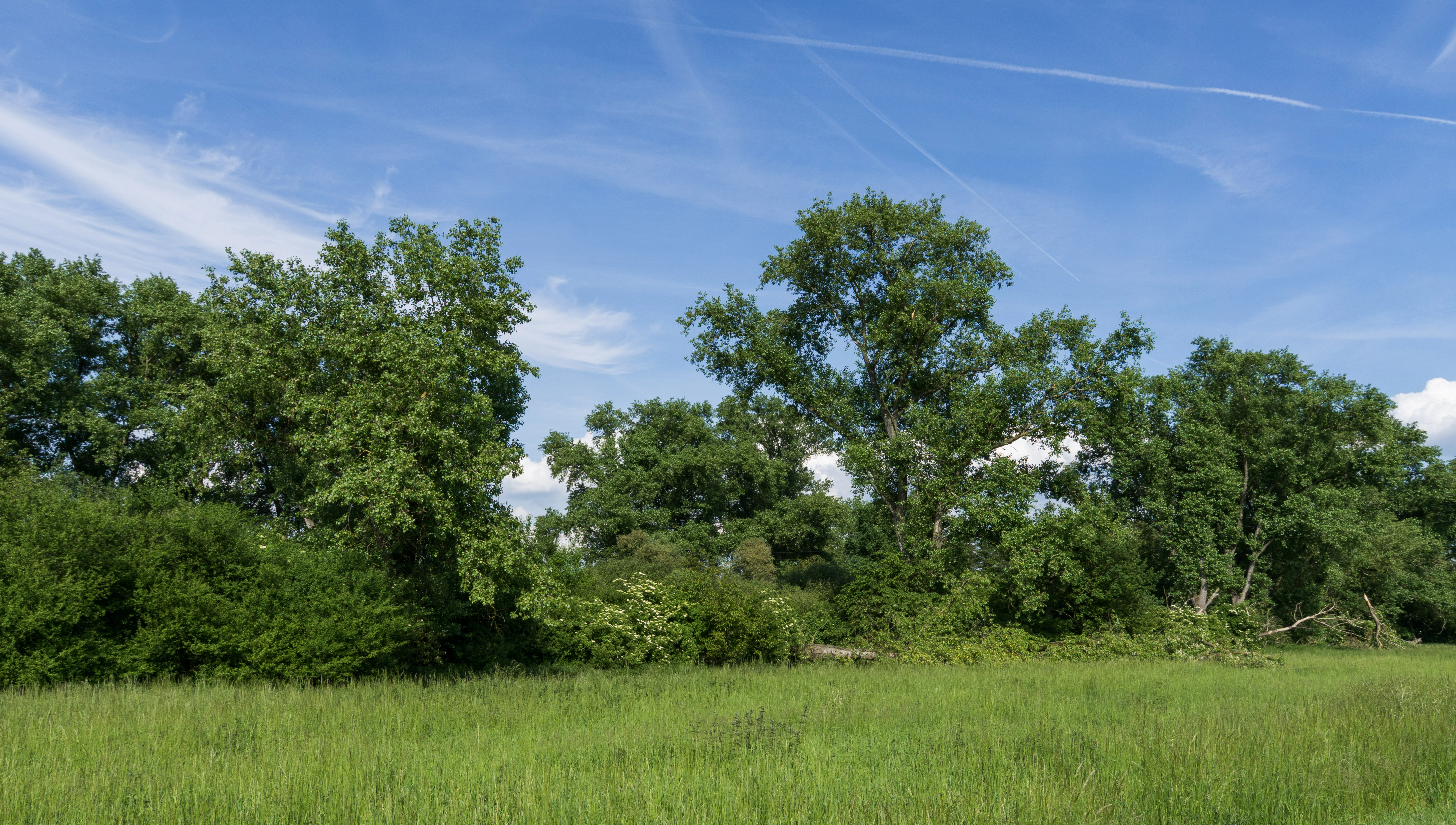
A green grassy field foreground transitions into a dense line of mature deciduous trees under a clear blue sky with thin clouds.
A summer view of the Neuzenlache von Viernheim nature reserve, showing a field edge and mature deciduous trees.

Neuzenlache von Viernheim ecosystems, habitats, and plant life

Ecologically, Neuzenlache von Viernheim represents an uncommon, historically water-led habitat complex in the Upper Rhine Plain. Its origin as a former Neckar arm gives it a hydrological legacy that, even after degradation, supports a distinctive combination of wetland, reed, and shrub communities.

Open water fragments, reedbeds (Röhricht), hedgerows, and bushy thickets form the core habitat structure of the reserve. This mosaic supports a range of plant and animal species, including historically rare wetland species that once thrived here when water levels were higher. Although groundwater lowering has favored silting up and reduced the wetland area, the combination of habitats still functions as a biotope complex of conservation value.

The presence of two bald cypress trees (Sumpfzypressen) on the eastern edge adds an ecological and cultural-natural layer to the reserve. These trees, like the more famous exotic plantings in the nearby Exotenwald near Weinheim, speak to the long tradition of introducing non-native species in the Bergstraße region and contribute to the botanical diversity of the protected area.

Neuzenlache von Viernheim wildlife and species highlights

Historically, the wetland conditions of Neuzenlache von Viernheim supported rare animals and plants, making it a localized hotspot for biodiversity in the Upper Rhine Plain. Although heavy silting from groundwater lowering has reduced its wetland character over time, the site still functions as a valuable biotope complex.

The combination of open water remnants, reedbeds, hedges, and shrub thickets provides habitat conditions for a range of species typical of dynamic lowland wetlands and transitional habitats. Birdlife associated with reedbed and shrub habitats, invertebrates tied to wet habitats, and species that use hedgerow structures all benefit from the mosaic structure of the area. The reserve's position amid agricultural land makes it a useful refuge for wildlife in an otherwise heavily modified landscape.

Neuzenlache von Viernheim conservation status and protection priorities

Neuzenlache von Viernheim is formally protected under German nature conservation law as a Naturschutzgebiet. Its designation date of 5 December 1990 reflects recognition of its ecological value despite, and partly because of, the pressures it faces from groundwater lowering and habitat change.

The reserve is registered in conservation databases under its German ID 1431020 and the World Database on Protected Areas (WDPA) entry 164805, with an IUCN management category of IV, meaning it is recognized as a Habitat/Species Management Area. In practical terms, this means the reserve is managed to maintain specific habitats and species rather than left as a strict wilderness reserve, fitting its status as a complex of small-scale habitats in a working landscape.

The site's inclusion in the larger Geo-Naturpark Bergstraße-Odenwald reinforces its conservation role, connecting it with regional landscape protection, geotourism, and educational work. Within the local network of protected areas in the Bergstraße district, Neuzenlache von Viernheim stands as an example of small-scale but meaningful protection of a former riverland ecosystem.

Neuzenlache von Viernheim cultural meaning and human context

Although the primary cultural significance of Neuzenlache von Viernheim is ecological, the site carries a quiet but interesting cultural-natural legacy. The two bald cypress trees on its eastern edge connect the reserve to the Bergstraße region's tradition of exotic tree cultivation, a tradition strongly linked to Freiherr von Berckheim, who also inspired the exotic forest (Exotenwald) near Weinheim.

The reserve's location in the Upper Rhine Plain, one of Germany's most historically significant cultural landscapes, places it within a regional setting shaped by centuries of river management, agriculture, and settlement. Its name, tied to the historic Neuzenlache settlement area south of Viernheim, reflects the local historical geography of the area and the way small wetland features have long been part of the regional land identity.

Top sights and standout views in Neuzenlache von Viernheim

The protected area stands out for several distinctive features: its origin as an ancient Neckar river arm, its mosaic of water, reed, hedge, and shrub habitats, and its formal protection as a Naturschutzgebiet since 1990. The presence of two mature bald cypress trees adds a botanical and cultural-natural highlight to the reserve.

As part of the Geo-Naturpark Bergstraße-Odenwald and located at the Hesse/Baden-Württemberg border, Neuzenlache von Viernheim is a small but meaningful ecological refuge in a heavily worked part of the Rhine lowlands.

Best time to visit Neuzenlache von Viernheim

The reserve can be observed across much of the year, but visiting in spring or early summer offers the most vivid ecological perspective, when reed and shrub vegetation are active and wetland birdlife is at its peak. Late spring and early summer also make the bald cypress trees more visually prominent against fresh green surroundings.

Late autumn and winter visits emphasize a different character, with the open water areas, leafless hedges, and the silhouettes of mature trees dominating the landscape. Because the reserve depends on subtle microhabitat variation, visits at different times of year reveal varied facets of its ecological mosaic. The generally mild climate of the Upper Rhine Plain means that none of the seasons are extreme, allowing for a fairly broad window for observation.

Monthly climate preview

Long-term representative temperature and precipitation patterns across the protected landscape

Neuzenlache von Viernheim Climate Normals and Annual Weather by Month

Historical data records recorded mean monthly temperatures ranging from near freezing to warm summer highs alongside consistent daily precipitation averages at the representative coordinate. Examining the full twelve-month profile reveals detailed monthly fluctuations in temperature extremes and precipitation distributions across the protected area.
Annual mean10 °C
0 °C20 °C
Jan
Feb
Mar
Apr
May14°
Jun18°
Jul20°
Aug20°
Sep15°
Oct10°
Nov
Dec
Warmest month
July

20.3 °C

Coolest month
January

0.1 °C

Wettest month
July

2.4 mm/day

Driest month
April

1.5 mm/day

Park location guide

Geography guide, regional context, and park location map for Neuzenlache von Viernheim

Neuzenlache von Viernheim park geography, regions, and map view in Germany

Understand where Neuzenlache von Viernheim sits in Germany through a broader geographic reading of the surrounding landscape, nearby location context, and its mapped position within the national park landscape.

How Neuzenlache von Viernheim fits into Germany

Germany is a federal republic in Western and Central Europe with a population of over 83 million across sixteen constituent states. It is Europe's largest economy by nominal GDP and a major global exporter and importer. The capital is Berlin, and the country borders Denmark, Poland, Czech Republic, Austria, Switzerland, France, Luxembourg, Belgium, and the Netherlands.

Wider geography shaping Neuzenlache von Viernheim in Germany

Germany is located in Western and Central Europe, spanning 357,022 km². It borders Denmark to the north, Poland and the Czech Republic to the east, Austria and Switzerland to the south, and France, Luxembourg, Belgium, and the Netherlands to the west. The country has coastlines on the Baltic Sea and North Sea to the north, with the Alps located in the southern region.

Map view of Neuzenlache von Viernheim

Use this park location map to pinpoint Neuzenlache von Viernheim in Germany, understand its exact geographic position, and read its mapped placement within the surrounding landscape more clearly.

Pigeon | © OpenStreetMap contributors

Location context for Neuzenlache von Viernheim

Hessen

Visualizing the ancient river arm, wetlands, and protected terrain

Neuzenlache von Viernheim Photos and Landscape Scenery

Visual records document the distinct topography of an ancient river arm, open water fragments, and dense reed margins across the protected nature reserve. Examining photographic scenery reveals how natural wetland habitats and mature exotic trees persist within the agricultural Rhine lowlands.

A green meadow in the foreground leads to a line of trees, including one dead, leafless tree standing in the center, under a blue sky with thin, wispy clouds.

A wide angle view of a sunlit grassy clearing bordered by thick trees and shrubs in a nature reserve.

A green grassy field foreground transitions into a dense line of mature deciduous trees under a clear blue sky with thin clouds.

Park atlas

Compare adjacent wetland habitats and regional lowland reserves across the Upper Rhine Plain.

Parks Near Neuzenlache von Viernheim and Surrounding Protected Areas

Browse nearby protected areas and regional nature reserves connected to the broader geographic context of Neuzenlache von Viernheim. Comparing adjacent lowland habitats and ancient river remnants provides deeper insight into the ecological patterns of the Rhine valley.
A watercolor-style illustration of a soft, grassy landscape featuring sparse coniferous trees and a gently rolling, light-colored horizon.
Nature reserveHessen
About 4 km away#1 closest

West

Glockenbuckel von Viernheim: Mapping the Protected Dunes of Hessen

Nature reserve featuring dry grassland and inland sand biotopes

Located in the Bergstrasse district, Glockenbuckel von Viernheim is a protected area preserving rare inland sand dune landscapes. The site features nutrient-poor sandy soils and open grassland patches maintained for specialized species, reflecting an unusual conservation history born from former military training grounds within the Upper Rhine plain.

Area
0.411 km²
Established
1998
IUCN
IV
A horizontal watercolor painting showing a calm lake or pond surrounded by green trees and shrubs against a soft, light background.
Nature reserveHesse
About 4.2 km away#2 closest

Northwest

Oberlücke von Viernheim Nature Reserve: Mapped Wetland Landscapes in Hesse, Germany

A protected quarry lake refuge for waterbirds and amphibians

The Oberlücke von Viernheim nature reserve represents a significant successional habitat within the Hessian Ried. Formed from an abandoned sand and gravel quarry, its five-hectare water body and surrounding riparian margins serve as a critical wetland sanctuary. This protected area highlights the intersection of industrial legacy and ecological recovery, functioning as a key node for local wildlife in the dense landscape of western Germany.

Area
0.129 km²
Established
1985
IUCN
IV
Relief
Lowland
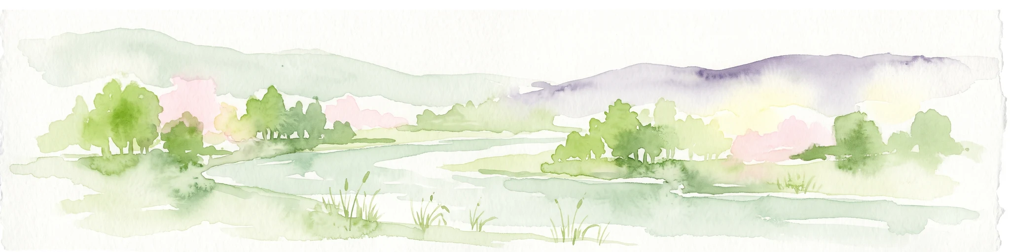
A watercolor painting showing a winding river flowing through a green valley with rolling hills in the background, executed in a soft, impressionistic style with light greens, purples, and pinks.
Protected landscapeRhein-Neckar-Kreis
About 7.4 km away#3 closest

South

Neckartal I-Kleiner Odenwald: Protected Landscape and Regional Geography in Rhein-Neckar-Kreis

Mapping the sandstone ridges and river valley systems of southwestern Germany.

The Neckartal I-Kleiner Odenwald protected landscape serves as a prime example of a transitional natural region where the Neckar river cuts through the Odenwald highlands. This record provides a detailed look at the area's physical geography, including its signature abandoned river bends, block-strewn slopes, and the dense forest canopy that characterizes this significant protected land in the Rhein-Neckar-Kreis district.

Area
63.159 km²
Established
2002
IUCN
V
Relief
Mountain
Nature reserveHesse
About 13 km away#4 closest

East

In der Striet bei Vöckelsbach Nature Reserve: Regional Geography and Mapped Protected Landscapes

A compact forest and wetland mosaic in the Odenwald of southern Hesse

The nature reserve In der Striet bei Vöckelsbach is an essential protected area covering four and a half hectares of valley floor. It provides a dense habitat gradient from reeded spring zones through alder forests to mixed deciduous slopes. This record details the park landscape, stream systems, and its integration into the larger Geo Naturpark Bergstraße Odenwald and Natura 2000 protected areas.

Area
0.048 km²
Established
1988
A wide watercolor illustration showing a river curving through a grassy valley with trees and hills in the background.
Nature reserveHessen
About 13 km away#5 closest

Northeast

In der Erbach bei Mörlenbach Nature Reserve: Protected Odenwald Stream Valley

Regional geography and habitat mapping in southern Hessen

The In der Erbach bei Mörlenbach nature reserve preserves a well-defined side-valley ecosystem within the broader Odenwald landscape. Its protected boundaries encompass a moisture-rich corridor featuring wet meadows, reedbeds, and forest edges that exemplify the traditional cultural geography of the Weschnitz river basin in southern Germany.

Area
0.197 km²
Established
1997
IUCN
IV
Relief
Upland
Protected landscapeBaden-Württemberg
About 14 km away#6 closest

Southwest

Waldpark Mannheim: Protected Floodplain Landscape and Riparian Geography

Natural fluvial terrain along the Rhine in Baden-Württemberg

Waldpark Mannheim encompasses 150 hectares of protected floodplain forest, meadows, and old Rhine river channels. This landscape serves as a crucial ecological zone, defined by shifting water levels and a lack of artificial flood defenses, illustrating the natural rhythm of riparian habitats in southwestern Germany.

Area
1.496 km²
Established
1975
IUCN
V
Relief
Lowland
A soft-focus watercolor painting of a wetland scene showing a calm body of water with reeds in the foreground and a tree-lined horizon under a pastel sky.
Nature reserveHessen
About 14 km away#7 closest

North

Erlache bei Bensheim: Exploring Protected Wetlands and Altneckar Landscapes in Hessen

A distinct nature reserve and bird sanctuary site

The Erlache bei Bensheim nature reserve serves as a critical wetland corridor in the Hessian Rhine plain. This area features a former loop of the River Neckar, now characterized by alder swamp forest, reedbeds, and open water, creating a highly specific ecological terrain surrounded by the regional infrastructure of the Bergstraße district.

Area
0.49 km²
Established
2000
IUCN
IV
Relief
Lowland
Watercolor painting of a green wetland landscape with a winding stream and distant hills in soft pastel colors.
Nature reserveHesse
About 14 km away#8 closest

Northeast

Albersbacher Riedwiesen Nature Reserve: Mapped Geography and Protected Landscapes in Hesse

A detailed atlas view of the Albersbach stream valley conservation corridor.

Situated in the Weschnitz valley region of Hesse, the Albersbacher Riedwiesen nature reserve offers a concentrated look at traditional Odenwald landscapes. The area protects a unique combination of wet meadows, reedbeds, and dry grasslands that follow the natural meandering course of the Albersbach stream, providing a vital study in local geomorphology and conservation geography.

Area
0.124 km²
Established
1996

Common questions about visiting, size, designation, and location context for Neuzenlache von Viernheim

Neuzenlache von Viernheim FAQs for park facts, access, geography, and protected area context

Find quick answers about Neuzenlache von Viernheim, including protected-area facts, park geography, trail and visitor context, and how the park fits into its surrounding country and regional landscape.
MoriAtlas Explorer

Continue Your Protected Areas Search Across the Global Atlas

Deepen your exploration by continuing the structured search for national parks and protected areas worldwide. Utilize the comprehensive filtering capabilities to compare different conservation landscapes and refine your understanding of global park geography. Discover more about the distribution and characteristics of protected natural areas.

Global natural geography