
Mori Atlas logo
Protected landscapeOberes Filstal-Stadt Wiesensteig

Tracing the karst topography, forest mosaic, and cultural geography of the upper Fils valley

Oberes Filstal-Stadt Wiesensteig: A Protected Landscape Map of the Swabian Alb Region

(Landschaftsschutzgebiet "Oberes Filstal-Stadt Wiesensteig")

Oberes Filstal-Stadt Wiesensteig represents a significant landscape protection area within the Landkreis Göppingen of Baden-Württemberg. This territory encompasses the municipal surroundings of Wiesensteig, featuring a complex mosaic of forested ridges, agricultural patches, and remnant heathland characteristic of the Mittlere Kuppenalb. By preserving the interplay between the plateau surface and the transitioning valley corridors, the protected area maintains essential ecological links to larger European conservation sites like the Filsalb Natura 2000 network.

landscape protection areaSwabian AlbMittlere Kuppenalbkarst plateaumixed foresthedgerow mosaic
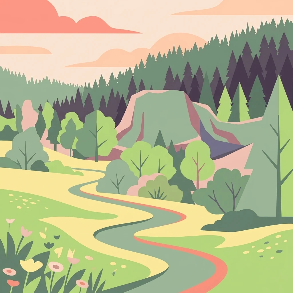
A flat-style digital illustration showing a winding path through a meadow with surrounding hills, a forest of coniferous trees, and a sunset-colored sky.

Oberes Filstal-Stadt Wiesensteig

Protected landscape

Park overview

Structured park overview, official facts, and landscape profile for Oberes Filstal-Stadt Wiesensteig

Oberes Filstal-Stadt Wiesensteig park facts, protected area profile, and essential visitor context

Review the core facts for Oberes Filstal-Stadt Wiesensteig, including designation, size, terrain, visitor scale, habitats, and operating context in one park-focused overview.

About Oberes Filstal-Stadt Wiesensteig

Oberes Filstal-Stadt Wiesensteig is a landscape protection area in the Landkreis Göppingen, in the eastern part of Baden-Württemberg. It is centered on the small town of Wiesensteig and the neighbouring village of Gruibingen, both of which sit on the rim of the Swabian Alb where the Fils river cuts a valley through the plateau.

Geologically and ecologically, the park lies entirely within the Mittlere Kuppenalb, the central dome-and-basin section of the Swabian Alb. This is a karst-dominated limestone plateau where centuries of farming have produced a finely textured cultural landscape. On the surface it appears soft and gently rolling rather than dramatic: rounded hilltops, shallow valleys, and small brooks moving between field and forest.

What makes the Oberes Filstal-Stadt Wiesensteig area distinctive is the combination of high habitat diversity compressed into a relatively compact footprint. Mixed deciduous and coniferous woodland stands next to hedgerow-bounded fields, stream corridors lined with alder and ash, and small open patches that retain heath-like vegetation. The protected designation was deliberately shaped to maintain this mosaic, recognizing that the interplay of land uses, not any single habitat, gives the area its ecological and scenic value.

The area is also a connecting element in a broader conservation network. Several neighbouring landscape protection areas adjoin it, and inside its boundaries lies the smaller Sterneck nature reserve, which is enclosed by the larger landscape protection area. Overlapping designations with the Filsalb FFH site and the Mittlere Schwäbische Ala Special Protection Area (SPA) mean that local landscape protection here contributes directly to European-level habitat and bird conservation goals.

Quick facts and research context for Oberes Filstal-Stadt Wiesensteig

Oberes Filstal-Stadt Wiesensteig is a landscape protection area (Landschaftsschutzgebiet) with the official identification number 1.17.067, located in the Landkreis Göppingen in Baden-Württemberg, Germany. It was established on 20 March 1985 by order of the Landratsamt Göppingen and is administered by the same district authority. The area covers about 171 hectares and is registered in the World Database on Protected Areas under WDPA ID 323372.

Geographically, it belongs to the Mittlere Kuppenalb natural region within the broader Schwäbische Alb. Parts of its territory overlap with the FFH site Filsalb (7423-342) and the bird protection area Mittlere Schwäbische Alb (7422-441), and it encircles the smaller Sterneck nature reserve. The area is bordered by several other landscape protection areas, forming part of a wider network of protected landscapes along the central Swabian Alb.

Protection and recognition

Documented terrestrial protection scope, international recognition sources, and official park records.

Oberes Filstal-Stadt Wiesensteig Protection Status and Designated Area Record

Oberes Filstal-Stadt Wiesensteig features a documented terrestrial protection scope cataloged within official conservation databases. Verified designation data and recognized management details provide reliable structural facts for geographic analysis.

Protection details

Protection scope
Terrestrial
Transboundary protection
No
WDPA ID
323372
Park context

Deeper park guide and search-rich context for Oberes Filstal-Stadt Wiesensteig

Oberes Filstal-Stadt Wiesensteig history, landscape, wildlife, and travel context

Explore Oberes Filstal-Stadt Wiesensteig through its history, landscape character, ecosystems, wildlife, conservation priorities, cultural context, and seasonal travel timing in a structured park guide built for atlas discovery and search intent.

Why Oberes Filstal-Stadt Wiesensteig stands out

The protected area is best known for preserving the classic Swabian Alb cultural landscape around Wiesensteig: an undulating plateau mosaic of forest, hedgerows, field patches, brook-side woodland, and open heath-like areas that together form one of the most habitat-diverse sections of the Mittlere Kuppenalb. It is also notable for its overlapping designations with EU-level Natura 2000 sites, linking a relatively small local landscape protection area to larger-scale conservation efforts for the Filsalb habitats and the broader Middle Swabian Alb bird area.
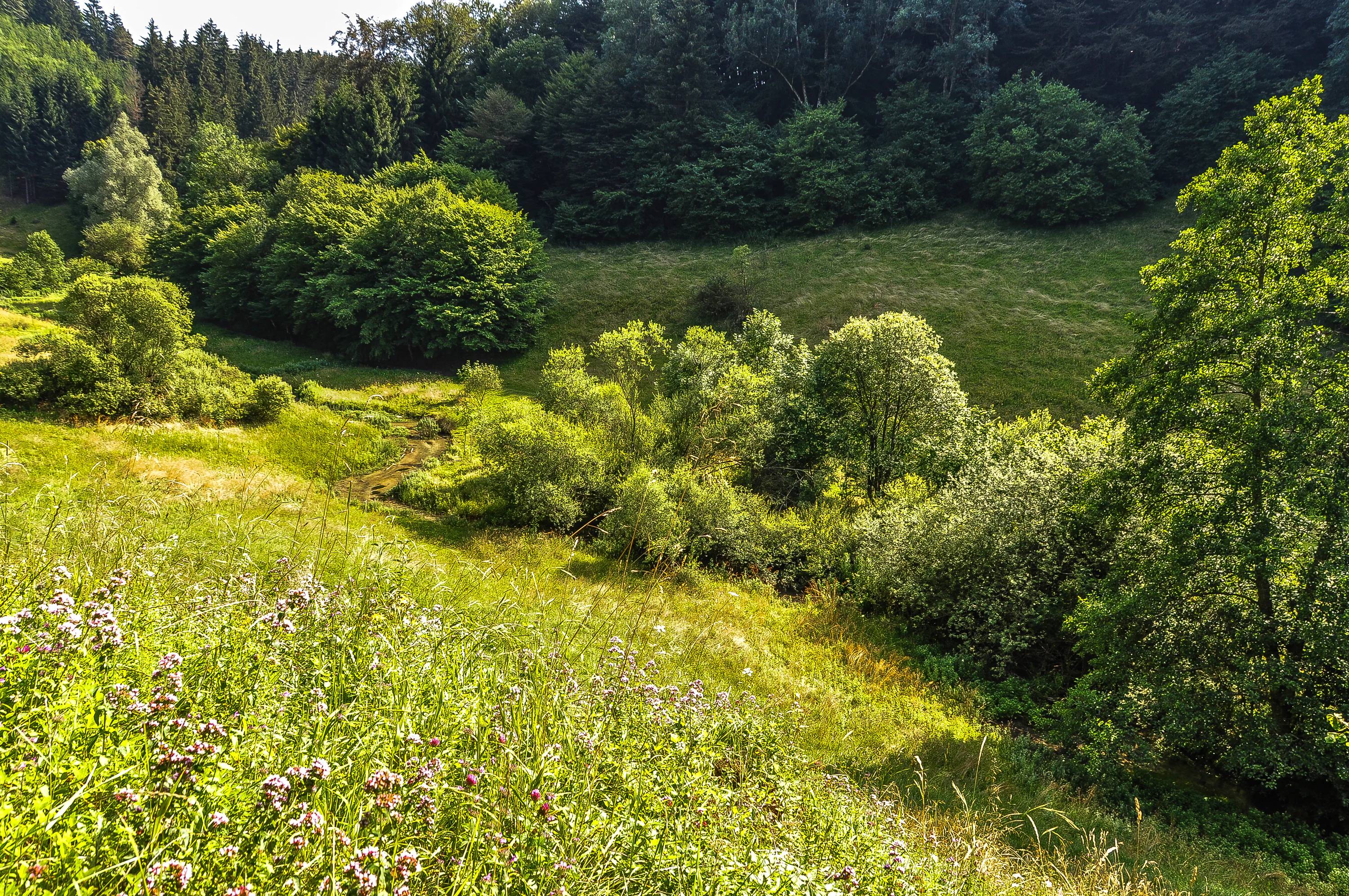
A lush, grassy valley with scattered shrubs and trees, leading up to a denser forest line on a hillside in the Swabian Alb.
The rolling green landscape of the Upper Filstal near Wiesensteig, characterizing the scenery of the Swabian Alb.

Oberes Filstal-Stadt Wiesensteig history and protected-area timeline

The Schutzgebiet was formally established on 20 March 1985 through a legal ordinance (Verordnung) issued by the Landratsamt Göppingen. The ordinance brought several earlier protection orders into a single, coherent framework for the area around Wiesensteig.

Specifically, the 1985 designation superseded earlier local ordinances that had protected landscape elements and scenic features along the historical Reichsautobahn Stuttgart-München through the districts of Esslingen, Nürtingen, Göppingen, and Ulm, dating back to 12 August 1940. It also replaced older orders from the former Landratsamt Göppingen protecting summer sheep pastures (Sommerschafweiden) as landscape features from 27 June 1939, as well as two earlier orders from the Landratsamt Geislingen from August and November 1937 concerning the protection of landscape elements near Wiesensteig.

In this way, the modern Oberes Filstal-Stadt Wiesensteig landscape protection area consolidated a patchwork of pre-war and wartime regional landscape orders into a unified conservation framework for the post-war administrative territory of Wiesensteig. Administration has remained with the Landkreis Göppingen since designation, and the area has since been incorporated into the national protected-area register and the WDPA.

Oberes Filstal-Stadt Wiesensteig landscape and geographic character

The protected area sits on the Mittlere Kuppenalb, a landscape of low, rounded Kuppen or dome-shaped hills typical of the central Swabian Alb. The terrain is gently undulating rather than rugged: broad ridges and shallow basins carved into Jurassic limestone, with surface drainage routed through small brooks that flow toward the upper Fils valley.

In the western part of the area, near Gruibingen, the protected land climbs onto this higher plateau. Here the topography levels out into the broader Albhochfläche, and a large contiguous forest block known locally as the Große Weite and Brunnen covers much of the surface. Further east, the protected territory wraps around the built-up area of Wiesensteig itself, following the transition between plateau and valley down toward the upper Fils corridor.

The visual character of the area is shaped by this alternation. From a distance, the landscape reads as a soft patchwork of dark forest patches, lighter green meadows, and yellow fields separated by hedgerows. Closer up, the karst character of the Alb becomes visible in small sinkholes, shallow dolines, and intermittent streams that disappear underground. Rock outcrops and dry, thin-soil communities become more common where woodland has been cleared or where traditional sheep grazing has historically kept the vegetation open.

Oberes Filstal-Stadt Wiesensteig ecosystems, habitats, and plant life

Ecologically, Oberes Filstal-Stadt Wiesensteig is significant because it preserves a particularly fine-grained mosaic of habitats within a small area. Wooded areas range from older mixed deciduous stands on moist slopes to planted conifer blocks on the dry plateau tops. Between them lie field hedges, solitary fruit trees, and small field copses that together create the structural diversity typical of long-cultivated Alb landscapes.

Stream and brook corridors contribute a second habitat layer. Narrow ribbons of alder and ash woodland follow the small watercourses, with wet flushes and small marshy patches where springs emerge on the karst slopes. These moist micro-habitats contrast sharply with dry, species-rich grassland fragments and the open heath-like areas that survive on shallow soils.

The cultural land-use mosaic is itself a key ecological feature. Historically grazed summer sheep pastures (Sommerschafweiden), old field boundaries, and remnant orchard meadows provide open-ground habitats that are otherwise scarce on the wooded Alb plateau. The protected-area ordinance explicitly cites the alternation of forests, fields, brook woodlands, hedgerows, and heath patches as the basis for the area's high floristic diversity and ecological value.

Oberes Filstal-Stadt Wiesensteig wildlife and species highlights

The area's wildlife value is closely tied to its habitat mosaic and to its overlap with Natura 2000 sites. Stream-side woodland and wet flushes support typical central European forest fauna, while the mix of open fields, hedgerows, and orchard meadows creates edge habitats that benefit smaller mammals, breeding birds, and pollinator communities.

Birdlife is particularly relevant because portions of the protected area lie within the Mittlere Schwäbische Alb Special Protection Area (SPA) 7422-441, which is aimed at conserving the bird assemblages of the broader central Swabian Alb plateau. This elevates the area's status beyond purely local landscape protection and gives its hedgerow, orchard, and open-field habitats an explicit role in European bird conservation.

In addition to birds, the combination of deciduous and coniferous forest, karst features, and grazed open patches supports typical Swabian Alb fauna including various bat species that use the area's woodland and built structures. Detailed species inventories are managed at the level of the overlapping Natura 2000 sites rather than within the landscape protection area itself.

Oberes Filstal-Stadt Wiesensteig conservation status and protection priorities

From a conservation perspective, Oberes Filstal-Stadt Wiesensteig is a small but strategically placed landscape protection area. Its significance lies less in any single flagship species and more in its role as a connective landscape-scale reserve. By covering the entire rural municipal area of Wiesensteig together with a large forest block on the Alb plateau, it maintains continuity across land-use types that would otherwise be fragmented.

The protection ordinance explicitly defines the goal as preserving the diversity, character, and beauty of the Wiesensteig and Gruibingen Alb landscape, together with its high ecological value and its role for public recreation. The mosaic of woodland, hedge-bordered fields, brook corridors, and heath patches is identified as the defining feature worth maintaining.

Its overlap with the Filsalb FFH site and the Mittlere Schwäbische Ala Special Protection Area extends the conservation relevance beyond local landscape protection into the European Natura 2000 framework. Encirclement of the smaller Sterneck nature reserve gives the area an additional role as a buffer and connecting landscape for stricter habitat protection at its core.

Oberes Filstal-Stadt Wiesensteig cultural meaning and human context

The protected area reflects the long cultural shaping of the central Swabian Alb by farming and pastoral use. The traditional Sommerschafweiden, summer sheep pastures, that are explicitly mentioned in the area's predecessor protection orders from 1937 and 1939 are part of this heritage. These open, grazed patches and the surviving orchard meadows around Wiesensteig and Gruibingen are direct cultural-ecological remnants of earlier agricultural systems.

Wiesensteig itself is a small historic town on the edge of the Alb, and the surrounding landscape forms its immediate rural and ecological setting. The protected-area designation treats the town's wider landscape as a cultural asset to be maintained alongside its ecological functions, reflecting a regional approach to landscape protection common in Baden-Württemberg, where Landschaftsschutzgebiete often cover complete rural territories around small towns rather than isolated natural fragments.

Top sights and standout views in Oberes Filstal-Stadt Wiesensteig

The area's standout features include its unusually fine habitat mosaic compressed into 171 hectares, its role enclosing the Sterneck nature reserve, and its embedding within a wider chain of landscape protection areas along the central Swabian Alb. The overlapping Natura 2000 designations, both the Filsalb FFH site and the Mittlere Schwäbische Ala SPA, give a small local protection area a meaningful role in European ecological networks.

Equally notable is the historical layering of the protection regime: pre-war and wartime ordinances for sheep pastures and roadside landscape features have been folded into a single modern landscape protection area, making Oberes Filstal-Stadt Wiesensteig a representative example of how German landscape conservation has consolidated earlier regional protections into coherent modern units.

Best time to visit Oberes Filstal-Stadt Wiesensteig

As an evergreen landscape protection area rather than a developed visitor park, the attraction is the rural Swabian Alb landscape itself: forest, hedgerows, fields, and the edges of Wiesensteig and Gruibingen. Late spring and early summer tend to be especially rewarding, when wildflowers brighten the field margins and orchard meadows, and the beech and mixed forest canopy is fully in leaf.

Early autumn is also attractive on the plateau, when the mixed woodland shows varied colour and the agricultural mosaic is at its most visually contrastive: recently harvested fields next to still-green grassland and dark forest stands. Winter visits have their own appeal in the karst landscape, when open ground can show small sinkholes and dry valleys more clearly, though conditions on the Alb plateau can be cold and snowy.

Monthly climate preview

Long-term representative point measurements tracking monthly averages across the protected landscape

Oberes Filstal-Stadt Wiesensteig Climate Normals and Temperature Rhythms

Representative coordinate records show measured temperature ranges spanning sub-zero winter minimums to warm summer maximums alongside consistent daily precipitation. Detailed monthly climate profiles provide full comparative baseline data for the terrain.
Annual mean8 °C
-1 °C18 °C
Jan-1°
Feb
Mar
Apr
May13°
Jun16°
Jul18°
Aug18°
Sep14°
Oct
Nov
Dec
Warmest month
July

18.2 °C

Coolest month
January

-1.1 °C

Wettest month
July

3.2 mm/day

Driest month
February

1.7 mm/day

Park location guide

Geography guide, regional context, and park location map for Oberes Filstal-Stadt Wiesensteig

Oberes Filstal-Stadt Wiesensteig park geography, regions, and map view in Germany

Understand where Oberes Filstal-Stadt Wiesensteig sits in Germany through a broader geographic reading of the surrounding landscape, nearby location context, and its mapped position within the national park landscape.

How Oberes Filstal-Stadt Wiesensteig fits into Germany

Germany is a federal republic in Western and Central Europe with a population of over 83 million across sixteen constituent states. It is Europe's largest economy by nominal GDP and a major global exporter and importer. The capital is Berlin, and the country borders Denmark, Poland, Czech Republic, Austria, Switzerland, France, Luxembourg, Belgium, and the Netherlands.

Wider geography shaping Oberes Filstal-Stadt Wiesensteig in Germany

Germany is located in Western and Central Europe, spanning 357,022 km². It borders Denmark to the north, Poland and the Czech Republic to the east, Austria and Switzerland to the south, and France, Luxembourg, Belgium, and the Netherlands to the west. The country has coastlines on the Baltic Sea and North Sea to the north, with the Alps located in the southern region.

Map view of Oberes Filstal-Stadt Wiesensteig

Use this park location map to pinpoint Oberes Filstal-Stadt Wiesensteig in Germany, understand its exact geographic position, and read its mapped placement within the surrounding landscape more clearly.

Pigeon | © OpenStreetMap contributors

Location context for Oberes Filstal-Stadt Wiesensteig

Baden-Württemberg

Visual exploration of plateau forests, limestone terrain, and habitat mosaics across the Swabian Alb

Oberes Filstal-Stadt Wiesensteig Landscape Photos and Protected Area Scenery

Examine detailed photographs capturing the undulating plateau terrain, mixed forest blocks, and traditional hedgerow mosaics defining Oberes Filstal-Stadt Wiesensteig. Visual documentation reveals the distinct geomorphology, karst features, and protected landscape character unique to this region of southwestern Germany.

A lush, grassy valley with scattered shrubs and trees, leading up to a denser forest line on a hillside in the Swabian Alb.

Park atlas

Compare nearby regional parks and protected areas across the central Swabian Alb

Other Parks Like Oberes Filstal-Stadt Wiesensteig and Surrounding Protected Landscapes

Browse protected areas and regional parks located near Oberes Filstal-Stadt Wiesensteig to compare surrounding Swabian Alb landscapes. Evaluating adjacent terrain helps place local karst plateaus and forest mosaics into a broader geographic conservation context.
A soft watercolor painting depicting rolling green hills and meadows against a white background.
Protected landscapeBaden-Württemberg
About 2.3 km away#1 closest

Northwest

Neidlinger Tal Protected Landscape: Regional Geography and Mapped Boundaries

A study of the Swabian Alb and Alb foreland transition terrain

The Neidlinger Tal protected landscape represents a vital intersection of natural regions in Baden-Württemberg. Its boundaries encompass a mosaic of forest and farmland, providing a comprehensive look at how historical land use patterns coexist with modern conservation efforts within the Swabian Alb, including various bird and habitat protection designations.

Area
10.959 km²
Established
1975
IUCN
V
Relief
Upland
Protected landscapeBaden-Württemberg
About 2.8 km away#2 closest

East

Oberes Filstal-Gemeinde Mühlhausen im Täle: Protected Landscape Geography and Map Data

Swabian Alb regional landscape and habitat mosaic

Analyze the protected landscape of Oberes Filstal-Gemeinde Mühlhausen im Täle through its unique physical terrain and ecological structure. This area in the Göppingen district features a complex interplay of river valleys and plateau uplands, creating a habitat corridor that links the Fils valley with the wider Swabian Alb, supporting diverse flora and traditional land-use patterns.

Area
5.13 km²
Established
1983
IUCN
V
A soft watercolor illustration showing a rolling landscape with gentle hills, grassy fields, and tree lines in shades of green, yellow, and faint pink.
Protected landscapeBaden-Württemberg
About 4.8 km away#3 closest

North

Oberes Filstal-Gemeinde Gruibingen: Protected Landscape and Regional Geography

Swabian Alb terrain within the Göppingen district

Oberes Filstal-Gemeinde Gruibingen forms a crucial ecological envelope around specialized nature reserves on the Swabian Alb. The landscape is defined by its characteristic kuppen hill-and-basin topography, featuring ridge slopes, stream-cut valleys, and traditional agricultural land that supports high floristic diversity within the Baden-Württemberg region.

Area
1.71 km²
Established
1984
IUCN
V
A pale, soft-toned watercolor painting depicting a gentle, rolling landscape with green fields, distant hills, and sparse clusters of trees.
Protected landscapeBaden-Württemberg
About 5.8 km away#4 closest

Southwest

Sommerschafweide hinter dem Hockenden Stein, Auchtweide Protected Landscape and Map

Historic Swabian Alb pasture and geological Kanzel terrain

Discover the geographic layout of Sommerschafweide hinter dem Hockenden Stein, Auchtweide, a protected area in Baden-Württemberg. This site highlights traditional grazed Magerrasen, mature pasture beeches, and the striking geological rock formation known as the Hockender Stein, offering insight into the conservation of the Mittlere Kuppenalb cultural landscape.

Area
0.065 km²
Established
1955
IUCN
V
Relief
Upland
Protected landscapeBaden-Württemberg
About 6.2 km away#5 closest

Northwest

Weilheim an der Teck auf Gemarkungen Weilheim und Hepsisau Protected Landscape Atlas

Volcanic hill geography in the Baden-Württemberg region

This protected area safeguards a richly structured landscape where rolling foothills meet the steep escarpments of the Swabian Alb. Centered on the volcanic peaks of Limburg and Egelsberg, the region maintains a vital balance between forest corridors and open agricultural plains within the district of Esslingen.

Area
13.615 km²
Established
1979
IUCN
V
A horizontal watercolor painting depicting a soft-focus landscape with green fields, patches of trees, and rolling hills in the background under a pale sky.
Protected landscapeBaden-Wuerttemberg
About 10 km away#6 closest

East

Nellingen Protected Landscape: Mapping the Cultural and Karstic Terrain of Central Swabia

Protected landscape geography and regional land use

Nellingen Protected Landscape encompasses over 1,500 hectares of the Swabian Alb, forming an essential link in the regional conservation network. This site provides insight into the karstic landforms of the Kuppenalb, including sinkholes and dry valleys, while preserving a living history of agricultural practices such as orchard management and sheep grazing. This analysis provides a structured overview of the area topography and its significance in the regional landscape context.

Area
15.212 km²
Established
1999
IUCN
V
Relief
Upland
A minimalist watercolor painting depicting a soft-focus landscape with rolling hills, distant ridgelines, and scattered trees across a meadow, rendered in muted greens, purples, and pinks on a white background.
Protected landscapeBaden-Württemberg
About 11 km away#7 closest

Northwest

Ohmden-Holzmaden Protected Landscape: Swabian Alb Foothill Mapping

A diverse mosaic of traditional orchards and stream valleys

Ohmden-Holzmaden encompasses a vital protected landscape in the Esslingen district, defined by the Trinkbach, Seebach, and Aubach valleys. This geography of traditional orchards, meadows, and hedgerows maintains an open, structured rural habitat that serves as a critical refuge within the broader Swabian Alb foothill region of Germany.

Area
3.111 km²
Established
1993
IUCN
V
Relief
Upland
Protected landscapeBaden-Württemberg
About 11 km away#8 closest

North

Wolfschlugen Protected Landscape: Geography and Atlas of the Filder Plateau

Mapped protected lands in Baden-Württemberg Germany

Wolfschlugen stands as a significant protected area in the Esslingen district, preserving traditional orchard meadows and open agricultural plains. The area offers a detailed study of regional land use, featuring a mosaic of meadow habitats and stream-side wetlands essential to the Filder plateau landscape character.

Area
0.51 km²
Established
1985
IUCN
V

Common questions about visiting, size, designation, and location context for Oberes Filstal-Stadt Wiesensteig

Oberes Filstal-Stadt Wiesensteig FAQs for park facts, access, geography, and protected area context

Find quick answers about Oberes Filstal-Stadt Wiesensteig, including protected-area facts, park geography, trail and visitor context, and how the park fits into its surrounding country and regional landscape.
MoriAtlas Explorer

Continue Your Protected Areas Search Across the Global Atlas

Deepen your exploration by continuing the structured search for national parks and protected areas worldwide. Utilize the comprehensive filtering capabilities to compare different conservation landscapes and refine your understanding of global park geography. Discover more about the distribution and characteristics of protected natural areas.

Global natural geography