
Mori Atlas logo
Nature reserveOberlücke von Viernheim

A transformed quarry lake serving as a critical biodiversity refuge within the Hessian Ried landscape

Oberlücke von Viernheim Nature Reserve: Protected Wetland Landscapes and Regional Geography in Hesse

(Naturschutzgebiet Oberlücke von Viernheim)

Oberlücke von Viernheim is a protected nature reserve in the Bergstraße district of Hesse, Germany, illustrating how former industrial extraction sites evolve into vital wetland habitats. Within this thirteen-hectare area, the former sand and gravel quarry provides essential waterbird and amphibian refuges amidst the surrounding agricultural and developed terrain of the Upper Rhine Plain. Mapping the reserve reveals a complex micro-landscape of open water, vegetated margins, and dry sandy terrain that forms part of the regional Bird Protection Area and Natura 2000 network.

wetlandquarry lakewaterbird refugeamphibian habitatnature reserveHessian Ried
A digital illustration of a waterfall cascading down a yellow cliffside into a small body of water, surrounded by trees and stylized leaves in the foreground.

Oberlücke von Viernheim

Nature reserve

Park overview

Structured park overview, official facts, and landscape profile for Oberlücke von Viernheim

Oberlücke von Viernheim park facts, protected area profile, and essential visitor context

Review the core facts for Oberlücke von Viernheim, including designation, size, terrain, visitor scale, habitats, and operating context in one park-focused overview.

About Oberlücke von Viernheim

Oberlücke von Viernheim is a small but ecologically significant nature reserve in the Hesse region of western Germany, located in the Bergstraße district near the town of Viernheim. It occupies a former sand and gravel pit that ceased operation in 1980 and was subsequently left unmanaged, allowing natural ecological processes to shape its current character. The result is a mosaic of open water, reedy margins, scrub, and dry sandy banks that together create a rich variety of habitats within a compact footprint of about thirteen hectares.

The reserve sits within the Hessian Ried, a lowland landscape along the Upper Rhine Plain characterized by former floodplain forests, gravel terraces, and a long history of human modification through agriculture, forestry, and mineral extraction. Oberlücke fits this regional profile but stands out for having been deliberately set aside and allowed to rewild, rather than being reclaimed for further development. Its setting, tucked between allotment gardens to the west and south and the busy A6 and A67 motorways nearby, makes it an oasis-like enclave of semi-natural habitat.

Today, Oberlücke is valued primarily as a waterbird and amphibian refuge. Its lake supports breeding populations of little grebes and great crested grebes, while mute swans, coots, and mallards are regular residents. Grey herons and cormorants feed here throughout the year, and during migration periods the water attracts diving ducks such as common pochards and gadwalls. Amphibians benefit from a regular exchange of individuals with a wooded lake east of the A6, helping to maintain genetic diversity in an otherwise fragmented landscape.

The site's conservation significance is underlined by its inclusion in the Natura 2000 network and the surrounding Bird Protection Area, as well as its IUCN Category IV classification as a habitat and species management area. Although infrastructure such as a 220 kV power line and neighboring allotment gardens constrain some of its use by more sensitive species, the reserve nevertheless demonstrates how modest post-industrial sites can become important refuges for wildlife when protected and allowed to develop along natural lines.

Quick facts and research context for Oberlücke von Viernheim

Oberlücke von Viernheim is a nature reserve (Naturschutzgebiet) in Hesse, Germany, located in the town of Viernheim within the Bergstraße district. It covers about 13 hectares, of which roughly five hectares consist of open water. The protected area was formally designated on 13 September 1985 and is catalogued under the identifier 1431012, with World Database on Protected Areas entry 164899.

The site is classified as an IUCN Category IV habitat and species management area and lies within the Bird Protection Area "Wälder der südlichen hessischen Oberrheinebene." It is also part of the European Natura 2000 network. Geographically, the reserve sits west of the A6 and A67 motorways, in the southern arc of the Viernheim interchange, within the broader Hessian Ried lowlands along the Upper Rhine Plain.

Protection and recognition

Examine documented terrestrial boundary records and official conservation status metrics.

Oberlücke von Viernheim Protection Status and International Recognition Facts

Oberlücke von Viernheim holds a documented terrestrial protection status within global conservation registries. Official designation records provide structured baseline data regarding management parameters and administrative tracking.

Protection details

Protection scope
Terrestrial
Transboundary protection
No
WDPA ID
164899
Park context

Deeper park guide and search-rich context for Oberlücke von Viernheim

Oberlücke von Viernheim history, landscape, wildlife, and travel context

Explore Oberlücke von Viernheim through its history, landscape character, ecosystems, wildlife, conservation priorities, cultural context, and seasonal travel timing in a structured park guide built for atlas discovery and search intent.

Why Oberlücke von Viernheim stands out

The reserve is best known for being a former sand and gravel quarry that has been left to ecological succession and has developed into a thriving wetland refuge. Its roughly five-hectare water body, surrounded by recovering dry and moist habitats, supports breeding populations of little grebes, great crested grebes, and mute swans, as well as a year-round presence of grey herons and cormorans. The site is also recognized for its role in amphibian conservation, with regular genetic exchange between Oberlücke and a nearby forested lake east of the A6 motorway. Its integration into both Natura 2000 and the regional Bird Protection Area gives it an importance that far exceeds its modest size, making it a textbook example of how abandoned extraction sites can gain lasting conservation value in intensively used lowland landscapes.
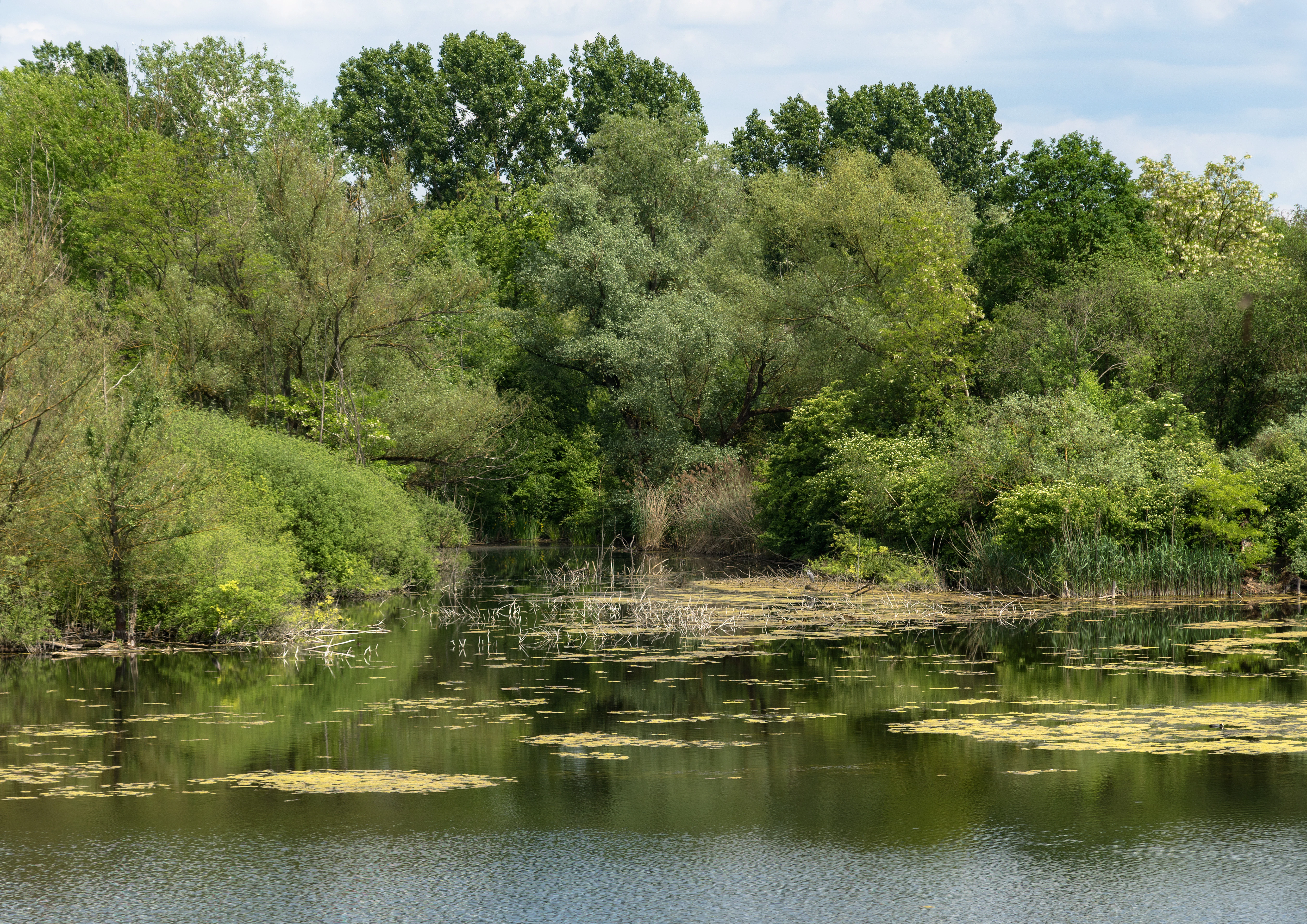
A calm, dark-water pond reflecting the surrounding lush green trees and shrubs on a summer day.
A serene view of the pond at Oberlücke von Viernheim, surrounded by dense riparian vegetation.

Oberlücke von Viernheim history and protected-area timeline

The site that would become the Oberlücke von Viernheim nature reserve began its modern history as an active sand and gravel quarry within the Hessian Ried. Extraction of gravel and sand continued on the site until 1980, after which the operation was abandoned. Rather than being backfilled or converted to other uses, the disused quarry was left to natural processes, allowing vegetation to colonize the exposed ground and water to accumulate across part of the pit floor.

In the years that followed, this former industrial site began to develop into a lively habitat for waterbirds and amphibians. Recognizing its growing ecological value, the regional authorities formally placed the area under nature protection on 13 September 1985 under Hessian state conservation law. The designation aimed specifically to preserve the disused gravel pit as a refuge for bird and amphibian species whose habitat in the surrounding plain had become increasingly scarce.

Further recognition came with the site's integration into the European Natura 2000 network and its inclusion within the broader Bird Protection Area covering the forests of the southern Hessian Upper Rhine Plain. This step connected Oberlücke to wider continental conservation frameworks and underscored its role in maintaining viable populations of waterbirds and amphibians across the region. Since then, the reserve has continued to function largely as a low-intervention site, managed primarily through its allowed progression along natural successional pathways.

Oberlücke von Viernheim landscape and geographic character

The landscape of Oberlücke is shaped directly by its origin as a sand and gravel quarry, which gives the reserve a distinctive artificial yet recovering character. Within its roughly thirteen-hectare footprint, the most prominent feature is an open water body of about five hectares, occupying the deeper parts of the former pit. This central lake is ringed by a varied margin of sandy banks, gravelly slopes, emergent vegetation, and scrub.

Surrounding the water, the terrain includes drier sandy areas typical of the Upper Rhine Plain, interspersed with patches of taller vegetation that have established since extraction ceased in 1980. The mix of dry mineral ground, moist shoreline, and standing water creates a small but instructive cross-section of lowland habitats. The reserve's topography is subtle, with only modest relief, but the contrast between wet and dry zones produces an unusually varied micro-landscape for such a small site.

Externally, the reserve is framed by a strongly human-made environment. Allotment gardens border it to the west and south, and a regional recycling yard lies along the autobahn side. A high-voltage power line passes west of the gardens, adding to the anthropogenic backdrop. Despite this setting, Oberlücke functions as an isolated but coherent natural feature within the broader Hessian Ried, contributing a meaningful piece of wetland and rough-ground habitat to a landscape otherwise dominated by settlements, roads, and farmland.
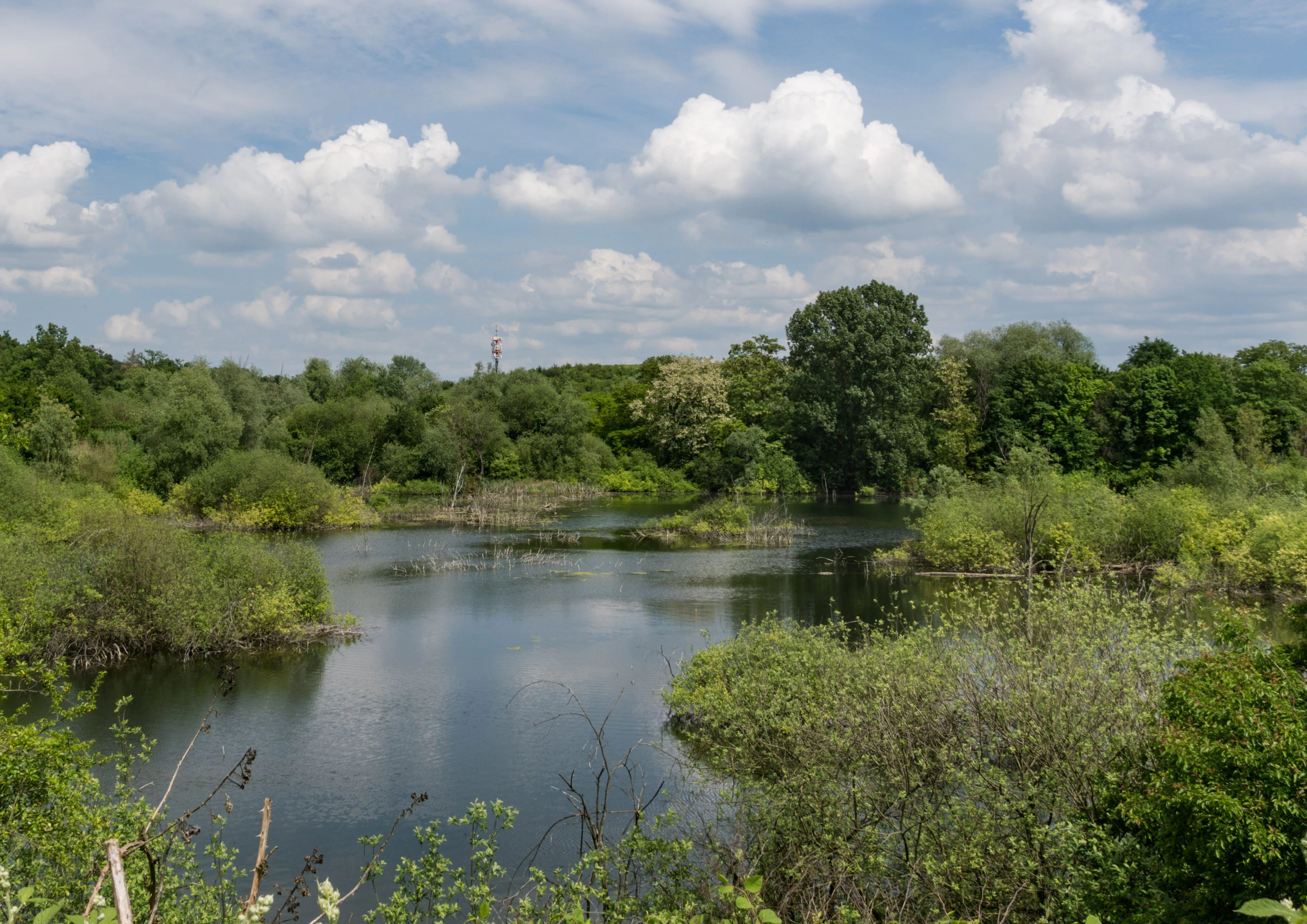
A peaceful pond surrounded by lush green trees and shrubs under a cloudy blue sky, with a radio mast visible in the distance.
A view of the pond and surrounding vegetation at Oberlücke von Viernheim, a nature reserve established in a former gravel pit.

Oberlücke von Viernheim ecosystems, habitats, and plant life

Ecologically, Oberlücke is fundamentally a successional habitat, having been allowed to develop naturally since the cessation of sand and gravel extraction in 1980. Over four decades, the reserve has transitioned from a raw extraction pit to a mosaic of aquatic, wetland, scrub, and dry-grassland communities. This dynamic, still ongoing process is central to the site's ecological identity, even though its total area is modest.

The open water forms the ecological heart of the reserve and supports a combination of submerged, floating, and emergent vegetation typical of lowland quarry lakes. Water levels fluctuate with groundwater and rainfall patterns across the Hessian Ried, shaping the extent of shallow margins that are particularly valuable for wading birds, waterfowl, and amphibians. The shoreline mosaic of gravel, sand, and organic sediment provides breeding substrate for ground-nesting species and feeding areas for predators.

Surrounding the lake, dry sandy banks grade into scrubby thickets and patches of rough grassland, generating structural diversity in a small area. These drier and intermediate habitats are important for many of the bird and amphibian species that depend on the site, and they also contribute to the botanical interest of the reserve. The combination of dry and wet habitats in such proximity is rare in this intensively developed section of the Upper Rhine Plain, which is what elevates Oberlücke's conservation relevance well beyond its size.
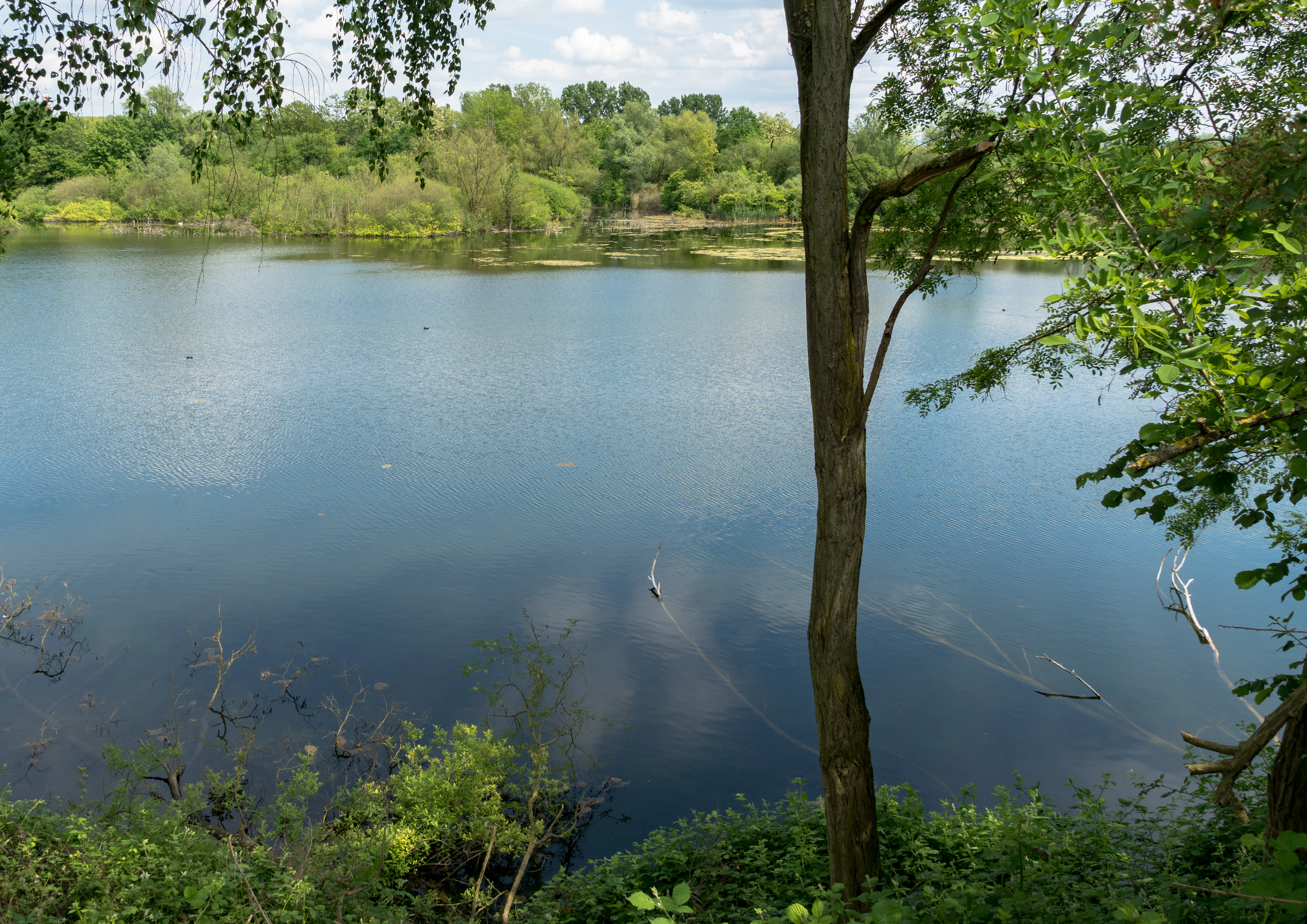
A serene pond scene surrounded by green trees and foliage, with a calm water surface and a tall tree trunk framing the right foreground.
A view of the Oberlücke von Viernheim nature reserve, showing its central pond surrounded by lush riparian vegetation.

Oberlücke von Viernheim wildlife and species highlights

The wildlife profile of Oberlücke is dominated by waterbirds and amphibians, reflecting the site's character as a quarry lake embedded in a lowland plain. The lake supports breeding populations of little grebes and great crested grebes, both of which depend on undisturbed quiet water with vegetated margins. Mute swans and coots are also regular breeders, while mallards use the open water extensively for feeding and rearing young.

Grey herons and cormorants are present throughout the year, drawn to the lake as reliable feeding habitat. During the spring and autumn migration periods, diving ducks such as common pochards and gadwalls stop at the water to rest and forage, adding seasonal variety to the bird community. Over time, non-native species have also established themselves at the site, including Canada geese and Egyptian geese, which are increasingly competing with native waterfowl for food and nest sites.

Amphibians are a central part of the reserve's fauna. The Oberlücke population maintains regular genetic exchange with a forested lake known also as the Anglersee, located east of the A6 motorway, helping to sustain diversity across an otherwise fragmented network of breeding sites in the Hessian Ried. Together, the bird and amphibian communities form the core of Oberlücke's wildlife identity and underline its importance within both the regional Bird Protection Area and the wider Natura 2000 framework.
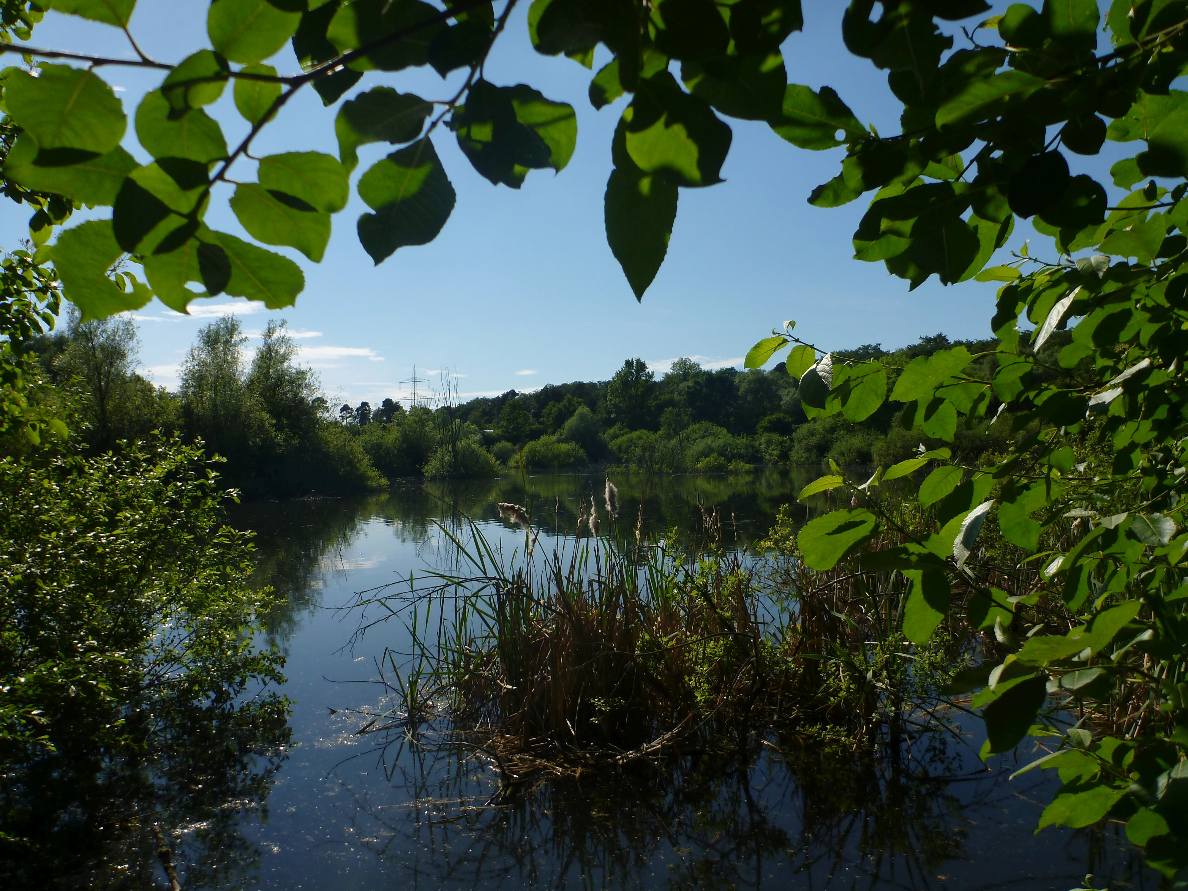
A tranquil pond surrounded by lush green trees and foliage, viewed through a natural frame of overhanging branches.
A peaceful view of the water and surrounding vegetation at the Oberlücke von Viernheim nature reserve.

Oberlücke von Viernheim conservation status and protection priorities

From a conservation perspective, Oberlücke is a striking example of how small, locally protected sites can punch far above their weight when embedded in larger networks. The reserve's designation as a Naturschutzgebiet under Hessian law, its classification as an IUCN Category IV habitat and species management area, and its inclusion in the European Natura 2000 system each contribute to a layered protection status that recognizes both the site's intrinsic value and its role in regional biodiversity.

The reserve helps to compensate for the widespread loss of natural or semi-natural wetland habitats across the Upper Rhine Plain, an area dominated by agriculture, infrastructure, and settlement. By maintaining breeding sites for grebes and swans, regular feeding areas for herons and cormorants, and amphibian breeding habitat with connections to other water bodies, Oberlücke supports multiple species of conservation concern that would otherwise have very limited options in this part of Hesse.

Constraints on the site include the proximity of allotment gardens, the regional recycling facility, and a high-voltage power line, all of which can disturb or exclude more sensitive species. Nonetheless, the reserve's protection framework and its integration with adjacent protected landscapes mean that its habitat values can be maintained over time through low-intervention management, continued monitoring, and the careful balance between preservation and the surrounding human land uses.

Oberlücke von Viernheim cultural meaning and human context

Oberlücke sits within Viernheim, a town whose historical identity has been shaped by its position along the Upper Rhine Plain between the Bergstraße hills and the Rhine lowlands. The reserve itself does not carry prominent cultural or historical landmarks, but its location reflects a broader regional pattern in which former mineral extraction sites have been reintegrated into local landscapes and, in some cases, set aside for nature conservation.

The surrounding allotment garden culture, visible along the western and southern edges of the reserve, represents an enduring tradition of small-scale urban horticulture that is widespread across German towns and is closely tied to community identity. The proximity of these gardens to Oberlücke illustrates how closely everyday cultural life and protected natural areas can coexist in the modern German countryside, with the reserve providing a counterpoint of wilder habitat amid the highly tended surroundings.
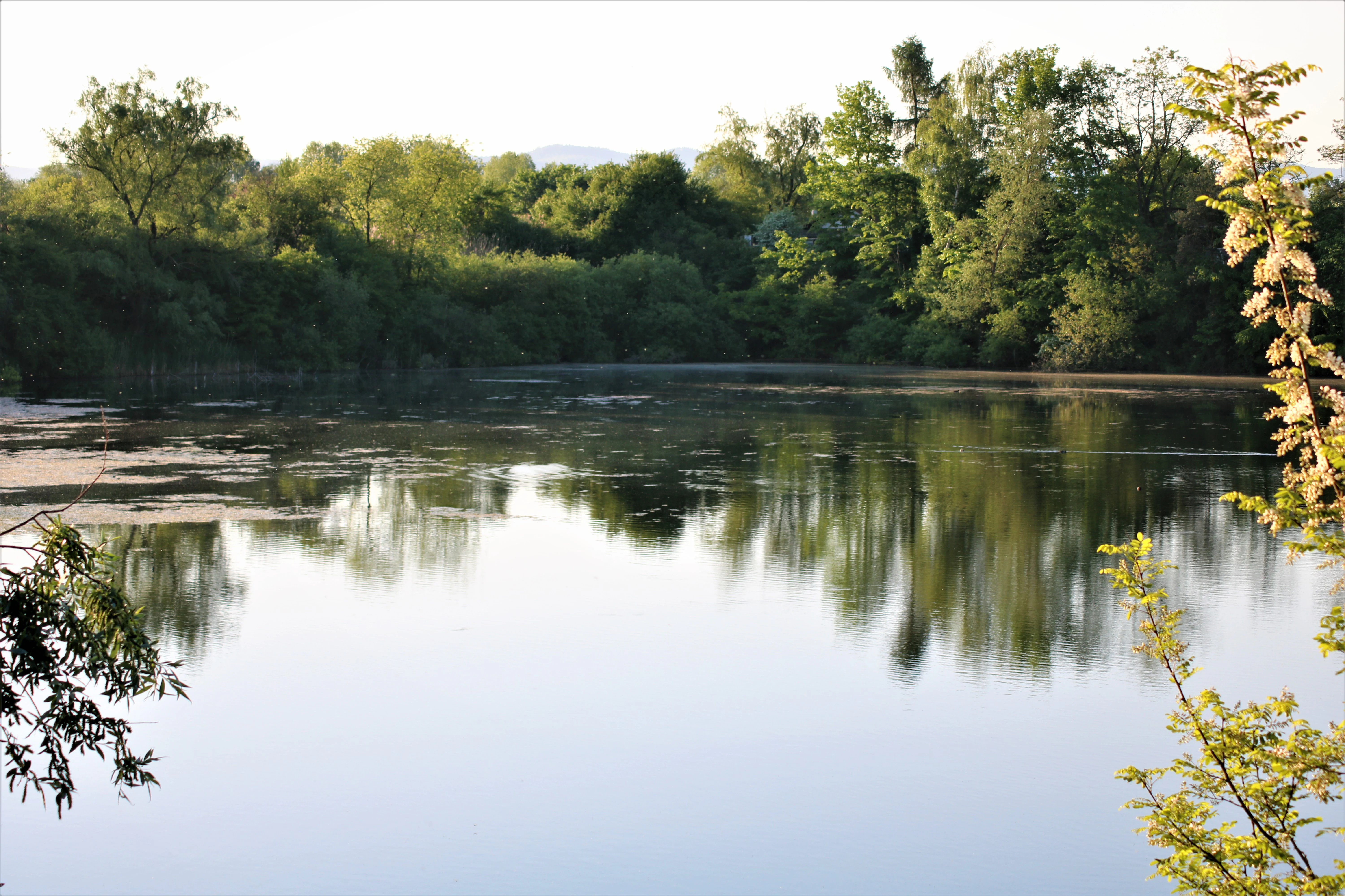
A calm, reflective pond in a nature reserve, surrounded by dense green trees and shrubs on the banks, with a bright sky overhead.
A peaceful view of the pond at the Oberlücke von Viernheim nature reserve.

Top sights and standout views in Oberlücke von Viernheim

A compact quarry-lake wetland that has become one of the most important small waterbird refuges in the Hessian Ried. The reserve's roughly five-hectare lake supports breeding grebes and swans, year-round feeding habitat for herons and cormorants, and seasonal visits by migrant diving ducks, all within an area of just thirteen hectares.

Its layered conservation status under Hessian nature protection law, the European Natura 2000 network, and the regional Bird Protection Area gives Oberlücke a level of protection and recognition that far exceeds what its modest size might suggest. The site also illustrates the broader story of how former industrial landscapes in the Rhine plain have been quietly transformed into places where wildlife can return.
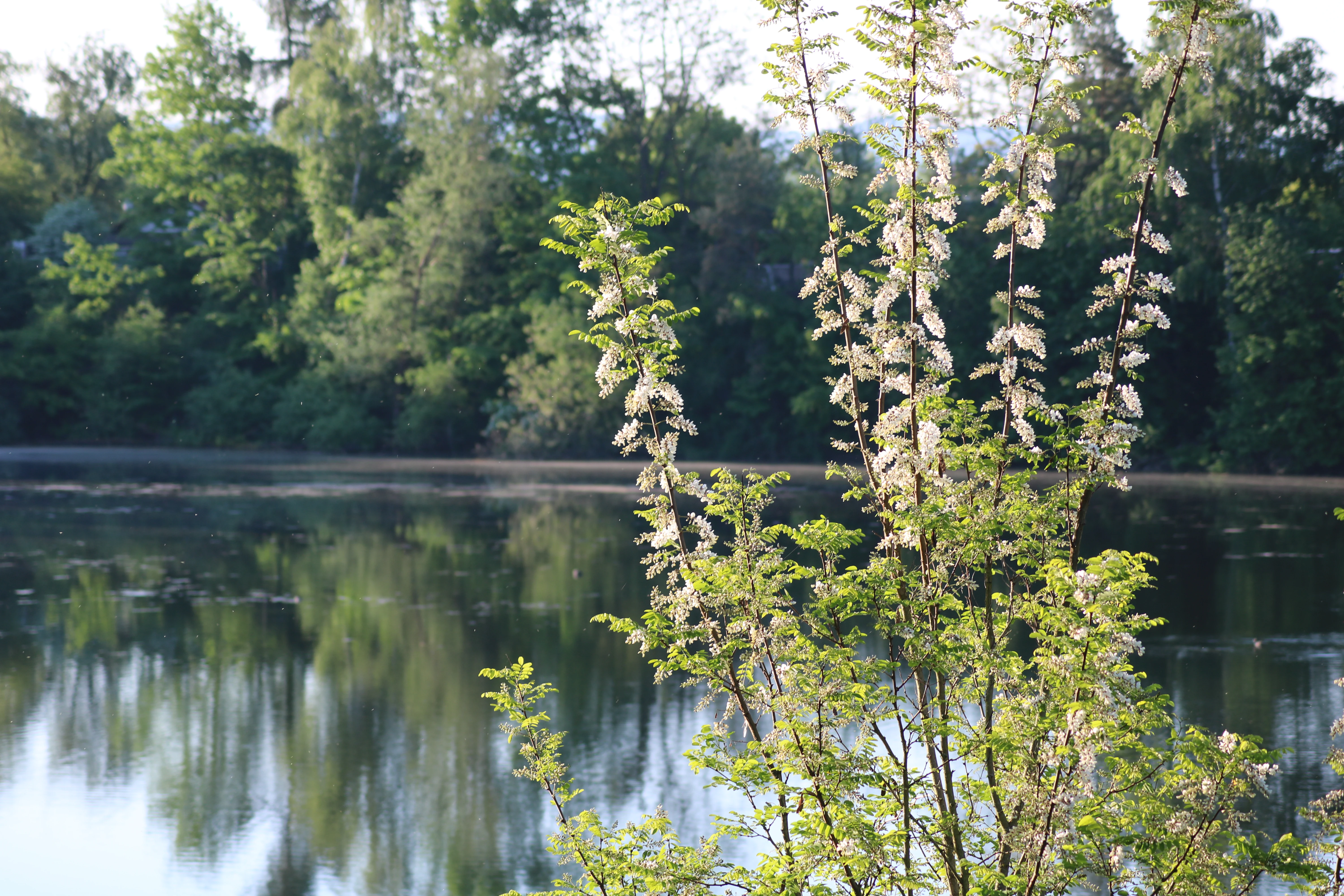
A calm lake in the Oberlücke von Viernheim nature reserve, with flowering white acacia trees in the foreground and a dense forest line reflecting in the water in the background.
Flowering acacia trees along the shore of the Oberlücke von Viernheim nature reserve.

Best time to visit Oberlücke von Viernheim

Oberlücke can be appreciated at any time of year, as the reserve functions as a year-round habitat for waterbirds and amphibians. Spring is especially rewarding, when breeding grebes, swans, and coots are active and the wetland margins come alive with amphibian movement between the quarry lake and neighboring water bodies. This is also when water levels are typically favorable for observing nesting behavior close to the shoreline.

Late summer and early autumn bring migrating diving ducks such as pochards and gadwalls, which stop at the lake to rest and forage alongside the more sedentary residents. Winter offers a different character, with grey herons and cormorants often the most visible users of the open water and reduced vegetation allowing clearer sightlines across the site. Throughout the year, the reserve rewards quiet observation rather than active tourism, and visitors should avoid disturbing breeding birds and amphibians along the sensitive shorelines.

Monthly climate preview

Long-term representative measurements of monthly temperature and precipitation for Oberlücke von Viernheim

Oberlücke von Viernheim Climate Normals and Annual Temperature Rhythm

Oberlücke von Viernheim exhibits a measured annual cycle spanning sub-freezing winter minimums to warm summer maximums alongside consistent multi-millimeter daily precipitation averages. Examining the complete monthly climate normals provides a detailed historical baseline for temperature variation and moisture distribution across the representative coordinate.
Annual mean10 °C
0 °C20 °C
Jan
Feb
Mar
Apr
May14°
Jun18°
Jul20°
Aug20°
Sep15°
Oct10°
Nov
Dec
Warmest month
July

20.3 °C

Coolest month
January

0.1 °C

Wettest month
July

2.4 mm/day

Driest month
April

1.5 mm/day

Park location guide

Geography guide, regional context, and park location map for Oberlücke von Viernheim

Oberlücke von Viernheim park geography, regions, and map view in Germany

Understand where Oberlücke von Viernheim sits in Germany through a broader geographic reading of the surrounding landscape, nearby location context, and its mapped position within the national park landscape.

How Oberlücke von Viernheim fits into Germany

Germany is a federal republic in Western and Central Europe with a population of over 83 million across sixteen constituent states. It is Europe's largest economy by nominal GDP and a major global exporter and importer. The capital is Berlin, and the country borders Denmark, Poland, Czech Republic, Austria, Switzerland, France, Luxembourg, Belgium, and the Netherlands.

Wider geography shaping Oberlücke von Viernheim in Germany

Germany is located in Western and Central Europe, spanning 357,022 km². It borders Denmark to the north, Poland and the Czech Republic to the east, Austria and Switzerland to the south, and France, Luxembourg, Belgium, and the Netherlands to the west. The country has coastlines on the Baltic Sea and North Sea to the north, with the Alps located in the southern region.

Map view of Oberlücke von Viernheim

Use this park location map to pinpoint Oberlücke von Viernheim in Germany, understand its exact geographic position, and read its mapped placement within the surrounding landscape more clearly.

Pigeon | © OpenStreetMap contributors

Location context for Oberlücke von Viernheim

Hesse

Visualizing the wetland habitats and protected terrain of the nature reserve

Oberlücke von Viernheim Photos and Landscape Scenery

Visual records illustrate the open water body, sandy banks, and recovering vegetation characteristic of this protected lowland environment. Examining these images reveals the ecological transition of the former quarry into an important waterbird refuge within the Hessian Ried.

A calm, dark-water pond reflecting the surrounding lush green trees and shrubs on a summer day.

A calm, reflective lake surrounded by dense green trees and shrubs, with aquatic vegetation on the water surface.

A peaceful pond surrounded by lush green trees and shrubs under a cloudy blue sky, with a radio mast visible in the distance.

A serene pond scene surrounded by green trees and foliage, with a calm water surface and a tall tree trunk framing the right foreground.

A tranquil pond surrounded by lush green trees and foliage, viewed through a natural frame of overhanging branches.

A calm, still pond covered in patches of aquatic vegetation, surrounded by a dense forest fringe under soft lighting.

A calm, reflective pond in a nature reserve, surrounded by dense green trees and shrubs on the banks, with a bright sky overhead.

A calm lake in the Oberlücke von Viernheim nature reserve, with flowering white acacia trees in the foreground and a dense forest line reflecting in the water in the background.

Park atlas

Compare adjacent wetland reserves and lowland habitats across the Hessian Ried.

Parks Near Oberlücke von Viernheim and Protected Areas in the Surrounding Region

Browsing parks near Oberlücke von Viernheim reveals connected wetland habitats and protected lowland landscapes across the Rhine plain. Comparing adjacent nature reserves provides deeper geographic context for understanding regional biodiversity networks.
A watercolor-style illustration of a soft, grassy landscape featuring sparse coniferous trees and a gently rolling, light-colored horizon.
Nature reserveHessen
About 1.9 km away#1 closest

South

Glockenbuckel von Viernheim: Mapping the Protected Dunes of Hessen

Nature reserve featuring dry grassland and inland sand biotopes

Located in the Bergstrasse district, Glockenbuckel von Viernheim is a protected area preserving rare inland sand dune landscapes. The site features nutrient-poor sandy soils and open grassland patches maintained for specialized species, reflecting an unusual conservation history born from former military training grounds within the Upper Rhine plain.

Area
0.411 km²
Established
1998
IUCN
IV
A soft watercolor illustration depicting a marshy wetland with rolling hills, trees, and tall grasses in a muted, pastel color palette.
Nature reserveHessen
About 4.2 km away#2 closest

Southeast

Neuzenlache von Viernheim Nature Reserve: Geographic Overview and Protected Landscape Mapping

A rare remnant of an ancient Neckar river arm in Hessen

Neuzenlache von Viernheim offers a focused look at small-scale conservation within the Upper Rhine Plain. This nature reserve provides valuable insight into the transformation of historical river landscapes, featuring a complex of reedbeds and exotic bald cypress trees that mark its unique cultural and natural heritage.

Area
0.091 km²
Established
1990
IUCN
IV
Relief
Lowland
A watercolor painting showing a winding river flowing through a green valley with rolling hills in the background, executed in a soft, impressionistic style with light greens, purples, and pinks.
Protected landscapeRhein-Neckar-Kreis
About 9.6 km away#3 closest

South

Neckartal I-Kleiner Odenwald: Protected Landscape and Regional Geography in Rhein-Neckar-Kreis

Mapping the sandstone ridges and river valley systems of southwestern Germany.

The Neckartal I-Kleiner Odenwald protected landscape serves as a prime example of a transitional natural region where the Neckar river cuts through the Odenwald highlands. This record provides a detailed look at the area's physical geography, including its signature abandoned river bends, block-strewn slopes, and the dense forest canopy that characterizes this significant protected land in the Rhein-Neckar-Kreis district.

Area
63.159 km²
Established
2002
IUCN
V
Relief
Mountain
A soft watercolor painting showing a winding river through a green landscape with soft, rolling hills in the background under a pale sky.
Nature reserveHessen
About 11 km away#4 closest

Northwest

Naturschutzgebiet Lampertheimer Altrhein: Mapped Wetland Nature Reserve in Hessen Germany

Historic Rhine meander and protected bird sanctuary landscape

The Naturschutzgebiet Lampertheimer Altrhein stands as a landmark of floodplain conservation in Hessen, protecting a large-scale former Rhine meander. This reserve integrates shallow oxbow lakes, extensive wet grasslands, and riparian forest into a coherent mosaic of habitats, offering a detailed glimpse into the ecological evolution of the Upper Rhine valley.

Area
5.156 km²
Established
1937
IUCN
IV
Relief
Lowland
A soft-focus watercolor painting of a wetland scene showing a calm body of water with reeds in the foreground and a tree-lined horizon under a pastel sky.
Nature reserveHessen
About 12 km away#5 closest

North

Erlache bei Bensheim: Exploring Protected Wetlands and Altneckar Landscapes in Hessen

A distinct nature reserve and bird sanctuary site

The Erlache bei Bensheim nature reserve serves as a critical wetland corridor in the Hessian Rhine plain. This area features a former loop of the River Neckar, now characterized by alder swamp forest, reedbeds, and open water, creating a highly specific ecological terrain surrounded by the regional infrastructure of the Bergstraße district.

Area
0.49 km²
Established
2000
IUCN
IV
Relief
Lowland
Protected landscapeBaden-Württemberg
About 13 km away#6 closest

Southwest

Waldpark Mannheim: Protected Floodplain Landscape and Riparian Geography

Natural fluvial terrain along the Rhine in Baden-Württemberg

Waldpark Mannheim encompasses 150 hectares of protected floodplain forest, meadows, and old Rhine river channels. This landscape serves as a crucial ecological zone, defined by shifting water levels and a lack of artificial flood defenses, illustrating the natural rhythm of riparian habitats in southwestern Germany.

Area
1.496 km²
Established
1975
IUCN
V
Relief
Lowland
Nature reserveRhineland-Palatinate
About 14 km away#7 closest

Northwest

Wormser Ried Nature Reserve: Mapped Landscape and Protected Area Context

A wetland mosaic in the Rhineland-Palatinate floodplain

Situated in the southern periphery of Worms, the Wormser Ried is a compact, embanked nature reserve defined by its history as an industrial settling area. The site represents a distinct, internally managed wetland system comprising ponds, reed belts, and softwood alluvial forest fragments that support regional biodiversity within an otherwise developed landscape.

Area
0.353 km²
Established
1968
Relief
Lowland
Climate
Temperate
A watercolor painting of a pastoral landscape with soft green meadows, scattered trees, and distant purplish hills under a white sky.
Nature reserveHessen
About 15 km away#8 closest

Northeast

Magerrasen von Gronau mit angrenzenden Flächen Protected Landscape and Regional Geography

A network of calcareous meadows in the Odenwald foothills

Located in the Bergstraße district of Hessen, this protected area spans three distinct sub-areas characterized by nutrient-poor calcareous soils. These warm, sun-exposed meadows serve as an essential refugium for orchid diversity and specialized butterfly populations, standing as a representative example of successfully managed dry grassland ecosystems within the broader Geo-Naturpark Bergstraße-Odenwald.

Area
1.6 km²
Established
2004

Common questions about visiting, size, designation, and location context for Oberlücke von Viernheim

Oberlücke von Viernheim FAQs for park facts, access, geography, and protected area context

Find quick answers about Oberlücke von Viernheim, including protected-area facts, park geography, trail and visitor context, and how the park fits into its surrounding country and regional landscape.
MoriAtlas Explorer

Continue Your Protected Areas Search Across the Global Atlas

Deepen your exploration by continuing the structured search for national parks and protected areas worldwide. Utilize the comprehensive filtering capabilities to compare different conservation landscapes and refine your understanding of global park geography. Discover more about the distribution and characteristics of protected natural areas.

Global natural geography