

Mori Atlas logo
Protected areaObo National Park

Discover the protected land boundaries and regional geographic context of Obo National Park.

Obo National Park: Protected Area Geography and Mapped Landscape of Sao Tome and Principe

(Parque Natural Obô de São Tomé)

Obo National Park serves as a key protected area within the island nation of Sao Tome and Principe. This page provides an atlas-focused exploration of its geographic scope, mapped landscape features, and its role as a distinct protected land entity. Understand the terrain and regional context that defines Obo National Park, contributing to the unique natural heritage of the Gulf of Guinea.

Rainforest National ParksIsland Protected AreasEndemic Species HabitatsImportant Bird AreasCloud ForestsVolcanic Mountain Landscapes

Obo National Park

Protected area

Park overview

Structured park overview, official facts, and landscape profile for Obo National Park

Obo National Park park facts, protected area profile, and essential visitor context

Review the core facts for Obo National Park, including designation, size, terrain, visitor scale, habitats, and operating context in one park-focused overview.

About Obo National Park

Obo National Park represents the ecological heart of São Tomé island, protecting the most significant remaining tract of primary forest on this Gulf of Guinea island nation. The park encompasses three geographically separated zones that together capture the island's remarkable environmental diversity: the central mountain massif rising to over 2,000 meters with its twin peaks of Pico de São Tomé and the iconic Pico Cão Grande, the southern coastal zone around Malanza with its mangrove and savanna ecosystems, and the northern coastal area encompassing Praia das Conchas and Lagoa Azul. Established in 2006, the park remains without a formal IUCN protected area category, though it functions as a fully protected national park preserving the island's biological heritage. The forests of São Tomé and Príncipe were scientifically evaluated in 1988 as the second most important forest ecosystem in Africa among 75 examined forests, with the majority of the islands' species concentrated within what is now Obo National Park. The WWF's Global 200 designation places this forest among the 200 most critical biological areas on Earth, while BirdLife International has recognized it as an Important Bird Area of Africa. The park includes both virgin Atlantic high-altitude rainforest and secondary forest known locally as capoeira, the latter containing remnants of abandoned plantations slowly being reclaimed by forest regeneration. The protection of this park is essential not only for the island's endemic species but for understanding the ecological processes that make oceanic islands such critical reservoirs of global biodiversity.

Quick facts and research context for Obo National Park

Obo National Park occupies the central and southern portions of São Tomé island in the island nation of São Tomé and Príncipe. The park was established in 2006 and spans approximately 195 square kilometers across multiple districts including Caué, Lemba, Lobata, and Mé-Zóchi. The protected area encompasses the island's two highest peaks, Pico de São Tomé and Pico Cão Grande, and includes virgin Atlantic high-altitude rainforest, secondary forest, mangroves, and savanna zones. The park is recognized as an Important Bird Area by BirdLife International and supports at least 95 endemic plant species alongside 16 endemic bird species.

Protection and recognition

Verifying the terrestrial management scope and official geographic designations

Official Terrestrial Protection and Designation Status of Obo National Park

Map-based researchers can verify the terrestrial protection status and conservation framework established for Obo National Park. Understanding official designations and boundary classifications helps establish the exact level of ecological oversight within the regional geographic system.

Protection details

Protection scope
Terrestrial
Park context

Deeper park guide and search-rich context for Obo National Park

Obo National Park history, landscape, wildlife, and travel context

Explore Obo National Park through its history, landscape character, ecosystems, wildlife, conservation priorities, cultural context, and seasonal travel timing in a structured park guide built for atlas discovery and search intent.

Why Obo National Park stands out

Obo National Park is best known for its exceptionally biodiverse primeval rainforests, which remain among the most significant in all of Africa. The park protects the central mountain massif of São Tomé island, including the dramatic Pico Cão Grande volcanic plug that rises dramatically from the surrounding forest. The park's cloud forests harbor extraordinary endemism, with the island's 700 plant species including 95 endemics concentrated largely within the protected area. The birdlife is particularly notable, with 16 endemic species including the São Tomé olive pigeon, São Tomé ibis, São Tomé fiscal, giant sunbird, and São Tomé oriole. The combination of virgin high-altitude Atlantic rainforest, dramatic volcanic mountain scenery, and unparalleled endemic biodiversity makes this park a globally significant conservation priority.

Obo National Park history and protected-area timeline

Obo National Park was formally established in 2006 as the primary protected area for São Tomé island's forest ecosystems. The creation of the park represented the culmination of growing international recognition of the exceptional biological significance of São Tomé and Príncipe's forests, which had been scientifically evaluated and found to be among Africa's most important. Prior to formal protection, the forest areas had faced pressures from agricultural expansion, particularly coffee and cocoa plantations, which had left their mark on the landscape in the form of secondary forest or capoeira. The park's establishment also built upon the earlier recognition of the islands' birdlife significance, with the area having been identified as an Important Bird Area prior to formal park creation. While the park has been created and functions as a protected area, it has yet to receive a formal IUCN protected area category classification, a status that remains under consideration. The park's management involves coordination across four districts: Caué, Lemba, Lobata, and Mé-Zóchi.

Obo National Park landscape and geographic character

The landscape of Obo National Park is defined by the dramatic volcanic topography of São Tomé island, which rises steeply from the Atlantic Ocean to the central mountain massif at the island's core. The park encompasses the two highest peaks on the island: Pico de São Tomé reaches elevations exceeding 2,000 meters, while Pico Cão Grande rises as an iconic volcanic plug with sheer cliff faces towering above the surrounding forest canopy. The central massif contains steep valleys, ridges, and the headwaters of numerous streams that descend toward the coast. In the southern portion around Malanza, the landscape transitions to coastal lowlands with mangrove systems and savanna patches. The northern zone near Praia das Conchas and Lagoa Azul offers a different character with coastal lagoons and beach landscapes. Throughout the park, the terrain ranges from lowland areas near sea level to high-altitude zones in the mountain interior, creating a compressed diversity of landscapes within the 195 square kilometer protected area. The visible presence of the ocean on multiple horizons from elevated areas within the park adds to the dramatic setting.

Obo National Park ecosystems, habitats, and plant life

The nature of Obo National Park centers on its remarkable forest ecosystems, which represent the most significant remaining tracts of primary forest on São Tomé island. The park contains a mosaic of habitat types including virgin Atlantic high-altitude rainforest at higher elevations, secondary forest in areas previously used for agriculture, mangrove ecosystems along the southern and northern coasts, and patches of savanna. The classification of these forests as the second most important in Africa reflects both their age and the degree of endemism they contain. The high-altitude cloud forests feature constant moisture, epiphytic vegetation, and a characteristic vertical stratification. The secondary forest areas, known locally as capoeira, represent areas where plantations have been abandoned and forest is regenerating, creating a complex mosaic of mature trees, younger growth, and open areas. The range of biotopes within the park, from lowland to mountain forest and from mangrove to savanna, contributes to an ecosystem of unusual complexity and resilience.

Obo National Park wildlife and species highlights

The wildlife of Obo National Park is characterized by extraordinary endemic diversity, particularly notable among birds, amphibians, and plants. The park supports 16 endemic bird species found nowhere else on Earth, including the São Tomé olive pigeon, São Tomé ibis, critically endangered São Tomé fiscal, São Tomé shorttail, São Tomé grosbeak, giant sunbird, São Tomé oriole, and São Tomé thrush. The amphibian fauna includes several endemic species: Ptychadena newtoni, Hyperolius thomensis, Hyperolius molleri, Phrynobatrachus leveleve, and the caecilian Schistometopum thomense. The only endemic terrestrial mammal is the shrew Crocidura thomensis, while three bat species are endemic: the São Tomé collared fruit bat, São Tomé free-tailed bat, and São Tomé leaf-nosed bat. Invertebrate endemism includes moth species such as Theretra viridis, Hyalobathra barnsalis, and Pseudoclanis tomensis, along with the ant Tetramorium renae. The plant kingdom adds approximately 95 endemic species among the island's total of 700 plant species, with the evergreen conifer Afrocarpus mannii being particularly characteristic of the higher elevation forests.

Obo National Park conservation status and protection priorities

Obo National Park represents one of the most significant conservation priorities in Africa, recognized as such by multiple international conservation organizations and scientific assessments. The 1988 scientific classification of São Tomé and Príncipe's forests as the second most important in Africa among 75 examined forest ecosystems provides foundational justification for the park's conservation value. The WWF's inclusion of these forests in the Global 200 emphasizes their global significance among the planet's 200 most critical biological areas. BirdLife International's designation as an Important Bird Area further reinforces the park's international conservation importance, while the pending IUCN category assignment reflects ongoing institutional development of the protected area. The conservation challenge involves protecting the remaining primary forest from pressures including agricultural expansion, invasive species, and climate change impacts on endemic species with limited distributions. The park's conservation significance is amplified by the inherent vulnerability of island ecosystems and the irreplaceable nature of endemic species found nowhere else.

Obo National Park cultural meaning and human context

The cultural context of Obo National Park relates to the historical land use patterns that have shaped the forest landscape and the local communities that interact with the protected area. The secondary forest areas within the park, known locally as capoeira, represent former plantation areas where coffee, cocoa, and other crops were cultivated during the colonial period and subsequently abandoned as forest regenerated. This historical land use has created a mosaic landscape of primary forest, regenerating secondary forest, and remnant plantation vegetation. The park spans four administrative districts: Caué, Lemba, Lobata, and Mé-Zóchi, each containing communities with historical connections to the forest areas now protected. Local ecological knowledge about forest types, species, and traditional uses contributes to understanding the park's human dimensions, though the protected area maintains a primarily ecological conservation focus rather than cultural heritage designation.

Top sights and standout views in Obo National Park

The most outstanding highlights of Obo National Park include the dramatic volcanic peak of Pico Cão Grande rising as a sheer volcanic plug above the forest, the exceptional concentration of endemic species including 95 plant endemics and 16 bird endemics, the virgin Atlantic cloud forest at high altitude, and the park's recognition as Africa's second most important forest ecosystem. The birdlife is particularly spectacular, with species like the giant sunbird and São Tomé oriole representing globally unique wildlife spectacles. The range of ecosystems from mangroves to mountain forest within a single protected area creates remarkable diversity. The park's inclusion in the WWF Global 200 and designation as an Important Bird Area underscore its international conservation significance. The combination of dramatic mountain scenery, pristine forest, and extraordinary biodiversity makes Obo National Park a flagship conservation area for São Tomé and Príncipe and for African island ecosystems.

Best time to visit Obo National Park

The best time to visit Obo National Park relates to São Tomé's equatorial climate, which produces relatively consistent conditions throughout the year with seasonal variations in rainfall. The dry season from June through September typically offers more comfortable conditions for hiking and wildlife observation, with reduced precipitation and clearer visibility in the mountain areas. The wet season from October through May brings higher rainfall, particularly to the mountain zones, but also results in lusher vegetation and more dramatic waterfalls and stream flow. Birdwatching can be productive throughout the year, though the dry season may concentrate bird activity around water sources. The high-altitude cloud forest maintains persistent mist and moisture regardless of season, creating the characteristic atmospheric conditions that support the unique epiphytic vegetation. Visitors should be prepared for variable mountain weather conditions regardless of season, with cooler temperatures at higher elevations and the possibility of rapid weather changes in the central massif.

Monthly climate preview

Long-term representative temperature and monthly precipitation patterns across the protected landscape

Obo National Park Climate Normals and Measured Weather by Month

Historical data recorded between 1991 and 2000 reveals shifting monthly averages, including peak temperatures above 28 degrees Celsius and marked variations in daily precipitation. Detailed monthly breakdowns provide deeper insight into long-term environmental rhythms across this representative coordinate.
Annual mean26 °C
24 °C28 °C
Jan27°
Feb27°
Mar28°
Apr27°
May27°
Jun25°
Jul24°
Aug24°
Sep25°
Oct26°
Nov26°
Dec27°
Warmest month
March

27.5 °C

Coolest month
July

24.1 °C

Wettest month
April

5.9 mm/day

Driest month
August

0.4 mm/day

Park location guide

Geography guide, regional context, and park location map for Obo National Park

Obo National Park park geography, regions, and map view in Sao Tome and Principe

Understand where Obo National Park sits in Sao Tome and Principe through a broader geographic reading of the surrounding landscape, nearby location context, and its mapped position within the national park landscape.

How Obo National Park fits into Sao Tome and Principe

São Tomé and Príncipe is an island nation in the Gulf of Guinea, consisting of two main volcanic islands located about 81 nautical miles apart off the coast of Central Africa. Formerly a Portuguese colony, the country achieved independence in 1975 and is now a stable democratic state with a population of around 220,000. The economy is developing, with agriculture (cocoa, coffee) and tourism as key sectors.

Wider geography shaping Obo National Park in Sao Tome and Principe

São Tomé and Príncipe consists of two main islands in the Gulf of Guinea, approximately 81 nautical miles apart. The islands lie about 135 km off the northwestern coast of Gabon and 225 km off the coast of Cameroon. Both islands are volcanic in origin, with mountainous terrain rising from the coast. São Tomé island is the larger of the two.

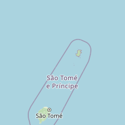
Map view of Obo National Park

Use this park location map to pinpoint Obo National Park in Sao Tome and Principe, understand its exact geographic position, and read its mapped placement within the surrounding landscape more clearly.

Pigeon | © OpenStreetMap contributors
Park atlas

Compare Obo National Park with other protected areas across São Tomé's unique volcanic and rainforest geography.

Explore Nearby National Parks and Protected Areas Beyond Obo National Park, São Tomé

Browse a curated list of national parks and protected areas near Obo National Park to understand the broader conservation landscape of São Tomé and its surrounding marine territories. Trace the regional spread of rainforests, volcanic formations, and coastal ecosystems by comparing features, management, and geographic settings across diverse protected zones.
Wildlife reserveEstuaire
About 298 km away#1 closest

East

Réserve de Wonga Wongué: Atlantic Coastal Protected Landscape and Wildlife Map

Explore the geography of Gabon's expansive lowland coastal reserve

Examine the geographic boundaries and protected landscape of Réserve de Wonga Wongué, a crucial site in Gabon that features a blend of forest, hill, and plateau terrain. This reserve provides a comprehensive look at coastal river systems, marshes, and the habitats of central African megafauna along the Atlantic shore, highlighting its role as a Ramsar Wetland of International Importance and its evolving identity as a conservation area.

Area
4,281 km²
Established
1972
National parkGabon
About 305 km away#2 closest

East

Pongara National Park: Protected Landscape and Geographic Exploration in Gabon

Mapped boundaries and regional natural context.

Pongara National Park is a designated national park within Gabon, offering a unique opportunity for structured exploration of protected lands. Users can investigate its specific geographic setting, understand its mapped boundaries, and appreciate its place within the regional landscape context. This entry provides a factual foundation for understanding the park's identity as a protected natural area and its contribution to Gabon's geography.

Area
929 km²
Established
2002
IUCN
II
Relief
Lowland
National parkGabon
About 321 km away#3 closest

East

Akanda National Park: A Key Protected Landscape on Gabon's Atlantic Coast

Explore Gabon's vital mangrove ecosystems and coastal protected areas.

Akanda National Park in Gabon is a significant protected area celebrated for its expansive mangrove forests and critical role in supporting migratory bird populations. Located along the Atlantic coast, this park's unique landscape at the nexus of tidal waters and coastal terrain makes it a valuable site for understanding regional ecology and mapped protected lands. It serves as a primary destination for exploring the natural geography and conservation significance of West African coastal environments.

Area
540 km²
Established
2002
IUCN
II
Relief
Lowland
National parkGabon
About 379 km away#4 closest

Southeast

Loango National Park: Gabon's Coastal Wilderness and Unique Protected Landscape

Explore savanna, forest, beach, and lagoon ecosystems in this vital national park.

Loango National Park in Gabon is a significant protected area recognized for its remarkable geographic diversity. This national park encompasses over 100 kilometers of pristine, uninhabited Atlantic coastline, rare mangrove systems, and expansive savanna plains transitioning into dense tropical forests. Its unique landscape, particularly the Iguéla Lagoon, offers rich opportunities for atlas-style exploration of coastal ecosystems and protected areas. Understanding the park's mapped boundaries and regional setting is key to appreciating its ecological importance.

Area
1,550 km²
Established
2002
IUCN
II
Relief
Lowland
National parkWoleu-Ntem Province
About 394 km away#5 closest

East

Crystal Mountains National Park: National Park Protected Area and Geographic Context in Woleu-Ntem Province

Explore its mapped boundaries and regional landscape.

Crystal Mountains National Park is a designated national park offering critical insights into its protected landscape and geographic setting. Users can explore the mapped boundaries of this protected area, understand its regional terrain, and gain context within Woleu-Ntem Province through structured geographic data. This page provides the foundational atlas information for comprehending the park's conservation significance and natural features.

Area
1,200 km²
Established
2002
IUCN
II
Relief
Mountain
Marine protected areaCameroon
About 404 km away#6 closest

Northeast

Parc national marin Manyange na Elombo-Campo: Marine Protected Area and Regional Geography

Coastal conservation mapping in the South Region of Cameroon

Spanning a vast offshore territory in the Atlantic Ocean, Parc national marin Manyange na Elombo-Campo represents a major step in Central African marine conservation. The park boundary encompasses complex seafloor topography and river-mouth influences that provide essential habitat for vulnerable marine species. This atlas entry provides a detailed look at its marine extent and its integration into the larger Gulf of Guinea protected corridor.

Area
42,364 km²
Established
2021
Relief
Lowland
Climate
Tropical
National parkEquatorial Guinea
About 420 km away#7 closest

East

Monte Alén National Park National Park: Mapped Protected Landscape in Equatorial Guinea

Explore regional geography and park boundaries.

Monte Alén National Park, a designated national park in Equatorial Guinea, offers a unique focal point for understanding protected landscapes. This entry provides detailed geographic context, highlighting the park's mapped boundaries and its significance within the atlas of Central African natural terrain. Investigate the terrain and regional setting of Monte Alén National Park for structured geographic discovery.

Area
2,000 km²
Established
1990
IUCN
II
Relief
Mountain
National parkCameroon
About 429 km away#8 closest

Northeast

Campo Ma'an National Park: Essential Protected Landscape in Cameroon's Atlantic Biafran Forest

Mapped evergreen canopy and vital great ape habitat in a key conservation area.

Campo Ma'an National Park is a crucial protected area in Cameroon, spanning 2,680 square kilometers of dense Atlantic Biafran forest. Established for environmental compensation, it safeguards critical habitat for western lowland gorillas and central chimpanzees, alongside forest elephants and diverse birdlife. The park's landscape is defined by a persistent evergreen canopy ecosystem, offering a unique context for understanding Central African rainforest geography and protected land status.

Area
2,680 km²
Established
2000
IUCN
II
Climate
Tropical

Common questions about visiting, size, designation, and location context for Obo National Park

Obo National Park FAQs for park facts, access, geography, and protected area context

Find quick answers about Obo National Park, including protected-area facts, park geography, trail and visitor context, and how the park fits into its surrounding country and regional landscape.
MoriAtlas Explorer

Continue Your Protected Areas Search Across the Global Atlas

Deepen your exploration by continuing the structured search for national parks and protected areas worldwide. Utilize the comprehensive filtering capabilities to compare different conservation landscapes and refine your understanding of global park geography. Discover more about the distribution and characteristics of protected natural areas.

Global natural geography

