

Mori Atlas logo
Nature reserveOrbishöhe von Auerbach und Zwingenberg

Examining the ecological terrain, slope terraces, and botanical significance of this Hessian nature reserve.

Orbishöhe von Auerbach und Zwingenberg: A Detailed Map and Geographic Protected Area Analysis

(Naturschutzgebiet Orbishöhe von Auerbach und Zwingenberg)

Orbishöhe von Auerbach und Zwingenberg represents a specialized nature reserve in the Bergstraße district, where industrial quarry history meets high-value botanical conservation. This protected area features a mosaic of rock faces, woodland edges, and slope terraces that create a unique micro-topography along the western Odenwald mountains. By analyzing its geographic footprint and integration into larger Natura 2000 networks, observers gain insight into how small-scale protected landscapes anchor regional biodiversity.

nature reserveNaturschutzgebietquarry landscaperare plantsbotanical siteslope terraces

Orbishöhe von Auerbach und Zwingenberg

Nature reserve

Park overview

Structured park overview, official facts, and landscape profile for Orbishöhe von Auerbach und Zwingenberg

Orbishöhe von Auerbach und Zwingenberg park facts, protected area profile, and essential visitor context

Review the core facts for Orbishöhe von Auerbach und Zwingenberg, including designation, size, terrain, visitor scale, habitats, and operating context in one park-focused overview.

About Orbishöhe von Auerbach und Zwingenberg

Orbishöhe von Auerbach und Zwingenberg is a compact nature reserve set on the slopes above the Rhine plain at the edge of the Odenwald, in the Bergstraße district of Hesse. Although it covers only about 6.39 hectares, the area is ecologically distinctive because it combines a disused stone quarry, terraced slopes, and adjoining forest into a single protected unit.

The reserve straddles two municipal areas: parts of the Zwingenberg cadastral district known as "Auf der großen Höhe" and parts of the Auerbach district known as "Im Brunnenweg." This location places it in a transitional zone where the wooded hills of the western Odenwald meet the open agricultural lowlands of the Hessische Bergstraße, a landscape corridor long celebrated for its mild climate and botanical richness.

The reason the Orbishöhe received formal protection in 1988 was the presence of several rare and endangered plant species that occur together in a vegetation assemblage considered unique in the region. Former quarrying activity exposed rocky substrates and created the open, sun-warmed habitats that many of these species depend on, while the surrounding terraces and forest provide varied microclimates across a very small geographic footprint.

As a component of the broader FFH site "Kniebrecht, Melibocus und Orbishöhe bei Seeheim-Jugenheim, Alsbach und Zwingenberg," the reserve contributes to a continuous network of protected habitats across some of the most ecologically valuable terrain in the southern Hessian Bergstraße. This connection to Natura 2000 underscores that even very small protected areas like the Orbishöhe can play meaningful roles in safeguarding biodiversity at a regional scale.

Quick facts and research context for Orbishöhe von Auerbach und Zwingenberg

The reserve is a designated Naturschutzgebiet in the Landkreis Bergstraße, Hesse, lying between the town of Zwingenberg and the district of Auerbach within Bensheim. It was formally protected on 30 November 1988 and covers approximately 6.39 hectares, most of which consists of a former stone quarry, surrounding slope terraces, and adjoining forest.

It is recognized as an FFH-area component within the Natura 2000 network, integrated into a larger site that also includes the Kniebrecht and Melibocus landscapes. Its ecological significance is rooted in the unusual coexistence of rare and threatened plant species that thrive on the calcareous, rocky conditions left behind by historical quarrying.

Protection and recognition

Documented protection history and official international recognition records

Orbishöhe von Auerbach und Zwingenberg Protection Status and Conservation Data

Orbishöhe von Auerbach und Zwingenberg maintains registered protected area data compiled from official global databases. Conservation researchers review these structured records to analyze territorial management frameworks and recognition sources.

Protection details

WDPA ID
164948
Park context

Deeper park guide and search-rich context for Orbishöhe von Auerbach und Zwingenberg

Orbishöhe von Auerbach und Zwingenberg history, landscape, wildlife, and travel context

Explore Orbishöhe von Auerbach und Zwingenberg through its history, landscape character, ecosystems, wildlife, conservation priorities, cultural context, and seasonal travel timing in a structured park guide built for atlas discovery and search intent.

Why Orbishöhe von Auerbach und Zwingenberg stands out

The Orbishöhe is best known for its rare and threatened plant species growing in a unique vegetation composition on a disused quarry site. The combination of exposed rock faces, slope terraces, and adjacent woodland creates the special habitat mosaic that justified the area's protected status.
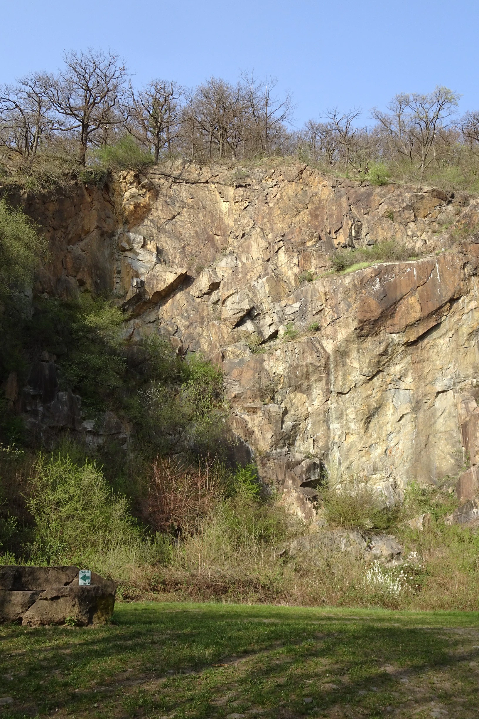
Quarry at Luciberg
An old quarry at Luciberg located within the Orbishöhe von Auerbach und Zwingenberg nature reserve, part of the Kniebrecht, Melibocus und Orbishöhe protected area in Bergstrasse, Hesse, Germany.

Orbishöhe von Auerbach und Zwingenberg history and protected-area timeline

The Orbishöhe area carries a place-name tradition going back to at least the 19th century, when the locality was already recorded under the field name "An der Orbishöhe." The landscape itself, however, was shaped earlier by quarrying activity, which altered the slopes and exposed the rocky substrates that would later prove to be of high conservation value.

Formal recognition of the site's ecological importance came on 30 November 1988, when the area was designated as a Naturschutzgebiet under Hessian nature protection law. The principal motivation for protection was the documentation of several rare and threatened plant species co-occurring in a vegetation composition that was considered unique within the region.

Following German and European conservation designations, the reserve was subsequently incorporated into the Natura 2000 network as part of the larger FFH site "Kniebrecht, Melibocus und Orbishöhe bei Seeheim-Jugenheim, Alsbach und Zwingenberg" (site code 6217-305), strengthening its long-term protection framework and linking it administratively with neighboring high-value landscapes in the western Odenwald.

Orbishöhe von Auerbach und Zwingenberg landscape and geographic character

The Orbishöhe landscape is defined by its quarrying heritage. The reserve centers on the rock faces, spoil areas, and rough terrain of a former stone quarry, which gives the slopes an unusually rugged, open character compared to the densely forested hills that surround it.

Surrounding the quarry, the terrain rises into slope terraces separated by woodland. These terraces create a stepped profile on the hillside, with patches of open ground interspersed among patches of forest. The combination of bare rock, thin soils on the terraces, and shaded woodland edge produces a finely varied micro-topography across a very small area.

Set at the western edge of the Odenwald near the town of Zwingenberg, the reserve lies in the climatic transition zone between the wooded uplands of the Odenwald and the milder, sunnier Rhine plain below. This geographic position gives the Orbishöhe a sheltered but well-lit hillside character, with the slopes facing the Rhine lowland and thus receiving considerable solar exposure.
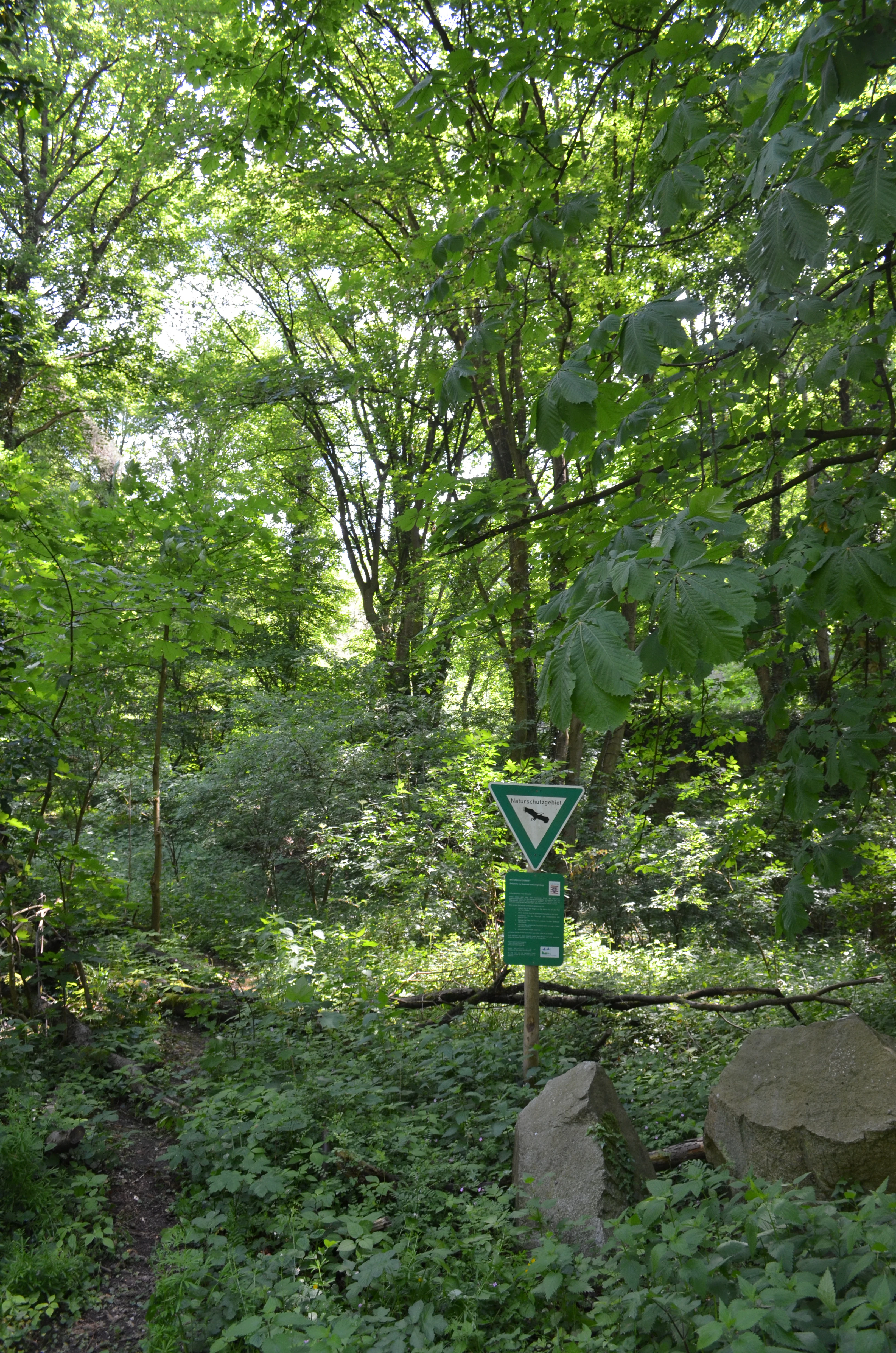
Orbishohe landscape view
View of the Orbishohe area near Auerbach and Zwingenberg

Orbishöhe von Auerbach und Zwingenberg ecosystems, habitats, and plant life

The ecological character of the Orbishöhe is shaped by the unusual coexistence of habitats created and maintained by past quarrying. Open rock, thin soils, and disturbed ground support stress-tolerant and warmth-loving plant communities, while adjacent terraces and forest patches provide more sheltered conditions with cooler, moister microclimates.

This patchwork produces a vegetation composition that conservation authorities have described as unique in the region. Several rare and threatened plant species occur within the reserve, taking advantage of the calcareous conditions and varied exposure of the quarry slopes.

Because the reserve is integrated into the Natura 2000 site "Kniebrecht, Melibocus und Orbishöhe," its ecological profile is closely linked to broader habitat complexes of the western Odenwald and the Bergstraße hills, where similar combinations of open rocky habitats and woodland edge environments protect regional biodiversity.
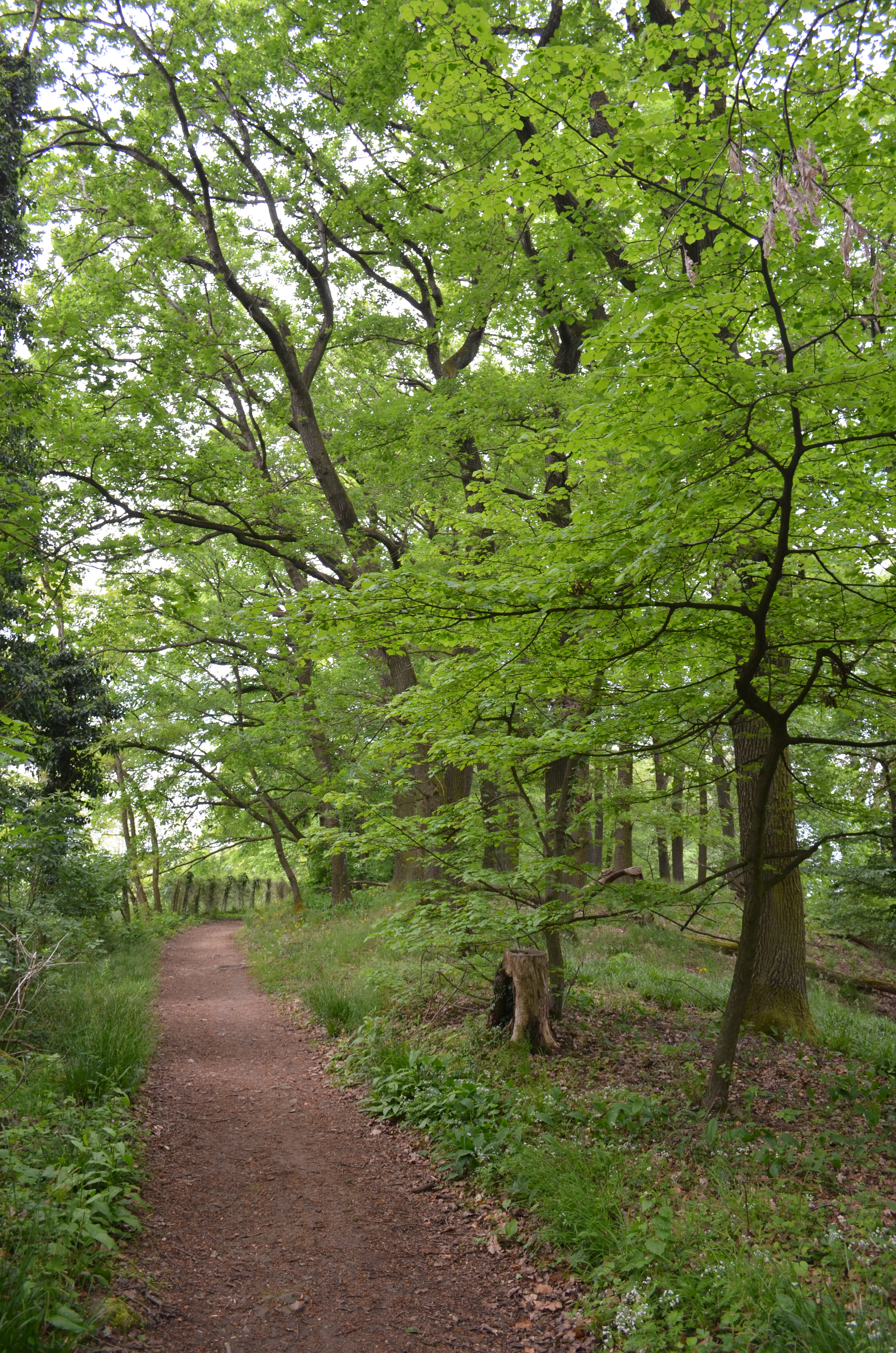
Orbishohe landscape view
A view of the Orbishohe area near Auerbach and Zwingenberg

Orbishöhe von Auerbach und Zwingenberg wildlife and species highlights

The available documentation for the Orbishöhe focuses primarily on vegetation rather than animal species, so wildlife-specific information is limited. The reserve's mix of rocky open ground, terraces, and woodland edge nonetheless provides habitat structure that supports typical fauna of the western Odenwald and the Bergstraße hills, including insect communities associated with warm, exposed rock and slope habitats.
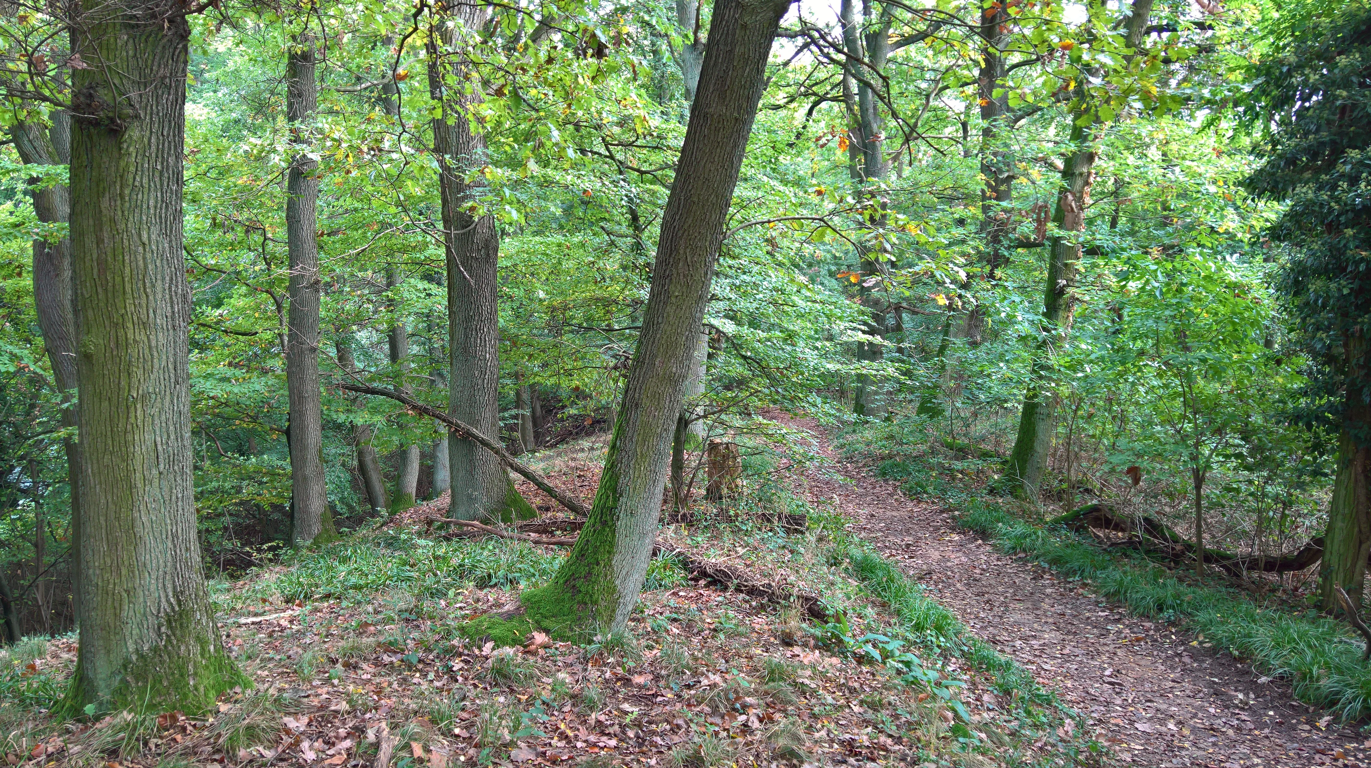
Orbishe Ridge trail
Ridge of the Orbishe between Auerbach and Zwingenberg featuring a hiking trail

Orbishöhe von Auerbach und Zwingenberg conservation status and protection priorities

The principal conservation value of the Orbishöhe lies in its rare plant species and the unique composition of vegetation that prompted its formal protection in 1988. As a Naturschutzgebiet, it benefits from the strongest level of habitat protection available under Hessian nature conservation law, restricting activities that could damage its characteristic habitats.

Integration into the Natura 2000 network through the FFH site "Kniebrecht, Melibocus und Orbishöhe bei Seeheim-Jugenheim, Alsbach und Zwingenberg" reinforces the reserve's conservation role at the European level, aligning it with habitat protection obligations for species and habitat types of EU-wide concern. In regional terms, the reserve functions as a small but ecologically significant refuge within a broader corridor of protected landscapes in the western Odenwald.

Orbishöhe von Auerbach und Zwingenberg cultural meaning and human context

The cultural dimension of the Orbishöhe is closely tied to the quarrying tradition that shaped its physical landscape. Quarrying modified the slopes and exposed the rock substrates on which the reserve's rare vegetation now depends, and this industrial past has indirectly shaped an area of recognized natural value.

The place name "Orbishöhe" is documented in the region at least back to the 19th century as a locally used field name, indicating a long-standing human relationship with this particular stretch of the Bergstraße hillside.

Top sights and standout views in Orbishöhe von Auerbach und Zwingenberg

The reserve's standout features include a disused quarry with exposed rock faces, slope terraces, and adjacent woodland forming a finely textured habitat mosaic in a very compact area. Its principal ecological highlight is the rare and threatened plant flora, which combines species in a vegetation composition considered unique in the region.

Equally important is the reserve's integration into the Natura 2000 FFH site "Kniebrecht, Melibocus und Orbishöhe," which embeds this small protected area within a larger network of high-value habitats in the western Odenwald and the Bergstraße.

Best time to visit Orbishöhe von Auerbach und Zwingenberg

The Orbishöhe is a small, low-elevation landscape in the mild climatic zone of the Hessian Bergstraße, which means its habitats remain accessible across much of the year. Late spring and early summer are typically the most rewarding periods to observe the rare plant communities that motivated the reserve's protection, when many characteristic species are in flower and visibility into the open quarry slopes is good. Autumn offers attractive leaf color in the surrounding forest, while winter visits can highlight the structure of the rocky quarry terrain itself.

Monthly climate preview

Long-term representative point measurements tracking monthly temperature and precipitation variation

Orbishöhe von Auerbach und Zwingenberg Climate Normals and Annual Temperature Rhythm

Historical data records mean monthly temperatures spanning from near freezing up to twenty degrees Celsius alongside steady daily precipitation rates across the representative elevation. Reviewing twelve-month baseline normals provides clear insight into long-term meteorological patterns and multi-month environmental trends.
Annual mean10 °C
0 °C20 °C
Jan
Feb
Mar
Apr
May14°
Jun18°
Jul20°
Aug20°
Sep15°
Oct10°
Nov
Dec
Warmest month
July

20.3 °C

Coolest month
January

0.1 °C

Wettest month
July

2.4 mm/day

Driest month
April

1.5 mm/day

Park location guide

Geography guide, regional context, and park location map for Orbishöhe von Auerbach und Zwingenberg

Orbishöhe von Auerbach und Zwingenberg park geography, regions, and map view in Germany

Understand where Orbishöhe von Auerbach und Zwingenberg sits in Germany through a broader geographic reading of the surrounding landscape, nearby location context, and its mapped position within the national park landscape.

How Orbishöhe von Auerbach und Zwingenberg fits into Germany

Germany is a federal republic in Western and Central Europe with a population of over 83 million across sixteen constituent states. It is Europe's largest economy by nominal GDP and a major global exporter and importer. The capital is Berlin, and the country borders Denmark, Poland, Czech Republic, Austria, Switzerland, France, Luxembourg, Belgium, and the Netherlands.

Wider geography shaping Orbishöhe von Auerbach und Zwingenberg in Germany

Germany is located in Western and Central Europe, spanning 357,022 km². It borders Denmark to the north, Poland and the Czech Republic to the east, Austria and Switzerland to the south, and France, Luxembourg, Belgium, and the Netherlands to the west. The country has coastlines on the Baltic Sea and North Sea to the north, with the Alps located in the southern region.

Map view of Orbishöhe von Auerbach und Zwingenberg

Use this park location map to pinpoint Orbishöhe von Auerbach und Zwingenberg in Germany, understand its exact geographic position, and read its mapped placement within the surrounding landscape more clearly.

Pigeon | © OpenStreetMap contributors

Location context for Orbishöhe von Auerbach und Zwingenberg

Hessen

Visualizing the rugged quarry terrain, slope terraces, and protected botanical habitats

Orbishöhe von Auerbach und Zwingenberg Photos and Landscape Scenery

Visual records capture the rugged terrain, exposed rock faces, and slope terraces defining the protected quarry environment of Orbishöhe von Auerbach und Zwingenberg. Examining these landscape photographs helps clarify the unique botanical micro-topography and habitat mosaics sheltered across the reserve.

Quarry at Luciberg

Orbishohe view

Orbishohe landscape view

Orbishohe landscape view

Orbishe Ridge trail

Park atlas

Compare regional protected areas and connected conservation sites across the western Odenwald.

Explore Parks Near Orbishöhe von Auerbach und Zwingenberg and Surrounding Protected Landscapes

Browse other parks and protected areas situated along the Bergstraße transition zone near Orbishöhe von Auerbach und Zwingenberg. Comparing adjacent reserves reveals the broader ecological spread and habitat diversity shared across the regional upland terrain.
Nature reserveHesse
About 3.1 km away#1 closest

Northwest

Im Dulbaum bei Alsbach Nature Reserve: Mapped Inland Dunes and Grassland Geography

A vital protected sandy terrain in the Hessian Rhine Plain

Im Dulbaum bei Alsbach protects a remnant of the historic Rhine graben sand dune belt in southern Hesse. This nature reserve provides essential habitat connectivity for heat-loving species through its distinct calcareous sand grasslands and former quarry terrain, offering a look into the region's complex ecological history.

Area
0.092 km²
Established
1994
IUCN
IV
Relief
Lowland
Nature reserveHessen
About 3.3 km away#2 closest

Southeast

Magerrasen von Gronau mit angrenzenden Flächen Protected Landscape and Regional Geography

A network of calcareous meadows in the Odenwald foothills

Located in the Bergstraße district of Hessen, this protected area spans three distinct sub-areas characterized by nutrient-poor calcareous soils. These warm, sun-exposed meadows serve as an essential refugium for orchid diversity and specialized butterfly populations, standing as a representative example of successfully managed dry grassland ecosystems within the broader Geo-Naturpark Bergstraße-Odenwald.

Area
1.6 km²
Established
2004
Nature reserveHessen
About 3.8 km away#3 closest

East

Felsberg bei Reichenbach Nature Reserve: Geography and Granite Boulder Field Analysis

Protected forest and geological monument in the Odenwald range

Felsberg bei Reichenbach protects 168 hectares of Odenwald mountain slope in Southern Hessen. The site is centered on the Felsenmeer, a dramatic sea of granite boulders created by frost weathering, framed by mixed deciduous woodland. This area functions as an important Natura 2000 habitat, preserving both specialized rock ecosystems and montane forest, providing a clear geographic link between the Lautertal valley and the high slopes of the Felsberg summit.

Area
1.677 km²
Established
1972
IUCN
IV
Relief
Mountain
Nature reserveHessen
About 4.4 km away#4 closest

Northwest

Altneckarlachen von Alsbach, Hähnlein und Bickenbach: Protected Wetland and River Geography

A rare mosaic of prehistoric river loops in the Hessian Rhine plain

Altneckarlachen von Alsbach, Hähnlein und Bickenbach protects a unique sequence of prehistoric Neckar meanders featuring shallow water zones, reed belts, and black-alder swamp forest. This nature reserve in the Darmstadt-Dieburg district remains a critical wetland sanctuary, preserving a vital ecological cross-section of the ancient Rhine-Neckar landscape and its associated peatland soils.

Area
0.892 km²
Established
1990
IUCN
IV
Relief
Lowland
Nature reserveHesse
About 4.7 km away#5 closest

Northeast

Fuchswiese bei Stettbach: Mapped Nature Reserve and Protected Meadow Landscape in Hesse

Exploring the ecological boundaries of a specialized wet meadow reserve in southern Hesse

Fuchswiese bei Stettbach is a dedicated nature reserve serving as a critical habitat for threatened meadow butterfly species. Located in the Darmstadt-Dieburg district of Hesse, this protected area preserves wet meadow vegetation amidst the northern Odenwald fringe. The site offers a focused view into how small, carefully managed landscapes contribute to the broader ecological health and regional geography of central Germany.

Area
0.03 km²
Established
2010
Nature reserveHessen
About 5.5 km away#6 closest

North

Pfungstädter Moor Nature Reserve: Hessian Wetland and Ancient River Landscape

Protected wetland area in the Hessian Rhine plain

This nature reserve encompasses a rare silted-up segment of the ancient Neckar river, forming a complex of reed beds, alder carr, and peat bog habitats. Managed through creative restoration techniques that lift Rhine water into the moor, the landscape remains a vital ecological sanctuary in the heart of Hesse, standing in sharp contrast to the surrounding agricultural terrain.

Area
0.97 km²
Established
1955
IUCN
IV
Relief
Lowland
Nature reserveHesse
About 6.5 km away#7 closest

North

Kalksandkiefernwald bei Bickenbach, Pfungstadt und Seeheim-Jugenheim Protected Area Atlas

A rare calcareous sand pine forest in the Hessian Rhine plain

Located in the Darmstadt-Dieburg district, this reserve protects an airy, light-filled woodland on calcareous sandy ground. The terrain is defined by its gentle undulations and historical woodland grazing traces, offering a unique look at forest management in the Rhine plain. Explore the distribution of its two distinct sections, including the specialized sand grass vegetation found along its managed utility corridors.

Area
0.874 km²
Established
1996
IUCN
IV
Relief
Lowland
Nature reserveHessen
About 7.8 km away#8 closest

South

Erlache bei Bensheim: Exploring Protected Wetlands and Altneckar Landscapes in Hessen

A distinct nature reserve and bird sanctuary site

The Erlache bei Bensheim nature reserve serves as a critical wetland corridor in the Hessian Rhine plain. This area features a former loop of the River Neckar, now characterized by alder swamp forest, reedbeds, and open water, creating a highly specific ecological terrain surrounded by the regional infrastructure of the Bergstraße district.

Area
0.49 km²
Established
2000
IUCN
IV
Relief
Lowland

Common questions about visiting, size, designation, and location context for Orbishöhe von Auerbach und Zwingenberg

Orbishöhe von Auerbach und Zwingenberg FAQs for park facts, access, geography, and protected area context

Find quick answers about Orbishöhe von Auerbach und Zwingenberg, including protected-area facts, park geography, trail and visitor context, and how the park fits into its surrounding country and regional landscape.
MoriAtlas Explorer

Continue Your Protected Areas Search Across the Global Atlas

Deepen your exploration by continuing the structured search for national parks and protected areas worldwide. Utilize the comprehensive filtering capabilities to compare different conservation landscapes and refine your understanding of global park geography. Discover more about the distribution and characteristics of protected natural areas.

Global natural geography