

Mori Atlas logo
Protected areaPhillips Estuary/ʔNacinuxʷ Conservancy

Understanding the mapped boundaries and integrated river valley terrain of this coastal conservancy.

Phillips Estuary/ʔNacinuxʷ Conservancy: A Protected River and Estuarine Landscape in British Columbia

Phillips Estuary/ʔNacinuxʷ Conservancy serves as a critical protected corridor on the North Coast of Vancouver Island. This landscape bridges the gap between upland temperate forests and the saltwater environment of the Queen Charlotte Strait. By tracing the Phillips River valley and its tidal flats, the conservancy preserves an intact estuarine system within the Strathcona Regional District. The area highlights the intersection of freshwater ecosystems and marine foreshore environments in a contiguous protected zone.

estuarycoastal conservancyriver valleyforeshoretemperate rainforestNorth Coast Vancouver Island

Phillips Estuary/ʔNacinuxʷ Conservancy

Protected area

Park overview

Structured park overview, official facts, and landscape profile for Phillips Estuary/ʔNacinuxʷ Conservancy

Phillips Estuary/ʔNacinuxʷ Conservancy park facts, protected area profile, and essential visitor context

Review the core facts for Phillips Estuary/ʔNacinuxʷ Conservancy, including designation, size, terrain, visitor scale, habitats, and operating context in one park-focused overview.

About Phillips Estuary/ʔNacinuxʷ Conservancy

Phillips Estuary/ʔNacinuxʷ Conservancy is a mid-sized protected area on the northern coast of Vancouver Island, in the Strathcona Regional District of British Columbia. It was established in 2007 under the conservancy designation used by BC Parks, a status that recognizes areas of special environmental, cultural, or scientific value while allowing continued use of surrounding lands. The conservancy covers roughly 1,461 hectares, of which the great majority is upland forest with a smaller but ecologically critical portion made up of foreshore along the estuary.

Geographically, the park centers on the lower Phillips River valley and the estuary where that river empties into the marine waters of northern Vancouver Island. This combination of forested watershed and saltwater interface gives the conservancy its defining character. Estuarine environments are biologically productive transition zones, and the protected area preserves a representative stretch of this kind of habitat in a region where coastal development pressures are significant.

The conservancy lies north of Campbell River and not far from Port McNeill, but it contains no settlements of its own. It sits next to the Matsayno #5 reserve, the Kwiakah First Nation community of M̓ac̓inuxʷ, whose traditional territory encompasses the surrounding landscape. The park's bilingual name, pairing an English geographic description with the Indigenous place name, reflects the broader trend in British Columbia conservation toward acknowledging Indigenous connections to protected landscapes. The conservancy is also embedded within the larger Pałəmin/Estero Basin Conservancy and the surrounding M̓ac̓inuxʷ Special Forest Management Area, making it part of a coordinated network of conservation lands in this part of northern Vancouver Island.

Quick facts and research context for Phillips Estuary/ʔNacinuxʷ Conservancy

Phillips Estuary/ʔNacinuxʷ Conservancy is located in the Strathcona Regional District on the north coast of Vancouver Island, British Columbia, with the nearest town being Port McNeill. Designated as a conservancy under BC Parks and classified as IUCN Category II, it was established in 2007 and covers approximately 1,461 hectares, divided between upland forest and foreshore habitat. The conservancy protects part of the Phillips River estuary and valley, and sits adjacent to the Matsayno #5 reserve, a Kwiakah First Nation community known as M̓ac̓inuxʷ. There are no permanent settlements within the conservancy itself, and its territory is contained within the larger Pałəmin/Estero Basin Conservancy landscape.

Park context

Deeper park guide and search-rich context for Phillips Estuary/ʔNacinuxʷ Conservancy

Phillips Estuary/ʔNacinuxʷ Conservancy history, landscape, wildlife, and travel context

Explore Phillips Estuary/ʔNacinuxʷ Conservancy through its history, landscape character, ecosystems, wildlife, conservation priorities, cultural context, and seasonal travel timing in a structured park guide built for atlas discovery and search intent.

Why Phillips Estuary/ʔNacinuxʷ Conservancy stands out

Phillips Estuary/ʔNacinuxʷ Conservancy is best known for protecting a relatively intact estuarine and river-valley system on the North Coast of Vancouver Island. The estuary where the Phillips River meets the sea is the heart of the protected area, representing one of the biologically rich estuarine transitions that characterize this stretch of British Columbia's coastline. The conservancy is also recognized for its cultural association with the Kwiakah First Nation and the M̓ac̓inuxʷ community, and for carrying a name that records both the ecological and the Indigenous identity of the place. Its placement within the broader Pałəmin/Estero Basin Conservancy adds to its importance as a piece of a larger connected conservation landscape on northern Vancouver Island.

Phillips Estuary/ʔNacinuxʷ Conservancy history and protected-area timeline

Phillips Estuary/ʔNacinuxʷ Conservancy was established in 2007 as part of British Columbia's system of conservancies, a designation used by BC Parks to protect areas with recognized natural, cultural, or scientific values. Its creation came during a period of significant expansion of the provincial conservancy network on Vancouver Island, when previously unprotected estuarine and watershed areas were brought under formal conservation status.

The conservancy's planning and designation took into account the cultural landscape of the surrounding region, particularly the proximity of the Matsayno #5 reserve and the broader territory of the Kwiakah First Nation. The decision to incorporate the Indigenous place name ʔNacinuxʷ into the formal title reflects a wider movement in British Columbia park naming toward recognizing traditional Kwakwaka'wakw and other First Nations connections to the land.

Over time, the conservancy has continued to be managed as part of the larger Pałəmin/Estero Basin Conservancy network and the M̓ac̓inuxʷ Special Forest Management Area, integrating ecological protection with the broader land-use planning of northern Vancouver Island.

Phillips Estuary/ʔNacinuxʷ Conservancy landscape and geographic character

The landscape of Phillips Estuary/ʔNacinuxʷ Conservancy is shaped by the lower valley of the Phillips River and its transition into a saltwater estuary. The terrain combines forested uplands with low-lying estuarine flats and a strip of marine foreshore, producing a layered environment where freshwater and saltwater systems meet. The uplands, which dominate the protected area at roughly 1,382 hectares, are part of the rain-soaked coastal forests typical of northern Vancouver Island.

The estuary itself is the most distinct landscape feature. It is here that the Phillips River widens, slows, and deposits sediments, creating tidal flats and shallow margins that are visually and ecologically different from the surrounding forest. The foreshore portion, covering about 79 hectares, marks the tidal influence zone and connects the river system to the broader coastal waters of Queen Charlotte Strait and the Inside Passage.

The surrounding topography reflects the broader character of northern Vancouver Island, with steep forested ridges descending toward the coast and a pattern of deeply incised river valleys. Within the conservancy, the river valley acts as a natural corridor linking upland habitats to the shoreline, a structure that gives the protected area much of its landscape value.

Phillips Estuary/ʔNacinuxʷ Conservancy ecosystems, habitats, and plant life

Phillips Estuary/ʔNacinuxʷ Conservancy protects a transition between temperate coastal forest and estuarine habitat, two of the most ecologically productive environments on the British Columbia coast. The upland portion is dominated by the kinds of coniferous and mixed forests typical of the region, while the lowland portion captures the dynamic interface where a river meets the sea, complete with sediments, channels, and tidal influence.

Estuaries like the one preserved at Phillips are known for their ecological richness, supporting a wide range of species that depend on the mixing zone between fresh and salt water. The conservancy's ecological importance lies in maintaining this gradient intact, in a region where such intact transitions are increasingly rare. The combination of forested watershed, riparian zone, and tidal foreshore allows ecological processes to continue functioning across a broad spectrum of conditions.

By conserving both upland and foreshore components, the conservancy helps maintain habitat continuity along the Phillips River, supporting the movement of species and nutrients between forest, river, estuary, and sea. This ecological integration is a defining feature of the site's natural value within the broader Pałəmin/Estero Basin landscape.

Phillips Estuary/ʔNacinuxʷ Conservancy wildlife and species highlights

Wildlife in and around Phillips Estuary/ʔNacinuxʷ Conservancy is shaped by the site's position at the seam between coastal forest and estuarine waters. The forested uplands provide habitat for the mammals and birds typical of northern Vancouver Island's temperate rainforests, while the estuary and foreshore create conditions that support a distinct suite of species tied to tidal and shoreline environments.

Estuarine habitats of this kind are particularly important for migratory and shoreline-foraging birds, as well as for fish species that move between freshwater and saltwater at different stages of their life cycles. The Phillips River corridor offers a protected pathway for these transitions, while the surrounding forest supplies cover and nesting opportunities for resident species.

The conservancy's quiet, undeveloped character adds to its value for wildlife. With no settlements within its boundaries and limited uses beyond conservation, the area supports the kinds of undisturbed ecological processes that allow sensitive species to persist in a region where coastal habitat alteration is otherwise common.

Phillips Estuary/ʔNacinuxʷ Conservancy conservation status and protection priorities

From a conservation perspective, Phillips Estuary/ʔNacinuxʷ Conservancy is significant because it preserves an estuarine and river-valley system that would otherwise be vulnerable to coastal development pressures on Vancouver Island. Estuaries are limited and ecologically valuable features, and protecting one ensures that the natural functions of nutrient exchange, sediment deposition, and habitat formation can continue unimpeded.

The conservancy's designation under the BC Parks system recognizes it as having important natural, cultural, and scientific values. Its IUCN Category II classification places it in the same category as national parks worldwide, reflecting a high level of protection. By covering both upland and foreshore environments, the protected area buffers a watershed rather than just a single habitat type.

The conservancy also contributes to a broader conservation network through its inclusion within the Pałəmin/Estero Basin Conservancy and the M̓ac̓inuxʷ Special Forest Management Area. This integration with surrounding protected and managed lands strengthens the long-term resilience of the landscape, increasing the effective scale of conservation beyond the conservancy's own boundaries.

Phillips Estuary/ʔNacinuxʷ Conservancy cultural meaning and human context

The cultural context of Phillips Estuary/ʔNacinuxʷ Conservancy is closely tied to the Kwiakah First Nation and the nearby Matsayno #5 reserve of M̓ac̓inuxʷ, a Kwakwaka'wakw community whose traditional territory includes the rivers and coast of this part of northern Vancouver Island. The inclusion of ʔNacinuxʷ in the park's official name reflects the importance of Indigenous place names in the cultural geography of the region.

The surrounding landscape carries a long history of First Nations presence along the estuaries and sheltered coves of the North Coast. Estuaries in particular tend to be focal points of traditional settlement, fishing, and travel. The conservancy's proximity to M̓ac̓inuxʷ means that the area remains part of an active cultural landscape, not simply an isolated ecological reserve.

By incorporating Indigenous language into the official designation, the conservancy also reflects the evolving relationship between provincial conservation and First Nations in British Columbia, where protected areas increasingly carry names that acknowledge the Indigenous roots of the landscape.

Top sights and standout views in Phillips Estuary/ʔNacinuxʷ Conservancy

Phillips Estuary/ʔNacinuxʷ Conservancy stands out for protecting a complete estuarine and river-valley system, from forested upland to tidal foreshore, in a single contiguous protected area. This combination is relatively rare on the developed coastline of Vancouver Island and gives the conservancy a strong, integrated ecological identity. The pairing of the Phillips Estuary name with the Indigenous ʔNacinuxʷ also reflects a broader recognition of Kwiakah First Nation connections to the landscape.

Its position within the larger Pałəmin/Estero Basin Conservancy framework further increases its significance, situating the site within one of the more extensive conservation networks on northern Vancouver Island. The result is a protected area whose value comes not just from its individual habitats, but from its embedded role in a larger coastal landscape.

Best time to visit Phillips Estuary/ʔNacinuxʷ Conservancy

The character of a visit to Phillips Estuary/ʔNacinuxʷ Conservancy changes with the seasons in ways typical of the North Coast of Vancouver Island. Spring and early summer tend to bring fresh conditions in the forest and active ecological transitions in the estuary as river flows peak and marine species begin moving into warmer waters. Late summer and early autumn often offer calmer weather, lower river flows, and more predictable estuary conditions, making this a favorable window for observing shoreline and bird activity.

Winter on the North Coast is mild but wet, with heavy rainfall sustaining the river systems and estuary productivity that the conservancy protects. Visiting in this season highlights the rain-fed, river-driven nature of the landscape, though conditions can be more demanding. As with many remote coastal conservancies, weather, tides, and access routes strongly shape the practical experience of any visit.
Monthly climate preview

Long-term monthly temperature averages and precipitation measurements for the protected area

Phillips Estuary and ʔNacinuxʷ Conservancy Climate Normals and Temperature Rhythms

Phillips Estuary and ʔNacinuxʷ Conservancy records a measured annual cycle of long-term monthly temperature and precipitation values across twelve distinct sampling periods. Reviewing the complete monthly climate normals unlocks deeper comparison data for this representative coordinate location.
Annual mean7 °C
-1 °C16 °C
Jan-1°
Feb
Mar
Apr
May10°
Jun13°
Jul16°
Aug16°
Sep13°
Oct
Nov
Dec-1°
Warmest month
August

15.7 °C

Coolest month
December

-1 °C

Wettest month
November

7.8 mm/day

Driest month
July

2.5 mm/day

Park location guide

Geography guide, regional context, and park location map for Phillips Estuary/ʔNacinuxʷ Conservancy

Phillips Estuary/ʔNacinuxʷ Conservancy park geography, regions, and map view in Canada

Understand where Phillips Estuary/ʔNacinuxʷ Conservancy sits in Canada through a broader geographic reading of the surrounding landscape, nearby location context, and its mapped position within the national park landscape.

How Phillips Estuary/ʔNacinuxʷ Conservancy fits into Canada

Canada is a federal parliamentary constitutional monarchy spanning North America from the Atlantic to the Pacific and Arctic Oceans. With a population of over 41 million, it is officially bilingual in English and French at the federal level. The country gained independence from the United Kingdom through a gradual process culminating in 1982.

Wider geography shaping Phillips Estuary/ʔNacinuxʷ Conservancy in Canada

Canada occupies the northern portion of North America, sharing its longest international border with the United States. The country extends from the Atlantic Ocean to the Pacific Ocean and northward into the Arctic Ocean, giving it the longest coastline of any nation.

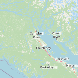
Map view of Phillips Estuary/ʔNacinuxʷ Conservancy

Use this park location map to pinpoint Phillips Estuary/ʔNacinuxʷ Conservancy in Canada, understand its exact geographic position, and read its mapped placement within the surrounding landscape more clearly.

Pigeon | © OpenStreetMap contributors

Location context for Phillips Estuary/ʔNacinuxʷ Conservancy

British ColumbiaStrathcona Regional District
Recorded earthquake history

View Historical Earthquake Records for Phillips Estuary/ʔNacinuxʷ Conservancy

Browse the documented catalogue of seismic events associated by distance with Phillips Estuary/ʔNacinuxʷ Conservancy. This resource from MoriAtlas provides essential historical data including event magnitude and epicentre location to support regional geographic and seismic understanding.

Phillips Estuary/ʔNacinuxʷ Conservancy Earthquake History

Catalogued events

2 events

Strongest magnitude

Magnitude 4.1

Most recent event

Jul 31, 2026

This history includes earthquakes recorded inside the park or within 50 km of its borders

Park atlas

Compare adjacent river valleys and connected marine conservancies across northern Vancouver Island.

Parks Near Phillips Estuary/ʔNacinuxʷ Conservancy and Surrounding Coastal Protected Areas

Browse protected areas near Phillips Estuary/ʔNacinuxʷ Conservancy to examine similar temperate rainforest valleys and coastal estuaries. Comparing adjacent reserves reveals the broader ecological and geographic patterns connecting regional watersheds along the Inside Passage.
Protected areaStrathcona Regional District
9.2 km away#1 closest

Southeast

Pałəmin/Estero Basin Conservancy: Geography and Protected Area Map of Northern Vancouver Island

Coastal forest and estuarine basin protected landscape

Located at the head of the Frederick Arm, Pałəmin/Estero Basin Conservancy offers a unique study in vertical coastal geography. Spanning from the tidal margins of the Estero Basin to the slopes near Egerton Peak, this protected area features a diverse landscape of temperate forests and sheltered marine inlets essential to the North Coast ecosystem.

Area
29.78 km²
Established
2007
IUCN
II
Relief
Mountain
Protected areaBritish Columbia
About 29 km away#2 closest

Southwest

Forward Harbour/Yexeweyem Conservancy Protected Area Geography and Coastal Atlas

Coastal wilderness protected landscape on Vancouver Island.

Forward Harbour/Yexeweyem Conservancy preserves a distinct segment of British Columbia coastline. Featuring the Thynne Peninsula and sheltered sections of Bassborough Bay, this remote protected area emphasizes the preservation of marine inlets and salmon habitats within a traditional Indigenous landscape.

Area
3.06 km²
Established
2007
Access
Remote access
Scope
Terrestrial
State or regional parkBritish Columbia
About 50 km away#3 closest

Southeast

Háthayim Marine Provincial Park: Coastal Geography and Marine Protected Areas

Coastal landscapes of the Discovery Islands, British Columbia

Háthayim Marine Provincial Park safeguards the marine environment of northern Cortes Island, featuring a network of rocky headlands, sheltered inlets, and productive intertidal habitats. This protected landscape reflects the complex coastal geography of the Discovery Islands, highlighting the significant relationship between forest shorelines and the tidal currents of the Salish Sea region in British Columbia.

Area
12.77 km²
Established
1993
IUCN
II
Relief
Lowland
Marine protected areaBritish Columbia
63 km away#4 closest

Southeast

Desolation Sound Marine Provincial Park: Mapped Geography and Protected Area Overview

Coastal terrain and marine protected zones in British Columbia

Explore the distinct geographic features of Desolation Sound Marine Provincial Park, a vital marine protected area on the coast of British Columbia. The landscape is defined by deep inlets, glaciated valleys, and essential kelp forest habitats that support a wide range of marine life. This detailed map-based overview provides insights into the park's structural complexity and its role as a key protected site within the regional British Columbia coastal corridor.

Area
84 km²
Established
1973
IUCN
II
Relief
Mountain
State or regional parkBritish Columbia
About 71 km away#5 closest

South

Mitlenatch Island Nature Provincial Park: Protected Coastal Geography and Marine Sanctuary Atlas

Coastal landscapes and protected seabird habitats in British Columbia

Mitlenatch Island Nature Provincial Park represents a specialized coastal refuge defined by grass-topped rocky outcrops and sheltered intertidal zones. This protected area in the Strait of Georgia functions as an important sanctuary for nesting seabird colonies and seasonal marine mammal populations, demonstrating how compact island geography provides high-density habitat within the broader British Columbia ecosystem.

Area
1.55 km²
Established
1961
IUCN
Ia
Relief
Lowland
Protected areaBritish Columbia
125 km away#6 closest

Southwest

Kiišḥniqʷus Conservancy: Coastal Wilderness and River Valley Geography in British Columbia

Protected coastal inlet and temperate rainforest terrain

Kiišḥniqʷus Conservancy protects a significant expanse of land between Sydney Inlet and Shelter Inlet on the outer coast of Vancouver Island. This area focuses on the Sydney River valley and the associated estuarine environments, forming a vital part of the regional wilderness corridor. The geography showcases the intersection of deep coastal fjords, dense coniferous forest, and historic cultural sites, providing an essential look at the natural and indigenous history of the region.

Area
110.12 km²
Established
2024
Scope
Terrestrial
Water
Major water bodies
Protected areaBritish Columbia
137 km away#7 closest

Southwest

Kʷuḥaa Conservancy: A Coastal Protected Area on Western Vancouver Island

Temperate rainforest, marine inlets, and cultural geography.

Kʷuḥaa Conservancy covers a rugged, forested stretch of the British Columbia coastline, focusing on the preservation of the Stewardson Inlet head. The area integrates coastal slopes with sheltered marine environments, providing a crucial addition to the regional network of protected lands. Explore the site's unique topographical features and its cultural significance within the Nuu-chah-nulth territory near Tofino.

Area
19.16 km²
Established
2024
Relief
Lowland
Climate
Temperate
Protected areaBritish Columbia
138 km away#8 closest

South

Č̓icy̓i Conservancy: Protected Coastal Rainforest and Flores Island Geography

Coastal wilderness in the Alberni-Clayoquot region

Spanning over nine thousand hectares on Flores Island, Č̓icy̓i Conservancy preserves a substantial wilderness area characterized by dense coastal temperate rainforests, rocky headlands, and expansive intertidal zones. As a significant addition to the protected network of outer Vancouver Island, the area integrates diverse Pacific marine and forest ecosystems. The geography highlights the cultural and ecological continuity of the coastline.

Area
92.69 km²
Established
2024
Access
Access unknown
Scope
Terrestrial

Common questions about visiting, size, designation, and location context for Phillips Estuary/ʔNacinuxʷ Conservancy

Phillips Estuary/ʔNacinuxʷ Conservancy FAQs for park facts, access, geography, and protected area context

Find quick answers about Phillips Estuary/ʔNacinuxʷ Conservancy, including protected-area facts, park geography, trail and visitor context, and how the park fits into its surrounding country and regional landscape.
MoriAtlas Explorer

Continue Your Protected Areas Search Across the Global Atlas

Deepen your exploration by continuing the structured search for national parks and protected areas worldwide. Utilize the comprehensive filtering capabilities to compare different conservation landscapes and refine your understanding of global park geography. Discover more about the distribution and characteristics of protected natural areas.

Global natural geography