
Mori Atlas logo
Nature reserveNaturschutzgebiet Pillebachtal, Dernkamp und Gallberg

Examining the ecological mosaic of stream valleys, beech forests, and wetland terrain

Naturschutzgebiet Pillebachtal, Dernkamp und Gallberg: A Protected Nature Reserve Landscape

Naturschutzgebiet Pillebachtal, Dernkamp und Gallberg represents a vital protected landscape situated in North Rhine-Westphalia, Germany. Spanning approximately 75 hectares near Dusseldorf, this nature reserve integrates old-growth beech forests with complex spring-fed meadow systems and regenerating stream corridors. The terrain reveals a diverse habitat mosaic that supports cavity-nesting bird populations and rare aquatic species across an undulating geography.

beech foreststream valleywet meadowreed bedcavity-nesting birdswoodpeckers
Stylized vector illustration showing a waterfall flowing down a cliff into a stream with fallen logs in the foreground, surrounded by trees.

Naturschutzgebiet Pillebachtal, Dernkamp und Gallberg

Nature reserve

Park overview

Structured park overview, official facts, and landscape profile for Pillebachtal, Dernkamp und Gallberg Nature Reserve

Pillebachtal, Dernkamp und Gallberg Nature Reserve park facts, protected area profile, and essential visitor context

Review the core facts for Pillebachtal, Dernkamp und Gallberg Nature Reserve, including designation, size, terrain, visitor scale, habitats, and operating context in one park-focused overview.

About Pillebachtal, Dernkamp und Gallberg Nature Reserve

Pillebachtal, Dernkamp und Gallberg is one of eleven designated nature reserves within the city limits of Dusseldorf, and it stands out for the diversity of ecological communities compressed into a small footprint near the urban edge. The reserve lies on the northeastern fringe of the city, north of the historic Gerresheim quarter, and extends across a gently rolling terrain shaped largely by the valley of the Pillebach and the wooded heights of the Gallberg. Two distinct sections make up the protected area: the main Pillebachtal around Gut Grosseforst, where streamside woodland, wet meadows, and reed beds dominate, and the Dernkamp and Gallberg sections, where mature beech forest, hedgerows, and a network of forest springs define the character of the landscape.

The central ecological feature is the Pillebach itself, a small tributary of the Dussel, portions of which have been restored toward a more natural state. Along its course, the reserve preserves alder, ash, and alder swamp woodlands, both shaded and open spring sources, wet meadows, and reed-dominated marshland. Collectively these form a near-natural forest-meadow-water-spring complex that supports a striking range of amphibians and reptiles alongside age-old forest specialists and wetland birds. The beech forests in particular are described as rich in structure and deadwood, providing old-growth conditions that are increasingly rare in a densely populated region like the Rhine-Ruhr area.

Although its accessibility from the urban core gives the reserve value as a local green space, its conservation significance is regional. The Fachinformationssystem of the North Rhine-Westphalian State Office for Nature, Environment and Climate describes the area as showing a great diversity of habitat types on a small scale within a settlement-proximate setting, and it explicitly lists numerous rare and threatened plant, mollusk, and amphibian species. These qualities make the reserve an important reference site for understanding how remnant forest, spring, and wetland systems can be maintained in a heavily urbanized landscape, and they explain why it has been protected since 1996 and is still actively managed under the city's 2020 landscape plan.

Quick facts and research context for Pillebachtal, Dernkamp und Gallberg Nature Reserve

Pillebachtal, Dernkamp und Gallberg is a North Rhine-Westphalian nature reserve (Naturschutzgebiet) located within the independent city of Dusseldorf, northeast of the urban core and north of Gerresheim. Two disjoint sections of the reserve together cover about 74.5 hectares and span elevations of roughly 66 to 110 meters, with an average around 88 meters. The reserve sits on both sides of the B 7 federal highway and is drained by the Pillebach, a small tributary of the Dussel river. It was first placed under formal protection in 1996 and is administratively managed by the Lower Landscape Authority (Untere Landschaftsbehorde) of the city of Dusseldorf, with the 2020 landscape plan further refining its objectives.

Protection and recognition

Examine the documented protection status, management framework, and official records.

Naturschutzgebiet Pillebachtal, Dernkamp und Gallberg Protection Status and Protected Area Designation

Review the documented protection status and designated framework established for Naturschutzgebiet Pillebachtal, Dernkamp und Gallberg. Access verified database metrics including the official WDPA reference record and associated conservation designations.

Protection details

WDPA ID
165002
Park context

Deeper park guide and search-rich context for Pillebachtal, Dernkamp und Gallberg Nature Reserve

Pillebachtal, Dernkamp und Gallberg Nature Reserve history, landscape, wildlife, and travel context

Explore Pillebachtal, Dernkamp und Gallberg Nature Reserve through its history, landscape character, ecosystems, wildlife, conservation priorities, cultural context, and seasonal travel timing in a structured park guide built for atlas discovery and search intent.

Why Pillebachtal, Dernkamp und Gallberg Nature Reserve stands out

The reserve is best known for packing a remarkable variety of habitat types into a small, urban-proximate area: old beech forests with mature and cavity-bearing trees, shaded and open forest springs, regenerating sections of the Pillebach, alder and ash streamside woodlands, reed beds, and wet meadows all occur within walking distance of Dusseldorf. It is also recognized for its bird diversity, especially cavity-nesting woodpeckers and pigeons in the beech stands, reed-dependent species such as the water rail and reed warbler in the marshy sections, and a locally notable yellowhammer population in the hedgerow and scrub transitions.
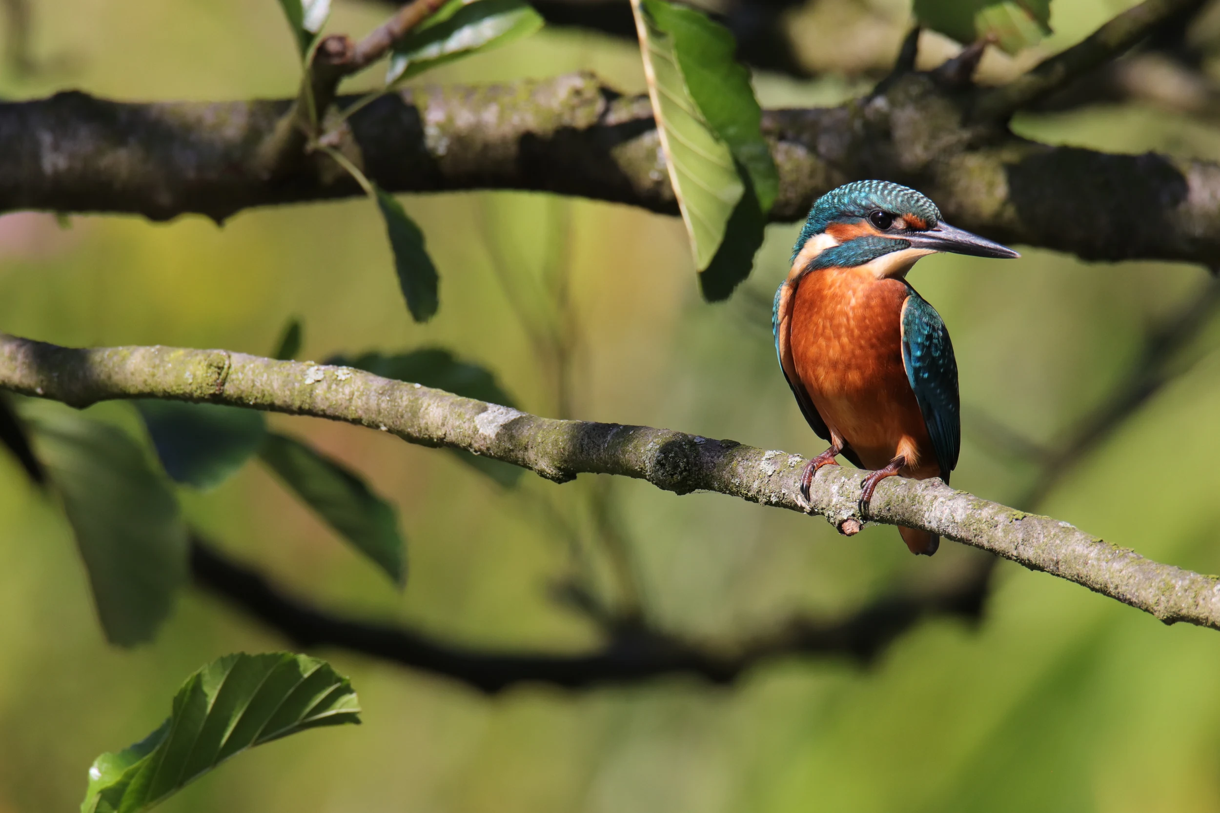
A vibrant common kingfisher with blue and orange plumage perched on a bare wooden branch surrounded by blurred green foliage.
A common kingfisher perched on a branch within the Pillebachtal nature reserve.

Pillebachtal, Dernkamp und Gallberg Nature Reserve history and protected-area timeline

The reserve was first placed under formal protection in 1996 under the key number D-010, recognizing its long-standing ecological value as a forest, meadow, and stream mosaic near the edge of Dusseldorf. At that time, the landscape authority moved to safeguard the small Pillebachtal against further alteration and to preserve the area's significance for amphibians, wetland plants, and breeding birds.

In 2016, the protection framework was reviewed and aligned with an updated city-level landscape plan, with a further approved landscape plan published in 2020. The 2020 plan adds additional species to the management description, including arrowhead, snakeroot, fleabane, cowslip, large twinflower, and meadow cranesbill among the plants, and the painter's mussel, the spring snail Bythinella dunkeri, and the lake limpet among the mollusks. It also lists slow worm, common toad, and common frog alongside the amphibians already recognized in the original designation. Administrative responsibility for the reserve rests with the Lower Landscape Authority of the city of Dusseldorf.

Pillebachtal, Dernkamp und Gallberg Nature Reserve landscape and geographic character

The landscape of Pillebachtal, Dernkamp und Gallberg is defined by the interplay between a small wooded valley and the surrounding low hills. Elevations run from roughly 66 meters along the valley floor to about 110 meters on the hilltops, with an average close to 88 meters, giving the reserve a soft, undulating character rather than a steep valley form. The Pillebach, a small tributary of the Dussel, has carved a modest valley through these elevations, and along its banks the terrain flattens into meadows and marshy ground.

On the higher ground, particularly in the Gallberg section, mature beech forest with highly visible root systems and pronounced microrelief dominates the terrain. Lower-lying areas along the stream feature wet meadows, transitions into reed beds, and stands of cattail. Spring activity contributes to the landscape's character: shaded forest springs emerge in the wooded zones while open meadow springs appear in the grassland sections, producing a mosaic of damp and drier ground that changes over short distances. The image of the Pillebachtal area at Gut Grosseforst shows reeds and willows; the Dernkamp and Gallberg sections show forest pathways along the Pillebach, exposed tree roots, and small relief features on the hilltops.
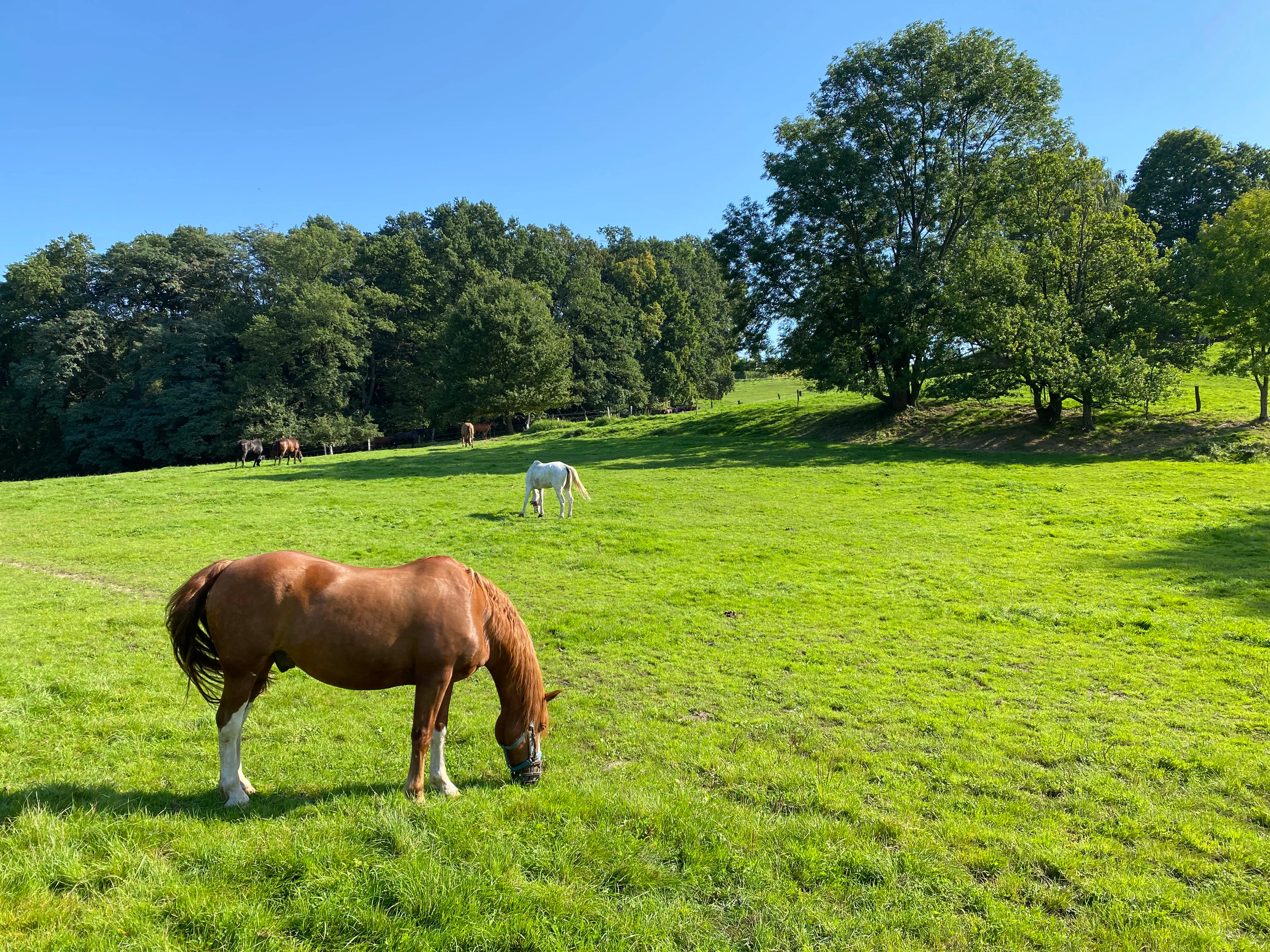
A group of horses grazing in a bright green pasture bordered by a forest in the background on a sunny day.
Horses grazing in a pasture within the Pillebachtal, Dernkamp und Gallberg nature reserve.

Pillebachtal, Dernkamp und Gallberg Nature Reserve ecosystems, habitats, and plant life

Ecologically, the reserve is best understood as a compact forest-meadow-stream-spring complex in which multiple habitat types meet within a few hundred meters of each other. The official habitat inventory highlights beech and mixed beech forests rich in structure and old growth, gallery woodlands of alder and ash along the Pillebach, alder swamp woodlands, regenerating sections of the stream itself, shaded and open forest springs, wet meadows, and reed-dominated marshland.
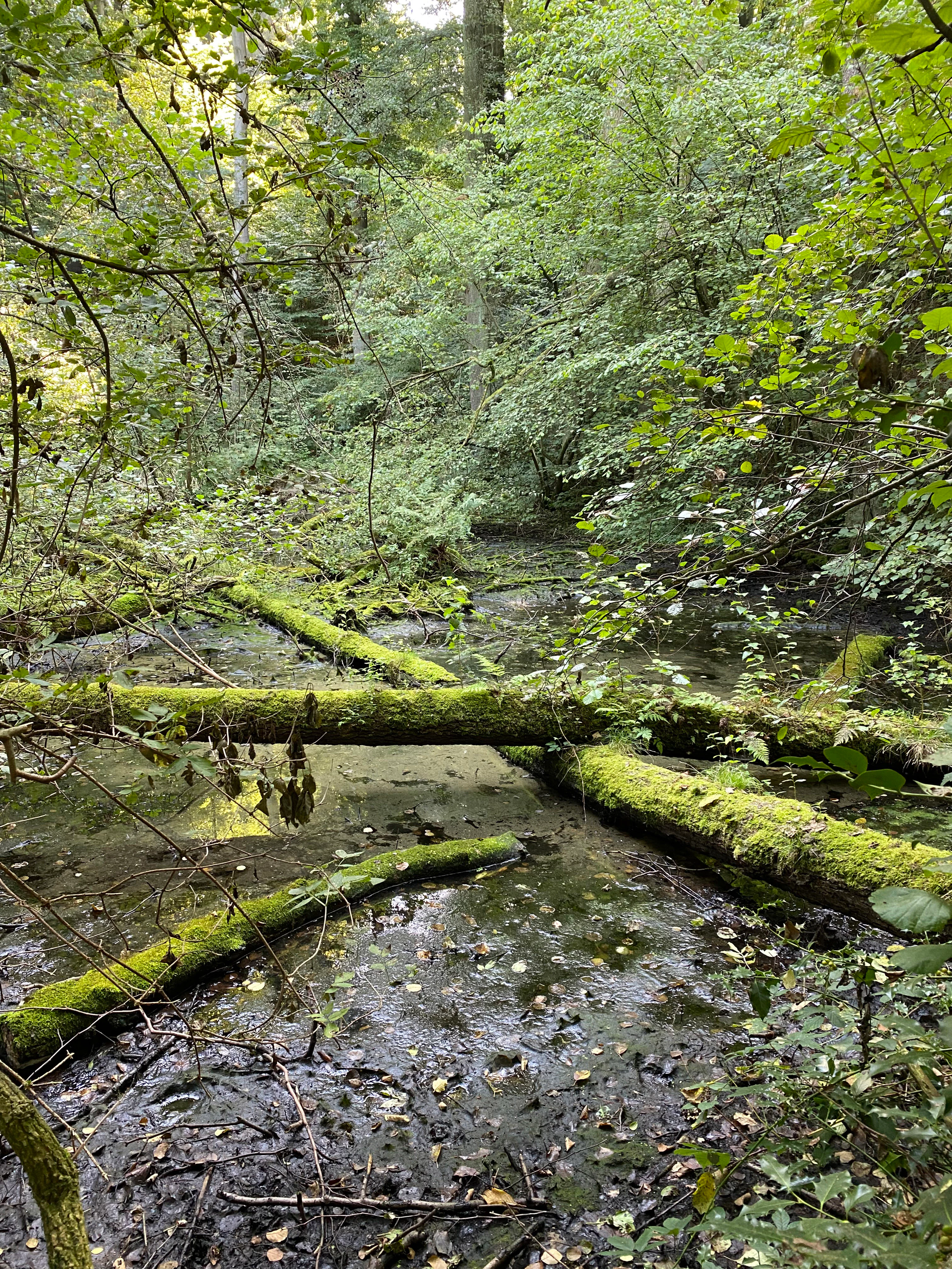
A small, murky wetland or stream area in a forest with several moss-covered fallen logs spanning the water.
A shaded, mossy wetland area within the Pillebachtal reserve, characterized by fallen logs and dense forest cover.

Pillebachtal, Dernkamp und Gallberg Nature Reserve wildlife and species highlights

The beech forests with their old, cavity-rich trees are a key resource for woodland birds. Hobby falcons and other raptors use the canopy edge, while cavity-breeding species such as lesser spotted woodpecker, great spotted woodpecker, middle spotted woodpecker, green woodpecker, stock dove, and jackdaw nest in the mature stands. The reed beds are inhabited by disturbance-sensitive water rail, listed as strongly threatened, along with reed warbler and reed bunting. Hedges and scrubby transitions support a locally important yellowhammer population within the city of Dusseldorf.
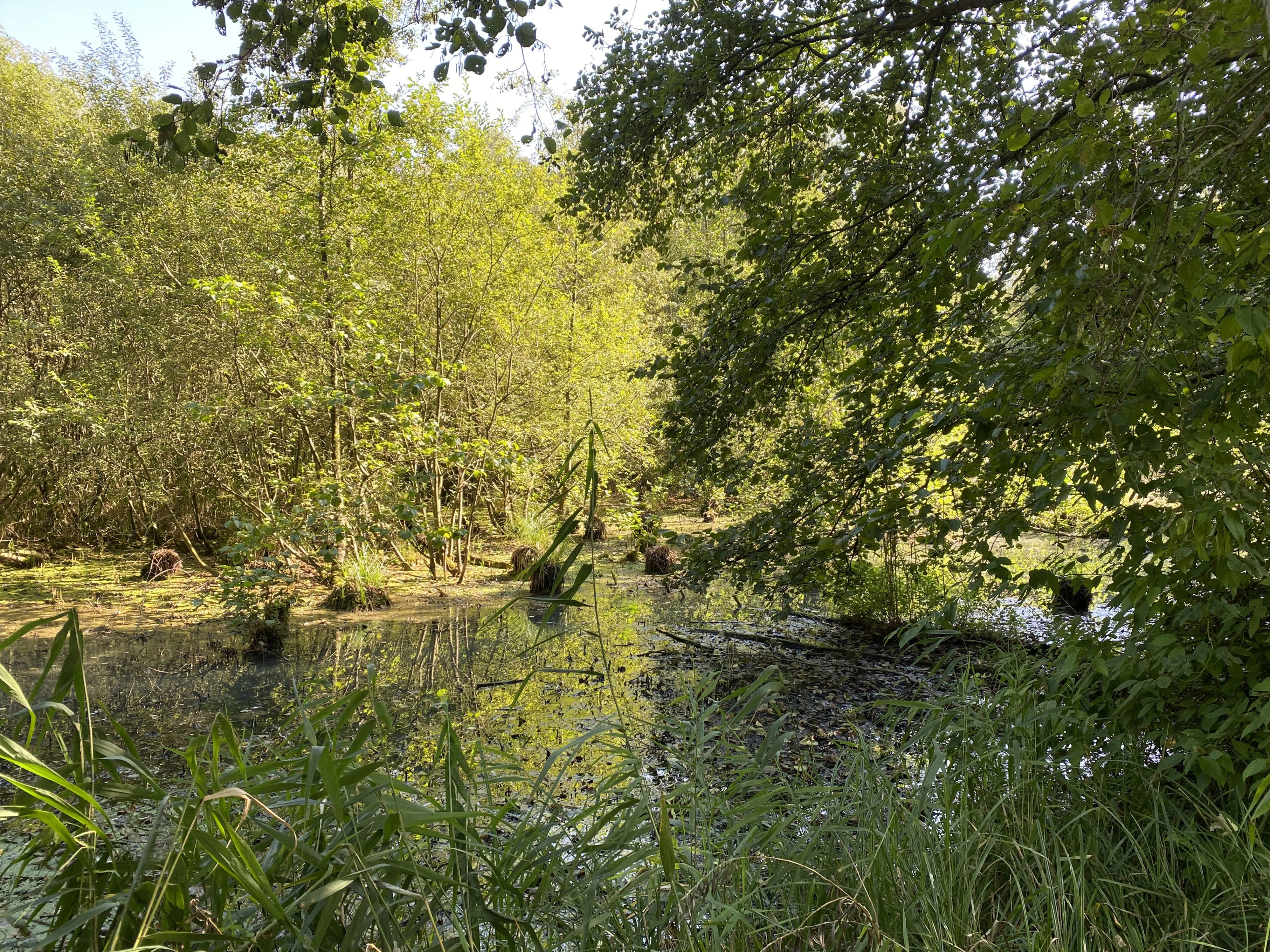
A calm, shallow pond surrounded by dense deciduous forest and marshy vegetation, featuring reflections of trees on the water surface.
A shaded wetland area within the Dernkamp sector of the Pillebachtal, Dernkamp und Gallberg nature reserve.

Pillebachtal, Dernkamp und Gallberg Nature Reserve conservation status and protection priorities

Protection objectives center on preserving and developing a near-natural, structurally rich forest-meadow-water-spring complex with high relevance for species protection. The value of the reserve for conservation is tied directly to the unusual concentration of habitat types within its small footprint and to the old-growth character of its beech stands. The beech forests are described as rich in structure and old wood, providing habitat for raptors and a suite of cavity-nesting species. Springs and wet habitats shelter threatened plants including ivy-leaved duckweed, floating crystalwort, beaked sedge, and panicled sedge, alongside amphibians such as water frog, smooth newt, and grass frog, and reptiles including viviparous lizard and grass snake. The reserve's location within the urban territory of Dusseldorf gives it additional value as a refuge for species that would otherwise be squeezed out by an intensely developed landscape, which is why the 1996 designation has been carried forward and refined in successive landscape plans.

Top sights and standout views in Pillebachtal, Dernkamp und Gallberg Nature Reserve

The reserve's standout qualities include the close coexistence of mature beech forest, spring-fed wetlands, and a restored small stream within a few kilometers of central Dusseldorf. Its old-growth beech stands support a notable community of cavity-nesting birds, while its reed beds hold a regionally important population of water rail and a strong population of reed warbler. The 2020 landscape plan records a rich inventory of rare plants, mollusks, amphibians, and reptiles, including the spring snail Bythinella dunkeri and the painter's mussel, alongside traditional meadow species like meadow cranesbill. Together these features make the reserve an unusually rich example of how wooded and wetland habitats can be maintained in a settlement-proximate setting.
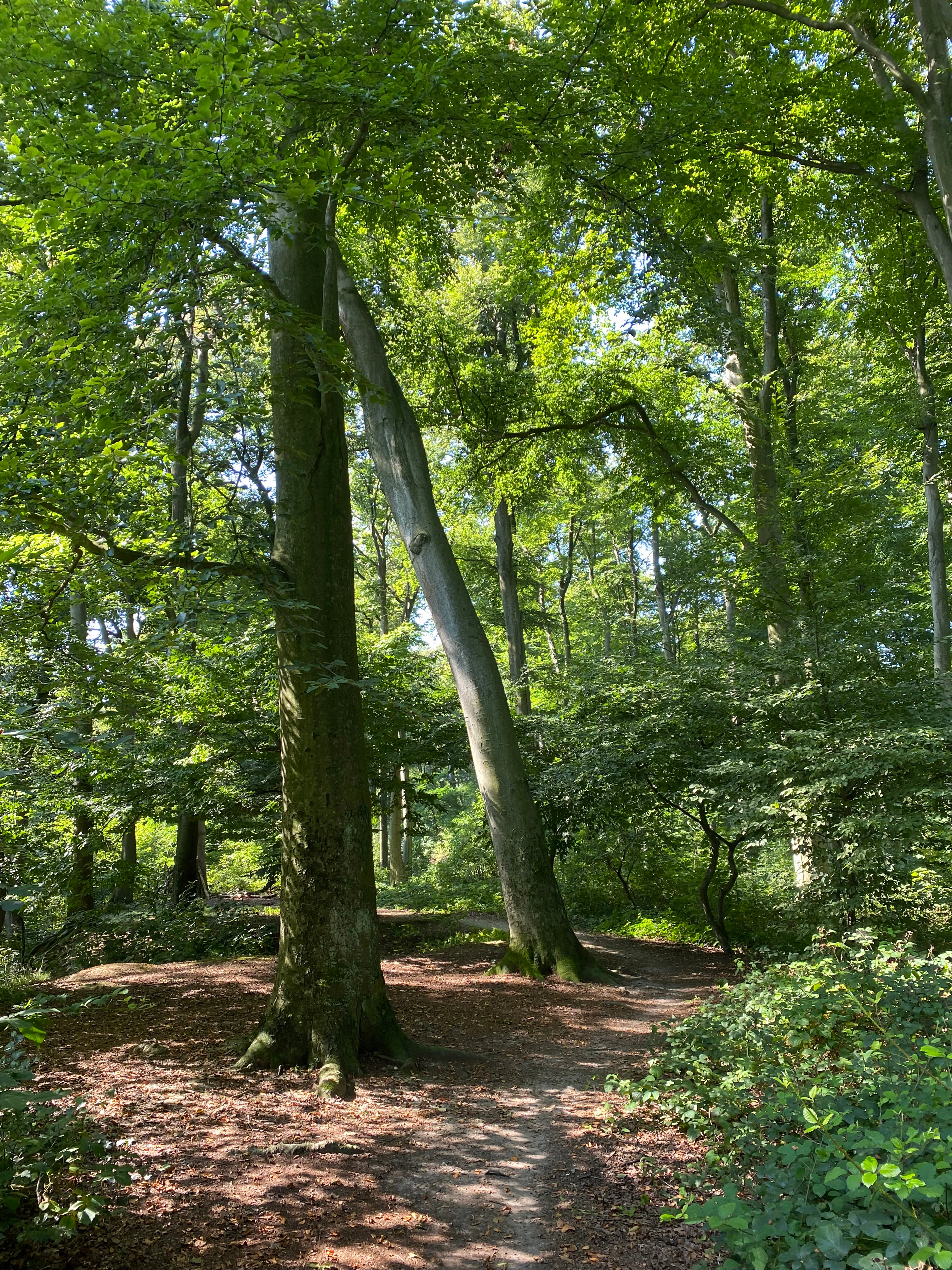

A dirt path winds through a deciduous forest with mature beech trees and a lush green canopy under daylight.
A woodland trail leading through a dense beech forest in the Gallberg area of the nature reserve.
Monthly climate preview

Long-term temperature ranges and precipitation patterns recorded across twelve monthly intervals.

Naturschutzgebiet Pillebachtal, Dernkamp und Gallberg Climate Normals and Weather by Month

Naturschutzgebiet Pillebachtal, Dernkamp und Gallberg records measured monthly temperatures ranging from winter minimums below freezing to summer maximums exceeding thirty degrees, paired with steady year-round precipitation. Reviewing the complete twelve-month record provides deeper perspective on long-term climate normals and annual environmental rhythms.
Annual mean10 °C
1 °C19 °C
Jan
Feb
Mar
Apr
May13°
Jun17°
Jul19°
Aug19°
Sep15°
Oct10°
Nov
Dec
Warmest month
July

19.2 °C

Coolest month
January

1.3 °C

Wettest month
December

2.6 mm/day

Driest month
April

1.6 mm/day

Park location guide

Geography guide, regional context, and park location map for Pillebachtal, Dernkamp und Gallberg Nature Reserve

Pillebachtal, Dernkamp und Gallberg Nature Reserve park geography, regions, and map view in Germany

Understand where Pillebachtal, Dernkamp und Gallberg Nature Reserve sits in Germany through a broader geographic reading of the surrounding landscape, nearby location context, and its mapped position within the national park landscape.

How Pillebachtal, Dernkamp und Gallberg Nature Reserve fits into Germany

Germany is a federal republic in Western and Central Europe with a population of over 83 million across sixteen constituent states. It is Europe's largest economy by nominal GDP and a major global exporter and importer. The capital is Berlin, and the country borders Denmark, Poland, Czech Republic, Austria, Switzerland, France, Luxembourg, Belgium, and the Netherlands.

Wider geography shaping Pillebachtal, Dernkamp und Gallberg Nature Reserve in Germany

Germany is located in Western and Central Europe, spanning 357,022 km². It borders Denmark to the north, Poland and the Czech Republic to the east, Austria and Switzerland to the south, and France, Luxembourg, Belgium, and the Netherlands to the west. The country has coastlines on the Baltic Sea and North Sea to the north, with the Alps located in the southern region.

Map view of Pillebachtal, Dernkamp und Gallberg Nature Reserve

Use this park location map to pinpoint Pillebachtal, Dernkamp und Gallberg Nature Reserve in Germany, understand its exact geographic position, and read its mapped placement within the surrounding landscape more clearly.

Pigeon | © OpenStreetMap contributors

Location context for Pillebachtal, Dernkamp und Gallberg Nature Reserve

North Rhine-Westphalia

Visual exploration of beech forests, stream valleys, and wetland habitats across the reserve

Naturschutzgebiet Pillebachtal, Dernkamp und Gallberg Photos and Landscape Scenery

Photographic documentation reveals the diverse terrain, mature beech woodlands, and spring-fed wetlands defining the protected landscape. Visual reference captures the intricate mosaic of stream valleys and meadow habitats within the urban-proximate reserve.

A vibrant common kingfisher with blue and orange plumage perched on a bare wooden branch surrounded by blurred green foliage.

A sunny, densely vegetated riparian forest scene with tall deciduous trees, dense green undergrowth, and a small patch of stagnant water visible in the middle distance.

A group of horses grazing in a bright green pasture bordered by a forest in the background on a sunny day.

A small, murky wetland or stream area in a forest with several moss-covered fallen logs spanning the water.

A calm, shallow pond surrounded by dense deciduous forest and marshy vegetation, featuring reflections of trees on the water surface.

Large, thick tree roots of a beech tree emerging from the ground on a wooded slope.

A dirt path winds through a deciduous forest with mature beech trees and a lush green canopy under daylight.

A small, murky pond covered in duckweed, surrounded by dense grasses, reeds, and green bushes.

A gravel trail winds through a lush, green deciduous forest with a wooden park bench situated on the right side of the path.

A view into a lush green deciduous forest with a narrow earthen path winding between tree trunks, dappled sunlight, and a fallen log on the left.

A narrow dirt trail winding through a dense, sunlit deciduous forest with lush undergrowth.

A view looking through trees into a clearing filled with tall green reeds in a wetland area.

A cluster of brown cattails growing in a marshy wetland area, with a grassy meadow and forest in the background.

Park atlas

Explore surrounding protected landscapes and nearby nature reserves across the region.

Parks Near Naturschutzgebiet Pillebachtal, Dernkamp und Gallberg: Compare Regional Protected Areas

Compare protected areas near Naturschutzgebiet Pillebachtal, Dernkamp und Gallberg to evaluate similar stream valleys, beech forests, and wetland habitats. Regional park discovery helps connect urban-proximate nature reserves with broader conservation landscapes.
Watercolor painting of a green valley with a winding stream and gentle hills in the background.
Nature reserveNordrhein-Westfalen
About 2.4 km away#1 closest

Southeast

Morper Bachtal: Mapped Nature Reserve and Stream Valley Geography in Germany

Protected wetland landscapes and regional habitat connectivity.

Morper Bachtal represents a tightly layered protected area where open water, reedbeds, and beech forests converge along the Rotthäuser Bach. This detailed look at its landscape composition and position within the district of Mettmann reveals the significance of its compact, undulating terrain and corridor role in German regional geography.

Area
0.74 km²
Established
1984
IUCN
IV
Relief
Upland
A soft, light watercolor painting of a green, rolling valley with trees and gentle hills, rendered in a minimalist style on a white background.
Nature reserveNordrhein-Westfalen
About 2.8 km away#2 closest

Southeast

Hubbelrather Bachtal: Nature Reserve and Protected Stream Valley in Nordrhein-Westfalen

A diverse habitat mosaic from lowland wetlands to dry sandy slopes

Hubbelrather Bachtal is a protected nature reserve in the Mettmann district, defined by a basin-shaped valley floor along the Hubbelrather Bach. The area features a complex mosaic of reedbeds, sedge-rich grasslands, and beech woodland slopes, providing essential refuge for endangered species in the urbanized corridor between Düsseldorf and the Bergisches Land.

Area
28.29 km²
Established
1997
IUCN
IV
A watercolor illustration of a gentle winding stream flowing through a lush green valley at dawn or dusk.
Nature reserveNordrhein-Westfalen
About 4.9 km away#3 closest

Northeast

Schwarzbachtal bei Götzenberg: Nature Reserve and Protected Landscape in North Rhine-Westphalia

Mapped stream valley, floodplain, and forest geography

Schwarzbachtal bei Götzenberg is an ecologically rich nature reserve located near Ratingen in the Mettmann district. The protected area features a well-preserved stretch of the Schwarzbach stream, old-growth beech stands, and complex wetland mosaics including reedbeds and ponds, providing essential habitat within a suburban landscape.

Area
0.54 km²
Established
1984
IUCN
IV
Relief
Lowland
A watercolor painting showing a soft, peaceful landscape with light green rolling hills in the background, a flat plain in the middle ground, and grasses and wildflowers in the foreground under a pale, warm sky.
Nature reserveNordrhein-Westfalen
About 6.1 km away#4 closest

East

Laubacher Steinbruch Nature Reserve: Mapped Geographic Overview and Protected Landscape Analysis

Calcareous habitats in the Neandertal valley, Germany

Laubacher Steinbruch is a distinct nature reserve characterized by a mosaic of sycamore maple forest, steep limestone cliffs, and dry scree fields. Situated within the Neandertal Natura 2000 site, it acts as a critical refuge for specialized plant communities and reptiles, forming an integral part of the regional conservation network in Nordrhein-Westfalen.

Area
0.06 km²
Established
1997
IUCN
IV
A watercolor painting showing a winding stream flowing through a green valley with soft hills and trees in the background.
Nature reserveKreis Mettmann
About 6.2 km away#5 closest

East

Laubachtal Nature Reserve: Geographic Mapping of the Mettmann Wetland Corridor

A protected stream valley in Kreis Mettmann, Germany

Laubachtal functions as a critical 15 hectare nature reserve within the Mettmann district, preserving a mosaic of stream, pond, and wet meadow habitats. This protected area serves as an essential ecological corridor for amphibians and migratory birds, offering a focused look at small-scale conservation geography within the urban-edge environment of North Rhine-Westphalia.

Area
0.15 km²
Established
1997
IUCN
IV
Relief
Upland
Nature reserveNordrhein-Westfalen
About 8.7 km away#6 closest

Northeast

Hofermühle Süd Nature Reserve: Mapped Protected Landscapes and Quarry Geography

Examining limestone quarry terrain and riparian zones in Nordrhein-Westfalen.

Explore the distinct geology of Hofermühle Süd, where a reclaimed limestone quarry meets the meandering Anger creek. This protected nature reserve in Nordrhein-Westfalen provides a vital study in secondary succession, showcasing thin calcareous soils, rare flora, and essential wetland habitats within a small but topographically varied site.

Area
0.166 km²
Established
1984
IUCN
IV
Relief
Lowland
Watercolor painting of a meandering stream flowing through a green meadow, with trees in the background.
Nature reserveNordrhein-Westfalen
About 9.2 km away#7 closest

Southeast

Hildener Stadtwald, Bereich Sandbach-Krebsbach Protected Nature Reserve and Wetland Geography

A mapped overview of the Bergische Heideterrasse riparian corridor.

Hildener Stadtwald, Bereich Sandbach-Krebsbach stands as an important nature reserve within the urbanised landscape of North Rhine-Westphalia. The area is characterized by its hydrologically dynamic sandy brooks, old-growth alder stands, and distinct microhabitats ranging from wet heath to dry oak-birch forests. This protected entity offers a clear look at the structural complexity of lowland mire ecosystems within a broader regional forest context.

Area
0.27 km²
Established
1938
IUCN
IV
Relief
Lowland
A watercolor painting showing a soft landscape scene with a winding stream, low-lying vegetation, and distant hills in pale green and earth tones.
Nature reserveNorth Rhine-Westphalia
About 9.7 km away#8 closest

Southeast

Mahnerter Bachtal: Mapping the Protected Stream Valley Habitats of North Rhine-Westphalia

A vital riparian landscape and lowland nature reserve

Mahnerter Bachtal preserves a significant lowland stream valley in Erkrath, featuring alder swamps, wet meadows, and ancient oak forests. This 28-hectare nature reserve functions as a crucial east-west ecological corridor, offering a rare glimpse of undisturbed valley geography within the sprawling industrial landscape of the German Rhine-Ruhr metropolitan area.

Area
0.28 km²
Established
1997
IUCN
IV

Common questions about visiting, size, designation, and location context for Pillebachtal, Dernkamp und Gallberg Nature Reserve

Pillebachtal, Dernkamp und Gallberg Nature Reserve FAQs for park facts, access, geography, and protected area context

Find quick answers about Pillebachtal, Dernkamp und Gallberg Nature Reserve, including protected-area facts, park geography, trail and visitor context, and how the park fits into its surrounding country and regional landscape.
MoriAtlas Explorer

Continue Your Protected Areas Search Across the Global Atlas

Deepen your exploration by continuing the structured search for national parks and protected areas worldwide. Utilize the comprehensive filtering capabilities to compare different conservation landscapes and refine your understanding of global park geography. Discover more about the distribution and characteristics of protected natural areas.

Global natural geography