
Mori Atlas logo
State or regional parkPiñones State Forest

Mapping the mangrove reserves, coastal dunes, and timberland corridors of the Loíza municipality

Piñones State Forest: A Detailed Geographic Atlas of Puerto Rico's Coastal Protected Landscape

(Bosque Estatal de Piñones)

Piñones State Forest represents a critical protected coastal corridor situated along the northern Atlantic shoreline of Puerto Rico. Spanning the municipality of Loíza, this state-managed reserve preserves a complex mosaic of mangrove wetlands, rare endemic flora habitats, and Caribbean dry woodland terrain. Through this atlas, you can examine the park's distinct coastal geography, understand its ecological position between urban development and the sea, and trace the boundaries of this essential recreational greenway.

coastal forestmangrove reserveCaribbean coasttimberlandendemic floraboardwalk trail
A stylized graphic illustration of a coastal scene featuring turquoise ocean waves, a rocky shoreline with green vegetation, and distant cliffs under a pastel-colored sky.

Piñones State Forest

State or regional park

Park overview

Structured park overview, official facts, and landscape profile for Piñones State Forest

Piñones State Forest park facts, protected area profile, and essential visitor context

Review the core facts for Piñones State Forest, including designation, size, terrain, visitor scale, habitats, and operating context in one park-focused overview.

About Piñones State Forest

Piñones State Forest sits at the meeting point of Puerto Rico's urban north coast and one of the island's longest stretches of beach. The reserve lies east of the Isla Verde resort district in the Torrecilla Baja barrio of Loíza, forming a green buffer between the international airport corridor and the Atlantic shoreline. Although small in scale, it carries an outsized ecological and recreational role for the San Juan metropolitan region, combining managed timberland, mangrove forest, coastal scrub, and rare remnant native vegetation within a single protected landscape.

The forest takes its popular name from the piñón tree, a Casuarina species originally introduced to Puerto Rico because of its tolerance for saline coastal conditions and its usefulness as lumber. Over time, the same hardiness that made it attractive for reforestation turned it into one of the most visible invasive elements of the local coast. Despite this ecological complication, the forest has matured into a recognizable coastal woodland that defines the visual identity of the Piñones corridor.

What truly distinguishes Piñones ecologically is the presence of mangrove wetlands and a fragile population of the endemic Puerto Rican tree Schoepfia arenaria, which survives at the headland called Punta Maldonado. Few living specimens of this species are known, making the forest's protection essential for the species' continued existence. This mixture of mangrove, rare dry-forest flora, and accessible coastal timberland gives the reserve a layered identity that is unusual for an urban-edge state forest in the Caribbean. Recreationally, the Piñones Trail and boardwalk allow visitors to experience these ecosystems on foot or by bicycle, threading between the forest, the mangrove zones, and the beach while minimizing disturbance to sensitive ecological and archaeological sites.

Quick facts and research context for Piñones State Forest

Piñones State Forest is a coastal timberland reserve on Puerto Rico's north coast, lying east of Isla Verde in the municipality of Loíza. It is administered by the Puerto Rico Department of Natural and Environmental Resources. The forest is named after the piñón tree, a Casuarina species introduced for lumber that has become invasive in local coastal environments. It serves as both a working forest and a natural reserve protecting mangrove ecosystems and rare Puerto Rican endemics, including a small surviving population of Schoepfia arenaria at Punta Maldonado.

Protection and recognition

Documented terrestrial protection scope and conservation status details

Piñones State Forest Protection Status and International Recognition Data

Piñones State Forest maintains a documented terrestrial protection scope without imported international recognition sources. Structured records outline the formal conservation status and administrative designation for this protected landscape.

Protection details

Protection scope
Terrestrial
Transboundary protection
No
Park context

Deeper park guide and search-rich context for Piñones State Forest

Piñones State Forest history, landscape, wildlife, and travel context

Explore Piñones State Forest through its history, landscape character, ecosystems, wildlife, conservation priorities, cultural context, and seasonal travel timing in a structured park guide built for atlas discovery and search intent.

Why Piñones State Forest stands out

Piñones State Forest is best known for its coastal mangrove reserve combined with recreational timberland near San Juan, and for hosting one of the rarest trees in Puerto Rico, Schoepfia arenaria, at Punta Maldonado. It is also recognized for the Piñones Trail and boardwalk, a family-friendly biking and walking route that weaves through the forest and was honored by the Federal Highway Administration in 2001 for excellence in non-motorized transportation. Together, these qualities make Piñones distinct as an accessible, urban-adjacent Caribbean coastal ecosystem with a strong ecological, recreational, and cultural identity.
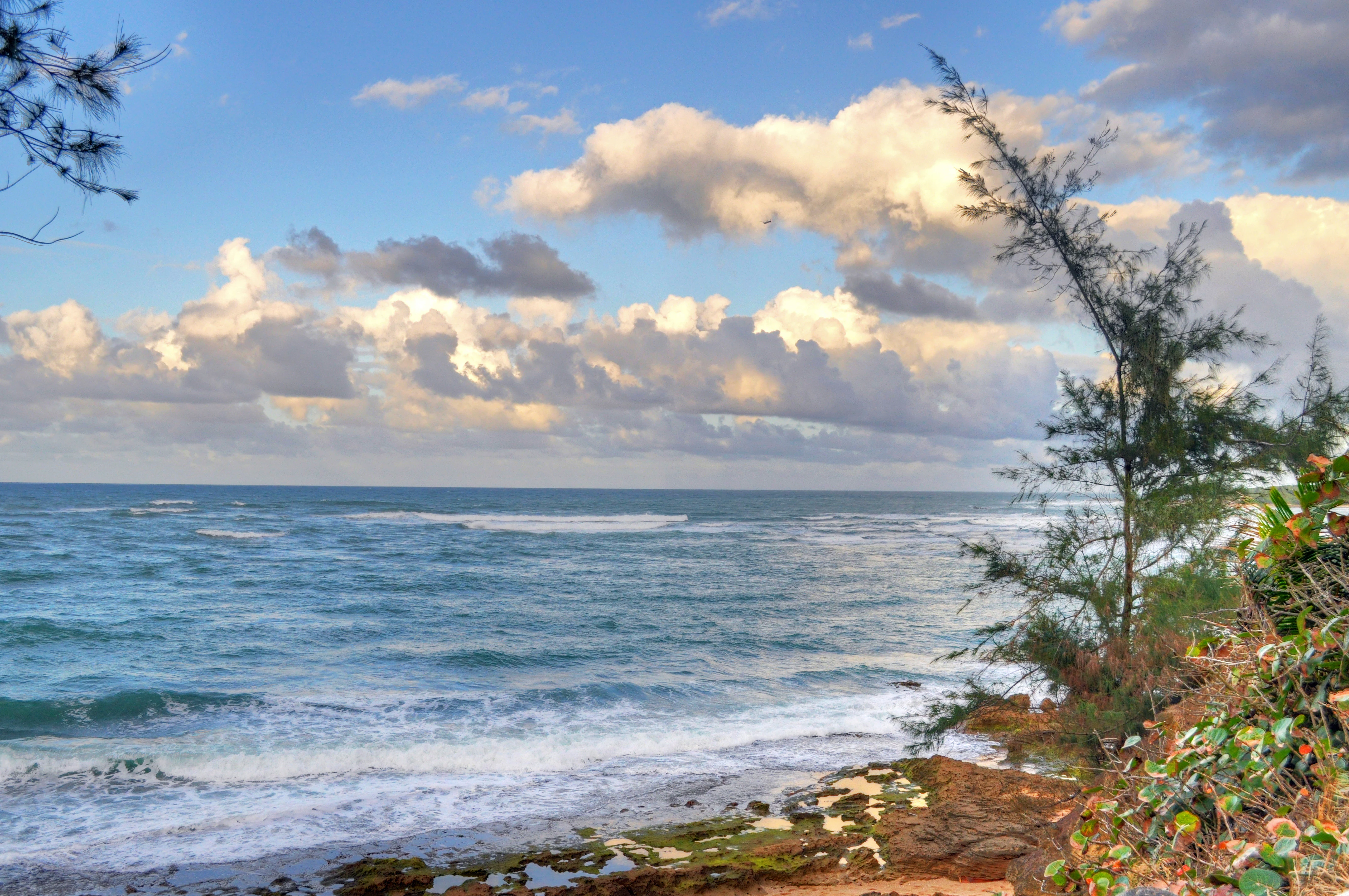
A coastal landscape view of Piñones State Forest showing a rocky shoreline with green vegetation and trees on the right, overlooking the turquoise ocean under a cloudy sky.
Coastal view of the Piñones State Forest shoreline.

Piñones State Forest history and protected-area timeline

The Piñones reserve developed as part of Puerto Rico's effort to protect coastal timberland near San Juan while balancing the recreational demands of a heavily populated metropolitan shoreline. The forest is administered by the Puerto Rico Department of Natural and Environmental Resources, the same agency that oversees most of Puerto Rico's state forests and natural reserves.

A notable moment in the forest's modern history came in 2001, when the Piñones Trail received an award from the Federal Highway Administration recognizing excellence in non-motorized transportation. The recognition reflected years of careful planning to integrate bike and pedestrian infrastructure through a sensitive ecological corridor, allowing family-oriented recreation without unduly fragmenting the mangrove and forest habitats. Today, the forest remains part of an evolving management story in which Puerto Rico continues to deal with the legacy of piñón tree plantings while trying to preserve native flora, mangroves, and archaeological values along the north coast.

Piñones State Forest landscape and geographic character

The landscape of Piñones State Forest is a narrow, low-lying coastal strip shaped by the interplay of Atlantic Ocean breezes, salt spray, and seasonal rainfall. The terrain is generally flat, with sandy substrates supporting both planted timber species and natural coastal vegetation. A defining scenic feature is the transition zone between the forest interior, mangrove wetlands, and the long sandy beach that runs along the adjacent shoreline.

Headlands, dunes, mangrove margins, and coastal scrub all coexist within the reserve's footprint. Punta Maldonado, a small promontory within the forest, is one of the more distinctive landforms and is ecologically important because of the rare plant communities it harbors. The visual character of the forest is dominated by tall, feathery piñón stands that contrast with the dense, low mangrove canopy and the open beach vistas nearby, giving Piñones a layered coastal appearance quite unlike the interior mountain reserves of Puerto Rico.
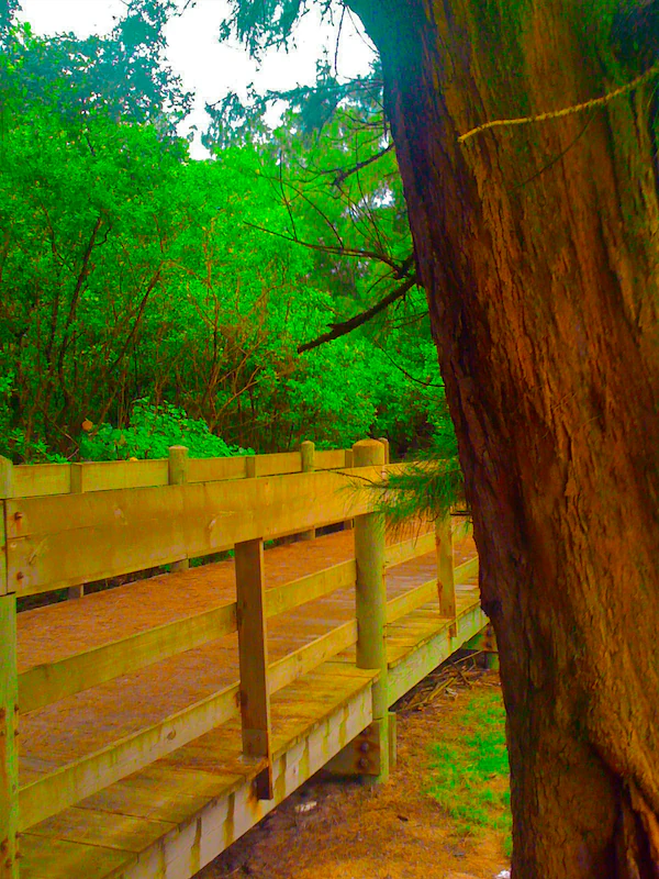
A wooden boardwalk with railings extends into the distance through a dense, bright green forest, with a large, textured tree trunk in the immediate right foreground.
A wooden boardwalk winding through the lush vegetation of the Piñones State Forest.

Piñones State Forest ecosystems, habitats, and plant life

Piñones supports a compressed but ecologically varied mosaic of Caribbean coastal habitats. Mangrove forest is one of the central ecosystems, providing a brackish transitional zone between the mainland and the sea, and supporting the usual functions of such systems in stabilizing sediment, sheltering juveniles of marine species, and protecting the inland forest from storm surge. Dry coastal woodland, dominated in many areas by the introduced piñón, forms the elevated interior of the reserve.

Within this framework, the forest contains patches of rarer native vegetation that have survived despite heavy coastal development pressure around Loíza and Isla Verde. These remnant habitats are ecologically precious because they represent fragments of what northern Puerto Rico's dry coastal flora may once have looked like. The presence of mangrove, coastal scrub, and these rare native patches together give the reserve a recognizable Caribbean coastal identity, even though its planted timber sections sit alongside the more natural communities.
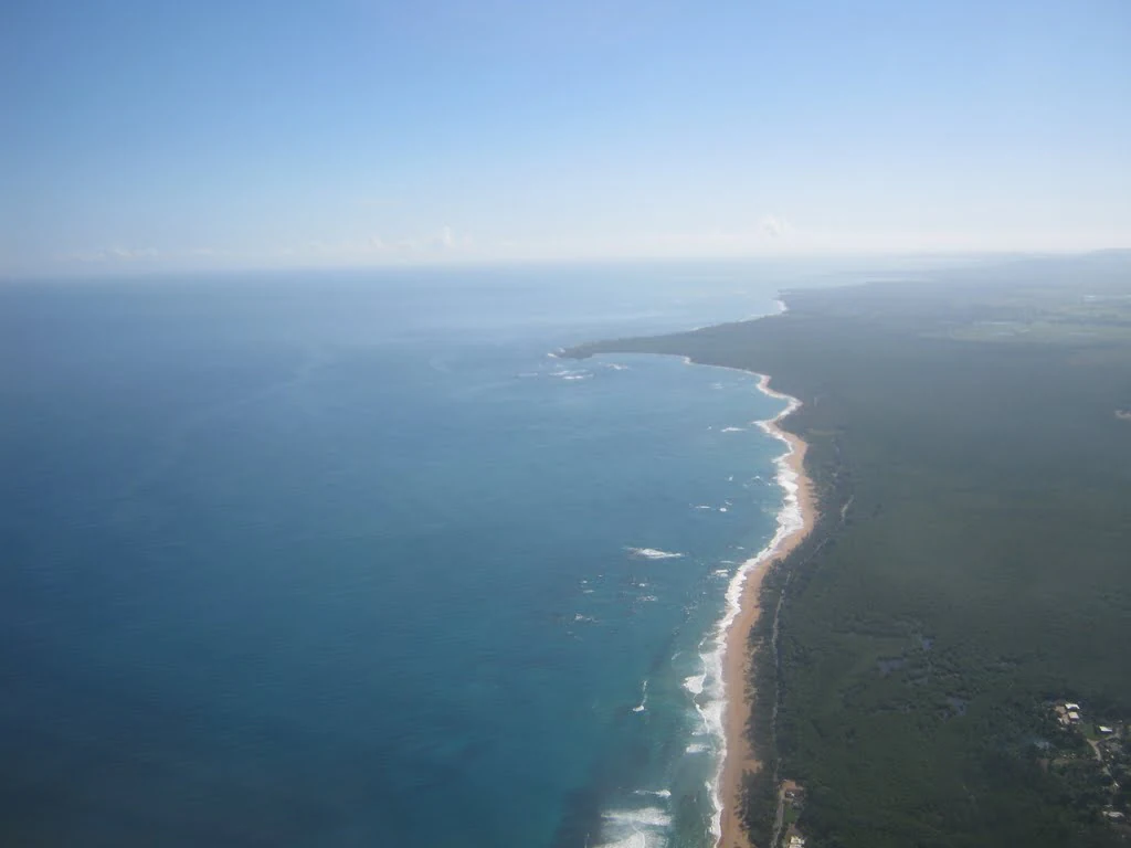
Aerial view of a long, narrow coastline with dense dark green vegetation on the right and the deep blue ocean on the left.
An aerial view of the coastline along Piñones State Forest, showcasing the dense mangrove forest meeting the Atlantic Ocean.

Piñones State Forest wildlife and species highlights

Wildlife coverage in the available source material for Piñones is limited, and there is little direct documentation of specific animal species present in the reserve. What can be said is that mangrove systems like the one at Piñones typically support coastal birds, crustaceans, juvenile fish, and reptile communities characteristic of Caribbean mangrove estuaries, while the adjacent beach and dune environments add shorebird habitat. The forest canopy, despite its strong presence of introduced piñón, also provides refuge for generalist birdlife common to Puerto Rico's north coast. Without stronger source support, more specific claims about fauna are not appropriate here.
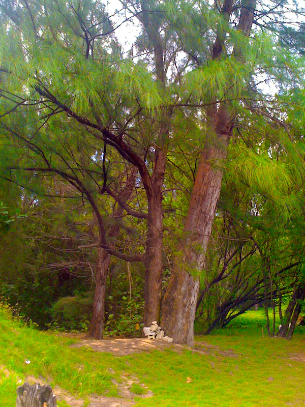
A group of tall trees with textured bark and thin green needle-like branches stands in a grassy area in Piñones State Forest.
Tall trees with needle-like foliage in Piñones State Forest.

Piñones State Forest conservation status and protection priorities

The conservation value of Piñones State Forest lies in its combination of mangrove protection, rare endemic plant preservation, and coastal habitat resilience in a heavily developed metropolitan corridor. The mangrove wetlands function as a natural buffer against storm surge and as nursery habitat for marine life, both of which are increasingly important in a Caribbean context vulnerable to hurricanes and sea-level rise.

Equally significant is the reserve's role in safeguarding Schoepfia arenaria, a Puerto Rican endemic tree so rare that fewer than 200 mature individuals are known. By protecting Punta Maldonado and the surrounding forest, the reserve helps ensure one of the few remaining refuges for this species. Conservation management at Piñones also involves balancing public recreation with ecological sensitivity, an effort reflected in the careful routing of the Piñones Trail through the forest and in ongoing control of invasive piñón influence on native plant communities.

Piñones State Forest cultural meaning and human context

Piñones sits in the municipality of Loíza, a coastal town long associated with Afro-Puerto Rican heritage and a distinct regional cultural identity that sets it apart from the surrounding tourism-oriented municipalities. The forest and its beach corridor are woven into the daily life of nearby communities, and the kiosks along PR-187, including establishments noted by the Puerto Rico Tourism Company, are part of a local food and crafts tradition associated with the Piñones shoreline.

The area also carries archaeological significance, with sensitive cultural sites along the trail corridor that authorities take into account when planning recreational infrastructure. Together, the neighboring communities, the trail, and the protected natural areas form a cultural-natural interface where Puerto Rican coastal traditions continue alongside efforts to conserve mangrove ecosystems and rare native species.
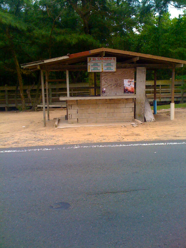
A small, open-air wooden kiosk with a cinderblock base situated next to an asphalt road in a wooded area.
A roadside kiosk in Piñones State Forest.

Top sights and standout views in Piñones State Forest

Piñones State Forest combines mangrove conservation, accessible urban-edge recreation, and rare endemic plant protection along one of Puerto Rico's most heavily visited coastal corridors. Its highlights include the Piñones Trail and boardwalk, the mangrove reserve east of Isla Verde, the rare Schoepfia arenaria population at Punta Maldonado, and the adjacent beach and kiosk culture along PR-187 in Loíza. The forest's blend of ecological fragility, recreational value, and proximity to San Juan makes it a distinctive small reserve in Puerto Rico's protected-area network.
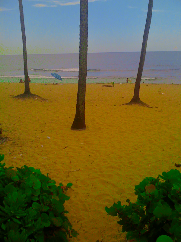
Three tall palm trees stand on a sandy beach looking out toward the ocean, with small figures and a blue umbrella visible in the distance.
A view of the sandy coastline at Aviones Beach within the Piñones area.

Best time to visit Piñones State Forest

Piñones is a coastal Caribbean reserve with consistently warm conditions year-round, so the experience is shaped less by temperature and more by rainfall, humidity, and surf conditions. The drier months of the Caribbean year generally offer more comfortable conditions for walking or biking the Piñones Trail, when mangrove and forest paths are less muddy and beach visits are more pleasant.

Hurricane season brings a higher chance of heavy rain, rough surf, and temporary trail disruptions, although it is also the period when mangrove ecosystems and coastal vegetation are most visibly active. Early morning visits during any season tend to be the most rewarding for bird activity, mangrove atmosphere, and avoiding the heat of midday. As always, visitors planning a trip should check current local conditions for the trail and beach access.

Monthly climate preview

Long-term representative point measurements tracking monthly temperature and precipitation rhythms

Piñones State Forest Climate Normals, Annual Temperature and Precipitation Profiles

Piñones State Forest records mean monthly temperatures ranging from 24.91 to 27.94 degrees Celsius alongside varying daily precipitation levels. Reviewing the complete twelve-month climatology dataset reveals detailed shifts across the representative coordinate.
Annual mean27 °C
25 °C28 °C
Jan25°
Feb25°
Mar25°
Apr26°
May27°
Jun27°
Jul28°
Aug28°
Sep28°
Oct27°
Nov26°
Dec25°
Warmest month
August

27.9 °C

Coolest month
January

24.9 °C

Wettest month
September

6 mm/day

Driest month
February

2.3 mm/day

Park location guide

Geography guide, regional context, and park location map for Piñones State Forest

Piñones State Forest park geography, regions, and map view in Puerto Rico

Understand where Piñones State Forest sits in Puerto Rico through a broader geographic reading of the surrounding landscape, nearby location context, and its mapped position within the national park landscape.

How Piñones State Forest fits into Puerto Rico

Puerto Rico is a Caribbean archipelago and island territory of the United States, classified as an unincorporated and organized territory under commonwealth status. Located in the North Atlantic Ocean east of the Dominican Republic, it serves as a significant cultural and economic hub in the region. The territory maintains its own constitution, governor, and legislative assembly while being represented in Congress by a resident commissioner.

Wider geography shaping Piñones State Forest in Puerto Rico

Puerto Rico is a Caribbean island archipelago located in the North Atlantic Ocean, approximately 1,600 kilometers southeast of Florida. The main island spans about 177 kilometers in length and 65 kilometers in width, with a total land area of approximately 8,868 km². The terrain ranges from coastal plains to mountainous interior regions, with the highest point at Cerro Punta reaching 1,338 meters. The island is bordered by the Atlantic Ocean and Caribbean Sea.

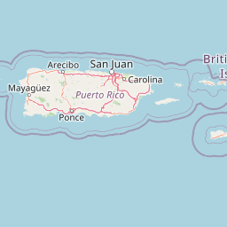
Map view of Piñones State Forest

Use this park location map to pinpoint Piñones State Forest in Puerto Rico, understand its exact geographic position, and read its mapped placement within the surrounding landscape more clearly.

Pigeon | © OpenStreetMap contributors

Location context for Piñones State Forest

Puerto Rico

Visualizing the mangroves, dunes, and coastal terrain of Puerto Rico

Piñones State Forest Photos and Coastal Scenery Imagery

Browse detailed photography showcasing the unique coastal landscape and mangrove wetlands of Piñones State Forest. Visual archives illustrate the protected timberlands, rare native flora habitats, and scenic Atlantic shoreline vistas.

A coastal landscape view of Piñones State Forest showing a rocky shoreline with green vegetation and trees on the right, overlooking the turquoise ocean under a cloudy sky.

A large, mature tree with spreading branches rises above a simple wooden structure with a sloped roof in a forested coastal area.

A wooden boardwalk with railings extends into the distance through a dense, bright green forest, with a large, textured tree trunk in the immediate right foreground.

Aerial view of a long, narrow coastline with dense dark green vegetation on the right and the deep blue ocean on the left.

A group of tall trees with textured bark and thin green needle-like branches stands in a grassy area in Piñones State Forest.

A small grassy forest clearing with a white rectangular sign on the ground, two wooden stumps, and a horizontal log, set against a background of trees.

A small, open-air wooden kiosk with a cinderblock base situated next to an asphalt road in a wooded area.

Three tall palm trees stand on a sandy beach looking out toward the ocean, with small figures and a blue umbrella visible in the distance.

A small, dilapidated cinder block structure sits beneath tall palm trees with stacks of wooden pallets in the foreground.

Park atlas

Compare coastal woodlands, mangrove reserves, and connected Caribbean habitats

Explore Other Parks Near Piñones State Forest and Regional Protected Areas

Continue browsing other protected areas near Piñones State Forest to compare regional coastal geography, mangrove ecosystems, and rare woodland habitats. Analyzing adjacent reserves provides broader context for understanding the ecological diversity found along the northern coast of Puerto Rico.
State or regional parkSan Juan
About 14 km away#1 closest

West

San Patricio State Forest: Protected Urban Karst and Mogote Terrain in San Juan

Mapping subtropical moist forest geography in Puerto Rico

San Patricio State Forest represents a unique conservation success as a reclaimed secondary forest within the San Juan metropolitan region. This protected area maintains the distinctive karst geology of Puerto Rico, featuring a prominent mogote landmark that provides habitat for endemic species and native plant communities amidst an urban environment.

Area
0.283 km²
Established
2000
Relief
Upland
Climate
Tropical
State or regional parkPuerto Rico
About 38 km away#2 closest

East

Ceiba State Forest: Mapping the Coastal Wetlands and Reefs of Eastern Puerto Rico

Coastal mangrove ecosystems and protected wetland habitats

Ceiba State Forest represents a critical coastal protected area in Puerto Rico, known for its dense mangrove ecosystems and adjacent coral reef environments. The reserve provides a compact, interconnected study of tidal wetlands and sandy shorelines. Use this structured profile to examine the geographic characteristics and protected boundaries that define this important avian sanctuary and coastal zone.

Area
1.42 km²
Established
1979
IUCN
Ia
Relief
Lowland
Watercolor painting of a tropical mountain landscape with lush vegetation and palm trees in the foreground and rolling hills in the background.
State or regional parkPuerto Rico
About 38 km away#3 closest

South

Carite State Forest: Volcanic Mountain Geography and Protected Watersheds in Puerto Rico

Mapping the Sierra de Cayey ecosystem and river headwaters.

Carite State Forest protects 2,600 hectares of rugged, volcanic mountain landscape in southeastern Puerto Rico. Known for its subtropical moist forest and high-elevation dwarf zones, the terrain provides a critical habitat for rare endemic species. The forest serves as a vital hydrological watershed, sustaining regional river systems through its complex network of ravines and forested mountain slopes.

Area
26 km²
Established
1935
Relief
Mountain
Climate
Tropical
State or regional parkPuerto Rico
About 59 km away#4 closest

South

Aguirre State Forest: Protected Coastal and Mangrove Geography in Southern Puerto Rico

Explore the estuarine terrain and tidal salt pond boundaries.

Aguirre State Forest encompasses a protected coastal mosaic of mangrove forests and salt-tolerant vegetation across the southern coast of Puerto Rico. This record outlines the forest's role as a primary node in the Jobos Bay estuarine system, characterized by low lying tidal channels and hypersaline flats that provide habitat for diverse avian and marine species within its protected borders.

Area
9.68 km²
Established
1918
Relief
Lowland
Climate
Tropical
State or regional parkPuerto Rico
About 65 km away#5 closest

Southwest

Los Tres Picachos State Forest: A Geographic Guide to Puerto Rico's Mountain Protected Areas

Cloud forests, volcanic terrain, and watershed protection

Los Tres Picachos State Forest encompasses a striking landscape in the Puerto Rican interior, marked by deep river valleys and its namesake triple peaks. This atlas feature provides insights into the forest's layered ecological zones and its role as a crucial hydrological anchor for the Toro Negro and Cialitos river systems within the Cordillera Central.

Established
1999
Relief
Mountain
Climate
Tropical
Access
Remote access
A wide watercolor illustration showing a forest scene with trees in the foreground, a winding path or river, and green hills in the background.
Nature reservePuerto Rico
About 67 km away#6 closest

West

Cambalache Forest Reserve: A Detailed Look at Northern Puerto Rico Karst Geography

Protected karst landscape and forest mosaic

Focusing on the rugged limestone mogotes that define the Northern Karst Belt, Cambalache Forest Reserve serves as a vital protected area for endemic flora and fauna. This record provides geographic context on its low-elevation forest structure, the ecological significance of its varied microclimates, and its role as a persistent research site since the mid-twentieth century.

Established
1943
Relief
Upland
Access
Easy access
Scope
Terrestrial
Watercolor painting of a hilly, green landscape featuring rolling mountains in the distance and vegetation in the foreground.
State or regional parkUnited States of America
About 76 km away#7 closest

Southwest

Cerrillos State Forest: Protected Subtropical Woodland and Reservoir Geography

Foothill landscapes and watershed features in Ponce, Puerto Rico

This protected area features a mix of tabonuco forest and water-based recreational terrain. Spanning the slopes of the Cordillera Central foothills, the forest encompasses the Cerrillos River and the man-made Lake Cerrillos reservoir, offering a distinct example of subtropical moist forest ecology within the United States commonwealth system.

Area
0.79 km²
Established
1996
Relief
Upland
Climate
Subtropical
State or regional parkUnited States of America
About 78 km away#8 closest

West

Río Abajo State Forest: Mapping the Karst Terrain and Protected Landscapes of Puerto Rico

Protected karst landscape and regional forest geography

Río Abajo State Forest serves as an essential example of Caribbean karst ecosystems, defined by its steep limestone mogotes, hidden ravines, and extensive sinkhole networks. Located in the northern karst belt of Puerto Rico, the forest provides deep insight into complex subterranean drainage patterns and serves as a primary hub for endangered species recovery within its uniquely broken, three-dimensional terrain.

Area
14.1 km²
Established
1943
Relief
Upland
Climate
Tropical

Common questions about visiting, size, designation, and location context for Piñones State Forest

Piñones State Forest FAQs for park facts, access, geography, and protected area context

Find quick answers about Piñones State Forest, including protected-area facts, park geography, trail and visitor context, and how the park fits into its surrounding country and regional landscape.
MoriAtlas Explorer

Continue Your Protected Areas Search Across the Global Atlas

Deepen your exploration by continuing the structured search for national parks and protected areas worldwide. Utilize the comprehensive filtering capabilities to compare different conservation landscapes and refine your understanding of global park geography. Discover more about the distribution and characteristics of protected natural areas.

Global natural geography