

Mori Atlas logo
State or regional parkRaft Cove Provincial Park

Mapping the rugged shoreline, old-growth forests, and estuary ecosystems of British Columbia

Raft Cove Provincial Park: Coastal Wilderness and Protected Landscapes of Vancouver Island

Raft Cove Provincial Park preserves a remote coastal stretch along the northwestern edge of Vancouver Island. The protected area features a striking crescent-shaped sandy beach, a dynamic river estuary, and stands of ancient western hemlock and red cedar. By analyzing the mapped boundaries and local topography, observers can understand the ecological transition between inland temperate rainforests and the exposed, storm-swept Pacific marine environment.

coastal parkPacific wildernessVancouver Islandtemperate rainforestold-growth forestwestern hemlock

Raft Cove Provincial Park

State or regional park

Park overview

Structured park overview, official facts, and landscape profile for Raft Cove Provincial Park

Raft Cove Provincial Park park facts, protected area profile, and essential visitor context

Review the core facts for Raft Cove Provincial Park, including designation, size, terrain, visitor scale, habitats, and operating context in one park-focused overview.

About Raft Cove Provincial Park

Raft Cove Provincial Park is one of the more secluded coastal parks on northwestern Vancouver Island, an area where the inner coastline gives way to long, exposed beaches, headlands, and rain-dominated western hemlock forests. The park sits south of San Josef Bay, in the outer reach of the island's Pacific shore, where the land is shaped as much by ocean weather as by its underlying geology. Together, its forests, estuary, sandy spit, and crescent-shaped beach form a compact but ecologically varied coastal landscape within the Nahwitti Lowland region.

The protected area combines terrestrial and marine environments, making it valuable not only for its scenery but also for its ecological function along the outer coast. Mature western hemlock and western red cedar stands dominate the interior, while the shoreline supports a river estuary and an extensive sandy beach that opens onto the open Pacific. This mix of habitats, combined with the park's remoteness, gives Raft Cove a wilderness quality that is increasingly rare along the more populated stretches of Vancouver Island.

Recreationally, the park is associated with backcountry experiences rather than developed facilities. Visitors typically arrive on foot via a rough coastal trail, carrying what they need for camping and hiking along the beach and forested interior. The park's waves have also drawn attention from surfers looking for powerful, uncrowded breaks, and the surf-friendly character of the cove has become one of its quietly recognizable traits. Whether approached as a wilderness campsite, a wildlife-viewing destination, or a surf exploration, Raft Cove offers a sense of isolation that defines its identity as a provincial park.

Quick facts and research context for Raft Cove Provincial Park

Raft Cove Provincial Park is located on the remote northwest coast of Vancouver Island in British Columbia, Canada, roughly southwest of the community of Port Hardy. It sits within the Nahwitti Lowland landscape, a coastal region characterized by rounded hills, poor drainage, and rugged Pacific shoreline. Established in 1990 and governed by BC Parks, the park covers a combined area of land and water along the outer coast of the island.

Protection and recognition

Examine documented conservation standing and administrative history.

Raft Cove Provincial Park Protection Status and Management Scope Facts

Raft Cove Provincial Park maintains a mixed protection scope governed by established provincial guidelines. Structured facts outline the recorded designation history and administrative framework for this protected landscape.

Protection details

Protection scope
Mixed
Transboundary protection
No
Park context

Deeper park guide and search-rich context for Raft Cove Provincial Park

Raft Cove Provincial Park history, landscape, wildlife, and travel context

Explore Raft Cove Provincial Park through its history, landscape character, ecosystems, wildlife, conservation priorities, cultural context, and seasonal travel timing in a structured park guide built for atlas discovery and search intent.

Why Raft Cove Provincial Park stands out

Raft Cove is best known for its combination of remote Pacific wilderness and a long, crescent-shaped sandy beach that fronts powerful Pacific surf. The park's signature features include its rugged coastal scenery, its old-growth western hemlock and western red cedar forests, and a river estuary that supports a notable black bear population. The park also has a reputation among surfers for heavy, uncrowded waves. Because the coastline is hard to reach and the weather and ocean conditions are demanding, Raft Cove has retained a backcountry character that distinguishes it from more accessible beaches elsewhere on Vancouver Island.
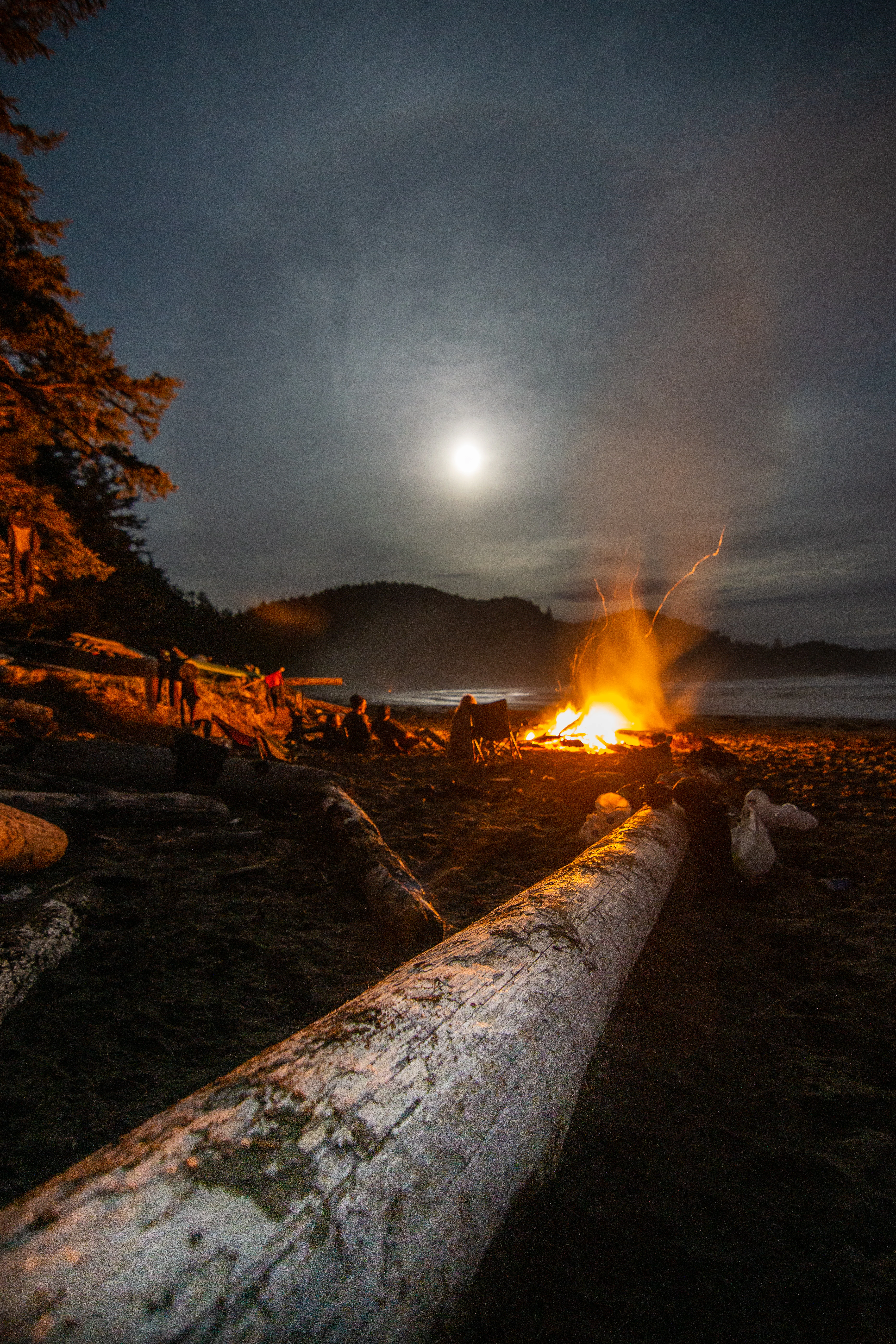
A night time scene at a beach showing a large campfire burning on the sand, with people sitting around it and a large piece of driftwood in the foreground under a moonlit sky.
A campfire illuminates the beach at Raft Cove under a bright moon.

Raft Cove Provincial Park history and protected-area timeline

Raft Cove Provincial Park was formally established in 1990, adding to British Columbia's network of protected coastal areas on Vancouver Island. Its designation as a provincial park reflected growing recognition of the ecological and wilderness value of the Nahwitti Lowland coastline, particularly its old-growth forests, estuary habitats, and remote beaches.

The park was created under the management of BC Parks, the agency responsible for provincial protected areas in British Columbia. From the outset, Raft Cove was framed less as a destination for high-volume visitation and more as a protective reserve for its natural coastal environment. Its subsequent history has been defined by this low-development approach, with access remaining difficult and facilities minimal, preserving the backcountry character that influenced its original protection.

Raft Cove Provincial Park landscape and geographic character

The landscape of Raft Cove Provincial Park is defined by its position on the exposed northwestern edge of Vancouver Island. The surrounding Nahwitti Lowland region is characterized by rounded, weathered hills, poorly drained interior terrain, and a deeply indented, rugged coastline. Within the park, these broader landform patterns are combined with a long gravel spit and a wide, crescent-shaped sandy beach that curves along the front of the cove.

A river estuary enters the cove where a creek meets the Pacific, creating a transition zone between freshwater outflow and marine shoreline. This estuary, surrounded by beach, driftwood, and forested margins, anchors the park's coastal geography. Above the beach, the terrain rises gently into forested slopes, with the heavy Pacific weather shaping both the vegetation and the shoreline. Sand, surf, headlands, and old forest together form the dominant visual identity of the park's landscape.

Raft Cove Provincial Park ecosystems, habitats, and plant life

Ecologically, Raft Cove sits within the temperate rainforest environment typical of British Columbia's outer coast. Mature western hemlock and western red cedar forests dominate the interior of the park, reflecting the wet, mild conditions that support some of the most productive coniferous forests on the Pacific coast. The presence of these species signals an old-growth or late-successional forest character in much of the protected area.

At the coast, the park's nature shifts toward estuarine and marine shoreline ecosystems. The river estuary introduces freshwater inflows, sediment deposition, and a productive riparian margin that contrasts with the dense conifer stands behind it. The long sand spit and crescent beach add a dynamic, wave-driven shoreline habitat where sand, gravel, and driftwood shape conditions for shore-based plants and invertebrates. Poorly drained lowland pockets across the park further diversify its habitat mosaic, providing additional ecological niches within a relatively compact area.

Raft Cove Provincial Park wildlife and species highlights

Wildlife is one of the most distinctive features of Raft Cove Provincial Park, particularly because of the way animals concentrate around the productive creek beds, estuary, and beach environments. The park supports a notable population of black bears, which are known to forage along the creek corridors and along the shoreline, taking advantage of the rich transition zones where land and water meet.

Beyond bears, the park's terrestrial wildlife includes wolves, cougars, black-tailed deer, raccoons, North American river otters, and red squirrels, reflecting the broader mammal community of the outer Vancouver Island coast. The combination of estuary, beach, forest, and stream environments also supports a variety of birdlife, ranging from forest-interior species associated with the hemlock and cedar stands to shorebirds and waterbirds that use the estuary and coastal margins. Together, these wildlife patterns reinforce Raft Cove's identity as a place where intact predator populations and intact coastal habitats coexist within a small protected footprint.

Raft Cove Provincial Park conservation status and protection priorities

Conservation value at Raft Cove centers on the protection of a representative slice of the Nahwitti Lowland coastal environment, including old-growth western hemlock and western red cedar forests, a functioning river estuary, and an intact outer-coast beach system. By safeguarding land and water together, the park preserves ecological processes that are increasingly rare along developed coastlines elsewhere in the region.

The park's importance is also tied to its role as a refuge for species that depend on the interface between forest, estuary, and shoreline. Black bears, wolves, cougars, and otters all rely on the complex of habitats that Raft Cove protects, and the continued low-impact management of the area helps maintain the predator-prey dynamics and habitat connectivity characteristic of the outer Vancouver Island coast. In this sense, Raft Cove serves as a small but ecologically meaningful contribution to provincial conservation networks in British Columbia.

Top sights and standout views in Raft Cove Provincial Park

Raft Cove's highlights cluster around its combination of wilderness isolation and ecological richness. The crescent-shaped sandy beach, the long protective spit, and the powerful surf create a coastal scene that feels both dramatic and unspoiled, while the surrounding western hemlock and western red cedar forests anchor the park in the classic coastal temperate rainforest identity of British Columbia.

Equally distinctive is the park's wildlife profile, especially the presence of black bears foraging along the creek beds and beach, alongside wolves, cougars, otters, and a diverse community of birds. Combined with its backcountry camping opportunities and emerging reputation among surfers, these qualities make Raft Cove a small but memorable example of Vancouver Island's outer-coast wilderness.

Best time to visit Raft Cove Provincial Park

The character of a visit to Raft Cove is closely tied to the Pacific coastal climate, where conditions remain wet and mild through much of the year. Summer and early autumn typically offer the most workable windows for backcountry travel, with longer daylight hours, drier forest trails, and generally calmer access conditions along the coastal approach to the park.

Surfers and adventurous hikers often gravitate toward periods when consistent Pacific swells reach the cove, while wildlife viewers may favor seasons when black bears and other mammals are active along salmon-bearing creeks and shoreline margins. Winter visits, while possible, are shaped by heavy rainfall, rough seas, and limited daylight, making the park a far more demanding destination outside the warmer months.
Monthly climate preview

Long-term representative monthly temperature and precipitation data for British Columbia

Raft Cove Provincial Park Climate Normals and Annual Weather Patterns

Raft Cove Provincial Park records measured annual temperature ranges alongside distinct monthly precipitation variations across twelve recorded intervals. Examining the complete twelve-month climatological profile provides structured long-term averages for comparative geographic analysis.
Annual mean9 °C
5 °C14 °C
Jan
Feb
Mar
Apr
May10°
Jun12°
Jul14°
Aug14°
Sep13°
Oct10°
Nov
Dec
Warmest month
August

14.4 °C

Coolest month
February

5.5 °C

Wettest month
November

9.7 mm/day

Driest month
July

2.2 mm/day

Park location guide

Geography guide, regional context, and park location map for Raft Cove Provincial Park

Raft Cove Provincial Park park geography, regions, and map view in Canada

Understand where Raft Cove Provincial Park sits in Canada through a broader geographic reading of the surrounding landscape, nearby location context, and its mapped position within the national park landscape.

How Raft Cove Provincial Park fits into Canada

Canada is a federal parliamentary constitutional monarchy spanning North America from the Atlantic to the Pacific and Arctic Oceans. With a population of over 41 million, it is officially bilingual in English and French at the federal level. The country gained independence from the United Kingdom through a gradual process culminating in 1982.

Wider geography shaping Raft Cove Provincial Park in Canada

Canada occupies the northern portion of North America, sharing its longest international border with the United States. The country extends from the Atlantic Ocean to the Pacific Ocean and northward into the Arctic Ocean, giving it the longest coastline of any nation.

Map view of Raft Cove Provincial Park

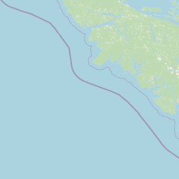
Use this park location map to pinpoint Raft Cove Provincial Park in Canada, understand its exact geographic position, and read its mapped placement within the surrounding landscape more clearly.

Pigeon | © OpenStreetMap contributors

Location context for Raft Cove Provincial Park

British Columbia

Visualizing the rugged terrain, old-growth forests, and protected shoreline of Vancouver Island

Raft Cove Provincial Park Photos and Coastal Scenery

Visual records capture the rugged terrain, stormy Pacific shores, and old-growth rainforests defining Raft Cove Provincial Park. Examining these protected environments reveals the remote coastal character and wildlife habitats of Vancouver Island.

A night time scene at a beach showing a large campfire burning on the sand, with people sitting around it and a large piece of driftwood in the foreground under a moonlit sky.

Park atlas

Compare adjacent Vancouver Island reserves and neighboring wilderness landscapes

Explore Protected Areas Near Raft Cove Provincial Park and Surrounding Coastal Terrain

Browsing other protected areas near Raft Cove Provincial Park reveals a broader network of wild coastal terrain and temperate rainforest habitats across Vancouver Island. Analyzing these adjacent locations helps visitors evaluate regional conservation patterns and find similar remote marine environments.
State or regional parkBritish Columbia
About 31 km away#1 closest

East

Quatsino Provincial Park: An Atlas Overview of Protected Coastal Lands in British Columbia

Mapping Old-Growth Rainforest and Sheltered Marine Estuaries

Quatsino Provincial Park offers a unique geographic profile, serving as a protected sanctuary for coastal temperate wildlife along the rugged northern edge of Vancouver Island. The area bridges marine, freshwater, and forest ecosystems, centering on the sheltered waters of Koprino Harbour and the surrounding ancient stands of old-growth trees. This atlas entry details the physical landscape, boundaries, and regional context of this isolated coastal haven.

Area
6.54 km²
Established
1995
IUCN
II
Relief
Lowland
Protected areaBritish Columbia
About 137 km away#2 closest

North

Hakai Lúxvbálís Conservancy: Protected Coastal Landscapes and Geography in British Columbia

Coastal wilderness, island terrain, and marine foreshore habitats

Spanning over 51,000 hectares of upland, Hakai Lúxvbálís Conservancy is defined by its connection between forested island ridges and the Pacific marine environment. This protected area on the British Columbia Central Coast offers a deep look into temperate rainforest geography and indigenous-led conservation frameworks that prioritize ecosystem integrity across island and sea.

Area
1,229.98 km²
Established
2008
IUCN
II
Relief
Lowland
Protected areaBritish Columbia
About 176 km away#3 closest

East

Forward Harbour/Yexeweyem Conservancy Protected Area Geography and Coastal Atlas

Coastal wilderness protected landscape on Vancouver Island.

Forward Harbour/Yexeweyem Conservancy preserves a distinct segment of British Columbia coastline. Featuring the Thynne Peninsula and sheltered sections of Bassborough Bay, this remote protected area emphasizes the preservation of marine inlets and salmon habitats within a traditional Indigenous landscape.

Area
3.06 km²
Established
2007
Access
Remote access
Scope
Terrestrial
Protected areaBritish Columbia
About 177 km away#4 closest

Southeast

Kiišḥniqʷus Conservancy: Coastal Wilderness and River Valley Geography in British Columbia

Protected coastal inlet and temperate rainforest terrain

Kiišḥniqʷus Conservancy protects a significant expanse of land between Sydney Inlet and Shelter Inlet on the outer coast of Vancouver Island. This area focuses on the Sydney River valley and the associated estuarine environments, forming a vital part of the regional wilderness corridor. The geography showcases the intersection of deep coastal fjords, dense coniferous forest, and historic cultural sites, providing an essential look at the natural and indigenous history of the region.

Area
110.12 km²
Established
2024
Scope
Terrestrial
Water
Major water bodies
Protected areaBritish Columbia
About 185 km away#5 closest

Southeast

Kʷuḥaa Conservancy: A Coastal Protected Area on Western Vancouver Island

Temperate rainforest, marine inlets, and cultural geography.

Kʷuḥaa Conservancy covers a rugged, forested stretch of the British Columbia coastline, focusing on the preservation of the Stewardson Inlet head. The area integrates coastal slopes with sheltered marine environments, providing a crucial addition to the regional network of protected lands. Explore the site's unique topographical features and its cultural significance within the Nuu-chah-nulth territory near Tofino.

Area
19.16 km²
Established
2024
Relief
Lowland
Climate
Temperate
Protected areaBritish Columbia
About 196 km away#6 closest

Southeast

Č̓icy̓i Conservancy: Protected Coastal Rainforest and Flores Island Geography

Coastal wilderness in the Alberni-Clayoquot region

Spanning over nine thousand hectares on Flores Island, Č̓icy̓i Conservancy preserves a substantial wilderness area characterized by dense coastal temperate rainforests, rocky headlands, and expansive intertidal zones. As a significant addition to the protected network of outer Vancouver Island, the area integrates diverse Pacific marine and forest ecosystems. The geography highlights the cultural and ecological continuity of the coastline.

Area
92.69 km²
Established
2024
Access
Access unknown
Scope
Terrestrial
Protected areaStrathcona Regional District
About 202 km away#7 closest

East

Phillips Estuary/ʔNacinuxʷ Conservancy: Geographic Mapping and Protected Area Context

Coastal river valley and estuarine conservation on Vancouver Island

Delve into the geography of the Phillips Estuary/ʔNacinuxʷ Conservancy, where riverine systems meet the marine coastline of the Strathcona Regional District. This protected area represents an essential transition zone, featuring forested uplands and tidal flats that form a continuous conservation landscape. Its mapping reveals the interconnected nature of the Phillips River valley, highlighting the ecological value of these protected lands for coastal researchers and geography enthusiasts.

Area
14.61 km²
Established
2007
IUCN
II
Protected areaStrathcona Regional District
About 212 km away#8 closest

East

Pałəmin/Estero Basin Conservancy: Geography and Protected Area Map of Northern Vancouver Island

Coastal forest and estuarine basin protected landscape

Located at the head of the Frederick Arm, Pałəmin/Estero Basin Conservancy offers a unique study in vertical coastal geography. Spanning from the tidal margins of the Estero Basin to the slopes near Egerton Peak, this protected area features a diverse landscape of temperate forests and sheltered marine inlets essential to the North Coast ecosystem.

Area
29.78 km²
Established
2007
IUCN
II
Relief
Mountain

Common questions about visiting, size, designation, and location context for Raft Cove Provincial Park

Raft Cove Provincial Park FAQs for park facts, access, geography, and protected area context

Find quick answers about Raft Cove Provincial Park, including protected-area facts, park geography, trail and visitor context, and how the park fits into its surrounding country and regional landscape.
MoriAtlas Explorer

Continue Your Protected Areas Search Across the Global Atlas

Deepen your exploration by continuing the structured search for national parks and protected areas worldwide. Utilize the comprehensive filtering capabilities to compare different conservation landscapes and refine your understanding of global park geography. Discover more about the distribution and characteristics of protected natural areas.

Global natural geography