Mori Atlas logo
Marine protected areaReserva marina Galera San Francisco

Understanding the coastal interface, marine topography, and regional geography of this protected reserve

Reserva marina Galera San Francisco: A Comprehensive Geographic Profile of the Marine Protected Area

Reserva marina Galera San Francisco encompasses a critical continuum between the rocky shoreline of Esmeraldas and the deep Pacific oceanic waters. This protected area integrates diverse geological features such as coastal cliffs, sandy pocket beaches, and mangrove-lined estuaries that link land and sea. Through detailed map-based discovery, examine the depth gradients, coral formations, and submarine environments that define this expansive marine conservation landscape along Ecuador's northern coast.

marine reservecoastal cliffsPacific coasttropical climatemangrove estuariescoral ecosystems

Reserva marina Galera San Francisco

Marine protected area

Park overview

Structured park overview, official facts, and landscape profile for Galera San Francisco Marine Reserve

Galera San Francisco Marine Reserve park facts, protected area profile, and essential visitor context

Review the core facts for Galera San Francisco Marine Reserve, including designation, size, terrain, visitor scale, habitats, and operating context in one park-focused overview.

About Galera San Francisco Marine Reserve

The Galera San Francisco Marine Reserve is a coastal and marine protected area in northwestern Ecuador, established to preserve the integrity of ecosystems that connect land and sea along the Pacific coast of Esmeraldas Province. Its location between the Atacames inlet and Mompiche places it within a region historically defined by fishing livelihoods and emerging tourism, where pressure on marine resources had grown over time. By creating the reserve, the country set out to protect the ecological backbone of those activities rather than exclude human presence outright, and the area is therefore classified under IUCN Category VI as a protected area with sustainable use of natural resources.

The reserve is overwhelmingly marine in extent. The small terrestrial component includes a stretch of cliffs, beaches, and estuarine mouths that form a thin but ecologically meaningful interface with the ocean. From the shoreline outward, the protected ocean covers a wide depth gradient, from shallow waters along the first nautical mile to deep zones offshore where depths exceed 200 meters. Coral formations and rocky seabeds punctuate this transition, and the waters are influenced by major equatorial current systems, including the North and South Equatorial Currents and the eastward-flowing Cromwell Current, which together shape the oceanographic character of the region.

On land, the reserve's cliffs constitute the dominant geomorphological feature, accounting for over half of the terrestrial surface, while the remainder is composed of sandy beaches, dissected plateaus, fault zones, and steep slopes. The beaches of Quingue, Caimito, El Progreso, Tongorachi, and San Francisco are particularly important because they host nesting activity for several species of sea turtles. At the same time, the estuaries of the Galera waterway and the San Francisco and Bunche rivers support mangrove ecosystems that thrive in the brackish conditions where freshwater meets saltwater.

Ecologically, the reserve integrates three main ecosystem types: marine environments including coral zones, coastal environments dominated by cliffs and beaches, and estuarine environments at the mouths of rivers and tidal channels. This combination makes the reserve a transitional conservation area, where nearshore productivity, coastal geomorphology, and open-ocean processes are protected together. Its climate is warm and humid, with average temperatures around 25 degrees Celsius, high rainfall distributed across most of the year, and ocean temperatures that fluctuate seasonally between roughly 26 and 27 degrees Celsius. Together, these conditions sustain the biological productivity that the reserve was designed to safeguard.

Quick facts and research context for Galera San Francisco Marine Reserve

The Galera San Francisco Marine Reserve lies in Esmeraldas Province on Ecuador's northwestern Pacific coast, between the Atacames inlet and Mompiche. It belongs to IUCN Category VI (Protected Area with Sustainable Use of Natural Resources) and protects roughly 54,500 hectares of ocean along with about 120 hectares of land, making it predominantly a marine reserve. Its boundaries reach from near the mouth of the Zapatillo estuary in the north to the Manglares Estuario del Río Muisne wildlife refuge in the south, extending seaward toward Punta Tortuga.

The reserve encompasses cliffs, beaches, mangrove-fringed estuaries, nearshore rocky areas, coral zones, and open ocean influenced by equatorial current systems such as the Cromwell Current.

Protection and recognition

Documented marine protection scope, management framework, and recognized status

Reserva marina Galera San Francisco Protection Status and Designation Records

Marine protection status records for Reserva marina Galera San Francisco outline the documented marine conservation scope and management framework. Structured designation facts provide clear context on official protection parameters and recognized conservation boundaries.

Protection details

Protection scope
Marine
Transboundary protection
No
Park context

Deeper park guide and search-rich context for Galera San Francisco Marine Reserve

Galera San Francisco Marine Reserve history, landscape, wildlife, and travel context

Explore Galera San Francisco Marine Reserve through its history, landscape character, ecosystems, wildlife, conservation priorities, cultural context, and seasonal travel timing in a structured park guide built for atlas discovery and search intent.

Why Galera San Francisco Marine Reserve stands out

Galera San Francisco is best known for its continuous coastal-marine interface along Ecuador's Esmeraldas coast, where high cliffs, pocket beaches, small estuaries, and mangrove fringes meet Pacific waters shaped by equatorial currents. The reserve protects a broad swath of ocean that includes coral zones, rocky seabed, and depths transitioning from shallow waters to more than 200 meters offshore, making it a single protected unit that integrates the shoreline with the marine environment. It is also recognized for hosting important sea turtle nesting habitat along its beaches and for safeguarding mangrove-supported estuaries at the mouths of the Galera, San Francisco, and Bunche waterways, where marine and coastal ecosystems converge.

Galera San Francisco Marine Reserve history and protected-area timeline

The process that led to the creation of the Galera San Francisco Marine Reserve began in 2002, when local actors grew concerned about the progressive decline of fisheries and the deteriorating state of coastal and marine environments in the area. In the following years, discussions and analyses were carried out to identify the central elements requiring attention, including conservation targets, existing conflicts, and management models for the area. These processes engaged a range of local, regional, and national stakeholders.

The discussions recognized that fishing and tourism were the main economic activities of the zone, and that without proper management they could damage the area's biodiversity. The reserve was formally created on 31 October 2008 through Interministerial Agreement No. 162, with publication in the Official Registry on 24 March 2009. The designation reflects an approach that aims to protect ecosystems while allowing regulated sustainable use of resources in line with its Category VI status.

Galera San Francisco Marine Reserve landscape and geographic character

The terrestrial part of the Galera San Francisco Marine Reserve is defined above all by cliffs that run along the entire coast and represent roughly half of the protected land area. The remainder of the surface includes beaches found at Quingue, Caimito, El Progreso, Tongorachi, and San Francisco, together with dissected plateaus, fault features, and steep slopes. This combination produces a rugged coastal fringe where cliffs drop toward the ocean and pocket beaches form at intervals along the shoreline.

Geologically, the area is dominated by the Tablazo formation, which extends across the northwestern portion of the reserve, and by additional formations including Onzole, Borbón, marine deposits, and colluvial-alluvial materials found throughout the central and southeastern zones. Soils reflect these geologies, with sandstone, clay, and silt substrates forming much of the land. Several small tidal channels and estuaries cross this coastal landscape, emptying into the Pacific at points such as Zapatillo, Malpello, Pachoche, Galera, de Piedras, Cumuliche, Galeritas, and Agua Fría.

Galera San Francisco Marine Reserve ecosystems, habitats, and plant life

The reserve is organized around three core ecosystems that together capture the transition from open ocean to land. The marine ecosystem includes coral zones and rocky substrates distributed at various depths along and offshore from the coast. The coastal ecosystem is characterized by cliffs and multiple beach types, providing both physical structure and nesting habitat for marine species. The estuarine ecosystem occurs where small rivers and tidal channels meet the sea, particularly at the mouths of the Galera waterway and the San Francisco and Bunche rivers.

These systems are sustained by a tropical humid climate with abundant rainfall distributed across most months of the year and consistently warm temperatures. The oceanographic environment is shaped by equatorial current systems, including the Cromwell Current, which together influence nutrient dynamics, water temperatures, and the distribution of marine habitats across the reserve's depth gradient from shallow nearshore waters to depths greater than 200 meters.

Galera San Francisco Marine Reserve wildlife and species highlights

The Galera San Francisco Marine Reserve supports wildlife patterns typical of the tropical Eastern Pacific, where marine and coastal species are closely linked to the shoreline-beach-ocean continuum. The reserve's beaches serve as nesting habitat for several species of sea turtles, making the coastal strip a focal point for reproductive activity in the broader protected zone. Estuarine mouths support mangrove-based communities that anchor estuarine food webs and provide shelter for juvenile fish and crustaceans.

Offshore, the combination of coral areas, rocky substrates, and a range of depths creates habitat heterogeneity that supports diverse reef-associated and pelagic species. The movement of equatorial currents through the reserve influences the distribution and productivity of marine life across the protected ocean area.

Galera San Francisco Marine Reserve conservation status and protection priorities

The reserve's conservation significance lies in its integration of marine, coastal, and estuarine ecosystems within a single protected framework, an arrangement that recognizes the ecological interdependence of these systems along Ecuador's northwestern coast. Its IUCN Category VI status reflects an approach centered on the sustainable use of natural resources, allowing regulated fishing and tourism while safeguarding ecosystem functions.

The protection of coral zones, sea turtle nesting beaches, and mangrove estuaries gives the reserve value for biodiversity conservation at a regional scale. Its role in maintaining fish stocks and the overall productivity of coastal waters also underpins the long-term viability of local fisheries, linking conservation goals directly to the livelihoods that depend on the area.

Galera San Francisco Marine Reserve cultural meaning and human context

The reserve is embedded in a coastal region of Esmeraldas Province where fishing and tourism have long been the principal economic activities. Its creation was driven by local actors who recognized the cultural and economic importance of marine resources and the risks that unregulated pressure on those resources posed to community life. The reserve's management model reflects this relationship by allowing regulated traditional uses of the sea and coast under a sustainable-use framework.

Top sights and standout views in Galera San Francisco Marine Reserve

A predominantly marine protected area along Ecuador's Esmeraldas coast, integrating cliffs, sandy beaches, mangrove estuaries, coral zones, and offshore waters into one continuous conservation system. Notable for its sea turtle nesting beaches and for protecting estuarine ecosystems at the mouths of small Pacific rivers and tidal channels. The reserve's value lies in linking terrestrial coastal features with a wide depth gradient of ocean habitat under a sustainable-use model.

Best time to visit Galera San Francisco Marine Reserve

The reserve has a tropical humid climate with warm temperatures of around 25 degrees Celsius and rainfall across most months of the year. Ocean water temperatures are warmest from April to June, when averages exceed 27 degrees Celsius, and slightly cooler from October to January, when averages are around 26 degrees Celsius. Coastal conditions remain generally favorable throughout the year, although rainfall patterns and seasonal ocean temperatures can influence visibility, sea conditions, and the experience of the shoreline and offshore environment.
Monthly climate preview

Long-term temperature and precipitation records measured across representative coordinate points

Reserva marina Galera San Francisco Climate Normals and Annual Temperature Rhythms

Representative coordinate data reveals sustained monthly temperature patterns alongside measurable shifts in daily precipitation averages throughout the year. Examining the full twelve-month profile provides complete context for long-term climatic conditions across this protected marine area.
Annual mean25 °C
25 °C26 °C
Jan25°
Feb26°
Mar26°
Apr26°
May26°
Jun25°
Jul25°
Aug25°
Sep25°
Oct25°
Nov25°
Dec25°
Warmest month
April

25.8 °C

Coolest month
November

24.9 °C

Wettest month
February

5.6 mm/day

Driest month
August

0.7 mm/day

Park location guide

Geography guide, regional context, and park location map for Galera San Francisco Marine Reserve

Galera San Francisco Marine Reserve park geography, regions, and map view in Ecuador

Understand where Galera San Francisco Marine Reserve sits in Ecuador through a broader geographic reading of the surrounding landscape, nearby location context, and its mapped position within the national park landscape.

How Galera San Francisco Marine Reserve fits into Ecuador

Ecuador is a presidential republic located in northwestern South America, with Quito as its capital and Guayaquil as its largest city. The country spans 283,561 km² and encompasses the Galápagos Islands, a volcanic archipelago famous for unique wildlife that helped shape Darwin's theory of evolution. Ecuador is a plurinational state with Spanish as the official language, though Kichwa and Shuar are recognized for indigenous peoples.

Wider geography shaping Galera San Francisco Marine Reserve in Ecuador

Ecuador is located in northwestern South America along the Pacific coast. It shares borders with Colombia to the north and Peru to the east and south. The country includes the Galápagos Islands, a volcanic archipelago in the Pacific Ocean approximately 1,000 km west of the mainland. The territory encompasses diverse terrain including the Amazon rainforest in the east, the Andean highlands in the center, and coastal plains along the Pacific.

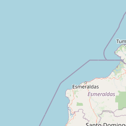
Map view of Galera San Francisco Marine Reserve

Use this park location map to pinpoint Galera San Francisco Marine Reserve in Ecuador, understand its exact geographic position, and read its mapped placement within the surrounding landscape more clearly.

Pigeon | © OpenStreetMap contributors

Location context for Galera San Francisco Marine Reserve

Esmeraldas
Park atlas

Compare adjacent marine reserves and regional conservation areas along the Pacific coast

Parks Near Reserva marina Galera San Francisco and Protected Coastal Landscapes

Browse other protected areas and coastal reserves situated near Reserva marina Galera San Francisco along the Pacific coast. Regional park comparison reveals broader ecological patterns across neighboring marine and terrestrial habitats.
Nature reserveEsmeraldas
About 30 km away#1 closest

Southeast

Reserva Ecológica Mache-Chindul: Coastal Mountain and Tropical Forest Protected Geography

Mapping the biodiversity of Esmeraldas provincial wilderness

Spanning over 119,000 hectares, Reserva Ecológica Mache-Chindul stands as a primary ecological shield against landscape degradation in coastal Ecuador. This site preserves rare mature forest mosaics, from dense Chocó lowland rainforest to misty high-altitude ridges. Gain geographic insight into this vital wilderness area through its distinct watershed basins and protected forest corridors.

Area
1,191.72 km²
Established
1996
IUCN
Ia
Relief
Mountain
Wildlife reserveEsmeraldas
About 44 km away#2 closest

South

Refugio de Vida Silvestre Manglares Estuario Río Muisne Coastal Wildlife Reserve

Esmeraldas, Ecuador protected estuarine landscape

Discover the complex geography of Refugio de Vida Silvestre Manglares Estuario Río Muisne, a vital wildlife refuge protecting all six native mangrove species. This area spans a rich transition of marine and brackish waters, tidal flats, and forest stands that define the northwestern Pacific coastline of Ecuador.

Area
922.46 km²
Established
2003
Relief
Lowland
Access
Access unknown
Nature reserveEsmeraldas
About 131 km away#3 closest

Northeast

Reserva ecológica Manglares Cayapas-Mataje: Mapped Coastal Wetland and Protected Landscape

A vast estuarine and mangrove refuge in the Esmeraldas province of Ecuador.

The Reserva ecológica Manglares Cayapas-Mataje spans over 49,000 hectares of diverse coastal terrain, including tidal estuaries, guandales, and tropical lowland forests. As a Ramsar-recognized wetland, this reserve preserves critical connectivity between riverine basins and the Pacific Ocean, acting as a vital geographic anchor for Chocó endemic species and complex aquatic habitats within the Esmeraldas region.

Area
490.71 km²
Established
1995
Relief
Lowland
Climate
Tropical
A horizontal watercolor painting showing layers of rolling green hills, a pink-toned foreground meadow, and distant hazy mountain ridgelines against a light background.
National parkImbabura
About 131 km away#4 closest

East

Cotacachi Cayapas National Park: A Study of Andean and Chocó Protected Geographic Landscapes

Exploring the extreme vertical transition across the northern Ecuadorian Andes

Cotacachi Cayapas National Park stands as a vital protected area, linking high-altitude páramo around Volcán Cotacachi to the lowland forests of the Chocó. The park features the iconic Laguna de Cuicocha and a dramatic range of ecosystems that define its complex terrain. This resource offers a clear look at the park's boundaries, geological features, and the distinct ecological zones that make it a central pillar of northern Ecuadorian geography.

Area
2,609.61 km²
Established
1968
IUCN
II
Visitors
50.2K annual
A wide watercolor illustration showing a misty landscape with green trees in the midground and faint mountain peaks in the background.
Nature reserveEcuador
About 182 km away#5 closest

Southeast

Reserva Ecológica Los Illinizas: Geographic Atlas and Andean Protected Nature Reserve

Volcanic terrain and cloud forest ecosystems in central Ecuador

Spanning across the provinces of Cotopaxi, Pichincha, and Santo Domingo de los Tsáchilas, Reserva Ecológica Los Illinizas preserves a significant vertical gradient of Andean ecosystems. The reserve protects the western flanks of the Illiniza volcanoes, Quilotoa, and El Corazón, offering a detailed look at high-altitude biodiversity and the transition from rugged mountain peaks to lush western cloud forests.

Area
1,342.33 km²
Established
1996
IUCN
Ia
Relief
Mountain
Watercolor illustration showing a panoramic view of a wide valley with green hills, a small stream, and forested clusters, rendered in a light and airy style.
Nature reservePichincha
About 202 km away#6 closest

Southeast

Reserva Geobotánica Pululahua: Protected Volcanic Caldera and Highland Ecosystems

A distinct geobotanical reserve in the Pichincha region of the Ecuadorian Andes.

Reserva Geobotánica Pululahua is a protected natural area centered on a massive, 12-kilometer-wide volcanic caldera. Its landscape features three prominent lava domes and a rare altitudinal gradient of vegetation, spanning from semi-dry mountain shrubland to dense cloud forest. This reserve serves as a critical study of volcanic geology and human-landscape interaction in the high Andes, offering a concentrated look at Ecuador's vertical ecological zonation.

Area
34.417 km²
Established
1966
Relief
Mountain
Climate
Subtropical
Wildlife reserveManabí
About 220 km away#7 closest

Southwest

Refugio de Vida Silvestre Marino Costera Pacoche: Geography and Protected Area Atlas

Coastal and forest protected landscapes in Manabí, Ecuador

Examine the unique geographic structure of Refugio de Vida Silvestre Marino Costera Pacoche, a protected reserve bridging the Tumbesian dry forest and the Pacific Ocean. This atlas entry focuses on the park's coastal cliffs, sediment-rich marine zones, and forest ridges, providing a clear visual and descriptive record of this ecologically significant Manabí sanctuary.

Established
2008
IUCN
V
Visitors
3.2K annual
Relief
Mixed relief
A pale, minimalist watercolor painting showing a wide, grassy field leading to distant, low mountain hills under a bright, light sky.
Wildlife reservePichincha
About 226 km away#8 closest

Southeast

Refugio de Vida Silvestre Pasochoa: Volcanic Crater and Andean Forest Protected Area

Geographic atlas of the Pichincha volcanic highlands

Located in the Pichincha province, Refugio de Vida Silvestre Pasochoa protects an essential highland habitat defined by its steep volcanic crater walls and dense bamboo stands. This area provides a scientific reference for inter-Andean vegetation, featuring a sharp contrast between forested inner slopes and surrounding agricultural landscapes. Map the ecological gradient of this protected refuge and explore its role within the broader northern Andean geographic context.

Area
9.799 km²
Established
1996
IUCN
Ib
Relief
Mountain

Common questions about visiting, size, designation, and location context for Galera San Francisco Marine Reserve

Galera San Francisco Marine Reserve FAQs for park facts, access, geography, and protected area context

Find quick answers about Galera San Francisco Marine Reserve, including protected-area facts, park geography, trail and visitor context, and how the park fits into its surrounding country and regional landscape.
MoriAtlas Explorer

Continue Your Protected Areas Search Across the Global Atlas

Deepen your exploration by continuing the structured search for national parks and protected areas worldwide. Utilize the comprehensive filtering capabilities to compare different conservation landscapes and refine your understanding of global park geography. Discover more about the distribution and characteristics of protected natural areas.

Global natural geography