
Mori Atlas logo
Protected landscapePřírodní park Říčanka

Mapping the rural corridor, fishpond systems, and ecological terrain of this protected Czech natural area.

Přírodní park Říčanka: Analyzing the Protected Landscape and Regional Geography of Prague

Přírodní park Říčanka functions as a significant elongated protected corridor stretching along the eastern fringe of Prague. This atlas entry examines its complex mosaic of fields, deciduous forests, and a historic chain of fishponds centered on the Říčanský potok stream. By maintaining a rural character through managed woodlands and valley lowlands, the area provides essential geographic context for understanding nature preservation within a major European capital.

natural parkPragueCzech Republicfishpondsrural landscapelowland stream
A flat-style digital illustration depicting a mountain valley, with jagged peaks and two waterfalls feeding into a river that flows through a forest of simplified trees.

Přírodní park Říčanka

Protected landscape

Park overview

Structured park overview, official facts, and landscape profile for Říčanka Nature Park

Říčanka Nature Park park facts, protected area profile, and essential visitor context

Review the core facts for Říčanka Nature Park, including designation, size, terrain, visitor scale, habitats, and operating context in one park-focused overview.

About Říčanka Nature Park

Říčanka Nature Park occupies a long, narrow stretch of eastern Prague that has resisted the suburbanization typical of the city's edges. Far from being remote, it sits immediately beyond the dense built-up districts of Prague's east, between the neighborhoods of Běchovice, Dubeč, and Uhříněves. The protected area traces the valley of the Říčanský potok, a small watercourse that gives the park its name and structurally organizes its landscape.

The park's character is defined by continuity with traditional Czech rural land use. Intact patches of forest alternate with meadows, fields, orchards, and ponds, so that the protected area reads as a cultural landscape rather than a strictly natural reserve. Several protected natural monuments lie within or adjacent to it, including the Uhříněves game reserve, the Rohožník quarry site in Dubeč, and the Lítožnice natural monument, adding smaller, more strictly protected ecological hotspots to the broader park.

What makes Říčanka distinctive within the Czech system of protected areas is its scale and location. Praha 10 governs the territory, yet the surrounding cadastral areas still bear the imprint of pre-20th-century rural land organization. The park includes the Panská zahrada estate area in Dubeč, as well as the relatively young Robotka forest, planted in 2016, which illustrates how the protected area continues to evolve. Memorial trees dot the landscape, including groups of oaks at the Uhříněves obora entrance, the boundary oak along the Uhříněves–Netluky path, oaks near the Podleský rybník dam, and an ash tree near St. Peter's Church in Dubeč.

For visitors, residents, and ecologists, Říčanka serves as a green wedge between urban Prague and the countryside beyond it, demonstrating that a capital city's edge can still support a coherent mosaic of farmland, woodland, water, and historic estates.

Quick facts and research context for Říčanka Nature Park

Říčanka Nature Park is a Czech "přírodní park" designation, a category of protected landscape used in the country for areas of regional ecological and aesthetic importance. It lies within the administrative territory of Prague, specifically in the Praha 10 district, around the cadastral areas of Dubeč and Uhříněves.

Established in 1984, it is coeval with the Botič–Milíčov Nature Park, making it among the oldest natural parks within the city of Prague. Across more than 400 hectares, the park preserves a working agricultural mosaic rather than a single wilderness block, integrating fields, forests, meadows, and fishponds into a continuous landscape.

Protection and recognition

Examine the documented protection framework and territorial recognition records.

Přírodní park Říčanka Protection Status and Terrestrial Conservation Scope

Přírodní park Říčanka maintains a defined terrestrial protection scope within its regional landscape boundary. Structured conservation records detail the administrative framework and official designation history associated with the protected area.

Protection details

Protection scope
Terrestrial
Transboundary protection
No
Park context

Deeper park guide and search-rich context for Říčanka Nature Park

Říčanka Nature Park history, landscape, wildlife, and travel context

Explore Říčanka Nature Park through its history, landscape character, ecosystems, wildlife, conservation priorities, cultural context, and seasonal travel timing in a structured park guide built for atlas discovery and search intent.

Why Říčanka Nature Park stands out

Říčanka Nature Park is best known for preserving a rural, pre-urban landscape on the edge of a major European capital. Its defining features are the Říčanský potok stream and the historic fishpond system along its course, particularly Podleský rybník, which remains the second-largest fishpond in Prague. The park is also distinguished by the inclusion of the Uhříněves game reserve (obora), with its old oaks, and by the small, ecologically important localities such as Lítožnice, which provides nesting habitat for marshland and woodland birds like the marsh harrier, sparrowhawk, and great crested grebe.
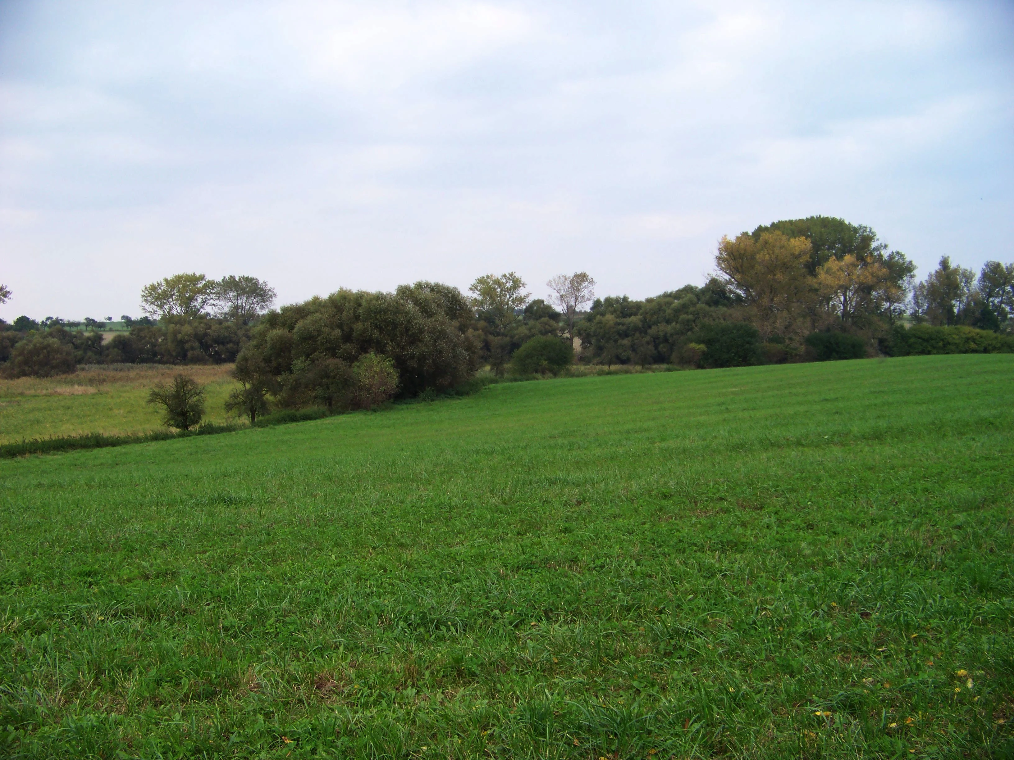
A wide view of a vibrant green pasture sloping gently in the foreground with a dense line of trees and bushes in the midground under a cloudy sky.
A rural landscape featuring green meadows and scattered deciduous trees near Netluky.

Říčanka Nature Park history and protected-area timeline

The territory of today's Říčanka Nature Park is a patchwork of zones with distinct histories, only formally brought together under a single protected designation in 1984.

At the southern end of the park lies the Uhříněves game reserve (obora). The first written reference to it dates from 1623, when its owner was Karel of Liechtenstein. The Liechtenstein family effectively administered the game reserve until 1945, anchoring centuries of aristocratic landscape management in this part of the corridor.

The Dubeč–Uhříněves area was already an extensive system of fishponds before the Thirty Years' War. Eighteenth-century maps still show a large pond basin in the upper Říčanský potok catchment. During the second half of the 19th century, most ponds around Dubeč were drained to make way for agriculture, leaving only Podleský rybník as a surviving fishpond. Lands belonging to the manor farm in Dubeč were used as arable fields and meadows, and an orchard survives to this day on the northeastern side of Podleský rybník.

The park and its immediate surroundings also contain historical and archaeological points of interest. Ceramic finds at Rohožník attest to ancient settlement, while the remains of a Renaissance-era fortress (tvrz) survive in Dubeč. Near the Uhříněves obora, a Jewish cemetery is protected as a cultural monument, layering cultural-historical value onto the park's natural significance.

Říčanka Nature Park landscape and geographic character

Geographically, Říčanka Nature Park is an elongated, irregular ribbon of protected countryside roughly one kilometer wide and about five kilometers long, running north to south along the eastern margin of Prague. Its shape is dictated by the valley of the Říčanský potok, which threads from Běchovice through Dubeč toward Uhříněves.

The terrain combines gentle valley lowlands around the stream and fishponds with slightly higher ground supporting field systems, meadows, and small woodland patches. The abandoned quarries at Rohožník expose the geological history of sedimentation in this part of the Prague Basin, providing a small-scale geological dimension to an otherwise soft agricultural landscape.

The visual character of the park is one of the Czech countryside at the edge of a city: a patchwork of arable fields, meadows, orchards, deciduous woodland, and a network of still waters. The park's largest water feature, Podleský rybník, anchors the central landscape, while the V Rohožníku pond and the three Lítožnice ponds create a chain of smaller, ecologically rich water bodies along the stream corridor.

Říčanka Nature Park ecosystems, habitats, and plant life

Ecologically, Říčanka Nature Park functions as a mosaic habitat rather than a single ecosystem. Its combination of variously aged deciduous woodlands, meadows, fields, orchards, ponds, and stream corridors supports a wide range of plants and animals. The Uhříněves game reserve (obora) is botanically notable, hosting old oak stands and other tree species of memorial value.

The park's water features are central to its ecological identity. The chain of fishponds and stretches of the Říčanský potok provides habitats for aquatic and wetland species, while the reedbeds and adjacent meadows around the Lítožnice ponds in particular function as important bird habitats. The transition zones between water, wet meadow, dry meadow, and woodland increase the diversity of niches within the relatively narrow corridor.

Memorial trees scattered through the park, including groups of oaks at the obora entrance, a boundary oak along the Uhříněves–Netluky path, oaks near the Podleský rybník dam, and an ash near the church in Dubeč, also serve as living evidence of the long-standing woodland character of parts of the protected area.

Říčanka Nature Park wildlife and species highlights

Wildlife attention in Říčanka Nature Park centers on its birdlife, particularly in the Lítožnice area, which is recognized as ornithologically significant. Nesting populations have been documented there for species such as the marsh harrier, the Eurasian sparrowhawk, and the great crested grebe, illustrating the importance of the pond and reed-edge habitats for both raptors and waterbirds.

The mosaic of woodland, water, and meadow also provides habitat for typical central European lowland species, supporting small game in the obora and a broader community of passerines, waterfowl, and woodland birds throughout the park. Although no large mammal fauna dominates the area, the continuity of habitat along the stream corridor makes the park a functioning ecological pathway within heavily urbanized Prague.

Říčanka Nature Park conservation status and protection priorities

Říčanka Nature Park's principal conservation value lies in maintaining a coherent rural landscape at the edge of a large capital city. By protecting more than 400 hectares of fields, meadows, woods, and ponds under the Czech "přírodní park" designation, the park safeguards a functioning mosaic of habitats that would otherwise be vulnerable to suburban sprawl from eastern Prague.

The layered protection system strengthens the park's conservation role: within the broader natural park, individual localities such as the Uhříněves obora, the Rohožník quarry, and Lítožnice are designated as smaller natural monuments, applying stricter protection to ecologically sensitive spots. The survival of Podleský rybník, the second-largest fishpond in Prague, is itself a distinctive conservation outcome, preserving a hydrological and ecological feature that was largely lost elsewhere in the surrounding landscape during 19th-century drainage.

The continuing management activities, including afforestation efforts such as the 2016 establishment of the Robotka forest, show that the park is treated not just as a static reserve but as a working landscape where habitat creation and restoration remain active priorities.

Říčanka Nature Park cultural meaning and human context

Although primarily valued for its natural character, Říčanka Nature Park carries substantial cultural and historical depth. The Uhříněves game reserve documents more than four centuries of aristocratic landscape management under the Liechtenstein family, from 1623 until 1945, embedding the park's southern end in the broader history of Czech noble estates.

Visible reminders of older settlement patterns persist: ceramic finds at Rohožník point to ancient habitation in the area, and the ruins of a Renaissance fortress (tvrz) in Dubeč anchor the local built heritage. The Jewish cemetery near the Uhříněves obora is itself a protected cultural monument, recognizing the multi-layered human history of this eastern Prague corridor. Together with surviving farm buildings, orchards, and field patterns, these elements frame the park as a protected cultural landscape as much as a natural one.

Top sights and standout views in Říčanka Nature Park

Among the strongest points of distinction at Říčanka Nature Park are the Říčanský potok corridor and its surviving fishpond system, particularly Podleský rybník, the second-largest fishpond in Prague. The mosaic of fields, meadows, woodlands, and ponds gives the protected area a coherent rural identity within the city.

The park also stands out for its nested protection structure, with the Uhříněves obora, the Rohožník quarry, and the Lítožnice natural monument raising the conservation profile of specific sites inside the broader park. Memorial oaks and other ancient trees, along with the relatively new Robotka forest planted in 2016, highlight both the age and the active management of the woodland here.

Best time to visit Říčanka Nature Park

Říčanka Nature Park rewards visits year-round, but its character shifts notably with the seasons. Spring and early summer are particularly strong for experiencing the meadows, ponds, and nesting birdlife around Lítožnice, when waterfowl, the marsh harrier, and other species are active around the reedbeds and wet meadow edges.

Late spring and early summer also showcase flowering meadows and the full green character of the fields and woodlands. Autumn brings harvest activity in the surrounding fields and rich color in the deciduous trees, especially the oaks of the Uhříněves obora and along the Podleský rybník dam. Winter visits emphasize the park's structural landscape, with bare trees revealing the valley system of the Říčanský potok and the historic field patterns that survive beneath the agricultural use.

Monthly climate preview

Measured monthly temperature ranges and precipitation averages from NASA POWER data

Přírodní park Říčanka Climate Normals and Long Term Temperature Patterns

Representative coordinate records show average monthly temperatures swinging from subzero winter minimums to warm summer maximums alongside consistent daily precipitation rates. Examining the full twelve month profile reveals detailed long term meteorological rhythms across the protected landscape.
Annual mean9 °C
-2 °C20 °C
Jan-2°
Feb-1°
Mar
Apr
May13°
Jun17°
Jul20°
Aug19°
Sep14°
Oct
Nov
Dec-1°
Warmest month
July

19.7 °C

Coolest month
January

-2.2 °C

Wettest month
June

2.6 mm/day

Driest month
February

1.1 mm/day

Park location guide

Geography guide, regional context, and park location map for Říčanka Nature Park

Říčanka Nature Park park geography, regions, and map view in Czechia

Understand where Říčanka Nature Park sits in Czechia through a broader geographic reading of the surrounding landscape, nearby location context, and its mapped position within the national park landscape.

How Říčanka Nature Park fits into Czechia

Czech Republic is a landlocked Central European country with a population of approximately 10.9 million people. The nation was established as an independent state on January 1, 1993, following the dissolution of Czechoslovakia. Its capital and largest city is Prague, with other major urban centers including Brno, Ostrava, Plzeň, and Liberec.

Wider geography shaping Říčanka Nature Park in Czechia

The Czech Republic is a landlocked country in Central Europe. It is bordered by Germany to the west, Austria to the south, Poland to the northeast, and Slovakia to the southeast. The landscape is predominantly hilly, with the territory covering 78,871 square kilometers.

Map view of Říčanka Nature Park

Use this park location map to pinpoint Říčanka Nature Park in Czechia, understand its exact geographic position, and read its mapped placement within the surrounding landscape more clearly.

Pigeon | © OpenStreetMap contributors

Location context for Říčanka Nature Park

Prague

Visual exploration of rural terrain, valley streams, and protected fishpond habitats

Přírodní park Říčanka Photos and Landscape Scenery

Visual records reveal the distinctive agricultural mosaic, lowland stream corridors, and historic fishponds that define the protected landscape of Přírodní park Říčanka. Examining field photographs and habitat views helps visitors understand the terrain variations and ecological character spanning the eastern edge of Prague.

A wide view of a vibrant green pasture sloping gently in the foreground with a dense line of trees and bushes in the midground under a cloudy sky.

Park atlas

Compare regional landscapes, valley streams, and protected natural corridors

Explore Parks Near Přírodní park Říčanka and Surrounding Protected Areas

Visitors exploring Přírodní park Říčanka can continue browsing adjacent protected areas and nearby lowland stream corridors. Comparing surrounding regional landscapes reveals broader patterns in regional park geography and local conservation networks.
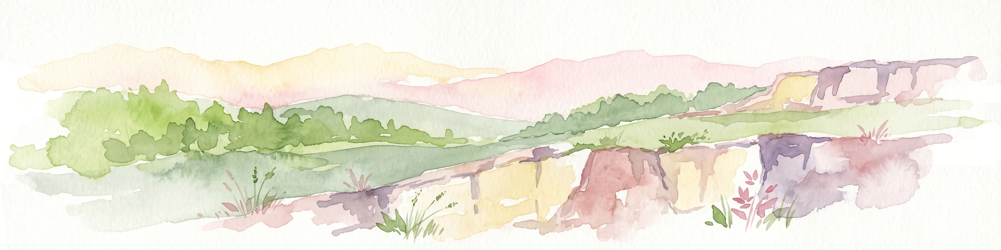
A watercolor painting showing a panoramic landscape with a rocky quarry ledge in the foreground, green hills in the midground, and soft, pastel colored rolling hills in the background.
Natural monumentPrague
About 1.3 km away#1 closest

West

Rohožník, lom v Dubči: Geological Natural Monument and Protected Landscape in Prague

Analyzing the Ordovician quartzite and tectonic rock exposures of the Prague Plateau

Rohožník, lom v Dubči serves as a crucial natural monument in the Prague region, protecting abandoned quarries that showcase clear M-shaped tectonic folds and thick quartzite deposits. This site acts as a living laboratory for geological history, connecting archaeological finds with dry grassland communities in an otherwise suburban-agricultural landscape on the edge of the capital.

Area
0.034 km²
Established
1988
IUCN
III
Relief
Upland
A soft watercolor painting of a winding stream moving through green meadows with distant rolling hills and a light, misty atmosphere.
Natural monumentPrague
About 5.1 km away#2 closest

West

Meandry Botiče Natural Monument: Mapped Geography and Protected Stream Landscapes in Prague

Analyzing the ecological boundaries and riparian terrain of the Botič stream corridor

Meandry Botiče represents a significant natural monument in Prague, distinguished by its pronounced stream meanders and dense bankside vegetation. This site offers deep insights into urban conservation, documenting the delicate balance between native riparian flora and the pressures of encroaching residential districts within a managed protected environment.

Area
0.067 km²
Established
1968
IUCN
III
Relief
Lowland
A pale, soft-toned watercolor painting of a rolling landscape featuring a stream in the foreground, scattered trees in the midground, and faint mountains in the distant background.
Protected landscapePraha
About 5.7 km away#3 closest

Southwest

Přírodní park Botič-Milíčov: Protected Landscape, River Valley, and Forest Map

A preserved green refuge featuring meandering streams and pond networks near Praha.

Přírodní park Botič-Milíčov stands as a significant protected landscape in Praha, defined by the seasonal flooding of the Botič and Pitkovický streams. The park hosts alluvial forests, a series of historic ponds, and archaeological traces of ancient mills. Through map-based exploration, identify the diverse terrain that includes rocky outcrops at Pitkovická stráň and extensive broadleaf woodlands on the edge of urban housing developments.

Area
8.24 km²
Established
1984
Relief
Lowland
Climate
Temperate
A soft, minimalist watercolor painting showing a green treeline against a pale pink and white background, suggestive of wetlands or ponds.
Natural monumentPrague
About 5.9 km away#4 closest

Southwest

Milíčovský les a rybníky: Protected Landscape and Wetland Map in Prague, Czech Republic

Natural monument geography and forest-wetland habitat atlas

Milíčovský les a rybníky represents a core natural monument in southern Prague, featuring a mature deciduous forest integrated with a managed system of ponds. This protected area serves as a critical refuge for rare wetland and woodland species. Use the mapping tools to trace the terrain, from the dense oak-hornbeam canopy to the extensive reedbeds and aquatic environments that define this unique urban-edge landscape.

Area
1.047 km²
Established
1991
IUCN
III
Relief
Upland
A soft watercolor painting of a green landscape featuring a small body of water, rolling hills, and trees, painted in a minimalist style on a white background.
Protected landscapePrague
About 6.8 km away#5 closest

West

Hostivař-Záběhlice Nature Park: Protected Landscape and Mapped Prague Geography

River valleys and reservoir terrain within the capital city.

Hostivař-Záběhlice Nature Park represents a vital natural zone in Prague, characterized by the mature forests and meandering river paths along the Botič stream. This record highlights the park's geographic composition, including its reservoirs, lowland forest patches, and its function as a preserved natural corridor within the city.

Area
4.23 km²
Established
1990
Relief
Lowland
Climate
Temperate
A watercolor illustration depicting a panoramic landscape with a golden meadow in the foreground and soft green hills in the distance.
Protected landscapeStředočeský kraj
About 7.3 km away#6 closest

East

Přírodní park Škvorecká obora, Králičina: Protected Landscape and Regional Geography

Natural terrain and historic forest near the Prague boundary

Přírodní park Škvorecká obora, Králičina preserves a layered cultural and natural landscape characterized by the Výmola stream floodplain. The area functions as a vital forest habitat on the eastern edge of the Prague Plateau, integrating rare botanical sites with historical remnants of a centuries-old game enclosure.

Established
2009
Relief
Lowland
Climate
Temperate
Access
Easy access
Nature reservePrague
About 12 km away#7 closest

Southwest

V hrobech Nature Reserve: A Protected Botanical Island within the Urban Landscape of Prague

Rare dry-grassland habitats in the Kamýk district

V hrobech is a designated nature reserve in Prague featuring 1.3 hectares of southeast-facing slopes and species-rich grassland. This site is home to rare thermophilic plants and represents an important example of intensive conservation management in an urban environment. Its protected boundaries connect with local forest fragments to maintain ecological value amidst the residential developments of Lhotka and Libuš.

Area
0.013 km²
Established
1988
IUCN
IV
Relief
Lowland
Nature reservePraha 5
About 14 km away#8 closest

West

Prokopské údolí Nature Reserve: Geological Mapping and Protected Area Discovery

A limestone karst landscape situated within the Praha 5 district

Prokopské údolí is an essential protected nature reserve in Praha 5, featuring a deep limestone valley that serves as a globally significant site for Paleozoic fossils and karst geography. This protected landscape encompasses a range of habitats including rock steppes, thermophilic woodlands, and volcanic outcrops, providing a unique look at urban-adjacent nature conservation and historical limestone quarrying within the Czech Republic.

Area
1.71 km²
Established
1978
IUCN
III
Relief
Upland

Common questions about visiting, size, designation, and location context for Říčanka Nature Park

Říčanka Nature Park FAQs for park facts, access, geography, and protected area context

Find quick answers about Říčanka Nature Park, including protected-area facts, park geography, trail and visitor context, and how the park fits into its surrounding country and regional landscape.
MoriAtlas Explorer

Continue Your Protected Areas Search Across the Global Atlas

Deepen your exploration by continuing the structured search for national parks and protected areas worldwide. Utilize the comprehensive filtering capabilities to compare different conservation landscapes and refine your understanding of global park geography. Discover more about the distribution and characteristics of protected natural areas.

Global natural geography