
Mori Atlas logo
Protected landscapeSan Isabel National Forest

A vast protected area encompassing the Sawatch Range, Collegiate Peaks, and Sangre de Cristo summits.

San Isabel National Forest: Mapping the High Country and Protected Mountain Landscapes of Colorado

San Isabel National Forest stands as a primary protected landscape in central Colorado, defined by its extraordinary elevation and topographic variety within the Southern Rocky Mountains. This expansive region supports nineteen peaks rising above 14,000 feet, including Mount Elbert, alongside deep glacial valleys and alpine tundra environments. Through its network of seven designated wilderness areas, the forest preserves critical watersheds and diverse mountain ecosystems, ranging from piñon-juniper foothills to high-altitude rocky summits.

national forestRocky Mountainsfourteenersalpine wildernessSawatch RangeSangre de Cristo Range
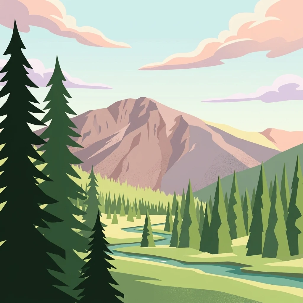
An illustration of a large mountain peak in the background, a forest of evergreen trees in the midground, and a small river flowing through a green meadow in the foreground.

San Isabel National Forest

Protected landscape

Park overview

Structured park overview, official facts, and landscape profile for San Isabel National Forest

San Isabel National Forest park facts, protected area profile, and essential visitor context

Review the core facts for San Isabel National Forest, including designation, size, terrain, visitor scale, habitats, and operating context in one park-focused overview.

About San Isabel National Forest

San Isabel National Forest occupies a central place in both Colorado's geography and its outdoor recreation culture. Located in the heart of the state, the forest includes major portions of three of the most recognizable mountain ranges in the southern Rockies: the Sawatch Range, home to many of the highest fourteeners; the Sangre de Cristo Range, a long and rugged southern escarpment; and the Collegiate Peaks area, named for the cluster of mountains named after prominent universities. These mountains define the forest's identity, creating a landscape of jagged alpine ridges, glacial cirques, forested valleys, and high meadows.

The forest encompasses an enormous area of land that crosses county, watershed, and ecological boundaries. Its terrain ranges from montane foothills along the Arkansas and South Platte drainages to true alpine environments above thirteen thousand feet. Much of this landscape is protected as designated wilderness, with seven official wilderness areas falling within its boundaries, and several more extending into adjoining national forests. This creates a near-continuous belt of protected high country running through the heart of the forest.

Administratively, the forest is part of the Pike and San Isabel National Forests combined management unit, which also includes the Cimarron and Comanche National Grasslands. Ranger district offices in Cañon City, Leadville, and Salida provide local management, while the combined forest headquarters sits in Pueblo. Management plans balance a wide range of uses, including hiking, camping, hunting, fishing, horseback riding, skiing, grazing, logging, and watershed protection. San Isabel's location near major population centers and several interstate corridors means its trails, campgrounds, and scenic byways see intensive use throughout the year.

For visitors and researchers alike, the forest is significant not only for its scenery but also for its ecological value. Its high peaks feed major river systems, its forests shelter wildlife ranging from elk to mountain goats, and its wilderness areas preserve some of the most complete stretches of alpine environment left in the southern Rockies. Together, these qualities give San Isabel National Forest a stature well beyond its status as a single administrative unit.

Quick facts and research context for San Isabel National Forest

San Isabel National Forest is a federally protected national forest in central Colorado, managed by the U.S. Forest Service as part of the combined Pike and San Isabel National Forests administrative unit. The forest spans eleven counties and covers a broad landscape of mountain ranges, forests, and high alpine terrain. Its defining geographic feature is its concentration of fourteeners, the highest of which is Mount Elbert, Colorado's tallest peak. The forest hosts seven official wilderness areas within the National Wilderness Preservation System and is a major hub for hiking, climbing, and mountain recreation in the southern and central Rockies.

Protection and recognition

Documented terrestrial protection scope and conservation status facts

San Isabel National Forest Protection Status and International Recognition

San Isabel National Forest maintains a documented terrestrial protection scope within its regional landscape. Comprehensive protected area designation details and international recognition records outline the formal administrative framework governing this terrain.

Protection details

Protection scope
Terrestrial
Transboundary protection
No
Park context

Deeper park guide and search-rich context for San Isabel National Forest

San Isabel National Forest history, landscape, wildlife, and travel context

Explore San Isabel National Forest through its history, landscape character, ecosystems, wildlife, conservation priorities, cultural context, and seasonal travel timing in a structured park guide built for atlas discovery and search intent.

Why San Isabel National Forest stands out

San Isabel National Forest is best known for its extraordinary concentration of high-altitude peaks, including nineteen fourteeners and the highest summit in the Rocky Mountains. The forest's mountain terrain spans the Sawatch Range, the Collegiate Peaks, and the Sangre de Cristo Range, giving it a level of vertical relief and topographic variety that few other national forests match. Equally distinctive is the forest's wilderness character. Seven designated wilderness areas protect major portions of these mountains, including the Collegiate Peaks Wilderness, one of the most heavily used alpine wilderness areas in the country, and the Sangre de Cristo Wilderness, which extends into neighboring national park land. Together, these features make San Isabel a defining landscape of Colorado's high country.
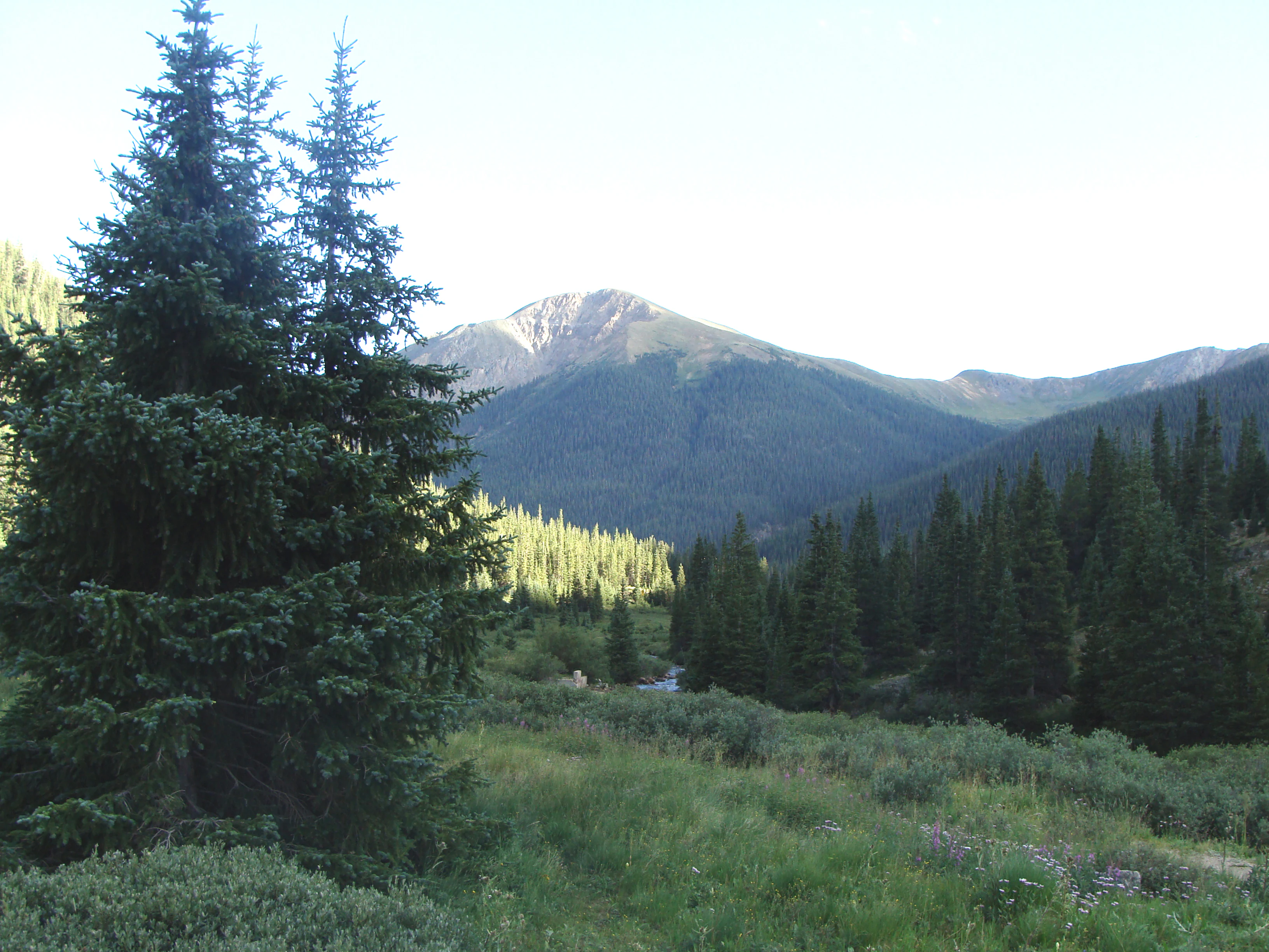
A wide view of a forest valley in the foreground with a tall mountain peak in the distance under a bright sky.
A scenic view of the Sawatch Range within San Isabel National Forest.

San Isabel National Forest history and protected-area timeline

San Isabel National Forest was established on April 11, 1902, in the early years of the U.S. Forest Service's expansion across the American West. Its creation reflected the growing federal recognition that the mountainous forests of central Colorado played an essential role in protecting watersheds, supplying timber, and supporting the agricultural and ranching economy of the surrounding valleys. The forest's early management was oriented around these practical uses, with grazing, logging, and water conservation as central priorities.

Over the course of the twentieth century, San Isabel's role expanded significantly as outdoor recreation grew in importance. The rise of automobile travel, highway infrastructure, and Front Range population centers transformed the forest into a major recreation destination, with trails, campgrounds, ski areas, and scenic roads drawing visitors from across Colorado and beyond. Iconic high-country destinations within the forest, including Mount Elbert and the Collegiate Peaks, became focal points for hiking, climbing, and wilderness exploration.

The modern identity of the forest has also been shaped by a series of administrative and conservation milestones. San Isabel was brought into a combined management unit with Pike National Forest and the Cimarron and Comanche National Grasslands, which together share leadership and infrastructure. Seven wilderness areas have been formally designated within the forest, securing long-term protection for major portions of its alpine environment. Today, the forest stands both as a working landscape and as a centerpiece of Colorado's outdoor heritage.

San Isabel National Forest landscape and geographic character

San Isabel National Forest is defined above all by its mountains. The forest holds large segments of the Sawatch Range, the backbone of central Colorado and home to many of the state's highest peaks, including Mount Elbert. The Sawatch are wide, broad-shouldered mountains with deep glacial valleys, and they give the forest much of its high-alpine character. Together with the Sawatch, the Collegiate Peaks add dramatically steep, pointed summits that are among the most visually striking in the southern Rockies.

To the south and east, the Sangre de Cristo Range contributes an entirely different kind of mountain terrain. Long, narrow, and rugged, the Sangre de Cristo rise abruptly from the surrounding plains and valleys, with sharp ridgelines, deep cirques, and dramatic vertical relief. Large portions of this range fall within designated wilderness, preserving some of the wildest and least developed terrain in the forest. The Spanish Peaks, two prominent volcanic summits in the southern part of the forest, add a distinctive geological signature and are themselves protected as a wilderness area.

Between these ranges lie extensive forests of spruce, fir, pine, and aspen, interspersed with open meadows, beaver ponds, mountain lakes, and glacial moraines. Lower elevations give way to piñon-juniper woodlands and grassy foothills, while the highest slopes transition into alpine tundra, bare rock, and permanent snow. This diversity of terrain creates a landscape of extraordinary variety, where travelers can move from dry southern foothills to high alpine summits within a single national forest.

San Isabel National Forest ecosystems, habitats, and plant life

The ecological character of San Isabel National Forest reflects its dramatic elevation range. Lower elevations support stands of ponderosa pine, piñon, juniper, and Gambel oak, gradually giving way to mixed conifer forests at middle elevations. Higher slopes are dominated by Engelmann spruce, subalpine fir, and lodgepole pine, while aspen groves add seasonal color and ecological diversity across multiple elevation zones. At the very top of the forest's range, vegetation gives way to alpine tundra, krummholz, and exposed rock.

The forest's watersheds are among its most ecologically significant features. Snowmelt from the Sawatch and Sangre de Cristo ranges feeds major rivers, including the Arkansas, creating downstream ecological and agricultural value far beyond the forest's boundaries. Wet meadows, willow thickets, beaver ponds, and high mountain lakes provide habitat for a wide range of birds, mammals, and aquatic species, and they create wet microhabitats that contrast with the surrounding dry slopes.

Large contiguous blocks of wild habitat are preserved within the forest's seven wilderness areas, which help maintain ecological processes across a significant portion of the landscape. This protected network, combined with the varied topography, supports a level of biological diversity uncommon in managed mountain forests. Different wilderness areas represent different ecological templates, from the Collegiate Peaks' high alpine environment to the Sangre de Cristo's rugged southern slopes.

San Isabel National Forest wildlife and species highlights

Wildlife in San Isabel National Forest is shaped by the same elevation gradients and habitat diversity that define the rest of the landscape. Large mammals including elk, mule deer, bighorn sheep, and moose are found across many parts of the forest, with bighorn sheep especially associated with the rugged Sangre de Cristo Wilderness and the Spanish Peaks. Black bears inhabit the forested middle elevations, while mountain lions and, more rarely, lynx move through the more remote terrain. Mountain goats are found in several of the high alpine zones, particularly among the most rugged peaks.

Birdlife is equally diverse. The forest supports breeding populations of raptors such as golden eagles and peregrine falcons, both of which nest on high cliffs and crags. More broadly, the range of elevations and habitats creates niches for everything from mountain bluebirds and Clark's nutcrackers in alpine zones to warblers, woodpeckers, and nuthatches in the coniferous forests. Wet meadows and beaver-created wetlands support additional bird diversity, including waterfowl and shorebirds during migration.

Aquatic life is supported by the forest's many streams, lakes, and high alpine wetlands, which sustain populations of trout and other cold-water fish. These aquatic habitats depend heavily on the watershed protection provided by surrounding forest and wilderness lands, making the forest's ecological connectivity an important factor in sustaining fish populations. Together, these wildlife patterns make San Isabel one of the more notable wildlife habitats in the central Rockies.

San Isabel National Forest conservation status and protection priorities

San Isabel National Forest plays a significant role in conservation across the southern Rocky Mountains, both through its wilderness system and through the broader landscape values it protects. Its seven designated wilderness areas collectively preserve hundreds of thousands of acres of high-alpine and subalpine wilderness, conserving core habitat for species such as bighorn sheep, mountain goats, and raptors while also safeguarding water quality and ecological processes.

The forest's importance extends well beyond its boundaries. Because much of central and southern Colorado's water supply originates in the high country managed by San Isabel, the forest contributes directly to downstream water quality, agricultural water availability, and ecological function. Watershed protection is therefore a central element of conservation management, alongside habitat preservation for wildlife and the protection of scenic and recreational resources.

The forest also benefits from being part of a wider conservation network. Its wilderness areas connect ecologically with neighboring national forests, national park land at Great Sand Dunes National Park, and even with U.S. Fish and Wildlife Service holdings. Together, these linked landscapes form one of the more significant blocks of protected mountain habitat in the southern Rockies, providing resilience, connectivity, and long-term ecological security across a substantial portion of Colorado's high country.

San Isabel National Forest cultural meaning and human context

The lands that make up San Isabel National Forest have a long human history that predates federal forest designation. Indigenous peoples inhabited the mountain valleys and high passes of central Colorado for thousands of years, with cultural and seasonal use patterns tied closely to the elevation, water, and wildlife resources that the forest still protects. Later, Hispanic and Anglo-American settlement, ranching, and mining brought new layers of cultural presence, especially in the valleys near Leadville, Salida, and the upper Arkansas River corridor.

Mining heritage is especially visible in parts of the forest and its surroundings. Historic mining districts left a legacy of trails, abandoned structures, and place names that remain part of the forest's cultural landscape. Railways that once served ore shipments, such as routes that crossed the mountains near Poncha and La Veta Passes, are remembered today in the form of recreational routes and scenic byways.

Recreation culture also defines the modern context of the forest. San Isabel is a major destination for hikers chasing fourteeners, families camping along its reservoirs and rivers, hunters pursuing elk and deer in the surrounding forests, and anglers fishing its high mountain streams. This combination of historic and contemporary uses gives the forest a layered identity that reflects both its natural and its human dimensions.

Top sights and standout views in San Isabel National Forest

San Isabel National Forest stands out for its exceptional concentration of Colorado's highest peaks, including Mount Elbert, the highest point in the Rocky Mountains. Its wilderness system is another defining feature, with the Collegiate Peaks, Sangre de Cristo, Mount Massive, and Spanish Peaks wilderness areas together protecting a remarkable range of alpine and subalpine environments. The forest's mix of dramatic ranges, deep glacial valleys, and broad forests gives it a topographic richness that few other national forests in the region can match.

Equally important is the forest's accessibility and recreational reach. Combined management with neighboring Pike National Forest and the Cimarron and Comanche National Grasslands connects the high country to a wider network of public lands, while nearby towns, scenic byways, and long-distance trails make the forest a centerpiece of outdoor life in central Colorado.

Best time to visit San Isabel National Forest

San Isabel National Forest offers distinctly different seasonal experiences. Summer is the most popular time to visit, as most alpine trails, high passes, and fourteeners become accessible once the snow melts. Wildflower displays in mid to late summer and long daylight hours make this season especially appealing for hiking and mountaineering, though afternoon thunderstorms are common.

Fall brings cooler weather, fewer crowds, and vibrant aspen colors across the mid-elevation forests, with the Sangre de Cristo and Sawatch ranges offering some of the most celebrated autumn scenery in Colorado. Winter transforms the forest into a snow-covered landscape suited to cross-country skiing, snowshoeing, and snowmobiling, while spring remains a transitional period when lower elevations begin to green up and high-country roads are often still closed. Each season emphasizes a different dimension of the forest's character.
Monthly climate preview

Long-term representative temperature and precipitation patterns across twelve recorded months

San Isabel National Forest Climate Normals and Annual Weather by Month

San Isabel National Forest exhibits a measured annual temperature and precipitation rhythm derived from long-term representative coordinate sampling between 1991 and 2020. Examining the complete monthly climate profile reveals detailed temperature bounds and precipitation averages across the protected landscape.
Annual mean9 °C
-2 °C22 °C
Jan-2°
Feb
Mar
Apr
May13°
Jun20°
Jul22°
Aug21°
Sep16°
Oct
Nov
Dec-2°
Warmest month
July

22 °C

Coolest month
December

-1.8 °C

Wettest month
July

2.1 mm/day

Driest month
January

0.5 mm/day

Park location guide

Geography guide, regional context, and park location map for San Isabel National Forest

San Isabel National Forest park geography, regions, and map view in United States of America

Understand where San Isabel National Forest sits in United States of America through a broader geographic reading of the surrounding landscape, nearby location context, and its mapped position within the national park landscape.

How San Isabel National Forest fits into United States of America

The United States of America is a federal presidential republic and one of the world's largest countries by area and population. It consists of 50 states across a vast territory spanning multiple time zones, with its capital in Washington, D.C. and largest city in New York City. The nation has a diverse economy, influential political system, and significant cultural and military presence globally.

Wider geography shaping San Isabel National Forest in United States of America

The United States occupies a vast territory in North America, bordered by Canada to the north and Mexico to the south. The 48 contiguous states stretch from the Atlantic to the Pacific Ocean, while Alaska occupies the northwestern region and Hawaii is an archipelago in the Pacific. The country encompasses diverse terrain including the Rocky Mountains, Appalachian Mountains, Great Plains, and extensive river systems.

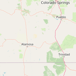
Map view of San Isabel National Forest

Use this park location map to pinpoint San Isabel National Forest in United States of America, understand its exact geographic position, and read its mapped placement within the surrounding landscape more clearly.

Pigeon | © OpenStreetMap contributors

Location context for San Isabel National Forest

Colorado
Recorded earthquake history

Review Historical Earthquake Data for San Isabel National Forest

Examine the historical record of seismic activity associated with the high peaks and alpine terrain of San Isabel National Forest. This dedicated collection organizes event data to support geographic exploration of regional seismic history as captured by geological monitoring sources.

San Isabel National Forest Earthquake History

Catalogued events

203 events

Strongest magnitude

Magnitude 5.3

Most recent event

Jul 27, 2026

This history includes earthquakes recorded inside the park or within 50 km of its borders

Visual reference of alpine terrain, glacial valleys, and protected wilderness

San Isabel National Forest Photos and Mountain Landscape Scenery

Visual records capture the rugged topography and high-altitude habitats defining San Isabel National Forest across central Colorado. Photographic archives reveal the distinct geological character of the Sawatch Range, the Sangre de Cristo summits, and surrounding protected environments.

A wide view of a forest valley in the foreground with a tall mountain peak in the distance under a bright sky.

Park atlas

Compare adjacent protected landscapes and mountain ranges across central Colorado

Exploring Parks Near San Isabel National Forest and Surrounding Mountain Regions

Browse nearby national forests and protected areas that share the high alpine terrain of the Rocky Mountains. Comparing adjacent wildlands reveals the broader geographic spread of regional peaks, glacial valleys, and connected wilderness ecosystems.
Wildlife reserveColorado
Park boundaries overlap#1 closest

Northwest

Holy Cross Wilderness: Mapped Alpine Landscapes and Colorado Protected Areas

Glacial valleys and high-country geography in the Sawatch Range

Discover the geographic layout of the Holy Cross Wilderness, a vital protected area in central Colorado. This resource details the rugged Sawatch Range environment, from high alpine lake basins to the iconic northern couloirs of its namesake mountain, offering a clear view of the park boundaries and surrounding high-country terrain.

Area
496.94 km²
Established
1980
IUCN
Ib
Relief
Mountain
A horizontal watercolor painting showing layers of pale green and soft pink mountain ridges behind a foreground of simple green and purple evergreen tree shapes.
Wildlife reserveColorado
Park boundaries overlap#2 closest

Northwest

Mount Massive Wilderness: A Protected Alpine Landscape in the Colorado Sawatch Range

High-altitude wilderness geography and Continental Divide terrain.

Mount Massive Wilderness represents a critical protected landscape in the central Colorado Rockies, encompassing glacially carved valleys, alpine tundra, and the second-highest peak in the state. This wilderness area provides a window into the rugged vertical relief and subalpine ecosystems that define the high-altitude geography surrounding Leadville, anchored by the iconic Sawatch Range and Continental Divide.

Area
123.6 km²
Established
1980
IUCN
Ib
Relief
Mountain
A soft watercolor illustration depicting a simplified, layered landscape of rolling hills and distant mountains in shades of light green, pale yellow, and soft pink.
Protected areaColorado
Park boundaries overlap#3 closest

North

Pike National Forest: Protected Mountain Landscapes and Regional Geography in Central Colorado

Granite peaks, montane forests, and diverse alpine terrain

Spanning from the rolling foothills of the Front Range to the high alpine summits of the Rocky Mountains, Pike National Forest is a significant protected area defined by its unique Pikes Peak granite bedrock and deep river-carved canyons. This analysis provides a structured look at its expansive wilderness boundaries, drainage basins, and the vertical transitions that characterize this vital central Colorado highland.

Area
4,478.27 km²
Established
1892
Relief
Mountain
Climate
Alpine
Watercolor painting of soft, layered mountain ranges behind green hills and patches of evergreen trees on a white background.
Protected landscapeColorado
Park boundaries overlap#4 closest

West

Rio Grande National Forest: Atlas and Geographic Profile of a Southern Colorado Landscape

Watershed geography and Continental Divide terrain analysis.

Rio Grande National Forest represents an immense protected landscape encompassing diverse terrain from high desert steppe to rugged alpine peaks. This profile details the forest's hydrological significance as the source of the Rio Grande and its role as a massive ecological transition zone in the Mountain West. Examine the boundaries and mountain geography that define this critical protected area.

Area
7,500 km²
Established
1908
Relief
Mountain
Climate
Boreal
National parkColorado
About 4.2 km away#5 closest

Southwest

Great Sand Dunes National Park and Preserve: Colorado's Unique Mapped Landscape

Explore the natural terrain and protected boundaries.

Great Sand Dunes National Park and Preserve offers a unique protected landscape within Colorado, characterized by its distinct natural terrain and extensive dune fields. This destination provides valuable context for atlas exploration, detailing the park's mapped boundaries and its specific geographic setting. Understand its significance as a protected area and appreciate the unique natural features that define its landscape for a richer geographic discovery.

Area
603.1 km²
Established
2004
IUCN
V
Visitors
432.5K annual
A soft watercolor painting of a mountain landscape with rolling green hills in the foreground and layered, pale purple peaks in the distance.
Wildlife reservePitkin County
About 6.9 km away#6 closest

Northwest

Hunter-Fryingpan Wilderness: Mapped Protected Geography in the Central Rocky Mountains

High-altitude wilderness area in Pitkin County, Colorado

Hunter-Fryingpan Wilderness encompasses approximately 82,000 acres of rugged terrain near the continental divide. This protected area acts as a headwaters sanctuary for the Fryingpan River and Hunter Creek, defined by its steep granite ridges, subalpine meadows, and clusters of pristine alpine lakes. Understanding its geography reveals the stark, glaciated character of the central Colorado Rockies.

Area
331.95 km²
Established
1978
IUCN
Ib
Relief
Mountain
Wildlife reserveColorado
14 km away#7 closest

Northwest

Eagles Nest Wilderness: Alpine Geography and Protected Landscape of the Colorado Gore Range

High-mountain protected area in the White River National Forest

Spanning the southern Gore Range, Eagles Nest Wilderness represents a core protected landscape in Colorado characterized by high-elevation peaks, glacial cirque lakes, and extensive backcountry trail networks. Its geography bridges the gap between deep coniferous forests and exposed alpine tundra, maintaining significant ecological and historical value within the mountainous terrain of Eagle and Summit Counties.

Area
546.79 km²
Established
1976
IUCN
Ib
Relief
Mountain
A wide watercolor illustration depicting a gentle landscape with green hills, scattered trees, and a pale sky with pink and purple hues.
Wildlife reserveGunnison County
About 16 km away#8 closest

Northwest

Fossil Ridge Wilderness: Mapped Geography and Protected Landscapes in Gunnison County

High-altitude ridges, Paleozoic geology, and alpine wilderness character.

Fossil Ridge Wilderness sits as a compact but geographically rich protected area within the Gunnison National Forest. This site offers an detailed look at high-elevation Rocky Mountain terrain, characterized by exposed carbonate rock, deep drainage corridors, and dramatic vertical relief that serves as essential habitat for bighorn sheep and mountain goats.

Area
56.62 km²
Established
1993
IUCN
Ib
Relief
Mountain

Common questions about visiting, size, designation, and location context for San Isabel National Forest

San Isabel National Forest FAQs for park facts, access, geography, and protected area context

Find quick answers about San Isabel National Forest, including protected-area facts, park geography, trail and visitor context, and how the park fits into its surrounding country and regional landscape.
MoriAtlas Explorer

Continue Your Protected Areas Search Across the Global Atlas

Deepen your exploration by continuing the structured search for national parks and protected areas worldwide. Utilize the comprehensive filtering capabilities to compare different conservation landscapes and refine your understanding of global park geography. Discover more about the distribution and characteristics of protected natural areas.

Global natural geography