
Mori Atlas logo
Protected landscapeSawtooth National Forest

Tracing the alpine terrain, glacial basins, and vast wilderness boundaries of central Idaho

Sawtooth National Forest: A Comprehensive Map of Idaho Protected Mountain Landscapes

Sawtooth National Forest spans two million acres of diverse mountainous terrain across central Idaho, anchoring the heart of the northern Rocky Mountains. This vast protected landscape encompasses the Sawtooth National Recreation Area and multiple wilderness complexes, offering a clear window into regional geography ranging from sagebrush steppe to high-alpine tundra. By examining its mapped glacial lakes, river headwaters, and serrated ridgelines, users gain a deeper understanding of the ecological and structural character defining this significant American wilderness area.

national forestRocky Mountainsmountainswilderness areasalpine lakesglacial lakes
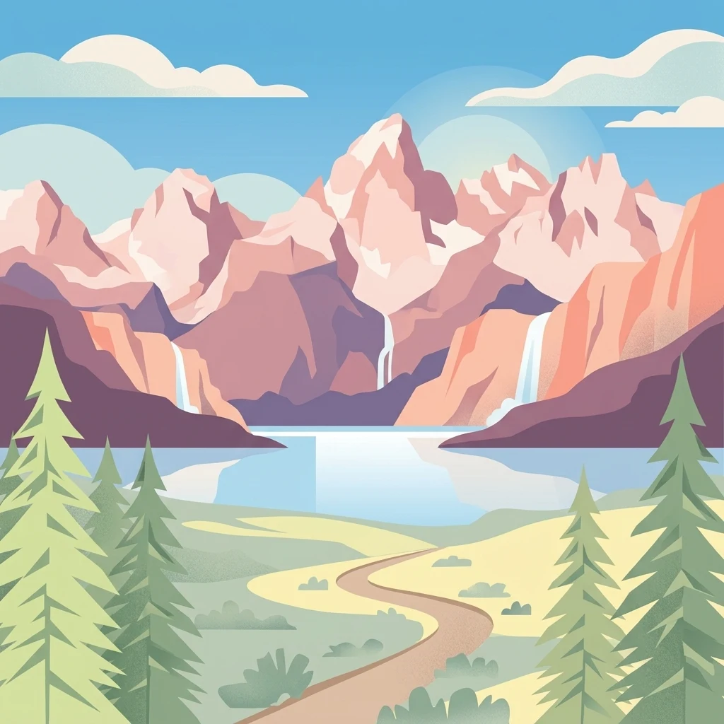
Vector illustration depicting tall, jagged mountains under a clear sky, with waterfalls cascading into a central lake and a dirt path winding through pine trees in the foreground.

Sawtooth National Forest

Protected landscape

Park overview

Structured park overview, official facts, and landscape profile for Sawtooth National Forest

Sawtooth National Forest park facts, protected area profile, and essential visitor context

Review the core facts for Sawtooth National Forest, including designation, size, terrain, visitor scale, habitats, and operating context in one park-focused overview.

About Sawtooth National Forest

Sawtooth National Forest is one of the largest and most ecologically diverse national forests in the Rocky Mountain West. It spans a broad swath of central and south-central Idaho, plus a smaller piece of northwestern Utah, and it captures both the northern Rocky Mountains and a southern extension into the Basin and Range Province. The result is a sweeping patchwork of mountain ranges, including the Sawtooth, White Cloud, Boulder, Pioneer, Smoky, Soldier, Boise, Albion, Black Pine, Raft River, and Sublett ranges.

The forest was created by the proclamation of President Theodore Roosevelt in 1905 as the Sawtooth Forest Reserve, and it became part of the new U.S. Forest Service after the Transfer Act of 1905. Over the course of the twentieth century it absorbed and shed neighboring reserves, was reshaped by mining and grazing politics, and gradually accumulated a layered set of protection designations. In 1972, Congress established the Sawtooth National Recreation Area within its boundaries, providing a framework that keeps traditional uses such as grazing, hunting, and recreation alongside stronger protections for scenery and ecology.

Sawtooth National Forest is also a conservation landscape of national significance. The Sawtooth Wilderness, originally protected as a Primitive Area in 1937 and designated under the Wilderness Act in 1972, was joined in 2015 by the Hemingway–Boulders, Jim McClure–Jerry Peak, and Cecil D. Andrus–White Clouds wilderness areas. Combined, these wilderness zones preserve more than a quarter-million acres of roadless country and harbor some of the cleanest air in the contiguous United States. The forest is also critical to wildlife, hosting large mammal populations, reintroduced wolves, rare endemic plants, and the headwater streams that sustain Idaho's salmon runs.

For visitors, the forest blends wilderness solitude with accessible adventure. It contains four ski areas, hundreds of miles of hiking and mountain biking trails, popular climbing peaks like Thompson Peak and Hyndman Peak, and scenic byways that wind through the Sawtooth Valley. Communities such as Stanley, Ketchum, and Sun Valley frame the forest's edges and supply the gateways through which most people experience this exceptional landscape.

Quick facts and research context for Sawtooth National Forest

Sawtooth National Forest is managed by the U.S. Forest Service and covers roughly 2.1 million administered acres, about 96 percent of which lies in Idaho with the remainder in Utah. It was originally established as the Sawtooth Forest Reserve by President Theodore Roosevelt in 1905, and in 1972 a large portion of the forest was designated the Sawtooth National Recreation Area.

The forest contains over 1,100 lakes and thousands of miles of rivers and streams, and its elevation rises from below 4,500 feet near Twin Falls to more than 12,000 feet at Hyndman Peak. It is organized into four management units around Fairfield, Ketchum, the Minidoka District, and the SNRA, and it is a key driver of recreation, habitat protection, and water supply in central Idaho.

Protection and recognition

Documented terrestrial protection scope, 1972 designation, and transboundary status

Sawtooth National Forest Protection Status and Designation History

Sawtooth National Forest features a documented terrestrial protection scope established in 1972 alongside transboundary status records. Public records assemble official designation history, management scope, and international recognition details for environmental analysis.

Protection details

Protection scope
Terrestrial
Designated year
1972
Transboundary protection
Yes
Park context

Deeper park guide and search-rich context for Sawtooth National Forest

Sawtooth National Forest history, landscape, wildlife, and travel context

Explore Sawtooth National Forest through its history, landscape character, ecosystems, wildlife, conservation priorities, cultural context, and seasonal travel timing in a structured park guide built for atlas discovery and search intent.

Why Sawtooth National Forest stands out

Sawtooth National Forest is best known for the dramatic Sawtooth Mountains, the alpine Sawtooth Wilderness, and the Sawtooth National Recreation Area that surrounds them. The forest's serrated ridgelines, more than a thousand glacial lakes, and clear mountain air have made it one of the most iconic landscapes in the American Rockies. It is also known for sheltering the headwaters of major rivers such as the Salmon and the Big Wood, supporting rare plant species like Christ's Indian paintbrush and the South Hills crossbill, and serving as a year-round playground anchored by the historic Sun Valley resort. The interplay of jagged peaks, glacial basins, sagebrush valleys, and protected wilderness is the defining identity of the forest.
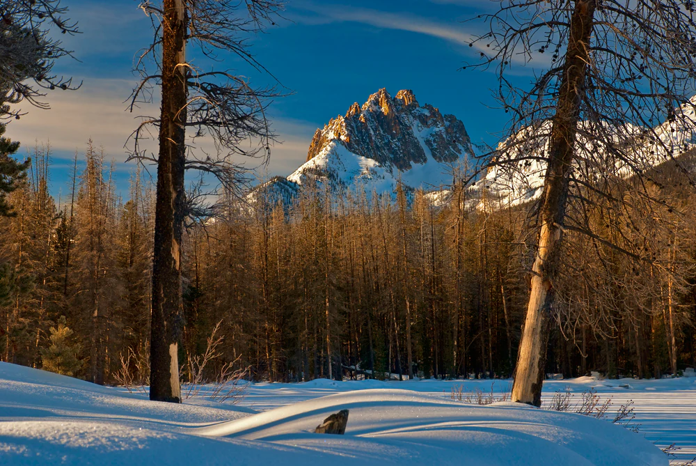
A snowy winter landscape in Sawtooth National Forest features rugged, snow-capped mountains illuminated by golden sunrise light behind a dense forest of thin, dark trees and deep snow drifts in the foreground.
Sunrise light hitting the jagged peaks of Mount Heyburn in Sawtooth National Forest, framed by snow-covered trees.

Sawtooth National Forest history and protected-area timeline

Sawtooth National Forest has a layered history that begins long before its official establishment. Spear points dating back roughly 12,000 years document the presence of Paleo-Indian peoples in the area, and by the early 1700s the Shoshone, Bannock, and Northern Paiute tribes made seasonal use of the forest's resources, harvesting fish, game, roots, and timber in small family groups near the northern ranges. Trappers and explorers arrived in the early 19th century, with Hudson's Bay Company fur trappers reaching the Stanley Basin in the 1820s. Mining began in the 1860s, peaked in the 1880s, and shaped the founding of towns like Stanley, Ketchum, and the short-lived Sawtooth City.

The modern forest was born under President Theodore Roosevelt. Originally designated as the Sawtooth Forest Reserve in 1905, it was later expanded and reorganized as administrative boundaries shifted and smaller reserves like Cassia, Raft River, and Minidoka were folded into the larger landscape. Subsequent decades brought intense political debate over the future of the Sawtooths. Senator James Pope proposed a national park in 1936, and Senator Frank Church pushed successive bills from 1960 through the late 1960s that ultimately led to the 1972 creation of the Sawtooth National Recreation Area. The legislation simultaneously protected the White Cloud and Boulder Mountains while preserving traditional uses such as logging, grazing, and hunting.

The 1972 SNRA designation was followed by decades of further protection. Wilderness status for the Sawtooth Primitive Area followed in the same year under the Wilderness Act. A sustained public battle over a proposed molybdenum mine at Castle Peak in the White Clouds forced continued attention to the area, and in 2015 President Barack Obama signed the Sawtooth National Recreation Area and Jerry Peak Wilderness Additions Act, creating three new wilderness areas: Hemingway–Boulders, Jim McClure–Jerry Peak, and White Clouds. In 2018, the White Clouds Wilderness was renamed in honor of Cecil Andrus, the Idaho governor and later U.S. Interior Secretary who had long championed its preservation.

Sawtooth National Forest landscape and geographic character

Sawtooth National Forest is defined by a striking telescoping landscape, with elevations ranging from below 4,500 feet up to more than 12,000 feet across multiple mountain systems. At its highest, Hyndman Peak in the Pioneer Mountains rises above the surrounding terrain as the forest's tallest summit, while the Sawtooth Mountains form a serrated ridge of more than fifty peaks above ten thousand feet to the north. The Boulder, White Cloud, and Smoky mountains add jagged relief, and the Albion, Black Pine, Raft River, and Sublett ranges at the southern end create smoother, more rolling topography typical of the Basin and Range Province.

Glacial history has shaped much of what visitors see today. Ice Age glaciers carved the cirques, arêtes, hanging valleys, and moraines of the Sawtooth, White Cloud, Boulder, and Smoky mountains, and many of the forest's signature lakes are the result of ancient and more recent glaciation. Redfish Lake, the largest body of water in the forest, sits in a moraine-dammed basin, while numerous unnamed tarns and alpine lakes cluster high in the cirque walls of Thompson Peak and other Sawtooth summits. Snowfields and rock glaciers still cling to north- and east-facing slopes, even as no surface glaciers remain.

The forest's waterways tie the landscape together. The northern reaches drain to the Salmon and Boise rivers, while the Big Wood River system flows through Ketchum and Stanley, and the Snake River Plain receives snowmelt from across the range. The Minidoka District, separated by the Snake River Plain, extends into drier country with pinyon-juniper woodland, sagebrush slopes, and unique features like the City of Rocks. Together, these varied mountain systems give the forest a layered sense of place, from harsh alpine basins to gentle desert foothills.
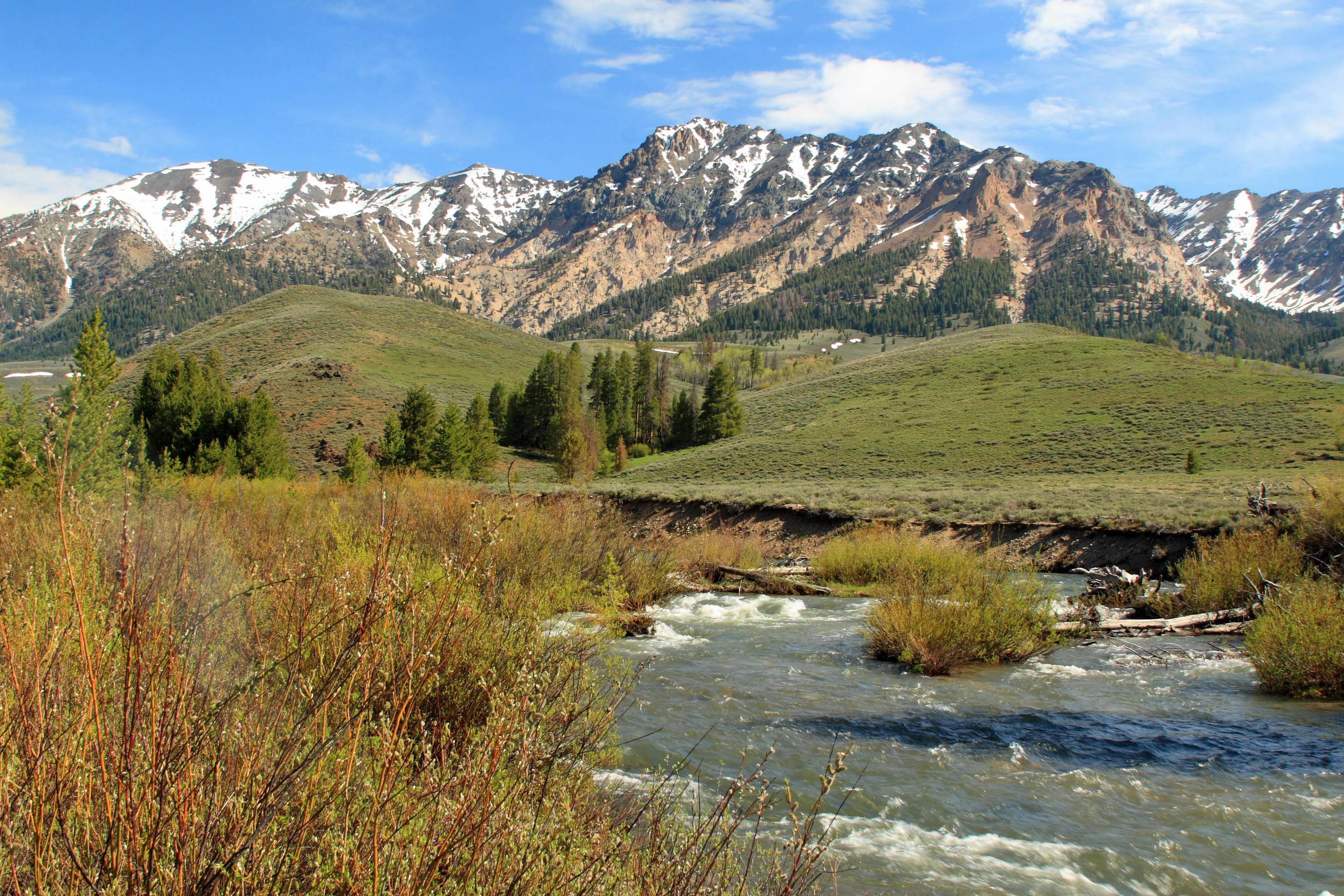
A rushing stream winds through a grassy riverbank towards a prominent, snow-capped mountain range under a clear blue sky.
The Big Wood River flowing through the landscape below the Boulder Mountains in the Sawtooth National Forest.

Sawtooth National Forest ecosystems, habitats, and plant life

Sawtooth National Forest is an ecological bridge between two of North America's great physiographic regions. Its northern ranges belong to the Rocky Mountains, while its southern Minidoka District falls within the Basin and Range Province, producing an unusual mix of vegetation and climate. Sagebrush steppe dominates the lower, drier elevations, while coniferous forests spread across middle elevations and bare alpine terrain takes over near the summits.

Roughly forty-seven percent of the forest is forested, with lodgepole pine, Douglas-fir, and quaking aspen as common middle-elevation species. Higher-elevation forests include whitebark pine, Engelmann spruce, subalpine fir, and limber pine, with some whitebark individuals believed to be seven hundred to a thousand years old. Ponderosa pine stands cover the dry, lower-elevation slopes of the western part of the forest, while pinyon, juniper, and curl-leaf mountain mahogany occupy drier southern ranges along with occasional cactus.

Riparian zones add another thread of biological diversity, with willows, alders, cottonwoods, and sedges tracing the forest's many streams. Two extremely rare plant species, Christ's Indian paintbrush and Davis' springparsley, are endemic to small high-elevation areas in the Albion Mountains, while the threatened Ute lady's tresses orchid may also find suitable habitat within the forest. The forest also faces ongoing ecological pressures, particularly from invasive weeds such as spotted knapweed, rush skeletonweed, leafy spurge, and cheatgrass, which the Forest Service actively manages near roads, campgrounds, and trails.
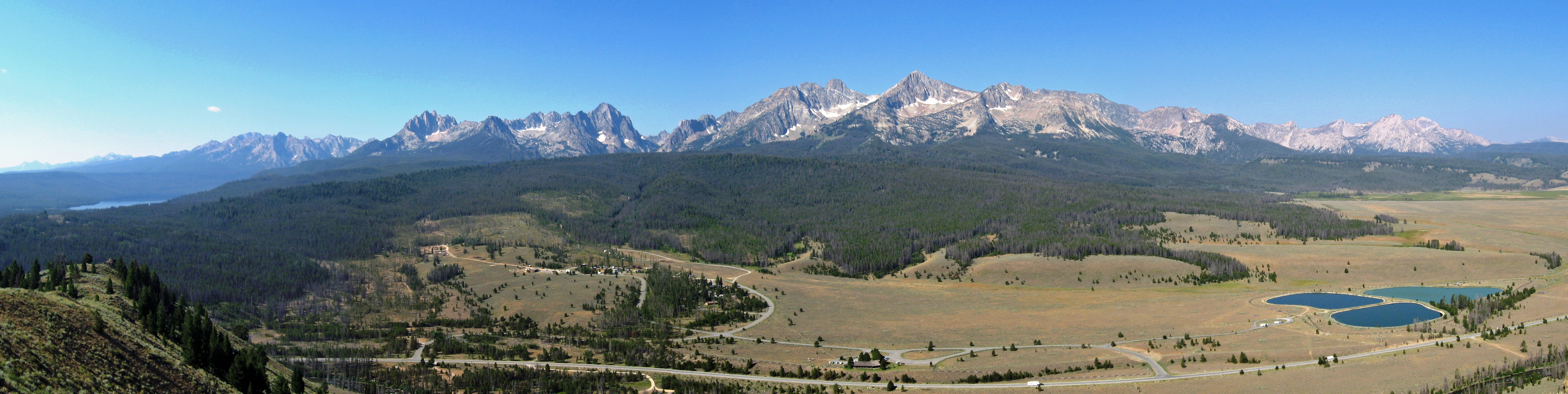
A wide panoramic landscape view featuring a jagged mountain range in the distance, a large pine forest at the base of the mountains, and a flat, open valley in the foreground with small ponds.
A wide-angle panorama of the Sawtooth Mountains as seen from a ridge near Stanley, Idaho.

Sawtooth National Forest wildlife and species highlights

Sawtooth National Forest hosts a rich and varied fauna shaped by elevation, habitat diversity, and ongoing conservation efforts. Large mammals define much of the forest's wildlife story: elk, mule deer, pronghorn, and moose are commonly observed, while bighorn sheep appear occasionally and mountain goats can be found climbing the higher slopes of the Boulder, White Cloud, Pioneer, and Sawtooth mountains. Predators such as cougars and reintroduced gray wolves are also present, and the forest has been a focal point in debates over predator management and ecosystem restoration.

Wolves were reintroduced into the Sawtooth National Recreation Area in the mid-1990s to restore ecosystem balance and reduce overbrowsing by elk, though this remains contentious. Although grizzly bears have become locally extinct, proposals to bring them back to central Idaho have been debated for decades. Northern and high-elevation areas contain potential habitat for wolverines and the endangered Canada lynx, though sightings are rare. Smaller mammals such as coyotes, bobcats, beavers, marmots, pikas, and badgers round out the mammal community.

The forest's rivers and lakes support a distinctive aquatic fauna. Bull trout are carefully monitored as a management indicator species, while rainbow, cutthroat, and mountain whitefish thrive in colder streams. The Wood River sculpin is endemic to the Big Wood River drainage and is considered vulnerable by the IUCN. The forest is also part of the long Columbia River salmon story, with Redfish Lake historically renowned for huge runs of sockeye salmon that have, in recent decades, recovered from near collapse.

Birdlife is particularly diverse, with more than 240 species documented across the upper Salmon River Basin. Bald eagles are found along rivers; golden eagles soar over sagebrush; northern goshawks nest in mature forests; greater sage-grouse inhabit open ranges; and black rosy finches breed at the very highest elevations. Several species of songbirds are tied to specific habitats, including the South Hills crossbill, a finch endemic to the South Hills and Albion Mountains that may represent a separate evolutionary lineage.
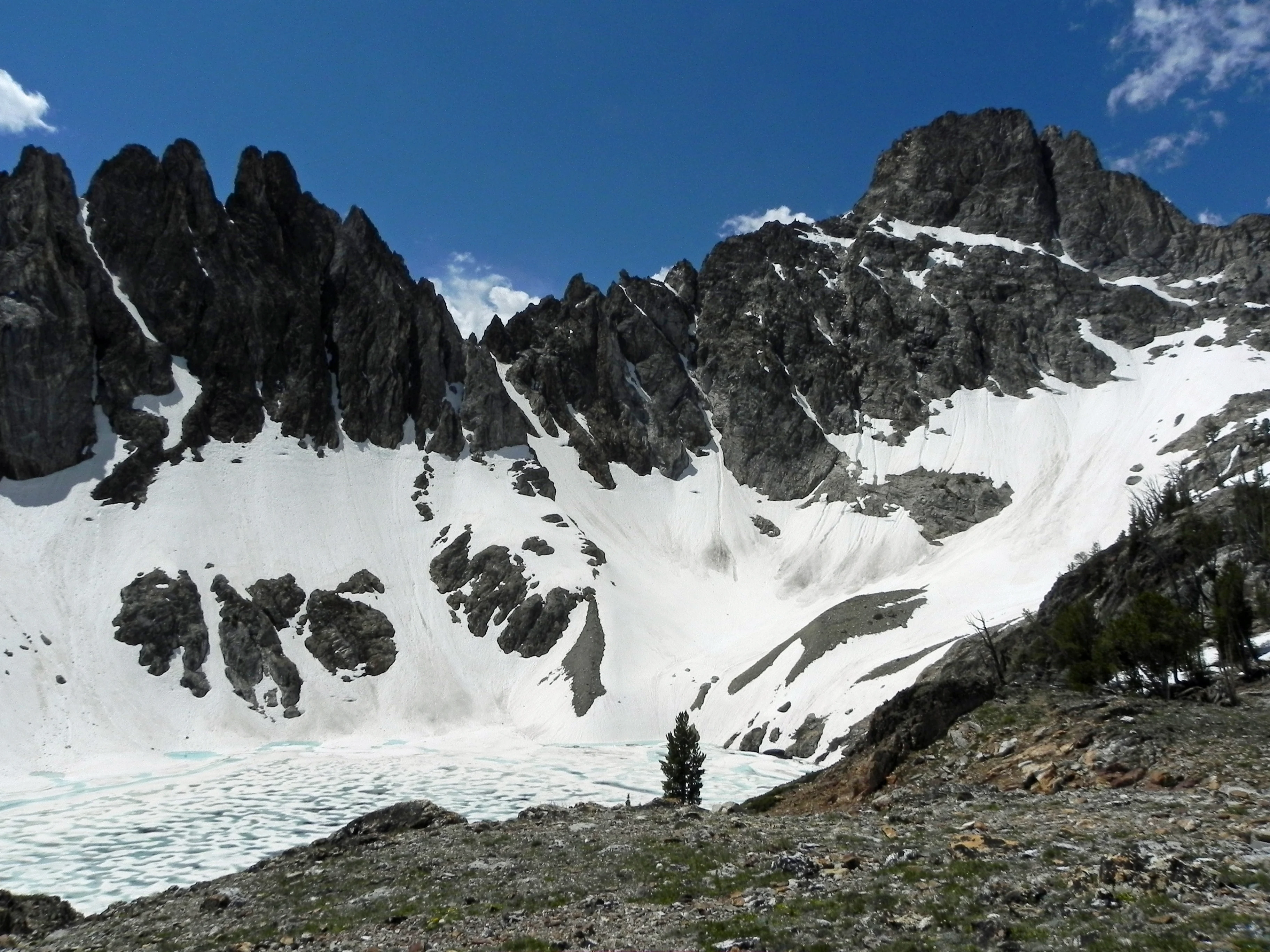
A jagged, dark granite mountain peak rises above a steep basin filled with patches of white snow and a partially frozen alpine lake.
Thompson Peak, the highest point in the Sawtooth Range, looms over a snow-covered alpine basin.

Sawtooth National Forest conservation status and protection priorities

Sawtooth National Forest sits at the heart of one of the strongest conservation stories in the American West. Its creation followed the original wave of forest reserves established in the early 20th century, and over the following decades it became a proving ground for ideas about wilderness preservation, recreation policy, and ecological management. The 1972 Sawtooth National Recreation Area legislation and the concurrent designation of the Sawtooth Wilderness set a national model for balancing traditional uses with landscape-scale protection.

Conservation significance also lies in the forest's air and water. The Sawtooth Wilderness has been identified as having some of the cleanest air in the contiguous United States, and the forest's snowfields feed rivers that sustain salmon migration, agriculture on the Snake River Plain, and downstream ecosystems. The 2015 wilderness additions protected the last large unprotected roadless area in the lower 48 states outside Alaska, while the 2018 renaming of one wilderness area honored Governor Cecil Andrus's role in safeguarding central Idaho. The forest also maintains conservation programs for invasive species and actively manages natural fire as an ecosystem process.

Sawtooth National Forest cultural meaning and human context

Sawtooth National Forest carries deep layers of cultural significance. Long before modern boundaries, Indigenous communities including the Shoshone, Bannock, and Northern Paiute lived within and traveled through these mountains, harvesting fish, game, roots, and stone tools in seasonal rounds. Trappers, prospectors, and miners of European descent followed in the 19th century, founding communities such as Stanley and Ketchum and establishing immigrant trails like the Oregon and California routes that crossed through the region.

In the 20th century, sheep and cattle grazing shaped the cultural landscape, with Basque-American and later Peruvian herders driving flocks to high summer pastures. The arrival of the Union Pacific Railroad and the opening of Sun Valley in 1936 transformed the Ketchum area into America's first winter-destination resort and brought figures like Ernest Hemingway into the forest's cultural history. Mining history remains visible in ghost towns such as Sawtooth City and in relics like the unrecovered B-24 bomber wreck on Mount Harrison.
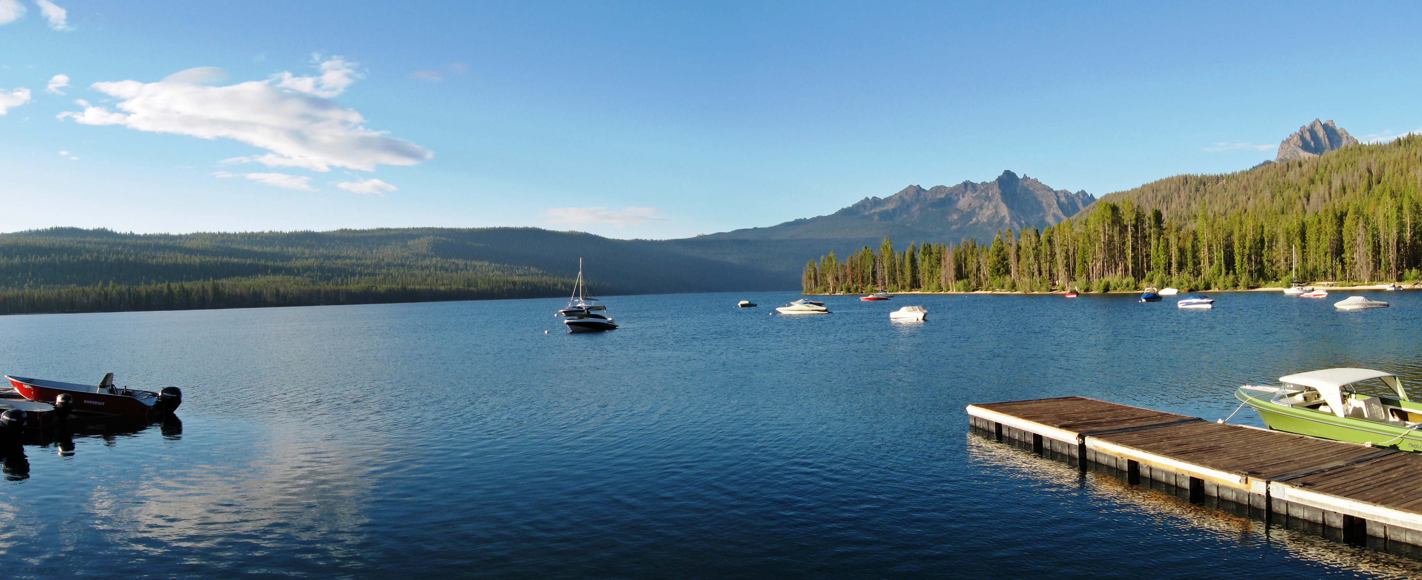
A calm, wide lake with several small boats moored on the water and a wooden dock in the foreground; pine forest and jagged mountain peaks line the distant shore under a clear blue sky.
Boats moored at Redfish Lake within the Sawtooth National Forest.

Top sights and standout views in Sawtooth National Forest

Sawtooth National Forest is anchored by the jagged Sawtooth Mountains, the Sawtooth Wilderness, and the Sawtooth National Recreation Area, with more than 1,100 glacial lakes and thousands of miles of rivers and streams running through it. The wilderness complex alone, including Hemingway–Boulders, Cecil D. Andrus–White Clouds, and portions of Jim McClure–Jerry Peak, protects more than a quarter million acres of roadless country with some of the cleanest air in the contiguous United States.

The forest also stands out for its ecological superlatives: it holds the headwaters of the Salmon River and supports the longest salmon migration in the continental United States, shelters rare endemic species such as Christ's Indian paintbrush and the South Hills crossbill, and combines Rocky Mountain wilderness with the desert-edge character of the southern Albion and Black Pine ranges. Its scenic byways, historic ski areas, and gateway towns of Stanley and Ketchum round out a landscape of both wild and cultural significance.
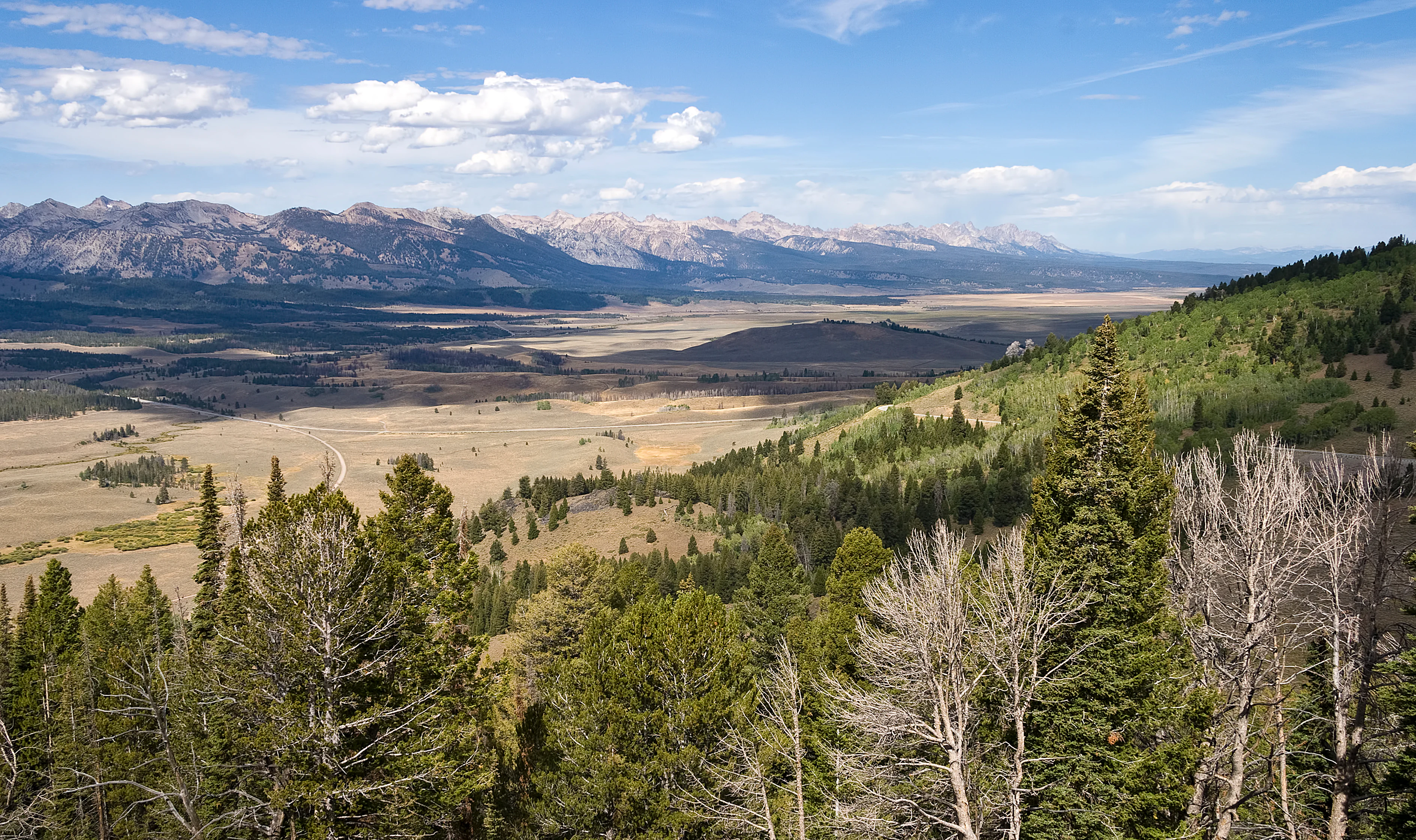
Wide-angle view looking over a broad, light-colored valley floor towards a distant, rugged mountain range under a blue sky with scattered clouds, viewed from a high vantage point overlooking a coniferous forest.
A scenic view of the Sawtooth Valley from Galena Summit in the Sawtooth National Forest.

Best time to visit Sawtooth National Forest

Summer is the most accessible and popular time to visit Sawtooth National Forest, with long daylight hours, open high-country trails, and snow-free access to most lakes and passes. This is the season for backpacking into the Sawtooth Wilderness, climbing Thompson Peak or Hyndman Peak, and enjoying the lakes of the Sawtooth Valley such as Redfish, Alturas, and Pettit.

Winter brings a very different experience, transforming the forest into a snow-covered playground centered on Sun Valley and Bald Mountain. The ski season, typically from late fall through early spring, draws visitors to downhill and Nordic skiing, snowshoeing, and snowmobiling, though many higher-elevation roads, campgrounds, and trails close for the season. Spring and fall are quieter shoulder periods, when wildlife viewing can be rewarding and the high country begins to shift between snow cover and wildflower bloom.
Monthly climate preview

Examine long-term average temperature and monthly precipitation patterns across a representative elevation point.

Sawtooth National Forest Climate Normals and Annual Weather by Month

Sawtooth National Forest records measured long-term temperature swings alongside distinct monthly precipitation variations across its representative coordinate point. Accessing the complete twelve-month climate profile reveals deeper historical normals and granular seasonal metrics.
Annual mean5 °C
-7 °C20 °C
Jan-7°
Feb-6°
Mar-1°
Apr
May
Jun14°
Jul20°
Aug19°
Sep13°
Oct
Nov-2°
Dec-7°
Warmest month
July

19.8 °C

Coolest month
January

-7.5 °C

Wettest month
December

2.1 mm/day

Driest month
July

0.4 mm/day

Park location guide

Geography guide, regional context, and park location map for Sawtooth National Forest

Sawtooth National Forest park geography, regions, and map view in United States of America

Understand where Sawtooth National Forest sits in United States of America through a broader geographic reading of the surrounding landscape, nearby location context, and its mapped position within the national park landscape.

How Sawtooth National Forest fits into United States of America

The United States of America is a federal presidential republic and one of the world's largest countries by area and population. It consists of 50 states across a vast territory spanning multiple time zones, with its capital in Washington, D.C. and largest city in New York City. The nation has a diverse economy, influential political system, and significant cultural and military presence globally.

Wider geography shaping Sawtooth National Forest in United States of America

The United States occupies a vast territory in North America, bordered by Canada to the north and Mexico to the south. The 48 contiguous states stretch from the Atlantic to the Pacific Ocean, while Alaska occupies the northwestern region and Hawaii is an archipelago in the Pacific. The country encompasses diverse terrain including the Rocky Mountains, Appalachian Mountains, Great Plains, and extensive river systems.

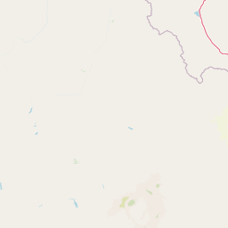
Map view of Sawtooth National Forest

Use this park location map to pinpoint Sawtooth National Forest in United States of America, understand its exact geographic position, and read its mapped placement within the surrounding landscape more clearly.

Pigeon | © OpenStreetMap contributors

Location context for Sawtooth National Forest

IdahoUtah
Recorded earthquake history

Review Historical Seismic Activity Near Sawtooth National Forest

Browse a comprehensive catalogue of recorded earthquakes associated with the geography of Sawtooth National Forest. This collection enables the exploration of historical seismic trends through event dates, magnitudes, and precise distance data derived from reliable regional records.

Sawtooth National Forest Earthquake History

Catalogued events

1,042 events

Strongest magnitude

Magnitude 6.9

Most recent event

Sep 12, 2026

This history includes earthquakes recorded inside the park or within 50 km of its borders

Visual reference of alpine lakes, jagged ridgelines, and diverse mountain habitats.

Sawtooth National Forest Photos, Landscape Scenery, and Protected Wilderness Views

Visual documentation of Sawtooth National Forest reveals the rugged topography, glacial cirques, and protected ecosystems spanning the northern Rocky Mountains. Photographic records provide clear insight into the complex terrain, elevation gradients, and wild character defining the regional landscape.

A snowy winter landscape in Sawtooth National Forest features rugged, snow-capped mountains illuminated by golden sunrise light behind a dense forest of thin, dark trees and deep snow drifts in the foreground.

A wide view of a calm, dark lake reflecting snow-dusted, rugged mountain peaks under a cloudy sky.

A rushing stream winds through a grassy riverbank towards a prominent, snow-capped mountain range under a clear blue sky.

A wide panoramic landscape view featuring a jagged mountain range in the distance, a large pine forest at the base of the mountains, and a flat, open valley in the foreground with small ponds.

A jagged, dark granite mountain peak rises above a steep basin filled with patches of white snow and a partially frozen alpine lake.

A wide landscape view of the Sawtooth Range mountains under a blue sky with scattered clouds, overlooking a dry, grassy valley and forest in the foreground.

A calm, wide lake with several small boats moored on the water and a wooden dock in the foreground; pine forest and jagged mountain peaks line the distant shore under a clear blue sky.

Wide-angle view looking over a broad, light-colored valley floor towards a distant, rugged mountain range under a blue sky with scattered clouds, viewed from a high vantage point overlooking a coniferous forest.

A hiker wearing a red shirt and backpack walks along a rocky mountain trail overlooking a deep, forested canyon flanked by craggy peaks.

A wide view of two rugged, snow-dusted granite mountain peaks looming over a green subalpine meadow and a dense evergreen forest under a clear blue sky.

A wide view of the Sawtooth Mountain Range with snow-capped peaks in the background, overlooking the Salmon River flowing through a grassy valley with a small house and a road in the foreground.

A snow covered mountain with visible ski runs cleared through the pine forest leading to the summit.

A close-up view of a steep, craggy mountain face showing layered rock strata and patches of snow at the base.

Black and white historical photograph showing a large flock of sheep grazing in a vast, open valley with a forest and rugged mountain range in the distance.

A close-up view of orange and yellow Castilleja christii flowers growing in a sunny meadow with other small white and yellow wildflowers in the background.

A clear, shallow creek winds through a lush green valley toward snow capped mountains under a clear blue sky.

Park atlas

Compare regional mountain ranges, alpine lakes, and connected wilderness terrain

Parks Near Sawtooth National Forest and Surrounding Protected Areas

Browsing nearby national parks and protected areas provides a wider geographical perspective beyond Sawtooth National Forest. Regional terrain comparison reveals how neighboring mountain ranges and alpine watersheds shape the broader ecosystem of the northern Rockies.
A soft watercolor painting of a mountain landscape with gentle green rolling hills, light green distant peaks, and scattered pink floral accents in the foreground against a white background.
Wildlife reserveIdaho
Park boundaries overlap#1 closest

Northeast

Jim McClure, Jerry Peak Wilderness: Geography and Protected Landscape Map in Idaho

Mapping central Idaho's remote mountain backcountry

Investigate the high-elevation wilderness geography of Jim McClure, Jerry Peak. This protected area in Custer County sits within the Salmon-Challis landscape, featuring a rugged mix of mountain peaks, dense coniferous forests, and remote drainages that define the character of the American West.

Area
473.07 km²
Established
2015
IUCN
Ib
Relief
Mountain
Soft watercolor illustration of a rolling mountain landscape with a forested foreground and faded, distant peaks.
Protected landscapeIdaho
Park boundaries overlap#2 closest

North

Salmon, Challis National Forest: Geography and Protected Land Map in Central Idaho

Extensive alpine ridges and wild river corridors

Spanning over 4.2 million acres, Salmon, Challis National Forest is a foundational protected landscape in Idaho. This area includes the highest peaks in the state, such as Borah Peak, and holds the majority of the Frank Church, River of No Return Wilderness. Utilize this atlas resource to examine the intricate mountain topography, expansive river systems, and the contiguous wild corridors that define this significant portion of the northern Rockies.

Area
17,142.2 km²
Established
1908
Relief
Mountain
Climate
Temperate
Watercolor painting of a tranquil lake surrounded by green forests and soft mountain ridgelines against a white background.
Protected landscapeIdaho
Park boundaries overlap#3 closest

North

Sawtooth National Recreation Area: Mapping the Protected Landscape of Central Idaho

A vast mountain wilderness of granite peaks and glacier-carved lakes.

The Sawtooth National Recreation Area encompasses a quintessential northern Rocky Mountain terrain defined by the dramatic Sawtooth, White Cloud, and Boulder ranges. This protected landscape preserves over 700,000 acres of high-elevation wilderness, ranging from jagged granite arêtes to the broad, U-shaped Sawtooth Valley, serving as a critical hydrologic anchor for the rivers of the American West.

Area
2,957.7 km²
Established
1972
Relief
Mountain
Climate
Alpine
Protected areaIdaho
2.2 km away#4 closest

Southeast

Curlew National Grassland: Protected Area Geography and Sagebrush Steppe Landscape in Idaho

Mapped regional geography and rangeland conservation context

Located in southeastern Idaho, Curlew National Grassland offers an expansive view of the Intermountain sagebrush steppe. This protected area provides a historical example of Depression-era land restoration and currently functions as a vital habitat for sagebrush-associated wildlife, showcasing the unique, rolling plains and semi-arid terrain characteristic of the northern Great Basin.

Area
193.4 km²
Established
1934
Relief
Upland
Scope
Terrestrial
A horizontal watercolor illustration depicting a winding river flowing through a forested valley surrounded by soft, hazy mountain silhouettes.
Wildlife reserveIdaho
9.2 km away#5 closest

North

Frank Church, River of No Return Wilderness: Idaho Protected Mountain and River Landscapes

Discover massive roadless geography and river-carved mountain terrain.

Spanning over 2.3 million acres in central Idaho, the Frank Church, River of No Return Wilderness represents one of the most significant intact roadless landscapes in the lower 48 states. This protected area features a complex mosaic of coniferous forests, high-altitude alpine ridges, and the steep, jagged canyons of the Salmon River, creating a unique geographic profile for regional exploration.

Area
9,578.21 km²
Established
1980
IUCN
Ib
Relief
Mountain
A watercolor painting showing soft green hills, distant pink-hued mountains, and a pale blue lake in a serene, stylized landscape.
Protected landscapeNevada
50 km away#6 closest

Southwest

Humboldt, Toiyabe National Forest: Protected Landscape and Regional Mountain Geography

A vast network of Nevada mountain ranges and alpine wilderness

Humboldt, Toiyabe National Forest serves as a defining public land entity across Nevada and eastern California. As the largest national forest in the contiguous United States, it preserves a striking collection of isolated mountain ranges, including the Ruby Mountains and the rugged Jarbidge wilderness, within a broader basin-and-range landscape. Examine the boundaries and terrain that characterize this complex, high-desert ecosystem.

Area
25,454 km²
Established
1908
Relief
Mountain
Access
Easy access
Protected landscapeIdaho
60 km away#7 closest

Northwest

Payette National Forest: Geographic Overview of Idaho's Rugged Mountain Wilderness

Protected granite landscapes and glacial basin geography

Encompassing a vast portion of central Idaho, Payette National Forest represents a significant protected wilderness corridor. The forest geography transitions from granite-based alpine peaks and deep river gorges to dense coniferous slopes, providing essential habitat and extensive trail connectivity throughout the Northern Rockies.

Area
9,419.55 km²
Established
1944
Relief
Mountain
Access
Access unknown
Wildlife reserveNevada
70 km away#8 closest

South

Jarbidge Wilderness: Protected Mountain Terrain and Geographic Map Context in Nevada

High-altitude wilderness geography and canyon landscapes

Located in the remote Jarbidge Mountains, this wilderness area transitions from arid sagebrush steppe to dense subalpine forests and dramatic river canyons. The region preserves headwater streams and over a dozen significant summits, offering a complex look at the natural topography of the northern Great Basin in Nevada.

Area
457.97 km²
Established
1964
IUCN
Ib
Relief
Mountain

Common questions about visiting, size, designation, and location context for Sawtooth National Forest

Sawtooth National Forest FAQs for park facts, access, geography, and protected area context

Find quick answers about Sawtooth National Forest, including protected-area facts, park geography, trail and visitor context, and how the park fits into its surrounding country and regional landscape.
MoriAtlas Explorer

Continue Your Protected Areas Search Across the Global Atlas

Deepen your exploration by continuing the structured search for national parks and protected areas worldwide. Utilize the comprehensive filtering capabilities to compare different conservation landscapes and refine your understanding of global park geography. Discover more about the distribution and characteristics of protected natural areas.

Global natural geography