
Mori Atlas logo
Nature reserveSchannenbacher Moor

A compact mosaic of raised bogs, wet meadows, and floodplain forest near the Krehberg slopes.

Schannenbacher Moor Nature Reserve: Mapped Protected Landscapes in the Hessen Odenwald

(Naturschutzgebiet Schannenbacher Moor)

Schannenbacher Moor sits on the western flank of the Krehberg in the southern Hessian Odenwald, encompassing sixteen hectares of diverse wetland and woodland habitats. This protected nature reserve preserves a rare hydrological relic of groundwater-fed bogs alongside alder-dominated floodplain forests and traditional hay meadows. Part of the broader Natura 2000 network, the site serves as a vital refuge for specialized bog vegetation, sensitive mosses, and rare butterfly populations within a managed low mountain landscape.

raised bogmireNaturschutzgebietNatura 2000wet meadowfloodplain forest
A stylized illustration showing a calm, winding river flowing through a forested valley with gentle hills and light pastel colors.

Schannenbacher Moor

Nature reserve

Park overview

Structured park overview, official facts, and landscape profile for Schannenbacher Moor

Schannenbacher Moor park facts, protected area profile, and essential visitor context

Review the core facts for Schannenbacher Moor, including designation, size, terrain, visitor scale, habitats, and operating context in one park-focused overview.

About Schannenbacher Moor

Schannenbacher Moor is a compact but ecologically rich nature reserve in the Odenwald foothills of southern Hesse. Set on the western flank of the Krehberg near the village of Schannenbach, it preserves one of the few remaining bog-like wetland complexes in the region, alongside a striking mosaic of associated habitats that include brook floodplain forest, fragmented ravine forest, wet meadows, reedbeds, and rocky outcrops.

The character of the site is defined by its small raised bog, once a groundwater-influenced lowland bog whose peat-forming Sphagnum and ericaceous vegetation can still be found in surviving patches. Although the original lowland bog communities have largely been lost to historical drainage, wastewater input, and intensified surrounding land use, the wetter parts of the reserve still maintain valuable relict stands, supported now by extensive hay meadows and reed-dominated fringes around small watercourses.

Surrounding woodland covers roughly a quarter of the protected area and contributes strongly to the site's identity. Brook floodplain forests are dominated by black alder, hosting species like winter horsetail and the rare Filziges Haarkelchmoos, while ravine and boulder-slope forests shelter shade-tolerant broadleaved trees such as sycamore maple, wych elm, and ash among scattered blocks of rock. The combination of moist woodland, open water features, mires, and meadows makes Schannenbacher Moor a representative example of lowland wetland forest ecology in the Odenwald.

The area received broader European recognition in 2003, when it became part of the FFH Natura 2000 site "Gronauer Bach mit Hummelscheid und Schannenbacher Moor." This designation reflects not only the botanical value of the bog system but also the importance of the Gronauer Bach stream corridor, its tributary network, and the adjacent wet and fresh meadows, all of which together support sensitive invertebrates, bryophytes, and a flowing-water habitat of regional conservation interest.

Quick facts and research context for Schannenbacher Moor

Schannenbacher Moor is a designated nature reserve (Naturschutzgebiet) in the Lautertal municipality, Landkreis Bergstraße, Hesse, Germany, situated south of the village of Schannenbach on the western slopes of the Krehberg in the Odenwald. The protected area covers about 16 hectares and was legally established in 1975. It is classified under IUCN Category IV as a Habitat/Species Management Area and has been part of the European Natura 2000 network since 2003.

Protection and recognition

Examine official protected area records and designated conservation context for Schannenbacher Moor.

Schannenbacher Moor Protection Status and Documented International Recognition

Examine the verified protection status and recorded administrative details associated with Schannenbacher Moor. Protected area records outline the established conservation framework and international database identifiers maintained for this terrain.

Protection details

WDPA ID
344834
Park context

Deeper park guide and search-rich context for Schannenbacher Moor

Schannenbacher Moor history, landscape, wildlife, and travel context

Explore Schannenbacher Moor through its history, landscape character, ecosystems, wildlife, conservation priorities, cultural context, and seasonal travel timing in a structured park guide built for atlas discovery and search intent.

Why Schannenbacher Moor stands out

Schannenbacher Moor is best known for its surviving Sphagnum-rich bog plant community of the Oxycocco-Sphagnetum type, which represents a relic of a former groundwater-fed lowland bog that has since developed into a raised bog. The reserve is also valued for its combination of near-natural floodplain forests, wet meadows, and rare specialized species such as the Dusky Large Blue butterfly.
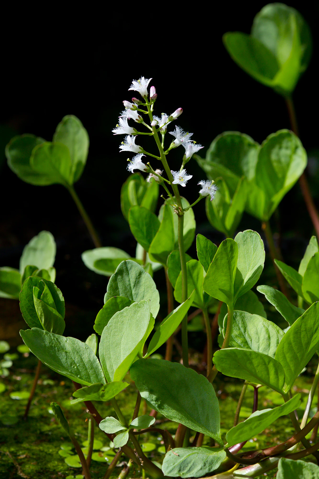
A close-up view of a bogbean plant with its trifoliate green leaves and a central, upright stalk bearing clusters of small, white, fringed flowers against a dark background.
Bogbean (Menyanthes trifoliata) in the wetland habitat of Schannenbacher Moor.

Schannenbacher Moor history and protected-area timeline

Schannenbacher Moor was formally placed under protection as a Naturschutzgebiet on 15 September 1975, securing its status as one of the recognized nature reserves of the Landkreis Bergstraße. The designation responded to the ecological value of the site's Sphagnum-rich bog vegetation and the surrounding near-natural forest communities at a time when many similar wetland features in the Odenwald had already been lost to drainage and conversion.

Over the decades following protection, the reserve's original lowland bog communities suffered further decline as a result of drainage measures, wastewater inputs, and intensified agricultural use in the surrounding landscape. Despite these pressures, the conservation framework has preserved the core hydrological and biological interest of the site, allowing relict patches of bog vegetation and the characteristic wet meadows and reedbeds to persist.

A major milestone came in 2003, when Schannenbacher Moor was incorporated into the European Natura 2000 network as part of the larger FFH site 6318-306, "Gronauer Bach mit Hummelscheid und Schannenbacher Moor." This step connected the bog area more formally to the broader stream valley ecosystem and gave it recognition as habitat of European importance for forests, meadows, rare butterflies, and mosses.

Schannenbacher Moor landscape and geographic character

The landscape of Schannenbacher Moor is shaped by the western flank of the Krehberg, the dominant hill rising just east of the village of Schannenbach. The protected area sits in a shallow basin below the mountain, where the terrain drops gently westward, allowing water to accumulate and form the bog and wetland habitats that define the site.

A small stream network drains the area, with the Meerbach flowing westward from the moor; downstream it becomes the Gronauer Bach above the locality of Gronau. The local road following the Teichkläranlage effectively divides the reserve into a smaller northern part and the main moor area to the south. The Krehbergstraße runs in a roughly semicircular course east of the reserve, framing the site against the forested hillside.

The terrain combines wet peatland hollows, reed- and sedge-dominated fringes along the brooks, hay meadows in the narrow stream floodplains, and surrounding deciduous woodland. Boulder-rich slopes and rocky outcrops within the woodland add structural variety, while roughly a quarter of the reserve is covered by near-natural forest that transitions between floodplain woodland at lower elevations and more shaded ravine and slope forest higher up.
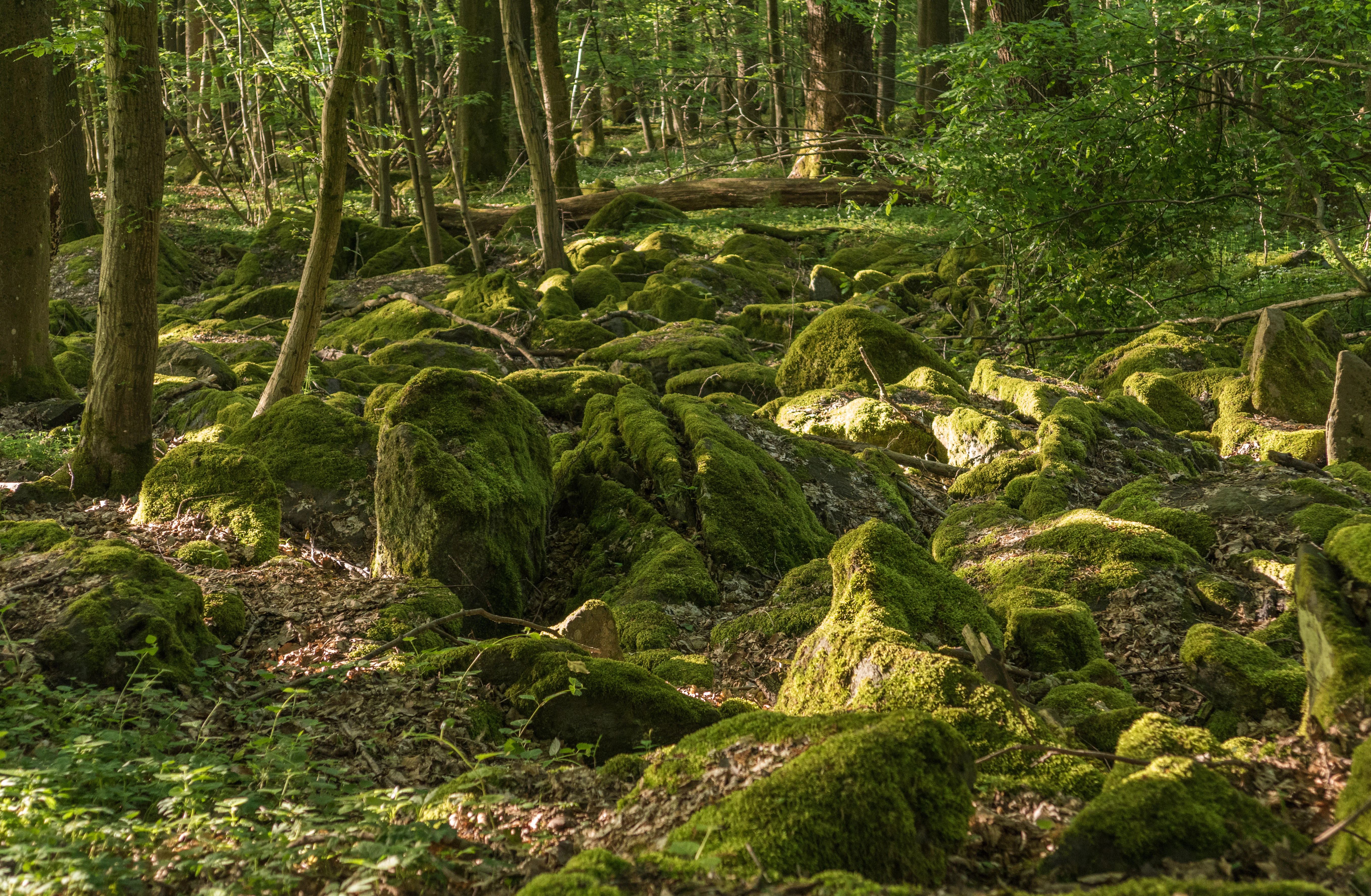
A forest floor covered in large, mossy boulders beneath a canopy of green trees.
Moss-covered rocks in the woodland habitat of Schannenbacher Moor.

Schannenbacher Moor ecosystems, habitats, and plant life

The ecological character of Schannenbacher Moor is built around the interplay between bog vegetation, wet grassland, and natural forest. At its core lies a raised bog complex with relict Sphagnum-rich vegetation of the Oxycocco-Sphagnetum type, a peat-forming community of mosses and ericaceous plants that signals the site's hydrological history as a former groundwater-fed lowland bog that has since evolved into a rain-fed raised mire.

Beyond the bog proper, the reserve maintains a patchwork of wet habitat types. Extensive hay meadows in the narrow stream floodplains support high floral and invertebrate diversity, while reedbeds shelter hygrophilous plants. Black alder-dominated brook floodplain forests occupy the lower, wetter ground, and on steeper, rock-strewn slopes the woodland shifts to ravine and boulder-slope forest characterized by shade-loving broadleaves.

This combination of mires, meadows, floodplain forest, and slope forest within a small area gives the reserve a dense concentration of ecological niches unusual for the surrounding, more intensively used Odenwald low mountain landscape. It also provides the substrate and microclimate conditions that allow sensitive mosses, ferns, and specialized invertebrates to persist in a region where such species have largely disappeared elsewhere.
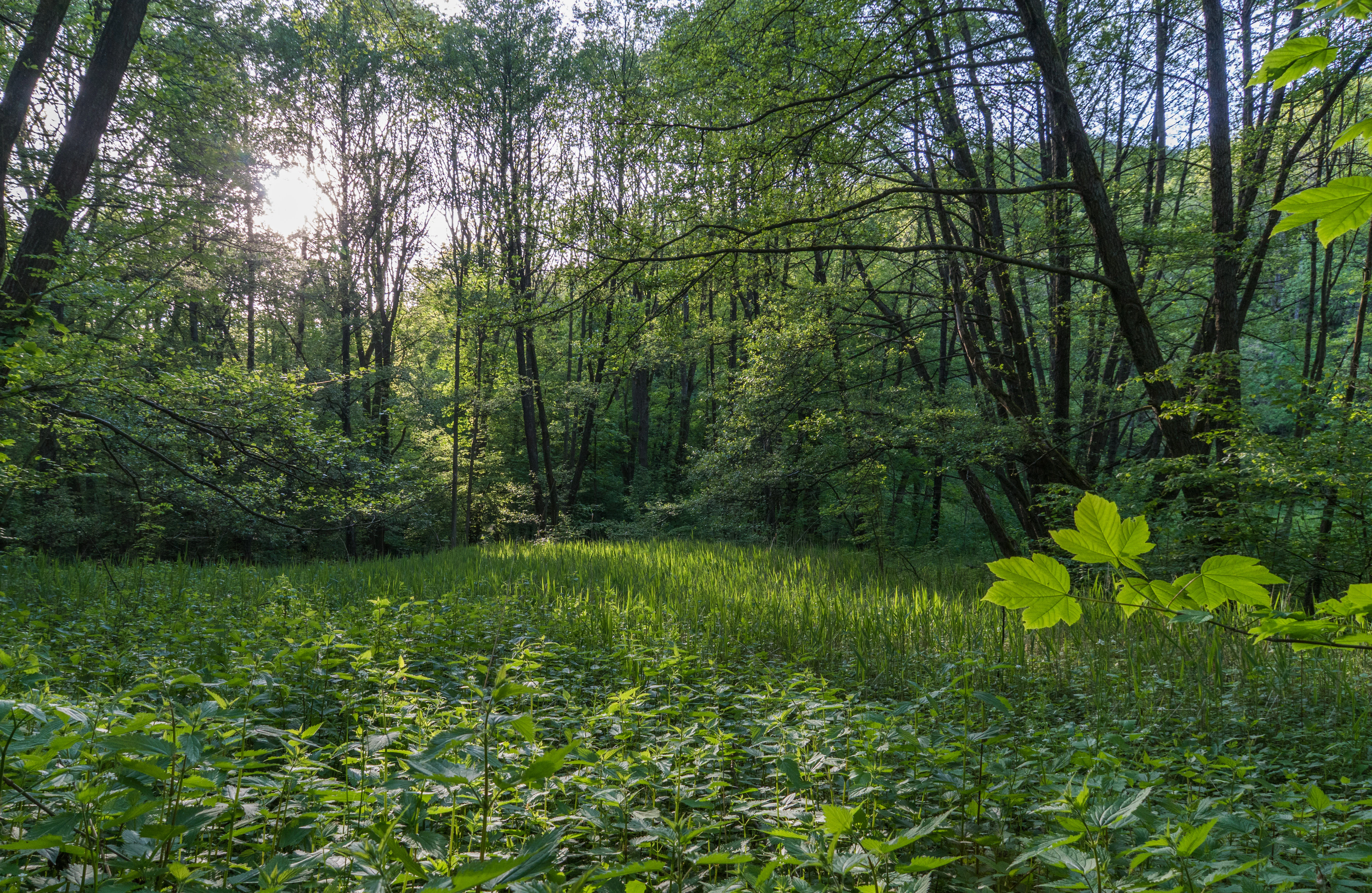
A lush green wetland scene featuring dense deciduous forest foliage, tall grasses, and dappled sunlight breaking through the trees.
Sunlight filtering through the dense canopy of Schannenbacher Moor.

Schannenbacher Moor wildlife and species highlights

Although small, Schannenbacher Moor supports a notable community of rare invertebrates, particularly butterflies and other insects tied to its meadows and bog habitats. The reserve is especially important for the Dusky Large Blue butterfly (Dunkler Wiesenknopf-Ameisenbläuling), whose caterpillars feed exclusively on the flowers of Great Burnet (Großer Wiesenknopf) and overwinter inside underground ant nests, making the species highly dependent on the wet meadows and their precise management.

The open meadows and fringes also host a range of other butterflies, including species such as the Marbled White and Silver-washed Fritillary, contributing to a rich insect community that benefits from the site's abundance of flowering plants. The wetter parts of the reserve support typical bog-associated fauna, including the threatened Sumpfschrecke, a grasshopper characteristic of intact mire habitats.

Streams and brook corridors around the moor harbor aquatic and semi-aquatic invertebrates as well, including mayflies whose presence reflects the relatively undisturbed character of the small watercourses. While the reserve is not characterized by large charismatic mammals, the combination of woodland, meadows, and wet ground provides diverse foraging and shelter conditions for the typical small mammal, bird, and insect fauna of the Odenwald foothills.
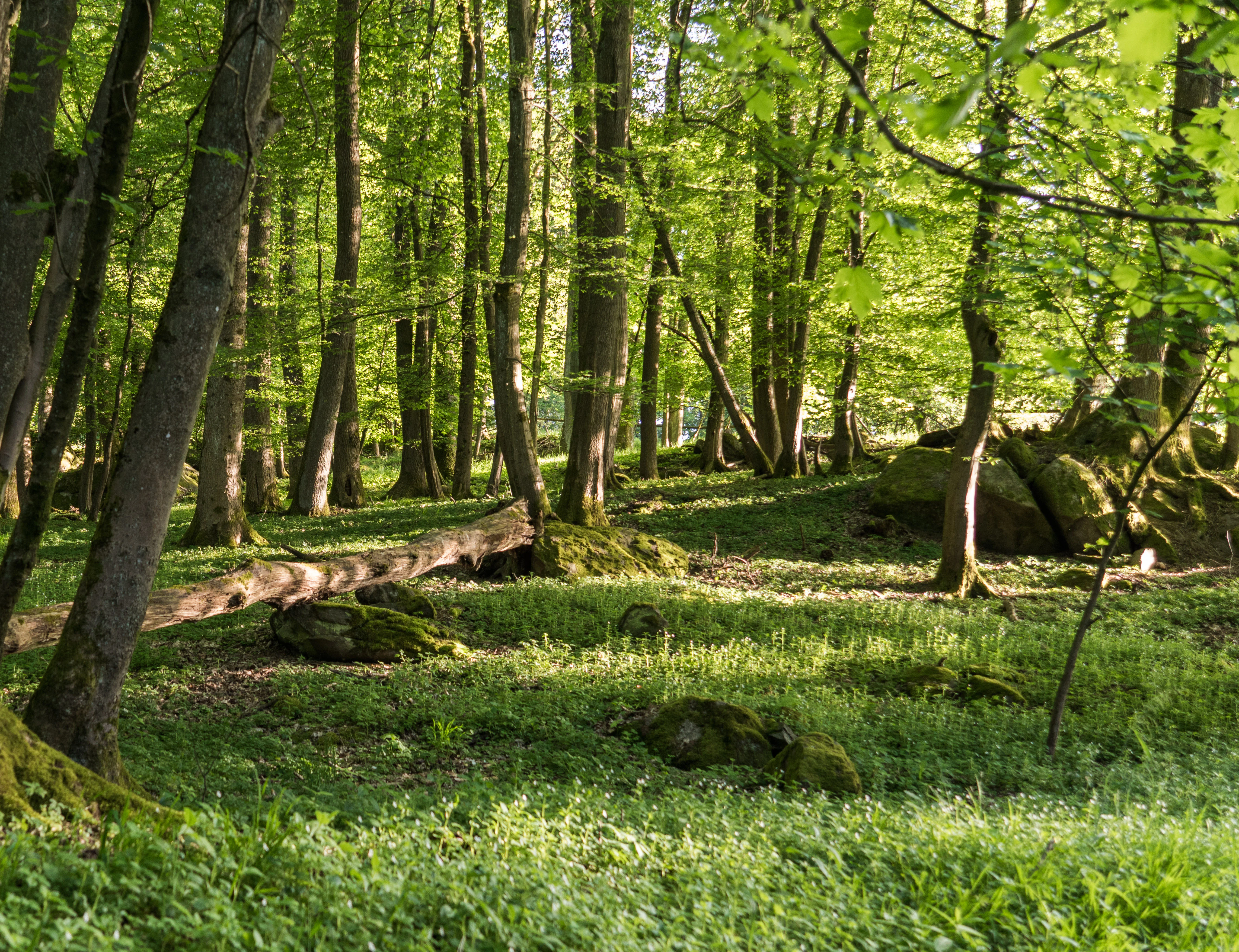
A bright, sunny deciduous forest with tall tree trunks, a carpet of green ground vegetation, and mossy rocks scattered on the forest floor.
Lush woodland scene within the Schannenbacher Moor nature reserve.

Schannenbacher Moor conservation status and protection priorities

Schannenbacher Moor is recognized as a habitat of substantial conservation value at both regional and European scales. Its protected status as a Naturschutzgebiet since 1975 was followed by inclusion in the Natura 2000 network in 2003, embedding the site within the European framework for safeguarding threatened habitat types and species.

The reserve plays a particularly important role in preserving near-natural forests, including rare forest types that qualify as part of the European natural heritage, as well as in maintaining habitats for specialized butterflies and mosses. The combination of bog remnants, intact floodplain forest, and traditionally managed hay meadows provides a working example of how varied wetland-dependent communities can be sustained within a small protected area.

Conservation management faces ongoing challenges from the legacy of historical drainage, wastewater impacts, and surrounding agricultural intensification, which continue to threaten the original lowland bog communities. The site's designation and its connection to the broader FFH area along the Gronauer Bach reflect a strategy of preserving not only the bog itself but also its surrounding buffer of meadows and stream habitat, helping maintain hydrological and ecological integrity in the face of these pressures.

Top sights and standout views in Schannenbacher Moor

Schannenbacher Moor stands out for its compact scale: within just 16 hectares, it bundles together raised bog relicts, reedbed-fringed wet meadows, alder floodplain forest, and shaded ravine woodland in a single protected area. The preserve's botanical rarities include specialist bog species and bryophytes such as the Grünen Besenmoos, an indicator of long-undisturbed forest, along with characteristic mire plants like cottongrass, marsh marigold, and bogbean.

Its location on the western slopes of the Krehberg, framed by the Krehbergstraße and drained by the Meerbach/Gronauer Bach system, also gives the reserve a clear sense of place within the Odenwald landscape. Combined with European-level recognition through its inclusion in the Natura 2000 site "Gronauer Bach mit Hummelscheid und Schannenbacher Moor," Schannenbacher Moor offers an unusually well-protected example of low mountain wetland and forest ecology in southern Hesse.

Monthly climate preview

Analysis of measured temperature ranges and monthly precipitation at a representative coordinate

Schannenbacher Moor Climate Normals and Long-Term Weather Patterns

Schannenbacher Moor experiences a recorded annual temperature rhythm ranging from subzero winter minimums to warm summer maximums alongside steady daily precipitation averages. Examining the complete twelve-month dataset clarifies long-term climate normals across the protected area.
Annual mean10 °C
0 °C20 °C
Jan
Feb
Mar
Apr
May14°
Jun18°
Jul20°
Aug20°
Sep15°
Oct10°
Nov
Dec
Warmest month
July

20.3 °C

Coolest month
January

0.1 °C

Wettest month
July

2.4 mm/day

Driest month
April

1.5 mm/day

Park location guide

Geography guide, regional context, and park location map for Schannenbacher Moor

Schannenbacher Moor park geography, regions, and map view in Germany

Understand where Schannenbacher Moor sits in Germany through a broader geographic reading of the surrounding landscape, nearby location context, and its mapped position within the national park landscape.

How Schannenbacher Moor fits into Germany

Germany is a federal republic in Western and Central Europe with a population of over 83 million across sixteen constituent states. It is Europe's largest economy by nominal GDP and a major global exporter and importer. The capital is Berlin, and the country borders Denmark, Poland, Czech Republic, Austria, Switzerland, France, Luxembourg, Belgium, and the Netherlands.

Wider geography shaping Schannenbacher Moor in Germany

Germany is located in Western and Central Europe, spanning 357,022 km². It borders Denmark to the north, Poland and the Czech Republic to the east, Austria and Switzerland to the south, and France, Luxembourg, Belgium, and the Netherlands to the west. The country has coastlines on the Baltic Sea and North Sea to the north, with the Alps located in the southern region.

Map view of Schannenbacher Moor

Use this park location map to pinpoint Schannenbacher Moor in Germany, understand its exact geographic position, and read its mapped placement within the surrounding landscape more clearly.

Pigeon | © OpenStreetMap contributors

Location context for Schannenbacher Moor

Hessen

Visual exploration of raised bogs, wet meadows, and protected Odenwald forest habitats

Schannenbacher Moor Photos and Landscape Scenery

Visual documentation captures the rare raised bogs, wet meadows, and floodplain forests defining the Schannenbacher Moor protected area. Examining photographic records reveals the distinct topography and plant communities sheltered along the slopes of the Krehberg.

A close-up view of a bogbean plant with its trifoliate green leaves and a central, upright stalk bearing clusters of small, white, fringed flowers against a dark background.

A wide view of a bright green meadow bordered by dense mixed forest under a soft, overcast sky.

A forest floor covered in large, mossy boulders beneath a canopy of green trees.

A lush green wetland scene featuring dense deciduous forest foliage, tall grasses, and dappled sunlight breaking through the trees.

A bright, sunny deciduous forest with tall tree trunks, a carpet of green ground vegetation, and mossy rocks scattered on the forest floor.

A wide, green grassy meadow bordered by lush deciduous trees under a clear blue sky.

Park atlas

Discover adjacent nature reserves and regional protected areas in the Odenwald.

Parks Near Schannenbacher Moor and Related Protected Landscapes to Compare

Compare Schannenbacher Moor with other regional nature reserves and protected areas located throughout the surrounding low mountain terrain. Continuing the geographic exploration reveals connected wetland habitats, floodplain forests, and comparable conservation landscapes across southern Hesse.
A watercolor painting of a pastoral landscape with soft green meadows, scattered trees, and distant purplish hills under a white sky.
Nature reserveHessen
About 3.9 km away#1 closest

West

Magerrasen von Gronau mit angrenzenden Flächen Protected Landscape and Regional Geography

A network of calcareous meadows in the Odenwald foothills

Located in the Bergstraße district of Hessen, this protected area spans three distinct sub-areas characterized by nutrient-poor calcareous soils. These warm, sun-exposed meadows serve as an essential refugium for orchid diversity and specialized butterfly populations, standing as a representative example of successfully managed dry grassland ecosystems within the broader Geo-Naturpark Bergstraße-Odenwald.

Area
1.6 km²
Established
2004
Watercolor painting showing a stylized, panoramic landscape of rolling hills and forest, depicted in soft green and earth tones against a white background.
Nature reserveHessen
About 4.4 km away#2 closest

Northwest

Felsberg bei Reichenbach Nature Reserve: Geography and Granite Boulder Field Analysis

Protected forest and geological monument in the Odenwald range

Felsberg bei Reichenbach protects 168 hectares of Odenwald mountain slope in Southern Hessen. The site is centered on the Felsenmeer, a dramatic sea of granite boulders created by frost weathering, framed by mixed deciduous woodland. This area functions as an important Natura 2000 habitat, preserving both specialized rock ecosystems and montane forest, providing a clear geographic link between the Lautertal valley and the high slopes of the Felsberg summit.

Area
1.677 km²
Established
1972
IUCN
IV
Relief
Mountain
Watercolor painting of a green wetland landscape with a winding stream and distant hills in soft pastel colors.
Nature reserveHesse
About 7.1 km away#3 closest

South

Albersbacher Riedwiesen Nature Reserve: Mapped Geography and Protected Landscapes in Hesse

A detailed atlas view of the Albersbach stream valley conservation corridor.

Situated in the Weschnitz valley region of Hesse, the Albersbacher Riedwiesen nature reserve offers a concentrated look at traditional Odenwald landscapes. The area protects a unique combination of wet meadows, reedbeds, and dry grasslands that follow the natural meandering course of the Albersbach stream, providing a vital study in local geomorphology and conservation geography.

Area
0.124 km²
Established
1996
A horizontal watercolor illustration of a soft, hazy landscape featuring light pink blooming trees in a green field, with rolling, misty purple and brown hills in the background.
Nature reserveHesse
About 8 km away#4 closest

Northwest

Fuchswiese bei Stettbach: Mapped Nature Reserve and Protected Meadow Landscape in Hesse

Exploring the ecological boundaries of a specialized wet meadow reserve in southern Hesse

Fuchswiese bei Stettbach is a dedicated nature reserve serving as a critical habitat for threatened meadow butterfly species. Located in the Darmstadt-Dieburg district of Hesse, this protected area preserves wet meadow vegetation amidst the northern Odenwald fringe. The site offers a focused view into how small, carefully managed landscapes contribute to the broader ecological health and regional geography of central Germany.

Area
0.03 km²
Established
2010
A soft watercolor painting of a rolling green hillside with trees, set against a pale, light-colored background.
Nature reserveHessen
About 8.4 km away#5 closest

Northwest

Orbishöhe von Auerbach und Zwingenberg: Geography, Landscape, and Protected Area Mapping

An examination of Hessian quarry-based ecological conservation sites.

The Orbishöhe von Auerbach und Zwingenberg nature reserve serves as a prime example of localized conservation within the Odenwald hills. Its landscape is defined by former quarry faces and open slope terraces, which provide a critical habitat for rare and threatened plant species. This resource offers a clear look at the reserve's topography, physical boundaries, and its broader role within the Natura 2000 network of protected German lands.

Area
0.064 km²
Established
1988
A wide watercolor illustration showing a river curving through a grassy valley with trees and hills in the background.
Nature reserveHessen
About 9.9 km away#6 closest

South

In der Erbach bei Mörlenbach Nature Reserve: Protected Odenwald Stream Valley

Regional geography and habitat mapping in southern Hessen

The In der Erbach bei Mörlenbach nature reserve preserves a well-defined side-valley ecosystem within the broader Odenwald landscape. Its protected boundaries encompass a moisture-rich corridor featuring wet meadows, reedbeds, and forest edges that exemplify the traditional cultural geography of the Weschnitz river basin in southern Germany.

Area
0.197 km²
Established
1997
IUCN
IV
Relief
Upland
A soft-focus watercolor painting of a wetland scene showing a calm body of water with reeds in the foreground and a tree-lined horizon under a pastel sky.
Nature reserveHessen
About 10 km away#7 closest

West

Erlache bei Bensheim: Exploring Protected Wetlands and Altneckar Landscapes in Hessen

A distinct nature reserve and bird sanctuary site

The Erlache bei Bensheim nature reserve serves as a critical wetland corridor in the Hessian Rhine plain. This area features a former loop of the River Neckar, now characterized by alder swamp forest, reedbeds, and open water, creating a highly specific ecological terrain surrounded by the regional infrastructure of the Bergstraße district.

Area
0.49 km²
Established
2000
IUCN
IV
Relief
Lowland
A watercolor painting showing a soft, stylized landscape of green meadows, sparse trees, and distant rolling hills against a white background.
Nature reserveHesse
About 11 km away#8 closest

Northwest

Im Dulbaum bei Alsbach Nature Reserve: Mapped Inland Dunes and Grassland Geography

A vital protected sandy terrain in the Hessian Rhine Plain

Im Dulbaum bei Alsbach protects a remnant of the historic Rhine graben sand dune belt in southern Hesse. This nature reserve provides essential habitat connectivity for heat-loving species through its distinct calcareous sand grasslands and former quarry terrain, offering a look into the region's complex ecological history.

Area
0.092 km²
Established
1994
IUCN
IV
Relief
Lowland

Common questions about visiting, size, designation, and location context for Schannenbacher Moor

Schannenbacher Moor FAQs for park facts, access, geography, and protected area context

Find quick answers about Schannenbacher Moor, including protected-area facts, park geography, trail and visitor context, and how the park fits into its surrounding country and regional landscape.
MoriAtlas Explorer

Continue Your Protected Areas Search Across the Global Atlas

Deepen your exploration by continuing the structured search for national parks and protected areas worldwide. Utilize the comprehensive filtering capabilities to compare different conservation landscapes and refine your understanding of global park geography. Discover more about the distribution and characteristics of protected natural areas.

Global natural geography