
Mori Atlas logo
Nature reserveSchönecker Schweiz

Examining the complex karst topography, deep stream gorges, and calcareous habitats of this protected Eifel basin.

Schönecker Schweiz Nature Reserve: A Detailed Geographic Atlas of the Prüm Kalkmulde Limestone Landscape

Schönecker Schweiz represents a critical nature protection area in the Eifel region of Rhineland-Palatinate, spanning 865 hectares of highly diverse limestone terrain. This protected landscape is defined by a distinct mosaic of semi-dry grasslands, juniper heaths, and ancient beech forests, all sculpted by persistent geomorphological processes. Our atlas coverage reveals the complex valley systems, including the Altburger Bachtal, shaped by underlying Devonian dolomite strata and karst features like dolines and disappearing streams.

limestone landscapekarst landscapecalcareous grasslandjuniper heathbeech forestgorge forest
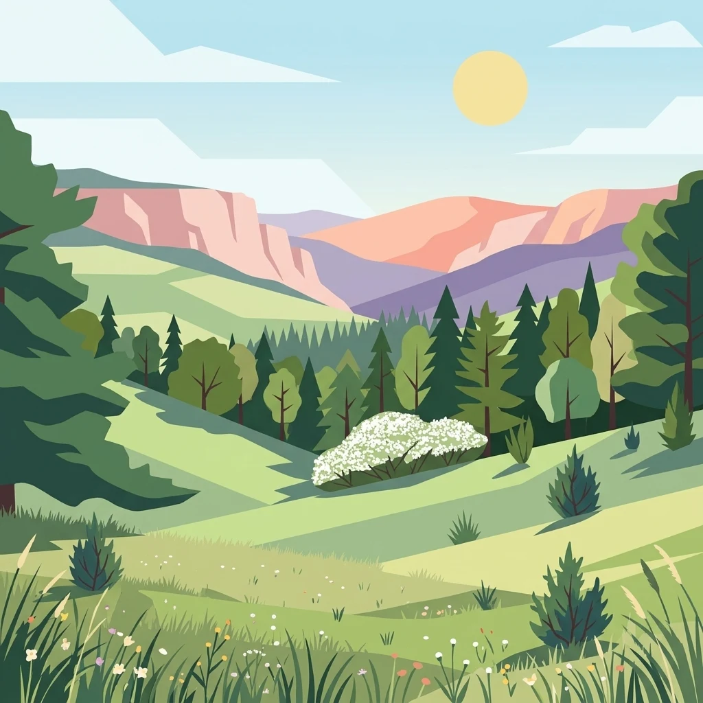
A flat-style digital illustration of a green valley framed by distant rocky hills under a sunny sky.

Schönecker Schweiz

Nature reserve

Park overview

Structured park overview, official facts, and landscape profile for Schönecker Schweiz

Schönecker Schweiz park facts, protected area profile, and essential visitor context

Review the core facts for Schönecker Schweiz, including designation, size, terrain, visitor scale, habitats, and operating context in one park-focused overview.

About Schönecker Schweiz

The Schönecker Schweiz is a protected natural area in the western German uplands, located in the southern Eifel region of Rhineland-Palatinate. Since 1991 it has been formally designated as a Naturschutzgebiet, with its protection administered through a formal legal ordinance that emphasises both ecological and landscape values. Roughly 865 hectares in extent, the reserve is the largest of its kind in the Eifelkreis Bitburg-Prüm district and forms a key component of the conservation framework for the Prüm Kalkmulde, a broader limestone basin landscape.

The character of the area is defined by the geology of the Middle Devonian, particularly dolomitic rocks of the Givetian stage that erode into a varied topography of steep slopes, plateau surfaces, and deeply cut stream valleys. The name "Schönecker Schweiz" highlights the most distinctive impression of the landscape: a richly dissected, often rugged terrain reminiscent of Swiss scenery, despite its relatively modest absolute elevations. Visible landforms include the Altburger Bachtal, the Kupferbach and Schalkenbachtal valleys, the Greimelscheid and Walbert ridges, and the prominent Burg, Forst, and Merker hills, which together form the largest connected stretch of natural and near-natural terrain within the Prüm Kalkmulde.

Ecologically, the reserve functions as a fine-scale mosaic of habitats that depend closely on one another. Calcareous soils derived from the dolomitic bedrock support semi-dry and dry grasslands, juniper heaths, rock and cliff communities, herbaceous edge biotopes, deciduous forests dominated by beech (including gorge beech forests and limestone beech forests), stream corridors, sedge-dominated wetlands, and tall-herb moist meadows. Streams, springs, and dolines add moisture variation across the slopes, reinforcing both habitat diversity and the area's scientific interest.

The protection ordinance recognises the Schönecker Schweiz as a particularly representative limestone landscape at submontane elevation under a suboceanic climate, shaped additionally by a pronounced geomorphologically driven microclimate. This combination supports a flora and fauna with a notably high proportion of rare or endangered species. The area is also valued as old cultural and settlement land, where traditional extensive land use has helped shape an environment rich in structural variety.

Quick facts and research context for Schönecker Schweiz

The Schönecker Schweiz is a nature protection area that has been officially protected since 1991 under Rhineland-Palatinate conservation law. It lies within the Prüm Kalkmulde, a limestone basin in the Eifelkreis Bitburg-Prüm district of Rhineland-Palatinate, Germany, spanning parts of the municipal areas of Schönecken, Niederhersdorf, Oberhersdorf, Giesdorf, Rommersheim, Fleringen, and Wallersheim.

At about 865 hectares, it is the largest Naturschutzgebiet in the Eifelkreis Bitburg-Prüm district. The reserve is centred on Middle Devonian dolomites, particularly Schönecker Dolomit from the Givetian stage, and neighbours the Wetteldorf Richtschnitt, Germany's first GSSP (Global Stratotype Section and Point), which marks the Lower-Middle Devonian boundary near 393.3 million years ago.

Protection and recognition

Documented terrestrial protection scope and Natura 2000 records

Schönecker Schweiz Protection Status and International Recognition Data

Schönecker Schweiz holds documented terrestrial protection status within the global protected area registry, supported by official Natura 2000 recognition sources. Detailed conservation records assemble designated management scopes and international administrative frameworks for precise geographic analysis.

International recognition

Protection details

Protection scope
Terrestrial
WDPA ID
165460
Park context

Deeper park guide and search-rich context for Schönecker Schweiz

Schönecker Schweiz history, landscape, wildlife, and travel context

Explore Schönecker Schweiz through its history, landscape character, ecosystems, wildlife, conservation priorities, cultural context, and seasonal travel timing in a structured park guide built for atlas discovery and search intent.

Why Schönecker Schweiz stands out

The Schönecker Schweiz is especially known for its mosaic of calcareous ecosystems embedded in a deeply incised limestone landscape, including semi-dry and dry grasslands, juniper heaths, limestone beech and gorge forests, and stream corridors. The reserve is considered a representative example of a submontane limestone region under suboceanic climate, with pronounced geomorphological features such as dolines, ponors, caves, rock fissures, cliffs, and exposed strata giving the area its pronounced topographical variety. Its picturesque combination of steep slopes, plateau uplands, and narrow gorge valleys is the origin of the name, which likens the terrain to Switzerland. Geologically, the area is also notable as the source of the Schönecker Dolomit, a Middle Devonian dolomite sequence closely associated with one of Germany's most important stratigraphic reference sections.
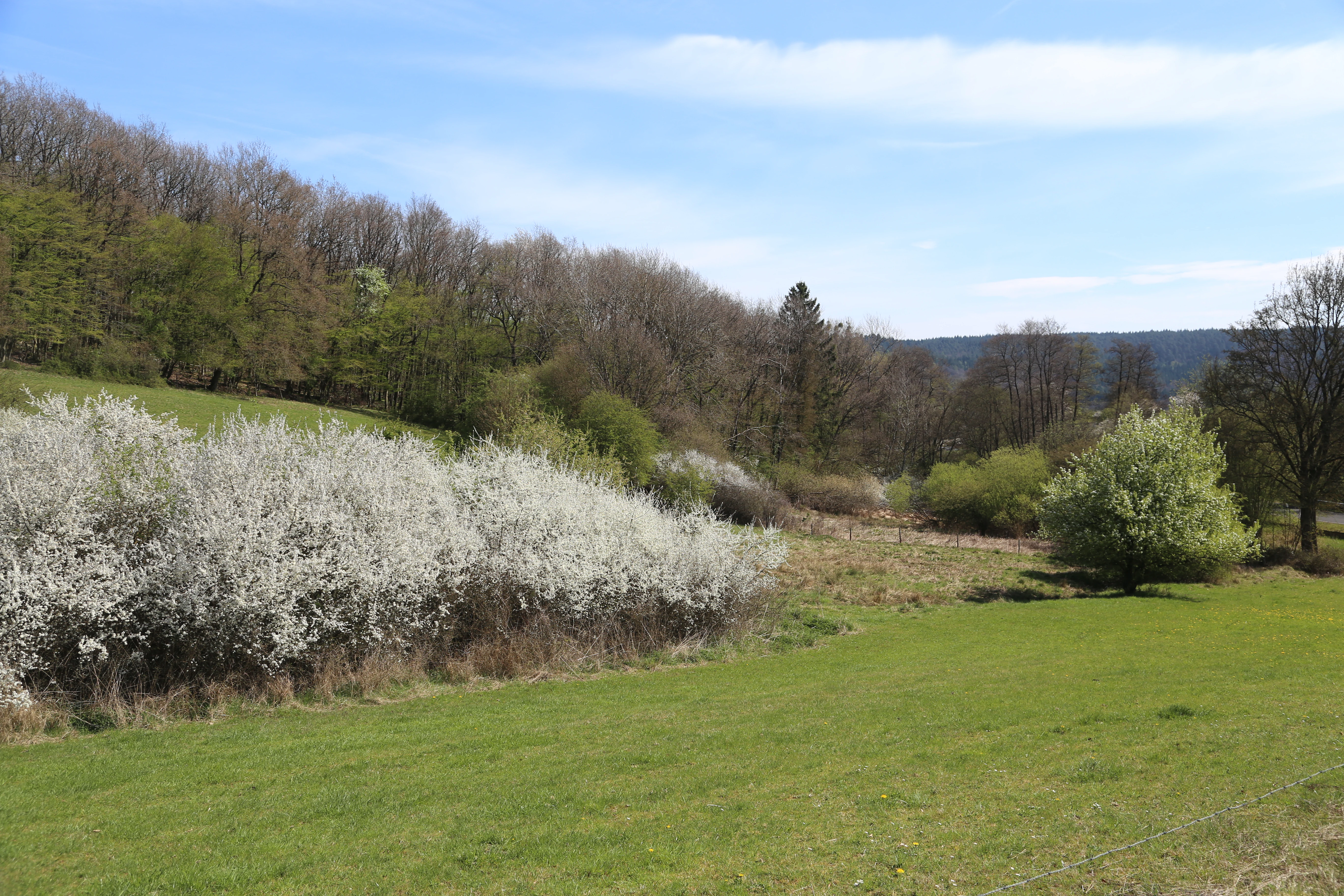
A green meadow in the foreground leads toward a line of flowering white blackthorn bushes with a forest-covered hillside in the background under a blue sky.
Spring blossoms in the Schönecker Schweiz nature reserve.

Schönecker Schweiz history and protected-area timeline

The Schönecker Schweiz was first placed under formal nature protection in 1991, when the responsible authorities in Rhineland-Palatinate designated it as a Naturschutzgebiet. The legal ordinance defining the reserve emphasised both its ecological significance as a representative limestone landscape and its landscape-aesthetic qualities, including the Altburger Bachtal, the Kupferbach and Schalkenbachtal valleys, the Greimelscheid and Walbert areas, and the Burg, Forst, and Merker hills, which were highlighted as the largest contiguous natural and near-natural section of the Prüm Kalkmulde.

Geologically, the area's importance long predates its formal protection. The Schönecker Dolomit, the dolomitic rock sequence dominant in the reserve, was deposited primarily during the Givetian stage of the Middle Devonian, roughly between 382 and 388 million years ago. In the immediate vicinity, the Wetteldorfer Richtschnitt, protected by the Ludwig-Happel-Hütte structure, marks Germany's first GSSP (Global Stratotype Section and Point), defining the Emsian-Eifelian boundary and the boundary between the Lower and Middle Devonian at approximately 393.3 million years ago, anchoring the area in the history of international stratigraphic research.

As an old cultural and settlement landscape, the region has been shaped over centuries by extensive agricultural use, including the maintenance of grasslands and juniper heaths that today form core elements of its conservation value.

Schönecker Schweiz landscape and geographic character

The landscape of the Schönecker Schweiz is one of the most topographically varied in the southern Eifel. The reserve occupies the largest continuous stretch of natural and near-natural terrain within the Prüm Kalkmulde, a limestone basin shaped largely by Middle Devonian dolomites. The most prominent landscape features include the Altburger Bachtal valley, the Kupferbach and Schalkenbachtal valleys, the ridges and slopes of Greimelscheid and Walbert, and the Burg, Forst, and Merker hills, which together give the area its characteristic combination of upland plateaus, descending slopes, and deeply incised streams.

Geomorphological processes have produced a striking variety of landforms. Steep slopes and high plateaus alternate with narrow gorge valleys and V-shaped ("Kerbsohlen") stream valleys, where erosion has cut rapidly downward into the soluble bedrock. Juniper heaths cap the drier elevations, while the valley floors host stream meadows, floodplain communities, and sedge wetlands. Rock features are widespread, including cliffs, rock walls, slope break edges, exposed stratum heads (Schichtköpfe), and structural ribs (Schichtrippen), where resistant dolomite layers stand out as linear ridges.

Karst processes typical of limestone terrain have shaped much of the relief. Solution hollows, dolines, and ponors (Bachschwinden, where streams disappear underground) characterise the surface, while caves and rock fissures underline the relationship between geology and surface morphology. The result is a landscape that is visually compact, vertically varied, and ecologically fragmented into many small, contrasting units, which is central to the reserve's identity and the origin of its evocative name.

Schönecker Schweiz ecosystems, habitats, and plant life

Ecologically, the Schönecker Schweiz functions as a tightly interlocked mosaic of calcareous habitats, with each landscape element contributing to a broader system rather than standing alone. Dry and semi-dry grasslands (Halbtrocken- and Trockenrasen), together with juniper heaths, dominate the warmer, sun-exposed slopes and plateau edges, while rock and cliff communities occupy the steepest outcrops and exposed dolomite faces. These open habitats form a richly structured transition zone where herbaceous edge biotopes (Saum-Biozönosen) act as corridors between grassland and woodland.

Deciduous forests are a defining element of the reserve, with beech (Fagus) the dominant species. The forest community includes both limestone beech forests (Kalkbuchenwälder) on more stable, productive sites and gorge beech forests (Schluchtwälder) on the steep, block-strewn slopes of the deeply cut valleys. These forests interact closely with the open landscape, especially where grazing or mowing maintains the adjacent grasslands and keeps the overall habitat structure diverse.

Wetland and stream habitats run through the valley floors. The Aubach, Altburger Bach, Kupferbach, and Schalkenbach corridors include flowing waters and stream meadows, sedge-dominated wetland communities (Großseggenriede), and tall-herb moist meadows (Feuchtwiesen). These linear wet habitats connect the open calcareous grasslands with the forest and rock communities, providing moisture gradients and habitat continuity across the reserve. The interaction of this habitat mosaic with the underlying karst geomorphology produces a pronounced microclimatic variation, which the legal ordinance cites as a key reason for the area's species richness.

Schönecker Schweiz wildlife and species highlights

The Schönecker Schweiz is characterised by a notably species-rich fauna that reflects the close interweaving of dry calcareous habitats, forests, rock communities, and stream corridors. The protection ordinance explicitly highlights the presence of rare and endangered species within the reserve, reflecting the ecological value of its habitat mosaic and its microclimatic variety.

The area is particularly significant for invertebrate life. It is documented as a refuge habitat (Rückzugsgebiet) for 60 species of macro-moths (Falterarten), a group that often serves as an indicator of habitat quality in calcareous landscapes. The combination of warm, dry grasslands, juniper heaths, and structurally diverse forest edges provides both larval host plants and sheltered roosting sites across the slope gradient.

The reserve's varied conditions also support a broader community of grassland, woodland, and wetland fauna, including species associated with juniper heaths, stream valleys, and rocky outcrops. The legal and scientific framing of the reserve emphasises that the structural richness of the landscape, rather than any single species, is the principal driver of its overall faunal diversity.

Schönecker Schweiz conservation status and protection priorities

The Schönecker Schweiz has been formally designated as a Naturschutzgebiet since 1991, giving it one of the stronger legal protection classes available in German conservation law. The protection ordinance defines the reserve's purpose explicitly as the preservation and development of an area of representative national significance, with priority given to maintaining and restoring the mosaic of natural and near-natural habitats that define the Prüm Kalkmulde.

From a conservation perspective, the reserve's importance lies in its role as the largest contiguous area of natural and near-natural terrain within the Prüm Kalkmulde, and as a particularly representative example of a submontane limestone landscape under suboceanic climate. Its habitat diversity, including dry and semi-dry grasslands, juniper heaths, limestone and gorge beech forests, stream corridors, and karst features such as dolines and ponors, supports a high proportion of rare and threatened species. The presence of 60 documented macro-moth species alone underlines the reserve's value as a long-term refuge for invertebrates dependent on habitat continuity.

The reserve is also valued for its geomorphological features and its status as an old cultural and settlement landscape, where traditional extensive land use has helped maintain open calcareous habitats. At international scale, the neighbouring Wetteldorfer Richtschnitt, Germany's first GSSP, adds a stratigraphic dimension to the area's broader scientific and conservation significance.

Schönecker Schweiz cultural meaning and human context

The Schönecker Schweiz sits within a region shaped by long-standing human activity, recognised in its protection ordinance as old cultural and settlement land. Traditional extensive land use, in particular the maintenance of open calcareous grasslands and juniper heaths through grazing and mowing, has long influenced the present-day structure of the landscape. Many of the open habitats now central to the reserve's conservation value are products of this long agricultural history, rather than purely natural formations.

The reserve takes its name from the town of Schönecken and from the ruggedness of its terrain, which early observers likened to Switzerland. This comparison has become part of local cultural identity, framing the area as a landscape of regional distinction. Local place names linked to the reserve, such as the Altburger Bachtal, the Kupferbach and Schalkenbachtal valleys, the Greimelscheid and Walbert ridges, and the Burg, Forst, and Merker hills, reflect the layered interactions between geology, settlement, and land use over centuries.

The broader geological identity of the area, anchored by the Schönecker Dolomit and the internationally recognised Wetteldorfer Richtschnitt GSSP nearby, also contributes to a regional identity tied to deep geological time, even though this dimension lies primarily in the scientific rather than folk-cultural realm.

Top sights and standout views in Schönecker Schweiz

The Schönecker Schweiz stands out for being the largest Naturschutzgebiet in the Eifelkreis Bitburg-Prüm district and for containing the most extensive natural and near-natural section of the Prüm Kalkmulde. Its defining identity lies in the dense interweaving of calcareous grasslands, juniper heaths, limestone and gorge beech forests, flowing waters, and karst landforms such as dolines, ponors, and rock fissures, all set within a compact topography of steep slopes, plateaus, and gorge valleys.

Geologically, the area is anchored by the Schönecker Dolomit of Givetian age and lies adjacent to the Wetteldorfer Richtschnitt, Germany's first GSSP. Ecologically, it functions as a refuge habitat for 60 documented macro-moth species, and supports a broader community of rare and endangered plants and animals tied to calcareous habitats. Together these features make the Schönecker Schweiz a key reference site for understanding both Devonian geology and the conservation of calcareous landscapes in the western Eifel.

Best time to visit Schönecker Schweiz

The character of the Schönecker Schweiz changes markedly through the year, reflecting the seasonal variation typical of central European calcareous landscapes. Spring brings a strong flowering display in the open grasslands, valley meadows, and juniper heaths, including species such as blackthorn (Schlehe), which contributes to the early-season visual impression of the reserve.

Summer, particularly in the warmer months, highlights the dry and semi-dry grasslands and juniper heaths on the south-facing slopes, when grasses and herbs reach full development and visibility across the slopes is highest. Late summer and early autumn, by contrast, emphasise the structure of the landscape itself, with grasses turning colour and the contrast between open slopes, rock outcrops, and forested valleys becoming more pronounced.

In practice, the reserve is best appreciated when habitats can be observed under stable, mild conditions that allow both the mosaic of grasslands and forests and the geomorphological features of the valleys and rock faces to be seen clearly. Visitors seeking to experience the flowering of the open calcareous habitats will generally find late spring the most rewarding period, while those focused on landscape structure and broader scenery may prefer the longer days of early to mid-summer.

Monthly climate preview

Long-term temperature ranges and monthly precipitation distributions for Schönecker Schweiz

Schönecker Schweiz Climate Normals and Annual Weather Patterns by Month

Representative coordinate measurements record monthly mean temperatures ranging from sub-zero winter minimums to warm summer maximums alongside consistent year-round precipitation averages. Access the complete twelve-month climatology profile to examine detailed monthly normals and temperature extremes across the protected area.
Annual mean8 °C
0 °C18 °C
Jan
Feb
Mar
Apr
May12°
Jun15°
Jul18°
Aug17°
Sep13°
Oct
Nov
Dec
Warmest month
July

17.7 °C

Coolest month
January

-0.2 °C

Wettest month
December

2.9 mm/day

Driest month
April

1.7 mm/day

Park location guide

Geography guide, regional context, and park location map for Schönecker Schweiz

Schönecker Schweiz park geography, regions, and map view in Germany

Understand where Schönecker Schweiz sits in Germany through a broader geographic reading of the surrounding landscape, nearby location context, and its mapped position within the national park landscape.

How Schönecker Schweiz fits into Germany

Germany is a federal republic in Western and Central Europe with a population of over 83 million across sixteen constituent states. It is Europe's largest economy by nominal GDP and a major global exporter and importer. The capital is Berlin, and the country borders Denmark, Poland, Czech Republic, Austria, Switzerland, France, Luxembourg, Belgium, and the Netherlands.

Wider geography shaping Schönecker Schweiz in Germany

Germany is located in Western and Central Europe, spanning 357,022 km². It borders Denmark to the north, Poland and the Czech Republic to the east, Austria and Switzerland to the south, and France, Luxembourg, Belgium, and the Netherlands to the west. The country has coastlines on the Baltic Sea and North Sea to the north, with the Alps located in the southern region.

Map view of Schönecker Schweiz

Use this park location map to pinpoint Schönecker Schweiz in Germany, understand its exact geographic position, and read its mapped placement within the surrounding landscape more clearly.

Pigeon | © OpenStreetMap contributors

Location context for Schönecker Schweiz

Rhineland-Palatinate
Recorded earthquake history

Explore the Historical Earthquake Catalogue for Schönecker Schweiz

Review the recorded history of seismic activity associated with the Schönecker Schweiz nature reserve. This catalogue provides a structured view of historical events by magnitude and proximity to the protected landscape, offering essential geographic context for the Eifel region.

Schönecker Schweiz Earthquake History

Catalogued events

16 events

Strongest magnitude

Magnitude 4.4

Most recent event

Nov 25, 2007

This history includes earthquakes recorded inside the park or within 50 km of its borders

Explore protected area photography, calcareous habitats, and rugged valley scenery.

Schönecker Schweiz Photos and Landscapes: Visualizing the Eifel Limestone Terrain

Visual documentation reveals the intricate mosaic of calcareous grasslands, juniper heaths, and rocky gorge forests that define the protected terrain. Examining these detailed field photographs provides a clearer understanding of the geomorphological features and unique topography shaping the natural reserve.

A green meadow in the foreground leads toward a line of flowering white blackthorn bushes with a forest-covered hillside in the background under a blue sky.

A wide, eye-level view of a green valley with meadows and patches of trees, showing the undulating limestone landscape characteristic of the region.

Park atlas

Compare regional park geography and connected limestone nature reserves

Explore Parks Near Schönecker Schweiz and Surrounding Protected Landscapes

Browse nearby protected areas and related regional parks to compare adjacent limestone terrain and valley ecosystems. Examining surrounding conservation landscapes reveals broader geological patterns across the western Eifel.
Nature reserveRhineland-Palatinate
About 1.7 km away#1 closest

North

Niesenberg bei Weinsheim Nature Reserve: Geography and Protected Area Overview

Dolomite hill and calcareous grassland in Rhineland-Palatinate

Niesenberg bei Weinsheim is a protected nature reserve located in the Eifel region of Germany, centered on a distinct dolomite hill. The reserve protects a fine-grained mosaic of semi-natural dry grasslands and pine stands that contrast sharply with the surrounding slate uplands. Its unique soil chemistry supports a specialized array of flora, making it an essential point of study for understanding the biodiversity of the Prüm Limestone Basin.

Area
0.085 km²
Established
1985
Relief
Upland
Climate
Temperate
Watercolor painting depicting gentle, rolling hills covered in light green forest, with a soft horizon line and pale foreground.
Nature reserveRhineland-Palatinate
About 17 km away#2 closest

East

Nerother Kopf: Volcanic Cinder Cone Landscape and Nature Reserve in Rhineland-Palatinate

Geological and protected woodland study in the German Eifel

Investigate the volcanic terrain of Nerother Kopf, a double cinder cone landmark in Rhineland-Palatinate. This nature reserve provides essential insights into Eifel geology, featuring a combination of protected beech forest, historical castle ruins, and visible basalt quarrying.

Relief
Mountain
Climate
Temperate
Access
Easy access
Scope
Terrestrial
A horizontal watercolor illustration showing soft, rolling hills, patches of forest, and a grassy foreground in muted green and pink tones against a pale yellow sky.
Nature reserveRhineland-Palatinate
About 18 km away#3 closest

East

Ernstberg Nature Reserve: Volcanic Geology and Forested Terrain in Rhineland-Palatinate

A key protected geological monument in the West Eifel

Ernstberg is a major basalt stratovolcano within the Vulkaneifel region, characterized by its distinct crater wall and historic millstone quarries. The area functions as a protected nature reserve and FFH site, showcasing important geological features such as the rocky Martinswand. Explore the physical geography, mapped volcanic profile, and protected habitat context of this significant German natural monument.

Area
0.96 km²
Established
1978
Relief
Mountain
Climate
Temperate
A horizontal watercolor painting depicting a calm lake surrounded by rolling hills and soft greenery, with a purple-toned ridgeline in the distance.
Nature reserveRheinland-Pfalz
About 19 km away#4 closest

East

Meerfelder Maar Nature Reserve: Volcanic Basin and Protected Eifel Landscape Mapping

Detailed volcanic crater geography and lake basin analysis

Discover the geological structure and protected habitats of Meerfelder Maar. This classic Eifel crater lake spans roughly 125 hectares, combining open water with fringing wetlands and forested slopes to create a unique natural landmark in Rheinland-Pfalz.

Area
2.6 km²
Established
1985
IUCN
IV
Relief
Upland
A soft watercolor painting of a rolling landscape with gentle hills, distant mountain ridges, and a foreground of trees and meadows.
Nature reserveNorth Rhine-Westphalia
About 20 km away#5 closest

North

Lewertbach mit Nebenbächen Nature Reserve: A Detailed Geographic and Landscape Atlas Profile

Examining the Nordeifel stream system and protected pastoral habitats

Located in the Euskirchen district, Lewertbach mit Nebenbächen protects a diverse mosaic of naturally flowing brooks and hedgerow-structured pastures. The reserve functions as a key component of the regional FFH habitat network, showcasing the delicate balance between aquatic drainage lines and traditional lowland meadow landscapes across three distinct parcels.

Area
0.713 km²
Established
2001
IUCN
IV
Nature reserveNorth Rhine-Westphalia
About 21 km away#6 closest

North

Simmeler Bach Nature Reserve: Geographic Atlas and Protected Landscape Overview

Riparian stream valleys and forest habitats in North Rhine-Westphalia

Simmeler Bach serves as a vital nature reserve and restored stream corridor in the Eifel district of Euskirchen. The protected area features a diverse landscape including open wet meadows, alder-lined brook banks, and rare mat-grass sward, all integrated into a wider regional network of conserved riparian habitats across western Germany.

Area
1.086 km²
Established
2001
Relief
Upland
Climate
Temperate
A horizontal watercolor illustration showing soft, rolling green hills, a background of distant purple mountains, and small clusters of pinkish trees.
Nature reserveNorth Rhine-Westphalia
About 23 km away#7 closest

Northeast

Lampertstal und Alendorfer Kalktriften mit Fuhrbach und Mackental: Eifel Protected Landscapes

A diverse nature reserve in North Rhine-Westphalia featuring karst geography

This extensive nature reserve in the Eifel region serves as a crucial habitat for limestone flora, featuring the largest juniper conservation site in North Rhine-Westphalia. Spanning a complex of valleys and hills, the area demonstrates a distinctive interaction between karst geology, medieval historical sites, and rare calcareous ecosystems that support a wide range of protected species.

Area
11.01 km²
Established
2007
Relief
Upland
Climate
Temperate
Nature reserveRhineland-Palatinate
About 23 km away#8 closest

West

Mittleres Ourtal zwischen Dreiländereck und Rellesmühle Protected Area and River Valley

Eifel region river geography and cross-border nature reserve

The Mittleres Ourtal zwischen Dreiländereck und Rellesmühle nature reserve serves as a critical ecological spine within the Eifelkreis district of Rhineland-Palatinate. It protects an undisturbed stretch of the Our river, integrating aquatic channels, riparian wetlands, and forest slopes into a single, cohesive landscape that supports diverse plant and animal populations across an international boundary.

Area
4.9 km²
Established
1989

Common questions about visiting, size, designation, and location context for Schönecker Schweiz

Schönecker Schweiz FAQs for park facts, access, geography, and protected area context

Find quick answers about Schönecker Schweiz, including protected-area facts, park geography, trail and visitor context, and how the park fits into its surrounding country and regional landscape.
MoriAtlas Explorer

Continue Your Protected Areas Search Across the Global Atlas

Deepen your exploration by continuing the structured search for national parks and protected areas worldwide. Utilize the comprehensive filtering capabilities to compare different conservation landscapes and refine your understanding of global park geography. Discover more about the distribution and characteristics of protected natural areas.

Global natural geography