
Mori Atlas logo
Nature reserveSchottental bei Heldmannsberg

Explore the karst springs, dolomite rock outcrops, and historic grazing lands defining this Bavarian valley.

Schottental bei Heldmannsberg Nature Reserve: A Protected Valley Landscape in the Franconian Alb

(Naturschutzgebiet Schottental bei Heldmannsberg)

Schottental bei Heldmannsberg represents a compact and ecologically diverse nature reserve in the Middle Franconia district of Bavaria, Germany. This protected area features a deeply incised side valley of the Albachtal, characterized by dolomite rock outcrops like the Bärenfels, meandering karst spring pools, and traditional sheep-grazed grasslands. The site serves as a vital segment of the broader Hersbrucker Alb valley system, showcasing how mixed woodland, calcareous meadows, and limestone terrain interact within a single geographic pocket.

nature reserveside valleydolomite outcropscalcareous grasslandmixed forestbeech forest
A flat-style digital illustration showing a mountain valley scene with a winding path in the foreground, coniferous trees, rocky mountain peaks, and a waterfall flowing down a cliff in the background.

Schottental bei Heldmannsberg

Nature reserve

Park overview

Structured park overview, official facts, and landscape profile for Schottental bei Heldmannsberg

Schottental bei Heldmannsberg park facts, protected area profile, and essential visitor context

Review the core facts for Schottental bei Heldmannsberg, including designation, size, terrain, visitor scale, habitats, and operating context in one park-focused overview.

About Schottental bei Heldmannsberg

Schottental bei Heldmannsberg is one of several smaller nature reserves in the Nürnberger Land district and, together with neighboring protected stream valleys, forms part of a broader conservation network across the Hersbrucker Alb in northern Bavaria. The protected area focuses on a fairly short but deeply cut side valley of the Albachtal, where natural topography, exposed dolomite, spring activity, and centuries of pasture use have combined to produce a habitat mosaic that feels far larger than its actual footprint.

The valley is steep sided, with mixed woodland covering the upper slopes and more open habitats below. The valley floor carries a small meandering stream fed by several spring pools, locally known as Topfquellen, that are themselves a notable landscape feature. A short distance beyond the southern boundary of the reserve, this stream joins the larger Alfelder Bach, providing a direct hydrological link to the wider catchment of the Albachtal.

Although the reserve covers only about 45 hectares, it packs considerable variety into that area. Mixed woods of beech and pine, areas of blackthorn scrub, small fern clusters on the shaded sides of the dolomite rocks, calcareous dry grasslands, lightly grazed meadows, and a small pond together create the kind of habitat patchwork that supports a wide range of species. The openness of the slopes is maintained by traditional sheep grazing, which has historically shaped the appearance of places like this across the Franconian Alb.

For visitors, the site offers a clear illustration of how protected areas in this part of Bavaria are often not vast wildernesses but carefully maintained working landscapes, where ecological value and cultural land use continue to reinforce one another.

Quick facts and research context for Schottental bei Heldmannsberg

Schottental bei Heldmannsberg is a designated nature reserve of about 45 hectares in Bavaria, just over 40 hectares of which form the formally protected core. It is catalogued under the identifier NSG500.054, has WDPA record 165467, and is included in the EU Natura 2000 network as part of the site Bachtäler der Hersbrucker Alb (DE6534371).

The reserve was formally established on 25 January 1996 and is classified under IUCN Category IV as a habitat and species management area. It sits on the eastern edge of the Nürnberger Land district, bordering the Amberg-Sulzbach district. The valley forms a deep side branch of the larger Albachtal system, with the Bärenfels dolomite outcrop reaching 427 meters above sea level as one of its most prominent landmarks.

Protection and recognition

Examine terrestrial protection scope, designation metrics, and administrative status records.

Schottental bei Heldmannsberg Protection Status and Protected Area Designation Facts

Schottental bei Heldmannsberg maintains a documented terrestrial protection scope within official conservation registers. Designated administrative parameters outline the operational management framework and associated conservation records.

Protection details

Protection scope
Terrestrial
Transboundary protection
No
WDPA ID
165467
Park context

Deeper park guide and search-rich context for Schottental bei Heldmannsberg

Schottental bei Heldmannsberg history, landscape, wildlife, and travel context

Explore Schottental bei Heldmannsberg through its history, landscape character, ecosystems, wildlife, conservation priorities, cultural context, and seasonal travel timing in a structured park guide built for atlas discovery and search intent.

Why Schottental bei Heldmannsberg stands out

Schottental bei Heldmannsberg is best known for its combination of dolomite rock faces, karst spring sources, and a traditional Hutanger landscape, the term used in the region for historically sheep-grazed open slopes integrated with woodland and meadows. The reserve is also recognized for its mosaic of mixed beech and pine forests, calcareous dry grasslands, blackthorn thickets, and small species-rich valley meadows, all confined within the steep walls of a narrow Franconian Alb side valley. This habitat diversity within a compact area is what gives the site its distinctive ecological profile.
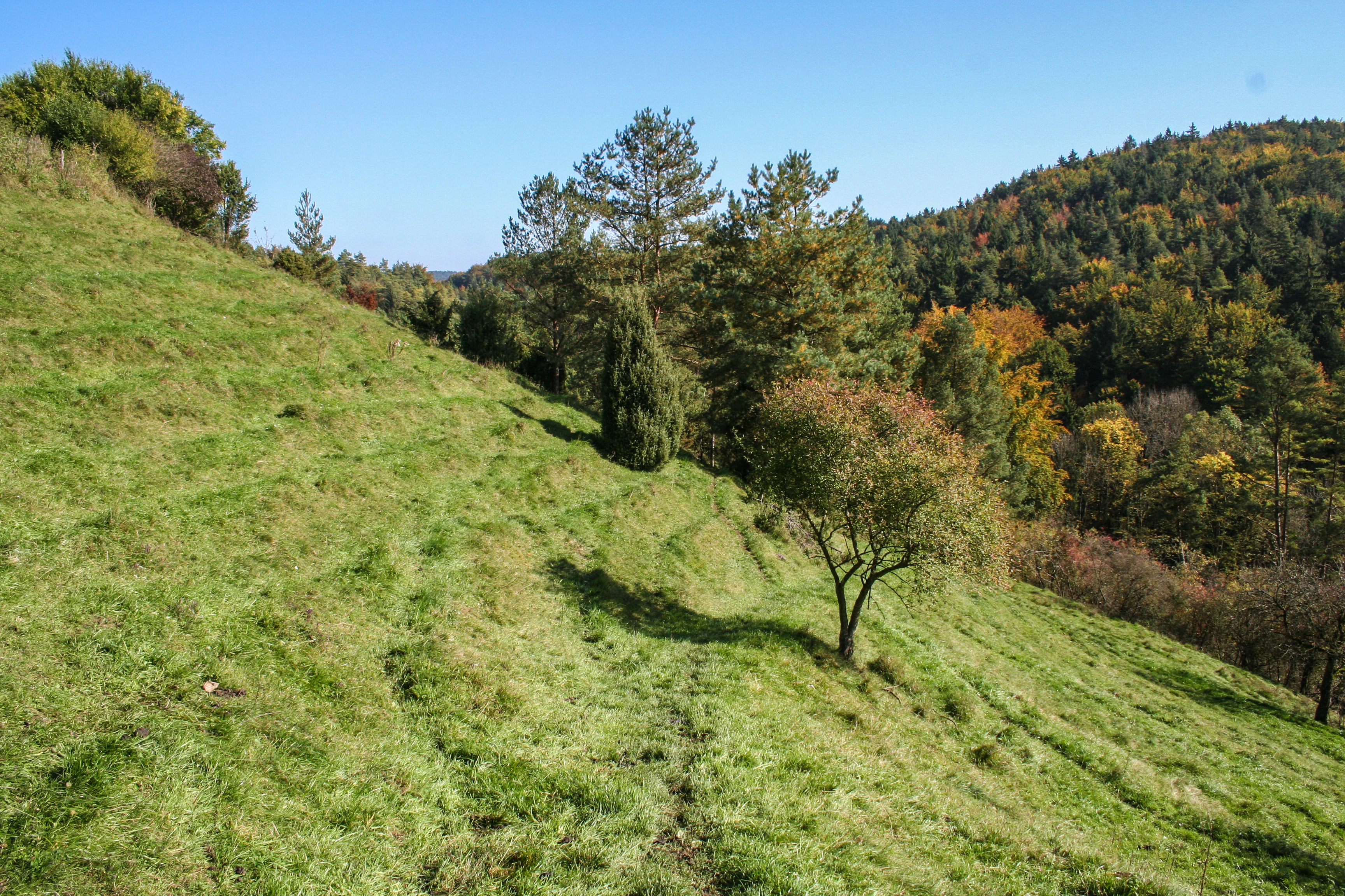
A green, grassy, sunlit hill slope with scattered pine and deciduous trees, descending toward a forested valley floor.
A grassy limestone slope typical of the Schottental bei Heldmannsberg nature reserve.

Schottental bei Heldmannsberg history and protected-area timeline

The area now protected as Schottental bei Heldmannsberg has a long pre-protection history shaped by agricultural use. The valley slopes were traditionally managed as a Hutanger, a Franconian and Oberpfälzer form of pasture that combines woodland, scrub, and open grazing land within a single enclosed unit. Sheep grazing on these slopes is not a modern conservation tactic but a continuation of historical land use, which is why the valley still shows its characteristic mixed pattern of wood and open.

Formal protection came relatively recently. The nature reserve was officially designated on 25 January 1996 under the catalog number NSG500.054, establishing the legal framework that has since governed management of the valley. Its inclusion in the Natura 2000 network as part of the larger stream-valley site Bachtäler der Hersbrucker Alb reflects a later stage in the recognition of its broader ecological significance beyond the borders of the immediate reserve.

The prehistoric and early-historic record around the valley also contributes to its long-term human story. Archaeological evidence in the surrounding area includes a Bronze Age hilltop settlement on the nearby Zant mountain, a prehistoric cave site near Ameisenberg, and Mesolithic open-air stations within the broader landscape. These prehistoric traces situate the valley within a much older pattern of human presence on the Hersbrucker Alb, even though the modern nature reserve itself is defined by its recent decades of formal protected status.

Schottental bei Heldmannsberg landscape and geographic character

The defining landform of Schottental bei Heldmannsberg is a narrow, steeply walled side valley of the Albachtal, carved into the limestone and dolomite bedrock of the Hersbrucker Alb. It reads as a compact, almost pocket-sized landscape, fitting several habitat types into a very small area.

The sides of the valley host the most eye-catching geological features. Outcrops of dolomite create small cliff faces and rocky knolls, the most prominent of which is the Bärenfels, reaching 427 meters above sea level. These rock formations provide bare outcrops, shaded crevices, and transition zones between forest and open ground. Ferns cling to the shaded rock faces, while open ledges support drought-adapted calcareous vegetation.

The valley floor is gentler but hydrologically distinctive. A small meandering brook, the Talbach, winds along the edge of the woodland, fed by several spring pools that emerge from the karst geology. These pools are a quiet landscape highlight in themselves. A small pond adds still water to the otherwise flowing character of the valley bottom. Surrounding the stream and pond are meadows, pasture, and scrub, with the upper slopes transitioning into mixed beech and pine woodland.
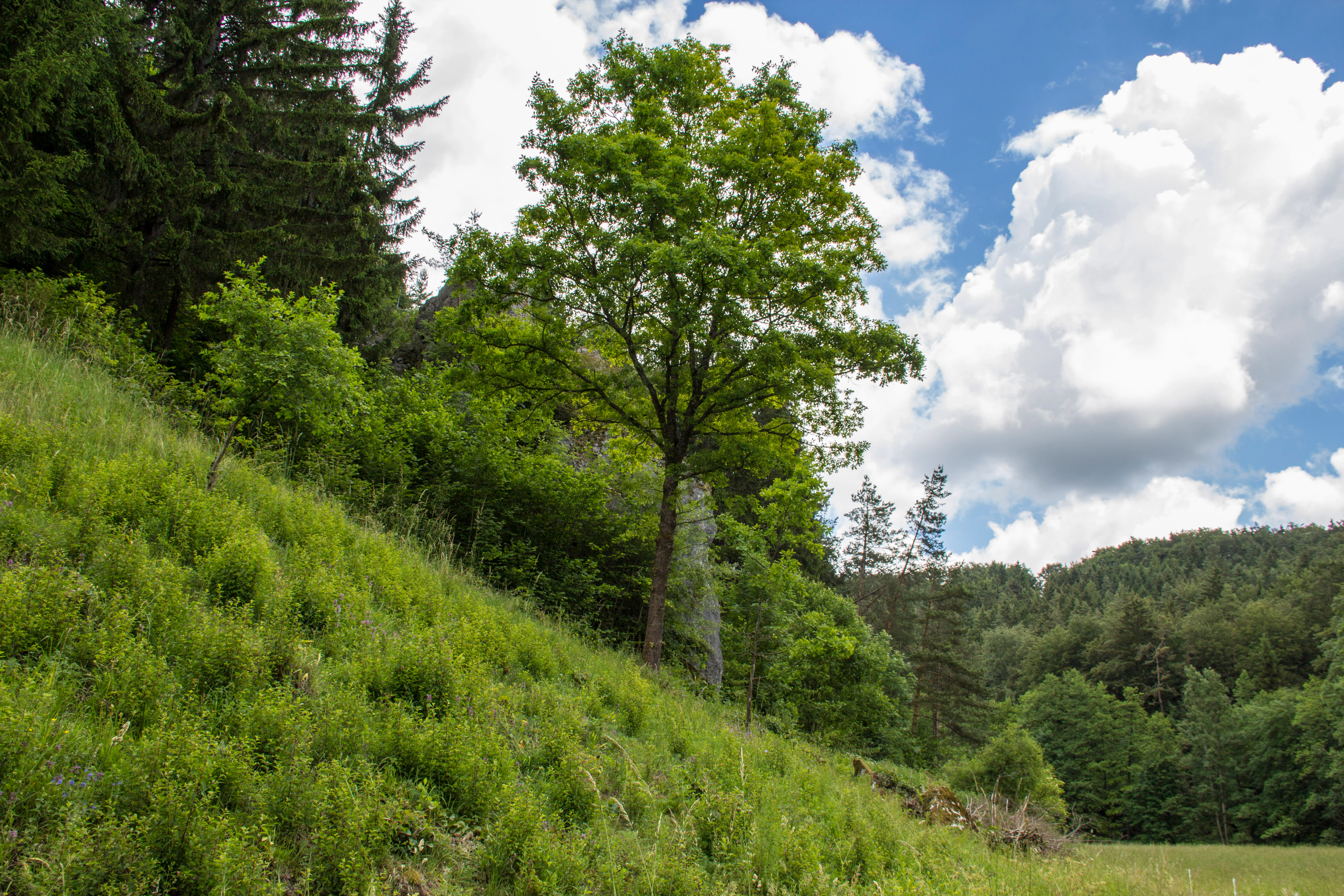
A sloped meadow covered in tall grasses leading up to a patch of mature broadleaf and coniferous trees under a partly cloudy sky.
A grassy slope and deciduous trees within the Schottental bei Heldmannsberg nature reserve.

Schottental bei Heldmannsberg ecosystems, habitats, and plant life

Ecologically, the reserve is built around its small-scale habitat mosaic rather than any single dominant ecosystem. The valley floor carries a patchwork of moderately used meadows, lightly grazed pasture, and small areas of fallow or partially abandoned grassland, all of which contribute to species richness in plants and insects. Blackthorn thickets and hedgerow-like scrub provide structural diversity along the edges between open and wooded ground, and are particularly important as breeding habitat for birds.

The slopes show an even sharper ecological contrast. On more acidic or deeper-soiled sections, mixed woodland dominated by beech with a substantial component of pine covers the upper slopes and steeper shaded areas. On shallower, sun-exposed ground, especially where dolomite or limestone approaches the surface, the vegetation shifts to calcareous dry grassland, known in German as Kalkmagerrasen, with related dry pasture. These open, flower-rich habitats are among the most ecologically valuable features of the reserve.

The shaded rock faces add a third ecological dimension, supporting fern communities and microhabitats that differ strongly from the open slopes. Together, the combination of woodland, dry grassland, meadow, scrub, rock, and running water gives the reserve a disproportionately rich ecological character for its size, and this mosaic character is precisely what the formal protection is intended to maintain.
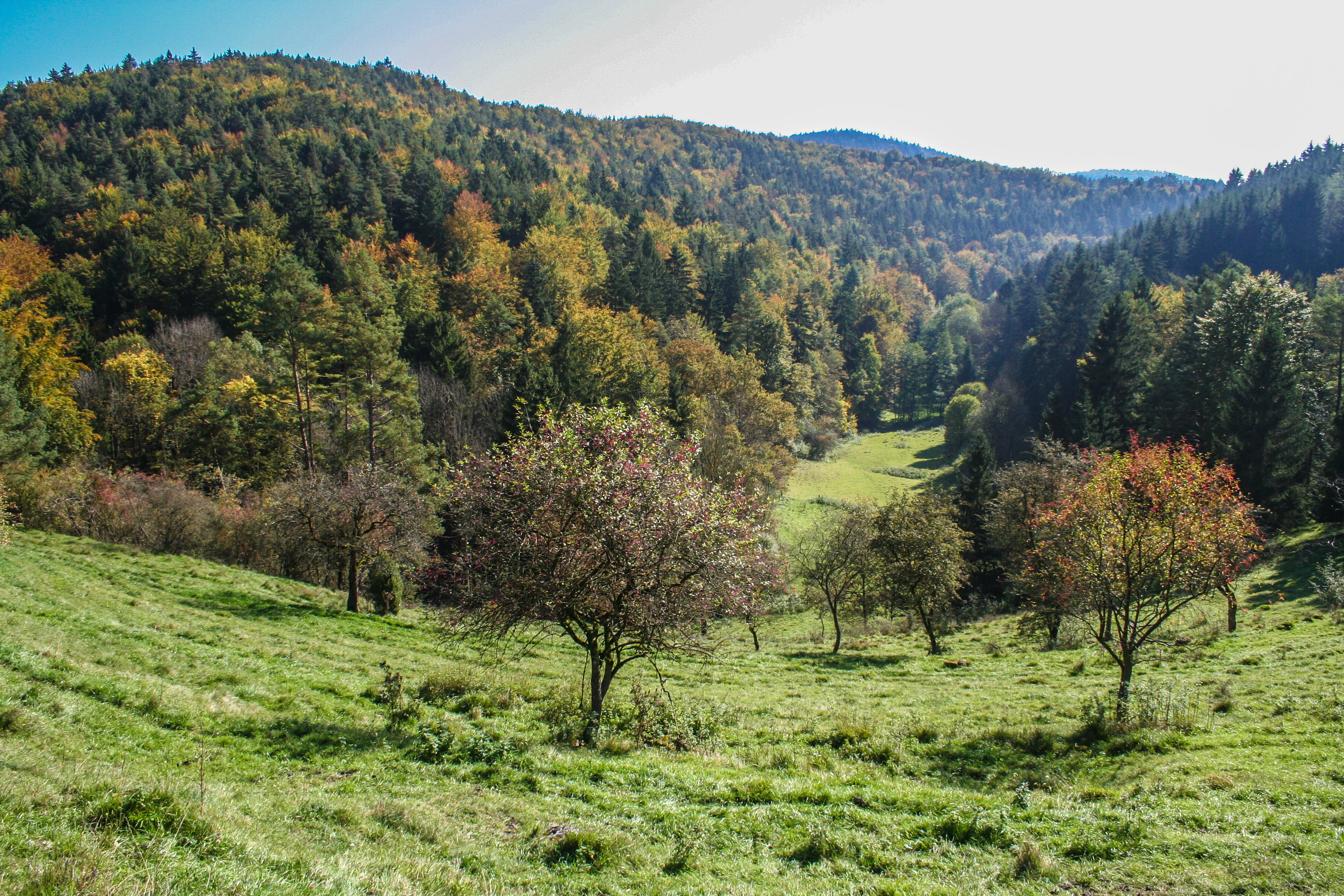
A downward view of a valley with green grassy slopes and scattered trees in the foreground, transitioning into a dense, multi-colored forest on the hillsides during autumn.
A scenic view of the valley and wooded slopes at Schottental bei Heldmannsberg.

Schottental bei Heldmannsberg wildlife and species highlights

The wildlife profile of the valley is shaped by the same habitat mosaic that defines its landscape. The blackthorn thickets and hedgerow structures along the slopes and field margins are highlighted in particular as nesting habitat for birds. The mix of meadow, scrub, and nearby forest supports a typical small-valley bird community of the Franconian Alb.

The calcareous dry grasslands on the open slopes are especially important for invertebrates. These warm, flower-rich areas support butterflies and other insects that depend on the particular plant communities of limestone and dolomite grassland. They are one of the key reasons the site carries ecological weight beyond what its area alone would suggest.

Other faunal interest centers on the stream and spring pools, which create small but valuable aquatic and riparian habitats for amphibians, aquatic insects, and other moisture-dependent species. The overall picture is not one of charismatic large mammals but of a functioning, interconnected small-valley ecosystem where habitat diversity drives species diversity.
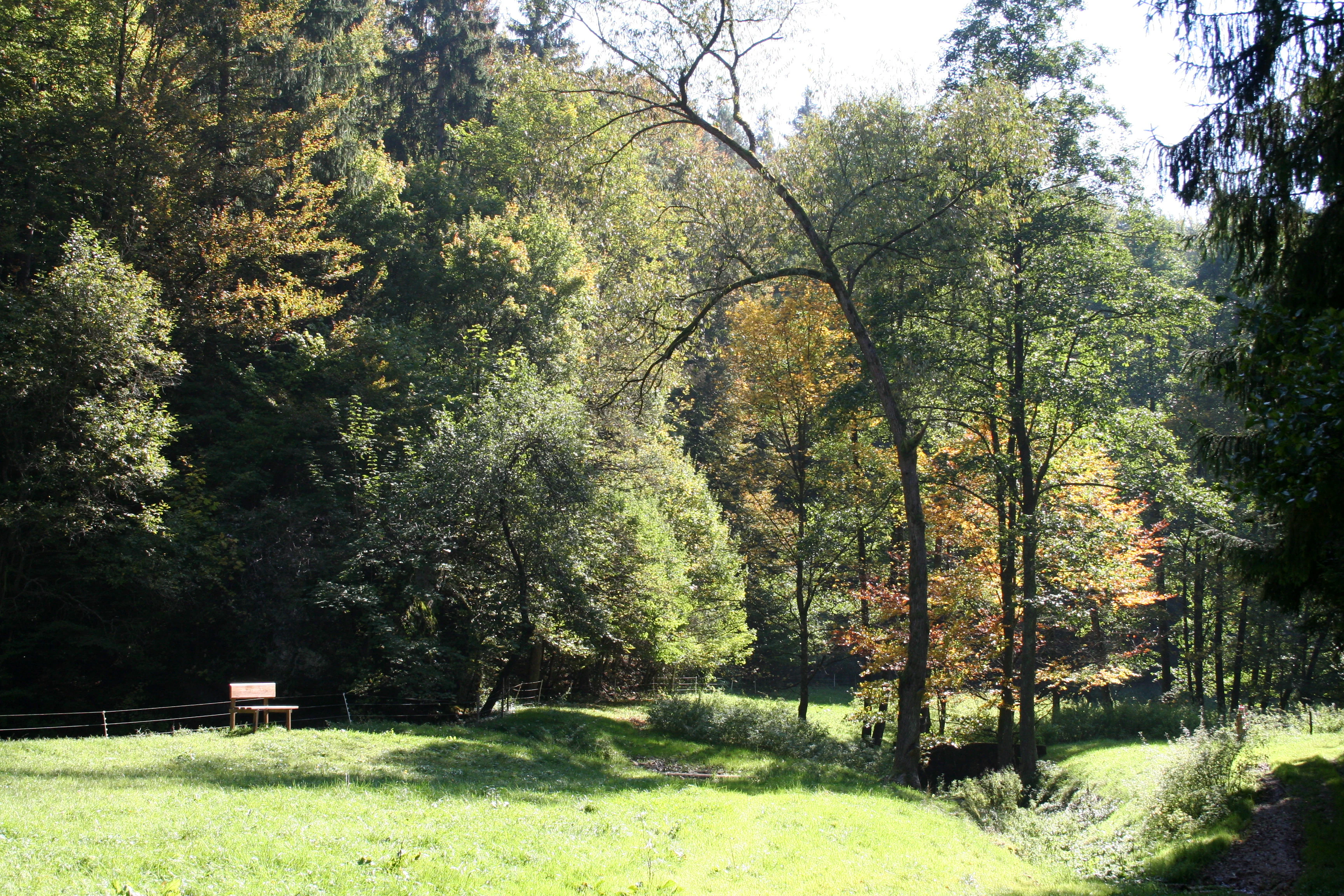
A sunny clearing with green grass in the foreground and a dense forest in the background, featuring a wooden park bench on the left.
A peaceful meadow and forest edge in the Schottental bei Heldmannsberg nature reserve.

Schottental bei Heldmannsberg conservation status and protection priorities

From a conservation standpoint, Schottental bei Heldmannsberg is significant because it ties together several layers of recognition. It is a nationally designated nature reserve, it is part of the European Natura 2000 network through its inclusion in the site Bachtäler der Hersbrucker Alb, and it corresponds to IUCN Category IV as a habitat and species management area. That means its primary purpose is not strict wilderness preservation but the active maintenance of specific habitats and species through managed land use.

The reserve's conservation value rests on the calcareous dry grasslands and the traditional Hutanger elements, both of which depend on continued grazing to remain open and species rich. Without grazing, succession would gradually close the open habitats, reducing habitat for the butterflies, plants, and birds that depend on them. The continuation of historical sheep grazing is therefore not nostalgia but a direct conservation tool.

The integration of the site into the larger Bachtäler der Hersbrucker Alb Natura 2000 area also gives it a wider role. While the formal NSG is small, its contribution to a connected network of protected stream valleys on the Hersbrucker Alb increases its importance for landscape-scale conservation of calcareous stream valleys, dry grasslands, and associated woodland in the region.

Schottental bei Heldmannsberg cultural meaning and human context

The cultural landscape around Schottental bei Heldmannsberg reflects centuries of pastoral tradition typical of the Hersbrucker Alb and the neighboring Oberpfalz. The Hutanger land use pattern, with woodland, scrub, and open sheep pasture integrated into a single managed unit, is itself a cultural artifact that continues to shape the visual character of the valley. The church of Mariae Himmelfahrt in nearby Heldmannsberg adds a further local heritage reference point within the broader setting of the reserve.

The broader landscape carries significantly older human traces as well. On the eastern Zant mountain, a Bronze Age hilltop settlement documents prehistoric use of the elevated ground above the valley. A prehistoric cave station near the Ameisenberg and Mesolithic open-air stations in the area point to even earlier activity, suggesting that the broader setting of the valley has been part of human settlement and movement for thousands of years.

Together, these elements give the site a layered cultural dimension: a very long prehistoric background, a centuries-old pastoral tradition still actively shaping the landscape, and a more recent formal protection regime that has secured the valley as a recognizable cultural and ecological unit.

Top sights and standout views in Schottental bei Heldmannsberg

The Bärenfels dolomite rock outcrop, rising to 427 meters above sea level, is the most distinctive single landmark of the valley, combining geological significance with a strong visual presence in the protected landscape.

The karst spring pools that feed the small meandering Talbach give the valley an unusually lively hydrological character for such a compact site, while the surviving Hutanger grazing tradition keeps the open slopes in the condition that makes the dry grassland habitats so valuable. For visitors, the strongest impressions often come from the simple contrast between the shaded rock faces and the open, flower-rich slopes above the valley floor.

Best time to visit Schottental bei Heldmannsberg

The most rewarding seasons to visit Schottental bei Heldmannsberg are late spring and early summer, when the valley meadows are in flower and the calcareous grasslands on the open slopes are at their most colorful and insect-rich. Early summer is also the period when butterfly activity on the dry slopes tends to be most visible.

Autumn is a second strong visiting season because of the foliage change in the mixed beech and pine woodland and the warm tones across the valley, both of which are considered particular highlights of the site. Winter visits are quieter but still feasible along the main path, though the valley's appeal lies mainly in its warmer-season vegetation and seasonal color change rather than in winter scenery.

Monthly climate preview

Monthly temperature ranges and precipitation averages for Bavaria

Schottental bei Heldmannsberg Climate Normals and Annual Temperature Patterns

Schottental bei Heldmannsberg records measured long term temperature variations alongside consistent daily precipitation rates across all twelve months. Reviewing the complete monthly climate profile provides detailed historical baseline data for analytical comparisons.
Annual mean8 °C
-2 °C19 °C
Jan-2°
Feb-1°
Mar
Apr
May13°
Jun17°
Jul19°
Aug19°
Sep14°
Oct
Nov
Dec-1°
Warmest month
July

19 °C

Coolest month
January

-2.2 °C

Wettest month
July

2.6 mm/day

Driest month
April

1.3 mm/day

Park location guide

Geography guide, regional context, and park location map for Schottental bei Heldmannsberg

Schottental bei Heldmannsberg park geography, regions, and map view in Germany

Understand where Schottental bei Heldmannsberg sits in Germany through a broader geographic reading of the surrounding landscape, nearby location context, and its mapped position within the national park landscape.

How Schottental bei Heldmannsberg fits into Germany

Germany is a federal republic in Western and Central Europe with a population of over 83 million across sixteen constituent states. It is Europe's largest economy by nominal GDP and a major global exporter and importer. The capital is Berlin, and the country borders Denmark, Poland, Czech Republic, Austria, Switzerland, France, Luxembourg, Belgium, and the Netherlands.

Wider geography shaping Schottental bei Heldmannsberg in Germany

Germany is located in Western and Central Europe, spanning 357,022 km². It borders Denmark to the north, Poland and the Czech Republic to the east, Austria and Switzerland to the south, and France, Luxembourg, Belgium, and the Netherlands to the west. The country has coastlines on the Baltic Sea and North Sea to the north, with the Alps located in the southern region.

Map view of Schottental bei Heldmannsberg

Use this park location map to pinpoint Schottental bei Heldmannsberg in Germany, understand its exact geographic position, and read its mapped placement within the surrounding landscape more clearly.

Pigeon | © OpenStreetMap contributors

Location context for Schottental bei Heldmannsberg

Bavaria

Visual reference collection featuring dolomite rock formations, karst spring pools, and traditional grazed slopes

Schottental bei Heldmannsberg Photos, Scenery, and Protected Valley Landscapes

Visual records illustrate the dramatic dolomite rock outcrops, spring-fed stream pools, and calcareous dry grasslands that shape the protected Franconian Alb valley. Exploring these landscape photographs reveals the diverse habitats, steep valley walls, and traditional land use patterns defining the nature reserve environment.

A green, grassy, sunlit hill slope with scattered pine and deciduous trees, descending toward a forested valley floor.

A narrow dirt trail curves through a lush green meadow towards a dense forest hillside in the background.

A sloped meadow covered in tall grasses leading up to a patch of mature broadleaf and coniferous trees under a partly cloudy sky.

A downward view of a valley with green grassy slopes and scattered trees in the foreground, transitioning into a dense, multi-colored forest on the hillsides during autumn.

A sunny clearing with green grass in the foreground and a dense forest in the background, featuring a wooden park bench on the left.

Park atlas

Compare adjacent Franconian Alb reserves and connected valley ecosystems

Parks Near Schottental bei Heldmannsberg: Exploring Surrounding Protected Landscapes

Browsing other protected areas near Schottental bei Heldmannsberg reveals broader regional continuity across the Franconian Alb. Expanding the geographic comparison highlights similar valley habitats, dolomite formations, and protected stream networks.
A horizontal watercolor painting depicting a soft, stylized landscape with rolling green hills, distant purple mountain ridges, and sparse clusters of trees against a light background.
Nature reserveBayern
About 3.6 km away#1 closest

Southwest

Rinntal bei Alfeld Nature Reserve: Geographic Profile and Protected Valley Landscape

A preserved limestone dry valley in the Franconian Jura of Bayern

Rinntal bei Alfeld is a significant nature reserve covering 34 hectares of dry valley landscape. Its geography includes abandoned field terraces, juniper-framed slopes, and rocky dolomite outcrops. As part of the Natura 2000 Bachtäler der Hersbrucker Alb network, the reserve showcases the traditional grazing influence and limestone karst features of the Franconian Jura plateau.

Area
0.338 km²
Established
2000
IUCN
IV
Relief
Upland
A soft watercolor painting of a winding river flowing through green rolling hills and meadows under a hazy, bright sky.
Protected landscapeBavaria
About 3.8 km away#2 closest

North

Naturpark Fränkische Schweiz, Frankenjura: An Atlas of Bavarian Karst and Forested Landscapes

Protected landscape geography within the northern Franconian Jura.

Naturpark Fränkische Schweiz, Frankenjura is a landmark protected area covering over 2,300 square kilometers across Bavaria. Its terrain is defined by a rhythmic sequence of limestone plateaux, winding river valleys, and dolomite formations, balanced by the quieter, pine-dominated reaches of the Veldensteiner Forst. This atlas entry details the park's geological complexity and its significant role in regional conservation.

Area
2,335.44 km²
Established
1968
Relief
Upland
Climate
Temperate
Nature reserveBavaria
About 8.5 km away#3 closest

North

Schergenbuck mit Schloss Neidstein: Nature Reserve and Protected Karst Landscape

Forestry and geological mapping of a historic Bavarian ridge

Located in the Amberg-Sulzbach district of Bavaria, this nature reserve integrates historic castle ruins with species-rich deciduous woodland and sensitive karst topography. It remains a key point of interest for understanding how small-scale protected areas preserve biodiversity, including native European yew, against the backdrop of the Franconian Jura landscape.

Area
0.177 km²
Established
1973
IUCN
IV
Relief
Upland
A watercolor illustration showing rolling green hills, small clusters of trees, and a distant forested ridgeline against a soft sky.
Protected landscapeBavaria
About 25 km away#4 closest

Southeast

Naturpark Hirschwald: A Protected Landscape and Geographic Overview in Bavaria, Germany

Calcareous dry grassland habitats and regional forest mosaic

Naturpark Hirschwald is a compact, mosaic-like protected landscape located in Bavaria. The park integrates the Lauterach valley, sun-exposed limestone slopes, and juniper-rich heathlands. Recognized for its critical role in bat conservation and diverse regional terrain, it provides a clear example of the ecological transition between the Franconian Alb and northern Upper Palatinate forests.

Area
277.6 km²
Established
2006
Relief
Upland
Climate
Temperate
A pale, soft-toned watercolor painting showing a wetland scene with grass, trees, and distant hills.
Nature reserveNürnberger Land
About 27 km away#5 closest

Southwest

Schwarzenbrucker Moor Nature Reserve: Geography and Protected Wetland Boundaries

A rare peatland habitat in the Middle Franconian landscape.

Schwarzenbrucker Moor is a preserved wetland complex situated within a bowl shaped former river meander. This nature reserve sustains a dense mosaic of open water, reedbeds, and alder bog woodland. Examine the site geography, mapped boundaries, and environmental significance of this protected habitat within the Nürnberger Land district.

Area
0.1 km²
Established
1992
IUCN
IV
Relief
Lowland
A soft, light-toned watercolor illustration of a river landscape with rolling hills in the background and a lone tree in the foreground.
Nature reserveBavaria
About 28 km away#6 closest

Southwest

Schwarzachschlucht Nature Reserve: Geographic Map and Protected Landscape Overview in Bavaria

A study of Franconian sandstone topography and riverine protected habitats

Schwarzachschlucht provides a focused example of geological erosion and forest conservation in Bavaria. This nature reserve features distinctive honeycomb-weathered cliffs, deep river-carved channels, and a significant moss-rich microclimate that has been protected since 1936. The site serves as a vital case for observing the transition between mixed forest slopes and alder-lined riverbanks within the Nürnberger Land district.

Area
0.38 km²
Established
1936
IUCN
IV
Relief
Upland
Protected landscapeBavaria
About 32 km away#7 closest

Northeast

Naturpark Nördlicher Oberpfälzer Wald: Protected Landscape and Regional Geography Map

Forested upland terrain and volcanic geology in Bavaria

Explore the structured geography of Naturpark Nördlicher Oberpfälzer Wald, a massive protected region in Bavaria. This detailed profile highlights the park's characteristic ridge and valley terrain, volcanic basalt landmarks, and its role as a vital ecological belt along the international border.

Area
1,380 km²
Water
Minor water
A horizontal watercolor illustration of a natural landscape showing sandy ground, patches of green vegetation, a small pond, and a distant treeline against a pale sky.
Nature reserveNuremberg
About 37 km away#8 closest

West

Sandgruben am Föhrenbuck Nature Reserve: Geography and Protected Area Overview in Nuremberg

A compact mosaic of restored quarry habitats and forest terrain in Bavaria.

Sandgruben am Föhrenbuck stands as a notable protected area in Nuremberg, Germany, defined by its dense concentration of varied ecosystems including wetlands, dry heath, and open sand. This former industrial site demonstrates how active management can foster diverse habitats, providing a rich area for studying land restoration and regional biodiversity within a forest-framed setting.

Area
0.219 km²
Established
1992
IUCN
IV

Common questions about visiting, size, designation, and location context for Schottental bei Heldmannsberg

Schottental bei Heldmannsberg FAQs for park facts, access, geography, and protected area context

Find quick answers about Schottental bei Heldmannsberg, including protected-area facts, park geography, trail and visitor context, and how the park fits into its surrounding country and regional landscape.
MoriAtlas Explorer

Continue Your Protected Areas Search Across the Global Atlas

Deepen your exploration by continuing the structured search for national parks and protected areas worldwide. Utilize the comprehensive filtering capabilities to compare different conservation landscapes and refine your understanding of global park geography. Discover more about the distribution and characteristics of protected natural areas.

Global natural geography