
Mori Atlas logo
Nature reserveSchwellenburg

Explore the karst gypsum terrain, terraced slopes, and rare xerothermic grasslands of central Germany.

Schwellenburg Nature Reserve: A Geological and Botanical Landmark in the Thuringian Basin

(Naturschutzgebiet Schwellenburg)

Schwellenburg stands as a prominent gypsum hill rising above the Thuringian Basin, defined by its historical quarrying terraces and dry, karstic microclimate. This protected nature reserve acts as a vital botanical refuge, hosting steppe-like plant communities and rare insect populations that are otherwise uncommon in central European environments. The site offers a specialized look at how specific geological formations create isolated habitats of significant scientific interest.

dry grasslandsteppe vegetationxerothermic habitatgypsum hillnature reserveThuringian Basin
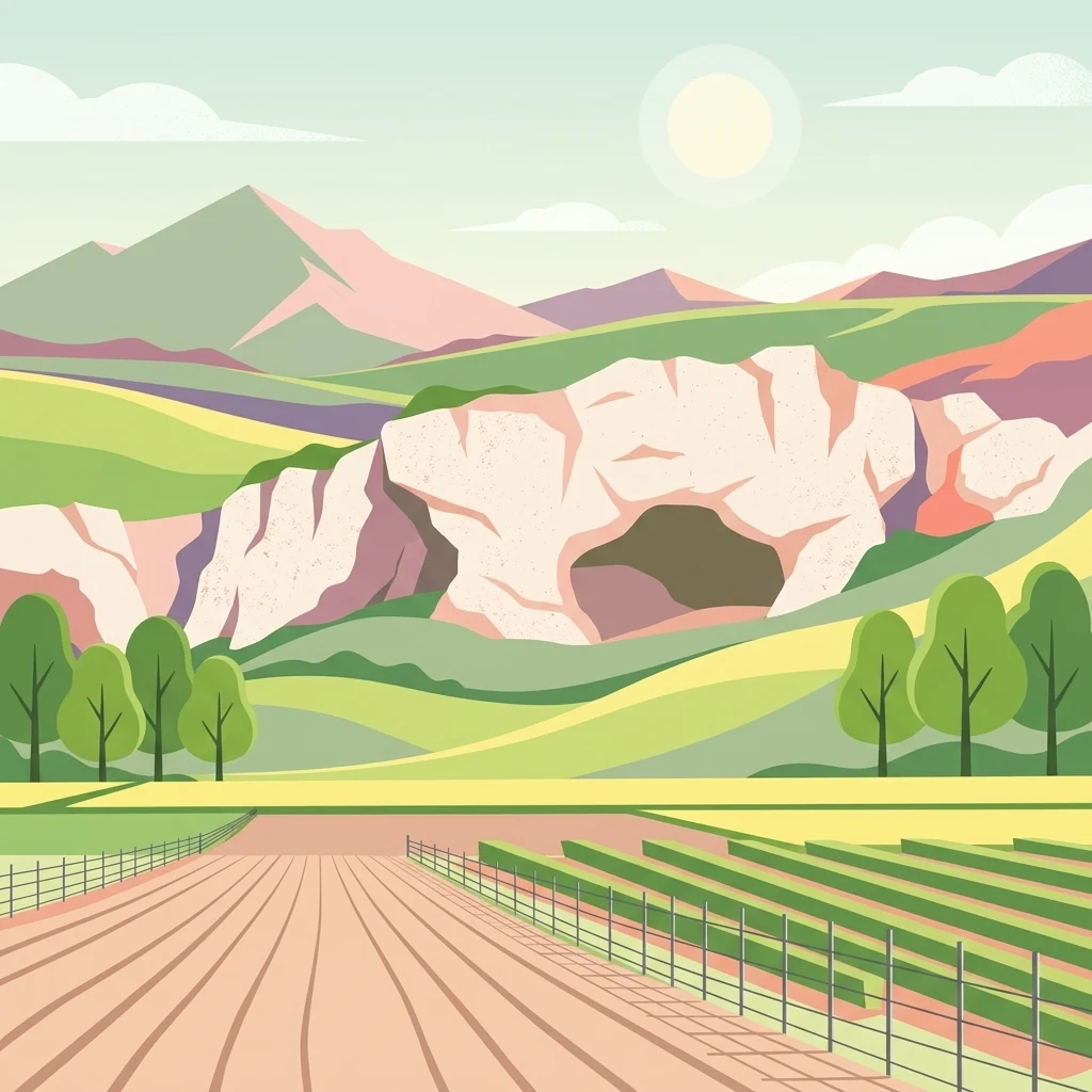
A flat vector style illustration depicts a light-colored gypsum rock formation with a prominent cave opening, set against rolling hills, green meadows, and agricultural rows in the foreground.

Schwellenburg

Nature reserve

Park overview

Structured park overview, official facts, and landscape profile for Schwellenburg

Schwellenburg park facts, protected area profile, and essential visitor context

Review the core facts for Schwellenburg, including designation, size, terrain, visitor scale, habitats, and operating context in one park-focused overview.

About Schwellenburg

The Schwellenburg occupies a striking position on the western edge of the Thuringian Basin, where the flat agricultural lowlands of central Thuringia meet the first foothill-like ridges of the regional hill country. It is the most prominent of several isolated ridges, or Härtlinge, that rise east of the Fahner Höhe, and it dominates the local skyline when approached from Erfurt to the southeast.

Geologically, the hill is built on Zechstein formations overlying older Rotliegend deposits, but its surface character is shaped by Keuper gypsum, which has been quarried here since 1865 for a small lime kiln at the foot of the slope. This history of extraction, combined with the natural karstic weathering of the gypsum, has left a terraced, stepped profile on the hillsides; these terraces, locally known as Schwellen, gave the hill its name.

Ecologically, the Schwellenburg is far more important than its modest size would suggest. The combination of a gypsum substrate that stores almost no water, low regional precipitation, southern exposures that warm and dry quickly, and centuries of disturbance has produced a habitat mosaic of dry grasslands that resembles true steppe rather than the typical central European woodland or meadow landscape. As a result, the hill has been a focal point of botanical research since the 19th century and continues to be a reference site for the conservation of xerothermic vegetation in Germany.

In modern times the Schwellenburg has also become a popular local recreation area. With new residential districts of Erfurt developed nearby, the hill attracts walkers and day visitors, bringing both appreciation and new pressures such as trampling damage and nutrient enrichment along paths.

Quick facts and research context for Schwellenburg

The Schwellenburg lies in the federal state of Thuringia in central Germany, just outside Erfurt and immediately adjacent to the Bundesstraße 4 federal highway. It is classified as a Naturschutzgebiet, Germany's strictest category of terrestrial nature reserve, with documented protection going back to 1939. Its highest point reaches roughly 227 meters above sea level, rising about 50 meters above surrounding fields and about 70 meters above the Gera river floodplain. The reserve covers about 22.5 hectares across an elongated hill roughly 1,200 by 500 meters in size.

Protection and recognition

Terrestrial conservation framework, management scope, and recognition data

Schwellenburg Protection Status and Official Designation Records

Schwellenburg features a documented terrestrial protection scope within official global databases. Conservation records compile baseline governance details and designation frameworks for structured analysis.

Protection details

Protection scope
Terrestrial
Transboundary protection
No
WDPA ID
165528
Park context

Deeper park guide and search-rich context for Schwellenburg

Schwellenburg history, landscape, wildlife, and travel context

Explore Schwellenburg through its history, landscape character, ecosystems, wildlife, conservation priorities, cultural context, and seasonal travel timing in a structured park guide built for atlas discovery and search intent.

Why Schwellenburg stands out

The Schwellenburg is best known for its xerothermic, steppe-like grassland vegetation, which is highly unusual for central Europe. Botanists have studied the site since the 19th century because of the rare plant communities that flourish on its dry, warm, gypsum-derived slopes. The hill is also a notable entomological site, hosting Germany's only known population of the leafhopper Praganus hofferi and other warmth-loving invertebrates typical of dry grassland habitats.
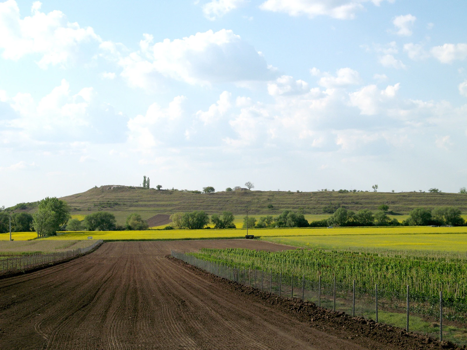
A wide landscape shot of a low, rolling hill rising above agricultural fields in rural Germany, with brown plowed earth and yellow blooming crops in the foreground.
Southern hillside view of the Schwellenburg nature reserve in Thuringia, Germany.

Schwellenburg history and protected-area timeline

The Schwellenburg's recent history is defined above all by its long-running role as a protected natural site. It has been under formal nature protection since 1939, predating much of modern German conservation legislation and reflecting its early recognition by botanists as a site of unusual scientific value.

The hill also has a documented history of human use reaching back well before modern times. Archaeological finds suggest a prehistoric hilltop settlement in the Stone Age, and the site appears to have served as a place of refuge in early historical periods. Despite the suggestive name 'Schwellenburg', there is no evidence of any medieval castle or fortification ever having stood on the hill.

Economic use of the Schwellenburg has shaped its physical landscape for over 150 years. Keuper gypsum was quarried here from 1865 onward to supply a lime-burning operation at the foot of the slope, and the characteristic terrace-like steps on the hillside are a relic of this extraction. The hill was also planted with vines from the Middle Ages until 1935, leaving a further imprint on the soil and vegetation. Some early botanical discoveries, including rare species found in 19th-century surveys, are believed to have been lost to overgrazing in subsequent decades, highlighting the long tension between use and conservation on the site.

Schwellenburg landscape and geographic character

The Schwellenburg is a compact but visually prominent hill shaped by its gypsum geology. It extends roughly 1,200 meters in length and about 500 meters in width, oriented as an elongated ridge within the otherwise flat surroundings of the Thuringian Basin. The highest point reaches approximately 227 meters above sea level, standing about 50 meters above the surrounding fields and around 70 meters above the alluvial plain of the Gera river.

The surface of the hill is defined by stepped, terrace-like forms that descend the slopes. These terraces are a direct legacy of historical gypsum quarrying rather than purely natural erosion, and they create a distinct, almost architectural profile visible from the adjacent federal highway. At the summit, gypsum rock breaks through the surface, and a number of small caves and weathered cavities are visible in these outcrops.

The hill lies in a low-precipitation part of central Thuringia, and the underlying gypsum karst drains water rapidly. Combined with strong sun exposure, particularly on the south-facing flank, this produces a landscape that feels noticeably warmer and drier than its surroundings, a condition that underpins the area's unusual vegetation.

Schwellenburg ecosystems, habitats, and plant life

Ecologically, the Schwellenburg is defined by its dry, steppe-like plant communities, an extraordinary feature at this latitude in central Europe. The interplay of gypsum substrate, karstic drainage, low rainfall and intense southern exposure produces conditions more reminiscent of eastern European or Pontic steppe than the forested, mesic landscapes that dominate the region. Different slope aspects and substrate conditions support different associations, creating a varied mosaic across a small area.

The vegetation is dominated by various forms of xerothermic dry grassland, known locally as Xerothermrasen. Among the documented community types are fescue feather-grass dry grassland and gamander feather-grass dry grassland, each associated with specific microhabitats on the hill. These communities have been studied continuously since the 19th century and are a key reason the site has held protected status for decades.

Human pressures have left visible fingerprints on the ecology. Grazing pressure in earlier periods is thought to have eliminated some species recorded in historic botanical surveys, while more recently the construction of nearby residential areas has introduced new challenges. Trampling along paths, the input of nitrates from foot traffic, and the encroachment of nitrogen-loving plant species along trails all alter the nutrient balance of these sensitive dry grasslands.

Schwellenburg wildlife and species highlights

The Schwellenburg's wildlife significance is closely tied to its dry grassland habitats. The warm, exposed slopes and sparse vegetation support invertebrate communities typical of central European dry grasslands, including species that are rare or absent elsewhere in the region. From a zoological perspective, the hill is regarded as a particularly valuable reference site.

The most notable wildlife record is entomological. The Schwellenburg is, within Germany, the only known location for the small leafhopper Praganus hofferi, a rare cicada species tied to xerothermic grassland habitats. The site has been referenced in entomological research since the late 1960s as an example of the distinctive insect fauna associated with central European dry grasslands.

Although the plant communities tend to attract the most attention, the animal life of the Schwellenburg reinforces its broader ecological importance as an island-like habitat for warmth-loving species within a largely agricultural and increasingly urbanized landscape.

Schwellenburg conservation status and protection priorities

The conservation significance of the Schwellenburg is unusually high relative to its size. It has been formally protected as a nature reserve, the strictest category of German terrestrial conservation designation, since 1939, an early date that reflects its long recognition by botanists and ecologists rather than any recent rediscovery.

Its protected status is rooted in the rarity of its habitat. The combination of gypsum geology, low rainfall, and historical land use has produced steppe-like dry grassland vegetation that is exceptionally uncommon in central Europe and is considered highly vulnerable. Because the soils are thin and the plant communities depend on low nutrient levels and minimal disturbance, even small changes in grazing pressure, trampling, or nutrient input can shift the ecological balance.

The site is also important as a long-term scientific reference. Repeated botanical and zoological surveys over more than a century have made the Schwellenburg a benchmark against which the conservation status of similar dry grassland sites elsewhere in Germany can be evaluated. Its proximity to expanding urban areas of Erfurt brings ongoing conservation challenges, including recreational pressure, off-road vehicle damage, and the spread of nitrophilous vegetation along paths.

Schwellenburg cultural meaning and human context

Although there are no documented medieval fortifications on the site, the name Schwellenburg nonetheless suggests a long cultural association with defense or refuge. Archaeological evidence points to a Stone Age hilltop settlement on the hill and to its use as a place of refuge in early historical periods, giving the landscape a deeper human history than its modest size might suggest.

More recent cultural layers include centuries of viticulture from the Middle Ages until 1935, gypsum quarrying from 1865 to supply a local lime kiln, and pastoral use that has profoundly shaped the vegetation. Today the hill functions as a local landscape identity marker on the outskirts of Erfurt, both a scientific reference and a familiar walking destination for residents of nearby new neighborhoods.

Top sights and standout views in Schwellenburg

The Schwellenburg's standout qualities are its gypsum geology, its terrace-shaped slopes shaped by 19th-century quarrying, and its unusually complete set of xerothermic dry grassland communities within a small area. It is also notable as Germany's only known site for the leafhopper Praganus hofferi, an insect signature of central European steppe habitats.

As a compact nature reserve with more than 80 years of formal protection and an even longer history of scientific study, the Schwellenburg functions as both a working conservation site and a local landmark, an unusual combination that gives it a distinctive identity on the outskirts of Erfurt.

Best time to visit Schwellenburg

Because the vegetation, insect fauna and landscape character of the Schwellenburg depend on warmth and dryness, the hill feels most alive botanically in late spring and summer, when the dry grasslands are in flower, the south-facing slopes are at their warmest, and thermophilic insects are most active. Spring visits are useful for seeing early bloomers in the dry grassland communities, while early summer offers the most complete display of feather-grass and associated herbaceous species.

Autumn and winter visits have their own appeal. The exposed gypsum outcrops and small caves at the summit become more visible when surrounding vegetation dies back, and the hill's distinctive terraced profile stands out sharply in low, raking light. Cooler, quieter months also reduce the pressure of recreational footfall, making them a good time for visitors interested primarily in geology, structure, and quiet observation rather than peak botanical display.


Monthly climate preview

Long term representative weather by month and historical climate rhythm for Schwellenburg

Schwellenburg Climate Normals, Annual Temperature and Precipitation Patterns

Schwellenburg experiences a measured annual temperature and precipitation rhythm recorded across representative coordinate normals from 1991 to 2020. Reviewing the complete twelve month profile provides deeper insight into historical averages and long term climate variations.
Annual mean9 °C
-1 °C19 °C
Jan-1°
Feb
Mar
Apr
May13°
Jun17°
Jul19°
Aug19°
Sep14°
Oct
Nov
Dec
Warmest month
July

18.9 °C

Coolest month
January

-1 °C

Wettest month
July

2.5 mm/day

Driest month
April

1.3 mm/day

Park location guide

Geography guide, regional context, and park location map for Schwellenburg

Schwellenburg park geography, regions, and map view in Germany

Understand where Schwellenburg sits in Germany through a broader geographic reading of the surrounding landscape, nearby location context, and its mapped position within the national park landscape.

How Schwellenburg fits into Germany

Germany is a federal republic in Western and Central Europe with a population of over 83 million across sixteen constituent states. It is Europe's largest economy by nominal GDP and a major global exporter and importer. The capital is Berlin, and the country borders Denmark, Poland, Czech Republic, Austria, Switzerland, France, Luxembourg, Belgium, and the Netherlands.

Wider geography shaping Schwellenburg in Germany

Germany is located in Western and Central Europe, spanning 357,022 km². It borders Denmark to the north, Poland and the Czech Republic to the east, Austria and Switzerland to the south, and France, Luxembourg, Belgium, and the Netherlands to the west. The country has coastlines on the Baltic Sea and North Sea to the north, with the Alps located in the southern region.

Map view of Schwellenburg

Use this park location map to pinpoint Schwellenburg in Germany, understand its exact geographic position, and read its mapped placement within the surrounding landscape more clearly.

Pigeon | © OpenStreetMap contributors

Location context for Schwellenburg

Thuringia

Visual reference guide to the protected nature reserve, dry grassland habitats, and distinctive geological terraces.

Schwellenburg Landscape Photos and Gypsum Terrain Scenery

Visual documentation captures the rugged gypsum ridges, exposed rock outcrops, and stepped quarry terraces defining the protected hill environment. Detailed photography reveals rare xerothermic vegetation and dry grassland habitats thriving across the Thuringian Basin.

A wide landscape shot of a low, rolling hill rising above agricultural fields in rural Germany, with brown plowed earth and yellow blooming crops in the foreground.

A low, weathered gypsum rock cliff face set into a grassy hill under a bright blue sky.

Park atlas

Compare nearby nature reserves and regional geological landmarks in central Germany.

Explore Other Parks Near Schwellenburg and Protected Areas Across the Region

Browsing other parks near Schwellenburg reveals distinct geological formations and protected dry grassland habitats across the surrounding Thuringian Basin. Expanding the comparison across nearby protected areas provides valuable context on regional conservation landscapes and rare botanical terrain.
Nature reserveThuringia
About 13 km away#1 closest

Northwest

Herbslebener Teiche Nature Reserve: Mapping the Wetland Mosaic and Floodplain Geography

A critical protected wetland and floodplain landscape in central Thuringia, Germany.

Herbslebener Teiche encompasses a varied landscape of reed beds, ponds, and riparian zones within the Unstrut river basin. This nature reserve provides essential habitat structure through its complex arrangement of fallow land, sedge meadows, and open water bodies, marking it as a significant protected entity in the Thuringia region.

Area
0.993 km²
Established
2000
Relief
Lowland
Climate
Temperate
A horizontal watercolor illustration depicting soft green rolling hills and a forested ridge against a pale white background.
Protected landscapeThuringia
About 13 km away#2 closest

West

Fahner Höhe Protected Landscape: Geography and Natural Terrain of the Thuringian Basin

Mapped limestone ridge and woodland protected area in central Germany

Fahner Höhe stands as a significant geological landmark in Thuringia, characterized by its long, narrow Muschelkalk ridge. The area features dense oak-hornbeam forests, deep erosional features like the Imtalgraben, and a rich variety of spring flora. As a designated protected landscape and Natura 2000 site, it offers a distinct contrast to the surrounding lowland basin, serving as a vital natural asset for the regional geography.

Area
26 km²
Relief
Upland
Climate
Temperate
Access
Easy access
A horizontal watercolor painting showing a green marshy landscape with a small winding stream, wildflowers in the foreground, and soft rolling hills in the background.
Nature reserveThuringia
About 17 km away#3 closest

Southwest

Siebleber Teich Nature Reserve: A Detailed Map of Thuringia's Historic Wetland Landscape

Exploring the ecology and cultural geography of a protected lowland fishpond

Siebleber Teich in Thuringia represents a unique convergence of late glacial wetland history and centuries of ducal pond management. This nature reserve protects a shallow aquatic environment surrounded by levees, mature linden trees, and marshes. It stands as a crucial geographic anchor for avian and amphibian populations within the Gotha district, showcasing how managed land evolves into a protected wildlife sanctuary.

Area
0.28 km²
Established
1717
Relief
Lowland
Climate
Temperate
Nature reserveThuringia
About 23 km away#4 closest

East

Südhang Ettersberg Nature Reserve: Geographic Overview and Protected Area Boundaries

A prominent protected ridge landscape in central Thuringia

Südhang Ettersberg encompasses 408 hectares of south-facing slopes, creating a unique microclimate in the Weimarer Land district. This nature reserve serves as a benchmark for dry grassland and thermophilic woodland conservation in central Germany, offering a distinct mapped landscape that stands out from the surrounding agricultural lowlands.

Area
4.083 km²
Established
1997
IUCN
IV
Relief
Upland
Nature reserveThuringia
About 24 km away#5 closest

Northwest

Großer Horn Nature Reserve: Protected Forest Geography and Mapped Landscape Context

A vital woodland reference site in the Thuringian Basin.

Großer Horn is a long-standing nature reserve located in northern Thuringia, notable for its strict totalreservat core and diverse forest composition. The protected area features an intricate soil mosaic of loess loam and limestone, supporting distinct oak and beech forest communities. This isolated habitat island provides essential insight into the ecological character of the subcontinental forest transition zone.

Area
0.159 km²
Established
1961
Relief
Upland
Climate
Temperate
Nature reserveIlm-Kreis
About 25 km away#6 closest

South

Gottesholz Nature Reserve: Mapping the Protected Landscapes of Ilm-Kreis, Thuringia

A study of shell-limestone woodland geography

Gottesholz serves as an essential nature reserve in Ilm-Kreis, defined by its porous shell-limestone bedrock and rich, diverse vegetation. This detailed view covers the physical landscape, the strict forest reserve status, and the ecological markers that define this distinctive central German site.

Area
0.593 km²
Established
1961
IUCN
IV
Nature reserveThuringia
About 28 km away#7 closest

South

Hohes Kreuz Nature Reserve: Mapping Forest Conservation in the Ilm District of Thuringia

A preserved oak-hornbeam landscape within the central German agricultural mosaic.

Hohes Kreuz is a protected nature reserve in Thuringia, Germany, renowned for preserving a residual oak-hornbeam forest on a Muschelkalk plateau. The site functions as an ecological refuge, supporting a wide variety of bird species and broadleaf vegetation while providing a striking contrast to the surrounding farmland of the Ilm district.

Area
0.105 km²
Established
1961
IUCN
IV
Relief
Upland
Protected landscapeThuringia
About 28 km away#8 closest

Southeast

Landschaftsschutzgebiet Mittleres Ilmtal: Protected Landscape Geography and Map Discovery

Thuringia regional atlas and protected area profile

Gain insight into the diverse topography of Landschaftsschutzgebiet Mittleres Ilmtal, which spans roughly 150 square kilometers. This protected landscape is characterized by its dramatic shifts from Buntsandstein forests in the Tannrodaer Sattel to the elevated Muschelkalk escarpments, offering a detailed case study in German mid mountain geography.

Area
150 km²
Relief
Upland
Climate
Temperate
Access
Access unknown

Common questions about visiting, size, designation, and location context for Schwellenburg

Schwellenburg FAQs for park facts, access, geography, and protected area context

Find quick answers about Schwellenburg, including protected-area facts, park geography, trail and visitor context, and how the park fits into its surrounding country and regional landscape.
MoriAtlas Explorer

Continue Your Protected Areas Search Across the Global Atlas

Deepen your exploration by continuing the structured search for national parks and protected areas worldwide. Utilize the comprehensive filtering capabilities to compare different conservation landscapes and refine your understanding of global park geography. Discover more about the distribution and characteristics of protected natural areas.

Global natural geography