

Mori Atlas logo
Protected landscapeSiargao Islands Protected Landscape and Seascape

A comprehensive look at the protected terrain, coastal biodiversity, and island geography spanning the Siargao archipelago.

Siargao Islands Protected Landscape and Seascape: Mapping the Philippines' Largest Marine Reserve

The Siargao Islands Protected Landscape and Seascape serves as a critical conservation area off the northeastern coast of Mindanao in Surigao del Norte. This expansive reserve integrates diverse terrestrial and marine ecosystems, ranging from limestone karst hills and lowland forests to extensive seagrass meadows, mangrove-lined coasts, and vibrant coral reef systems across its small island chain.

marine protected areaisland archipelagosurfing destinationcoral reefsseagrass meadowsmangroves

Siargao Islands Protected Landscape and Seascape

Protected landscape

Park overview

Structured park overview, official facts, and landscape profile for Siargao Islands Protected Landscape and Seascape

Siargao Islands Protected Landscape and Seascape park facts, protected area profile, and essential visitor context

Review the core facts for Siargao Islands Protected Landscape and Seascape, including designation, size, terrain, visitor scale, habitats, and operating context in one park-focused overview.

About Siargao Islands Protected Landscape and Seascape

The Siargao Islands Protected Landscape and Seascape represents the Philippine model of integrating terrestrial and marine conservation within a single protected-area designation. By covering both island landmass and surrounding waters within one institutional framework, SIPLAS manages landscapes that range from low limestone hills and basalt interior ridges to mangrove-fringed coastlines, reef platforms, seagrass beds, and offshore islands.

Geographically, the reserve clusters around Siargao Island and Bucas Grande and stretches across the smaller islands of Middle Bucas, East Bucas, Hinatuan, La Janosa, Anahawan, and Dako. The vast majority of its territory is marine, with the remaining portion consisting of island landscapes shaped by karst geology, alluvial coastal flats, and beach systems. The interplay of these environments creates a mosaic of habitats that supports species rarely seen elsewhere in such proximity, including both forest-dependent wildlife in the interior and reef- and seagrass-dependent species in the surrounding waters.

What makes SIPLAS especially significant within the Philippine conservation network is its scale and its combination of ecological and cultural relevance. The islands host communities that have long depended on fishing, coastal trade, and small-scale agriculture, and the protected-area framework is designed to safeguard both the ecosystems and the livelihoods connected to them. At the same time, the reserve has become a globally recognized tourism anchor, with surfing, island hopping, cave visits, and diving all driving interest in the area. This convergence of biodiversity, local culture, and international tourism makes SIPLAS a flagship example of how the Philippines approaches integrated coastal and marine conservation.

Quick facts and research context for Siargao Islands Protected Landscape and Seascape

Siargao Islands Protected Landscape and Seascape is located in the province of Surigao del Norte in the Caraga region of the Philippines, covering islands and waters off the northeastern tip of Mindanao. Established by Presidential Proclamation 902 on October 10, 1996, under President Fidel Ramos, the reserve spans a combined landscape and seascape of roughly 2,789 square kilometers, of which marine waters form the overwhelming majority. The municipal coverage includes Burgos, Dapa, Del San Isidro, San Benito, Santa Monica, and Socorro, with General Luna serving as a nearby gateway town.

Protection and recognition

Documented protection scope and international recognition records

Siargao Islands Protected Landscape and Seascape Protection Status

Siargao Islands Protected Landscape and Seascape maintains a documented mixed protection status within regional conservation records. Structured database entries outline available designation details, management frameworks, and formal administrative classifications.

Protection details

Protection scope
Mixed
Transboundary protection
No
Park context

Deeper park guide and search-rich context for Siargao Islands Protected Landscape and Seascape

Siargao Islands Protected Landscape and Seascape history, landscape, wildlife, and travel context

Explore Siargao Islands Protected Landscape and Seascape through its history, landscape character, ecosystems, wildlife, conservation priorities, cultural context, and seasonal travel timing in a structured park guide built for atlas discovery and search intent.

Why Siargao Islands Protected Landscape and Seascape stands out

SIPLAS is most recognized for combining three distinct identities: a marine biodiversity stronghold, an island and reef ecosystem with limestone karst features, and a world-class surfing reserve. The Cloud 9 reef break on the eastern side of Siargao Island places the area on the global surfing map during the northeast monsoon season, while the Sohoton cave system on Bucas Grande and its resident jellyfish lake offer a very different kind of natural attraction. Its biodiversity profile adds further distinction. The reserve hosts endemic and range-restricted species such as the Philippine colugo, the Philippine tarsier, and the red-vented cockatoo, alongside marine fauna including hawksbill and green sea turtles, dugongs, and bottlenose dolphins. The presence of dense coral banks and extensive seagrass meadows underscores why SIPLAS has been designated as a key coastal and marine protected landscape for the country.

Siargao Islands Protected Landscape and Seascape history and protected-area timeline

SIPLAS was formally established through Presidential Proclamation 902 signed by President Fidel Ramos on October 10, 1996. The proclamation recognized both the terrestrial and marine values of the Siargao archipelago and designated the area as a protected landscape and seascape, a category used in the Philippines for sites that combine scenic and ecological value across land and sea.

The establishment of SIPLAS reflected a broader attempt during the 1990s to strengthen the Philippines' network of marine protected areas and to address long-standing pressures on coastal ecosystems from fishing, resource extraction, and unregulated coastal development. By placing the islands and surrounding waters under a unified protected-area designation, the government created an administrative framework intended to curb destructive practices and to coordinate conservation across multiple municipalities.

Since its establishment, SIPLAS has been managed within the national protected-area system and has become one of the most prominent examples of integrated coastal and marine conservation in the country. Its growing international profile, particularly through surfing tourism at Cloud 9, has shaped subsequent discussions about managing visitor pressure, sustaining marine biodiversity, and ensuring that local communities continue to benefit from the reserve's resources.

Siargao Islands Protected Landscape and Seascape landscape and geographic character

The physical landscape of SIPLAS is shaped by its island geography and the sea that surrounds it. Siargao Island, the largest landmass in the protected area, rises to about 238 meters above sea level and is described as hilly with gentle gradients. The interior geology combines limestone formations, basalt in the central portions, and younger alluvial deposits along the coast. These geological layers produce karst-like features, freshwater springs, and softer lowlands where alluvial soils accumulate.

The coastline is characterized by sandy beaches, mangrove forests, and small offshore features that connect the islands to their marine environment. On Bucas Grande, dramatic limestone formations frame the Sohoton cave system, which is accessible only during low tide and supports one of the most distinctive visitor experiences within the reserve. The Magpupungko rock formation, located in a lagoon near the town of Pilar, offers further examples of karst erosion, with sculpted limestone and granite shapes shaped by long-term weathering.

Around the islands, the seascape includes extensive coral banks off La Janosa and Anahawan, seagrass meadows, reef flats, and the deeper waters that constitute the bulk of SIPLAS by area. The combination of rugged karst coastlines, gentle interior slopes, mangrove linings, and offshore reef platforms gives the protected area a layered scenic structure that spans everything from forested hilltops to submerged reef ecosystems.

Siargao Islands Protected Landscape and Seascape ecosystems, habitats, and plant life

Ecologically, SIPLAS functions as a bridge between terrestrial and marine systems. Its forests and coastal lowlands include mangrove ecosystems, beach forest, and interior vegetation types that have evolved in the context of the Philippines' broader biodiversity hotspot. The limestone and basalt substrates support different plant communities, and the alluvial coastal flats concentrate nutrients where freshwater and saltwater meet.

Marine habitats are particularly central to the reserve's ecological identity. Seagrass meadows provide grazing areas for the dugong, while reef structures and coral banks shelter high fish and mollusk diversity. The marine flora documented in the area includes a significant share of the seagrass species known from the Philippines, alongside a substantial number of seaweed species. This biological richness supports the reserve's role as one of the country's most important coastal and marine biodiversity areas.

The interaction between land and sea creates ecological corridors and transition zones that amplify biodiversity. Mangroves filter nutrients and shelter juvenile marine species, reef flats and seagrass beds link shallow waters to deeper marine zones, and forested uplands regulate freshwater flow into the coastal system. This ecological connectivity is one of the defining characteristics that led to SIPLAS being designated as both a landscape and a seascape protected area.

Siargao Islands Protected Landscape and Seascape wildlife and species highlights

SIPLAS is notable for the diversity and endemism of its wildlife, including both terrestrial and marine groups. Among birds, the area supports forest and coastal species such as the red-vented cockatoo, the silvery kingfisher, the Philippine broadbill, and the Philippine scops owl, as well as a range of gull and tern species. These birds reflect the reserve's combination of forest interior habitats, coastal wetlands, and offshore feeding zones.

Mammals in the protected area include the Philippine colugo, often called the flying lemur, and the Philippine tarsier, both of which highlight the area's importance for endemic and range-restricted mammals. Marine mammals include bottlenose dolphins and the eastern Pacific dolphin species, while reptiles include the estuarine crocodile and sea turtles such as the green turtle and the critically endangered hawksbill turtle. Nesting activity by hawksbill turtles has been recorded on Siargao Island itself, emphasizing the importance of the reserve's beaches for marine reptile conservation.

The marine fauna of SIPLAS is documented to include well over a hundred fish species and a similarly large number of mollusk species, underscoring the reserve's reef productivity. Coral banks off islands such as La Janosa and Anahawan provide habitat for many of these species. The presence of the dugong as a grazing species in the seagrass meadows adds a particularly strong conservation signal, as dugongs are considered vulnerable throughout their range.

Siargao Islands Protected Landscape and Seascape conservation status and protection priorities

Conservation significance is at the core of SIPLAS's identity. As the largest marine protected area in the Philippines, it plays a strategic role in protecting coral reef ecosystems, seagrass meadows, mangrove systems, and the species that depend on them. Its combined landscape and seascape status allows management efforts to address both upstream land-based pressures and downstream marine threats within a single framework.

The reserve protects habitat for several threatened species, including the hawksbill turtle, the dugong, and endemic avifauna such as the red-vented cockatoo. Its seagrass meadows and reef structures are important not only for local biodiversity but also for sustaining fisheries that support nearby coastal communities. Conservation of these ecosystems directly affects the long-term viability of small-scale fishing livelihoods across the municipalities covered by SIPLAS.

The protected area also illustrates the challenges of balancing conservation with tourism growth. Surfing tourism, particularly at Cloud 9, has brought significant economic activity to the area, but it also creates pressures on coastal infrastructure, waste management, reef health, and local culture. Addressing these pressures through zoning, sustainable tourism practices, and community engagement is increasingly part of the conservation agenda for SIPLAS, making it both a repository of natural value and a testing ground for integrated coastal management in the Philippines.

Siargao Islands Protected Landscape and Seascape cultural meaning and human context

The islands within SIPLAS are home to longstanding coastal and island communities whose livelihoods have historically centered on fishing, small-scale agriculture, and inter-island trading. The municipal coverage of the reserve, including Burgos, Dapa, Del San Isidro, San Benito, Santa Monica, and Socorro, reflects the distributed human presence across the Siargao archipelago and the integration of local life into the protected-area framework.

Surfing has emerged as a relatively recent but powerful cultural and economic force, reshaping aspects of community identity on Siargao Island while also creating new pressures on traditional ways of life. The seasonal rhythm of surfing tourism during the northeast monsoon months brings visitors, jobs, and exposure to local culture, while also raising questions about how to sustain community character alongside visitor growth.

The interplay between indigenous and long-established island culture, fishing traditions, and an expanding international tourism scene gives SIPLAS a layered cultural context in which local identity is closely tied to coastal and marine resources, and where conservation decisions have direct implications for community well-being and cultural continuity.

Top sights and standout views in Siargao Islands Protected Landscape and Seascape

SIPLAS stands out for the sheer scale of its marine coverage, the diversity of its island landscapes, and the convergence of ecological and tourism significance. Its combination of karst coastlines, mangrove-fringed beaches, and offshore reef systems produces one of the most visually varied protected seascapes in the Philippines. At the same time, the reserve hosts globally appealing features such as the Sohoton cave system on Bucas Grande and the Cloud 9 reef break on Siargao Island, which together offer both adventure and wildlife experiences.

Another defining highlight is the reserve's biodiversity depth, including the presence of dugongs, sea turtles, dolphins, endemic birds, and the Philippine colugo. The fact that seagrass beds supporting dugongs and coral banks supporting diverse reef life coexist within the same managed area underscores how SIPLAS integrates multiple conservation priorities into a single protected landscape and seascape.

Best time to visit Siargao Islands Protected Landscape and Seascape

The character of a visit to SIPLAS is shaped strongly by seasonal patterns tied to the northeast monsoon. From October through February, the prevailing northeast and southeast winds generate large, consistent swells on the eastern side of Siargao Island, producing the surfing conditions that have made Cloud 9 internationally famous. This period is the prime season for surfing-focused visits and for those interested in the area's wave-driven atmosphere.

Outside of the surfing season, conditions are generally calmer and more conducive to island hopping, reef exploration, mangrove tours, and visits to the Sohoton cave system on Bucas Grande. Rainfall is distributed throughout the year, with the heaviest rains from November to January and the driest conditions typically in June. This relatively even distribution of rainfall means that lush vegetation and green landscapes are maintained across most of the year, supporting strong nature and wildlife viewing throughout the seasons.

Monthly climate preview

Long-term representative temperature and monthly precipitation normals across the coordinate

Siargao Islands Protected Landscape and Seascape Climate and Weather by Month

Historical monitoring across a representative coordinate reveals steady thermal conditions alongside distinct shifts in monthly precipitation totals throughout the year. Reviewing the complete twelve-month record provides deeper context for long-term regional climate variations.
Annual mean28 °C
27 °C28 °C
Jan27°
Feb27°
Mar27°
Apr28°
May28°
Jun28°
Jul28°
Aug28°
Sep28°
Oct28°
Nov28°
Dec28°
Warmest month
May

28.3 °C

Coolest month
February

27 °C

Wettest month
January

16.3 mm/day

Driest month
May

4.9 mm/day

Park location guide

Geography guide, regional context, and park location map for Siargao Islands Protected Landscape and Seascape

Siargao Islands Protected Landscape and Seascape park geography, regions, and map view in Philippines

Understand where Siargao Islands Protected Landscape and Seascape sits in Philippines through a broader geographic reading of the surrounding landscape, nearby location context, and its mapped position within the national park landscape.

How Siargao Islands Protected Landscape and Seascape fits into Philippines

The Philippines, officially the Republic of the Philippines, is an archipelagic nation in Southeast Asia comprising approximately 7,641 islands categorized into three main geographical divisions: Luzon, Visayas, and Mindanao. Located in the western Pacific Ocean, it shares maritime borders with Taiwan, Japan, Palau, Indonesia, Malaysia, Vietnam, and China. Manila serves as the capital city, while Quezon City is the most populated city, both within Metro Manila.

Wider geography shaping Siargao Islands Protected Landscape and Seascape in Philippines

The Philippines is an archipelagic nation in Southeast Asia, positioned in the western Pacific Ocean. Its islands are bounded by the South China Sea to the west, Philippine Sea to the east, and Celebes Sea to the south. The country shares maritime borders with Taiwan to the north, Japan to the northeast, Palau to the east and southeast, Indonesia to the south, Malaysia to the southwest, Vietnam to the west, and China to the northwest.

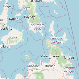
Map view of Siargao Islands Protected Landscape and Seascape

Use this park location map to pinpoint Siargao Islands Protected Landscape and Seascape in Philippines, understand its exact geographic position, and read its mapped placement within the surrounding landscape more clearly.

Pigeon | © OpenStreetMap contributors

Location context for Siargao Islands Protected Landscape and Seascape

Surigao del Norte
Park atlas

Compare surrounding regional reserves and connected coastal marine habitats

Parks Near Siargao Islands Protected Landscape and Seascape

Browse protected areas and marine reserves near Siargao Islands Protected Landscape and Seascape to compare regional island ecosystems. Evaluating adjacent conservation landscapes provides broader context for tropical wetland habitats and coral reef formations.
Protected landscapeSurigao del Norte
About 41 km away#1 closest

West

Mahaba Island Protected Landscape and Seascape: Regional Geography and Island Reserve

A combined coastal and marine protected area in Surigao del Norte.

Spanning both a flat sandy island and its surrounding sea, Mahaba Island Protected Landscape and Seascape illustrates the integrated conservation model of the Philippines. Discover the layered geography of mangrove-fringed shorelines, interior coconut patches, and marine habitats that form this protected reserve in the Caraga region.

Area
57.04 km²
Established
1991
Relief
Lowland
Climate
Tropical
Wildlife reserveAgusan del Norte
About 79 km away#2 closest

Southwest

Cabadbaran-Santiago Watershed Forest Reserve: Atlas and Geographic Context

Protected watershed landscapes of the Diwata mountain range

Cabadbaran-Santiago Watershed Forest Reserve serves as a primary forest stronghold in Agusan del Norte. This protected area shields the headwaters of the Cabadbaran and Narog river systems, featuring a diverse topographical mosaic of steep ridges, forested gorges, and montane slopes that define the northern section of the Diwata mountain range.

Area
160.25 km²
Established
1991
Relief
Mountain
Scope
Terrestrial
Nature reserveAgusan del Sur
About 109 km away#3 closest

South

Andanan Watershed Forest Reserve: Protected Landscape and Watershed Geography in Agusan del Sur

Exploring the Diwata Mountains and Andanan River headwaters

Spanning mountainous terrain in Agusan del Sur, the Andanan Watershed Forest Reserve acts as a primary catchment area for the Andanan River system. This nature reserve sustains a mosaic of forest and grassland habitats within the Diwata Mountains, representing a vital node in the regional protected-area network of Mindanao.

Area
150.97 km²
Established
1991
Relief
Mountain
Scope
Terrestrial
National parkPhilippines
About 151 km away#4 closest

Northwest

Kuapnit Balinsasayao National Park: Philippines Old-Growth Forest and Endemic Wildlife Atlas

Explore protected landscape boundaries and mountainous terrain on Leyte Island.

Kuapnit Balinsasayao National Park stands as a key protected area within the Philippines, distinguished by its mature old-growth forests and its critical role in conserving endemic bird species unique to the Eastern Visayas. Located on Leyte Island within the mountainous terrain of the Anonang-Lobi Mountain Range, the park's protected landscape identity is central to understanding its geographic significance. This park offers a valuable entry point for exploring the mapped natural features and conservation importance of protected areas across the Philippine archipelago.

Area
3.64 km²
Established
1937
IUCN
V
Relief
Mountain
Wildlife reserveAgusan del Sur
About 166 km away#5 closest

South

Agusan Marsh Wildlife Sanctuary: Mapping a Vast Freshwater Protected Area

Swamp forests and river basin geography in Agusan del Sur

Agusan Marsh Wildlife Sanctuary represents a crucial freshwater wetland complex within the Agusan River basin. The area is defined by its expansive swamp forests and semi-permanent floating lakes, which serve as essential migratory transit points and support an intricate network of aquatic ecosystems across the Mindanao region.

Area
148.36 km²
Established
1996
IUCN
IV
Relief
Lowland
A soft watercolor painting of a coastal landscape with green rolling hills, distant faint mountains, and light water reflections.
Protected landscapeLeyte
About 170 km away#6 closest

Northwest

Cuatro Islas Protected Landscape/Seascape: Leyte Marine and Island Geography Exploration

Detailed protected area atlas for the Camotes Sea island group

The Cuatro Islas Protected Landscape/Seascape is a notable Philippine conservation zone consisting of four distinct islands including Apid, Mahaba, Digyo, and Himokilan. This geographic profile details the diverse terrain, ranging from uplifted former coral reefs to coral sand islets, while providing a clear understanding of the surrounding marine ecosystem and its role in regional conservation.

Area
125 km²
Established
2000
Scope
Mixed
National parkPalo
About 187 km away#7 closest

Northwest

MacArthur Landing Memorial National Park: Protected Area Geography & Map Context

Explore the mapped boundaries of this national park in Palo, Philippines.

This entry details MacArthur Landing Memorial National Park, a protected national park located near Palo, Philippines. It focuses on its identity as a mapped landscape and a distinct protected area, offering insights into its geographic context and atlas presence. Understanding this park involves exploring its mapped boundaries and its contribution to the regional protected area landscape, providing a factual basis for geographic discovery.

Area
0.068 km²
Established
1977
Relief
Lowland
Climate
Tropical
Protected landscapeBohol
About 210 km away#8 closest

West

Rajah Sikatuna Protected Landscape: Mapping the Limestone Forest of Bohol, Philippines

A vital protected area of karst ridges and endemic forest habitats

Rajah Sikatuna Protected Landscape sits as a premier natural landmark in southern Bohol. This area is defined by its extensive karst topography, significant cave systems, and expansive limestone forests. It serves as an essential ecological anchor for the province, offering a unique perspective on the island's diverse upland geography and natural mountain systems.

Area
104.526 km²
Established
1987
IUCN
V
Relief
Mountain

Common questions about visiting, size, designation, and location context for Siargao Islands Protected Landscape and Seascape

Siargao Islands Protected Landscape and Seascape FAQs for park facts, access, geography, and protected area context

Find quick answers about Siargao Islands Protected Landscape and Seascape, including protected-area facts, park geography, trail and visitor context, and how the park fits into its surrounding country and regional landscape.
MoriAtlas Explorer

Continue Your Protected Areas Search Across the Global Atlas

Deepen your exploration by continuing the structured search for national parks and protected areas worldwide. Utilize the comprehensive filtering capabilities to compare different conservation landscapes and refine your understanding of global park geography. Discover more about the distribution and characteristics of protected natural areas.

Global natural geography