
Mori Atlas logo
Protected areaSix Rivers National Forest

Tracing the boundaries of river-cut mountain terrain and vast old-growth forested corridors

Six Rivers National Forest: A Comprehensive Geographic Overview of this California Protected Landscape

Six Rivers National Forest occupies a rugged expanse of northwestern California, characterized by its deep canyons and mountainous terrain carved by the Eel, Van Duzen, Klamath, Trinity, Mad, and Smith rivers. This protected landscape encompasses expansive old-growth Douglas-fir stands and connects to expansive wilderness areas across the region. The geography reflects a transition from moist coastal influences to drier inland montane environments, creating a complex and diverse ecosystem for study and exploration.

national forestPacific Northwestold growth forestcoastal Douglas-firriver valleyswild and scenic rivers
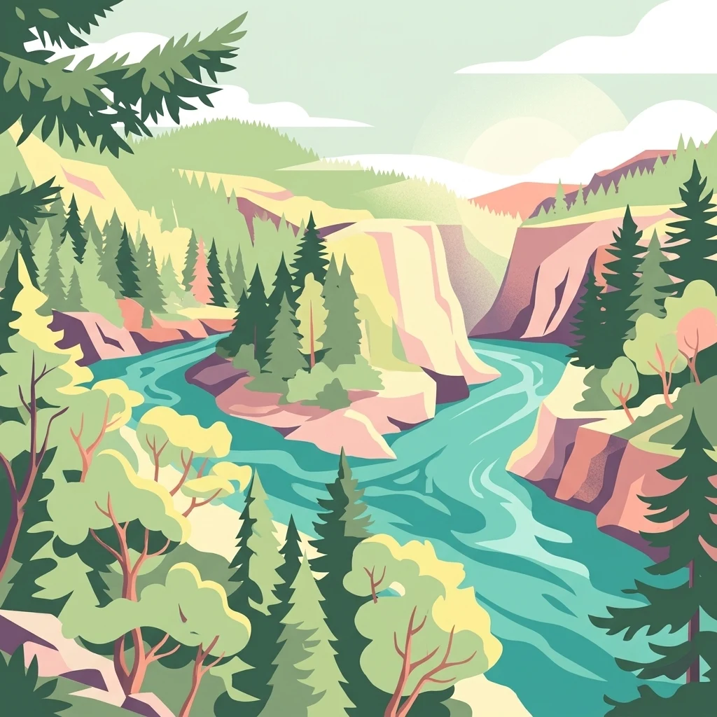
A stylized digital illustration of a turquoise river flowing through a deep canyon surrounded by lush evergreen forests and steep rocky cliffs under a soft, hazy sky.

Six Rivers National Forest

Protected area

Park overview

Structured park overview, official facts, and landscape profile for Six Rivers National Forest

Six Rivers National Forest park facts, protected area profile, and essential visitor context

Review the core facts for Six Rivers National Forest, including designation, size, terrain, visitor scale, habitats, and operating context in one park-focused overview.

About Six Rivers National Forest

Six Rivers National Forest occupies the northwestern corner of California, where the Coast Ranges meet the Klamath Mountains and the forests approach the Pacific Ocean. Managed by the U.S. Forest Service and headquartered in Eureka, the forest stretches across Del Norte, Humboldt, Trinity, and Siskiyou counties, enclosing portions of some of the state's most iconic river valleys. Its identity is shaped by water: the Eel, Van Duzen, Klamath, Trinity, Mad, and Smith rivers all flow through or near the forest's boundaries, and more than 366 miles of these waterways are protected under the National Wild and Scenic Rivers System.

Ecologically, Six Rivers bridges the wet, fog-shaped coastal forests and the drier, more montane interior forests of northern California. Coast Douglas-fir, tanoak, Pacific madrone, and white fir form the core of its old-growth and late-successional forests, with substantial stands of untouched timber still standing across the landscape. The forest includes six botanically distinctive areas and provides habitat for species tied to both salmon-bearing rivers and ancient conifer forests. The northern section, set aside as the Smith River National Recreation Area, highlights the forest's role as a recreation destination as well as a working landscape.

Wilderness protection reinforces the forest's conservation value. Mount Lassic, North Fork, Siskiyou, Trinity Alps, and Yolla Bolly-Middle Eel wildernesses all overlap with Six Rivers, with several extending into adjacent national forests and adjacent Bureau of Land Management holdings. These wilderness linkages connect Six Rivers into a much larger network of protected Pacific Northwest landscapes, helping maintain ecological continuity across a region known for its biodiversity, salmon streams, and rugged forest character.

Protection and recognition

Documented terrestrial protection scope, management framework, and conservation records

Six Rivers National Forest Protection Status and Terrestrial Conservation Data

Six Rivers National Forest maintains a documented terrestrial protection scope within its designated conservation boundaries. Structured records outline the official management framework and baseline recognition data associated with the protected area.

Protection details

Protection scope
Terrestrial
Transboundary protection
No
Park context

Deeper park guide and search-rich context for Six Rivers National Forest

Six Rivers National Forest history, landscape, wildlife, and travel context

Explore Six Rivers National Forest through its history, landscape character, ecosystems, wildlife, conservation priorities, cultural context, and seasonal travel timing in a structured park guide built for atlas discovery and search intent.

Why Six Rivers National Forest stands out

Six Rivers National Forest is best known for its deep network of forested river valleys in northwestern California, with the Smith, Klamath, Trinity, Mad, Van Duzen, and Eel rivers defining the landscape. It contains substantial old-growth coastal conifer stands, hundreds of miles of protected wild and scenic rivers, six formal botanical areas, and five designated wildernesses that link it directly with neighboring national forest ecosystems. The northern Smith River section is also nationally recognized for its recreation value and clear-water character.
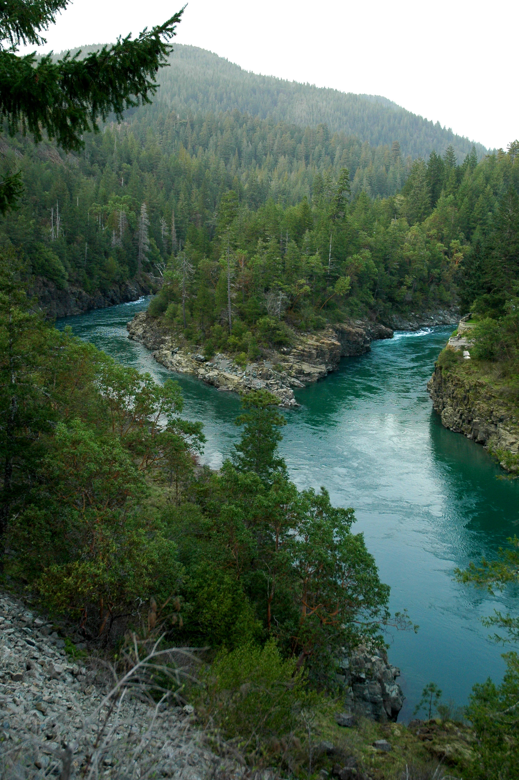
An elevated view looking down at a river confluence where two branches of the bright turquoise Smith River meet, surrounded by dense evergreen forest and rocky slopes.
The confluence of the South Fork Smith River and the main Smith River within Six Rivers National Forest.

Six Rivers National Forest history and protected-area timeline

Six Rivers National Forest was established on June 3, 1947, by U.S. President Harry S. Truman through the consolidation of portions of the Klamath, Siskiyou, and Trinity National Forests. Combining these three older forest reserves into one administrative unit allowed the U.S. Forest Service to manage what was, at the time, over a million acres of forestland in northwestern California as a single coordinated landscape.

From its founding, the forest played a role both as a working timber landscape and as a conservation area, with significant old-growth stands retained alongside managed forests. The inclusion of long stretches of wild and scenic rivers reflected national recognition of the region's ecological and recreational value. The forest has also figured into broader American cultural and legal history: the area was the setting for the Patterson-Gimlin film of 1967, claimed to depict a Bigfoot, and it was the location at the center of the 1988 U.S. Supreme Court decision Lyng v. Northwest Indian Cemetery Protective Association, which dealt with land claimed as sacred by regional Native American tribes. Both events helped fix Six Rivers in public awareness as a remote, culturally significant California wilderness.

Six Rivers National Forest landscape and geographic character

The landscape of Six Rivers National Forest is defined by the interplay of steep mountains and deeply carved river valleys. The Coast Ranges and Klamath Mountains combine to create a terrain of narrow canyons, forested ridges, and high country that drains toward the Pacific. The Smith River system on the northern edge cuts through terrain associated with the famous clear waters and dramatic rock formations of the north coast; further inland, the Klamath, Trinity, Mad, Van Duzen, and Eel rivers shape long forested corridors that have historically supported both salmon runs and river-based recreation.

Beyond the rivers, the land rises into higher elevation country, particularly toward the interior portions of the forest where it meets the Trinity Alps and Siskiyou ranges. This variation in elevation, combined with the strong moisture gradient moving inland from the coast, supports a transition from foggy coastal forests to drier, more montane forests with intermixed rocky openings and rugged ridges. Wild and scenic river corridors, deep gorges, and ridgeline trails define the visual character of much of the forest.

Six Rivers National Forest ecosystems, habitats, and plant life

The ecological identity of Six Rivers National Forest is rooted in the transition between coastal and interior forest types in the Pacific Northwest. Old-growth stands are among the forest's most important ecological features, with Coast Douglas-fir, tanoak, Pacific madrone, and white fir forming the architecture of mature forests across much of the landscape. These old-growth habitats are recognized as six distinct botanical areas within the forest, reflecting the unusually rich plant communities present across the range of elevations and moisture conditions.

In addition to its terrestrial forest ecosystems, Six Rivers includes extensive aquatic and riparian habitat. The wild and scenic river segments support salmon, steelhead, and other anadromous fish, while the surrounding riparian zones contribute to overall forest biodiversity. The combination of coastal influence, elevation variation, and large tracts of minimally disturbed forest makes Six Rivers ecologically significant at both the regional and state level.

Six Rivers National Forest wildlife and species highlights

Six Rivers National Forest provides habitat for wildlife typically associated with mature Pacific Northwest forests and cold, salmon-bearing rivers. Old-growth and late-successional stands support species that depend on large trees, snags, and downed wood, while riparian corridors along the wild and scenic rivers sustain salmon, steelhead, and trout populations that anchor the aquatic food web. The forest's mountainous interior and proximity to designated wilderness areas further broaden its value for species that require large, contiguous tracts of relatively undisturbed habitat.

Mammals typical of northern California's forested mountains, raptor species tied to cliff and canyon habitats along the rivers, and a range of resident and migratory birds all find suitable conditions within the forest. Although specific wildlife inventories are not the focus of the available source material, the forest's ecological setting clearly places it among the more biologically diverse national forest units in California.

Six Rivers National Forest conservation status and protection priorities

As one of the major national forest units in northwestern California, Six Rivers plays a substantial conservation role in the Pacific Northwest. The forest retains significant old-growth habitat, much of it protected within its 137,000 acres of old growth, and connects directly to surrounding protected landscapes through a system of designated wilderness areas that span multiple national forests and adjacent Bureau of Land Management lands. Hundreds of miles of rivers within the forest are protected under the National Wild and Scenic Rivers System, ensuring long-term conservation of their free-flowing character and ecological values.

The forest's network of protected river corridors, old-growth stands, and botanical areas gives it regional importance for salmonid habitat, mature coastal conifer ecosystems, and connectivity between the Coast Ranges and the Klamath Mountains. Six Rivers also plays a role in preserving landscapes of cultural importance, including sites considered sacred by regional Native American tribes, and in maintaining wilderness character across a large portion of northwestern California.

Six Rivers National Forest cultural meaning and human context

Six Rivers National Forest occupies a region with deep and continuing cultural significance for Native American peoples. Land within the forest became the focus of the 1988 U.S. Supreme Court case Lyng v. Northwest Indian Cemetery Protective Association, in which several regional tribes asserted sacred-use claims to specific sites within the forest. The decision drew national attention to the relationship between federal forest management and tribal cultural heritage, and remains a significant reference point in discussions of indigenous rights, sacred sites, and public land policy.

Beyond this legal and cultural history, the forest's remote river valleys and rugged terrain have shaped a regional identity connected to fishing, river-running, homesteading, and timber work. The forest also gained a distinctive place in American popular culture through the Patterson-Gimlin film, which has long been associated with the area's standing as a remote and mythologized northern California wilderness.

Top sights and standout views in Six Rivers National Forest

Six Rivers stands out for its combination of large-scale old-growth coastal forests, extensive wild and scenic river corridors, and direct linkage with adjoining wilderness areas across multiple national forests. The Smith River National Recreation Area anchors the northern portion of the forest and offers one of the region's most celebrated clear-water river experiences, while the forest's interior opens into the Trinity Alps and Siskiyou Mountains, accessing some of the most rugged backcountry in California.

The forest is also notable for its historical and cultural depth, from its establishment in 1947 by the consolidation of three older national forests to its ongoing cultural significance for regional Native American tribes and its place in American popular memory tied to the Patterson-Gimlin film. Together, these qualities make Six Rivers a forest of both ecological richness and cultural resonance within the U.S. National Forest System.

Best time to visit Six Rivers National Forest

The climate of northwestern California shapes Six Rivers National Forest into a year-round landscape, with each season offering a different character. Summer and early fall generally bring the most reliable conditions for hiking, camping, and river-based recreation, with lower rainfall, accessible higher-elevation trails, and warm water temperatures supporting a wide range of outdoor activities. Late spring, when snowmelt feeds the rivers and waterfalls, can be especially dramatic in the river canyons, though runoff can also complicate fishing and some river travel.

Winter and early spring bring heavy rainfall to the lower elevations and snow to the higher interior portions of the forest. This season transforms the landscape into a lush, green, fast-moving river environment, but also brings challenging road conditions, trail closures, and a greater emphasis on low-elevation camping and fishing. Visitors interested in salmonid viewing, peak river flows, or quiet forest solitude may favor the off-season, while those seeking wider trail access and stable weather often prefer late spring through early fall.

Monthly climate preview

Long term representative measurements of monthly temperature and precipitation for Six Rivers National Forest

Six Rivers National Forest Climate Normals and Annual Temperature Rhythm

Historical NASA records for Six Rivers National Forest outline a measured annual progression of average temperatures and monthly precipitation patterns. Reviewing the complete twelve month profile provides deeper insight into long term climate variations across the protected landscape.
Annual mean11 °C
4 °C20 °C
Jan
Feb
Mar
Apr
May11°
Jun15°
Jul20°
Aug20°
Sep17°
Oct12°
Nov
Dec
Warmest month
July

19.8 °C

Coolest month
December

3.8 °C

Wettest month
December

9.3 mm/day

Driest month
July

0.2 mm/day

Park location guide

Geography guide, regional context, and park location map for Six Rivers National Forest

Six Rivers National Forest park geography, regions, and map view in United States of America

Understand where Six Rivers National Forest sits in United States of America through a broader geographic reading of the surrounding landscape, nearby location context, and its mapped position within the national park landscape.

How Six Rivers National Forest fits into United States of America

The United States of America is a federal presidential republic and one of the world's largest countries by area and population. It consists of 50 states across a vast territory spanning multiple time zones, with its capital in Washington, D.C. and largest city in New York City. The nation has a diverse economy, influential political system, and significant cultural and military presence globally.

Wider geography shaping Six Rivers National Forest in United States of America

The United States occupies a vast territory in North America, bordered by Canada to the north and Mexico to the south. The 48 contiguous states stretch from the Atlantic to the Pacific Ocean, while Alaska occupies the northwestern region and Hawaii is an archipelago in the Pacific. The country encompasses diverse terrain including the Rocky Mountains, Appalachian Mountains, Great Plains, and extensive river systems.

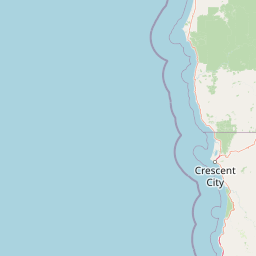
Map view of Six Rivers National Forest

Use this park location map to pinpoint Six Rivers National Forest in United States of America, understand its exact geographic position, and read its mapped placement within the surrounding landscape more clearly.

Pigeon | © OpenStreetMap contributors

Location context for Six Rivers National Forest

California
Natural feature types

Explore the Diverse Natural Features of Six Rivers National Forest

Trace the rivers, mountains, and ridges that shape one of California's most rugged protected areas. MoriAtlas provides a structured, map-focused view of the natural landscape, helping you navigate the complex terrain and protected watersheds found throughout Six Rivers National Forest.
Recorded earthquake history

Explore Historical Earthquake Records for Six Rivers National Forest

Review documented seismic events associated with the geography of Six Rivers National Forest. This MoriAtlas collection offers a clear, data-driven look at historical earthquake records to better understand the seismic landscape of this region.

Six Rivers National Forest Earthquake History

Catalogued events

695 events

Strongest magnitude

Magnitude 7.2

Most recent event

Sep 7, 2026

This history includes earthquakes recorded inside the park or within 50 km of its borders

Visualizing the rugged terrain, old growth forests, and protected watersheds of northwestern California.

Six Rivers National Forest Photos, Landscapes, and River Scenery

Visual records illustrate the steep mountain topography, dense coastal conifer stands, and carved river corridors that define the terrain of Six Rivers National Forest. Photographic documentation offers an intimate look at the protected habitats and remote watersheds spanning the Klamath Mountains.

An elevated view looking down at a river confluence where two branches of the bright turquoise Smith River meet, surrounded by dense evergreen forest and rocky slopes.

Park atlas

Compare connected river valleys and regional forest ecosystems across northern California

Parks Near Six Rivers National Forest and Surrounding Protected Areas

Explore nearby national forests and protected areas sharing the rugged mountainous terrain of northwestern California. Comparing these adjacent regional landscapes reveals broader patterns in coastal conifer zones, river drainages, and wilderness preservation.
A watercolor illustration showing a soft, panoramic view of green trees and rolling hills against pale, pinkish-yellow mountains in the background.
Protected landscapeCalifornia
Park boundaries overlap#1 closest

Southeast

Mendocino National Forest: Mapping California's Remote Protected Mountain Landscape

Examining wilderness boundaries and rugged coastal terrain

Mendocino National Forest serves as a significant protected area in California, known for being the only national forest in the state without major paved access. Its terrain spans 913,000 acres of mountain peaks, deep river canyons, and old-growth conifer forests. Home to the unique tule elk population at Lake Pillsbury, this landscape provides a rare example of wilderness isolation, complex geothermal features, and rugged, largely untouched northern coastal topography.

Area
3,696.02 km²
Established
1907
Relief
Mountain
Climate
Mediterranean
National parkCalifornia
Park boundaries overlap#2 closest

South

Redwood National and State Parks: Protected Landscape Geography and Mapped Boundaries

Explore California's protected area atlas.

Gain a structured understanding of Redwood National and State Parks as a protected national park within the geographic context of California. This dedicated page focuses on its mapped boundaries and protected landscape identity, offering critical atlas-level insights for regional geography exploration and conservation land context. Discover how this protected area fits into the larger mapped terrain.

Area
562.88 km²
Established
1968
IUCN
V
Visitors
458.4K annual
An artistic watercolor illustration showing a line of green evergreen trees in the foreground with hazy, distant mountains in the background against a light, neutral sky.
Protected landscapeOregon
Park boundaries overlap#3 closest

North

Rogue River, Siskiyou National Forest: Mapped Geography and Protected Area Overview

Tracing volcanic peaks and river-carved mountain terrain in Oregon

Spanning nearly 7,300 square kilometers, the Rogue River, Siskiyou National Forest acts as a crucial ecological anchor in the Pacific Northwest. This overview details its unique mountain geography, the extensive wilderness tracts within its boundaries, and the river systems that define its mountainous character.

Area
6,973.46 km²
Established
2004
Visitors
915K annual
Relief
Mountain
A soft watercolor painting depicting a serene landscape with gentle green hills, a small forest, and a calm lake at sunrise or sunset.
Protected landscapeCalifornia
Park boundaries overlap#4 closest

Southeast

Shasta, Trinity National Forest: Mapping the Protected Landscapes of Northern California

Volcanic peaks, expansive reservoirs, and rugged mountain wilderness

Spanning over two million acres, Shasta, Trinity National Forest represents a major protected landscape in Northern California. The geography includes the iconic Mount Shasta volcano and the complex shoreline of Shasta Lake, while hosting expansive wilderness areas and diverse terrain ranging from oak-forested foothills to alpine meadows.

Area
8,942.87 km²
Established
1954
Relief
Mountain
Climate
Temperate
A horizontal watercolor illustration showing a winding river flowing through a lush green valley with rolling hills in the background.
Protected landscapeCalifornia
Park boundaries overlap#5 closest

Northeast

Smith River National Recreation Area: Mapping the Klamath Mountain Protected Landscape

Watershed geography and rugged mountain terrain in northwestern California

Located in the heart of the Klamath Mountains, Smith River National Recreation Area represents a critical protected watershed in northern California. The area is defined by its deep, forested canyons and the clean, wild waters of the Smith River, which serve as a primary link between coastal redwood ecosystems and mountainous inland terrain. Users can study the park boundaries and regional landscape characteristics that sustain this remote environment.

Area
1,235 km²
Established
1990
Relief
Mountain
Climate
Mediterranean
Wildlife reserveOregon
3.4 km away#6 closest

North

Kalmiopsis Wilderness: Mapping the Protected Landscapes and Geology of Southwestern Oregon

Botanical richness and dramatic canyon terrain in the Klamath Mountains

Kalmiopsis Wilderness preserves a dramatic landscape of steep ridges and river-cut valleys across 180,000 acres in southwestern Oregon. Known for its distinct serpentine soils and high botanical diversity, the wilderness area offers a look at complex mountain ecology and significant Wild and Scenic River headwaters within the Rogue River-Siskiyou National Forest.

Area
727.44 km²
Established
1964
IUCN
Ib
Relief
Mountain
Protected landscapeCalifornia
3.9 km away#7 closest

Southeast

Marble Mountain Wilderness: Exploring Protected Mountain Landscapes in Northern California

Klamath Mountains Wilderness and Alpine Geography

Spanning hundreds of thousands of acres, Marble Mountain Wilderness offers a dense concentration of subalpine fir, deep glacial lakes, and steep drainage basins. This northern California protected landscape provides an atlas of rugged ridges and marble-toned peaks that represent one of the most ecologically diverse backcountry areas in the region.

Area
978.3 km²
Established
1964
IUCN
Ib
Relief
Mountain
A watercolor painting of soft, layered mountain ridges and forests in muted green, yellow, and red tones, presented in a wide, horizontal format against a white background.
Protected landscapeCalifornia
About 19 km away#8 closest

Southeast

Klamath National Forest; Protected Landscape Geography and Mapped Wilderness Boundaries

Diverse mountain terrain in Northern California

Klamath National Forest represents a significant protected area in Northern California, encompassing a vast, rugged landscape that bridges the Klamath Mountains and the Cascade Range. Its terrain is characterized by deeply incised river valleys, exposed rocky summits, and an intricate mosaic of coniferous forests. This geographic detail provides essential context on the forest's role as a major site for wilderness protection and ecological study in the Pacific Northwest.

Area
7,033 km²
Established
1905
Relief
Mountain
Climate
Temperate

Common questions about visiting, size, designation, and location context for Six Rivers National Forest

Six Rivers National Forest FAQs for park facts, access, geography, and protected area context

Find quick answers about Six Rivers National Forest, including protected-area facts, park geography, trail and visitor context, and how the park fits into its surrounding country and regional landscape.
MoriAtlas Explorer

Continue Your Protected Areas Search Across the Global Atlas

Deepen your exploration by continuing the structured search for national parks and protected areas worldwide. Utilize the comprehensive filtering capabilities to compare different conservation landscapes and refine your understanding of global park geography. Discover more about the distribution and characteristics of protected natural areas.

Global natural geography