
Mori Atlas logo
Protected landscapeSt. Peter, St. Märgen

Understanding the mapped boundaries and natural cultural landscape of the Hochschwarzwald plateau.

St. Peter, St. Märgen Protected Landscape: High Black Forest Regional Geography and Terrain

(Landschaftsschutzgebiet St. Peter, St. Märgen)

The St. Peter, St. Märgen protected landscape encompasses a 6719 hectare mosaic of high forest tracts, grassland, and traditional farmsteads within the High Black Forest of Baden-Württemberg. Its geography is defined by a transition from narrow, deeply incised valleys on the western edge to high plateau terrain rising above 1000 metres. This area maintains a vital ecological balance within the broader Natura 2000 network, preserving the regional character of the Hochschwarzwald against ongoing land use changes.

protected landscapeBlack ForestHochschwarzwaldBaden-WürttembergBreisgau-Hochschwarzwaldcultural landscape
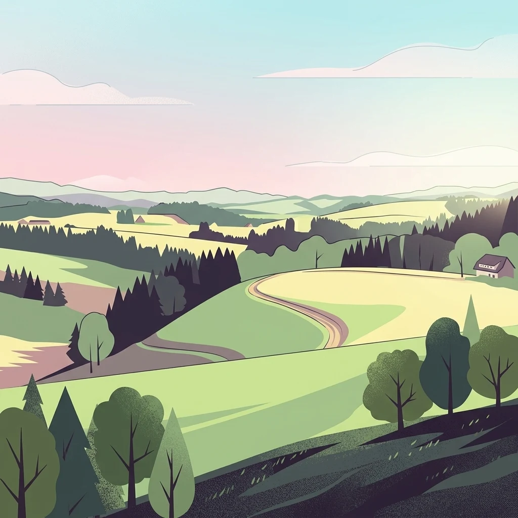
A stylized digital illustration of a rolling Black Forest landscape featuring green meadows, forested hills, and a small farmhouse under a soft sky.

St. Peter, St. Märgen

Protected landscape

Park overview

Structured park overview, official facts, and landscape profile for St. Peter, St. Märgen

St. Peter, St. Märgen park facts, protected area profile, and essential visitor context

Review the core facts for St. Peter, St. Märgen, including designation, size, terrain, visitor scale, habitats, and operating context in one park-focused overview.

About St. Peter, St. Märgen

St. Peter, St. Märgen is a designated protected landscape in the High Black Forest (Hochschwarzwald) region of Baden-Württemberg, southwestern Germany. Established by ordinance of the lower nature conservation authority at the district office of Breisgau-Hochschwarzwald on 16 June 2003, the area encircles the communities of St. Peter and St. Märgen and covers roughly 6719 hectares of representative Black Forest terrain. It is classified under IUCN Category V as a Protected Landscape or Seascape, reflecting its focus on maintaining a harmonious cultural and natural landscape rather than strict nature reserve protection.

The protected landscape spans two of the natural regions that make up the southern Black Forest: the Hochschwarzwald and the Südöstlicher Schwarzwald. Its terrain shows the typical High Black Forest topography, with deeply incised valleys and steep slopes along the western flank, broad plateau surfaces around the two villages, and elevations exceeding 1000 metres in the northern sectors. This varied relief, combined with the alternating pattern of extensive forest and open, mostly grassland countryside, gives the area its characteristic look and supports its role as a recognized recreational landscape.

The protection ordinance explicitly values the area for the characteristic alternation of forest and traditionally managed open land, the abundance of near-natural features such as brooks, wet meadows, hedgerows, tree rows and individual old trees, and the visual harmony created by scattered, often historic Black Forest farmsteads largely free of large-scale technical intrusions. The area overlaps with the Kandelwald, Roßkopf und Zartener Becken FFH site and the Mittlerer Schwarzwald bird protection area, while excluding the stricter Zweribach and Häuslematt nature reserves that lie within its boundaries.

Quick facts and research context for St. Peter, St. Märgen

Protected landscape covering roughly 6719 hectares around St. Peter and St. Märgen in the Breisgau-Hochschwarzwald district of Baden-Württemberg, designated on 16 June 2003 under IUCN Category V. Sits across the natural regions of Hochschwarzwald and Südöstlicher Schwarzwald, with landscapes ranging from steep western valleys to plateau terrain above 1000 metres. Notable as a representative, sparsely settled Black Forest cultural landscape where forest and traditionally managed grassland coexist, and where the protection area overlaps with an FFH site and a bird protection area while excluding the Zweribach and Häuslematt nature reserves.

Protection and recognition

Explore documented protected area records and official recognition history.

St. Peter, St. Märgen Protection Status and International Recognition Data

St. Peter, St. Märgen features structured records detailing official protection status, management scope, and international recognition sources. Review verified baseline data and conservation administrative details maintained within the global protected area registry.

Protection details

WDPA ID
324745
Park context

Deeper park guide and search-rich context for St. Peter, St. Märgen

St. Peter, St. Märgen history, landscape, wildlife, and travel context

Explore St. Peter, St. Märgen through its history, landscape character, ecosystems, wildlife, conservation priorities, cultural context, and seasonal travel timing in a structured park guide built for atlas discovery and search intent.

Why St. Peter, St. Märgen stands out

A classic Black Forest protected landscape in the High Black Forest (Hochschwarzwald) characterized by a scattered pattern of traditional farmsteads, large forest tracts interspersed with meadows, deeply cut valleys on its western edge, and high plateau ridges exceeding 1000 metres.
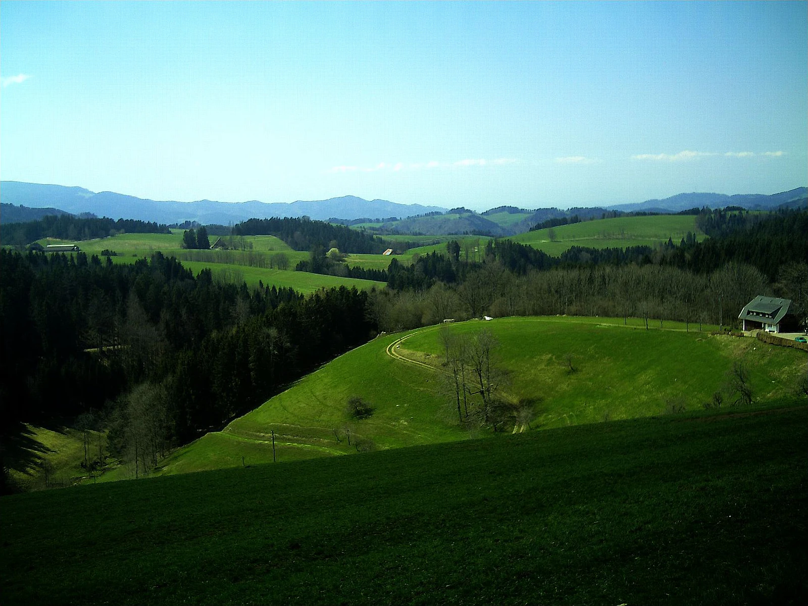
A wide landscape view of the Black Forest in April, showing lush green rolling hills, mixed evergreen and deciduous forest patches, and a small traditional farmhouse in the midground, with distant mountains under a blue sky.
Rolling green hills and forest patches in the Hochschwarzwald landscape near St. Märgen.

St. Peter, St. Märgen history and protected-area timeline

The landscape protection area was formally designated on 16 June 2003 through an ordinance issued by the lower nature conservation authority at the Breisgau-Hochschwarzwald district office. Its establishment marked an administrative effort to codify protection for a landscape that had long been shaped by traditional Black Forest land use, giving legal standing to the preservation of its forest-grassland mosaic, scattered historic settlement pattern and recreational value within the Breisgau-Hochschwarzwald district of Baden-Württemberg.

St. Peter, St. Märgen landscape and geographic character

The protected landscape surrounds the villages of St. Peter and St. Märgen in the High Black Forest and is split between the natural regions known as Hochschwarzwald and Südöstlicher Schwarzwald. Its western flank is shaped by narrow, deeply incised valleys with steep slopes, while the central villages sit on broad plateau surfaces and the northern parts rise above 1000 metres of elevation. This altitudinal range, combined with the contrast between dense forest and open mostly grassland, produces the varied scenery the protection ordinance explicitly aims to preserve. Small brooks, wet meadows, hedgerows, avenues of trees and isolated old trees enrich the visual texture of the terrain.

St. Peter, St. Märgen ecosystems, habitats, and plant life

Ecologically, the area is defined by large continuous forest stands alternating with open meadow landscapes used predominantly as grassland, which together form a characteristic and ecologically productive mosaic. The mix of stream courses, wet meadows, hedgerows and woodland edge habitats supports a diversity of animal and plant species and helps preserve the natural balance that the ordinance identifies as central to the site. The protected landscape shares ground with the Kandelwald, Roßkopf und Zartener Becken Habitats Directive site and the Mittlerer Schwarzwald bird protection area, tying its ecological function into the wider Central Black Forest habitat network.

St. Peter, St. Märgen wildlife and species highlights

The protection ordinance highlights the area's importance for sustaining a diverse community of animal and plant species, supported by the combination of forest, grassland, wet meadows, hedgerows and stream habitats that shape the High Black Forest around St. Peter and St. Märgen. Participation in the Mittlerer Schwarzwald bird protection area and a neighboring FFH habitat site reflects its broader role for wildlife within the Central Black Forest network, though individual species character is described in general terms rather than through detailed species inventories.

St. Peter, St. Märgen conservation status and protection priorities

Designated under IUCN Category V as a Protected Landscape, the area is valued for preserving the characteristic mosaic of forest and traditionally managed grassland that defines the High Black Forest, along with the cultural landscape formed by long-established scattered farm settlements. Its purpose is to safeguard a balanced natural environment, maintain landscape beauty and diversity, and secure recreation value. The protected landscape overlaps with the Kandelwald, Roßkopf und Zartener Becken FFH site and the Mittlerer Schwarzwald bird protection area, integrating it into broader European conservation frameworks, while excluding the stricter Zweribach and Häuslematt nature reserves that lie within its boundaries.

St. Peter, St. Märgen cultural meaning and human context

The protected area encompasses a long-established scattered settlement pattern of historic Black Forest farms (Schwarzwaldhöfe), whose traditional positioning, building styles and associated meadows and pastures shape much of the visual identity of the Black Forest. This dispersed human occupation, set among forest and grassland and largely free of large technical intrusions, is explicitly recognized in the protection ordinance as an essential element of the region's cultural landscape.

Top sights and standout views in St. Peter, St. Märgen

A representative stretch of the High Black Forest surrounding the villages of St. Peter and St. Märgen, where a near-natural mosaic of forest, meadows and scattered historic farmsteads is preserved under official landscape protection. Deeply incised valleys give way to high plateau terrain above 1000 metres, supporting a varied pattern of brooks, wet meadows, hedgerows, tree rows and solitary trees. The area functions as both a recognized recreational landscape and part of larger Natura 2000 and bird protection networks.

Best time to visit St. Peter, St. Märgen

Late spring through early autumn is the most rewarding season, when the mix of forest and open grassland is at its most varied, high-elevation walking routes on the plateau are accessible, and traditional Black Forest farmsteads are most active in the working cultural landscape.

Monthly climate preview

Long-term monthly temperature averages and precipitation patterns for St. Peter, St. Märgen

St. Peter, St. Märgen Climate Normals and Measured Temperature Rhythm

St. Peter, St. Märgen experiences measured mean temperatures ranging from sub-zero winter readings to warm summer highs alongside consistent daily precipitation throughout the year. Reviewing the complete twelve-month climate profile provides detailed historical temperature ranges and monthly precipitation distributions for this coordinate.
Annual mean8 °C
-2 °C17 °C
Jan-2°
Feb-1°
Mar
Apr
May12°
Jun15°
Jul17°
Aug17°
Sep12°
Oct
Nov
Dec-1°
Warmest month
July

16.8 °C

Coolest month
January

-1.5 °C

Wettest month
May

4 mm/day

Driest month
April

2.6 mm/day

Park location guide

Geography guide, regional context, and park location map for St. Peter, St. Märgen

St. Peter, St. Märgen park geography, regions, and map view in Germany

Understand where St. Peter, St. Märgen sits in Germany through a broader geographic reading of the surrounding landscape, nearby location context, and its mapped position within the national park landscape.

How St. Peter, St. Märgen fits into Germany

Germany is a federal republic in Western and Central Europe with a population of over 83 million across sixteen constituent states. It is Europe's largest economy by nominal GDP and a major global exporter and importer. The capital is Berlin, and the country borders Denmark, Poland, Czech Republic, Austria, Switzerland, France, Luxembourg, Belgium, and the Netherlands.

Wider geography shaping St. Peter, St. Märgen in Germany

Germany is located in Western and Central Europe, spanning 357,022 km². It borders Denmark to the north, Poland and the Czech Republic to the east, Austria and Switzerland to the south, and France, Luxembourg, Belgium, and the Netherlands to the west. The country has coastlines on the Baltic Sea and North Sea to the north, with the Alps located in the southern region.

Map view of St. Peter, St. Märgen

Use this park location map to pinpoint St. Peter, St. Märgen in Germany, understand its exact geographic position, and read its mapped placement within the surrounding landscape more clearly.

Pigeon | © OpenStreetMap contributors

Location context for St. Peter, St. Märgen

Baden-Württemberg

Visualizing the High Black Forest terrain, habitats, and historic farmsteads

St. Peter, St. Märgen Photos and Protected Landscape Scenery

Visual documentation reveals the distinctive topography and habitat mosaic defining St. Peter, St. Märgen across the High Black Forest. Examining these protected area views clarifies the relationship between steep wooded valleys, elevated plateau grasslands, and traditional rural settlements.

A wide landscape view of the Black Forest in April, showing lush green rolling hills, mixed evergreen and deciduous forest patches, and a small traditional farmhouse in the midground, with distant mountains under a blue sky.

Park atlas

Compare adjacent High Black Forest protected areas and connected natural reserves.

Parks Near St. Peter, St. Märgen: Explore Related Protected Landscapes and Regional Terrain

Browse nearby protected landscapes and surrounding regional terrain after viewing St. Peter, St. Märgen to understand broader conservation patterns. Comparing adjacent forest tracts and plateau ecosystems provides deeper context for the High Black Forest geography.
Protected landscapeBaden-Württemberg
About 5.5 km away#1 closest

South

Wagensteigtal-Höllental Protected Landscape: Geography and Terrain of the Black Forest

A bridge between regional natural zones in Baden-Württemberg

Wagensteigtal-Höllental serves as a quintessential example of protected Black Forest geography. Stretching across the Breisgau-Hochschwarzwald district, this area features the steep Rotbach gorge, dense forest ridges, and the prominent Hirschsprung rock formation. It provides a foundational look at how historical transport corridors and natural river breakthrough channels shape the modern landscape identity of southwestern Germany.

Area
29.118 km²
Established
1975
IUCN
V
Relief
Mountain
Protected landscapeBaden-Württemberg
About 13 km away#2 closest

Southeast

Titisee-Neustadt Protected Landscape: Mapping the Black Forest Terrain and Boundaries

Regional geography and protected area coverage in Baden-Württemberg

Gain insight into the Titisee-Neustadt protected landscape, a representative high Black Forest area defined by its mix of forested ridges and river-fed valley basins. This detailed geographic overview highlights the physical features, water systems, and structural conservation status that define this landmark site within the southern German state of Baden-Württemberg.

Area
83.17 km²
Established
2003
IUCN
V
Relief
Highland
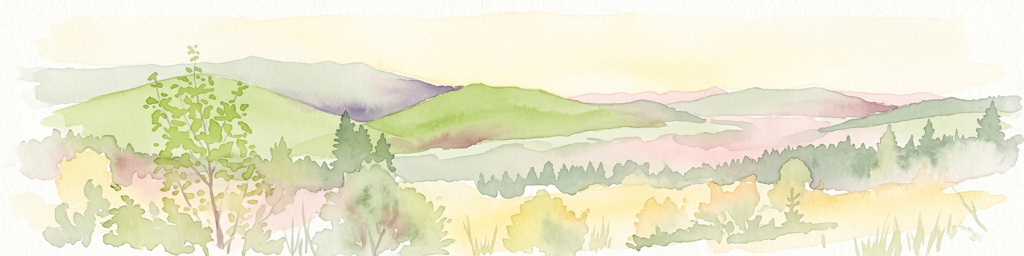
A wide panoramic watercolor illustration showing a green landscape with rolling hills, a line of trees, and foreground grass.
Protected landscapeBaden-Württemberg
About 19 km away#3 closest

Southwest

Östliches Hexental: Protected Landscape and Regional Geographic Context in Baden-Württemberg

Black Forest valley mosaic and protected meadow systems

Located in the Breisgau-Hochschwarzwald district, Östliches Hexental forms a vital protected landscape of approximately 526 hectares. The region showcases a traditional Black Forest valley structure, defined by riparian gallery forests, orchard meadows, and small field hedges that provide essential habitat connectivity between the High Black Forest and the Markgräfler Hügelland.

Area
5.264 km²
Established
2008
IUCN
V
A soft watercolor illustration of rolling hills, forested slopes, and meadow vegetation with a light, airy aesthetic.
Nature reserveBaden-Württemberg
About 20 km away#4 closest

Southwest

Belchen Nature Reserve: Exploring the Mountain Geography of the High Black Forest

A diverse protected landscape in Baden-Württemberg

Belchen represents an essential protected area in the southern Black Forest, known for its compressed ecological profile ranging from lowland beech forests to exposed subalpine summits. The site maps a complex mosaic of scree slopes, mires, and rocky habitats that sustain specialized bat species and rare montane flora, offering a detailed perspective on central European highland ecosystems.

Area
29.072 km²
Established
2019
Relief
Mountain
Climate
Temperate
Watercolor painting of a pastoral landscape featuring soft, rolling green hills and a small group of evergreen trees, with light pastel mountains in the background.
Protected landscapeBaden-Württemberg
About 25 km away#5 closest

South

St. Blasien Protected Landscape: Geographic Profile and Glacial Mapping

Southern Black Forest protected area in Baden-Württemberg.

The St. Blasien Protected Landscape represents a significant conservation zone in the southern Black Forest. Defined by its strong glacial influence, the area showcases a complex terrain of trough valleys, moraine ridges, and rocky crests alongside centuries-old alpine pastures. Its role in the regional conservation network makes it a key site for understanding the intersection of Pleistocene geography and traditional land management in Germany.

Area
35.754 km²
Established
2002
IUCN
V
Protected landscapeSchwarzwald-Baar-Kreis
About 27 km away#6 closest

East

Groppertal Protected Landscape in Schwarzwald-Baar-Kreis: Regional Geography and Atlas

Mapped riparian meadows and Black Forest woodland boundaries

Groppertal is a protected landscape situated within the Schwarzwald-Baar-Kreis, defined by the Brigach river valley. The area exhibits a unique contrast between maintained lowland wet meadows and expansive forest slopes. This geography provides an essential protected corridor connecting the riparian ecosystem of the river floodplain to the wider highland terrain of the South-eastern Black Forest, illustrating a complex rural-natural mosaic.

Area
5.397 km²
Established
1957
IUCN
V
Relief
Upland
Nature reserveBaden-Württemberg
About 30 km away#7 closest

Southeast

Blumberger Pforte und Mittlere Wutach: Protected Landscape and Gorge Geography

Nature reserve terrain and ecological atlas in Baden-Württemberg

This protected area captures the dramatic transition where the Wutach river cuts through limestone strata. Discover a rugged landscape mosaic featuring canyon forests, juniper heaths, and karst cave systems across the Swabian Alb and Black Forest fringe. The site offers significant value for understanding regional ecological gradients and limestone-dependent plant communities within the broader southern German geography.

Area
63.25 km²
Established
2019
Protected landscapeBaden-Württemberg
About 31 km away#8 closest

Northeast

Gaienbühl Protected Landscape: Regional Geography and Map of the Middle Black Forest

Protected mosaic of meadow and forest in Baden-Württemberg

Gaienbühl provides a concentrated example of the Middle Black Forest's rolling terrain, featuring a blend of forest patches and expansive central meadows. The area encompasses critical wetland biotopes and integrates into broader regional bird conservation zones. This record details the protected boundaries and landscape elements that define this specific site within the Schwarzwald-Baar-Kreis district.

Area
0.502 km²
Established
1954
IUCN
V

Common questions about visiting, size, designation, and location context for St. Peter, St. Märgen

St. Peter, St. Märgen FAQs for park facts, access, geography, and protected area context

Find quick answers about St. Peter, St. Märgen, including protected-area facts, park geography, trail and visitor context, and how the park fits into its surrounding country and regional landscape.
MoriAtlas Explorer

Continue Your Protected Areas Search Across the Global Atlas

Deepen your exploration by continuing the structured search for national parks and protected areas worldwide. Utilize the comprehensive filtering capabilities to compare different conservation landscapes and refine your understanding of global park geography. Discover more about the distribution and characteristics of protected natural areas.

Global natural geography