
Mori Atlas logo
Nature reserveSteilhänge der Saar

Analyzing the topography of steep forested slopes, tributary stream valleys, and river corridors

Steilhänge der Saar Nature Reserve and Protected River Valley Landscape in Saarland, Germany

(Naturschutzgebiet Steilhänge der Saar)

Steilhänge der Saar represents a significant consolidated nature reserve located in the Saarland state of southwestern Germany. The protected landscape comprises abrupt valley relief carved by the Saar river and its tributaries, providing an essential ecological corridor that integrates dry slope woodlands with moisture-rich valley bottoms. This area serves as a primary site within the European Natura 2000 network, anchoring regional conservation efforts across the municipalities of Mettlach, Perl, and Merzig.

river valleysteep slopesdeciduous forestdry slope woodlandtributary valleysSaar river
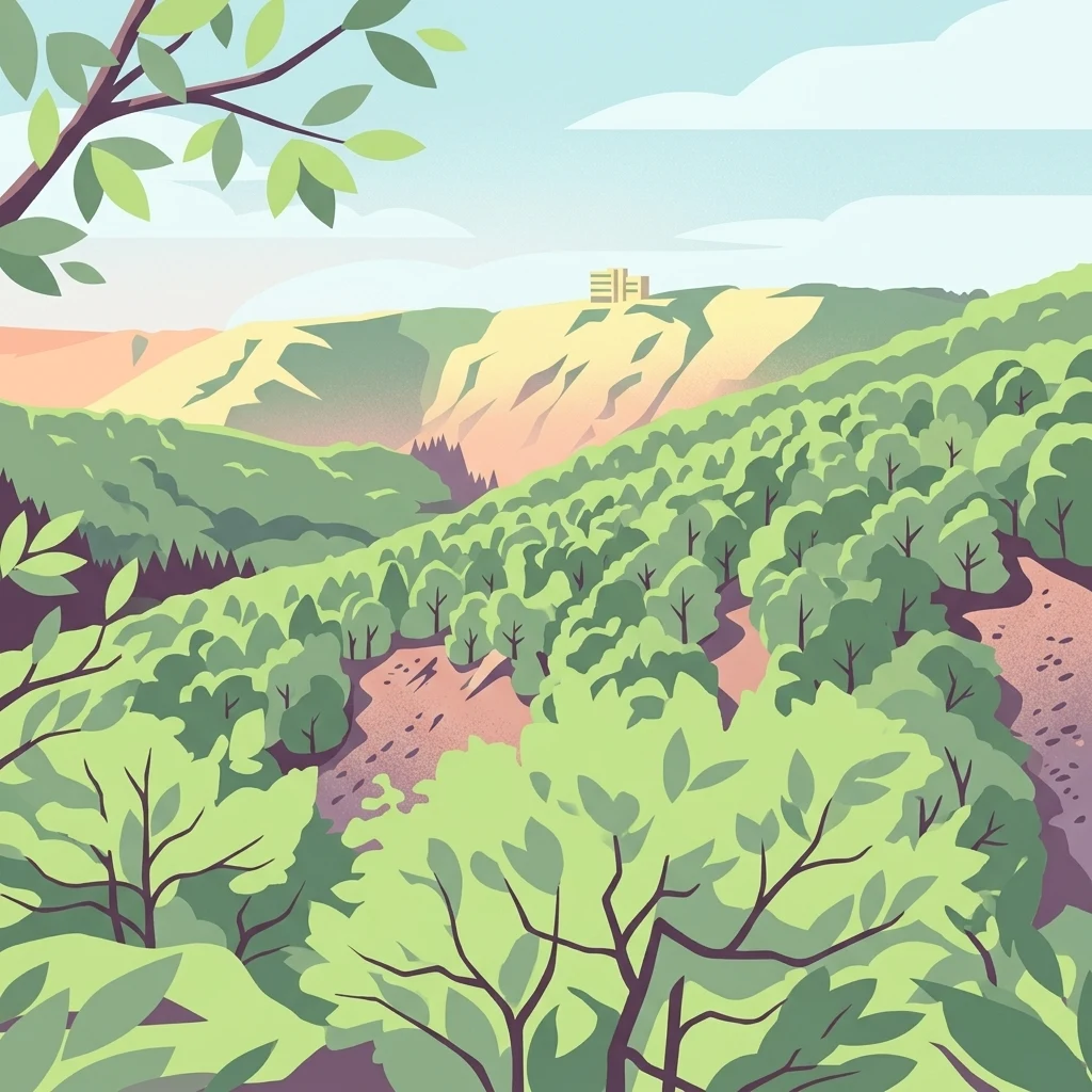
A stylized illustration showing a dense green forest on steep hillsides with a view towards a distant ridge line under a light blue sky.

Steilhänge der Saar

Nature reserve

Park overview

Structured park overview, official facts, and landscape profile for Steilhänge der Saar

Steilhänge der Saar park facts, protected area profile, and essential visitor context

Review the core facts for Steilhänge der Saar, including designation, size, terrain, visitor scale, habitats, and operating context in one park-focused overview.

About Steilhänge der Saar

Steilhänge der Saar is a designated nature reserve in the Saarland, one of Germany's smaller federal states, located in the southwest of the country close to the borders with Luxembourg, France, and Rhineland-Palatinate. The reserve protects a connected landscape of steep wooded slopes, dry hillside forests, and smaller stream valleys that descend toward the Saar river, immediately upstream of the well-known Saarschleife river loop.

The area lies within the Landkreis Merzig-Wadern and spans parts of three administrative units: the municipalities of Mettlach and Perl, and the town of Merzig. Its location straddles the Saar and several tributary valleys, with the regional road B 51 and state roads L 176 and L 178 crossing or bordering parts of the reserve. The state border with Rhineland-Palatinate runs along the northeastern edge of the protected area, positioning the reserve within a wider cross-border region of protected river-slope landscapes.

What distinguishes Steilhänge der Saar from many other lowland or upland forest reserves in Germany is its combination of steep Saar valley terrain and dual-tier conservation status. The same territory is recognised under German national nature conservation law as a Naturschutzgebiet and simultaneously under European Union nature law as both a Special Protection Area under the Birds Directive and a site under the Habitats Directive (FFH). This harmonisation reflects the area's value for habitat and species protection at local, national, and European levels.

The reserve was created on 21 June 2017 by bringing together four smaller, previously separate protection areas in the region, allowing the slopes, forests, and stream valleys around Saarhölzbach and downstream toward the Saarschleife to be managed as one coherent ecological unit. The protected landscape is part of the broader Saar valley identity that draws visitors to the Saarschleife, situating the reserve within one of the most recognisable natural landmarks in the Saarland.

Quick facts and research context for Steilhänge der Saar

Steilhänge der Saar is a German nature reserve (Naturschutzgebiet) in Saarland, covering about 10.86 square kilometres across Mettlach, Perl, and Merzig in the Landkreis Merzig-Wadern. It was formally designated on 21 June 2017 and is catalogued in the World Database on Protected Areas under WDPA ID 555638656. The reserve is broadly congruent with an EU Special Protection Area (SPA/Vogelschutzgebiet) and an FFH (Habitats Directive) site of the same name. The Saar river flows along and through the area, and the regional road B 51, together with state roads L 176 and L 178, crosses parts of the reserve.

Protection and recognition

Official conservation records, Natura 2000 entries, and designated boundary sources

Steilhänge der Saar Protection Status and International Recognition

Protected area records for Steilhänge der Saar compile documented conservation status and official Natura 2000 recognition sources. Structured administrative details provide reliable reference data for conservation tracking and geographic research.
Park context

Deeper park guide and search-rich context for Steilhänge der Saar

Steilhänge der Saar history, landscape, wildlife, and travel context

Explore Steilhänge der Saar through its history, landscape character, ecosystems, wildlife, conservation priorities, cultural context, and seasonal travel timing in a structured park guide built for atlas discovery and search intent.

Why Steilhänge der Saar stands out

The reserve is best known for protecting the steep, often rocky forested slopes of the Saar river valley upstream of the Saarschleife, a region noted for its mix of dry slope woodland, valley forests, and small tributary stream valleys. It is valued as a combined national and European-level conservation area, recognised as both a German Naturschutzgebiet and a Natura 2000 site for habitats and birds. Its position between Saarhölzbach and the Saarschleife, with the Saar river curving along and through the protected perimeter, gives the area its defining slope-and-river interplay that combines ecological value with a strong landscape identity.
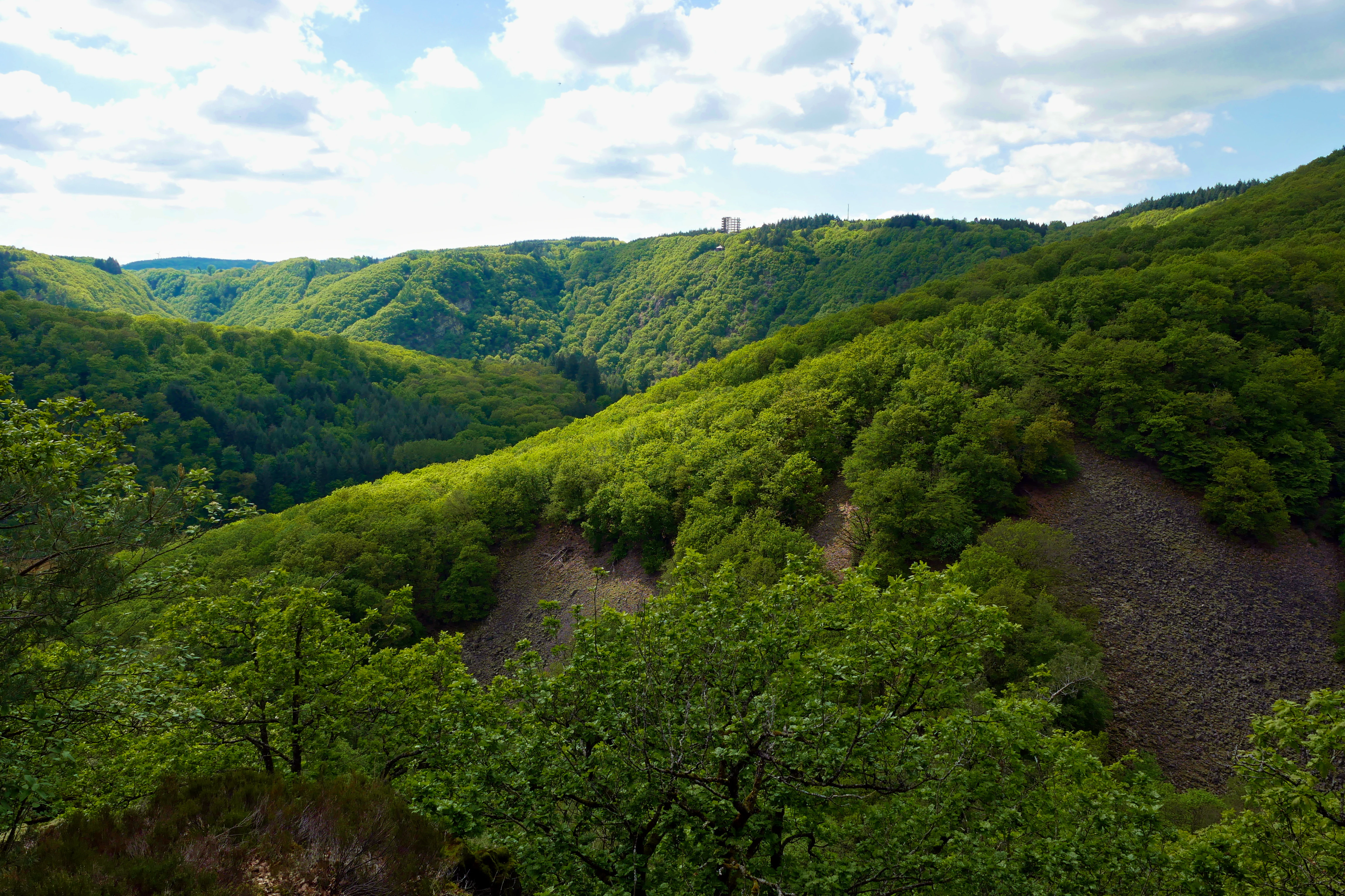
A wide view of a lush green forest covering steep hillsides, with visible grey boulder slopes, under a sky with scattered clouds.
Forested slopes and boulder fields within the nature reserve.

Steilhänge der Saar history and protected-area timeline

The Steilhänge der Saar nature reserve was formally established on 21 June 2017, issued through the Saarland protected-area ordinance (Verordnung über das Naturschutzgebiet "Steilhänge der Saar", N 6505-301, dated 21 June 2017). The designation came after a period in which the Saar slopes around the Saarschleife were protected only in fragmented pieces under several separate nature reserve orders.

Before 2017, the slopes, valley forests, and tributary streams that now sit inside the reserve were covered by a patchwork of earlier designations, principally the "Saar-Steilhänge/Lutwinuswald" reserve and the "Steinbachtal westlich Saarschleife", "Hundscheiderbachtal", and "Hundscheiderbachtal (Erweiterung)" areas. The 2017 ordinance replaced these four predecessor reserves with a single, broader protected landscape, aligning the national-level protection boundary with the existing EU-level SPA (Vogelschutzgebiet) and FFH (Habitats Directive) boundaries of the same name.

This consolidation marked a shift from a fragmented local protection approach to an integrated, cross-jurisdictional protected area that combines national and European legislative frameworks, and it also produced the unified WDPA record (ID 555638656) by which the reserve is now identified internationally.

Steilhänge der Saar landscape and geographic character

The landscape of Steilhänge der Saar is defined by the abrupt valley relief of the Saar river shortly before its most famous meander, the Saarschleife. Steep, often wooded hillsides rise sharply from the valley floor, alternating with narrow side valleys carved by small tributary streams such as the Steinbach and the Hundscheider Bach, whose names appear in the reserve's predecessor protected areas.

The area sits on both sides of the Saar where the river curves around the Saarschleife, with the four constituent sub-areas of the reserve extending northeast and southwest of Saarhölzbach, a district of Mettlach. Dry, sun-exposed upper slopes and rocky outcrops contrast with the cooler, moister valley bottoms and the stream corridors of the smaller tributary valleys, producing visible ecological gradients across short horizontal distances.

The Saar river itself runs along part of the perimeter and through parts of the reserve, with the Rhineland-Palatinate state border lying along the northeastern edge of the protected landscape. Roads cross parts of the area: the B 51 runs through and along the southeastern edge, the L 176 cuts through the interior, and the L 178 follows the western side, reflecting the integration of this natural landscape into the regional transport network around Merzig and Mettlach.

Steilhänge der Saar ecosystems, habitats, and plant life

The reserve's nature profile reflects a strongly valley-shaped ecological mosaic: dry, sun-warmed slope forests on the upper hillsides, mixed deciduous woodland in the mid-slope zones, and moist gallery forests and stream-side vegetation along the Saar and along smaller tributary valleys such as the Steinbach and the Hundscheider Bach.

This combination of dry and humid microclimates within a relatively compact area is characteristic of the Saar valley upstream of the Saarschleife, where abrupt relief creates sharp transitions between warm, exposed rock-and-forest slopes and cool, shaded valley bottoms. Such transitions are valuable for habitat diversity, supporting both thermophilic slope species and richer, more humid forest communities further down.

The site's recognition as both a Habitats Directive (FFH) site and a Special Protection Area (SPA/Vogelschutzgebiet) under the EU nature directives indicates that the vegetation and habitat structure is considered significant at European level, and the broad overlap of national and EU boundaries suggests a deliberate alignment of habitat and bird conservation goals for the same physical landscape.

Steilhänge der Saar conservation status and protection priorities

The conservation significance of Steilhänge der Saar lies in its being simultaneously protected under three overlapping legal frameworks: a Saarland national nature reserve (Naturschutzgebiet) under German law, an EU Special Protection Area under the Birds Directive, and an EU FFH site under the Habitats Directive. This means the same terrain carries protection obligations at the regional, national, and European levels.

By consolidating four smaller predecessor reserves into a single larger area aligned to the existing EU SPA and FFH boundaries, the 2017 designation also strengthened coherence in habitat and species management. The reserve is registered in the World Database on Protected Areas (WDPA ID 555638656), giving it an internationally recognised protected-area identifier.

The area's combination of dry slope woodland, valley forest, and stream corridors along the Saar provides habitat continuity that is rare for protected landscapes in this densely populated, cross-border region between Saarland, Rhineland-Palatinate, and Luxembourg, making it an important refugium for slope, forest, and river-associated species in the upper Saar valley.

Top sights and standout views in Steilhänge der Saar

Steilhänge der Saar stands out for its rare alignment of three conservation tiers: a German nature reserve, an EU Special Protection Area for birds, and an EU FFH site under the Habitats Directive, all covering essentially the same terrain around the slopes of the Saar river upstream of the Saarschleife.

It is also notable for being the result of a deliberate consolidation: four smaller pre-2017 reserves, including the Saar-Steilhänge/Lutwinuswald area and stream valleys such as the Steinbachtal and Hundscheiderbachtal, were merged into one coherent protected landscape in 2017. The resulting reserve combines steep wooded valley slopes, tributary stream valleys, and direct Saar river frontage within a single contiguous framework, anchoring the ecological protection of one of Saarland's most distinctive river landscapes.

Monthly climate preview

Long term temperature and precipitation records across representative coordinate sampling

Steilhänge der Saar Climate Normals and Monthly Weather Statistics

Historical monitoring records outline annual temperature fluctuations and monthly precipitation values measured across representative coordinates in Steilhänge der Saar. Examining the complete twelve month climatology profile provides deeper insight into long term environmental patterns.
Annual mean9 °C
0 °C19 °C
Jan
Feb
Mar
Apr
May12°
Jun16°
Jul19°
Aug18°
Sep14°
Oct
Nov
Dec
Warmest month
July

18.6 °C

Coolest month
January

-0.2 °C

Wettest month
December

2.9 mm/day

Driest month
April

1.7 mm/day

Park location guide

Geography guide, regional context, and park location map for Steilhänge der Saar

Steilhänge der Saar park geography, regions, and map view in Germany

Understand where Steilhänge der Saar sits in Germany through a broader geographic reading of the surrounding landscape, nearby location context, and its mapped position within the national park landscape.

How Steilhänge der Saar fits into Germany

Germany is a federal republic in Western and Central Europe with a population of over 83 million across sixteen constituent states. It is Europe's largest economy by nominal GDP and a major global exporter and importer. The capital is Berlin, and the country borders Denmark, Poland, Czech Republic, Austria, Switzerland, France, Luxembourg, Belgium, and the Netherlands.

Wider geography shaping Steilhänge der Saar in Germany

Germany is located in Western and Central Europe, spanning 357,022 km². It borders Denmark to the north, Poland and the Czech Republic to the east, Austria and Switzerland to the south, and France, Luxembourg, Belgium, and the Netherlands to the west. The country has coastlines on the Baltic Sea and North Sea to the north, with the Alps located in the southern region.

Map view of Steilhänge der Saar

Use this park location map to pinpoint Steilhänge der Saar in Germany, understand its exact geographic position, and read its mapped placement within the surrounding landscape more clearly.

Pigeon | © OpenStreetMap contributors

Location context for Steilhänge der Saar

Saarland
Recorded earthquake history

Examine the Historical Seismic Catalogue for Steilhänge der Saar

Analyze documented seismic activity near the Steilhänge der Saar nature reserve through our curated historical catalogue. MoriAtlas provides detailed access to recorded magnitudes and epicentre proximity for researchers and geographers examining regional geological history.

Steilhänge der Saar Earthquake History

Catalogued events

228 events

Strongest magnitude

Magnitude 4.5

Most recent event

Sep 28, 2008

This history includes earthquakes recorded inside the park or within 50 km of its borders

Visual exploration of the steep forested valley slopes, rocky river bends, and protected habitats along the Saar

Steilhänge der Saar Photos and Landscape Scenery

Photographic views document the steep wooded hillsides, dry slope woodlands, and rocky river valleys defining Steilhänge der Saar. Examining these protected landscapes reveals the dramatic terrain and rare ecological gradients surrounding the Saar river meander.

A wide view of a lush green forest covering steep hillsides, with visible grey boulder slopes, under a sky with scattered clouds.

Park atlas

Compare adjacent valley reserves and regional river basin geography

Parks Near Steilhänge der Saar and Surrounding Protected Landscapes

Browse protected areas near Steilhänge der Saar to evaluate related forest ecosystems and river valley terrain across the regional landscape. Extending your review beyond the Saar river slopes reveals connected conservation corridors and similar woodland habitats.
A horizontal watercolor painting of a wetland scene with still water, grassy banks, small islands, and rolling hills in the background.
Nature reserveSchengen
9.4 km away#1 closest

West

Haff Réimech Nature Reserve: Wetland Geography and Protected Landscape in Schengen

Reclaimed industrial wetlands in the Moselle river valley

Haff Réimech is a protected wetland sanctuary located in the Moselle valley near Schengen. The reserve features approximately forty shallow lakes created from former sand and gravel pits, now surrounded by reedbeds and riparian woodland. This mosaic landscape serves as a key site for migratory bird species, demonstrating a unique transition from industrial extraction to a managed, ecologically rich floodplain environment.

Area
1.008 km²
Established
1998
Relief
Lowland
Climate
Temperate
Nature reserveRhineland-Palatinate
About 15 km away#2 closest

North

Wiltinger Saarbogen: Mapping the Natural Saar River Meander and Floodplain Habitats

A critical protected nature reserve in the Rhineland-Palatinate river landscape.

Wiltinger Saarbogen remains a rare, natural river arc within the Saar valley. This protected area offers a deep look into riverine geography, featuring a concentrated mosaic of gravel banks, reed-fringed wetlands, and riparian forests that stand in contrast to the engineered shipping canals of the region.

Area
1.67 km²
Established
1997
Nature reserveRheinland-Pfalz
About 16 km away#3 closest

Northwest

Langheck bei Nittel Nature Reserve: A Detailed Atlas of Protected Moselle Landscapes

Ecological geography and calcareous grassland habitat in Rheinland-Pfalz

Langheck bei Nittel is a significant nature reserve located in the Upper Moselle valley of Germany. The site protects a rare mosaic of calcareous dry grasslands, shrubbery, and forest edges that host a high concentration of orchid species. As a critical component of the regional biotope network, it offers insight into the conservation of warm-loving flora and the management of stony, nutrient-poor landscapes.

Area
0.42 km²
Established
1998
Watercolor painting of a tranquil lake surrounded by soft green trees, grassy banks, and rolling hills in the background under a pale sky.
Protected areaSaarland
About 17 km away#4 closest

Southeast

Dillinger See Protected Area: Saarland Floodplain Geography and Bird Sanctuary Map

Mapping wetland habitats and ecological terrain in Saarland

Dillinger See is a protected ecological lake situated within the Saar River floodplain in Saarland. This area serves as a sanctuary for diverse avian species, with its landscape defined by reed belts and restored island habitats. Learn about the geographic significance of this site as an EU bird protection area and its role in regional flood management.

Area
0.8 km²
Established
1980
Relief
Lowland
Access
Easy access
Watercolor painting of a rolling green forest landscape with a winding path and soft, abstract hills in the background.
Nature reserveRhineland-Palatinate
18 km away#5 closest

North

Mattheiser Wald Nature Reserve: A Protected Forest Landscape in Rhineland-Palatinate

Ecological mapping of urban forest and valley terrain

Mattheiser Wald represents a vital nature reserve and Natura 2000 site in the Trier region. The area is characterized by high-value oak and hornbeam woodland, abandoned military disturbance zones that host rare wildlife, and an intricate stream valley system. This atlas entry provides a detailed look at the reserve's topography and its status as a critical conservation landscape within an urban environment.

Area
4.47 km²
Established
2003
Relief
Upland
Climate
Temperate
Nature reserveSaarland
18 km away#6 closest

East

Wadrilltal Nature Reserve: Geographic Context and Mapped Protected Landscapes in Saarland

A protected stream valley habitat in the Hochwald region of Germany.

Wadrilltal represents a crucial nature reserve that shelters a near-natural stream valley system within the Saarland municipality of Wadern. The area preserves a structural diversity of wet meadows, montane mat-grass swards, and floodplain forests that form part of the Natura 2000 network. Gain geographic insight into the valley's slopes and river corridor, which extend across state boundaries to maintain significant regional biodiversity.

Area
1.67 km²
Established
2016
Scope
Terrestrial
Water
Major water bodies
Nature reserveSaarland
19 km away#7 closest

East

Wiesenlandschaft bei Überroth: Nature Reserve Geography and Mapped Meadow Habitats

Essential protected land analysis in the Saarland region of Germany

Wiesenlandschaft bei Überroth functions as a core protected area for species-rich meadows in southwestern Germany. This detailed entry maps its two-part configuration and explains its role within the regional Saarland habitat network, providing a clear geographic perspective on its conservation status and semi-natural terrain characteristics.

Area
2.87 km²
Established
2015
IUCN
IV
Relief
Lowland
Watercolor painting of a green, rolling hillside landscape with faint pink floral details in the foreground.
Nature reserveRheinland-Pfalz
About 19 km away#8 closest

North

Perfeist bei Wasserliesch: Protected Grassland and Botanical Mapping in Rheinland-Pfalz

A regional sanctuary for rare orchids and calcareous meadow flora.

Perfeist bei Wasserliesch represents a significant protected area within the German Moselle landscape. Spanning 22 hectares of dry, sun-exposed calcareous soil on the Liescher Berg, the reserve offers a focused look at open grassland ecology. Its unique status as a botanical reference point highlights how small-scale protected land maintains rare plant species and fragile meadow habitats against the backdrop of the surrounding Moselle valley hill country.

Area
0.22 km²
Established
1986

Common questions about visiting, size, designation, and location context for Steilhänge der Saar

Steilhänge der Saar FAQs for park facts, access, geography, and protected area context

Find quick answers about Steilhänge der Saar, including protected-area facts, park geography, trail and visitor context, and how the park fits into its surrounding country and regional landscape.
MoriAtlas Explorer

Continue Your Protected Areas Search Across the Global Atlas

Deepen your exploration by continuing the structured search for national parks and protected areas worldwide. Utilize the comprehensive filtering capabilities to compare different conservation landscapes and refine your understanding of global park geography. Discover more about the distribution and characteristics of protected natural areas.

Global natural geography