
Mori Atlas logo
Nature reserveStein – Rachelsberg – Gobert

A historic forest complex along the former inner German border with unique ridge geography

Stein – Rachelsberg – Gobert Nature Reserve and Protected Limestone Landscape in Thuringia

Stein – Rachelsberg – Gobert encompasses 716 hectares of protected Natura 2000 terrain on the Thuringia and Hesse state border. This nature reserve features dramatic limestone ridges, steep cliff edges, and extensive mature beech forests that evolved in the seclusion of the historic inner German border strip. Known locally as the Eichsfeld Switzerland, the area provides a vital habitat for rare orchids, yew populations, and protected woodland species within a structured, deeply incised valley network.

beech forestlimestone landscapeNatura 2000 siteFFH habitatcliff and scree habitatsorchid-rich grasslands
A stylized vector illustration showing a waterfall flowing down purple and pink cliffs into a river, surrounded by green and autumn-colored trees and rolling hills.

Stein – Rachelsberg – Gobert

Nature reserve

Park overview

Structured park overview, official facts, and landscape profile for Stein, Rachelsberg, Gobert

Stein, Rachelsberg, Gobert park facts, protected area profile, and essential visitor context

Review the core facts for Stein, Rachelsberg, Gobert, including designation, size, terrain, visitor scale, habitats, and operating context in one park-focused overview.

About Stein, Rachelsberg, Gobert

Stein – Rachelsberg – Gobert is a Natura 2000 Habitats Directive site in the western Eichsfeld district of Thuringia. It follows the inter-state border with Hesse across an elongated ridge of wooded limestone hills whose elevations step up from about 300 meters in the valley floors to roughly 520 meters at the highest summits, including Auf dem Stein (around 496 m), Rachelsberg (around 523 m), and the Gobert plateau. The terrain is unusually varied for central Germany: long, steep slopes give way to limestone cliffs such as the Dietzenröder Klippen and the Silberklippe, and the deeply incised valleys of small Werra tributaries produce a small-scale scenery informally known as the "Eichsfeld Switzerland."

Forested habitat dominates the site. More than 580 hectares are woodland, and the Waldmeister beechwood (habitat type 9130) alone covers around 491 hectares. Above these cooler, shady woods, the warmer south-facing slopes support orchid-rich and thermophilic beechwoods (habitat type 9150) and small patches of priority dry woodland, while narrow stream ravines preserve alder-ash floodplain forest. Yew trees are unusually common here and are actively managed to maintain the population. Wild pear occurs sporadically, and dry juniper heaths and orchid-rich semi-dry grassland on basic soils add meaningful open-habitat character.

Fauna is another defining element. The site's designation rests significantly on two Annex II bat species, the greater mouse-eared bat and the lesser horseshoe bat, and its standard data form lists additional protected bats including the serotine, Daubenton's bat, Natterer's bat, and brown long-eared bat. Birds associated with mature deciduous forest and open mosaic landscapes are well represented, including black stork, black woodpecker, hobby, red kite, honey buzzard, and middle spotted woodpecker. Wildcat, midwife toad, yellow-bellied toad, palmate newt, fire salamander, sand lizard, and the striking dragonfly Gestreifte Quelljungfer have also been recorded, along with numerous butterfly species of conservation concern such as the lesser purple emperor, several fritillaries, and the alcon blue.

The cultural and political backdrop is integral to the park's ecological story. The hills have marked territorial boundaries since the Middle Ages, when they divided the Electorate of Mainz from the Landgraviate of Hesse. After 1945 the Wanfried Agreement shifted several villages between American and Soviet occupation zones, and during the German division the upper Gobert plateau lay inside the restricted border strip, completely closed to the public. This four-decade human absence allowed the forest to mature naturally, producing a rare case in which a major conservation value in modern Germany has been shaped by twentieth-century political geography.

Quick facts and research context for Stein, Rachelsberg, Gobert

Stein – Rachelsberg – Gobert is an EU Habitats Directive site (FFH-Gebiet 019, Natura 2000 number 4726-320) covering 716 hectares in the Eichsfeld district of Thuringia along the border with Hesse. Founded as an FFH area in 1999 and confirmed by the European Commission in 2004, it lies between roughly 300 and 520 meters elevation on a chain of Triassic limestone ridges and is dominated by beech forest, with beechwood alone covering more than 500 hectares. It is also embedded in the 8,433 hectare Werrabergland SPA bird protection area, the Obereichsfeld landscape protection area, the Eichsfeld-Hainich-Werratal nature park, and the Heinz Sielmann Foundation's Grosser Eichsfeld-Werratal Green Belt project.

Protection and recognition

Documented terrestrial protection history and international recognition sources

Stein – Rachelsberg – Gobert Protection Status and Natura 2000 Records

Stein – Rachelsberg – Gobert carries a documented terrestrial protection status established in 2004 alongside official Natura 2000 designations. Official recognition sources provide structured context regarding the geographic designation history and management scope of the protected area.

International recognition

Protection details

Protection scope
Terrestrial
Designated year
2004
Transboundary protection
No
WDPA ID
555520071
Park context

Deeper park guide and search-rich context for Stein, Rachelsberg, Gobert

Stein, Rachelsberg, Gobert history, landscape, wildlife, and travel context

Explore Stein, Rachelsberg, Gobert through its history, landscape character, ecosystems, wildlife, conservation priorities, cultural context, and seasonal travel timing in a structured park guide built for atlas discovery and search intent.

Why Stein, Rachelsberg, Gobert stands out

Stein, Rachelsberg, Gobert is best known for its extensive, structurally rich beech forests that developed largely undisturbed along the former inner-German border. The site combines large stands of Waldmeister beechwood with rare orchid-rich thermophilic beechwoods on south-facing cliffs, unusual dry woodland communities, and protected limestone rock and scree habitats. It also stands out for the survival of old yew populations and the presence of vulnerable species such as the lesser horseshoe bat, greater mouse-eared bat, black stork, wildcat, and a remarkable orchid flora that includes lady's slipper and several other rare wild orchids. The combination of ecological value and a forested Cold War border landscape gives the site a distinctive and historically layered identity within Thuringia's protected-area network.
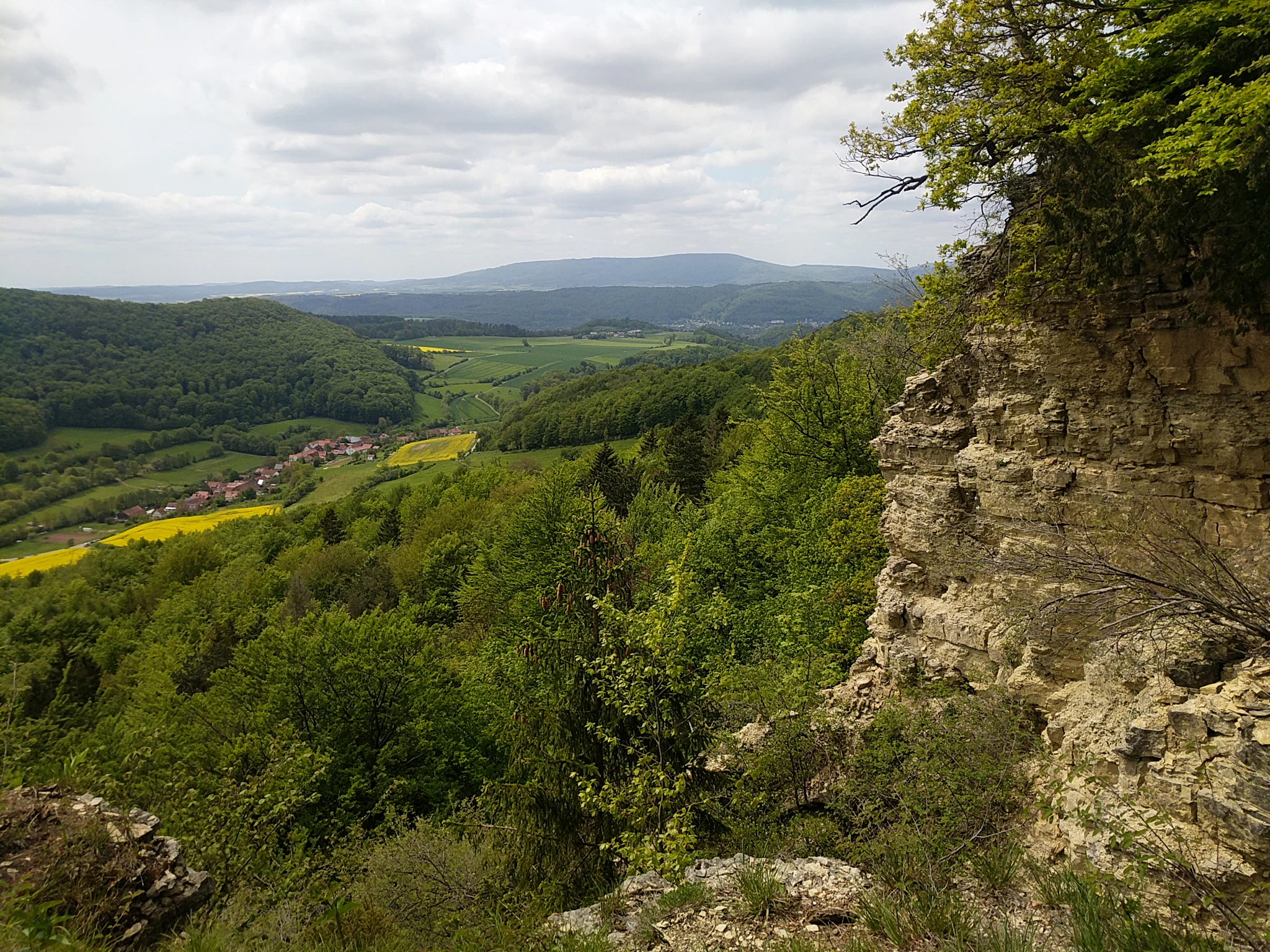
A high-angle landscape view showing a rugged limestone cliff face on the right foreground, overlooking a lush green valley with forests, yellow fields, a small village, and distant rolling hills under a cloudy sky.
View from the Nase bei Asbach cliffs overlooking the forested valley and distant hills of the Stein-Rachelsberg-Gobert nature reserve.

Stein, Rachelsberg, Gobert history and protected-area timeline

The Stein – Rachelsberg – Gobert area has been a borderland for centuries. Medieval boundary lines on these ridges separated the Electorate of Mainz from the Landgraviate of Hesse, with boundary stones from the 13th and 14th centuries still marking parts of the old course. After the 1803 Imperial Recess, the Mainz-administered Eichsfeld passed to Prussia while Hesse became an electorate, and in 1837 the Thuringian-Hessian border was reaffirmed with new stones inscribed KP for Kingdom of Prussia and KH for Kurfürstentum Hessen.

In September 1945 the order to adjust borders was given new urgency by the so-called Whisky-Wodka Treaty, or Wanfried Agreement, which transferred the Hessian villages of Asbach, Sickenberg, Vatterode, Weidenbach, and Henschrode to the Soviet zone and shifted the Thuringian villages of Werleshausen and Neuseesen together with the strategically important Bebra-Eichenberg rail link to the American zone. During the Cold War the inner-German border then ran across the Gobert plateau above Volkerode, Pfaffschwende, and Kella, and the eastern Gobert forest sat within a 500-meter restricted strip that was closed to ordinary citizens, fenced with three-meter-high metal mesh, and patrolled by the GDR border troops.

That closure had an environmental consequence: the forests could not be managed or visited for several decades, allowing beech and yew stands to grow into a structurally rich, near-natural state that helped motivate their later designation. When the Berlin Wall fell in November 1989, residents gathered at the so-called Altes Sägewerk site to celebrate the opening, and by Rosenmontag 1990 the border company at Pfaffschwende cooperated in having sections of the fence dismantled.

Formal nature protection followed. The landscape was nominated by Thuringia's environment ministry in September 2000, accepted by the European Commission in December 2004, and given its formal protection declaration through the Thuringian Natura 2000 Conservation Objectives Ordinance of 29 May 2008. In March 1990 the broader area had already been provisionally secured as part of the Eichsfeld-Hainich-Werratal nature park through the GDR National Park Programme, formally confirmed by Thuringian regulation in December 2011. In December 2023 an inner 505.9 hectare Stein – Rachelsberg nature reserve was declared within the FFH site, and in November 2018 the Thuringian parliament declared the former border strip a National Natural Monument, fully integrating the protected area into the Green Belt Eichsfeld-Werratal large-scale conservation project of the Heinz Sielmann Foundation.

Stein, Rachelsberg, Gobert landscape and geographic character

The landscape of Stein – Rachelsberg – Gobert is shaped by a long chain of Triassic limestone ridges that mark the western edge of the Thuringian Basin. Elevations rise from about 300 meters in the valley floors to around 523 meters at Rachelsberg, with Auf dem Stein (around 496 m) and the Gobert ridge as neighboring high points. The natural-region classification places the area within the Gobert sub-unit of the Upper Eichsfeld, on the northwestern rim of the Thuringian Basin, bordered to the east by the Rosoppe-Frieda hill country and to the west by units of the Lower Werra hill country.

The relief is unusually dramatic for this part of Germany. Muschelkalk (shell limestone) has produced long, steep slope faces, abrupt cliff edges, and exposed rocky ledges, giving the area its local nickname "Eichsfeld Switzerland." Features on the landscape include the Dietzenröder Klippen, the Silberklippe, the Vatteröder Stein, the Dietzenröder Stein, and the prominent rock spur called the Nase near Asbach, which was designated a natural monument as early as 1938. Small forested ravines descend toward the Werra, while the upper Gobert forms a relatively open plateau traversed by the historical Kolonnenweg patrol road that once ran along the border fence.
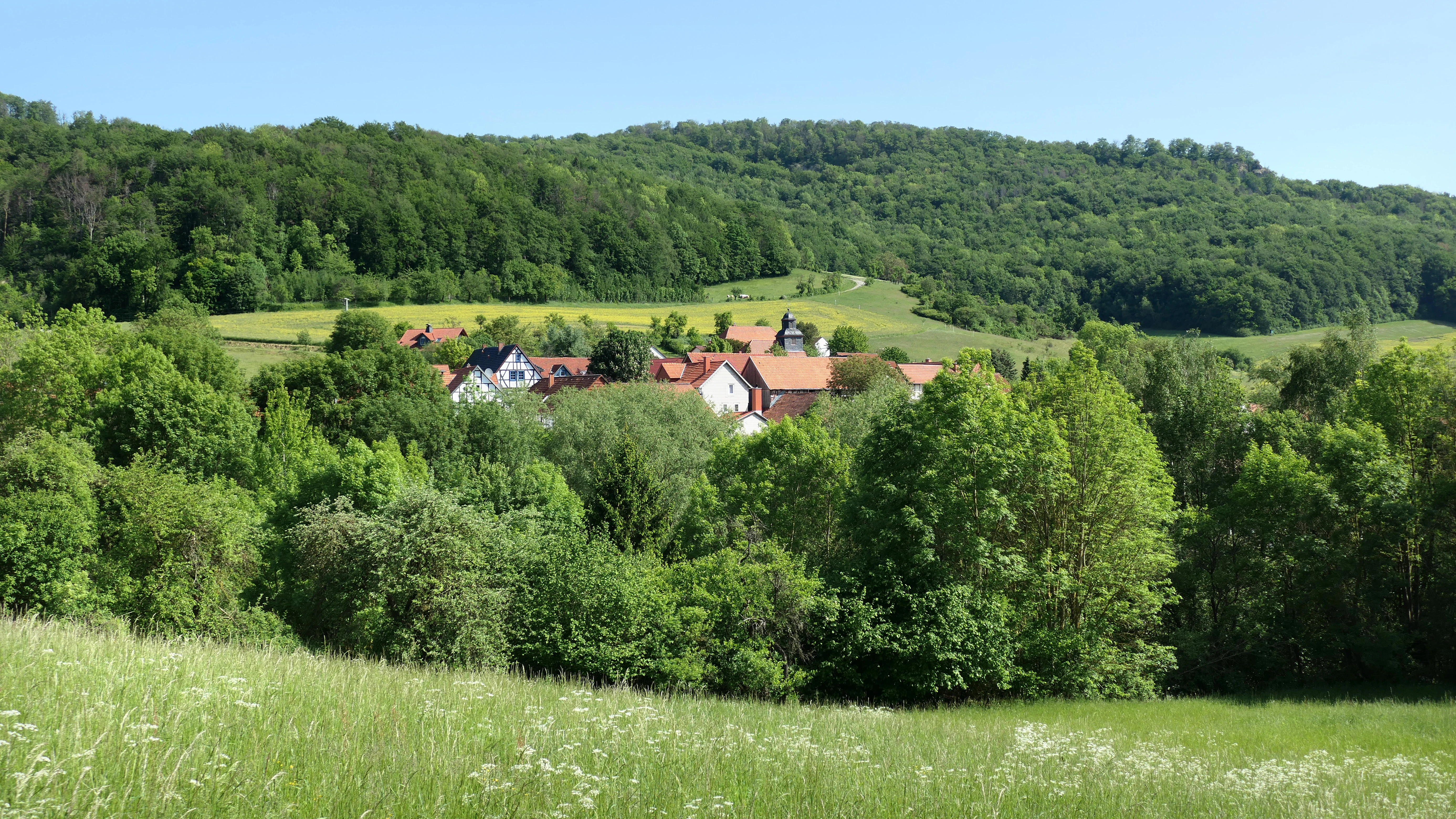
A landscape view of a forested hill with a small village of red-roofed houses nestled in the valley, seen from a grassy meadow.
View of the Stein, Rachelsberg, Gobert protected area from Asbach, showing forested hills and a small village.

Stein, Rachelsberg, Gobert ecosystems, habitats, and plant life

Ecologically, Stein – Rachelsberg – Gobert is a rare concentration of high-quality deciduous forest on limestone bedrock. The total woodland share exceeds 580 hectares, with mixed deciduous forest making up roughly 58 percent and pure deciduous stands a further 23 percent. The Waldmeister beechwood (habitat type 9130) is by far the most extensive forest community, while thermophilic orchid beechwood (habitat type 9150) covers a significant 37.77 hectares on warm, south-facing slopes. Smaller priority habitats include 0.50 hectares of ravine and slope mixed forest (habitat type 9180*) and 0.82 hectares of alder-ash floodplain forest (habitat type 91E0*) along stream courses. Roughly 24 hectares are classified as protected dry woodland of particular note.

Open habitats are less extensive but ecologically important. Around 39 hectares are mapped as magere Rasen on basic soils (habitat type 6210), including priority orchid-rich calcareous dry grassland (habitat type 6210*), classified phytosociologically as sub-Mediterranean brome dry and semi-dry grassland. Species such as Fieder-Zwenke, Aufrechte Trespe, Tauben-Skabiose, Frühlings-Fingerkraut and orchids including Stattliches Knabenkraut, Fuchssches Knabenkraut, and Große Händelwurz characterize these swards, and one orchid-rich semi-dry grassland northwest of Volkerode also supports a stand of the strictly protected Frauenschuh orchid (Cypripedium calceolus), an Annex II species.

Rock and spring habitats further underline the site's conservation value. Kalk-Schutthalden (habitat type 8160*) harbor mosses, lichens, ferns, Schwalbenwurz, and the rare Alpen-Distel (Alpine thistle), a strongly threatened plant in Thuringia. Limestone cliffs (habitat type 8210) at the Dietzenröder Klippen, the Silberklippe, and the Pfaffschwender Kuppe host Kalk-Blaugras, Mauerlattich, and Wald-Habichtskraut, alongside a small stand of priority lime-pioneer grassland (habitat type 6110*) with Scharfer Mauerpfeffer. Silicate cliffs near the Altenstein castle ruin (habitat type 8220) carry Gewöhnlicher Tüpfelfarn. Finally, the upper reaches of the Alte Hainsbach contain priority Kalktuffquellen (habitat type 7220*), tufa-depositing seepage and pool springs that support feuchte Hochstaudenfluren (habitat type 6430) of meadowsweet, Knolliger Kälberkropf, and Wasserdost.

A view inside a forest with tall grey tree trunks and dark green conical evergreen trees, with the ground covered in brown fallen leaves.
Forest interior within the Stein-Rachelsberg-Gobert conservation area featuring beech trees and yew trees in autumn.

Stein, Rachelsberg, Gobert wildlife and species highlights

Faunal interest is a primary reason for the site's Natura 2000 status. Bats are central: the area supports Annex II species including the greater mouse-eared bat (Myotis myotis) and the lesser horseshoe bat (Rhinolophus hipposideros), and the standard data form additionally lists the serotine bat, Daubenton's bat, Natterer's bat, and brown long-eared bat as European protected species. Part of the site's conservation obligation is to preserve the functional link to a bat roost in a residential building at Dietzenrode.

Woodland and mosaic-landscape birds protected under Annex I of the Birds Directive or Article 4(2) of the EU Birds Directive are present, including black stork, black woodpecker, hobby, and red kite. Within the broader 8,433 hectare Werrabergland SPA, additional target species include honey buzzard, grey, middle and black woodpeckers, red and black kites, turtle dove, red-backed shrike, great grey shrike, quail, woodcock, kingfisher, and eagle owl.

Among other animal groups, European wildcat, midwife toad, yellow-bellied toad, palmate newt, fire salamander, and sand lizard are documented, along with the dragonfly Gestreifte Quelljungfer. Butterflies are particularly diverse and include the Märzveilchen-Perlmuttfalter, Veilchen-Perlmuttfalter, Waldteufel, Perlbinde, Braunauge, Kleiner Eisvogel, Quendel-Ameisenbläuling, Himmelblauer Bläuling, Wundklee-Bläuling, Kreuzdorn-Zipfelfalter, and Ulmen-Zipfelfalter, several of which are listed as endangered or strongly endangered at federal or state level.
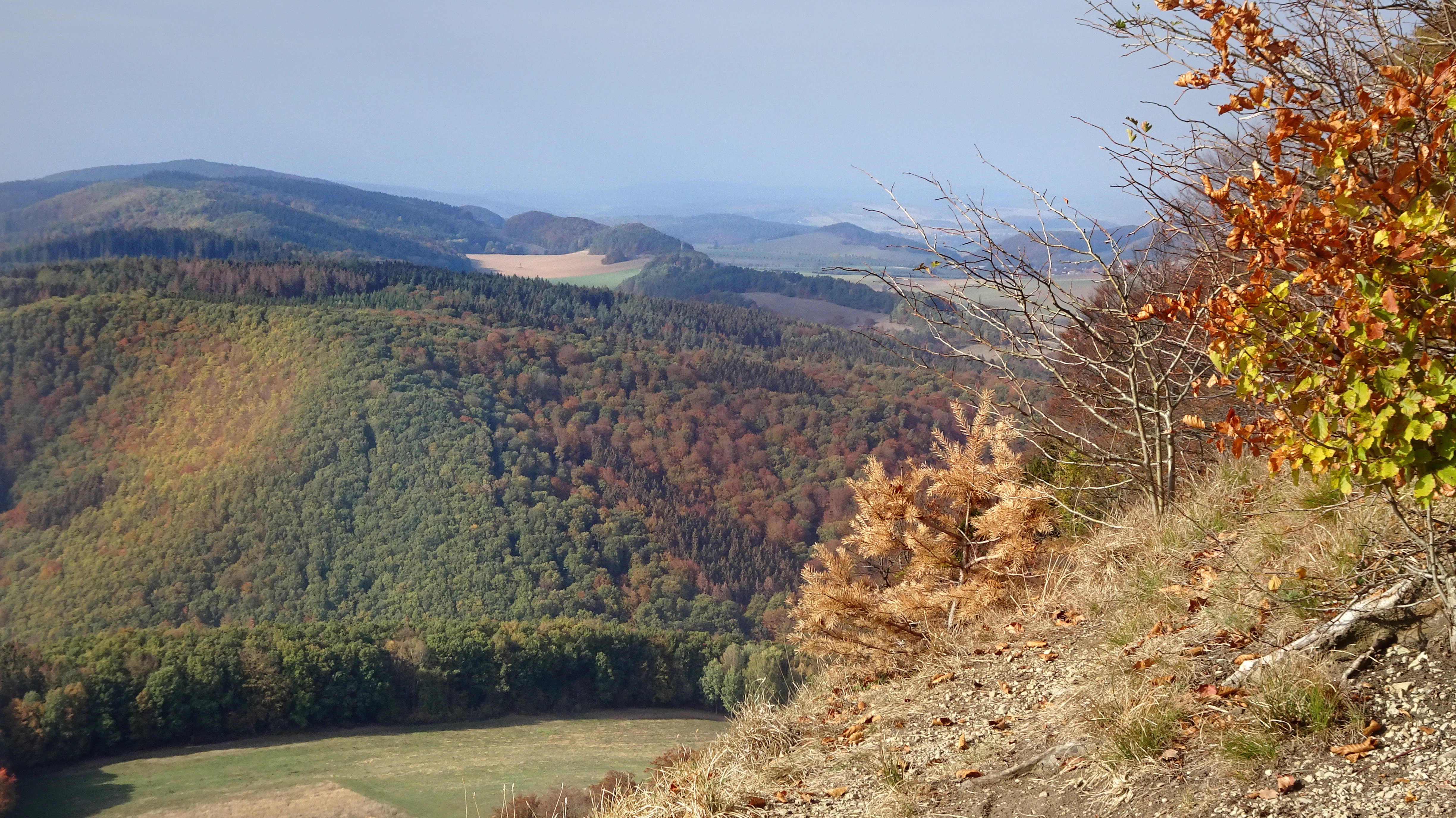
Wide landscape photograph showing a rocky cliff edge with autumn-colored trees in the foreground, overlooking forested hills and distant mountain ridges under a clear sky.
Autumn view from the Dietzenroder Klippen cliffs overlooking forested hills in the Stein-Rachelsberg-Gobert protected area, Thuringia, Germany.

Stein, Rachelsberg, Gobert conservation status and protection priorities

Stein – Rachelsberg – Gobert carries multiple, layered designations that together place it among the most strictly protected forest landscapes in Thuringia. As a 716 hectare FFH area under the EU Habitats Directive (Natura 2000 site 4726-320) its formal conservation objective is the maintenance, or restoration where necessary, of structurally rich near-natural beechwoods, orchid beechwoods and Hainsimsen beechwoods with lady's slipper orchid and bat habitat, the functional link to the bat roost at Dietzenrode, juniper heaths and calcareous semi-dry grasslands with orchid-rich stands, and the cliff, scree, pioneer and tufa-spring communities on undisturbed limestone ridges and steep slopes of the Werra hill country. Its quality has been assessed as good in formal monitoring.

Since 28 December 2023, an inner 505.9 hectare core has carried an additional Thuringian nature reserve designation (Naturschutzgebiet Stein – Rachelsberg, number 68), concentrating protection on the Waldgersten-Buchenwälder beech community, orchid-rich thermophilic beechwoods on hilltops and steep slopes, and alder-ash floodplain forests along narrow streams. Parts of the state-owned forest are already excluded from regular forestry use to allow permanent natural development, with extensive management continuing elsewhere to maintain stand-typical character. The wider FFH site is also wholly within the Werrabergland SPA bird protection area, the 38,000 hectare Obereichsfeld landscape protection area, and the 858 square kilometer Eichsfeld-Hainich-Werratal nature park.

Its conservation story is also shaped by the Green Belt. After the Thuringian parliament declared the former border strip a National Natural Monument in November 2018, Stein – Rachelsberg – Gobert became part of the Heinz Sielmann Foundation's Grosser Naturschutzprojekt Grünes Band Eichsfeld-Werratal, an inter-state biotope-connectivity project. Practical conservation work on the ground is supported by the yew preservation program, which uses targeted forestry measures to maintain this unusually rich yew population, and by habitat-management planning that has been carried out by ThüringenForst for the woodland and by the consultancy Triops for the open-land areas between 2019 and 2020.

Stein, Rachelsberg, Gobert cultural meaning and human context

The hills of Stein – Rachelsberg – Gobert have long served as a cultural as well as a political boundary. Medieval routes and boundary stones still visible along the ridge once divided the territory of the Electorate of Mainz from that of the Landgraviate of Hesse, and the mainzer Rad symbol used as the mark for the Eichsfeld-Wanderweg still commemorates that long ecclesiastical-period affinity. The 1837 Prussian-Hessian boundary redefined the line, and the main boundary stones from that period can still be found on the ridge inscribed KP and KH.

Following the Wanfried Agreement of 1945, the villages of Asbach, Sickenberg and Vatterode were transferred from Hesse into Thuringia, and the villages of Werleshausen and Neuseesen moved in the opposite direction. These border shifts explain why about 55 percent of the FFH area today lies within the parishes of Asbach and Sickenberg, communities whose identity is more Hessian than Eichsfelder in origin. The Cold War period left a further visible imprint: the Kolonnenweg, control strip, vehicle barrier trench, and three-meter-tall mesh fence above the Gobert plateau remain as an open-air record of the inner-German division.

The reunification of the landscape has itself become a place of memory. At the rest area Am Alten Sägewerk on the Gobert, exhibition texts, photographs and a fragment of the original metal fence recall the opening of the border in late 1989, when the GDR border company at Pfaffschwende cooperated in dismantling part of the fence in February 1990. Hiking routes through the area, including the Werra-Burgen-Steig and the Eichsfeld-Wanderweg, connect these themes with the area's medieval castles such as the ruined Höhenburg Altenstein, which sits within the perimeter of the new nature reserve.
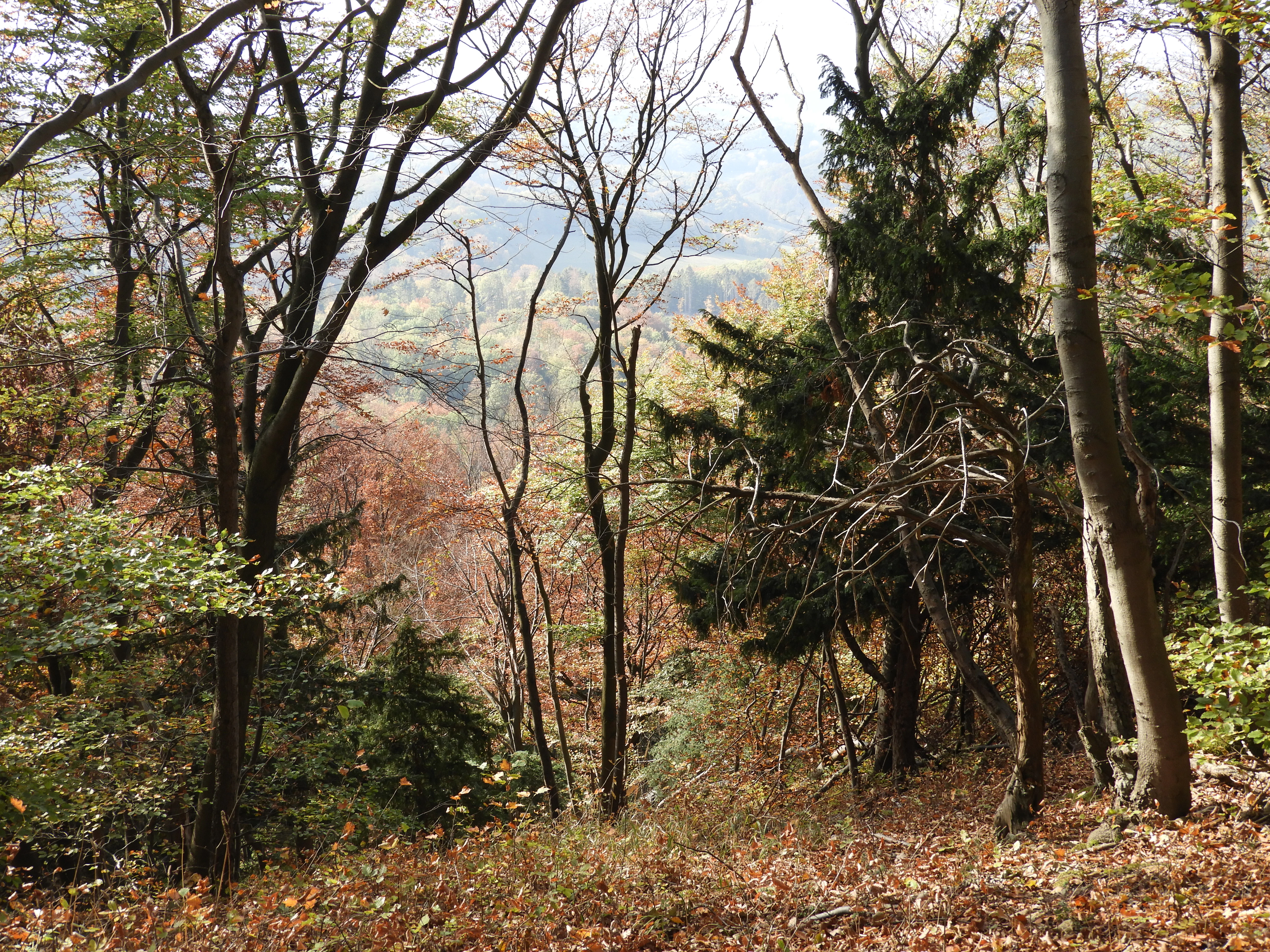
A forest scene showing bare deciduous trees and dark green coniferous trees, with a view of a valley covered in autumn foliage in the background. The ground is covered in brown fallen leaves.
Yew trees and mixed forest on the Rachelsberg in autumn, overlooking a valley.

Top sights and standout views in Stein, Rachelsberg, Gobert

A 716 hectare Natura 2000 beech forest landscape on the Thuringia-Hesse border, with elevations rising from roughly 300 to 523 meters across a chain of limestone ridges informally called the Eichsfeld Switzerland. The protected area combines large, structurally rich beech woodlands, including around 491 hectares of Waldmeister beechwood and 37.77 hectares of orchid-rich beechwood, with orchid-rich dry grasslands that host the Annex II species lady's slipper orchid and rare dry woodland, limestone cliff and scree habitats, and undisturbed tufa springs. Long biological continuity has been preserved by the site's location inside the former restricted strip of the inner-German border, allowing beech and yew to mature into one of the most natural forest complexes in Thuringia. The protected area is also central to the national Green Belt heritage corridor and supports exceptional bat, woodland bird, butterfly, and amphibian communities, alongside documented wildcat and remarkable concentrations of yew.
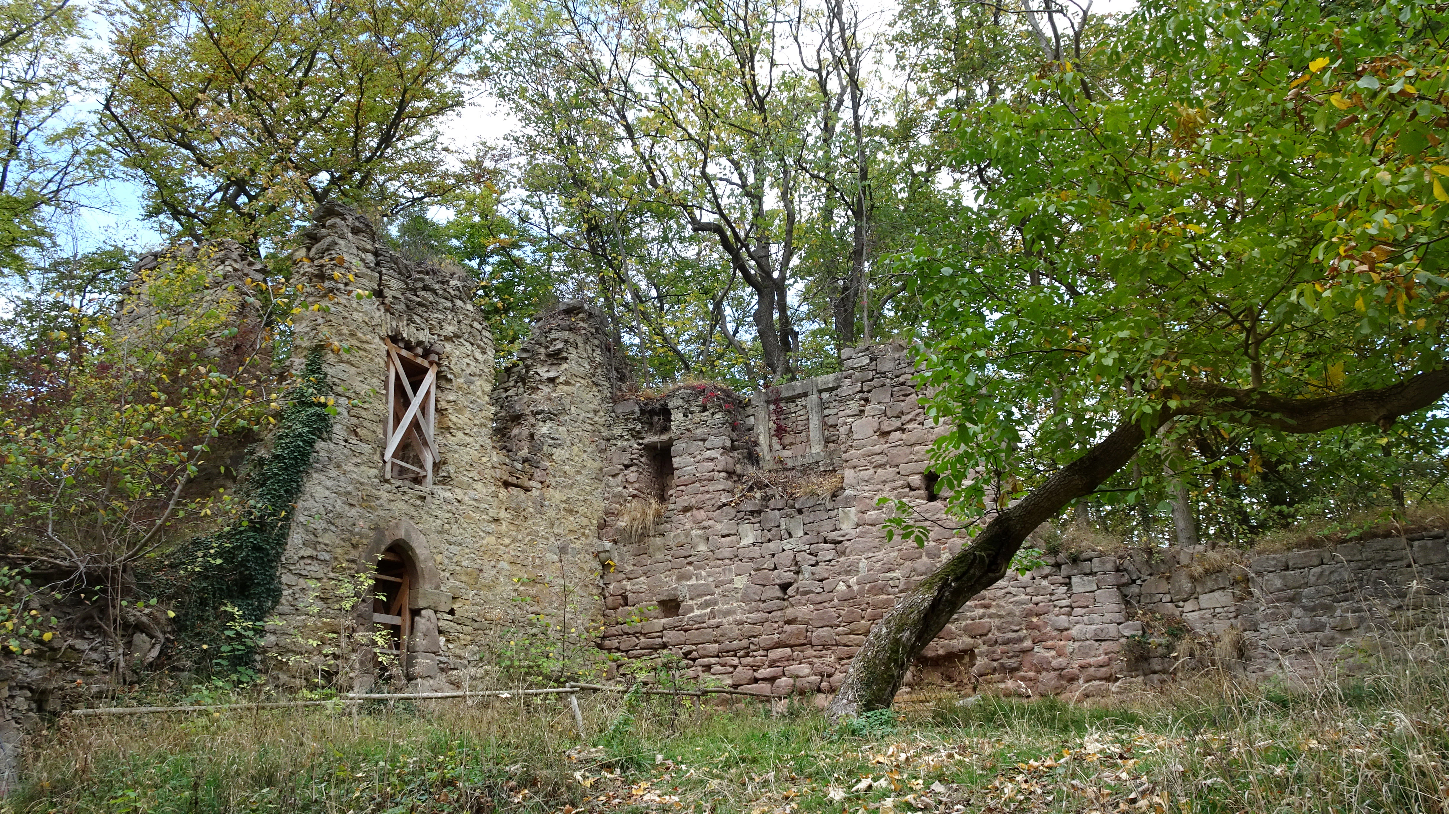
Stone ruins of a castle wall with arched doorways and windows, overgrown with ivy and surrounded by green trees in a forest.
Ruins of a 14th-century hill castle surrounded by forest in the Stein-Rachelsberg-Gobert protected area.

Best time to visit Stein, Rachelsberg, Gobert

Late spring through early autumn is broadly the most rewarding period for visiting Stein – Rachelsberg – Gobert, as the dry grasslands and orchid-rich semi-dry swards reach their peak in late May and June, when the Fuchssches Knabenkraut and other terrestrial orchids are flowering and butterfly activity is highest. Summer brings the densest forest canopy and active bat roosting and foraging around the cliff edges and forest edges, while the cooling temperatures of early autumn make the cliff viewpoints, rock features such as the Nase and Dietzenröder Klippen, and the route to the ruined Altenstein castle especially good for clear, long-distance views across the Werra hill country and the broader Eichsfeld.

Monthly climate preview

Long-term monthly temperature and precipitation patterns across representative coordinates

Stein – Rachelsberg – Gobert Climate Normals and Annual Temperature Rhythm

Long-term representative records track measured monthly temperature ranges and daily precipitation averages across twelve distinct cycles at Stein – Rachelsberg – Gobert. Analyzing the complete climate profile provides deeper context for seasonal thermal shifts and baseline moisture distribution.
Annual mean8 °C
-1 °C18 °C
Jan-1°
Feb
Mar
Apr
May12°
Jun16°
Jul18°
Aug18°
Sep14°
Oct
Nov
Dec
Warmest month
July

18.2 °C

Coolest month
January

-0.9 °C

Wettest month
July

2.6 mm/day

Driest month
April

1.5 mm/day

Park location guide

Geography guide, regional context, and park location map for Stein, Rachelsberg, Gobert

Stein, Rachelsberg, Gobert park geography, regions, and map view in Germany

Understand where Stein, Rachelsberg, Gobert sits in Germany through a broader geographic reading of the surrounding landscape, nearby location context, and its mapped position within the national park landscape.

How Stein, Rachelsberg, Gobert fits into Germany

Germany is a federal republic in Western and Central Europe with a population of over 83 million across sixteen constituent states. It is Europe's largest economy by nominal GDP and a major global exporter and importer. The capital is Berlin, and the country borders Denmark, Poland, Czech Republic, Austria, Switzerland, France, Luxembourg, Belgium, and the Netherlands.

Wider geography shaping Stein, Rachelsberg, Gobert in Germany

Germany is located in Western and Central Europe, spanning 357,022 km². It borders Denmark to the north, Poland and the Czech Republic to the east, Austria and Switzerland to the south, and France, Luxembourg, Belgium, and the Netherlands to the west. The country has coastlines on the Baltic Sea and North Sea to the north, with the Alps located in the southern region.

Map view of Stein, Rachelsberg, Gobert

Use this park location map to pinpoint Stein, Rachelsberg, Gobert in Germany, understand its exact geographic position, and read its mapped placement within the surrounding landscape more clearly.

Pigeon | © OpenStreetMap contributors

Location context for Stein, Rachelsberg, Gobert

Thuringia
Recorded earthquake history

Examine Recorded Earthquake History Near Stein – Rachelsberg – Gobert

View the historical catalogue of seismic events recorded in the vicinity of the Stein – Rachelsberg – Gobert nature reserve. MoriAtlas provides this data as a reference to examine recorded magnitudes and event dates associated with the geography of this Thuringian protected landscape.

Stein – Rachelsberg – Gobert Earthquake History

Catalogued events

4 events

Strongest magnitude

Magnitude 3.6

Most recent event

Oct 25, 2006

This history includes earthquakes recorded inside the park or within 50 km of its borders

Visual reference guide to limestone ridges, steep beech forests, and protected cliff habitats

Stein – Rachelsberg – Gobert Photos and Mapped Landscape Scenery

Visual documentation captures the rugged topography and limestone cliffs that define the protected landscape across the Thuringia and Hesse border. Photographic records reveal the structural diversity of ancient beech woodlands, rocky outcrops, and remote ravine habitats within the reserve.

A high-angle landscape view showing a rugged limestone cliff face on the right foreground, overlooking a lush green valley with forests, yellow fields, a small village, and distant rolling hills under a cloudy sky.

A wide landscape view showing a bright yellow field of flowers in the foreground, green meadows and trees in the middle distance, and forested hills under a clear blue sky.

A landscape view of a forested hill with a small village of red-roofed houses nestled in the valley, seen from a grassy meadow.

A view inside a forest with tall grey tree trunks and dark green conical evergreen trees, with the ground covered in brown fallen leaves.

Wide landscape photograph showing a rocky cliff edge with autumn-colored trees in the foreground, overlooking forested hills and distant mountain ridges under a clear sky.

A straight concrete slab path with grass growing between the panels, running through a green meadow flanked by trees, leading toward forested rolling hills under a partly cloudy blue sky

A forest scene showing bare deciduous trees and dark green coniferous trees, with a view of a valley covered in autumn foliage in the background. The ground is covered in brown fallen leaves.

Stone ruins of a castle wall with arched doorways and windows, overgrown with ivy and surrounded by green trees in a forest.

Park atlas

Compare adjacent limestone reserves and regional conservation corridors across Thuringia

Other Parks Near Stein – Rachelsberg – Gobert and Surrounding Protected Landscapes

Browsing other parks near Stein – Rachelsberg – Gobert reveals connected limestone ridges, old growth beech forests, and protected natural areas across the surrounding region. Comparing adjacent protected landscapes provides valuable geographic context for understanding regional biodiversity and terrain patterns.
Nature reserveThuringia
Mapped location lies within the park boundary#1 closest

North

Stein, Rachelsberg Nature Reserve: Mapped Muschelkalk Terrain in Thuringia

Protected low mountain hills and forested karst landscapes

The Stein, Rachelsberg nature reserve in Thuringia represents a protected mosaic of Muschelkalk ridges and Buntsandstein valleys. Its geography is defined by strongly broken relief, rocky outcrops, and a unique ring of forested summits including the Dieberg and Goburg, forming an essential link in regional conservation networks across the Thuringia and Hesse border.

Area
5.06 km²
Established
2023
Relief
Mountain
Climate
Temperate
Watercolor painting of a green landscape with rolling hills, a winding path or stream, and trees on both sides against a light background.
Nature reserveWerra-Meißner-Kreis
About 0.1 km away#2 closest

Northwest

Kalkklippen südlich des Iberges Nature Reserve and Muschelkalk Landscape Atlas

Protected beech forests and active landslide topography

This nature reserve in Werra-Meißner-Kreis reveals an active Muschelkalk ridge characterized by steep limestone cliffs and boulder-strewn talus slopes. Study the site's unique ecological composition, featuring noble hardwood-rich beech forests and native European yew populations that highlight the region's complex natural history and geological significance.

Area
0.473 km²
Established
1995
IUCN
IV
A horizontal watercolor illustration depicting gentle rolling hills, grassy meadows, and distant mountain silhouettes in muted pastel tones.
Nature reserveThuringia
0.7 km away#3 closest

Northwest

Röhrsberg - Hasenwinkel - Mühlberg: Mapping the Protected Landscapes of Thuringia

Geological ridge systems and native forest habitat networks.

The Röhrsberg - Hasenwinkel - Mühlberg nature reserve represents a significant protected area in Thuringia, characterized by the juxtaposition of Muschelkalk limestone hills and Zechstein dolomite ridges. This site offers a concentrated view of regional terrain, shifting from closed beech forests to open juniper heaths. It serves as an essential geographic reference for understanding the ecological mosaic of the lower Werra hill country.

Area
4.51 km²
Established
1999
IUCN
IV
Relief
Upland
A watercolor painting showing a soft, stylized landscape with rolling hills in the background and a variety of bushes and wild vegetation in the foreground.
Nature reserveWerra-Meißner-Kreis
About 2.9 km away#4 closest

South

Mönchesrieth bei Grebendorf Nature Reserve in Werra-Meißner-Kreis, Germany

A restored wetland refuge in the Werra river floodplain.

Located in northern Hesse, Mönchesrieth bei Grebendorf is a protected nature reserve formed by the flooding of a former gravel extraction site. Its geography features a network of shallow bays and shoreline vegetation that provide essential nesting and foraging grounds for waterbirds within the busy Werra valley corridor. The site represents a successful transition from industrial terrain to a quiet, managed refuge for regional biodiversity.

Area
0.181 km²
Established
1999
IUCN
IV
Relief
Lowland
A horizontal watercolor illustration showing a soft, panoramic landscape with rolling green hills, small clumps of trees, and rocky formations on a white background.
Nature reserveLandkreis Eichsfeld
About 2.9 km away#5 closest

Northwest

Hasenwinkel bei Fretterode: Protected Dolomite Ridge and Juniper Heath in Landkreis Eichsfeld

Nature reserve geography and landscape analysis

The Hasenwinkel bei Fretterode nature reserve is characterized by a prominent dolomite ridge rising above the agricultural lands of Landkreis Eichsfeld. This site offers an look at historically grazed calcareous grasslands and rocky outcrops. Our mapping covers its extent as a vital component of the regional protected-area network, showcasing its ecological importance and distinctive geology.

Area
0.062 km²
Established
1939
IUCN
IV
Relief
Upland
A wide watercolor illustration of a rolling landscape with green fields, patches of pink flowers, and distant purple hills under a pale sky.
Nature reserveWerra-Meißner-Kreis
About 4.8 km away#6 closest

Southwest

Jestädter Weinberg: Protected Zechstein Cliffs and Werra River Valley Mosaic

A botanical and geological hotspot in northern Hesse

Jestädter Weinberg represents a critical protected landscape defined by its steep dolomite rock faces and sun-exposed slopes. This nature reserve provides an essential habitat for orchids and diverse insect populations, bridging the gap between high-altitude limestone ridges and the riparian meadows of the Werra river valley.

Area
0.6 km²
Established
1924
IUCN
IV
Relief
Upland
Watercolor painting of a rolling forested ridge under a pale sky.
Nature reserveThuringia
About 5.3 km away#7 closest

North

Lengenberg Nature Reserve: A Geographical Overview of the Eichsfeld Ridge

Protected beech and yew woodlands in Thuringia, Germany

The Lengenberg Nature Reserve forms a prominent, fully forested ridge within the Eichsfeld region of Thuringia. Renowned for hosting one of the most substantial yew populations in central Europe, the reserve showcases a geological transition between shell limestone and red sandstone. This mapping of the terrain provides insight into the ecological structure of the Eichsfeld-Hainich-Werratal area.

Area
0.26 km²
Established
1961
Relief
Mountain
Climate
Temperate
A horizontal watercolor painting depicting a calm lake with marshy grass in the foreground and rolling mountains in the distance under a soft, pale sky.
Nature reserveWerra-Meißner-Kreis
About 5.5 km away#8 closest

Southeast

Kiesteich bei Frieda Nature Reserve: Exploring the Protected Geography of Werra-Meißner-Kreis

A detailed look at wetland habitats and landscape reclamation in the Werra valley

Kiesteich bei Frieda is a protected nature reserve nestled in the Werra valley of the Werra-Meißner-Kreis. This area, originally formed through gravel mining, now provides a dense vegetative buffer and aquatic ecosystem that serves as a vital corridor for amphibians and waterbirds. Discover the geographic features that define this essential protected sanctuary and understand its integration into the wider regional environmental network.

Area
0.066 km²
Established
1988
IUCN
IV
Relief
Lowland

Common questions about visiting, size, designation, and location context for Stein, Rachelsberg, Gobert

Stein, Rachelsberg, Gobert FAQs for park facts, access, geography, and protected area context

Find quick answers about Stein, Rachelsberg, Gobert, including protected-area facts, park geography, trail and visitor context, and how the park fits into its surrounding country and regional landscape.
MoriAtlas Explorer

Continue Your Protected Areas Search Across the Global Atlas

Deepen your exploration by continuing the structured search for national parks and protected areas worldwide. Utilize the comprehensive filtering capabilities to compare different conservation landscapes and refine your understanding of global park geography. Discover more about the distribution and characteristics of protected natural areas.

Global natural geography