
Mori Atlas logo
Nature reserveTannersand und Gierenberg

A rare mosaic of sand-based heath, coniferous ridges, and shallow Slatts in Oldenburg

Tannersand und Gierenberg Nature Reserve: Protected Inland Dunes and Wetland Landscapes

(Naturschutzgebiet Tannersand und Gierenberg)

The Tannersand und Gierenberg nature reserve near Oldenburg preserves a striking geological anomaly of inland dunes and peat-rich wetlands. This protected area features a unique mosaic of conifer-covered ridges and shallow bog pools known as Slatts. Visitors and researchers can analyze the mapped terrain of this inland dune system, which contrasts dry sandy heath with specialized floating Sphagnum mats, providing critical habitat within the larger Osenberge landscape.

inland dunesbog poolsSlattspeatlandSphagnum mosssand heath
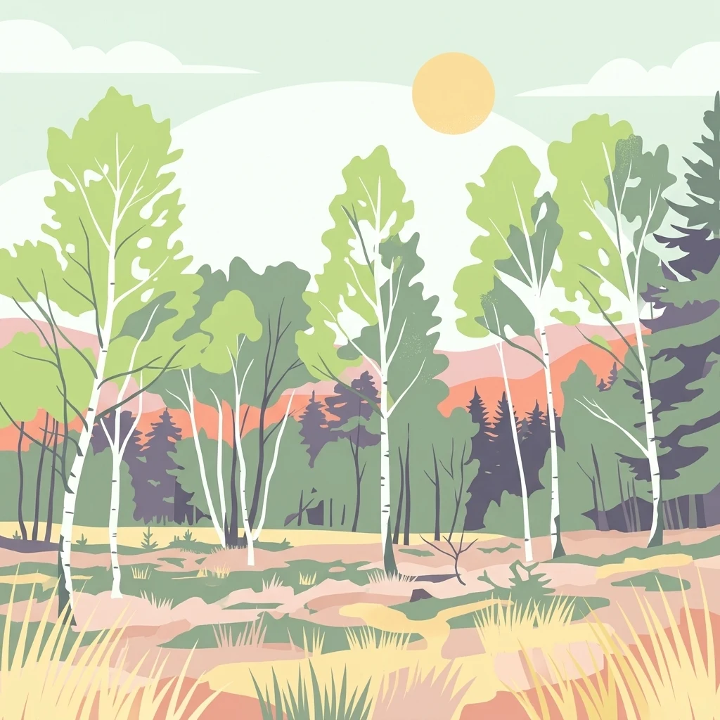
A digital illustration of a forest scene featuring slender birch trees with white trunks and light green leaves, set against a soft background of rolling hills and a pale sun.

Tannersand und Gierenberg

Nature reserve

Park overview

Structured park overview, official facts, and landscape profile for Tannersand und Gierenberg

Tannersand und Gierenberg park facts, protected area profile, and essential visitor context

Review the core facts for Tannersand und Gierenberg, including designation, size, terrain, visitor scale, habitats, and operating context in one park-focused overview.

About Tannersand und Gierenberg

Tannersand und Gierenberg is one of the smaller but ecologically distinctive nature reserves in the Oldenburg region of Lower Saxony. Covering about 35 hectares in the municipality of Hatten, it lies within the Osenberge range, a low sandy ridge system that forms part of the broader Wildeshauser Geest. Although modest in size, the reserve captures a remarkable range of habitats in a compact footprint, from dry inland dunes to wet peatlands.

The defining character of the site is its inland dune system, a sand-dominated landscape that reflects the glacial and post-glacial history of northwestern Germany. Coniferous trees, largely pines, dominate much of the area. Interspersed among these forested dunes are shallow wetland depressions called Slatts, unique local features that hold standing water, floating Sphagnum mats, and fringing vegetation such as cottongrass and sedges. Small ponds within the area carry their own specialized plant communities of shoreweed and dwarf rush.

Beyond the bog pools, the reserve includes sandy heath patches where heather, crowberry, and blueberry grow alongside various mosses. This combination of dry, sandy uplands and wet, peat-forming lowlands makes Tannersand und Gierenberg ecologically richer than its size suggests, and it has been integrated into the EU Natura 2000 network as a Flora-Faura-Habitat zone. The surrounding landscape protection area extends across the neighboring Staatsforst Alt-Osenberge and the broader Oldenburger Sand, providing a wider buffer of forest and heath around the core reserve.

Quick facts and research context for Tannersand und Gierenberg

Tannersand und Gierenberg is a nature reserve (Naturschutzgebiet) of approximately 35 hectares, located in the municipality of Hatten in the Landkreis Oldenburg, Lower Saxony, just south of Oldenburg. It carries the official designation NSG WE 066 and is largely coincident with an EU Flora-Faura-Habitat area of the same name.

The site lies within the Naturpark Wildeshauser Geest and is fully enclosed by the landscape protection area covering Oldenburger Sand and the surrounding Osenberge forests. It was placed under protection on 27 December 1938 and expanded to its current extent on 22 December 2018, with management responsibility held by the Landkreis Oldenburg as the lower nature conservation authority.

Protection and recognition

Examining official conservation designations and recorded protected area data

Tannersand und Gierenberg Protection Status and Natura 2000 Recognition

Tannersand und Gierenberg features documented Natura 2000 recognition alongside verified protected area registry records. Official conservation status details provide clear context for international tracking and regional ecological management.
Park context

Deeper park guide and search-rich context for Tannersand und Gierenberg

Tannersand und Gierenberg history, landscape, wildlife, and travel context

Explore Tannersand und Gierenberg through its history, landscape character, ecosystems, wildlife, conservation priorities, cultural context, and seasonal travel timing in a structured park guide built for atlas discovery and search intent.

Why Tannersand und Gierenberg stands out

The reserve is best known for its inland dune landscape, an unusual landform well inland from the North Sea coast, combined with embedded bog pools called Slatts. These shallow wetland depressions host floating peat-moss mats with cottongrass, sundews, and rare bog-edge vegetation, while the dry dune ridges support conifer stands and sand heath with heather and crowberry. This tight juxtaposition of dry sandy dunes and wet peat-forming slatts within such a small area is characteristic of the reserve and gives the site its distinct ecological identity. It is also recognized as a habitat for specialized bog invertebrates such as the Bog Fritillary butterfly and the Moorland Blue butterfly.
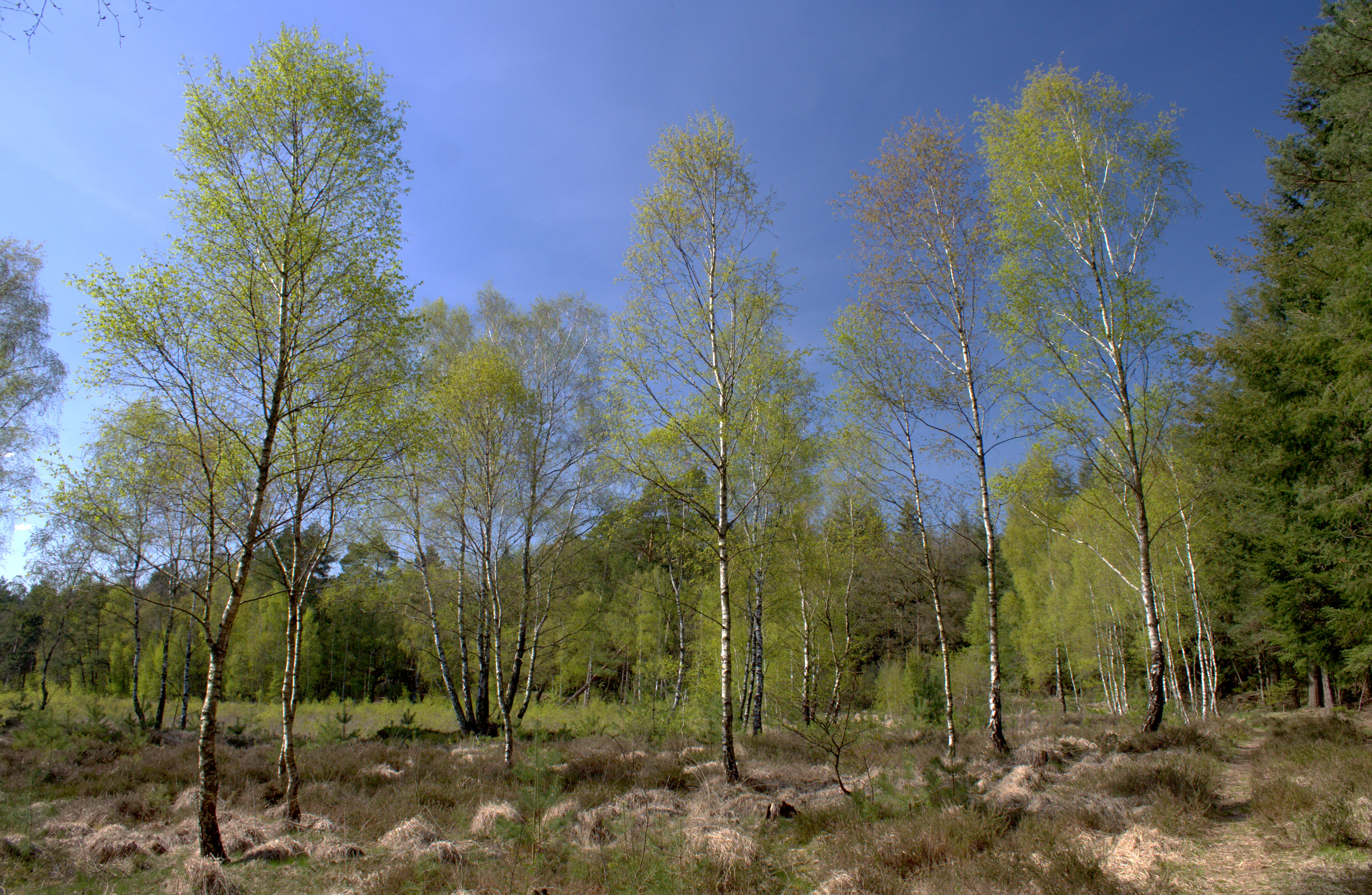
A group of slender birch trees with fresh spring foliage stands in a low-lying boggy landscape with patches of brown grass and shrubs under a clear blue sky.
Birch trees growing in the damp, moorland habitat of the Tannersand und Gierenberg nature reserve.

Tannersand und Gierenberg history and protected-area timeline

Tannersand und Gierenberg has been a designated nature reserve since 27 December 1938, making it one of the older formal protected areas in the Landkreis Oldenburg. Its designation reflected early recognition of the unusual inland dune and bog habitat combination in the Osenberge.

For most of its protected history, the reserve covered approximately 29.6 hectares. On 22 December 2018, the area was expanded in the Gierenberg portion to its present size of about 35 hectares, incorporating additional habitat along one of the dune ridges. Today the reserve is administered by the Landkreis Oldenburg as the responsible lower nature conservation authority, with broader coordination provided through the Niedersächsischer Landesbetrieb für Wasserwirtschaft, Küsten- und Naturschutz (NLWKN). The site has also been formalized as part of the EU Natura 2000 Flora-Faura-Habitat network.

Tannersand und Gierenberg landscape and geographic character

The landscape of Tannersand und Gierenberg is shaped by a system of inland dunes that rise modestly above the surrounding terrain, with elevations ranging roughly from 16 to 24 meters. These sandy ridges are the dominant landform and give the reserve its name, with the Gierenberg being one of the more prominent dune elevations within the area.

Set among the dune ridges are several Slatts, the local term for small, shallow wetland depressions characteristic of the sandy geest landscapes of northwestern Germany. These pools and their surrounding swampy edges create zones of open water, floating vegetation, and peat-forming mats that interrupt the otherwise dry, forested sand surface. Small ponds with fringing communities of shoreweed and dwarf rushes add further habitat diversity.

At the margins of the dunes and bogs, sandy heath vegetation develops on the drier ground. This mosaic of dune ridges, wet slatts, heath patches, and conifer stands forms a compact yet varied terrain within the larger Osenberge range and the Naturpark Wildeshauser Geest.

Tannersand und Gierenberg ecosystems, habitats, and plant life

Ecologically, Tannersand und Gierenberg is defined by the contrast between its dry sandy substrate and its embedded wet habitats. The upland dunes support conifer-dominated forest, while the margins hold open sand heath communities with heather, crowberry, blueberry, and a variety of mosses. These drier areas form part of the broader Oldenburger Sand landscape, a regionally significant sandy ridge system.

The wetland component is equally important. The Slatts and surrounding swamps are peat-forming environments dominated by Sphagnum mosses, including Magellanic bog moss. They support cottongrass species such as narrow-leaved and sheath-bearing cottongrass together with white beak-sedge, round-leaved sundew, common cranberry, and sedges such as grey sedge and blunt-flowered rush. Tiny ponds within the system carry specialized vegetation of shoreweed and dwarf rushes. Together these wetland elements make the reserve a functioning, though small, peatland ecosystem within a predominantly sandy setting.

Tannersand und Gierenberg wildlife and species highlights

The reserve is particularly significant for specialized bog and heath invertebrates. Among its notable species are the Bog Fritillary butterfly and the Moorland Blue, both of which depend on the open, moist heath and bog-edge habitats maintained within the reserve. The bog areas also host the distinctive Bog Owlet moth.

On the drier dune and heath margins, reptiles such as the smooth snake find suitable conditions, reflecting the warm, sandy, open character of these parts of the reserve. The combination of forest, heath, bog, and open water creates habitat for a range of smaller fauna adapted to these specific microhabitats, although the reserve's compact size and dense conifer cover limit large mammal presence.

Tannersand und Gierenberg conservation status and protection priorities

Tannersand und Gierenberg has been under formal protection since 1938 and has gained additional conservation importance through its inclusion in the EU Natura 2000 network as a Flora-Faura-Habitat site. The reserve is also fully encircled by the larger landscape protection area "Staatsforst Alt-Osenberge, Wunderhorn, Oldenburger Sand, Tannersand mit Randgebieten," which buffers the core zone against development and land-use change.

From a conservation perspective, the reserve protects a regionally rare combination of inland dunes and peat-forming bog pools in a small, contiguous area. The peat mosses, sundews, cottongrasses, and specialized bog butterflies are particularly sensitive to drainage and disturbance, making the protected status ecologically important. The 2018 expansion strengthened the reserve by adding more dune habitat, improving habitat connectivity within the Osenberge system.

Tannersand und Gierenberg cultural meaning and human context

The reserve sits within the Osenberge, a traditional sandy ridge landscape of the Wildeshauser Geest that has shaped local life for centuries. The term Slatt, used for the small wetland pools within the area, reflects the regional Low German vocabulary of northwestern Germany and underscores the deep local knowledge of these distinctive landscape features.

The surrounding landscape protection area includes historic state forests such as the Staatsforst Alt-Osenberge, pointing to a long history of forest management in the region. While the reserve itself is primarily recognized for its natural values rather than built heritage, its place within a regionally distinctive cultural landscape of geest dunes and bogs gives it additional identity.

Top sights and standout views in Tannersand und Gierenberg

Among the reserve's strongest points of distinction are its inland dune formations, unusual for a location well inland from the North Sea coast. The Slatts, with their floating Sphagnum and cottongrass mats, provide a clear example of active peat formation in a sandy setting, while the sand heath margins add a contrasting dry habitat.

The reserve is also notable for harboring specialized bog species such as the Bog Fritillary and Moorland Blue butterflies, and for its integration into both the EU Natura 2000 network and the surrounding Oldenburger Sand landscape protection area. Its long protection history, dating to 1938, makes it one of the older small reserves in the Landkreis Oldenburg.

Best time to visit Tannersand und Gierenberg

Because Tannersand und Gierenberg is a quiet, low-relief inland dune and bog landscape without major seasonal access constraints, visitation is largely a matter of personal preference. Late spring through early autumn tends to be the most rewarding period, when the heath plants are in bloom, the bog pools are at their most biologically active, and butterflies such as the Bog Fritillary and Moorland Blue are on the wing in the open heath and bog-edge habitats.

Winter visits can offer a different perspective, with bare sandy ridges, quiet conifer stands, and frost-rimmed bog pools, though some species are less observable. The compact size and gentle terrain mean that timing is less about access and more about matching intended interests, such as botany, bog ecology, or insect watching.

Monthly climate preview

Long-term representative monthly averages tracking temperature ranges and precipitation rhythm

Tannersand und Gierenberg Climate Normals, Annual Temperature and Precipitation Patterns

Representative coordinates record long-term monthly temperature spans from sub-zero winter minimums to warm summer maximums alongside consistent daily precipitation. Accessing the complete twelve-month climatology profile allows detailed examination of monthly weather patterns across the protected landscape.
Annual mean9 °C
1 °C18 °C
Jan
Feb
Mar
Apr
May13°
Jun16°
Jul18°
Aug18°
Sep14°
Oct10°
Nov
Dec
Warmest month
July

17.9 °C

Coolest month
January

1.2 °C

Wettest month
July

2.5 mm/day

Driest month
April

1.4 mm/day

Park location guide

Geography guide, regional context, and park location map for Tannersand und Gierenberg

Tannersand und Gierenberg park geography, regions, and map view in Germany

Understand where Tannersand und Gierenberg sits in Germany through a broader geographic reading of the surrounding landscape, nearby location context, and its mapped position within the national park landscape.

How Tannersand und Gierenberg fits into Germany

Germany is a federal republic in Western and Central Europe with a population of over 83 million across sixteen constituent states. It is Europe's largest economy by nominal GDP and a major global exporter and importer. The capital is Berlin, and the country borders Denmark, Poland, Czech Republic, Austria, Switzerland, France, Luxembourg, Belgium, and the Netherlands.

Wider geography shaping Tannersand und Gierenberg in Germany

Germany is located in Western and Central Europe, spanning 357,022 km². It borders Denmark to the north, Poland and the Czech Republic to the east, Austria and Switzerland to the south, and France, Luxembourg, Belgium, and the Netherlands to the west. The country has coastlines on the Baltic Sea and North Sea to the north, with the Alps located in the southern region.

Map view of Tannersand und Gierenberg

Use this park location map to pinpoint Tannersand und Gierenberg in Germany, understand its exact geographic position, and read its mapped placement within the surrounding landscape more clearly.

Pigeon | © OpenStreetMap contributors

Location context for Tannersand und Gierenberg

Oldenburg
Recorded earthquake history

Review the Tannersand und Gierenberg Earthquake and Seismic History

Browse a structured catalogue of historical earthquakes recorded near the Tannersand und Gierenberg nature reserve. This dataset allows for precise review of seismic events, providing essential geographic context and proximity data for the region through the MoriAtlas geological record.

Tannersand und Gierenberg Earthquake History

Catalogued events

2 events

Strongest magnitude

Magnitude 4

Most recent event

Jul 2, 2006

This history includes earthquakes recorded inside the park or within 50 km of its borders

Visual exploration of inland dunes, bog pools, and protected habitats

Tannersand und Gierenberg Photos and Landscape Scenery

Visual records reveal the striking juxtaposition of dry sandy ridges and wet peat-forming slatts across the protected terrain. Examining these detailed landscape photographs provides a deeper understanding of the rare ecosystems preserved within the nature reserve.

A group of slender birch trees with fresh spring foliage stands in a low-lying boggy landscape with patches of brown grass and shrubs under a clear blue sky.

Park atlas

Discover related protected areas across the surrounding Lower Saxony terrain

Other Parks Near Tannersand und Gierenberg for Regional Landscape Comparison

Compare Tannersand und Gierenberg with other nearby protected areas, including adjacent inland dune reserves and wetland habitats throughout the surrounding region. Extending the geographic review provides deeper context on the regional spread of rare sand heaths and peat-forming ecosystems.
Nature reserveOldenburg
11 km away#1 closest

East

Stühe Nature Reserve: A Detailed Map and Geographic Overview of the Delmenhorster Geest

Protected beech forests and lowland bog ecosystems in Oldenburg

Stühe serves as a significant forest refuge in the Oldenburg district, showcasing a rare intersection of beech, oak, and riparian floodplain forests. This nature reserve, anchored within the wider Delmenhorster Geest landscape, features glacial depressions, kettle-like stillwaters, and preserved bog monuments that document the natural history of the northwest German lowlands.

Area
2.17 km²
Established
2018
Relief
Lowland
Climate
Temperate
Nature reserveLower Saxony
18 km away#2 closest

East

Stenumer Holz Nature Reserve: Protected Ancient Woodland Geography in Lower Saxony

A detailed map-based overview of ancient oak and beech forest ecosystems

Stenumer Holz functions as a critical nature reserve within the Oldenburg district, preserving an ancient broadleaf forest mosaic that stretches across 96 hectares of sandy-geest terrain. The area is defined by its diverse structural composition, including moist oak-hornbeam stands, drier Luzula beech ridges, and narrow alluvial corridors that support specialized woodland flora and old-growth ecological features.

Area
0.96 km²
Established
2018
Relief
Lowland
Climate
Temperate
Nature reserveLower Saxony
About 19 km away#3 closest

Southeast

Wunderburger Moor Nature Reserve: Mapped Bog Habitats and Lower Saxony Geography

Protecting a dense mosaic of mire and peatland landscapes

Wunderburger Moor in Lower Saxony represents a significant protected example of a small bog landscape, or Kleinmoor. The reserve contains a compact range of habitat types, including moor heath, reedbeds, and wet birch woodland, providing a clear window into the ecological diversity of northwestern German peatlands within a managed site.

Area
0.34 km²
Established
1967
IUCN
IV
Relief
Lowland
Nature reserveLandkreis Cloppenburg
About 26 km away#4 closest

Southwest

Talsperre Thülsfeld Nature Reserve: Geography and Protected Land Profile

Inland dune and wetland conservation in Landkreis Cloppenburg

Talsperre Thülsfeld functions as a protected nature reserve showcasing the traditional northwest German lowland landscape. The site contains a five kilometer long reservoir, expansive heathlands, and bog communities, offering a clear view of how glacial geography shapes modern conservation areas. Researchers and observers can examine the transition between dry sandy dunes and damp riverine floodplains within this concentrated ecological boundary.

Area
4.62 km²
Established
1957
Relief
Lowland
Climate
Temperate
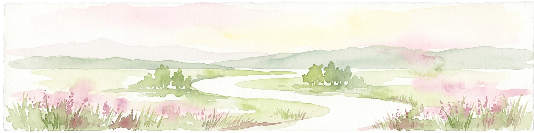
A horizontal watercolor painting depicting a soft-focus landscape with a pond in the foreground, pink and green heath vegetation, and distant tree lines under a pale sky.
Nature reserveBremen
About 26 km away#5 closest

Northeast

Eispohl, Sandwehen und Heideweiher: Protected Landscape and Geest Geography

Nature reserve featuring historic dunes and heath pond networks

This nature reserve in Bremen protects a remnant of the Rekumer Geest, featuring a complex of inland dunes, wet heath, and small heath ponds. Through its combination of extensively grazed grasslands and mixed forests, the area serves as a vital habitat corridor, maintaining the traditional Geest landscape patterns that once dominated the region between Bremen and the lower Weser.

Area
0.036 km²
Established
1988
Relief
Lowland
Climate
Temperate
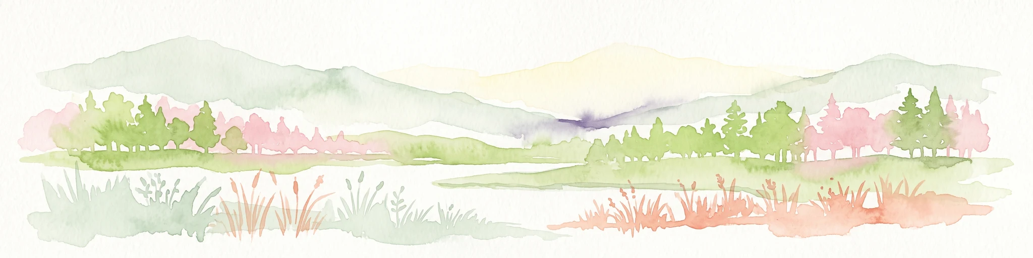
Watercolor painting of a green and pink landscape featuring a forest line with tall grasses in the foreground and soft hills in the background.
Protected landscapeNiedersachsen
27 km away#6 closest

Northwest

Elmendorfer Holz: Protected Landscape and Forest Ecology in Niedersachsen, Germany

Mapping lowland forest habitats and regional protected boundaries

Elmendorfer Holz is a significant protected area and forest reserve situated north of the Zwischenahner Meer. It is defined by its near-natural oak and hornbeam canopy and dense layering of conservation status. The forest serves as a vital ecological anchor within the broader agricultural mosaic of the Ammerland district, providing a clear reference for northwestern German lowland woodland characteristics.

Area
0.285 km²
Established
2007
Nature reserveBremen
About 29 km away#7 closest

East

Ochtumniederung bei Brokhuchting: Wetland Nature Reserve and Floodplain Geography

A core conservation area within the Bremen Niedervieland

This protected area stands as a primary example of large-scale river floodplain restoration in the Bremen region. The landscape includes a dense network of canals, reedbeds, and seasonal flood zones that provide critical shelter for waterfowl and waders. Through careful environmental management, this site integrates natural riverine terrain with the surrounding industrial and urban framework of northwestern Germany, offering a distinct study of managed wetland ecosystems.

Area
3.75 km²
Established
1998
Relief
Lowland
Climate
Temperate
Nature reserveBremen
About 29 km away#8 closest

Northeast

Hammersbecker Wiesen: Protected Nature Reserve and Meadow Landscape in Bremen

Ecological mosaic of wet meadows and stream valley terrain

Hammersbecker Wiesen encompasses 25.8 hectares of ecologically significant wet grassland and hedgerow habitats in Bremen. This nature reserve provides an essential refuge for diverse plant species and local amphibians within an urban-adjacent setting, illustrating the preserved character of traditional northern German meadow systems.

Area
0.258 km²
Established
1986

Common questions about visiting, size, designation, and location context for Tannersand und Gierenberg

Tannersand und Gierenberg FAQs for park facts, access, geography, and protected area context

Find quick answers about Tannersand und Gierenberg, including protected-area facts, park geography, trail and visitor context, and how the park fits into its surrounding country and regional landscape.
MoriAtlas Explorer

Continue Your Protected Areas Search Across the Global Atlas

Deepen your exploration by continuing the structured search for national parks and protected areas worldwide. Utilize the comprehensive filtering capabilities to compare different conservation landscapes and refine your understanding of global park geography. Discover more about the distribution and characteristics of protected natural areas.

Global natural geography