Mori Atlas logo
Nature reserveTaubental Nature Reserve

Tracing the boundaries of a core forest reserve defined by Buntsandstone ridges and habitat connectivity.

Taubental Nature Reserve: An Analysis of Protected Woodland and Regional Geography in Saarland, Germany

(Naturschutzgebiet Taubental (NSG-117))

Taubental Nature Reserve represents a critical protected woodland block situated within the Saarland region of Germany. Established to conserve mixed broadleaf and coniferous forest on characteristic red sandstone substrate, it serves as a vital core zone within the broader Bliesgau Biosphere Reserve. This atlas entry examines the reserve as a sustained forest landscape existing alongside significant transport corridors, illustrating the integration of high-tier habitat protection within a densely organized regional environment.

mixed broadleaf forestbiosphere reserve core zoneBuntsandstein woodlandSaarlandSaarpfalz-Kreishabitat and species management

Taubental Nature Reserve

Nature reserve

Park overview

Structured park overview, official facts, and landscape profile for Taubental Nature Reserve

Taubental Nature Reserve park facts, protected area profile, and essential visitor context

Review the core facts for Taubental Nature Reserve, including designation, size, terrain, visitor scale, habitats, and operating context in one park-focused overview.

About Taubental Nature Reserve

Taubental Nature Reserve sits in the wooded hills east of the village of Kirkel, in the heart of the Bliesgau region of Saarland. Although the Saarland is one of Germany's smaller states and historically has been shaped by mining, industry, and dense settlement, this particular corner retains extensive forest cover stretching across a ridge of Buntsandstein, the red sandstone bedrock that gives much of the southwestern German countryside its warm, rust-colored soils.

The reserve functions as a core zone, or Kernzone, within the larger Bliesgau Biosphere Reserve. Biosphere reserves under German and UNESCO frameworks consist of multiple zones, with core zones representing the highest level of protection and the strictest restrictions on human use. Taubental therefore belongs to the most strictly protected tier of that regional conservation system, aiming to let forest processes operate with minimal interference. Its designation under IUCN Category IV reflects a management approach focused on the conservation of particular habitats and species rather than full wilderness exclusion of human activity.

The setting is typical of the Saarpfalz region: rolling forested ridges alternating with small valleys, bisected by streams and bordered by farmland. Within this landscape, Taubental contributes a substantial block of mixed deciduous and coniferous forest that helps anchor ecological connectivity in an area otherwise dissected by roads, fields, and towns. Its location near major transport routes, including the A6 and A8 motorways, also makes it an accessible example of how nature protection and infrastructure coexist in densely settled western Europe.

Quick facts and research context for Taubental Nature Reserve

Taubental Nature Reserve covers roughly 4.26 square kilometers in the German state of Saarland, within the Saarpfalz district. It was established as a nature reserve (Naturschutzgebiet) by legal ordinance in April 2007 and carries the official identifier NSG-117. The area is classified as IUCN Category IV and is designated as a core zone within the Bliesgau Biosphere Reserve, matching its German status as a habitat and species management area. Geographically it lies north and east of Kirkel, bordered by the A6 and A8 motorways and crossed by state road L119, with the Blies river flowing along its eastern edge.

Protection and recognition

Examine documented protection scope, international designations, and administrative records for Taubental Nature Reserve.

Taubental Nature Reserve Protection Status and Official International Recognition Data

Taubental Nature Reserve maintains documented protection status and official recognition records within global databases. Protected area datasets track administrative management scope and international designation history for conservation analysis.

Protection details

WDPA ID
555734417
Park context

Deeper park guide and search-rich context for Taubental Nature Reserve

Taubental Nature Reserve history, landscape, wildlife, and travel context

Explore Taubental Nature Reserve through its history, landscape character, ecosystems, wildlife, conservation priorities, cultural context, and seasonal travel timing in a structured park guide built for atlas discovery and search intent.

Why Taubental Nature Reserve stands out

The reserve is best known for its mixed broadleaf woodland growing on the characteristic red sandstone (Buntsandstein) of the Bliesgau region. Its core zone designation within the UNESCO-affiliated Bliesgau Biosphere Reserve places it among the more strictly protected forest areas in southwest Germany, valued for the contrast it provides against the surrounding agricultural and settled landscape.
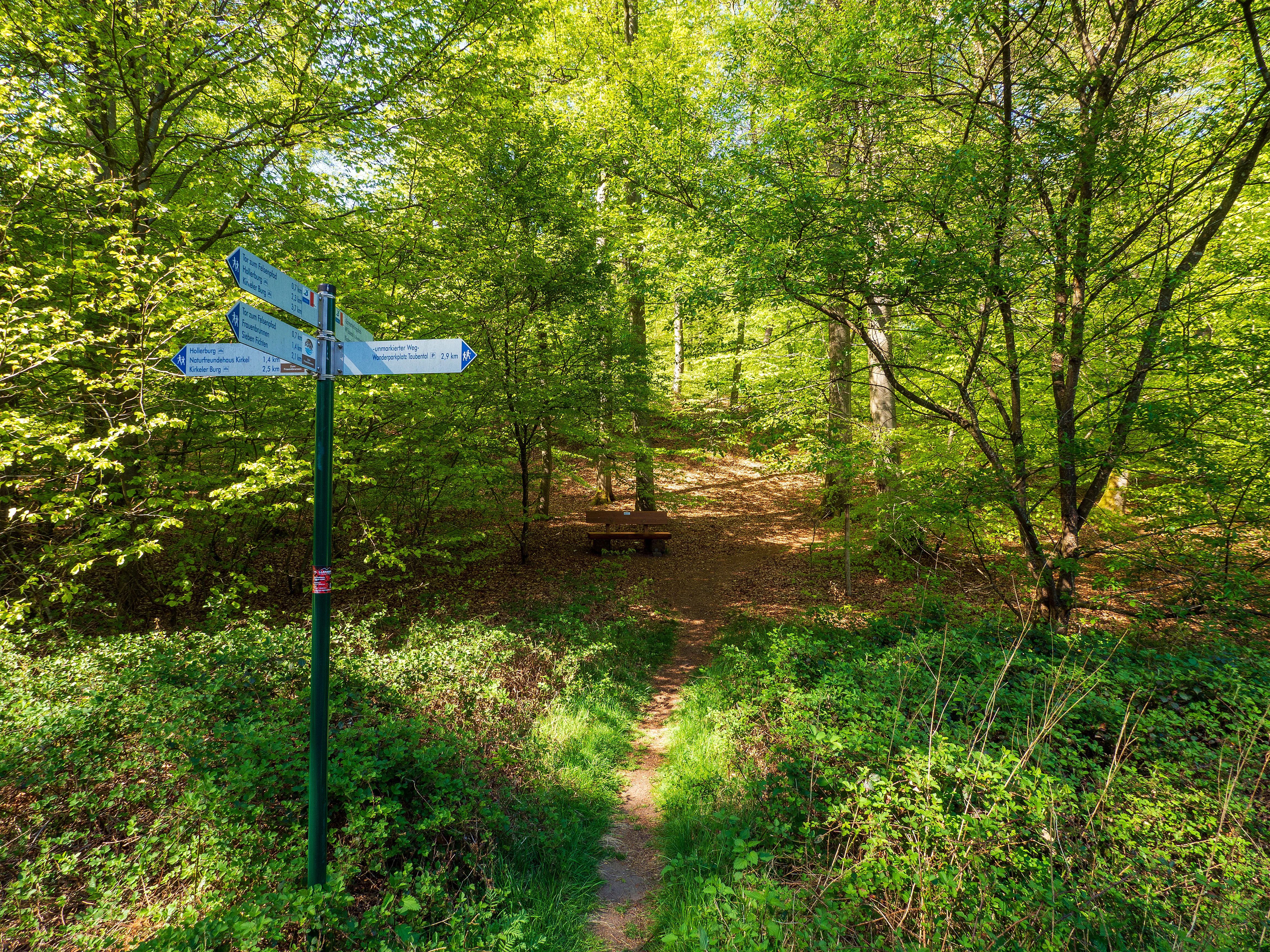
A green metal signpost with blue directional signs stands on the edge of a dirt trail in a bright green deciduous forest.
A trail signpost marks a junction within the lush, deciduous forest of the Taubental Nature Reserve.

Taubental Nature Reserve history and protected-area timeline

Taubental's modern history as a protected area begins in 2007. The reserve was formally designated by ordinance on 20 April 2007 under the identifier NSG-117, as part of a broader regulatory effort to structure the Bliesgau Biosphere Reserve. The defining legal document, the ordinance establishing the Bliesgau Biosphere Reserve dated 30 March 2007, listed Taubental explicitly as one of its core zones.

This designation placed Taubental within the German system of nature reserves (Naturschutzgebiete), which provide the strongest domestic protection for individual habitat areas. The timing reflects the early development of the biosphere reserve concept in the region, when authorities sought to identify and legally secure those parts of the landscape most valuable for biodiversity, forestry, and ecological processes.

Beyond the formal designation, the forested landscape itself has a longer history of use. The sandstone hills here have supported forestry and small-scale woodland management for centuries, and the structure of the current forest, with its mix of broadleaf canopy and coniferous patches on the ridges, reflects both natural regeneration and generations of human influence on the woodlands of the Saarpfalz.

Taubental Nature Reserve landscape and geographic character

The reserve occupies a section of the gently undulating Saarpfalz uplands east and northeast of the central village of Kirkel. The terrain is defined by the reddish Buntsandstone that underlies much of the region, weathering into nutrient-poor, often acidic soils that are well suited to mixed broadleaf woodland. The result is a landscape of forested ridges and shallow valleys rather than dramatic peaks, where elevation changes map onto subtle shifts in soil type, drainage, and tree species.

On the higher ground, coniferous stands, especially spruce, become more common, taking advantage of the slightly drier, less fertile soils of the ridge tops. In the lower slopes and valley bottoms, deciduous species dominate, producing the layered canopy structure characteristic of unmanaged or near-natural Central European broadleaf forest. Small streams and seasonal watercourses drain the slopes, eventually flowing toward the Blies river, which marks the eastern edge of the broader landscape.

The reserve is bordered by major transport corridors: the A6 motorway runs to the northwest and the A8 to the north, with the L119 state road passing along its northwestern margin. Despite being embedded in this infrastructure-rich setting, the woodland block itself reads as continuous and relatively intact from within, illustrating how a sizeable forest can persist near densely settled territory when protected and connected to other wooded areas, such as the adjacent Kirkeler Bachtal nature reserve to the southwest.

Taubental Nature Reserve ecosystems, habitats, and plant life

Ecologically, Taubental is dominated by mixed broadleaf forest on sandstone, a habitat type that has become increasingly rare in Germany's intensive agricultural and urban landscapes. Oak and beech are likely to be among the principal broadleaf species, forming the productive summer canopy, while birch and other light-demanding trees often colonize gaps and edges. Coniferous trees, particularly spruce, supplement the canopy on the higher, poorer soils of the ridges, a pattern reflecting both the region's soil chemistry and a long history of forestry practice.

The sandstone substrate and the associated acidic soils define much of the understory vegetation. The forest floor tends to support mosses, ferns, and a relatively specialized ground flora adapted to low-nutrient conditions, rather than the lush herb layer of richer soils elsewhere in Germany. Fallen deadwood, standing snags, and old-growth features are increasingly valued within such reserves because they provide habitat for saproxylic fungi, beetles, and cavity-nesting birds.

As a biosphere reserve core zone, Taubental is intended to maintain and develop these forest processes with minimal intervention, distinguishing it from production forestry or simply regulated hunting land. Its protected status also contributes to landscape-scale connectivity, linking with the smaller Kirkeler Bachtal reserve and other forested areas in the Saarpfalz-Kreis to form a broader network of woodland habitat across the Bliesgau.

Taubental Nature Reserve wildlife and species highlights

While the reserve is primarily valued for its forest structure rather than its charismatic megafauna, that forest supports a community of species typical of Central European mixed woodland. Woodland birds are likely to be among the most visible wildlife elements, including typical canopy and understory species of oak and beech forest. Deadwood-dependent invertebrates, including saproxylic beetles and a wide range of fungi, benefit from the reserve's core zone status, which encourages the retention of old trees and fallen wood.

Larger mammals present in this part of the Saarland, such as red deer, roe deer, and wild boar, can move through and use such forested blocks as core resting and foraging habitat. The reserve's role in the regional network also benefits less conspicuous fauna, including bats that roost in older trees and stream-side species that use the small valleys draining toward the Blies.

Taubental Nature Reserve conservation status and protection priorities

Taubental's conservation significance rests on its dual identity: it is both a formally designated nature reserve under German law and a core zone of the Bliesgau Biosphere Reserve. This combination places it within the most strongly protected category of land in the regional hierarchy, with regulations limiting activities that could disturb soils, water, vegetation, or wildlife within the boundary.

The 2007 ordinance reflects a deliberate effort to secure a substantial block of mixed broadleaf forest in a region where such habitat has become fragmented by agriculture, roads, and settlement. By placing the area under IUCN Category IV, the designation emphasizes targeted habitat and species management rather than complete wilderness withdrawal, allowing conservation objectives to be pursued alongside the broader land uses of the surrounding biosphere reserve.

The reserve also contributes to ecological connectivity across the Saarpfalz-Kreis. It complements neighboring protected sites such as the Kirkeler Bachtal, which extends along the L113 to the southwest, and supports the biosphere reserve's wider goal of maintaining functional habitat networks for forest-inhabiting species in southwestern Germany.

Taubental Nature Reserve cultural meaning and human context

The Taubental area lies within the Bliesgau, a region whose name and identity are closely tied to traditional agriculture, small villages, and the patchwork of fields, orchards, and woodland that still characterizes parts of Saarland and the neighboring Palatinate. Although the reserve itself is a strictly protected natural area, its surrounding cultural landscape, with hamlets around Kirkel, Blieskastel, and Homburg, reflects centuries of mixed land use.

Forestry traditions in the Saarland have been shaped by the demands of nearby mining and metalworking industries, which historically consumed large quantities of wood for fuel and construction. The mix of broadleaf and coniferous stands seen today in the Taubental area partly echoes this legacy, with conifers on the ridges reflecting reforestation practices from earlier centuries. The biosphere reserve framework explicitly seeks to reconcile these long-standing land uses with modern conservation goals, making Taubental both an ecological and a cultural landscape feature.

Top sights and standout views in Taubental Nature Reserve

A core zone of mixed broadleaf and coniferous forest within the Bliesgau Biosphere Reserve, anchored on the Buntsandstone ridges east of Kirkel.

Designated as NSG-117 in 2007 and classified under IUCN Category IV, providing a high tier of legal protection within the Saarpfalz-Kreis network of nature reserves.

The reserve illustrates how forest habitat of regional importance can be maintained close to major transport corridors, including the A6 and A8 motorways, while still functioning as a coherent woodland block.

Best time to visit Taubental Nature Reserve

As a protected forest reserve without significant tourism infrastructure, Taubental is best appreciated for its woodland character in late spring and early summer, when the broadleaf canopy is fully leafed and the understory is most accessible. Early morning visits in these seasons are likely to offer the richest bird activity and a greater chance of observing woodland wildlife.

Autumn is also rewarding for visitors interested in forest ecology, when the deciduous component of the canopy shows fall color against the persistent conifers on the ridges, and fruiting fungi become more evident on the woodland floor. Winter visits can reveal the structure of the forest more clearly, with bare broadleaf trees allowing views through the woodland and emphasizing the reserve's topographic setting on the sandstone ridges.


Monthly climate preview

Long-term monthly temperature and precipitation patterns across the representative terrain

Taubental Nature Reserve Climate Normals and Annual Temperature Rhythm

Historical climate data for Taubental Nature Reserve records measured temperature variations and precipitation rates across a representative elevation point from 1991 to 2020. Examining the complete monthly profile provides detailed context for long-term meteorological trends across the protected landscape.
Annual mean9 °C
0 °C19 °C
Jan
Feb
Mar
Apr
May13°
Jun17°
Jul19°
Aug19°
Sep14°
Oct
Nov
Dec
Warmest month
July

19.2 °C

Coolest month
January

-0.2 °C

Wettest month
December

2.4 mm/day

Driest month
April

1.5 mm/day

Park location guide

Geography guide, regional context, and park location map for Taubental Nature Reserve

Taubental Nature Reserve park geography, regions, and map view in Germany

Understand where Taubental Nature Reserve sits in Germany through a broader geographic reading of the surrounding landscape, nearby location context, and its mapped position within the national park landscape.

How Taubental Nature Reserve fits into Germany

Germany is a federal republic in Western and Central Europe with a population of over 83 million across sixteen constituent states. It is Europe's largest economy by nominal GDP and a major global exporter and importer. The capital is Berlin, and the country borders Denmark, Poland, Czech Republic, Austria, Switzerland, France, Luxembourg, Belgium, and the Netherlands.

Wider geography shaping Taubental Nature Reserve in Germany

Germany is located in Western and Central Europe, spanning 357,022 km². It borders Denmark to the north, Poland and the Czech Republic to the east, Austria and Switzerland to the south, and France, Luxembourg, Belgium, and the Netherlands to the west. The country has coastlines on the Baltic Sea and North Sea to the north, with the Alps located in the southern region.

Map view of Taubental Nature Reserve

Use this park location map to pinpoint Taubental Nature Reserve in Germany, understand its exact geographic position, and read its mapped placement within the surrounding landscape more clearly.

Pigeon | © OpenStreetMap contributors

Visualizing the mixed broadleaf woodland, sandstone terrain, and protected habitats of the Saarland uplands.

Taubental Nature Reserve Photos and Forest Landscape Scenery

Visual records capture the mixed broadleaf canopy, red sandstone ridges, and protected forest environment defining Taubental Nature Reserve. Photographic documentation reveals the underlying terrain and habitat continuity supporting this conservation core zone.

A green metal signpost with blue directional signs stands on the edge of a dirt trail in a bright green deciduous forest.

Park atlas

Compare surrounding forest reserves and regional conservation landscapes

Discover Other Parks Near Taubental Nature Reserve and Protected Areas in the Region

Browsing other parks near Taubental Nature Reserve reveals connected woodland valleys and protected habitats across the Saarpfalz district. Comparing adjacent reserves provides broader context for regional forest conservation and local landscape patterns.
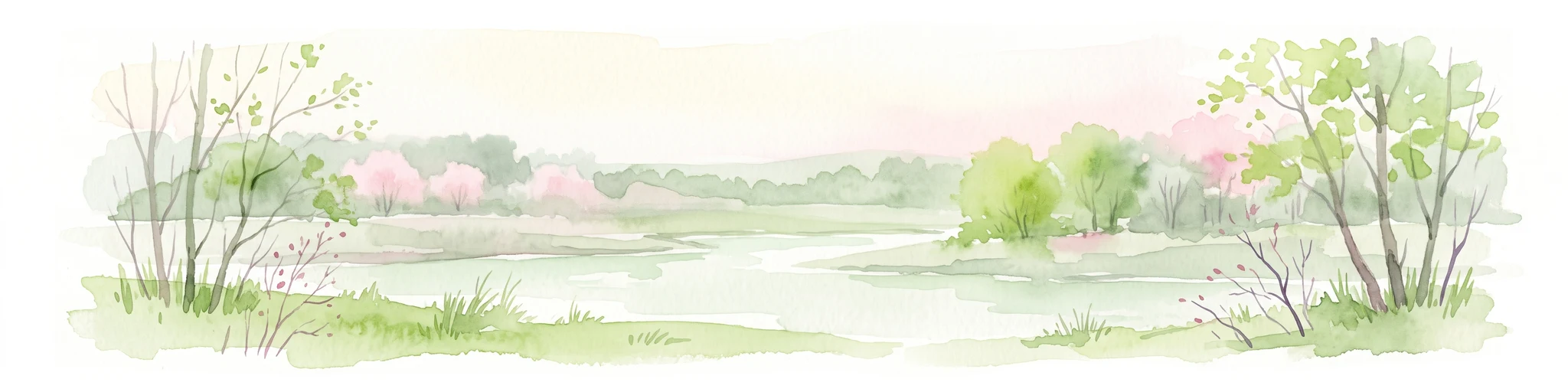
A soft, artistic watercolor painting showing a wide, tranquil wetland scene with soft green and yellow hues, distant rolling hills, and patches of trees and vegetation in a floodplain environment.
Protected landscapeSaarland
About 3.5 km away#1 closest

Northeast

Beeder Bruch Protected Landscape: Blies River Floodplain and Wetland Geography in Saarland

A managed riverine sanctuary in the Bliesgau Biosphere Reserve

Beeder Bruch is a formally recognized protected landscape in Saarland, defined by the extensive floodplain of the Blies river. The site integrates wet meadows, riparian forests, and reedbeds, serving as a key European bird protection zone. Visitors can explore the mapped terrain, which utilizes conservation grazing to maintain essential wetland habitats and support local biodiversity within the Bliesgau region.

Area
127 km²
Established
2015
IUCN
V
A soft watercolor illustration depicting a river flowing through a lush green floodplain with trees, grasses, and a hazy background.
Nature reserveSaarland
About 6.6 km away#2 closest

South

Bliesaue zwischen Blieskastel und Bliesdalheim Nature Reserve and Regional Landscape Geography

Protected floodplain ecosystems in Saarland, Germany

The Bliesaue zwischen Blieskastel und Bliesdalheim protects a near-natural river course and its surrounding floodplain in the Saarland region. The reserve is characterized by complex soil conditions from Buntsandstein and Muschelkalk substrates, supporting a rich network of wetlands, marshes, and meadows that function as a cohesive ecological unit for migratory birds and protected species.

Area
1.981 km²
Established
2015
Relief
Lowland
Climate
Temperate
Nature reserveSaarland
About 8.7 km away#3 closest

South

Badstube Mimbach Nature Reserve: Protected Limestone Grasslands and Woodland in Saarland

A regional atlas exploration of Saarland biodiversity hotspots

Badstube Mimbach stands as a significant nature reserve located within the Bliesgau region of Saarland. This protected landscape is defined by its south-facing limestone slopes and terraced fields, providing essential habitat for rare flora and specialized fauna in a compact ten-hectare mosaic of open meadow and beech forest.

Area
0.095 km²
Established
2016
IUCN
IV
Nature reserveRhineland-Palatinate
About 12 km away#4 closest

Northeast

Westricher Moorniederung Nature Reserve: Protected Wetland and Moorland Atlas

Mapping low-lying basin landscapes and riparian corridors in the German Palatinate.

Spanning 40 kilometers between the Bliesaue and Kaiserslautern, the Westricher Moorniederung protects an intricate network of bogs, marsh zones, and alluvial forests. This lowland basin acts as a vital ecological link within Rhineland-Palatinate, defined by its drainage systems and diverse mire habitats. Gain insight into the regional geography and protected land boundaries that define this significant wetland system.

Area
21.52 km²
Established
1998
IUCN
IV
Nature reserveRheinland-Pfalz
About 14 km away#5 closest

Southeast

Monbijou Nature Reserve: Mapped Protected Landscapes in the Südwestpfalz District

Regional geography and conservation of dry grassland habitats

Monbijou stands as a significant twenty-six hectare nature reserve in Rheinland-Pfalz, defined by its mosaic of sun-exposed dry grasslands and forest-edge communities. This protected area plays a crucial role in maintaining rare plant species and uncommon animal habitats within the rolling terrain of the southwestern Palatinate, near the Hornbach stream and the local airfield.

Area
0.26 km²
Established
1978
Scope
Terrestrial
Water
Minor water
A soft watercolor illustration depicting rolling green hills and meadows with subtle hints of pink flora, set against a pale background.
Nature reserveRhineland-Palatinate
About 15 km away#6 closest

East

Battweiler Höhe Nature Reserve: Mapped Protected Landscapes and Ridge Geography in Germany

A vital calcareous grassland habitat in the Zweibrücken hill country

Battweiler Höhe preserves a rare strip of semi-dry, lime-rich grassland on a gentle hill ridge in the Südwestpfalz district. This nature reserve in Rhineland-Palatinate exemplifies specialized habitat conservation, protecting a mosaic of meadows and forest edges that support uncommon plant species like pasqueflowers and orchids. The site is a significant link in the broader regional biotope network, maintaining its ecological health through traditional land management.

Area
0.244 km²
Established
2003
Nature reserveRheinland-Pfalz
About 15 km away#7 closest

Northeast

Neuwoogmoor Nature Reserve: Protected Peatland and Wetland Landscape Mapping in Rheinland-Pfalz

Essential geographic data on this historic Palatinate mire system.

Neuwoogmoor serves as a crucial nature reserve in Rheinland-Pfalz, protecting one of the few remaining peat moorland fragments in the Landstuhler Bruch. The site encompasses a diverse mosaic of bog pools, reed beds, and bog woodland that create an intimate and highly structured wetland terrain. This detailed entry provides geographic context on its protected status, hydrological features, and role as a habitat for rare plant communities in the western Palatinate landscape.

Area
0.6 km²
Established
1986
IUCN
IV
Relief
Lowland
Nature reserveRheinland-Pfalz
About 15 km away#8 closest

Southeast

Wahlbacher Heide Nature Reserve: Geographic Mapping and Protected Landscape Analysis

Explore the Muschelkalk dry grasslands of the Westpfalz region

Wahlbacher Heide offers a focused look at the calcareous dry grassland habitats within the Westpfalz region of Germany. This nature reserve provides essential insights into the preservation of rare orchids and gentians on Lower Muschelkalk bedrock. Use this mapped resource to understand the interplay between the crescent-shaped open meadows, juniper stands, and the surrounding agricultural corridor that frames this important protected site.

Area
0.074 km²
Established
1985

Common questions about visiting, size, designation, and location context for Taubental Nature Reserve

Taubental Nature Reserve FAQs for park facts, access, geography, and protected area context

Find quick answers about Taubental Nature Reserve, including protected-area facts, park geography, trail and visitor context, and how the park fits into its surrounding country and regional landscape.
MoriAtlas Explorer

Continue Your Protected Areas Search Across the Global Atlas

Deepen your exploration by continuing the structured search for national parks and protected areas worldwide. Utilize the comprehensive filtering capabilities to compare different conservation landscapes and refine your understanding of global park geography. Discover more about the distribution and characteristics of protected natural areas.

Global natural geography