
Mori Atlas logo
Protected landscapeTitisee-Neustadt

Tracing the protected boundaries and natural valley basin terrain within Baden-Württemberg

Titisee-Neustadt Protected Landscape: Mapped Geography and Regional Black Forest Character

(Landschaftsschutzgebiet Titisee-Neustadt)

The Titisee-Neustadt protected landscape encompasses a distinct geographic region within the southern Black Forest of Baden-Württemberg. This area consists of a dense network of forested mountain ridges interspersed with shallow valley basins and significant water features, including the Wutach river and Titisee lake. Serving as a crucial ecological node, the territory overlaps with broader conservation zones to maintain the traditional scenic integrity and habitat stability of this elevated German landscape.

protected landscapeBlack Foresthigh Black Forestsoutheastern Black Forestforested ridgesvalley basins
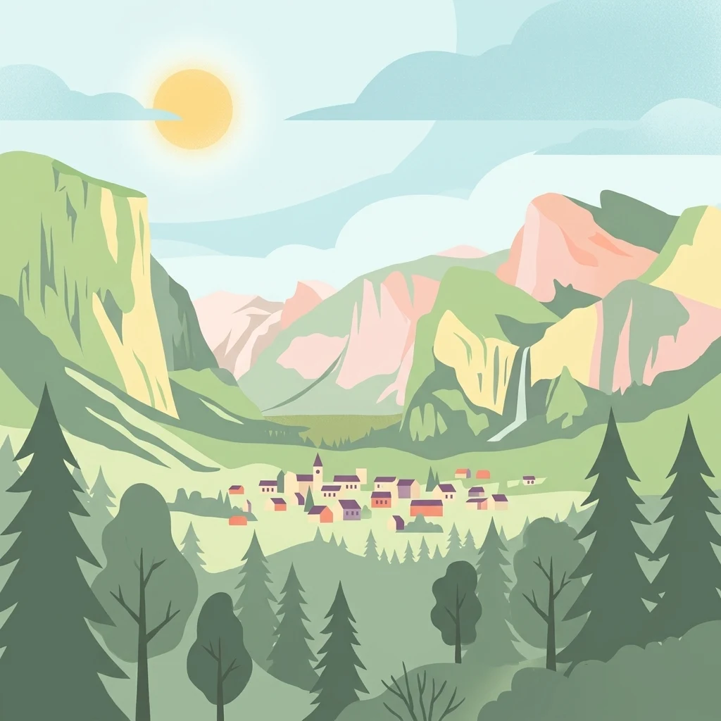
Digital vector illustration of a valley town with a church and houses, surrounded by green mountains and evergreen forests, under a bright sun.

Titisee-Neustadt

Protected landscape

Park overview

Structured park overview, official facts, and landscape profile for Titisee-Neustadt Protected Landscape

Titisee-Neustadt Protected Landscape park facts, protected area profile, and essential visitor context

Review the core facts for Titisee-Neustadt Protected Landscape, including designation, size, terrain, visitor scale, habitats, and operating context in one park-focused overview.

About Titisee-Neustadt Protected Landscape

Titisee-Neustadt Protected Landscape is a medium-scale conservation area in the southern Black Forest of southwestern Germany. With a size of roughly 83 square kilometers, it forms a near-complete ring around the town of Titisee-Neustadt and also encompasses the surrounding community of Waldau. The site belongs to the natural geographic units known as the High Black Forest and the Southeastern Black Forest, two of the most scenically distinctive and ecologically sensitive parts of the wider Black Forest range.

The landscape is characterized by the typical elements of a traditional Black Forest setting: dark, conifer-dominated forest stands across rounded ridges, interspersed with open valley floors, scattered farmsteads, and modest settlements. According to its official profile, the area is regarded as a representative example of a sparsely populated Black Forest landscape with particular character, diversity, and beauty. The terrain alternates between elevated ridges and gently formed, often shallowly incised valley basins, creating a mosaic of forested slopes and more open lowlands.

Hydrological features give the protected area additional ecological and scenic value. The River Wutach, a well-known Black Forest watercourse, flows through the area, while the southern part of the protected landscape contains the lake Titisee and the smaller Eisweiher pond. These water bodies, together with forested slopes and valley meadows, support the habitat complexity that the designation aims to safeguard. The protected landscape also intersects with the High Black Forest around Hinterzarten FFH area and the Central Black Forest Bird Protection Area, extending its ecological relevance into the broader European Natura 2000 framework.

Administered by the Breisgau-Hochschwarzwald district, the protected landscape was formally designated on 20 March 2003 under a regulation issued by the lower nature conservation authority. Its protected status is intended to keep this representative piece of the Black Forest intact as both a working rural landscape and a refuge for the species that depend on its varied habitats.

Quick facts and research context for Titisee-Neustadt Protected Landscape

Titisee-Neustadt Protected Landscape covers about 83.17 square kilometers and surrounds the town of Titisee-Neustadt and the community of Waldau in the Breisgau-Hochschwarzwald district of Baden-Württemberg, Germany. It was designated on 20 March 2003 through a regulation issued by the lower nature conservation authority at the district office and is classified under the IUCN Category V framework for protected landscapes and seascapes.

The area lies within the natural regions of the High Black Forest and the Southeastern Black Forest and includes the Wutach river as well as the Titisee lake and Eisweiher pond in its southern reaches. Part of its territory overlaps with the High Black Forest around Hinterzarten FFH site and the Central Black Forest Bird Protection Area, linking it into larger European ecological networks.

Protection and recognition

Review documented terrestrial protection scope and official designation records for Titisee-Neustadt.

Titisee-Neustadt Protection Status and International Recognition Details

Terrestrial protection status and designation records for Titisee-Neustadt provide verifiable data regarding management scope and official recognition sources. Conservation researchers utilize these structured facts to analyze protected area frameworks and geographic classifications.

Protection details

Protection scope
Terrestrial
WDPA ID
325181
Park context

Deeper park guide and search-rich context for Titisee-Neustadt Protected Landscape

Titisee-Neustadt Protected Landscape history, landscape, wildlife, and travel context

Explore Titisee-Neustadt Protected Landscape through its history, landscape character, ecosystems, wildlife, conservation priorities, cultural context, and seasonal travel timing in a structured park guide built for atlas discovery and search intent.

Why Titisee-Neustadt Protected Landscape stands out

Titisee-Neustadt Protected Landscape is best known for preserving a representative, sparsely settled Black Forest landscape where forested mountain ridges alternate with shallow, trough-like valleys. The area captures the classic scenic identity of the High Black Forest, including the lakes and river corridors that define the Titisee-Neustadt region. It is also notable for its integration into the wider conservation fabric of southern Baden-Württemberg, sharing territory with Natura 2000 habitats and bird protection areas. This layered protection underscores its importance for both landscape character and biodiversity in the Black Forest.
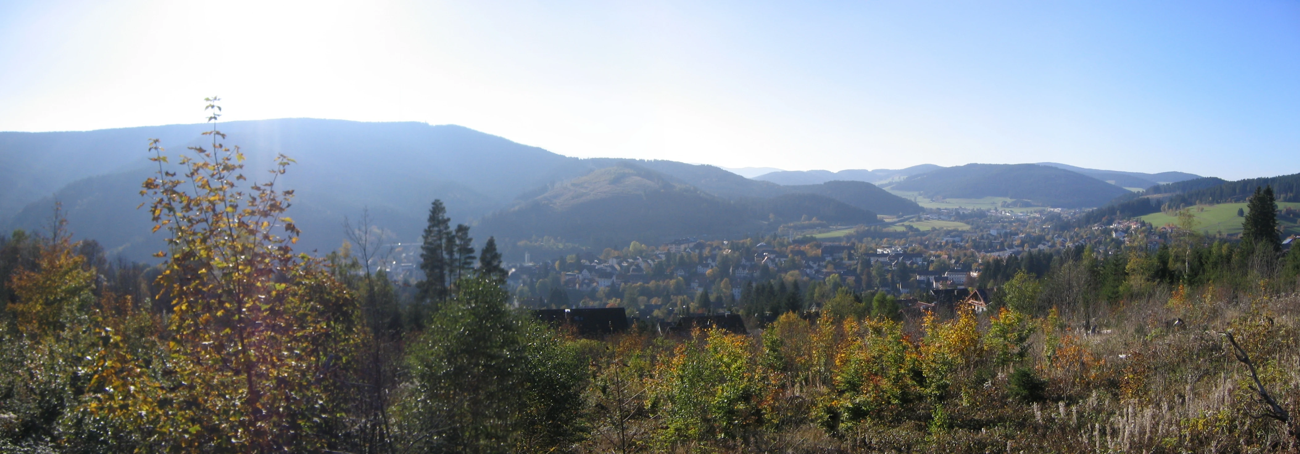
Panoramic landscape view of the town of Neustadt situated in a valley surrounded by forested hills under a clear sky.
A panoramic view looking over the town of Neustadt within the Black Forest.

Titisee-Neustadt Protected Landscape history and protected-area timeline

The protected landscape status of Titisee-Neustadt was established relatively recently within the history of Black Forest conservation. On 20 March 2003, the lower nature conservation authority at the Breisgau-Hochschwarzwald district office issued a regulation formally designating the surrounding countryside as a protected landscape, or Landschaftsschutzgebiet, under the number 3.15.033.

The designation followed the broader pattern of late twentieth- and early twenty-first-century protection efforts across Baden-Württemberg, when many traditional Black Forest landscapes were placed under formal protection to safeguard their character against expanding land use. By incorporating a large buffer around the town of Titisee-Neustadt and the community of Waldau, the 2003 regulation ensured that the hills, forests, valleys, and water features visible from the town would remain part of a coherent protected mosaic rather than being managed on a fragmented basis.

Over time, the protected landscape has been recognized as a supporting element within larger European ecological networks, particularly through its partial overlap with the High Black Forest around Hinterzarten FFH site and the Central Black Forest Bird Protection Area.

Titisee-Neustadt Protected Landscape landscape and geographic character

The Titisee-Neustadt Protected Landscape is a textbook example of high-elevation Black Forest scenery. Its topography is built around a series of forested mountain ridges that frame broad, gently formed valley basins. These valleys are typically shallow rather than deeply incised, producing a rounded, soft profile rather than the dramatic canyon-like relief found in parts of the nearby Wutach gorge region.

Forests dominate the slopes, reflecting the classic mix of spruce and fir that gives the Black Forest its name and character. Open land tends to cluster in the valley floors and along the corridors of streams and lakes, creating a patchwork of woodland and small clearings that define the traditional appearance of the area.

Water plays a defining role in shaping the protected area's identity. The Wutach river flows through the protected zone, while the southern portion includes the well-known Titisee lake and the Eisweiher pond. These standing and running waters punctuate the forested ridges with bright, reflective openings and serve as focal points for scenic views around the town of Titisee-Neustadt.

Titisee-Neustadt Protected Landscape ecosystems, habitats, and plant life

Ecologically, Titisee-Neustadt Protected Landscape reflects the broader environmental character of the High Black Forest and the Southeastern Black Forest natural regions. The dominant habitats are conifer-dominated forests on the ridges, valley meadows along the streams and basin floors, and shoreline and aquatic habitats associated with Titisee and the Eisweiher pond.

The combination of forested slopes, open valley bottoms, and waterways supports a varied mosaic of habitats within a relatively compact area. This mix of forest cover, open land, and water is the structural backbone of the ecosystem and the reason the area is recognized as particularly valuable for both plant and animal species.

Because the protected landscape extends into both the High Black Forest around Hinterzarten FFH site and the Central Black Forest Bird Protection Area, it is also part of larger networks designed to maintain habitat continuity across the southern Black Forest. The result is an ecological profile that is at once regionally characteristic and networked into wider European conservation efforts.

Titisee-Neustadt Protected Landscape wildlife and species highlights

Wildlife in the Titisee-Neustadt Protected Landscape reflects the broader character of the southern Black Forest, where extensive conifer forests, valley meadows, and water features support a broad community of forest, meadow, and aquatic species. The official protection purpose explicitly recognizes the area's importance for a wide variety of animal and plant life, emphasizing the role of habitat diversity in sustaining this richness.

The forested ridges provide habitat for typical woodland species, while the river Wutach, the lake Titisee, and the Eisweiher pond create conditions favorable for water-associated fauna, including fish, amphibians, and aquatic invertebrates. Open valley areas contribute habitat for meadow-dependent species and increase the overall structural diversity that supports complex food webs.

Because parts of the protected area overlap with the Central Black Forest Bird Protection Area, the landscape also has recognized significance for birdlife, contributing to the conservation of species that depend on the mix of forest, open land, and water found across the southern Black Forest.

Titisee-Neustadt Protected Landscape conservation status and protection priorities

Titisee-Neustadt Protected Landscape was designated to preserve the distinctive character, diversity, and beauty of a representative Black Forest cultural landscape. Its core conservation purpose includes safeguarding the visual and structural identity of a sparsely settled Black Forest setting, maintaining the alternation between forested mountain ridges and shallowly formed valley basins, and protecting the variety of habitats on which many species depend.

The protected landscape is integrated into a layered conservation architecture. At the European level, parts of its territory fall within the High Black Forest around Hinterzarten FFH site, an area designated for habitats and species of European importance, and within the Central Black Forest Bird Protection Area, which addresses the conservation needs of bird species across the southern Black Forest.

At the regional and local level, the area is administered by the Breisgau-Hochschwarzwald district and is part of the broader network of protected landscapes in Baden-Württemberg. This layered status helps ensure that the scenic and ecological values of the Titisee-Neustadt area are considered in land-use, forestry, and water management decisions well beyond the boundaries of the town itself.

Titisee-Neustadt Protected Landscape cultural meaning and human context

The protected landscape is closely tied to the cultural identity of the Black Forest, where small, scattered farmsteads and modest villages have shaped the land for centuries. Titisee-Neustadt and the community of Waldau are traditional Black Forest settlements, and the surrounding countryside reflects the long-standing balance between forestry, small-scale agriculture, and tourism that characterizes the region.

The inclusion of water features such as Titisee and the Wutach river into the protected area also reflects the cultural importance of these landscapes, which have long been valued both for their scenic appeal and for their role in supporting local livelihoods and recreation. As a protected landscape rather than a strict nature reserve, the designation acknowledges the continued presence of human land use while aiming to keep its overall character intact.

Top sights and standout views in Titisee-Neustadt Protected Landscape

Titisee-Neustadt Protected Landscape stands out for the way it frames the entire town of Titisee-Neustadt with a continuous protected buffer of Black Forest countryside, including the community of Waldau. Its combination of forested ridges, shallow valleys, and water features makes it a particularly complete example of a traditional high-Black Forest setting.

The area's overlap with two Natura 2000 sites, including a bird protection area covering much of the central Black Forest, adds cross-border ecological significance. As a result, the protected landscape functions both as a local scenic anchor around Titisee-Neustadt and as a meaningful node in wider European conservation networks.

Best time to visit Titisee-Neustadt Protected Landscape

The Titisee-Neustadt Protected Landscape reflects the seasonal rhythms of the high Black Forest. Summer months generally offer the most accessible conditions for walking and appreciating the open valley meadows and lakeside scenery around Titisee and the Eisweiher pond, when the mix of forest, cleared valley bottoms, and water features is at its most visually balanced.

Winter transforms the area into a snow-covered forest landscape typical of the region, with frozen or partially frozen water features and quiet, snow-laden slopes around the ridges. Year-round, the area's character is defined primarily by the interplay of forest and the dark upland scenery that gives the Black Forest its name, rather than by dramatic seasonal extremes.

Monthly climate preview

Track representative temperature ranges and precipitation rates across twelve measured months.

Titisee-Neustadt Climate Normals and Long-Term Monthly Weather Patterns

Representative coordinate sampling from nineteen ninety-one to twenty twenty reveals multi-year average temperature and precipitation rhythms across Titisee-Neustadt. Examining the complete monthly climate normals profile provides deeper analytical depth regarding long-term thermal variations and precipitation distribution.
Annual mean8 °C
-2 °C17 °C
Jan-2°
Feb-1°
Mar
Apr
May12°
Jun15°
Jul17°
Aug17°
Sep12°
Oct
Nov
Dec-1°
Warmest month
July

16.8 °C

Coolest month
January

-1.5 °C

Wettest month
May

4 mm/day

Driest month
April

2.6 mm/day

Park location guide

Geography guide, regional context, and park location map for Titisee-Neustadt Protected Landscape

Titisee-Neustadt Protected Landscape park geography, regions, and map view in Germany

Understand where Titisee-Neustadt Protected Landscape sits in Germany through a broader geographic reading of the surrounding landscape, nearby location context, and its mapped position within the national park landscape.

How Titisee-Neustadt Protected Landscape fits into Germany

Germany is a federal republic in Western and Central Europe with a population of over 83 million across sixteen constituent states. It is Europe's largest economy by nominal GDP and a major global exporter and importer. The capital is Berlin, and the country borders Denmark, Poland, Czech Republic, Austria, Switzerland, France, Luxembourg, Belgium, and the Netherlands.

Wider geography shaping Titisee-Neustadt Protected Landscape in Germany

Germany is located in Western and Central Europe, spanning 357,022 km². It borders Denmark to the north, Poland and the Czech Republic to the east, Austria and Switzerland to the south, and France, Luxembourg, Belgium, and the Netherlands to the west. The country has coastlines on the Baltic Sea and North Sea to the north, with the Alps located in the southern region.

Map view of Titisee-Neustadt Protected Landscape

Use this park location map to pinpoint Titisee-Neustadt Protected Landscape in Germany, understand its exact geographic position, and read its mapped placement within the surrounding landscape more clearly.

Pigeon | © OpenStreetMap contributors

Location context for Titisee-Neustadt Protected Landscape

Baden-Württemberg

Explore photographic records of forested mountain ridges, valley basins, and aquatic features.

Titisee-Neustadt Photos and Scenery: Visualizing Protected Black Forest Landscapes

Examine detailed visual documentation of Titisee-Neustadt to understand the topography, forested slopes, and water corridors defining this protected landscape. Photographic records reveal the regional character of high-elevation habitats and traditional Black Forest terrain.

Panoramic landscape view of the town of Neustadt situated in a valley surrounded by forested hills under a clear sky.

Park atlas

Compare adjacent Black Forest reserves and regional conservation areas

Explore Other Parks Near Titisee-Neustadt and Surrounding Protected Landscapes

Browse nearby national parks and protected areas sharing the forested ridges and valley basins of the southern Black Forest. Comparing adjacent conservation landscapes helps trace regional geographic patterns beyond Titisee-Neustadt.
Protected landscapeBaden-Württemberg
About 12 km away#1 closest

West

Wagensteigtal-Höllental Protected Landscape: Geography and Terrain of the Black Forest

A bridge between regional natural zones in Baden-Württemberg

Wagensteigtal-Höllental serves as a quintessential example of protected Black Forest geography. Stretching across the Breisgau-Hochschwarzwald district, this area features the steep Rotbach gorge, dense forest ridges, and the prominent Hirschsprung rock formation. It provides a foundational look at how historical transport corridors and natural river breakthrough channels shape the modern landscape identity of southwestern Germany.

Area
29.118 km²
Established
1975
IUCN
V
Relief
Mountain
A watercolor painting showing a panoramic view of rolling golden hills, a line of green trees, and soft purple mountain silhouettes in the distance.
Protected landscapeBaden-Württemberg
About 13 km away#2 closest

Northwest

St. Peter, St. Märgen Protected Landscape: Geography and Regional Context in the Black Forest

Detailed atlas view of the High Black Forest plateau and valleys.

This protected landscape in Baden-Württemberg represents a classic cultural geography of the High Black Forest. It encompasses a vast area surrounding the villages of St. Peter and St. Märgen, where the terrain shifts between steep-sided valleys and elevated plateaus. The protected status secures a varied mosaic of meadows, old-growth hedgerows, and forest tracts that maintain the regional ecological integrity of this significant southwestern German landscape.

Area
67.199 km²
Established
2003
IUCN
V
Nature reserveBaden-Württemberg
About 17 km away#3 closest

Southeast

Blumberger Pforte und Mittlere Wutach: Protected Landscape and Gorge Geography

Nature reserve terrain and ecological atlas in Baden-Württemberg

This protected area captures the dramatic transition where the Wutach river cuts through limestone strata. Discover a rugged landscape mosaic featuring canyon forests, juniper heaths, and karst cave systems across the Swabian Alb and Black Forest fringe. The site offers significant value for understanding regional ecological gradients and limestone-dependent plant communities within the broader southern German geography.

Area
63.25 km²
Established
2019
Watercolor painting of a pastoral landscape featuring soft, rolling green hills and a small group of evergreen trees, with light pastel mountains in the background.
Protected landscapeBaden-Württemberg
About 19 km away#4 closest

South

St. Blasien Protected Landscape: Geographic Profile and Glacial Mapping

Southern Black Forest protected area in Baden-Württemberg.

The St. Blasien Protected Landscape represents a significant conservation zone in the southern Black Forest. Defined by its strong glacial influence, the area showcases a complex terrain of trough valleys, moraine ridges, and rocky crests alongside centuries-old alpine pastures. Its role in the regional conservation network makes it a key site for understanding the intersection of Pleistocene geography and traditional land management in Germany.

Area
35.754 km²
Established
2002
IUCN
V
Protected landscapeSchwarzwald-Baar-Kreis
About 22 km away#5 closest

Northeast

Groppertal Protected Landscape in Schwarzwald-Baar-Kreis: Regional Geography and Atlas

Mapped riparian meadows and Black Forest woodland boundaries

Groppertal is a protected landscape situated within the Schwarzwald-Baar-Kreis, defined by the Brigach river valley. The area exhibits a unique contrast between maintained lowland wet meadows and expansive forest slopes. This geography provides an essential protected corridor connecting the riparian ecosystem of the river floodplain to the wider highland terrain of the South-eastern Black Forest, illustrating a complex rural-natural mosaic.

Area
5.397 km²
Established
1957
IUCN
V
Relief
Upland
A soft watercolor illustration of rolling hills, forested slopes, and meadow vegetation with a light, airy aesthetic.
Nature reserveBaden-Württemberg
About 24 km away#6 closest

Southwest

Belchen Nature Reserve: Exploring the Mountain Geography of the High Black Forest

A diverse protected landscape in Baden-Württemberg

Belchen represents an essential protected area in the southern Black Forest, known for its compressed ecological profile ranging from lowland beech forests to exposed subalpine summits. The site maps a complex mosaic of scree slopes, mires, and rocky habitats that sustain specialized bat species and rare montane flora, offering a detailed perspective on central European highland ecosystems.

Area
29.072 km²
Established
2019
Relief
Mountain
Climate
Temperate
Protected landscapeBaden-Württemberg
About 27 km away#7 closest

Northeast

Gaienbühl Protected Landscape: Regional Geography and Map of the Middle Black Forest

Protected mosaic of meadow and forest in Baden-Württemberg

Gaienbühl provides a concentrated example of the Middle Black Forest's rolling terrain, featuring a blend of forest patches and expansive central meadows. The area encompasses critical wetland biotopes and integrates into broader regional bird conservation zones. This record details the protected boundaries and landscape elements that define this specific site within the Schwarzwald-Baar-Kreis district.

Area
0.502 km²
Established
1954
IUCN
V
A wide panoramic watercolor illustration showing a green landscape with rolling hills, a line of trees, and foreground grass.
Protected landscapeBaden-Württemberg
About 28 km away#8 closest

West

Östliches Hexental: Protected Landscape and Regional Geographic Context in Baden-Württemberg

Black Forest valley mosaic and protected meadow systems

Located in the Breisgau-Hochschwarzwald district, Östliches Hexental forms a vital protected landscape of approximately 526 hectares. The region showcases a traditional Black Forest valley structure, defined by riparian gallery forests, orchard meadows, and small field hedges that provide essential habitat connectivity between the High Black Forest and the Markgräfler Hügelland.

Area
5.264 km²
Established
2008
IUCN
V

Common questions about visiting, size, designation, and location context for Titisee-Neustadt Protected Landscape

Titisee-Neustadt Protected Landscape FAQs for park facts, access, geography, and protected area context

Find quick answers about Titisee-Neustadt Protected Landscape, including protected-area facts, park geography, trail and visitor context, and how the park fits into its surrounding country and regional landscape.
MoriAtlas Explorer

Continue Your Protected Areas Search Across the Global Atlas

Deepen your exploration by continuing the structured search for national parks and protected areas worldwide. Utilize the comprehensive filtering capabilities to compare different conservation landscapes and refine your understanding of global park geography. Discover more about the distribution and characteristics of protected natural areas.

Global natural geography