
Why Trotternish National Scenic Area stands out
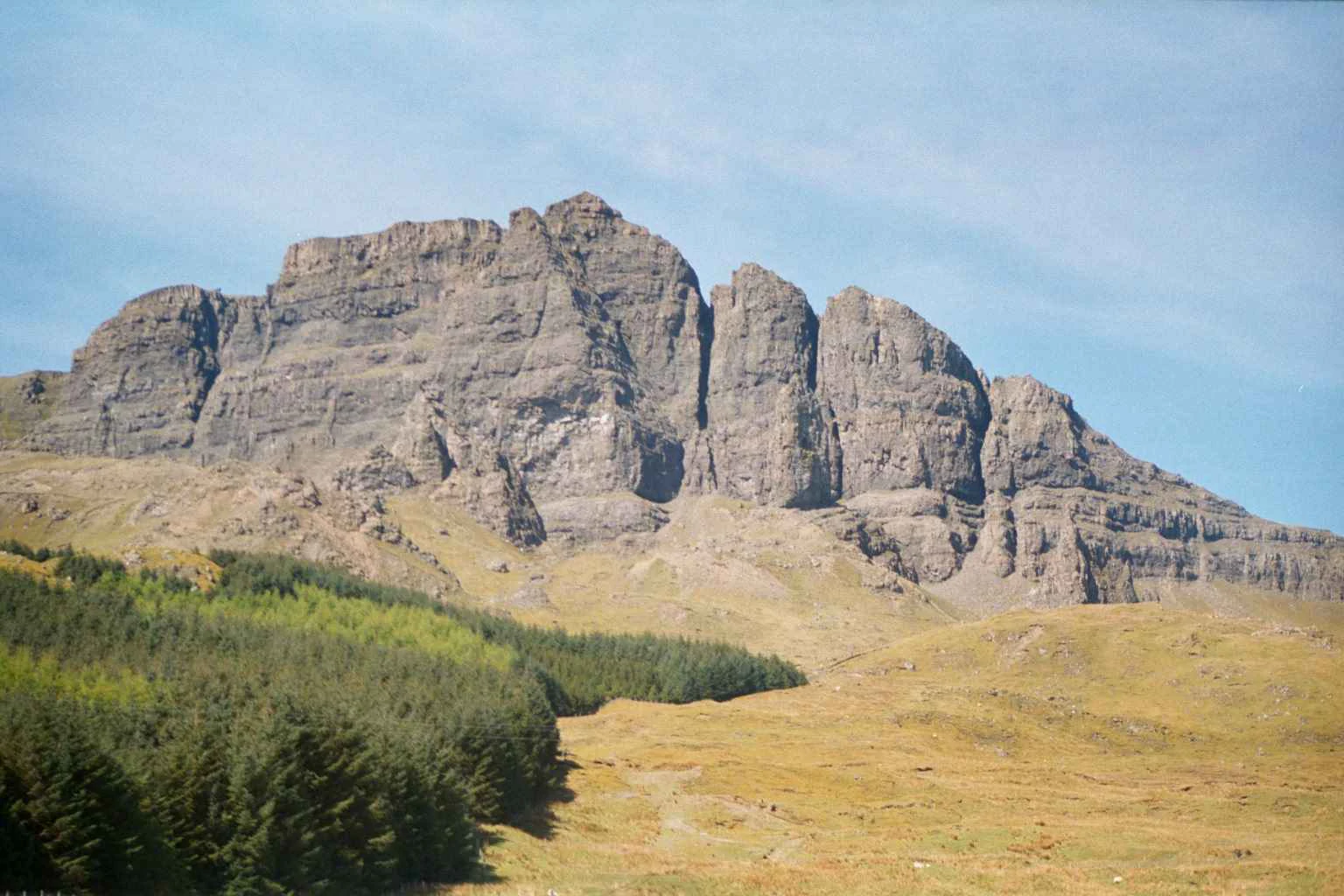
Trotternish is most famous for its nearly continuous basalt escarpment, which forms a near-vertical wall along the spine of the peninsula and hosts some of Skye's most photographed landmarks. The Quiraing is a striking series of pinnacles, cliffs, and slip-off slopes that appear to shift over time as landslides continue to reshape them, while the Old Man of Storr rises as an isolated rock pillar visible from much of northern Skye. Equally distinctive is the peninsula's Middle Jurassic geology, which preserves footprints and bones of dinosaurs such as theropods, sauropods, and thyreophorans. These fossils, along with the dramatic coastal cliffs of Kilt Rock and the inland landscape preserved within the National Scenic Area, give Trotternish an identity that fuses scenery with deep geological and paleontological significance.
Trotternish National Scenic Area history and protected-area timeline
Trotternish has been inhabited since the Mesolithic period, with the An Corran site near Staffin representing one of the oldest known locations of hunter-gatherer activity in Scotland, dating back to the seventh millennium BC. Evidence recovered from the site shows that it continued to be used over thousands of years, with Neolithic human remains, Bronze Age activity, and Iron Age metalwork all discovered alongside much more recent nineteenth and twentieth-century materials.
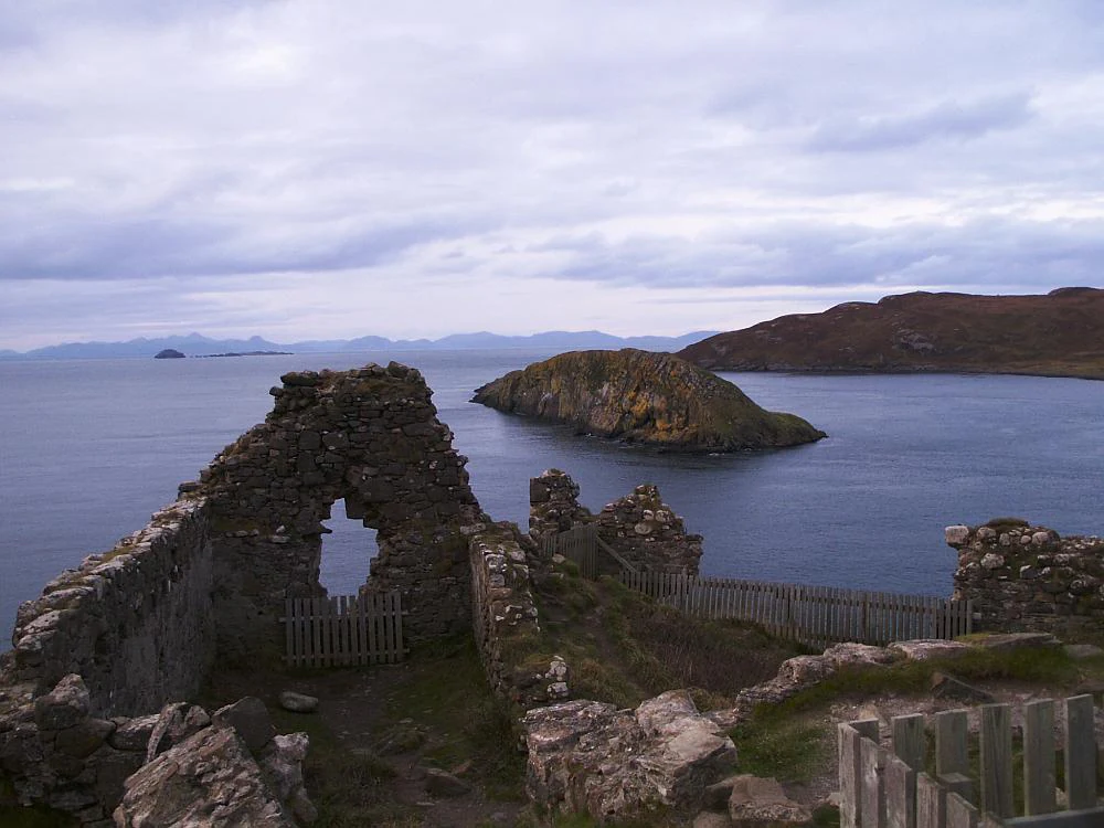
Its later history is tied to clan rivalry in the medieval and early modern periods. Duntulm Castle, perched on a promontory at the northern tip of the peninsula, was built in the fourteenth and fifteenth centuries during feuds between the MacLeods and the MacDonalds. It served as the seat of the Clan MacDonald of Sleat in the seventeenth century before being abandoned around 1732, when Sir Alexander MacDonald relocated the family seat southward to Monkstadt House.
The peninsula also bears the imprint of Highland and Jacobite memory. Flodigarry, north of Staffin, was the home of Flora MacDonald, famed for assisting Prince Charles Edward Stuart after the Battle of Culloden, where she lived between 1750 and 1772 before moving to Kingsburgh on the southwestern coast. It was at Kingsburgh that James Boswell and Samuel Johnson met her in 1773 during their celebrated tour of the Western Isles. The peninsula's Gaelic-speaking identity has continued to strengthen into the modern era, with Staffin recognised in 2010 by Comunn na Gàidhlig as their Gaelic Community of the Year.
Trotternish National Scenic Area landscape and geographic character
The defining feature of Trotternish is its long basalt escarpment, a near-continuous wall of cliffs, pinnacles, and slipped rock faces that runs along the eastern side of the peninsula. The escarpment gives Trotternish a sharp topographical contrast: gentle, cultivated slopes and crofting land on the west, and rugged, almost vertical terrain on the east. Basalt bedrock underpins the whole peninsula, producing relatively fertile soils compared to many parts of Skye and shaping the strange landforms that emerge along the ridge.
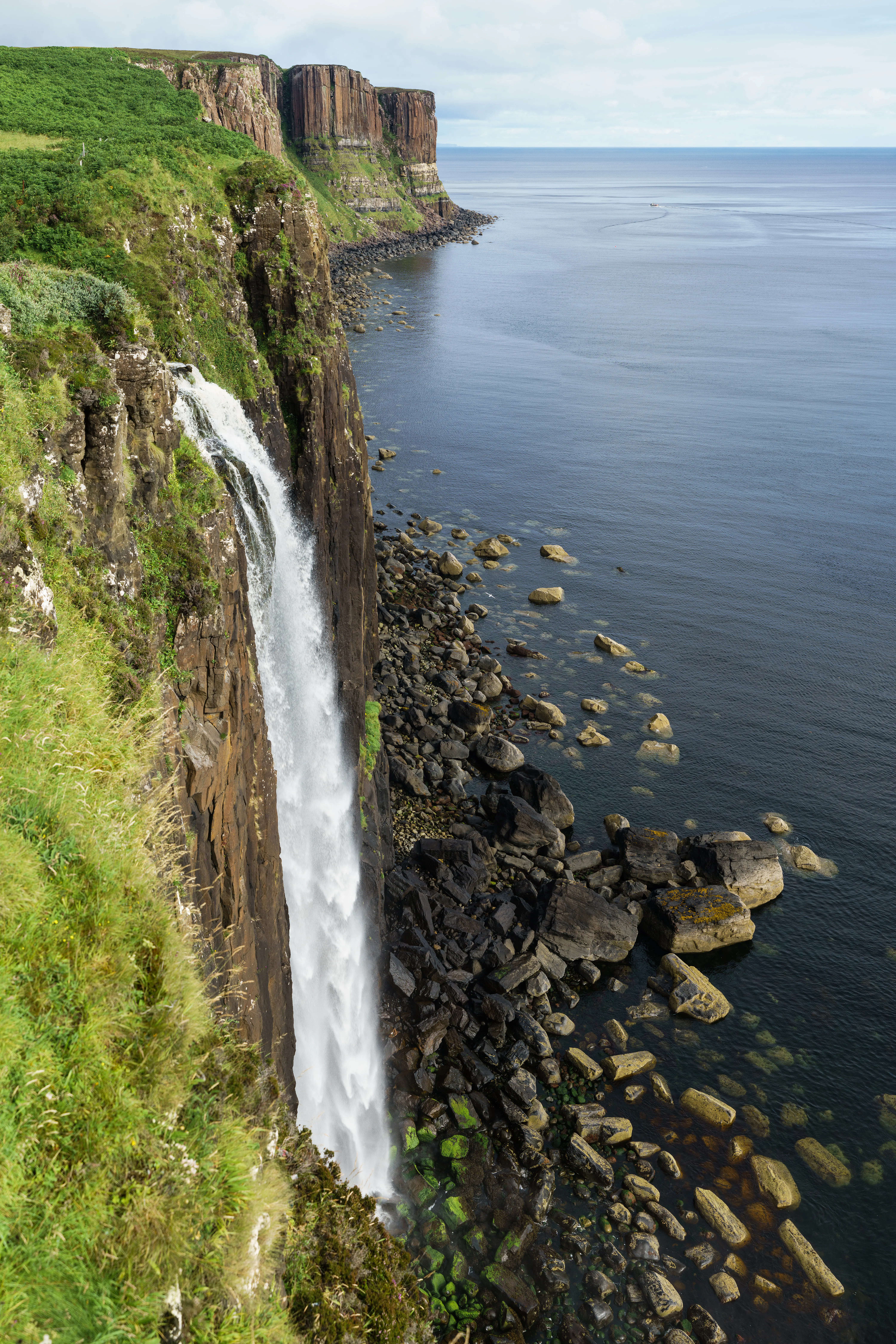
Along the escarpment, the old landslips have carved a series of named landmarks. The Quiraing, on the north-eastern part of the peninsula, is a complex of pinnacles, hidden plateaus, and shifting slopes that continues to be reshaped by ongoing landslides. Further south rises the Old Man of Storr, an isolated rock pinnacle standing above the surrounding cliffs and visible from a wide area of northern Skye, with the summit of The Storr itself forming the highest point of the peninsula at 719 metres above sea level. Dropping down to the coast, Kilt Rock is named for the tartan-like patterns in its 105-metre cliffs, with the Mealt Waterfall often seen falling directly into the sea nearby.
Trotternish National Scenic Area ecosystems, habitats, and plant life
Trotternish lies within Scotland's Highland biogeographical context, where maritime climate, exposed terrain, and basalt soils interact to produce a distinctive mix of habitats. The western lowlands of the peninsula support a patchwork of crofting grasslands, peat bogs, machair-influenced coastal strips, and small freshwater lochs, while the eastern escarpment maintains rough moorland, cliff vegetation, and grassy ledges within sometimes unstable slip zones.
The underlying basalt provided by ancient volcanic activity gives the peninsula relatively rich soils for the Hebrides, and the combination of altitude, exposure, and varied microclimates supports plant communities that range from Atlantic coastal heath to alpine-like communities on the higher ridges around the Storr and Quiraing. Wet flushes and watercourses draining the escarpment sustain bog communities that contribute to the Special Area of Conservation habitat network protecting the peninsula.
Trotternish National Scenic Area wildlife and species highlights
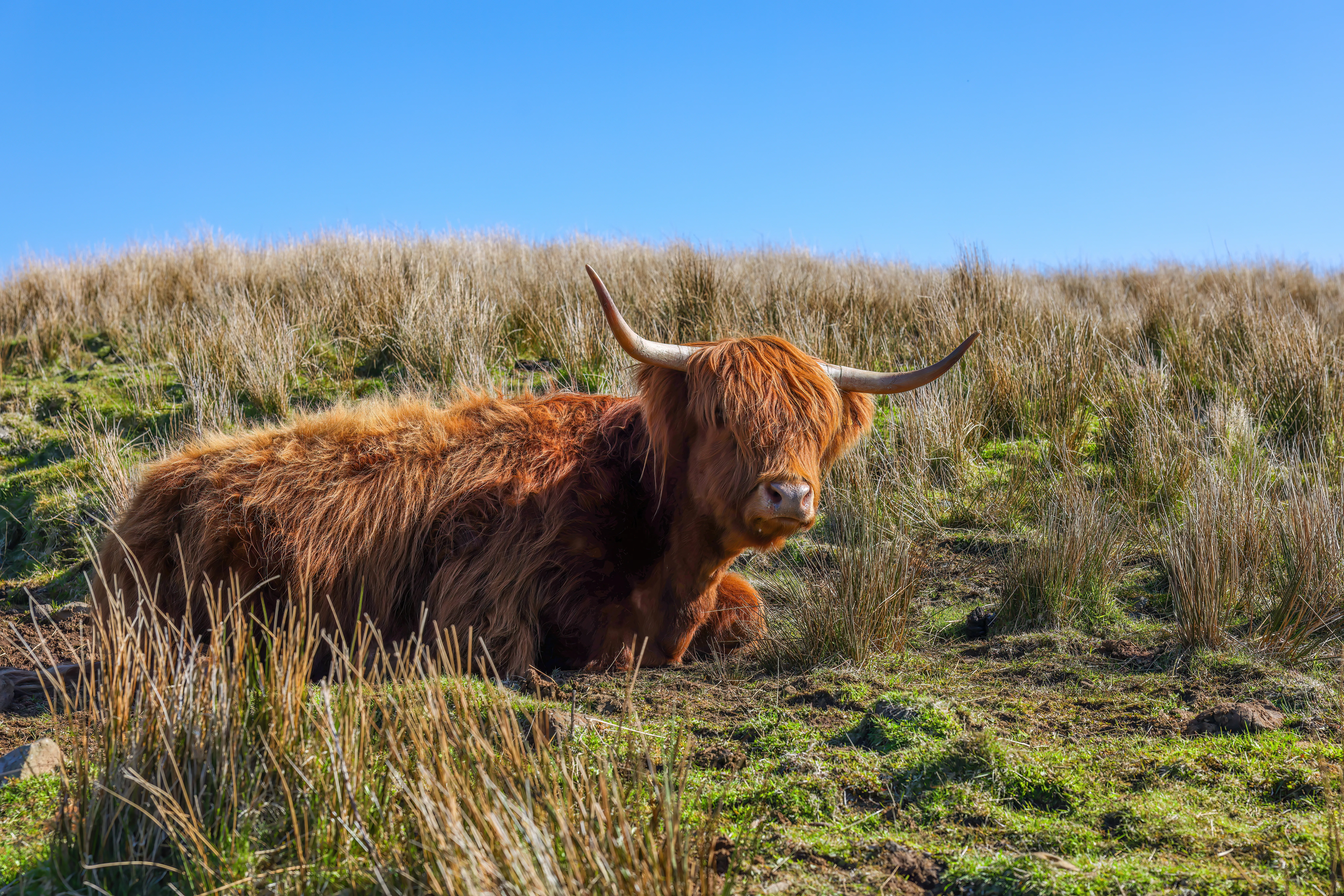
The Trotternish escarpment and surrounding habitats are notable for their upland and coastal birdlife, with cliff-nesting seabirds, raptors such as golden eagles and hen harriers, and moorland species like red grouse and skylarks regularly associated with the area's mix of cliff, moor, and pastoral land. The peninsula's relatively undeveloped crofting landscape, combined with extensive rough grazing, also provides habitat for red deer and smaller mammals typical of the Hebrides.
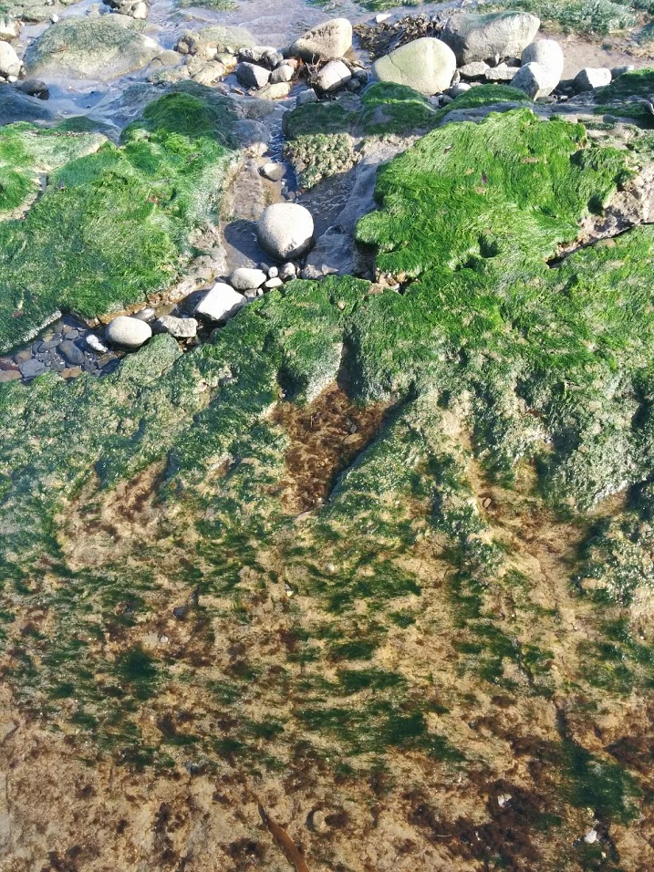
Trotternish is also internationally significant for its paleontological fauna rather than living wildlife. The Middle Jurassic rocks of the peninsula preserve evidence of a diverse dinosaur community, including theropods, sauropods, thyreophorans, and possible ornithopods. Their footprints, found along several accessible shorelines including An Corran, Brother's Point, and Duntulm, are protected under the Skye Nature Conservation Order 2019 and are showcased at the Staffin Museum in Ellishadder.
Trotternish National Scenic Area conservation status and protection priorities
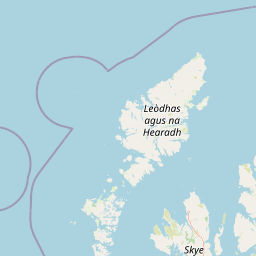
Trotternish benefits from a layered system of protection that recognises both its scenic and ecological values. The north-eastern portion around the Quiraing has been a National Scenic Area since 1981, one of forty such designations in Scotland intended to safeguard areas of exceptional scenery from inappropriate development. The designated area covers roughly 7,919 hectares in total, including a marine extension over the waters along the eastern coast below low tide level.
In parallel, the entire length of the Trotternish escarpment is designated as a Special Area of Conservation under the European Natura 2000 programme, classified by the International Union for Conservation of Nature as a Category IV protected area. This status reflects the importance of the escarpment's habitats and underlying geology, including the active landslip systems and the internationally important Middle Jurassic fossil localities. The Skye Nature Conservation Order 2019 adds further specific protection for the dinosaur fossils and footprints found along the peninsula's shorelines. NatureScot, Scotland's public body for natural heritage, plays a central role in the governance of these overlapping designations.
Trotternish National Scenic Area cultural meaning and human context
Trotternish carries a deep Gaelic cultural inheritance that remains visibly alive in daily life. In the 2001 census, 61 percent of the peninsula's population identified as Gaelic speakers, making it the strongest Gaelic-speaking area of the Isle of Skye. Gaelic-medium education is supported through units in Staffin and Kilmuir primary schools, and the area is the focus of Comunn na Gàidhlig's Gaelic development initiative known as _Lasair_.
The peninsula's cultural landscape also reflects centuries of clan history and Highland memory. The ruins of Duntulm Castle stand as a reminder of medieval and early modern clan rivalries, while Flodigarry and Kingsburgh are tied to the legacy of Flora MacDonald and the Jacobite story. Traditional crofting settlements such as Staffin, Kilmuir, and Uig continue to anchor the modern Gaelic community, and the cultural museum tradition exemplified by the Skye Museum of Island Life, with its preserved blackhouse architecture, complements the peninsula's natural heritage.
Top sights and standout views in Trotternish National Scenic Area
The Trotternish escarpment is the single most defining feature of the peninsula, a near-continuous geological wall crowned by landmarks like the Old Man of Storr and the Quiraing. Kilt Rock and the Mealt Waterfall add one of Skye's most photographed coastal scenes, where patterned basalt cliffs fall directly to the sea.
Equally distinctive is the peninsula's deep-time record. Jurassic rocks expose dinosaur footprints and bones from around 174 to 164 million years ago, with key sites at An Corran, Brother's Point, and Duntulm protected under Scottish law and showcased in the Staffin Museum. Combined with the surviving Gaelic cultural landscape, these features make Trotternish a place where scenery, geology, and heritage converge.
Best time to visit Trotternish National Scenic Area
Trotternish's scenery shifts dramatically with the seasons, making shoulder months particularly rewarding for visitors. Late spring and early summer typically bring longer daylight hours for exploring the escarpment, greener slopes, and a more active feel to crofting settlements such as Staffin and Uig. Wildflowers on the cliffs and lower slopes tend to be at their best during these months, while the marine layer often softens views of the rock pinnacles.
Autumn offers its own atmosphere, with russet hues across the moorland, quieter roads, and shifting light that enhances the dark basalt rocks of the Storr and Quiraing. Winter visits bring shorter days and frequent storms sweeping in off the Minch, but also clear, atmospheric views when weather windows open. Because the peninsula's weather can shift quickly, visitors should plan for changes in conditions regardless of season, recognising that the dramatic interplay of cloud, sea, and cliffs is part of what defines the Trotternish experience.