
Mori Atlas logo
Nature reserveUm die Rochsburg

Explore the geographic boundaries, riverine woodland, and tributary valley terrain surrounding Rochsburg Castle.

Um die Rochsburg Nature Reserve: Protected River Valley Landscapes in Central Saxony

(Naturschutzgebiet Um die Rochsburg)

Um die Rochsburg is a significant nature reserve located in the Mittelsachsen district of Saxony, encompassing a diverse network of river-influenced slopes and stream corridors. This protected area centers on the Zwickauer Mulde valley and the adjacent Brausebach tributary, forming an intricate mosaic of woodland and rocky terrain. The site serves as a vital conservation landscape, managing habitat and species associations across a range of slope exposures and elevations. This atlas entry provides an overview of the protected boundaries and the distinctive river valley geography defining this central Saxon natural site.

nature reserveSaxonyMittelsachsenZwickauer Mulde valleyriver valley woodlanddeciduous forest
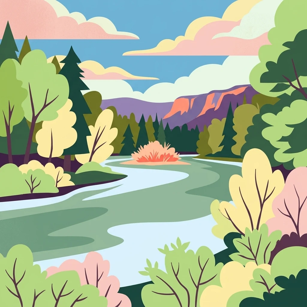
An illustration in a flat graphic style depicting a river winding through a valley surrounded by dense forests, shrubs, and distant hills under a pastel-colored sky.

Um die Rochsburg

Nature reserve

Park overview

Structured park overview, official facts, and landscape profile for Um die Rochsburg

Um die Rochsburg park facts, protected area profile, and essential visitor context

Review the core facts for Um die Rochsburg, including designation, size, terrain, visitor scale, habitats, and operating context in one park-focused overview.

About Um die Rochsburg

Um die Rochsburg is a nature reserve in central Saxony that protects a substantial section of the Zwickauer Mulde valley and the adjoining Brausebach valley, in the immediate vicinity of Rochsburg and its prominent hilltop castle. The reserve sits within Landkreis Mittelsachsen and is jointly administered across the municipalities of Burgstädt, Lunzenau, and Penig, reflecting how the natural area is shaped by the underlying river system rather than by administrative boundaries.

The landscape around Rochsburg is characteristic of the Saxon mid-elevation river country, where the Zwickauer Mulde cuts through gently rolling terrain and produces steep, often forested valley flanks. The reserve covers these slopes on the south and east sides of the village of Rochsburg, including both the direct Mulde valley edges and the side valley of the Brausebach as it descends toward the main river. Elevations within the protected area lie roughly between 191 meters and 265 meters above sea level, a relatively modest range that nonetheless produces a clearly defined valley landscape with strong contrasts between the riverside meadows, the wooded slopes, and the upper rim of the plateau.

Ecologically, the area is managed as a habitat and species management zone under IUCN Category IV, an approach that recognizes the importance of active conservation measures alongside general habitat protection. The interplay between the larger Mulde river corridor and the smaller Brausebach valley is central to the reserve's character, providing a gradient of flowing-water habitats, slope forests, and transition zones between woodland and open valley ground. The 2019 expansion, which grew the reserve from its original 143.6 hectares to its current 259.6 hectares, was explicitly designed to extend the protected zone more comprehensively across these valley systems.

The broader geographic and cultural setting is the traditional Saxon landscape between Chemnitz and Leipzig, where the Mulde river system has shaped human settlement, agriculture, and transport for centuries. The reserve lies just below Rochsburg Castle, making the protected natural area an integral part of the visual and ecological environment of one of the region's most recognizable cultural sites. Together, the natural and cultural elements give the reserve both practical conservation significance and a notable position within the regional protected-area network.

Quick facts and research context for Um die Rochsburg

Um die Rochsburg is a Saxony nature reserve (Naturschutzgebiet) with the official designation C 01, registered in the World Database on Protected Areas. It lies in Landkreis Mittelsachsen and covers parts of the municipalities of Burgstädt, Lunzenau, and Penig, south and east of Rochsburg.

The reserve protects the valley slopes of the Zwickauer Mulde and the Brausebach valley, with elevations ranging roughly from 191 to 265 meters above sea level. It is classified as an IUCN Category IV habitat and species management area, emphasizing active management for particular habitats and species. After expansion in 2019, the total protected area covers about 259.6 hectares, up from the original 143.6 hectares established in 1961.

Protection and recognition

Documented conservation status, management scope, and recognition data

Um die Rochsburg Protection Status and International Designation Records

Um die Rochsburg features structured data regarding protected area designation records, management parameters, and international recognition sources. Conservation researchers analyze official protected landscape metrics and administrative frameworks linked to global databases.

Protection details

WDPA ID
14520
Park context

Deeper park guide and search-rich context for Um die Rochsburg

Um die Rochsburg history, landscape, wildlife, and travel context

Explore Um die Rochsburg through its history, landscape character, ecosystems, wildlife, conservation priorities, cultural context, and seasonal travel timing in a structured park guide built for atlas discovery and search intent.

Why Um die Rochsburg stands out

The reserve is best known for protecting the wooded and rocky slopes around the Rochsburg Castle reach of the Zwickauer Mulde, where the Mulde valley narrows between Saxony's mid-elevation countryside. It combines the larger Mulde river valley with the smaller Brausebach tributary valley, producing a varied mosaic of south- and east-facing slopes, riverine woodland, and stream-side habitats. Its identity is strongly tied to the way the natural area frames one of Saxony's iconic castle landscapes, while still functioning as a working conservation site for habitat and species management. The 2019 expansion, which broadened the zone well beyond the original 1961 boundaries, further emphasized its role as a central link in the network of protected river-valley sites in Mittelsachsen.
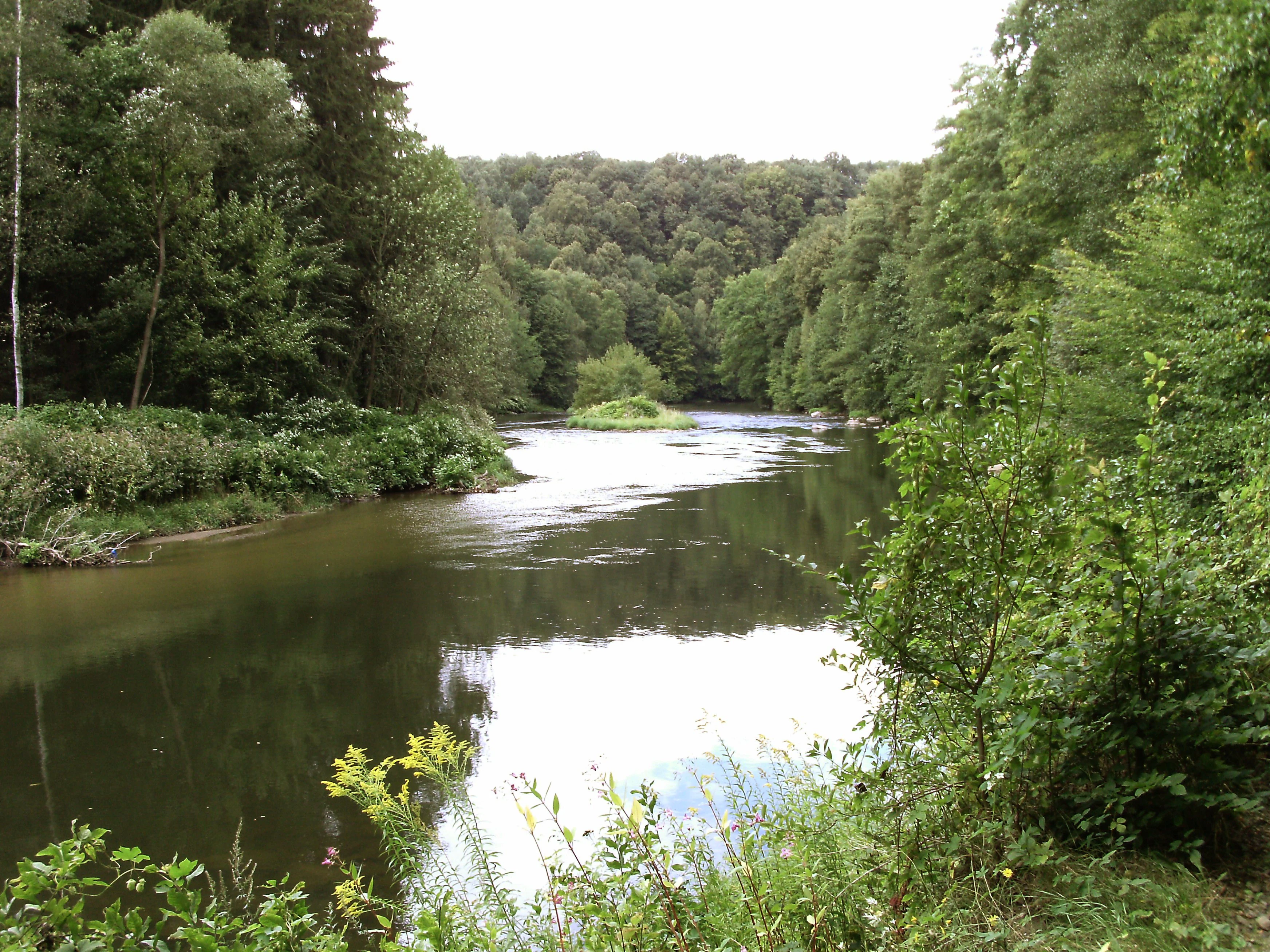
A calm, winding river flows through a dense forest with green trees lining both banks under an overcast sky.
The Zwickauer Mulde river flowing through the forested valley landscape of the Um die Rochsburg nature reserve.

Um die Rochsburg history and protected-area timeline

The original Um die Rochsburg nature reserve was established under the administration of the German Democratic Republic. It was created by an order (Anordnung) of the Ministry of Agriculture, Land Use Planning, and Forestry (Ministerium für Landwirtschaft, Erfassung und Forstwirtschaft, MfLEF) dated 30 March 1961, which was published in the official gazette of the GDR (Gesetzblatt Teil II, page 166). The original reserve covered approximately 143.6 hectares and focused on the immediate valley slopes around Rochsburg along the Zwickauer Mulde.

After German reunification, the reserve was formally continued under Saxon state law via the transitional clause (Section 51) of the Saxon Nature Conservation Act (Sächsisches Naturschutzgesetz), preserving its protected status under the new federal and state framework. It received the official Saxon nature reserve number C 01 and a World Database on Protected Areas entry (WDPA 14520), integrating it into the modern German protected-area system.

In November 2017, the Mittelsachsen district office launched the formal public consultation process for a new protective ordinance and the proposed expansion of the reserve. On 15 February 2019, the Landratsamt Mittelsachsen issued the new ordinance (published in the Sächsische Gesetz- und Verordnungsblatt on page 257), which expanded the protected area to its current extent of 259.6 hectares. This expansion modernized the reserve's boundaries, brought additional sections of the Zwickauer Mulde valley and the Brausebachtal under protection, and re-established the reserve within the current Saxon legal framework for nature conservation.

Um die Rochsburg landscape and geographic character

The landscape of Um die Rochsburg is defined by two converging river valleys in the Saxon mid-elevation countryside. The dominant feature is the valley of the Zwickauer Mulde, one of the major rivers in western Saxony, which flows in a generally east to north-easterly direction past Rochsburg and creates a clearly incised valley with steep, partially wooded slopes. The reserve lies along the south and east sides of Rochsburg, capturing the more sheltered, often south- and east-facing flanks of that valley.

Joining the Mulde system within the protected area is the Brausebach valley, a smaller tributary that has cut its own side valley down toward the main river. The Brausebachtal adds a finer-scale variation to the landscape, with narrower valley bottoms, more confined slopes, and a closer, more intimate relationship between the watercourse and the surrounding woodland. The result is a layered topography that ranges from the river level of the Mulde up to plateau edges around 265 meters elevation, with the lower boundary of the reserve near 191 meters above sea level.

Soils, slope exposures, and elevation differences within this relatively short vertical range create a mosaic of site conditions. Steeper, sun-exposed slopes contrast with cooler, moister, north-facing sections, while the transition from the open valley lowlands to the higher slopes produces distinct vegetation belts. The overall landscape impression is of a wooded, river-cut countryside typical of central Saxony, in which the cultural landmark of Rochsburg Castle sits directly above the protected natural scenery.

Um die Rochsburg ecosystems, habitats, and plant life

Ecologically, Um die Rochsburg is shaped by its position within the Zwickauer Mulde river system and by the gradient between valley floor and valley edge. The reserve's habitat and species management designation under IUCN Category IV reflects an active approach to maintaining and developing the biological communities associated with these river-valley landscapes.

The valley slopes around Rochsburg support mixed deciduous woodland typical of Saxon river valleys, with stands that vary according to slope angle, soil depth, and exposure. Along the Mulde and the Brausebach, the reserve includes riparian and near-riparian zones where riverside vegetation, wetter woodland pockets, and stream-course habitats interact with the broader slope forests. The transition zones between the riverbank, the mid-slope woods, and the upper edge of the valley are an important focus of the area's ecological value, since they provide a continuum of habitats that many species depend on.

The combination of a larger river valley with a smaller side valley means the reserve contains more than one type of flowing-water environment. The Mulde offers the wider, higher-energy main-river setting with characteristic bankside communities, while the Brausebach provides a smaller, more shaded brook habitat that supports different plant and animal assemblages. This juxtaposition of habitats within a single protected area is central to its ecological identity and to its function within the regional network of Saxon nature reserves.

Um die Rochsburg wildlife and species highlights

The wildlife value of Um die Rochsburg is closely tied to the structure of the river valleys and the surrounding woodland. The mixture of mature and younger slope forests, riverside habitats along the Zwickauer Mulde, and the smaller brook environment of the Brausebach creates conditions for a wide range of forest and valley-associated species typical of central Saxony.

River and stream environments support typical Saxon valley fauna, including fish, amphibians, and invertebrates associated with the Mulde and its tributary brooks. The side-valley woodland and transitional edge habitats offer shelter and foraging opportunities for woodland birds, small mammals, and a broad community of insects tied to deciduous forest and riverside vegetation. Larger mammals and other forest-dwelling species typical of the Saxon mid-elevation forests can also be expected to use the reserve, particularly where the connected woodland cover extends beyond its formal boundaries.

By protecting a connected stretch of both the Mulde and the Brausebachtal, the reserve provides continuity for wildlife movement along the river systems. The 2019 expansion enhanced this role by extending protection further along the valley axes, increasing the functional size of the protected habitat network and offering more stable conditions for species that depend on these valley landscapes.

Um die Rochsburg conservation status and protection priorities

Um die Rochsburg is recognized in conservation terms as a Habitat and Species Management Area under IUCN Category IV, one of the more actively managed categories within the international protected-area framework. This designation indicates that the reserve is not only protected against harmful interference but is also managed to maintain and develop specific habitats and species assemblages.

The reserve is part of the network of Saxon Naturschutzgebiete and is one of the protected sites within Landkreis Mittelsachsen. Its conservation significance lies in its protection of a substantial section of the Zwickauer Mulde valley and the adjoining Brausebachtal, including both the riverbanks and the wooded valley slopes. This combination of riverine and slope habitats makes the reserve an important node for the regional conservation of Saxon river-valley ecosystems, which are otherwise subject to pressures from agriculture, forestry, settlement, and infrastructure along the Mulde corridor.

The 2019 expansion was a major conservation milestone for the site. By enlarging the protected area from approximately 143.6 hectares to about 259.6 hectares, the district office of Mittelsachsen substantially strengthened the legal protection of additional valley sections, supporting habitat connectivity and reinforcing the reserve's role within the wider Saxon protected-area network. Entry in the World Database on Protected Areas (WDPA 14520) further reflects its formal recognition at the international level.

Um die Rochsburg cultural meaning and human context

The cultural context of Um die Rochsburg is inseparable from Rochsburg itself and from the long history of the Zwickauer Mulde valley as a corridor of settlement, trade, and defense in Saxony. The village of Rochsburg, perched above the river, has been associated with the medieval Rochsburg Castle for centuries; the castle sits prominently above the natural area that now carries its name.

The Mulde valley broadly has shaped human life in central Saxony since medieval times, providing a navigable river route, water power for mills and later industry, and a natural corridor between the Ore Mountains (Erzgebirge) further south and the lowlands toward Leipzig. The reserve today reflects how that historical pattern of human use of the valley persists in the form of scattered settlements, agricultural use of the flatter valley areas, and the ongoing presence of cultural landmarks such as the castle.

The reserve's preservation, particularly its 2019 expansion, has occurred alongside continued recognition of the area's cultural value. Conservation of the valley slopes and watercourses supports not only ecological aims but also the broader identity of the Saxon Mulde landscape, in which natural scenery, historic settlements, and landmark architecture like Rochsburg Castle remain closely linked.

Top sights and standout views in Um die Rochsburg

The reserve's defining highlight is the protected stretch of the Zwickauer Mulde valley right at the foot of Rochsburg Castle, where the natural scenery and one of Saxony's well-known cultural landmarks meet directly. The combination of a major river valley with the side valley of the Brausebach within a single protected area gives the site unusual habitat diversity for its size.

Another notable feature is the way the reserve fits into the broader Saxon nature conservation network, as one of the protected areas of Landkreis Mittelsachsen and as part of the formal Saxon Naturschutzgebiete system. The transition from an original 143.6-hectare reserve established in 1961 to the current 259.6-hectare reserve following the 2019 expansion highlights the long-standing recognition of the site's ecological value and its evolution under successive German legal frameworks.

Best time to visit Um die Rochsburg

Um die Rochsburg is best experienced during the late spring and early summer months, when deciduous woodland along the Mulde and Brausebach valleys is fully leafed out and the river valleys present their most characteristic green, vegetated appearance. Late spring is also a productive period for observing the renewed activity of valley wildlife and the contrast between sun-exposed slopes and cooler, shaded valley sections.

Autumn offers a distinct alternative character, with the wooded valley slopes turning color and the river-side landscapes taking on a softer, more muted atmosphere. Because the reserve focuses on valley slopes and forests rather than on alpine or coastal scenery, seasonal variation comes mainly from vegetation and weather conditions; visitors interested in combining the nature reserve with the nearby cultural landmarks of Rochsburg will find the site accessible across the typical Saxon outdoor season, with cool-layer clothing recommended for the often noticeably cooler air in the deeper valley sections.

Monthly climate preview

Long-term representative point measurements tracking monthly temperature and precipitation patterns

Um die Rochsburg Climate Normals, Annual Temperature and Precipitation Rhythms

Representative point records for Um die Rochsburg track measured monthly temperature ranges alongside daily precipitation averages from 1991 to 2020. Examining the complete twelve-month climatology reveals detailed shifts in baseline thermal conditions and moisture distribution across the protected area.
Annual mean9 °C
-1 °C19 °C
Jan-1°
Feb
Mar
Apr
May13°
Jun17°
Jul19°
Aug19°
Sep14°
Oct
Nov
Dec
Warmest month
July

19.1 °C

Coolest month
January

-0.9 °C

Wettest month
July

2.7 mm/day

Driest month
April

1.3 mm/day

Park location guide

Geography guide, regional context, and park location map for Um die Rochsburg

Um die Rochsburg park geography, regions, and map view in Germany

Understand where Um die Rochsburg sits in Germany through a broader geographic reading of the surrounding landscape, nearby location context, and its mapped position within the national park landscape.

How Um die Rochsburg fits into Germany

Germany is a federal republic in Western and Central Europe with a population of over 83 million across sixteen constituent states. It is Europe's largest economy by nominal GDP and a major global exporter and importer. The capital is Berlin, and the country borders Denmark, Poland, Czech Republic, Austria, Switzerland, France, Luxembourg, Belgium, and the Netherlands.

Wider geography shaping Um die Rochsburg in Germany

Germany is located in Western and Central Europe, spanning 357,022 km². It borders Denmark to the north, Poland and the Czech Republic to the east, Austria and Switzerland to the south, and France, Luxembourg, Belgium, and the Netherlands to the west. The country has coastlines on the Baltic Sea and North Sea to the north, with the Alps located in the southern region.

Map view of Um die Rochsburg

Use this park location map to pinpoint Um die Rochsburg in Germany, understand its exact geographic position, and read its mapped placement within the surrounding landscape more clearly.

Pigeon | © OpenStreetMap contributors

Location context for Um die Rochsburg

Saxony

Explore protected river slopes, woodland habitats, and rocky valley scenery.

Um die Rochsburg Photos and Landscapes: Visualizing the Zwickauer Mulde Valley

Visual records capture the steep valley slopes, mixed woodland, and riverine habitats that define the protected nature reserve along the Zwickauer Mulde. Examining these detailed photographic views reveals the complex terrain, slope exposures, and distinct conservation environments surrounding the historic castle landscape.

A calm, winding river flows through a dense forest with green trees lining both banks under an overcast sky.

Park atlas

Compare surrounding river valleys, woodland habitats, and regional nature reserves

Explore Other Protected Areas and Parks Near Um die Rochsburg in Central Saxony

Browse other protected areas and river valley reserves located throughout the surrounding Saxon countryside. Comparing these neighboring habitats reveals broader patterns in regional conservation landscapes and riverine woodland ecosystems.
A horizontal watercolor painting depicting a soft-focus forest in the foreground and rolling hills in the background.
Nature reserveThuringia
About 13 km away#1 closest

West

Leinawald Nature Reserve: Mapping the Protected Forests and Wetland Habitats of Eastern Thuringia

A comprehensive look at the landscape geography, pond networks, and conservation status of this German woodland.

Leinawald represents a unique confluence of historical forestry, wartime heritage, and ecological recovery within the Altenburger Land region. The area is defined by its loess-mantled ridges and periodic wetland valleys, containing a complex grid of ponds, brooks, and secondary habitats formed in former quartz quarries. Understanding the environmental layers of this site reveals the intersection of natural vegetation potential and 20th century landscape transformation.

Area
18.437 km²
Established
1961
IUCN
IV
Relief
Upland
A horizontal watercolor illustration depicting a wetland landscape with grassy banks, a winding stream, and reeds.
Nature reserveSachsen
About 18 km away#2 closest

Northwest

Eschefelder Teiche: Protected Wetland Landscapes and Pond Geography in Sachsen

Historic water basins and regional wetland habitats

The Eschefelder Teiche nature reserve occupies a distinctive position in the Saxon landscape, tracing a historic chain of artificial ponds from Frohburg to Eschefeld. This protected area offers insight into managed wetland ecosystems, featuring the expansive Großteich and preserved heritage structures like the Teichhaus complex, which remain central to local conservation and bird populations.

Area
5.62 km²
Relief
Lowland
Climate
Temperate
Access
Easy access
Nature reserveSachsen
About 20 km away#3 closest

Southeast

Um den Eibsee: A Detailed Atlas and Geographic Overview of the Saxony Nature Reserve

Examining the terrain, lake basin, and regional landscape context.

Located near Chemnitz, the Um den Eibsee nature reserve represents a managed cultural landscape spanning 39 hectares. This area integrates the Eibsee lake with surrounding open pastures, protected specifically to prevent habitat loss through active conservation grazing. Gain insights into the boundary mapping and ecological structure that define this unique Saxon protected area.

Area
0.39 km²
Established
2000
IUCN
IV
Relief
Lowland
A horizontal watercolor painting showing a tranquil lake with soft green hills and sparse vegetation along the shoreline under a pale, warm sky.
Nature reserveSachsen
About 25 km away#4 closest

Northwest

Bockwitz Nature Reserve: Mapping the Industrial Reclamation Landscapes of Sachsen, Germany

A Protected Mosaic of Rewetted Lakes and Mining Follow-on Terrain

Spanning 545 hectares, the Bockwitz nature reserve offers a unique look at the transformation of former lignite opencast pits into a thriving wetland habitat. The protected area is characterized by its significant residual water bodies, including Bockwitzer See and the Südkippe pit, which showcase the evolution of Sachsen landscape geography following industrial decline. This site serves as a vital example of habitat management within an anthropogenic environment.

Area
5.454 km²
Established
2003
IUCN
IV
Water
Major water bodies
Nature reserveSachsen
About 29 km away#5 closest

Northeast

Scheergrund Nature Reserve: Geographic Atlas and Protected Landscape Overview

Mapping the geology and woodland history of the Leisnig region

Scheergrund functions as a vital nature reserve and geological reference site within the Saxon landscape. This area provides insight into Holocene tufa systems, ancient dam structures, and the complex interplay between spring-fed stream morphology and human development in the Freiberger Mulde tributary valley.

Area
0.578 km²
Established
1961
IUCN
IV
A horizontal watercolor illustration showing soft green rolling hills, trees, and a pale yellow sky.
Nature reserveSaxony
About 32 km away#6 closest

North

Alte See, Ruhmberg Nature Reserve: Geographic Atlas of a Protected Landscape in Saxony

Ecological recovery of former military sites in the German lowlands.

Situated in the Landkreis Leipzig, the Alte See, Ruhmberg nature reserve offers a complex study in land use and conservation. The protected area features a unique transition between alder carr wetlands along the Parthe river and the dry, open grasslands of the Ruhmberg hill, creating a high-density biodiversity hotspot within the broader context of Saxon geography.

Area
2.66 km²
Established
2015
IUCN
IV
Nature reserveSachsen
About 34 km away#7 closest

South

Hartensteiner Wald Nature Reserve: Saxon Protected Landscapes and Regional Geography

Woodland habitat and river valley terrain in Zwickau

Hartensteiner Wald functions as a key Natura 2000 protected area within the Free State of Sachsen. This reserve offers a layered landscape of native beech woodlands, steep valley slopes, and striking rocky outcrops along the Zwickauer Mulde. Use this atlas perspective to map the reserve's historic features, such as the Prinzenhöhle and Knoblauchfelsen, while understanding its conservation role in the broader Erzgebirge transition zone.

Area
0.89 km²
Established
1961
IUCN
IV
Relief
Upland
Nature reserveThuringia
About 37 km away#8 closest

Northwest

Phönix Nord Nature Reserve: Mapped Protected Area in the Altenburger Land of Thuringia

A restored post-mining mosaic of heath, scrub, and woodland

Phönix Nord preserves a unique post-mining landscape shaped by historic lignite extraction. This nature reserve in Thuringia features a mosaic of rewilded slopes and reclaimed mineral soils, managed as a vital habitat for native species. Through its distinct topography and conservation efforts, it stands as a key example of industrial renaturation in central Germany.

Area
1.672 km²
Established
2008
IUCN
IV
Relief
Lowland

Common questions about visiting, size, designation, and location context for Um die Rochsburg

Um die Rochsburg FAQs for park facts, access, geography, and protected area context

Find quick answers about Um die Rochsburg, including protected-area facts, park geography, trail and visitor context, and how the park fits into its surrounding country and regional landscape.
MoriAtlas Explorer

Continue Your Protected Areas Search Across the Global Atlas

Deepen your exploration by continuing the structured search for national parks and protected areas worldwide. Utilize the comprehensive filtering capabilities to compare different conservation landscapes and refine your understanding of global park geography. Discover more about the distribution and characteristics of protected natural areas.

Global natural geography