
Mori Atlas logo
Protected landscapeUr-Brenztal

A rare open floodplain corridor situated between the Swabian Albuch and Härtsfeld plateaus.

Ur-Brenztal Protected Landscape: Mapping the Ancient River Valleys of Baden-Württemberg

(Landschaftsschutzgebiet "Ur-Brenztal")

Ur-Brenztal represents a significant surviving fragment of wet grassland within the broad, flat valley of the upper Brenz river in southern Germany. As a designated protected landscape, the area preserves critical meadow habitats that serve as a green corridor between the higher plateaus of the Albuch and the Härtsfeld. This geographic record maps the unique remnants of the ancient Urbrenz drainage system, offering insight into a valley form shaped by ancestral river capture.

wet meadowsprotected landscapeSwabian AlbBrenz valleymeadow birdsstepping stone habitat
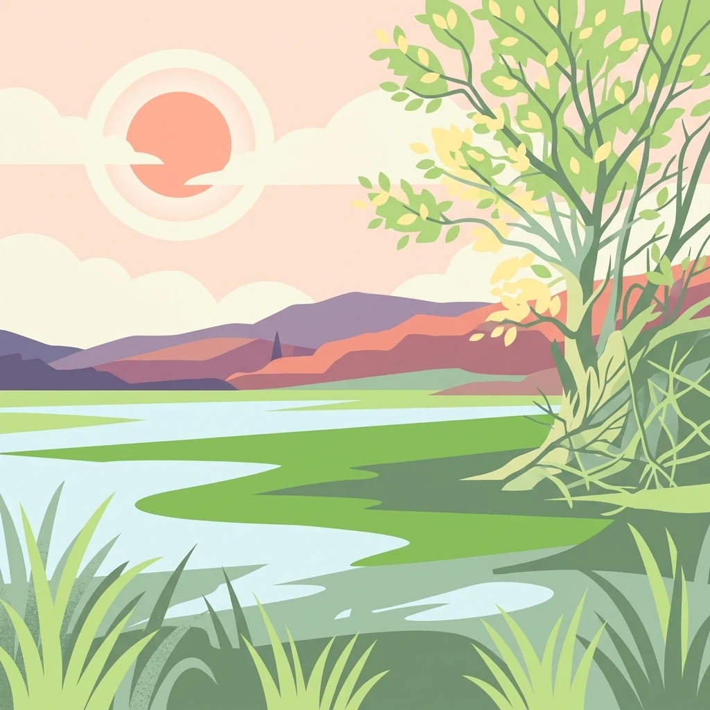
A flat-style digital illustration of a wetland scene with a tree in the foreground, water, and rolling hills in the background under a sunset.

Ur-Brenztal

Protected landscape

Park overview

Structured park overview, official facts, and landscape profile for Ur-Brenztal Landscape Protection Area

Ur-Brenztal Landscape Protection Area park facts, protected area profile, and essential visitor context

Review the core facts for Ur-Brenztal Landscape Protection Area, including designation, size, terrain, visitor scale, habitats, and operating context in one park-focused overview.

About Ur-Brenztal Landscape Protection Area

Ur-Brenztal is a landscape protection area in the Landkreis Heidenheim of Baden-Württemberg, in the south of Germany. Although small, at roughly 69 hectares, it captures a particularly distinctive slice of the eastern Swabian Alb landscape: the broad, flat, open floodplain of the Seegartenhofgraben and the upper Ziegelbach, two small streams that join near Königsbronn to form the longest northern headwater branch of the Brenz river.

The protected area sits within the natural region known as Albuch und Härtsfeld, a transitional zone between the higher karst plateaus of the Swabian Alb and their eastern flanks. In this stretch, the Brenz system has carved an unusually broad valley floor that contrasts strongly with the steep slopes of the surrounding uplands. The Bundesstraße 19 runs along much of the eastern edge of the area, separating the protected meadows from settlement and traffic infrastructure to the east.

Today, Ur-Brenztal is valued less for dramatic scenery or rare geological features than for what it represents ecologically: an island of traditional, open wet grassland in a region where the valley floor has otherwise been almost entirely absorbed by the long settlement corridor running from Aalen in the north through Heidenheim and onward to Giengen an der Brenz. The protected meadows serve as a green bridge between the Albuch plateau to the west and the Härtsfeld plateau to the east, allowing birds, bats, and other animals to move between habitats that would otherwise be separated by built-up land.

From a conservation perspective, the protection ordinance from 27 June 2003 aims explicitly at preserving these meadow landscapes and the wet conditions that sustain them. The presence of threatened bat species, breeding populations of several rare bird species, and the area's role as a feeding and resting site for migrating birds all reflect the unusually high ecological value packed into this small valley floor.

Quick facts and research context for Ur-Brenztal Landscape Protection Area

Ur-Brenztal is a state-recognized landscape protection area (Landschaftsschutzgebiet) with the official designation number 1.35.080 and a WDPA identifier of 325368. It was established by ordinance of the Landratsamt Heidenheim on 27 June 2003 and is administered by the Landkreis Heidenheim.

The area lies within the natural region 096, Albuch und Härtsfeld, which is part of the major natural unit 09, the Swäbische Alb (Swabian Alb). It sits on the unusually wide upper valley floor of the Brenz river system, where the Seegartenhofgraben feeds into the Ziegelbach before the Brenz begins its longer course toward the Danube.

Protection and recognition

Examine the terrestrial protection records and official designation framework for Ur-Brenztal.

Ur-Brenztal Protection Status and Documented Conservation Scope

Ur-Brenztal maintains documented terrestrial protection records and defined conservation boundaries within global protected area databases. Review the verified international recognition sources and management scope associated with this protected natural landscape.

Protection details

Protection scope
Terrestrial
Transboundary protection
No
WDPA ID
325368
Park context

Deeper park guide and search-rich context for Ur-Brenztal Landscape Protection Area

Ur-Brenztal Landscape Protection Area history, landscape, wildlife, and travel context

Explore Ur-Brenztal Landscape Protection Area through its history, landscape character, ecosystems, wildlife, conservation priorities, cultural context, and seasonal travel timing in a structured park guide built for atlas discovery and search intent.

Why Ur-Brenztal Landscape Protection Area stands out

Ur-Brenztal is best known for protecting a surviving fragment of open, species-rich wet grassland in an otherwise heavily settled stretch of the upper Brenz valley. Its meadows and pastures are an important stepping stone for migratory and meadow-nesting birds, including species such as the Yellow Wagtail, Meadow Pipit, and Hen Harrier, which find food and breeding habitat here between the high plateaus of the Albuch and the Härtsfeld. The area is also notable for its striking geographical curiosity: the broad valley was originally carved by the much longer predecessor of the Brenz, the Urbrenz, whose former northern headwaters have since been captured by the Kocher river system, draining instead toward the Rhine. Ur-Brenztal is the surviving remnant of that ancient, much larger drainage basin.
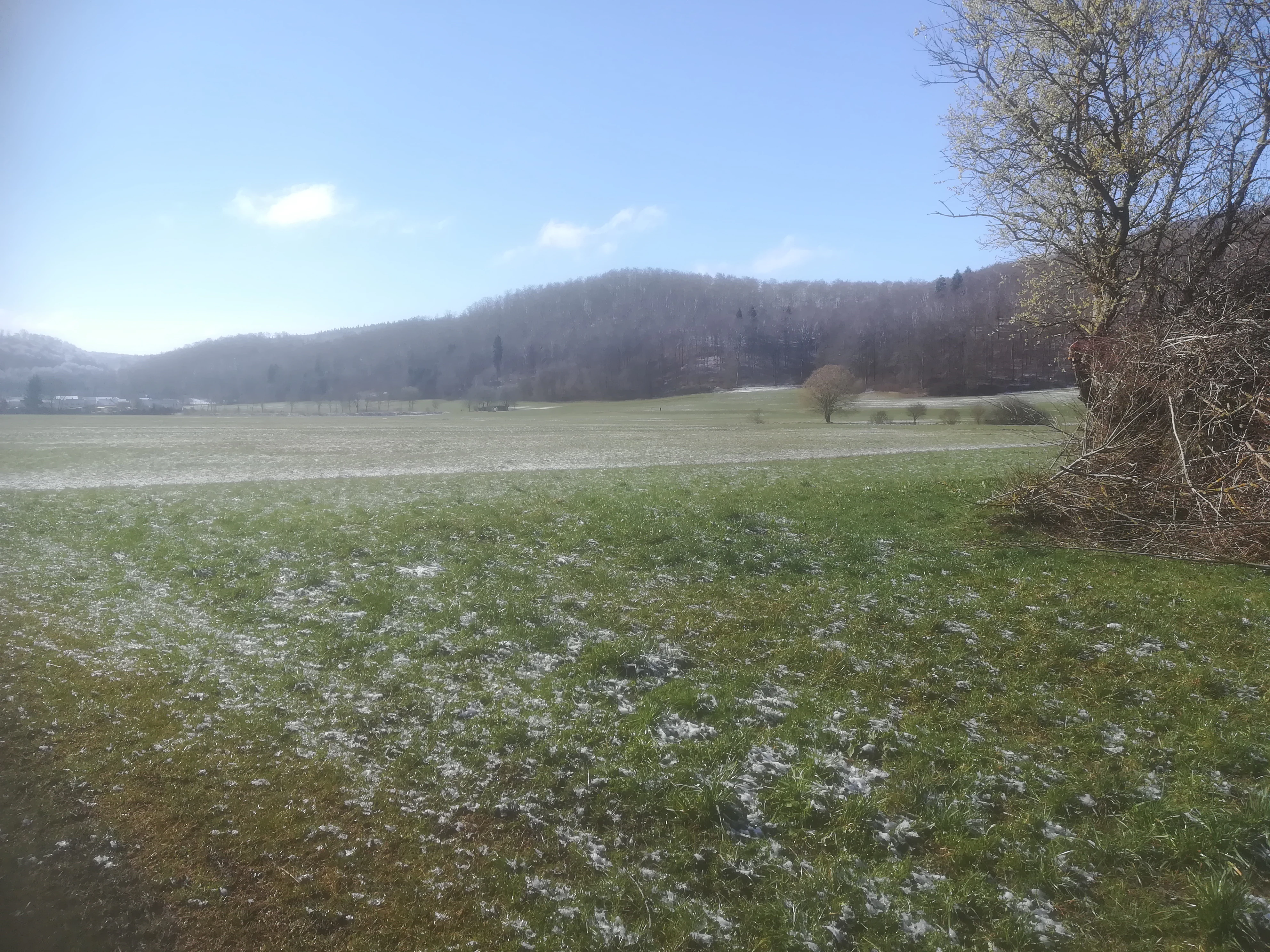
A wide, grassy field with patches of snow under a clear blue sky, with forested hills in the background.
A view of the Ur-Brenztal valley in early spring.

Ur-Brenztal Landscape Protection Area history and protected-area timeline

Ur-Brenztal was formally designated as a landscape protection area by ordinance of the Landratsamt Heidenheim on 27 June 2003 under the German nature conservation framework for protected landscapes. The designation number 1.35.080 places it within the official register of protected areas maintained for the state of Baden-Württemberg.

The protection ordinance was issued specifically to preserve the remaining open grassland character of the valley floor and, in particular, the wet meadows along the Seegartenhofgraben and the upper Ziegelbach. The area had long been recognized as a step in the bird migration corridor of the upper Brenz valley, and its formal protection was a response to ongoing pressure from settlement expansion, road infrastructure, and agricultural intensification in the surrounding region.

The area's natural history, however, goes much further back than its 2003 designation. The unusually broad valley floor was originally shaped by the Urbrenz, an ancient precursor of today's Brenz. Over geological time, the Kocher river system progressively captured the upper reaches of that older drainage basin, leaving behind the now much-reduced Brenz stream that still flows through Ur-Brenztal as the longest surviving northern headwater branch of the original system.

Ur-Brenztal Landscape Protection Area landscape and geographic character

The landscape of Ur-Brenztal is dominated by the unusually broad and flat valley floor of the upper Brenz, flanked by the higher lands of the Swabian Alb on either side. Where many valleys in this region are narrow and steep-sided, the protected area opens out into a wide, gently sloping floodplain shaped by the much larger ancestral drainage system of the Urbrenz.

Along the valley bottom, the low-energy channels of the Seegartenhofgraben and the Ziegelbach wind through meadows and pastures, with shallow gradients encouraging the formation of wet and marshy ground. To the east, the Bundesstraße 19 forms a long boundary along the foot of the slope, while the western edge transitions more gradually into the wooded and open country of the Albuch. On the opposite side, the open Härtsfeld plateau rises above the valley.

The result is a corridor-like landscape: a flat, open band of grassland squeezed between ascending ridges, with the contrast between settlement-influenced valley slopes and the protected open floor visible at a glance. The open character of the valley floor is itself the defining scenic feature of Ur-Brenztal, since it preserves a stage in the historical family of Brenz river landscapes that has otherwise been heavily modified.

Ur-Brenztal Landscape Protection Area ecosystems, habitats, and plant life

Ecologically, Ur-Brenztal is essentially a wetland grassland reserve set within a wider upland landscape. The protected area's meadows and pastures remain in a relatively traditional state, with significant patches of wet meadow (Feuchtwiese) maintained by ongoing agricultural use rather than abandonment. These conditions create the moist, herb-rich sward structure that supports the area's bird and insect life.

The habitats of the area belong to the broader Albuch und Härtsfeld natural region, which is part of the Swabian Alb. Within that context, Ur-Brenztal stands out for holding an unusually intact band of wet, open habitat at the bottom of an otherwise increasingly dry and built-over valley system. The wet meadows act as a kind of ecological substitute for the lost floodplain dynamics of the much larger ancestral Urbrenz river.

Because the area sits between two higher plateaus and interrupts a long settlement corridor, it functions as a habitat island and stepping stone rather than as an extensive forest or wilderness landscape. Its ecological value comes from this strategic position: small in area, but disproportionately important as a refuge and connection point for grassland and wetland species in an otherwise heavily human-shaped valley.

Ur-Brenztal Landscape Protection Area wildlife and species highlights

The meadows and wet grassland of Ur-Brenztal support a notably diverse community of birds for so small an area. The protection ordinance explicitly highlights the reserve's role as a stepping stone for bird migration, and lists feeding and resting habitat for the Grey Heron, the Common Snipe, the Yellow Wagtail, which breeds here, and for migrating Meadow Pipit, Water Pipit, Northern Wheatear, Common Wood Pigeon, and Stock Dove.

Threatened breeding species recorded in the area include the Red Kite, Red-backed Shrike, Common Whitethroat, and Lesser Whitethroat, along with the Hen Harrier, which uses the open valley as a hunting ground. Together, these species give the area a profile more typical of larger, traditional wet meadow landscapes than of a small protected strip within a settled valley.

The reserve is also recognized for its bat fauna, with threatened species such as the Greater Mouse-eared Bat and the Common Pipistrelle documented in the area. The combination of mature trees, old buildings, and the abundant insect life of the wet meadows makes the valley an important local refuge for bat populations on the eastern Swabian Alb.

Ur-Brenztal Landscape Protection Area conservation status and protection priorities

From a conservation standpoint, Ur-Brenztal matters primarily because of what it preserves rather than because of any single rare species. The ordinance that established the protected area in 2003 is specifically aimed at maintaining the open grassland character and, in particular, the wet meadows along the upper Brenz, recognizing these habitats as irreplaceable in the current regional landscape.

The reserve carries the IUCN Category V designation, meaning it is classified as a Protected Landscape/Seascape. In practical terms, this reflects both the scenic value of the open valley floor and the way in which traditional land use interacts with natural river dynamics to maintain habitat. Because most of the surrounding valley floor has been converted to settlement or intensive agriculture, the survival of any open wet grassland here depends directly on the protection regime.

The conservation significance of Ur-Brenztal also lies in its role as a connecting landscape element. By maintaining a continuous strip of open habitat between the Albuch and the Härtsfeld plateaus, the protected area supports the movement of species, including bats and birds, between otherwise fragmented habitats. Its small size is offset by its strategic position in the regional ecological network.

Ur-Brenztal Landscape Protection Area cultural meaning and human context

Ur-Brenztal lies within a landscape that has been shaped by centuries of agricultural use and by the slow, layered history of settlement along the Brenz valley. The protected meadows represent one of the last surviving examples of traditional wet grassland management in a valley where the floor is otherwise dominated by villages, roads, and infrastructure.

The name "Ur-Brenztal" itself reflects local awareness of the area's deeper geological history, referring to the Urbrenz, the ancient, much larger ancestor of today's Brenz. Although the original drainage system has long since been altered by river capture, the surviving open valley retains a cultural memory of that older landscape.

Top sights and standout views in Ur-Brenztal Landscape Protection Area

The standout features of Ur-Brenztal are its surviving wet meadow habitats in the unusually broad upper Brenz valley, its role as a stepping stone for migrating and breeding meadow birds, and its function as a green corridor between the Albuch and Härtsfeld plateaus. The area also has quiet geological interest: its wide valley form is a relic of the ancestral Urbrenz system, whose former northern headwaters now drain into the Rhine via the Kocher.

Best time to visit Ur-Brenztal Landscape Protection Area

Ur-Brenztal is most rewarding at times when wet meadows are biologically and visually active. Spring brings breeding Yellow Wagtails, returning Red Kites, and the first wave of migrating waders and pipits. Late summer and early autumn tend to be the best periods for observing passage species such as Northern Wheatears, Meadow Pipits, and hen harriers hunting over the open valley. Winter can be quieter but offers views of overwintering waterbirds and the open, frost-touched character of the broad valley floor. Because the reserve is a working agricultural landscape with open meadows, conditions on the ground vary with hay cutting and grazing.

Monthly climate preview

Long-term representative point measurements tracking monthly averages across the park terrain

Ur-Brenztal Climate Normals, Annual Temperature and Precipitation Rhythm

Historical climate data for Ur-Brenztal records a measured annual rhythm of monthly temperature ranges and precipitation rates based on coordinates at a 462 meter elevation. Analyzing the complete twelve month weather profile clarifies long term averages across the representative protected location.
Annual mean9 °C
-1 °C18 °C
Jan-1°
Feb
Mar
Apr
May13°
Jun16°
Jul18°
Aug18°
Sep14°
Oct
Nov
Dec
Warmest month
July

18.4 °C

Coolest month
January

-1 °C

Wettest month
July

3 mm/day

Driest month
April

1.6 mm/day

Park location guide

Geography guide, regional context, and park location map for Ur-Brenztal Landscape Protection Area

Ur-Brenztal Landscape Protection Area park geography, regions, and map view in Germany

Understand where Ur-Brenztal Landscape Protection Area sits in Germany through a broader geographic reading of the surrounding landscape, nearby location context, and its mapped position within the national park landscape.

How Ur-Brenztal Landscape Protection Area fits into Germany

Germany is a federal republic in Western and Central Europe with a population of over 83 million across sixteen constituent states. It is Europe's largest economy by nominal GDP and a major global exporter and importer. The capital is Berlin, and the country borders Denmark, Poland, Czech Republic, Austria, Switzerland, France, Luxembourg, Belgium, and the Netherlands.

Wider geography shaping Ur-Brenztal Landscape Protection Area in Germany

Germany is located in Western and Central Europe, spanning 357,022 km². It borders Denmark to the north, Poland and the Czech Republic to the east, Austria and Switzerland to the south, and France, Luxembourg, Belgium, and the Netherlands to the west. The country has coastlines on the Baltic Sea and North Sea to the north, with the Alps located in the southern region.

Map view of Ur-Brenztal Landscape Protection Area

Use this park location map to pinpoint Ur-Brenztal Landscape Protection Area in Germany, understand its exact geographic position, and read its mapped placement within the surrounding landscape more clearly.

Pigeon | © OpenStreetMap contributors

Location context for Ur-Brenztal Landscape Protection Area

Baden-Württemberg

Visual reference guide to wet meadows, stream corridors, and habitats

Ur-Brenztal Photos, Landscapes, and Protected Valley Scenery

Visual documentation reveals the flat, open wet grassland and stream channels defining the protected valley floor of Ur-Brenztal. Examining photography and terrain views helps observers understand the rare floodplain landscape nestled between surrounding plateaus.

A wide, grassy field with patches of snow under a clear blue sky, with forested hills in the background.

Park atlas

Compare regional valley corridors, plateau habitats, and nearby protected areas.

Exploring Parks Near Ur-Brenztal and Surrounding Protected Landscapes

Browsing other protected areas near Ur-Brenztal reveals broader ecological patterns across the Swabian Alb and surrounding river valleys. Comparing these adjacent conservation landscapes provides valuable context for understanding regional terrain diversity and wetland habitats.
Protected landscapeBaden-Württemberg
About 4.7 km away#1 closest

Southeast

Weidmichele, Eichelesäcker und anschließender Talgrund Protected Landscape Atlas

Geographic analysis of Swabian Alb dry valley terrain

Examine the topographical profile of Weidmichele, Eichelesäcker und anschließender Talgrund. This landscape protection area showcases the classic karst dry valley form found in Baden-Württemberg, providing a vital, narrow grassland corridor between upland plateaus and the lower Brenz valley ecosystem.

Area
0.153 km²
Established
1978
IUCN
V
A horizontal watercolor painting showing rolling green meadows with small clusters of trees and soft hills in the background on a white background.
Protected areaBaden-Württemberg
About 5.4 km away#2 closest

Northwest

Albuchwiesen: A Protected Landscape of Wetlands and Historical Grasslands on the Swabian Alb

Geographic atlas of the smallest Habitats Directive site in Baden-Württemberg

Albuchwiesen represents a critical refuge for wetland biodiversity outside the Brenz valley, characterized by its scattered parcels of calcareous dry grasslands and wet meadow systems. The area preserves essential remnants of historical land use on the Ostalb, including distinct clay-lined ponds and transitional mires that define this localized plateau terrain.

Area
51.1 km²
Established
2019
Faint watercolor illustration of rolling green hills and a pinkish foreground against a white background.
Protected areaBaden-Württemberg
About 11 km away#3 closest

West

Albtrauf Donzdorf-Heubach: Protected Escarpments and Karst Terrain in the Swabian Alb

Natura 2000 protected area in eastern Baden-Württemberg

The Albtrauf Donzdorf-Heubach site comprises eight protected parcels along the Swabian Alb. Its geography is defined by steep limestone cliffs, dissected valleys, and extensive karst systems that support specialized biodiversity. This protected landscape highlights the complex interaction between Upper Jurassic geological formations and traditional land-use patterns across the Göppingen and Ostalbkreis districts.

Area
25.333 km²
Established
2019
Relief
Highland
Climate
Temperate
A pale, horizontal watercolor illustration depicting rolling green hills, scattered trees, and a forested horizon line on a white background.
Protected areaBaden-Württemberg
About 16 km away#4 closest

South

Hungerbrunnen-, Sacken- und Lonetal Protected Area: Geography and Landscape Atlas

Karst limestone valleys and juniper heath corridors

This protected area showcases the unique hydrology and geology of the eastern Swabian Alb. The landscape is defined by its dramatic transition from plateau to valley floor, featuring intermittent stream beds, limestone rocky outcrops, and high-value beech forest ecosystems that form a vital part of the local Natura 2000 network.

Area
9.179 km²
Established
2005
Relief
Upland
Climate
Temperate
A watercolor painting showing a soft, impressionistic landscape with green hills, forested ridgelines in the distance, and pink wildflowers in the foreground.
Protected landscapeBaden-Württemberg
About 25 km away#5 closest

South

Mittleres Lonetal Protected Landscape: Swabian Alb Geography and Mapping

A regional protected area within the Alb-Donau-Kreis district

Mittleres Lonetal represents a key protected landscape in Baden-Württemberg, following the linear path of the Lone valley. The area integrates diverse terrain, including broadleaf forest, juniper heaths, and moisture-rich meadow dales, offering a comprehensive look at the rural geography and conservation zoning typical of the Swabian Alb region.

Area
31.581 km²
Established
1989
IUCN
V
Protected landscapeAlb-Donau-Kreis
About 28 km away#6 closest

South

Westerstetten Protected Landscape: Mapping the Swabian Alb Karst and Valley Terrain

Protected landscape geography within the Alb-Donau-Kreis region

The Westerstetten protected landscape preserves a layered mosaic of karst plateaus, juniper heath, and dry side valleys in the northern Swabian Alb. This region serves as a connective buffer for local ecosystems, featuring extensive woodland blocks and traditional field hedges that represent the historic character of the Alb-Donau-Kreis countryside.

Area
5.834 km²
Established
1998
IUCN
V
Relief
Upland
A soft watercolor painting of a calm reservoir surrounded by light green trees and low vegetation.
Protected landscapeBaden-Wuerttemberg
About 28 km away#7 closest

North

Speicherbecken Orrot: Geography and Protected Landscape Analysis in Baden-Wuerttemberg

Reservoir, valley terrain, and wetland mapping

Speicherbecken Orrot serves as a significant example of a protected valley landscape within the Ostalbkreis. The area centers on the Orrotsee reservoir, surrounded by a mosaic of fish ponds, wet meadows, and forested slopes. Our mapping provides a clear view of the park boundaries and the ecological features that distinguish this wetland geography from the surrounding upland terrain.

Area
0.567 km²
Established
1968
IUCN
V
Nature reserveBaden-Württemberg
About 28 km away#8 closest

South

Donaumoos Nature Reserve: A Detailed Atlas of Wetland Geography in Baden-Württemberg

Mapped mire ecosystems and diverse protected landscapes.

Donaumoos spans 14 sub-areas throughout the Donau-Iller-Lech plateau, defining a landscape of wet meadows, tall herb fringes, and alluvial forests. This protected area offers a deep look into the hydrological identity and ecological connectivity of the upper Danube wetland network, serving as a critical habitat node within the broader German Natura 2000 protected-land framework.

Area
9.16 km²
Established
2019

Common questions about visiting, size, designation, and location context for Ur-Brenztal Landscape Protection Area

Ur-Brenztal Landscape Protection Area FAQs for park facts, access, geography, and protected area context

Find quick answers about Ur-Brenztal Landscape Protection Area, including protected-area facts, park geography, trail and visitor context, and how the park fits into its surrounding country and regional landscape.
MoriAtlas Explorer

Continue Your Protected Areas Search Across the Global Atlas

Deepen your exploration by continuing the structured search for national parks and protected areas worldwide. Utilize the comprehensive filtering capabilities to compare different conservation landscapes and refine your understanding of global park geography. Discover more about the distribution and characteristics of protected natural areas.

Global natural geography