
Mori Atlas logo
Nature reserveVal de Tardoire

A detailed geographic analysis of riparian corridors, rocky escarpments, and biodiversity zones.

Val de Tardoire Nature Reserve: Mapping the Protected River Valleys of Charente, France

(Vallée de la Tardoire)

Val de Tardoire protects a significant mosaic of alluvial forests, wet meadows, and siliceous rocky outcrops along the Tardoire river. Situated in the eastern Charente department of France, this nature reserve serves as a vital corridor for rare amphibians, horseshoe bat colonies, and specialized riverine flora. The area provides a unique window into the erosional dynamics and ecological connectivity of the southwestern French landscape.

Natura 2000river valleyCharenteNouvelle-Aquitainewet meadowsbroadleaf forest
Digital illustration of a rocky trail leading through a vibrant landscape with trees, shrubs, and rolling hills under a soft sky.

Val de Tardoire

Nature reserve

Park overview

Structured park overview, official facts, and landscape profile for Val de Tardoire

Val de Tardoire park facts, protected area profile, and essential visitor context

Review the core facts for Val de Tardoire, including designation, size, terrain, visitor scale, habitats, and operating context in one park-focused overview.

About Val de Tardoire

Val de Tardoire is a protected river-valley landscape in southwestern France that links geological distinctiveness with biological richness within a single Natura 2000 designation. Situated on the edge of the Massif Central in eastern Charente, the site traces the upper to middle course of the Tardoire river, following erosional landforms that include rock outcrops, cliffs, and a corridor of fast-moving water.

Beyond its geomorphological character, what makes the valley stand out is the way its varied geology supports a layered mosaic of habitats. Semi-natural wet and mesophile grasslands cover around 40 percent of the area and form the backbone of its butterfly and amphibian populations. Broadleaf woodland, dominated by deciduous trees but with a small share of conifers, contributes another roughly 35 percent, providing roosting habitat for bats and habitat for saproxylic insects. Heath and scrub, small orchards and vineyard plots, exposed rock and scree, small water surfaces, and modest areas of roads and built land fill the remaining patchwork. The altitudinal range is narrow but expressive: the highest points reach about 213 meters while the valley floor descends to roughly 108 meters, framing the river in a relatively tight corridor of landscape.

The administrative distribution of the site is itself characteristic of the French rural model. About 14.5 percent belongs to the Conseil Général de la Charente, another 14.5 percent is held by the Communauté de communes Seuil Charente-Périgord, and the remainder is in private ownership. Public-private coordination therefore lies at the heart of how the site is managed, and Natura 2000 chartes allow individual landowners to commit voluntarily to good practice in exchange for property tax exemption. Within this larger unit, the 120-hectare Régionale Naturel Reserve of the Renaudie Valley, owned by the Communauté de communes Seuil Charente-Périgord and straddling the communes of Montbron, Rouzède, and Écuras, has anchored conservation work since becoming the Charente's first Voluntary Nature Reserve in 1998.

Quick facts and research context for Val de Tardoire

Val de Tardoire is a French Natura 2000 Special Area of Conservation located in eastern Charente, Nouvelle-Aquitaine, near the town of Montbron. The protected area covers approximately 3,149 hectares along the Tardoire valley, a sub-tributary of the Charente river that originates near the edge of the Massif Central. Its habitat mosaic is dominated by extensive semi-natural wet and mesophile grasslands, broadleaf deciduous forest, smaller shares of heathland, orchards, vineyard patches, and rocky slopes, with only minor urban and road surface. The site was formally validated in 1999 and incorporates the 120-hectare Régionale Naturel Reserve of the Renaudie Valley, which became the Charente's first Voluntary Nature Reserve in 1998.

Protection and recognition

Documented terrestrial protection scope and Natura 2000 registry sources

Val de Tardoire Protection Status and International Recognition Data

Val de Tardoire maintains a documented terrestrial protection scope with verified Natura 2000 recognition sources in official registries. Official records outline international designation frameworks and conservation status details for this protected landscape.

International recognition

Protection details

Protection scope
Terrestrial
Transboundary protection
No
WDPA ID
555526184
Park context

Deeper park guide and search-rich context for Val de Tardoire

Val de Tardoire history, landscape, wildlife, and travel context

Explore Val de Tardoire through its history, landscape character, ecosystems, wildlife, conservation priorities, cultural context, and seasonal travel timing in a structured park guide built for atlas discovery and search intent.

Why Val de Tardoire stands out

Val de Tardoire is best known as a valley-based Natura 2000 site where unusual geomorphology within an otherwise rural French landscape meets rich community-interest biodiversity. Its rocky escarpments and fast-flowing river create the conditions for siliceous chasmophytic vegetation, hanging alluvial alder-ash forests, and Ranunculion-type aquatic plant communities. The valley also supports a remarkable concentration of protected fauna, including multiple horseshoe bat colonies, the yellow-bellied toad, the Planer lamprey, the bullhead fish, the stag beetle, and several priority dragonfly and butterfly species that depend on its mosaic of meadows, woodland, and clear watercourses.
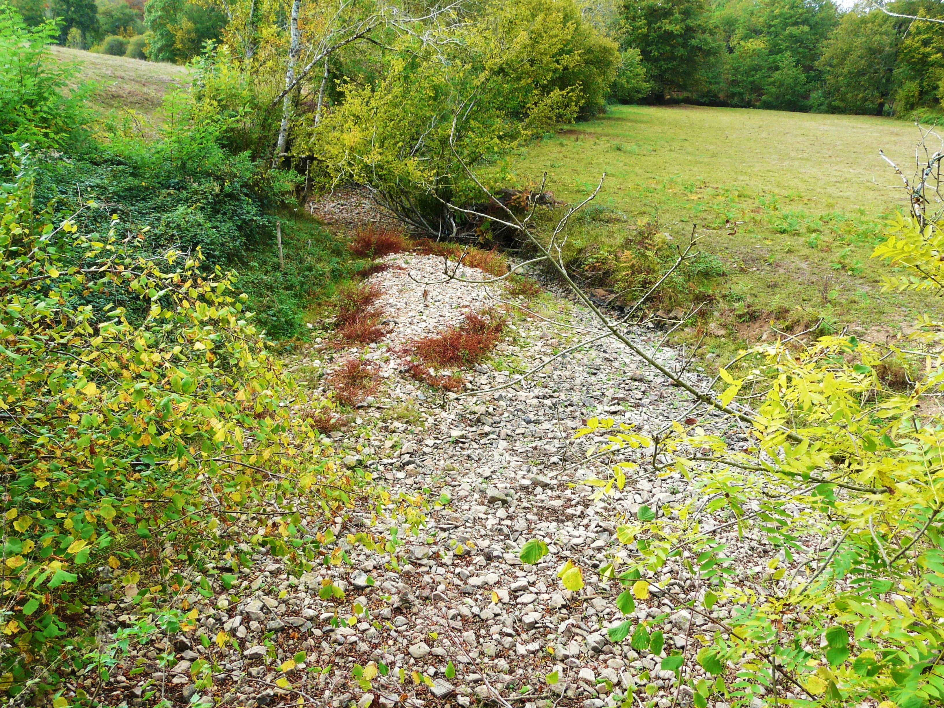
A dry, rocky stream bed winding through a rural landscape with surrounding trees and grassy fields.
The dry bed of the Renaudie stream in Montbron, characteristic of the Val de Tardoire region.

Val de Tardoire history and protected-area timeline

The site history of Val de Tardoire is rooted in two overlapping conservation milestones. In 1998, the 120-hectare Vallée de la Renaudie, then privately coordinated, became the first Voluntary Nature Reserve (Réserve Naturelle Volontaire) in the Charente department, an early French mechanism that allowed landowners to commit formally to conservation management. Its success helped justify the larger surrounding landscape, including its unusual rocky escarpments and fast-flowing river, as a candidate for European protection.

The Natura 2000 designation for the Vallée de la Tardoire itself was then validated on 27 May 1999, covering 3,149 hectares and integrating the Renaudie reserve within its perimeter. Since then, the Renaudie area was reclassified as a Régionale Naturel Reserve under regional authority, reflecting a more durable institutional anchoring within Nouvelle-Aquitaine, while the broader Natura 2000 perimeter continued to function through chartes signed parcel by parcel. These chartes, each binding for five years, link property-tax relief on the non-built land portion to commitments such as avoiding destruction of habitats and species, prohibiting most phytosanitary treatments, respecting recommended seasonal windows for mowing and other works, and granting access to site coordinators for monitoring.

Val de Tardoire landscape and geographic character

The landscape of Val de Tardoire is shaped by the Tardoire river and by the erosional dynamics typical of a watercourse leaving the foothills of the Massif Central. In eastern Charente the valley alternates between confined rocky corridor sections and broader lowland reaches, producing a terrain that combines steep slopes, rocky escarpments, and outcrops that drop sharply toward the river. The altitudinal range of the protected site, from about 108 meters at the valley floor to 213 meters on the highest slopes, is modest but produces strong visual relief along the course of the water.

Around and above this primary river channel, the broader valley geography is unusually varied for a French Natura 2000 site. The mosaic includes wet and mesophile semi-natural grasslands, deciduous and small coniferous woodland, heath and scrubland, scattered orchards, vineyards, and a small share of arable land, punctuated by rocky ledges and scree. A modest but ecologically important share of the surface is water and exposed rock, and the human footprint (roads and small settlements) is limited. The result is a rural, fine-grained valley landscape in which small-scale land cover changes happen often and the river corridor remains visually dominant.

Val de Tardoire ecosystems, habitats, and plant life

The ecological identity of Val de Tardoire rests on the interaction between its hydrology, geology, and traditional land use, which together maintain a habitat mosaic that has become rare in lowland France. The site holds five habitats of community interest. Species-rich lowland hay meadows, classified as a very important habitat on the site, are accompanied by river vegetation of the Ranunculion fluitantis and Callitricho-Batrachion types that colonize the running water, and by siliceous chasmophytic vegetation on its rocky slopes. Completing this ecological backbone are alluvial alder-ash woodlands along the floodplain and unused caves that provide sheltered microhabitats for cave-dependent fauna.

Beyond designated community habitats, the site hosts a wider set of vegetation patterns that reflect its microtopography and land-use history. Semi-natural wet hay meadows remain important for yellow-bellied toad breeding and for marshland butterflies; mesophile grasslands support nectar sources for rarer insects; broadleaf deciduous forest provides structural diversity for bats, saproxylic beetles, and understory plants. Heath and scrub areas, including smaller patches with bracken-type vegetation, support relict and margin species. The valley thus functions as an interconnected ecological system, with the river acting as a central axis linking aquatic, wet meadow, woodland, and rocky slope communities into a single working landscape.

Val de Tardoire wildlife and species highlights

Val de Tardoire supports a remarkably broad community-interest fauna. The site is most strongly associated with bat populations: the lesser horseshoe bat, the greater horseshoe bat, Schreibers' bat, and the greater mouse-eared bat are resident species of community interest, with the horseshoe species additionally reinforced by winter migrants. These bats roost in forest cavities, old buildings, and notably in the valley's unused caves, which form a quieter but ecologically central element of the site.

Aquatic and semi-aquatic wildlife are equally significant. The yellow-bellied toad, listed as vulnerable at both global and French metropolitan levels, has documented breeding stations in the valley and is the focus of targeted population monitoring. The river itself shelters Planer's lamprey and the bullhead, both protected fish species associated with clean, well-oxygenated gravelly streams. Saproxylic beetles such as the stag beetle and the great capricorn beetle are well established in the site's mature broadleaf trees, and the dragonflies Oxygastra curtisii (vulnerable) and Coenagrion mercuriale (near threatened) use the watercourses and margins.

In addition, several non-community-interest species confirm the valley's broader biodiversity value. The white-throated dipper inhabits the rapids as a typical torrent bird. Reptiles including the green-and-yellow whip snake, the common wall lizard, and the western green lizard are present. Amphibians such as the common tree frog, agile frog, midwife toad, natterjack toad, and marbled newt complement the yellow-bellied toad within healthy breeding networks. Mammals include the genet, a nocturnal carnivore rarely recorded this far north in France. The butterfly fauna is anchored by the Camberwell beauty, Nymphalis antiopa, in very strong national regression and considered a determining species for Poitou-Charente, found within the Charente department essentially only in this sector.

Val de Tardoire conservation status and protection priorities

Val de Tardoire is protected primarily through the European Natura 2000 network as a Site of Community Importance and Special Area of Conservation under the Habitats Directive. Its conservation value lies in the persistence of lowland hay meadows, alluvial forests, siliceous rocky vegetation, and river communities that have largely disappeared elsewhere in intensively farmed parts of western France. The site's cave systems also make it an important refuge for cave-dwelling bats. Validation of the 3,149-hectare perimeter in 1999 created a long-term framework within which habitat and species monitoring, including targeted study of yellow-bellied toad populations, can be carried out across multiple administrative cycles.

Management is built on voluntary engagement with landowners and public partners. Approximately 29 percent of the site is in public ownership (Charente departmental council and Communauté de communes Seuil Charente-Périgord), while the rest remains privately held. Through five-year Natura 2000 chartes signed parcel by parcel, individual owners commit to avoid destruction of habitats and species, to forgo most phytosanitary treatments, to respect seasonal windows for mowing and other interventions, and to grant site coordinators access for monitoring. In return, owners benefit from an exemption of the communal portion of the tax on non-built land. The Renaudie Reserve, in turn, anchors local conservation work and provides the departure point for three marked discovery trails with interpretation panels, supported by a booklet available at the Montbron tourist office.

Val de Tardoire cultural meaning and human context

The Renaudie Valley within Val de Tardoire is notable for having been the Charente's first Voluntary Nature Reserve in 1998, a step that signaled local engagement with formal conservation earlier than in many neighboring areas. This pioneering status continues to shape how the valley is perceived locally, combining traditional rural land use (hay meadows, mixed woodland, small orchards and vineyards) with active biodiversity monitoring. The site's location near Montbron, on the edge of the Massif Central, also places it within the broader Horte and Tardoire natural region, whose identity has historically been tied to this river corridor and to the small market towns that depend on it.

Top sights and standout views in Val de Tardoire

Among the most distinctive elements of Val de Tardoire are the siliceous rock escarpments and fast-flowing Tardoire river that anchor its geomorphological significance, and the resulting concentration of community-interest habitats along a relatively compact valley. The site stands out for its combined bat richness, with multiple resident horseshoe and mouse-eared bat species using caves, woodland, and rural buildings, and for the valley's role as one of the last refuges of the yellow-bellied toad in the area. Equally notable are the Planer lamprey and bullhead populations in the clean upper river sections, the presence of protected saproxylic beetles in mature broadleaf trees, and the persistence of rare dragonflies and butterflies, including the vulnerable Oxygastra curtisii and the nationally regressive Camberwell beauty, that depend on a working mosaic of wet meadows, woodland, and rocky habitats.

Best time to visit Val de Tardoire

The valley's character varies with the agricultural and ecological calendar more than with fast-changing tourist seasons. Late spring and early summer are typically when species-rich hay meadows reach peak botanical interest and when many butterflies, dragonflies, and amphibians are most active, while late summer and early autumn can be the period when rivers are lowest and rocky habitats most visible. The discovery trails departing from the Renaudie reserve parking area are accessible year-round, although access conditions and trail comfort depend on weather. Visitors interested in bat colonies and breeding amphibians generally benefit from milder evenings, while winter can be quieter but offers a clearer view of valley geomorphology and woodland structure.
Monthly climate preview

Long-term monthly temperature averages and precipitation records for Charente

Val de Tardoire Climate Normals, Annual Temperature and Precipitation Rhythm

Representative coordinate records show monthly mean temperatures shifting between four degrees Celsius and over twenty-one degrees Celsius alongside consistent precipitation rates throughout the year. Reviewing the complete twelve-month climate profile provides detailed historical baseline data for temperature ranges and daily precipitation patterns.
Annual mean12 °C
4 °C21 °C
Jan
Feb
Mar
Apr10°
May15°
Jun18°
Jul21°
Aug21°
Sep17°
Oct13°
Nov
Dec
Warmest month
August

21.3 °C

Coolest month
January

4 °C

Wettest month
November

3 mm/day

Driest month
July

1.7 mm/day

Park location guide

Geography guide, regional context, and park location map for Val de Tardoire

Val de Tardoire park geography, regions, and map view in France

Understand where Val de Tardoire sits in France through a broader geographic reading of the surrounding landscape, nearby location context, and its mapped position within the national park landscape.

How Val de Tardoire fits into France

France is a unitary semi-presidential republic and one of the world's largest economies. It borders Belgium, Luxembourg, Germany, Switzerland, Italy, Monaco, Andorra, and Spain, with a maritime border to the United Kingdom. The country is known for its cultural influence, art, cuisine, and political history spanning centuries.

Wider geography shaping Val de Tardoire in France

France is located in Western Europe. Metropolitan France extends from the Rhine to the Atlantic Ocean and from the Mediterranean Sea to the English Channel and North Sea. The country borders Belgium, Luxembourg, Germany, Switzerland, Italy, Monaco, Andorra, Spain, and has a maritime border with the United Kingdom.

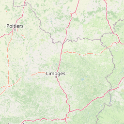
Map view of Val de Tardoire

Use this park location map to pinpoint Val de Tardoire in France, understand its exact geographic position, and read its mapped placement within the surrounding landscape more clearly.

Pigeon | © OpenStreetMap contributors

Location context for Val de Tardoire

CharenteNouvelle-Aquitaine
Recorded earthquake history

View the Val de Tardoire Earthquake History and Historical Seismic Records

Examine the documented seismic activity associated with the Val de Tardoire valley landscape. This MoriAtlas catalogue organizes historical earthquake records to provide a clearer understanding of regional seismic history through accessible data on magnitudes, event dates, and epicentre proximity.

Val de Tardoire Earthquake History

Catalogued events

7 events

Strongest magnitude

Magnitude 4.1

Most recent event

Jan 31, 2005

This history includes earthquakes recorded inside the park or within 50 km of its borders

Explore detailed imagery of rocky escarpments, watercourses, and diverse valley habitats.

Val de Tardoire Photos and Landscape Scenery: Visualizing the Protected River Valley

Visual records reveal the complex terrain, fast-flowing river channels, and distinct geological formations defining the protected natural environment. Detailed photography helps researchers analyze the mosaic of wet meadows, broadleaf woodlands, and river ecosystems across the valley.

A dry, rocky stream bed winding through a rural landscape with surrounding trees and grassy fields.

Park atlas

Discover other protected areas and river valley reserves across the surrounding region

Parks Near Val de Tardoire and Related Protected Landscapes to Compare

Browsing other protected areas near Val de Tardoire reveals a broader spectrum of river valleys, rocky escarpments, and lowland habitats. Comparing adjacent reserves expands geographical context and highlights connected ecological corridors throughout the region.
Nature reserveNouvelle-Aquitaine
Mapped location lies within the park boundary#1 closest

North

Réserve naturelle régionale de la vallée de la Renaudie Protected Landscape and Map Atlas

A geological crossroads in the heart of Nouvelle-Aquitaine.

Trace the 6 kilometer stretch of the Réserve naturelle régionale de la vallée de la Renaudie. This protected area showcases an unusual geological interface between limestone and granite, creating a compact mosaic of riparian woodland, dry rocky cliffs, and meadows that support significant regional biodiversity.

Area
0.73 km²
Established
2012
IUCN
IV
Relief
Mixed relief
Nature reserveNouvelle-Aquitaine
18 km away#2 closest

Southwest

Vallée de la Nizonne Nature Reserve: Mapped Geography and Protected Wetland Landscapes

A critical river corridor and Natura 2000 conservation zone in Nouvelle-Aquitaine.

Discover the geographic structure of the Vallée de la Nizonne, a protected area shaped by the flow of the Nizonne and Lizonne rivers. This landscape mosaic features peatlands, wet meadows, and alluvial forests that serve as a refuge for rare species. Gain insight into the regional terrain and conservation boundaries that define this important French wetland corridor.

Area
33.91 km²
Established
2016
Relief
Upland
Climate
Temperate
Protected areaNouvelle-Aquitaine
31 km away#3 closest

Southwest

Vallée de la Tude Protected Area: Regional Geography and Alluvial Landscape Map

Exploring the river valley networks of Nouvelle-Aquitaine

The Vallée de la Tude is a significant protected area located in the Charente department of southwestern France. This site features a series of wet meadows, lowland brooks, and woodland fragments that form an essential ecological network. Our atlas entry provides a detailed look at the geographic distribution and landscape composition of this unique alluvial valley.

Area
15.57 km²
Established
2006
Relief
Upland
Climate
Temperate
Nature reserveNouvelle-Aquitaine
About 32 km away#4 closest

East

Réserve naturelle régionale du réseau de landes atlantiques du Parc naturel régional Périgord-Limousin

A networked regional nature reserve in Nouvelle-Aquitaine.

This protected area serves as a critical network of Atlantic heathland sites embedded within the larger Périgord-Limousin Regional Natural Park. By conserving these scattered clearings of acidic soil and low vegetation, the reserve maintains a distinct biogeographic feature far from the French coast, offering a clear view into how regional authorities manage fragmented open habitats in the Haute-Vienne.

Area
0.409 km²
Established
2015
IUCN
IV
Scope
Terrestrial
Nature reserveNouvelle-Aquitaine
55 km away#5 closest

West

Vallée de l'Antenne: A Protected River Valley and Alluvial Landscape in Nouvelle-Aquitaine

Mapping riparian ecosystems and rare wetland habitats

Trace the course of the Antenne river as it meanders through a finely textured mosaic of ash and alder forests, poplar plantations, and floodplains. As a designated Natura 2000 site, this nature reserve acts as a critical refuge for biodiversity in western France, offering a textbook example of a low-energy river system that descends gently through the landscape of the Charente departments.

Area
12.08 km²
Established
1999
Relief
Lowland
Climate
Mediterranean
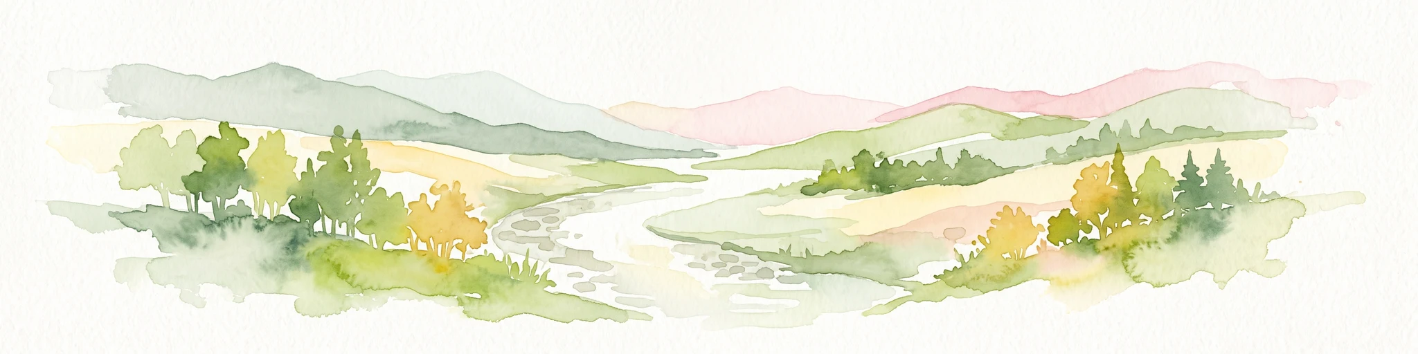
A soft watercolor painting of a wide, gently rolling landscape with green fields, forested hills in the distance, and native vegetation in the foreground.
Nature reserveHaute-Vienne
About 66 km away#6 closest

East

Lande de la Flotte et du Cluzeau: Geological Landscapes of Haute-Vienne, France

Nature reserve featuring rare serpentinite heathland habitats

Lande de la Flotte et du Cluzeau preserves a rare type of serpentine heathland on the Limousin plateau. By protecting stony outcrops that contrast with the local forest and farmland, this reserve maintains a significant botanical environment within Haute-Vienne, reflecting the complex metamorphic history of the region.

Area
132 km²
Established
1993
IUCN
IV
A soft watercolor painting of a natural landscape showing rolling green hills, a distant purple mountain range, and a calm body of water reflecting the light, with green foliage on the right bank.
Nature reserveNouvelle-Aquitaine
About 71 km away#7 closest

Northeast

Réserve naturelle régionale des Sauvages: Protected Landscape and Regional Geography

Mapped Habitat Mosaic in the Haute-Vienne of Nouvelle-Aquitaine

Discover the geographic composition of Réserve naturelle régionale des Sauvages, a protected nature reserve in France that integrates diverse habitats including heather-dominated moorland, peatland, beech forest, and historical ponds. This site serves as a key component of the regional conservation landscape within the Haute-Vienne.

Area
0.826 km²
Established
2015
IUCN
IV
Relief
Upland
Wildlife reserveNouvelle-Aquitaine
About 100 km away#8 closest

Southwest

Terres d'oiseaux Wildlife Reserve: Protected Estuarine Landscape in Nouvelle-Aquitaine

Migratory bird habitat and Gironde estuary geography

Terres d'oiseaux is a significant wildlife reserve positioned within the Blayais marshes of Nouvelle-Aquitaine. The site encompasses a diverse mosaic of estuarine wetlands, including reedbeds and open water, providing critical stopover habitat for migratory birds along the Atlantic flyway. Its geography represents a blend of tidal interaction and controlled natural management, essential for regional avian monitoring and ecological studies.

Area
1.2 km²
Established
2010
IUCN
IV
Relief
Lowland

Common questions about visiting, size, designation, and location context for Val de Tardoire

Val de Tardoire FAQs for park facts, access, geography, and protected area context

Find quick answers about Val de Tardoire, including protected-area facts, park geography, trail and visitor context, and how the park fits into its surrounding country and regional landscape.
MoriAtlas Explorer

Continue Your Protected Areas Search Across the Global Atlas

Deepen your exploration by continuing the structured search for national parks and protected areas worldwide. Utilize the comprehensive filtering capabilities to compare different conservation landscapes and refine your understanding of global park geography. Discover more about the distribution and characteristics of protected natural areas.

Global natural geography