
Mori Atlas logo
Nature reserveVallée de la Nizonne

Mapping the ecological mosaic of alkaline marshes, peatlands, and riparian corridors in southwestern France.

Vallée de la Nizonne Protected Area: Geographic Overview of the Nizonne River Valley in Nouvelle-Aquitaine

Vallée de la Nizonne represents a vital conservation landscape spanning the Dordogne and Charente departments of Nouvelle-Aquitaine. This protected river valley forms a continuous axis of biodiversity, defined by its rare alkaline low marshes, extensive wet meadows, and intact deciduous woodlands. The area functions as a key alluvial corridor for threatened European species, maintaining a delicate hydrological balance from the Nizonne river source to its confluence with the Dronne.

Natura 2000Special Area of Conservationriver valleywet meadowsalkaline marshesCladium
Digital vector-style illustration of a scenic valley featuring a winding river, towering cliffs, and a waterfall cascading down the rock face, surrounded by trees.

Vallée de la Nizonne

Nature reserve

Park overview

Structured park overview, official facts, and landscape profile for Vallée de la Nizonne

Vallée de la Nizonne park facts, protected area profile, and essential visitor context

Review the core facts for Vallée de la Nizonne, including designation, size, terrain, visitor scale, habitats, and operating context in one park-focused overview.

About Vallée de la Nizonne

Vallée de la Nizonne is a Natura 2000 protected site in southwestern France that follows the course of a small river through a rural, lightly developed landscape. Recognized by a ministerial order of 4 April 2016, it functions as a Special Area of Conservation under the European Union Habitats Directive, and its boundaries are designed to preserve a continuous corridor of natural and semi-natural habitats along the river.

The site covers about 3,391 hectares spread across 19 communes, with additional territory coming from six former communes that were merged into the new commune of Mareuil en Périgord in 2017. About two-thirds of the area lies in the Dordogne department, and roughly one-third extends into the neighboring Charente department. A portion of the site overlaps with the Parc naturel régional Périgord-Limousin, which provides an additional framework of regional landscape management and protection.

The valley is centered on the Nizonne river, also called the Lizonne, which the site follows entirely from its source to its confluence with the Dronne. Two tributaries, the Belle and the Pude, contribute to the habitat mosaic in their lower courses, broadening the riparian influence and supporting diverse wetland communities. Elevations across the site range gently between roughly 50 and 200 meters, giving the valley a calm, low-relief character rather than dramatic relief.

Land use within the site reflects a traditional rural agriculture pattern: extensive cereal farming covers the largest share, while significant areas are given over to wet and mesophile meadows, deciduous woodlands, improved grasslands, and small but ecologically critical patches of marsh, low marsh, and peatland. Together these habitats form a network of open, semi-open, and wooded environments around the river, supporting a wide range of species characteristic of alluvial valleys in western France.

The site's identity as a Natura 2000 area means that its value is primarily measured in ecological and conservation terms rather than as a tourism destination. It exists to maintain habitat integrity, support threatened species populations, and preserve the ecological functions of the river system for the long term.

Quick facts and research context for Vallée de la Nizonne

Vallée de la Nizonne is a Natura 2000 Special Area of Conservation (Zone Spéciale de Conservation) in the Nouvelle-Aquitaine region of France. It was formally validated by a ministerial order from the French Ministry of the Environment on 4 April 2016.

The site covers a total surface area of approximately 3,391 hectares, distributed across 19 communes plus several former communes now merged into Mareuil en Périgord. About 68 percent of the site lies in the Dordogne department and 32 percent in the Charente department, with roughly 31 percent of the territory falling inside the Parc naturel régional Périgord-Limousin.

The protected area spans elevations from about 50 to 200 meters and encompasses the full course of the Nizonne (Lizonne) river along with the lower reaches of two tributaries, the Belle and the Pude. Its land cover is dominated by extensive cereal crops, semi-natural wet and mesophile meadows, broadleaf deciduous forest, improved grasslands, and notable areas of marsh, low marsh, and peatland.

Protection and recognition

Documented terrestrial protection scope, designation history, and Natura 2000 recognition.

Vallée de la Nizonne Protection Status and Official Designation Record

Vallée de la Nizonne maintains a documented terrestrial protection scope established in 2016 alongside official Natura 2000 recognition sources. Structured protection facts compile designated status records and international framework listings for analytical evaluation.

International recognition

Protection details

Protection scope
Terrestrial
Designated year
2016
Transboundary protection
No
Park context

Deeper park guide and search-rich context for Vallée de la Nizonne

Vallée de la Nizonne history, landscape, wildlife, and travel context

Explore Vallée de la Nizonne through its history, landscape character, ecosystems, wildlife, conservation priorities, cultural context, and seasonal travel timing in a structured park guide built for atlas discovery and search intent.

Why Vallée de la Nizonne stands out

Vallée de la Nizonne is best known as the principal area in the former Aquitaine region for alkaline low marshes featuring Cladium, a habitat type that is rare and ecologically valuable across western Europe. The valley's combination of wet meadows, peatlands, and a free-flowing river system makes it a notable stronghold for species associated with intact alluvial landscapes. It is also widely recognized for hosting one of the most important populations of the European mink (Vison d'Europe) in France, an extremely rare and threatened mustelid whose conservation is closely tied to healthy wetland corridors. The diversity of Annex II species recorded here, including dragonflies, bats, fish, and the European pond turtle, reinforces its standing as a key conservation site within the Natura 2000 network.
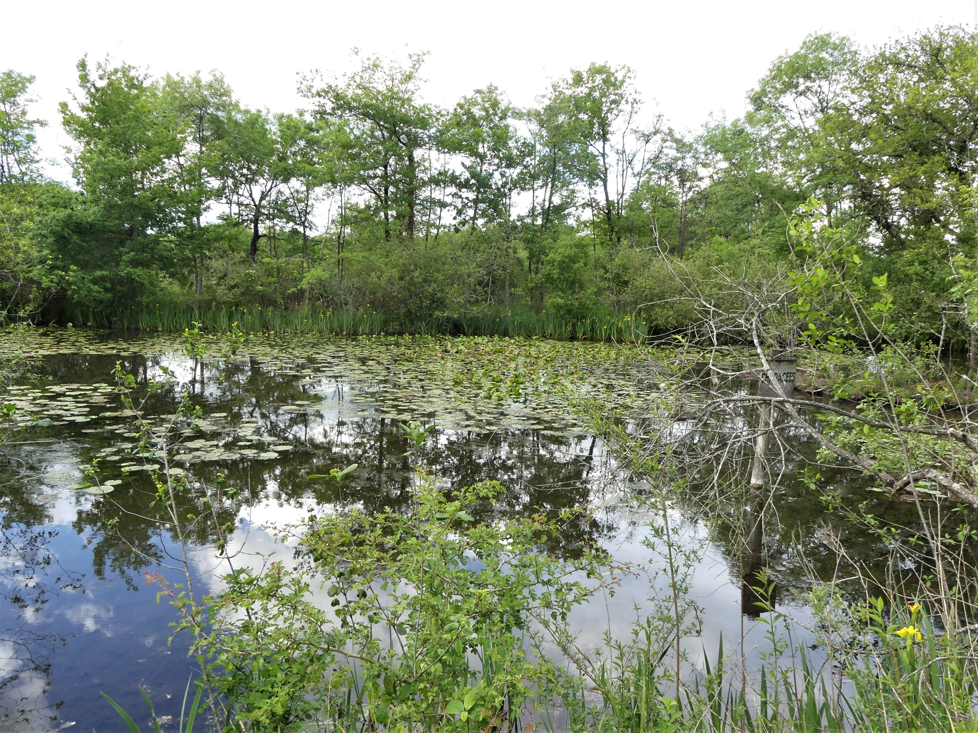
A calm, reflective pond covered in lily pads, framed by dense green trees and marsh vegetation in a wetland environment.
A tranquil pond surrounded by lush vegetation in the peat bogs of Vendoire, within the Vallée de la Nizonne site.

Vallée de la Nizonne history and protected-area timeline

The Vallée de la Nizonne's recognition as a protected site is the result of a formal European and French regulatory process rather than a single dramatic act of establishment. The site was identified during inventories of natural habitats of European importance within the Natura 2000 framework, then proposed and validated as a Zone Spéciale de Conservation.

Its formal designation was confirmed through a ministerial order of the French Ministry of the Environment, Energy, and the Sea dated 4 April 2016. This administrative step consolidated its status within the European Union Natura 2000 network and committed the site to ongoing conservation management under the Habitats Directive.

The territory itself has long been shaped by traditional agriculture and small rural communities, with the river valley serving as both a livelihood and a defining landscape feature for the surrounding communes. Several of the communes that host the site have undergone administrative reorganization, notably with the creation of the new commune of Mareuil en Périgord in 2017, which gathered six previously separate communes into a single municipality.

Vallée de la Nizonne landscape and geographic character

The landscape of Vallée de la Nizonne is defined by a gently sloping alluvial valley at the northern edge of the Dordogne department and the southeastern edge of the Charente. Elevations rise modestly from about 50 meters along the river to roughly 200 meters on the surrounding terrain, producing soft, rolling relief rather than steep or dramatic features.

The hydrological backbone of the site is the Nizonne river, also known locally as the Lizonne, which the protected area follows in its entirety from the river's source to its junction with the Dronne. Two tributaries broaden this riverine setting: the Belle contributes its final five kilometers, and the Pude its last four kilometers, weaving additional wetland margins into the broader valley system.

A defining landscape element is the presence of meadows, marshes, low marshes, and peatlands along the floodplain. The site is recognized as the principal alkaline low-marsh area with Cladium in the former Aquitaine region, a habitat that gives the valley a distinctive ecological texture. Deciduous woodlands line parts of the river, while extensive cereal fields occupy the drier slopes and plateaus around the wetter core. Small ponds and channels, such as the étangs of Vendoire and the Canal des Moulins at Salles-Lavalette, add further structural variety to the mosaic.
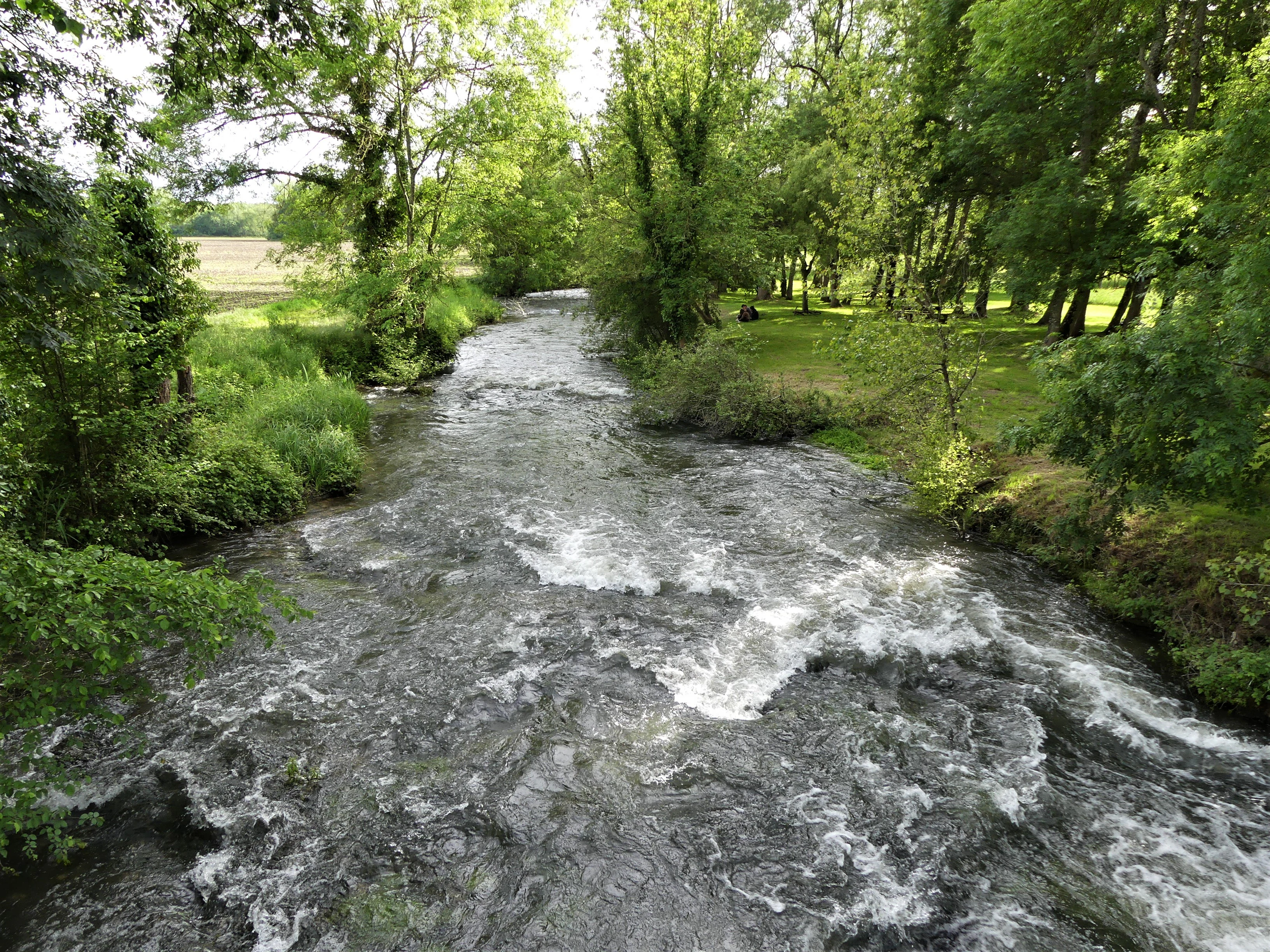
A rushing river flows downstream through a lush, green woodland area in France.
The Lizonne River viewed downstream from the bridge connecting Vendoire and Gurat.

Vallée de la Nizonne ecosystems, habitats, and plant life

Vallée de la Nizonne encompasses a mosaic of habitats characteristic of lowland river valleys in southwestern France. Alluvial meadows and other semi-natural wet grasslands form the most ecologically distinctive layer, complemented by small but important areas of marsh, low marsh, and peatland. These wet habitats are framed by broadleaf deciduous forest along the riverbanks and bordered by improved grasslands and extensive cereal cultivation on the better-drained land.

The site is especially notable for its alkaline low marshes, particularly those dominated by Cladium, a sedge-rich wetland type that has become scarce across much of western Europe. The combination of running fresh water, peat-forming ground, and traditional meadow management helps maintain the hydrological and chemical conditions on which these specialized habitats depend.

At the landscape scale, the site functions as an interconnected ecological corridor. The river and its tributaries provide continuous habitat along the valley axis, while the surrounding meadows, forests, and cultivation create transitions that support species with very different requirements. This structural complexity is central to the site's ability to host a relatively rich community of rare and threatened species within a constrained area.
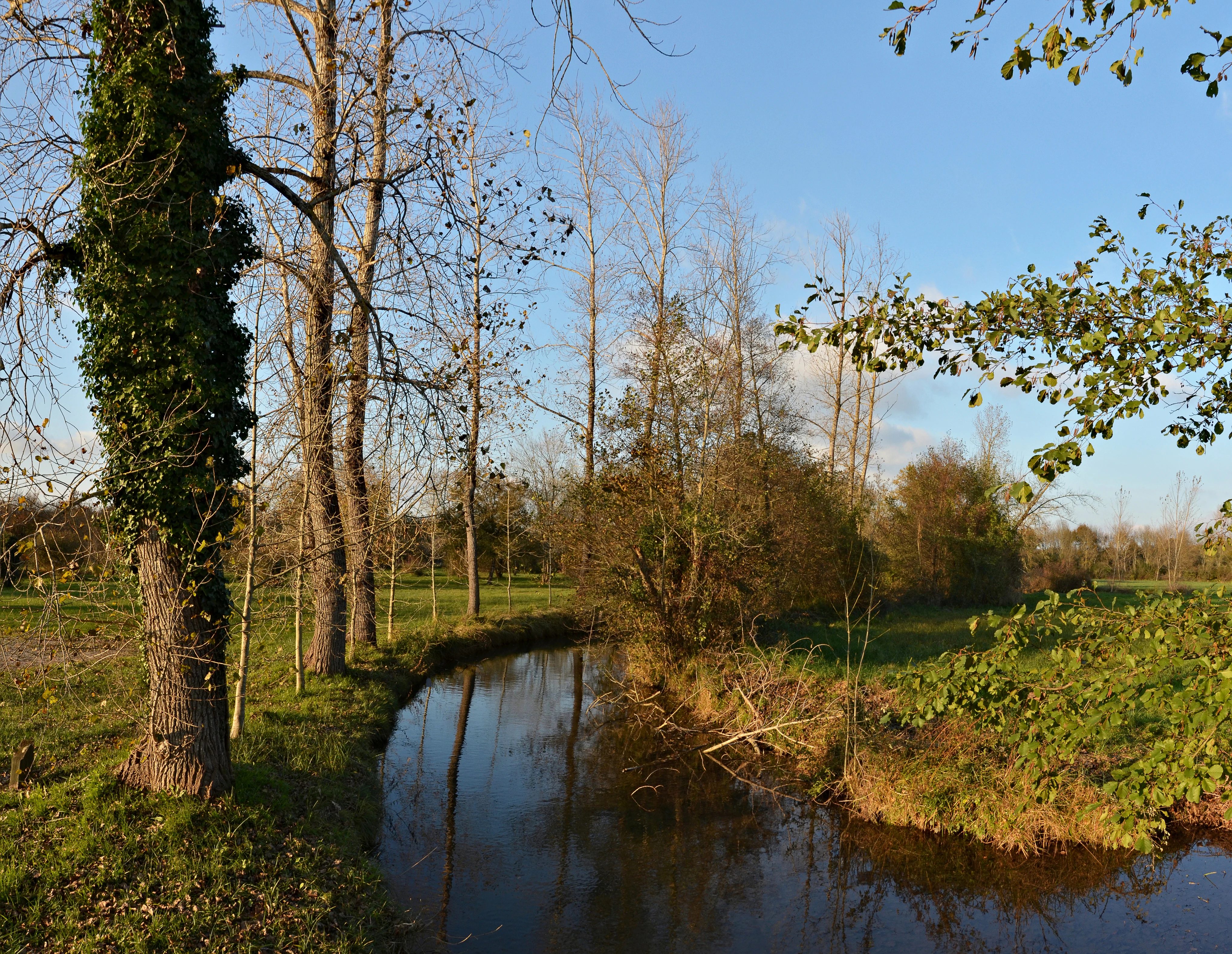
A small, calm river flows through a grassy meadow bordered by tall trees with some ivy-covered trunks.
The Lizonne river winding through the landscape at the Vendoire site.

Vallée de la Nizonne wildlife and species highlights

The wildlife of Vallée de la Nizonne is among its most distinguishing features, with twenty animal species listed under Annex II of the European Union Habitats Directive recorded on the site. This includes seven insect species, ten mammal species, two fish species, and one reptile species, reflecting the diversity of habitats within the valley.

The site is particularly important for the European mink (Mustela lutreola), one of the most threatened mammals in Europe and a species whose presence is closely tied to the integrity of river and wetland systems. The European otter (Lutra lutra) is also recorded here, reinforcing the valley's significance for riparian carnivores. In addition, eight bat species are listed, including Bechstein's bat, the greater mouse-eared bat, the greater horseshoe bat, Geoffroy's bat, the lesser horseshoe bat, the Mediterranean horseshoe bat, Schreiber's bent-winged bat, and the western barbastelle, indicating strong woodland and roosting resources.

The insects include several rare dragonflies and butterflies tied to wet meadows and clean water, such as the Mercury dragonfly (Coenagrion mercuriale), the dusky large blue (Phengaris teleius), the orange-spotted emerald (Oxygastra curtisii), the large copper (Lycaena dispar), the marsh fritillary (Euphydryas aurinia), the false ringlet (Coenonympha oedippus), and the yellow clubtail (Gomphus graslinii). In the rivers themselves, the bullhead (Cottus perifretum) and the European brook lamprey (Lampetra planeri) inhabit the cleaner stretches of the Nizonne and its tributaries. The European pond turtle (Emys orbicularis) represents the reptile fauna, completing a community shaped by the interplay of water, meadow, and woodland.
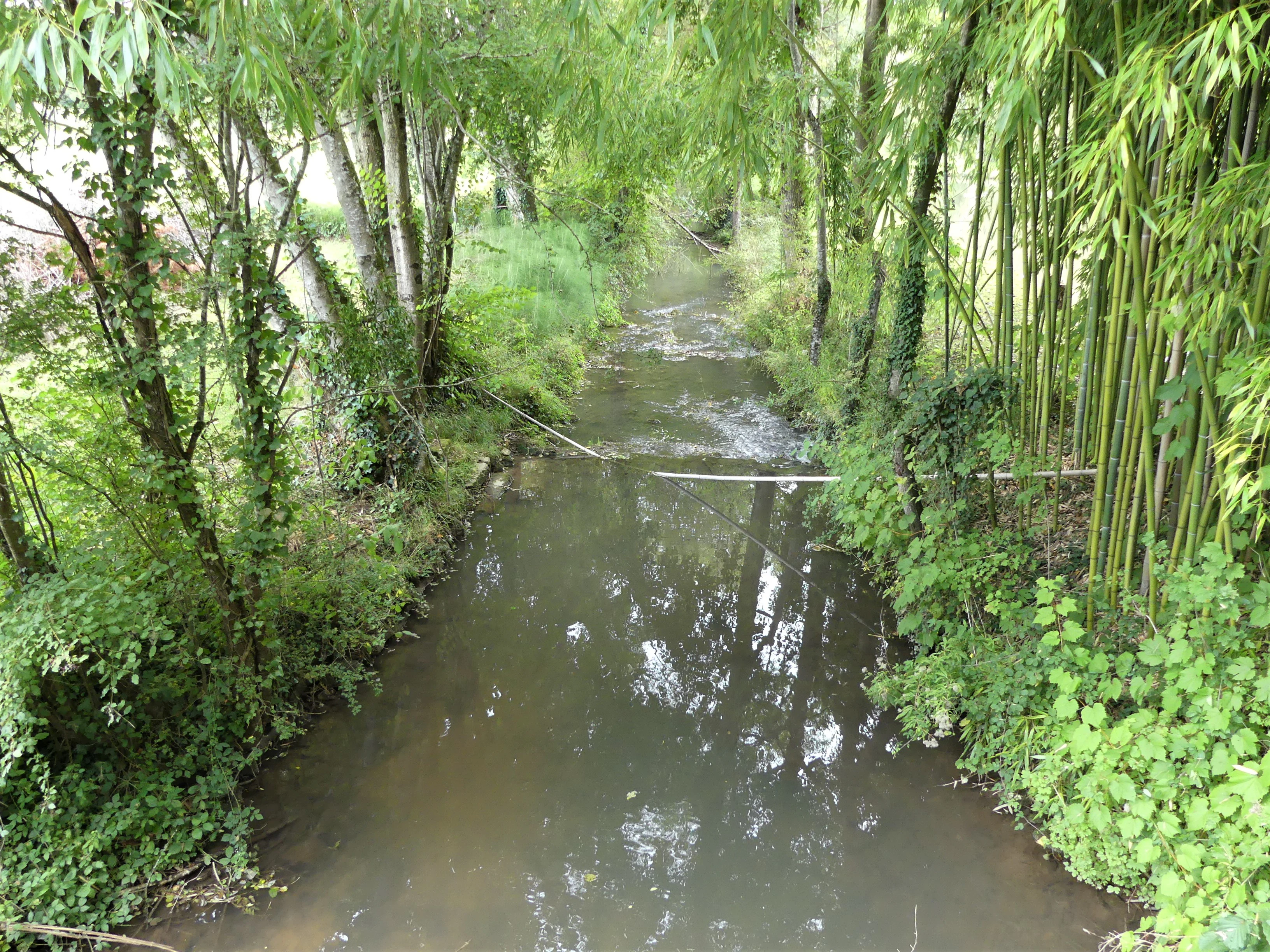
A view of the Nizonne River framed by lush green trees and bamboo on both banks, looking downstream from a bridge.
The Nizonne River flowing under the D99 road bridge.

Vallée de la Nizonne conservation status and protection priorities

Vallée de la Nizonne is a designated Special Area of Conservation within the European Natura 2000 network, meaning that its primary purpose is to protect habitats and species of European importance under the Habitats Directive. Its designation reflects the presence of multiple Annex II species and habitat types that are considered priorities for conservation across the European Union.

The site's particular conservation significance lies in its alkaline low marshes with Cladium, a habitat type for which the valley is recognized as the principal area in the former Aquitaine region. Together with peatlands, wet meadows, and the free-flowing Nizonne river, these habitats support rare and declining species such as the European mink, the European otter, and a suite of wetland-dependent insects, fish, and bats.

Its overlap with the Parc naturel régional Périgord-Limousin, covering roughly 31 percent of the site, adds a complementary layer of regional landscape management. The conservation value of the area therefore depends not only on formal Natura 2000 protections but also on the surrounding rural land use patterns, traditional meadow management, and the ecological functionality of the river system that continues to shape life across the valley.

Vallée de la Nizonne cultural meaning and human context

The cultural context of Vallée de la Nizonne is tied to the traditional rural and agricultural life of the northern Dordogne and southeastern Charente. The site's territory is shared across many small communes, and the landscape reflects long-standing patterns of mixed farming, meadow management, and small-scale river-based economies that have shaped the valley for generations.

The administrative history of the region is also visible in the site's geography. The 2017 creation of the new commune of Mareuil en Périgord, which absorbed six former communes within the protected area, illustrates the broader French trend of municipal consolidation in low-density rural areas. While not a focus of the site's ecological mission, this human settlement pattern is an integral part of the context within which conservation efforts operate, linking the preservation of habitats to the continued presence of traditional land uses and rural communities in the valley.
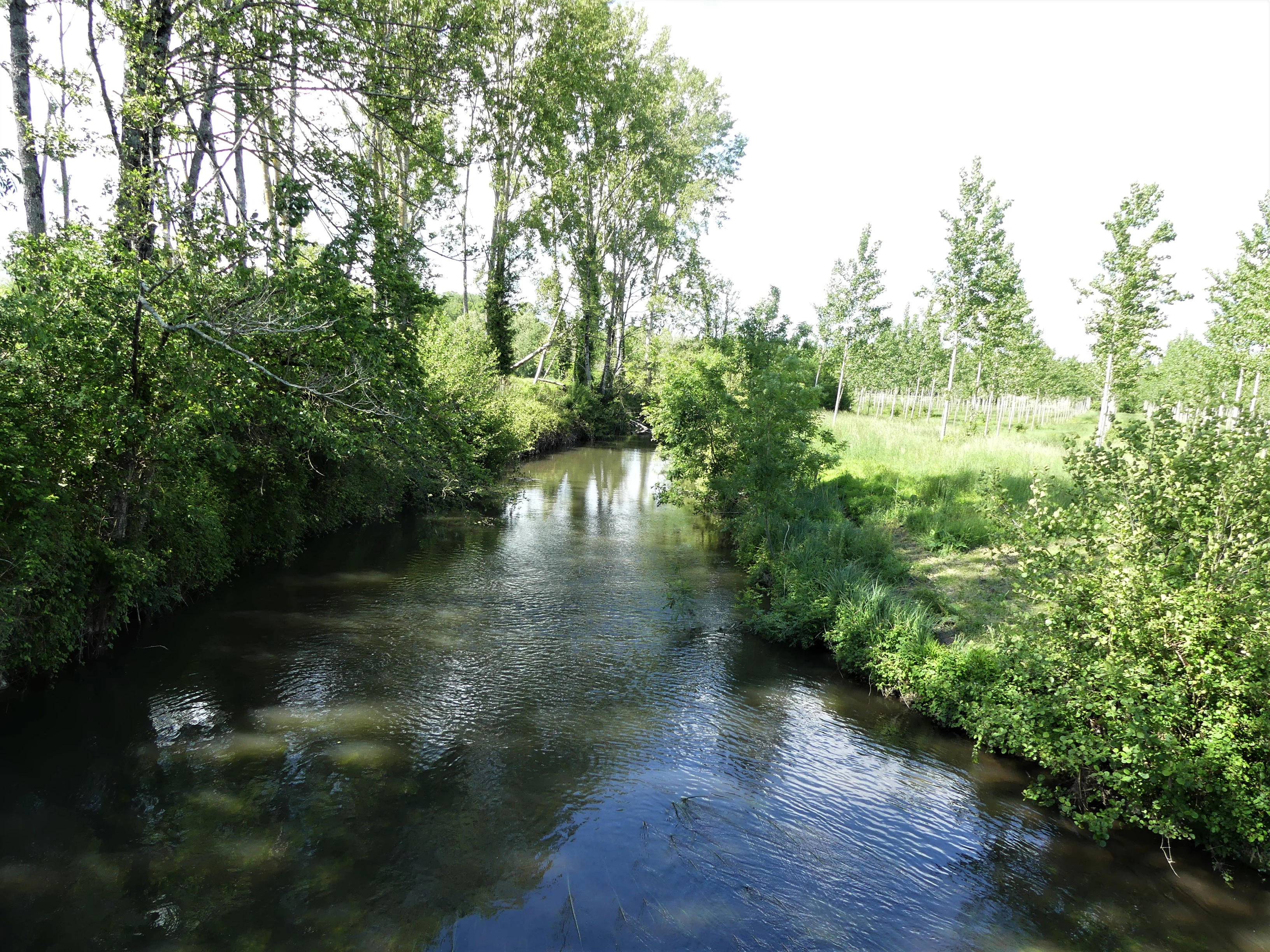
A calm river flowing through a lush, green riparian forest in the French countryside.
The Lizonne River flowing through the wetlands of the Vallée de la Nizonne.

Top sights and standout views in Vallée de la Nizonne

Vallée de la Nizonne stands out for the exceptional concentration of rare species within a relatively compact and clearly defined river valley. Its status as a Special Area of Conservation since 2016 underscores its role as a reference site for the conservation of European mink and other Annex II species in southwestern France.

The valley's mosaic of alkaline low marshes, peatlands, wet meadows, deciduous forests, and cereal cultivation gives it both ecological richness and visual variety. The full course of the Nizonne (Lizonne), supplemented by the lower Belle and Pude, provides a continuous axis of natural habitat across a quiet, rural landscape largely undisturbed by large-scale development.
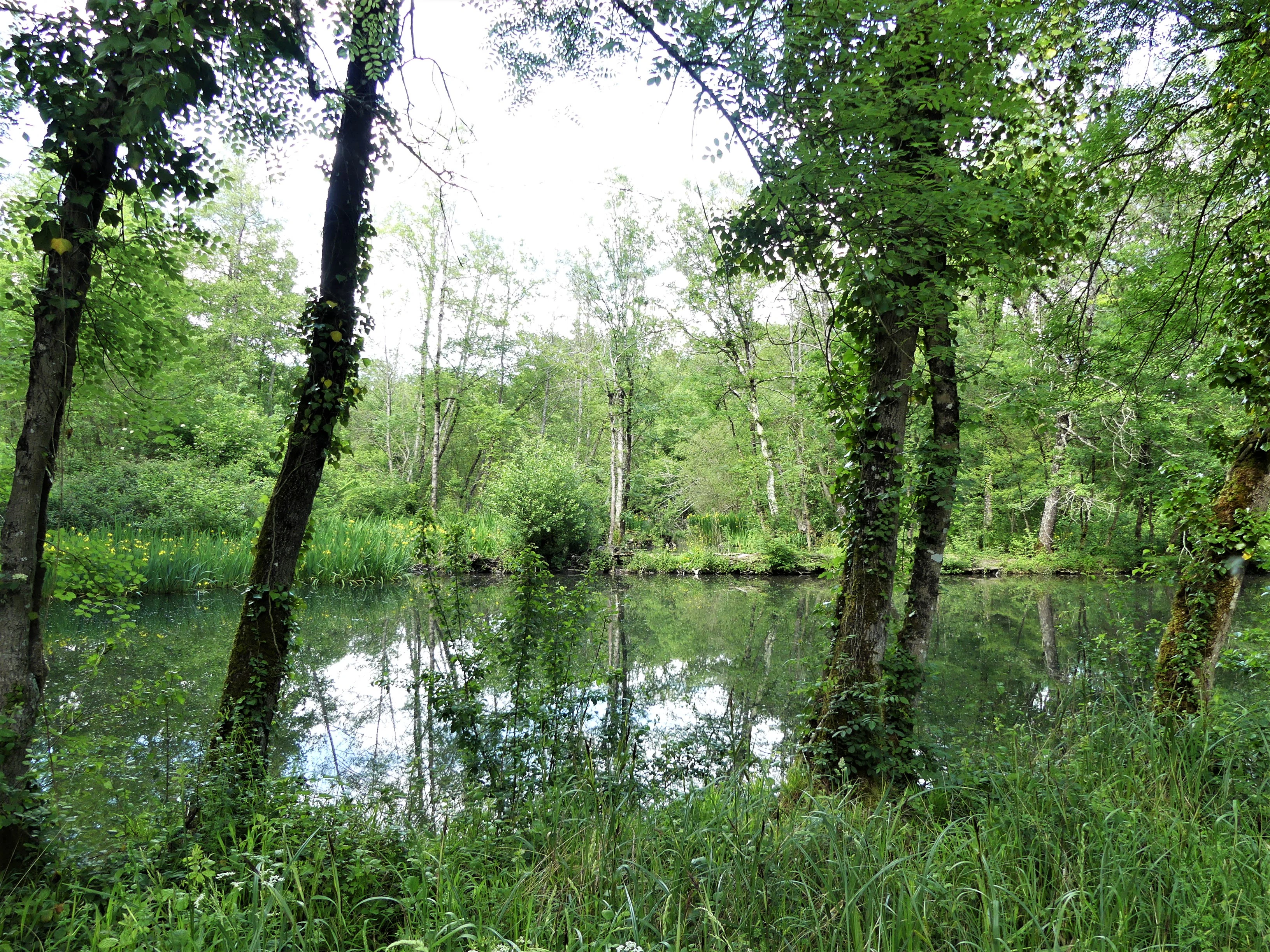
A calm, reflective pond surrounded by dense green deciduous forest and wetland vegetation.
A tranquil wetland area in the Vallée de la Nizonne.

Best time to visit Vallée de la Nizonne

Vallée de la Nizonne is a conservation-focused site rather than a tourism destination, and its climate follows the temperate, oceanic-influenced patterns of southwestern France. Spring and early summer tend to be the most active periods for observing wetland flora and many of the rare insects recorded on the site, including dragonflies and butterflies, when meadows are in growth and aquatic habitats are full.

Late spring through early summer is generally a rewarding period for appreciating the wet meadows in flower, including species such as the snake's head fritillary. Autumn can provide quieter, milder conditions for walking the rural landscape and observing seasonal changes in the deciduous woodlands and river habitat. As with most rural Natura 2000 sites, visiting outside peak agricultural activity and during stable weather generally offers the best experience of the valley's natural character.
Monthly climate preview

Long-term annual temperature and precipitation cycles across twelve recorded months

Vallee de la Nizonne Climate Normals and Measured Temperature Patterns

Vallee de la Nizonne records measured monthly mean temperatures spanning from four degrees Celsius in January to over twenty-one degrees Celsius in August alongside consistent daily precipitation. Examining the complete twelve-month climatology profile reveals detailed thermal ranges and multi-year meteorological baselines for this representative coordinate.
Annual mean12 °C
4 °C21 °C
Jan
Feb
Mar
Apr10°
May15°
Jun18°
Jul21°
Aug21°
Sep17°
Oct13°
Nov
Dec
Warmest month
August

21.3 °C

Coolest month
January

4 °C

Wettest month
November

3 mm/day

Driest month
July

1.7 mm/day

Park location guide

Geography guide, regional context, and park location map for Vallée de la Nizonne

Vallée de la Nizonne park geography, regions, and map view in France

Understand where Vallée de la Nizonne sits in France through a broader geographic reading of the surrounding landscape, nearby location context, and its mapped position within the national park landscape.

How Vallée de la Nizonne fits into France

France is a unitary semi-presidential republic and one of the world's largest economies. It borders Belgium, Luxembourg, Germany, Switzerland, Italy, Monaco, Andorra, and Spain, with a maritime border to the United Kingdom. The country is known for its cultural influence, art, cuisine, and political history spanning centuries.

Wider geography shaping Vallée de la Nizonne in France

France is located in Western Europe. Metropolitan France extends from the Rhine to the Atlantic Ocean and from the Mediterranean Sea to the English Channel and North Sea. The country borders Belgium, Luxembourg, Germany, Switzerland, Italy, Monaco, Andorra, Spain, and has a maritime border with the United Kingdom.

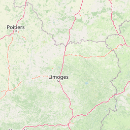
Map view of Vallée de la Nizonne

Use this park location map to pinpoint Vallée de la Nizonne in France, understand its exact geographic position, and read its mapped placement within the surrounding landscape more clearly.

Pigeon | © OpenStreetMap contributors

Location context for Vallée de la Nizonne

Nouvelle-Aquitaine
Recorded earthquake history

Browse the Historical Earthquake Records for Vallée de la Nizonne

Access a detailed catalogue of recorded seismic events associated with the Vallée de la Nizonne. This MoriAtlas resource tracks historical earthquake data by date, depth, and epicentre location, providing a transparent view into the recorded seismic landscape of this region.

Vallée de la Nizonne Earthquake History

Catalogued events

9 events

Strongest magnitude

Magnitude 4.5

Most recent event

Apr 6, 2019

This history includes earthquakes recorded inside the park or within 50 km of its borders

Visual reference guide to wet meadows, alkaline marshes, and alluvial habitats across the valley

Vallée de la Nizonne Photos, Scenery, and Protected River Landscapes

Photographic records capture the soft rolling terrain, river channels, and diverse wetland habitats that define the protected landscape of Vallée de la Nizonne. Visual documentation reveals the ecological texture of wet meadows, peatlands, and deciduous woodlands supporting rare European species.

A calm, reflective pond covered in lily pads, framed by dense green trees and marsh vegetation in a wetland environment.

A calm, reflective pond surrounded by lush green trees and vegetation under a sky with scattered white clouds.

A rushing river flows downstream through a lush, green woodland area in France.

A small, calm river flows through a grassy meadow bordered by tall trees with some ivy-covered trunks.

A view of the Nizonne River framed by lush green trees and bamboo on both banks, looking downstream from a bridge.

A view looking downstream of a narrow, rocky section of the Nizonne river, flanked by trees and grassy banks, with a small building visible in the background.

A calm river flowing through a lush, green riparian forest in the French countryside.

A calm, reflective pond surrounded by dense green deciduous forest and wetland vegetation.

A narrow rural road is flooded by the Nizonne River, with water covering the pavement between dense tree-lined banks.

A narrow stream or canal flows through lush green wetlands and meadows, framed by trees and shrubs in the French countryside.

A calm, narrow river flows through a wooded, rural landscape with bare trees and grassy riverbanks.

Park atlas

Compare surrounding regional landscapes and connected river valley ecosystems

Explore Protected Areas and Parks Near Vallée de la Nizonne

Browse other protected natural areas and regional reserves connected to the broader Nouvelle Aquitaine ecosystem. Continuing the comparison reveals how neighboring river valleys and wetland habitats share similar conservation priorities.
Protected areaNouvelle-Aquitaine
3.9 km away#1 closest

Southwest

Vallée de la Tude Protected Area: Regional Geography and Alluvial Landscape Map

Exploring the river valley networks of Nouvelle-Aquitaine

The Vallée de la Tude is a significant protected area located in the Charente department of southwestern France. This site features a series of wet meadows, lowland brooks, and woodland fragments that form an essential ecological network. Our atlas entry provides a detailed look at the geographic distribution and landscape composition of this unique alluvial valley.

Area
15.57 km²
Established
2006
Relief
Upland
Climate
Temperate
Nature reserveCharente
18 km away#2 closest

Northeast

Val de Tardoire Nature Reserve: Geography and Protected Area Mapping in Charente

A detailed river valley landscape in Nouvelle-Aquitaine, France.

This protected area centers on the Tardoire river valley, featuring a high density of wet meadows, broadleaf forests, and rocky escarpments. The site represents a crucial node for European-interest habitats and diverse fauna, offering an in-depth look at the natural terrain and ecological composition of the Charente department.

Area
31.49 km²
Established
1999
Relief
Upland
Climate
Temperate
Nature reserveNouvelle-Aquitaine
About 23 km away#3 closest

Northeast

Réserve naturelle régionale de la vallée de la Renaudie Protected Landscape and Map Atlas

A geological crossroads in the heart of Nouvelle-Aquitaine.

Trace the 6 kilometer stretch of the Réserve naturelle régionale de la vallée de la Renaudie. This protected area showcases an unusual geological interface between limestone and granite, creating a compact mosaic of riparian woodland, dry rocky cliffs, and meadows that support significant regional biodiversity.

Area
0.73 km²
Established
2012
IUCN
IV
Relief
Mixed relief
Nature reserveNouvelle-Aquitaine
About 38 km away#4 closest

Northeast

Réserve naturelle régionale du réseau de landes atlantiques du Parc naturel régional Périgord-Limousin

A networked regional nature reserve in Nouvelle-Aquitaine.

This protected area serves as a critical network of Atlantic heathland sites embedded within the larger Périgord-Limousin Regional Natural Park. By conserving these scattered clearings of acidic soil and low vegetation, the reserve maintains a distinct biogeographic feature far from the French coast, offering a clear view into how regional authorities manage fragmented open habitats in the Haute-Vienne.

Area
0.409 km²
Established
2015
IUCN
IV
Scope
Terrestrial
Nature reserveNouvelle-Aquitaine
57 km away#5 closest

Northwest

Vallée de l'Antenne: A Protected River Valley and Alluvial Landscape in Nouvelle-Aquitaine

Mapping riparian ecosystems and rare wetland habitats

Trace the course of the Antenne river as it meanders through a finely textured mosaic of ash and alder forests, poplar plantations, and floodplains. As a designated Natura 2000 site, this nature reserve acts as a critical refuge for biodiversity in western France, offering a textbook example of a low-energy river system that descends gently through the landscape of the Charente departments.

Area
12.08 km²
Established
1999
Relief
Lowland
Climate
Mediterranean
A soft watercolor painting of a wide, gently rolling landscape with green fields, forested hills in the distance, and native vegetation in the foreground.
Nature reserveHaute-Vienne
About 59 km away#6 closest

East

Lande de la Flotte et du Cluzeau: Geological Landscapes of Haute-Vienne, France

Nature reserve featuring rare serpentinite heathland habitats

Lande de la Flotte et du Cluzeau preserves a rare type of serpentine heathland on the Limousin plateau. By protecting stony outcrops that contrast with the local forest and farmland, this reserve maintains a significant botanical environment within Haute-Vienne, reflecting the complex metamorphic history of the region.

Area
132 km²
Established
1993
IUCN
IV
Wildlife reserveNouvelle-Aquitaine
About 69 km away#7 closest

West

Terres d'oiseaux Wildlife Reserve: Protected Estuarine Landscape in Nouvelle-Aquitaine

Migratory bird habitat and Gironde estuary geography

Terres d'oiseaux is a significant wildlife reserve positioned within the Blayais marshes of Nouvelle-Aquitaine. The site encompasses a diverse mosaic of estuarine wetlands, including reedbeds and open water, providing critical stopover habitat for migratory birds along the Atlantic flyway. Its geography represents a blend of tidal interaction and controlled natural management, essential for regional avian monitoring and ecological studies.

Area
1.2 km²
Established
2010
IUCN
IV
Relief
Lowland
A soft watercolor painting of a natural landscape showing rolling green hills, a distant purple mountain range, and a calm body of water reflecting the light, with green foliage on the right bank.
Nature reserveNouvelle-Aquitaine
About 81 km away#8 closest

Northeast

Réserve naturelle régionale des Sauvages: Protected Landscape and Regional Geography

Mapped Habitat Mosaic in the Haute-Vienne of Nouvelle-Aquitaine

Discover the geographic composition of Réserve naturelle régionale des Sauvages, a protected nature reserve in France that integrates diverse habitats including heather-dominated moorland, peatland, beech forest, and historical ponds. This site serves as a key component of the regional conservation landscape within the Haute-Vienne.

Area
0.826 km²
Established
2015
IUCN
IV
Relief
Upland

Common questions about visiting, size, designation, and location context for Vallée de la Nizonne

Vallée de la Nizonne FAQs for park facts, access, geography, and protected area context

Find quick answers about Vallée de la Nizonne, including protected-area facts, park geography, trail and visitor context, and how the park fits into its surrounding country and regional landscape.
MoriAtlas Explorer

Continue Your Protected Areas Search Across the Global Atlas

Deepen your exploration by continuing the structured search for national parks and protected areas worldwide. Utilize the comprehensive filtering capabilities to compare different conservation landscapes and refine your understanding of global park geography. Discover more about the distribution and characteristics of protected natural areas.

Global natural geography