
Mori Atlas logo
Nature reserveRéserve naturelle régionale de la vallée de la Renaudie

Mapping the interface of limestone and granite terrains within this unique Charente valley protected area.

Réserve naturelle régionale de la vallée de la Renaudie: Geological and Geographic Protected Landscape Map

The Réserve naturelle régionale de la vallée de la Renaudie serves as a critical protected landscape in Nouvelle-Aquitaine, France. Stretching across a narrow 6 kilometer corridor, this nature reserve acts as a geological crossroads where limestone cliffs meet granitic formations. Discover the mapped topography of this diverse riparian corridor and its dense mosaic of meadows, ponds, and woodland habitats managed for ecological conservation.

regional nature reserveriver valleytributaryriparian woodlanddry cliffslimestone and granite interface
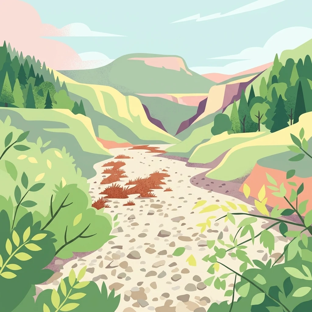
A digital illustration showing a view looking down into a green valley with a dry rocky riverbed in the center, flanked by forested hills and rising cliffs under a light sky.

Réserve naturelle régionale de la vallée de la Renaudie

Nature reserve

Park overview

Structured park overview, official facts, and landscape profile for Vallée de la Renaudie Regional Nature Reserve

Vallée de la Renaudie Regional Nature Reserve park facts, protected area profile, and essential visitor context

Review the core facts for Vallée de la Renaudie Regional Nature Reserve, including designation, size, terrain, visitor scale, habitats, and operating context in one park-focused overview.

About Vallée de la Renaudie Regional Nature Reserve

The Vallée de la Renaudie Regional Nature Reserve is a slender protected corridor that follows the Renaudie stream through a quiet, lightly populated stretch of the Charente countryside. Although it covers only about 73 hectares, the reserve's geometry makes its ecological impact disproportionate to its surface area: the protected strip extends for 6 kilometers along the watercourse while rarely exceeding a few tens of meters in width, concentrating conservation effort onto the most biologically active part of the valley system.

The site lies in the eastern Charente, on the communes of Écuras, Montbron, and Rouzède, in a transitional zone between the limestone plateaus typical of much of the department and the older, more acidic granitic formations found farther south. This geologic boundary is the defining feature of the reserve. Dry cliffs at the former Boucu quarry rise above sections of the stream, while gentler stretches have allowed the development of wet meadows, ponds, and mature riparian woodland. The result is a landscape where acidic-loving and calcareous-loving plant communities are unusually close together, often within the same short walk.

Beyond its ecological role, the reserve is also an educational landscape. Three marked discovery trails have been laid out, each around three to four kilometers long and designed to last roughly two and a half hours. One focuses on biodiversity, one on geology, and one on water, offering structured ways for visitors to engage with the three defining dimensions of the site.

Management of the reserve is entrusted to the Conservatoire d'espaces naturels de Nouvelle-Aquitaine, which oversees protection of the stream, its associated habitats, and the many species they shelter. The reserve also contributes to the broader conservation framework of the Tardoire valley through its inclusion in the Natura 2000 network.

Quick facts and research context for Vallée de la Renaudie Regional Nature Reserve

The Vallée de la Renaudie Regional Nature Reserve (RNR134) is a French regional nature reserve located in the Charente department of Nouvelle-Aquitaine. Spanning roughly 73 hectares, it follows a 6 kilometer corridor of the Renaudie stream, a tributary of the Tardoire river, through the communes of Écuras, Montbron, and Rouzède.

The reserve is IUCN Category IV and falls within the Natura 2000 site known as the Vallée de la Tardoire. It is administered by the Conservatoire d'espaces naturels de Nouvelle-Aquitaine. Its territory concentrates a surprising diversity of habitats within a narrow valley, including riparian woodland, ponds, dry cliffs at the former Boucu quarry, meadows, and mixed woodland developed over both limestone and granite substrates.

Protection and recognition

Examine the official designation history, terrestrial protection scope, and formal records.

Protection Status and International Recognition for Réserve naturelle régionale de la vallée de la Renaudie

Terrestrial protection status records for Réserve naturelle régionale de la vallée de la Renaudie establish the official designation history established in 2012. Documented protection details outline the conservation framework without assuming external international recognition sources.

Protection details

Protection scope
Terrestrial
Designated year
2012
Transboundary protection
No
WDPA ID
555559612
Park context

Deeper park guide and search-rich context for Vallée de la Renaudie Regional Nature Reserve

Vallée de la Renaudie Regional Nature Reserve history, landscape, wildlife, and travel context

Explore Vallée de la Renaudie Regional Nature Reserve through its history, landscape character, ecosystems, wildlife, conservation priorities, cultural context, and seasonal travel timing in a structured park guide built for atlas discovery and search intent.

Why Vallée de la Renaudie Regional Nature Reserve stands out

The reserve is best known for protecting a narrow stream valley where calcareous and granitic geological influences meet, creating an unusually compact mosaic of habitats. Its combination of riparian forest, dry cliffs, meadows, ponds, and woodland supports a rich biodiversity for such a small site, including many orchids, woodland birds such as the black woodpecker and the wallcreeper, amphibians like the yellow-bellied toad, and rare butterflies such as the marsh fritillary.
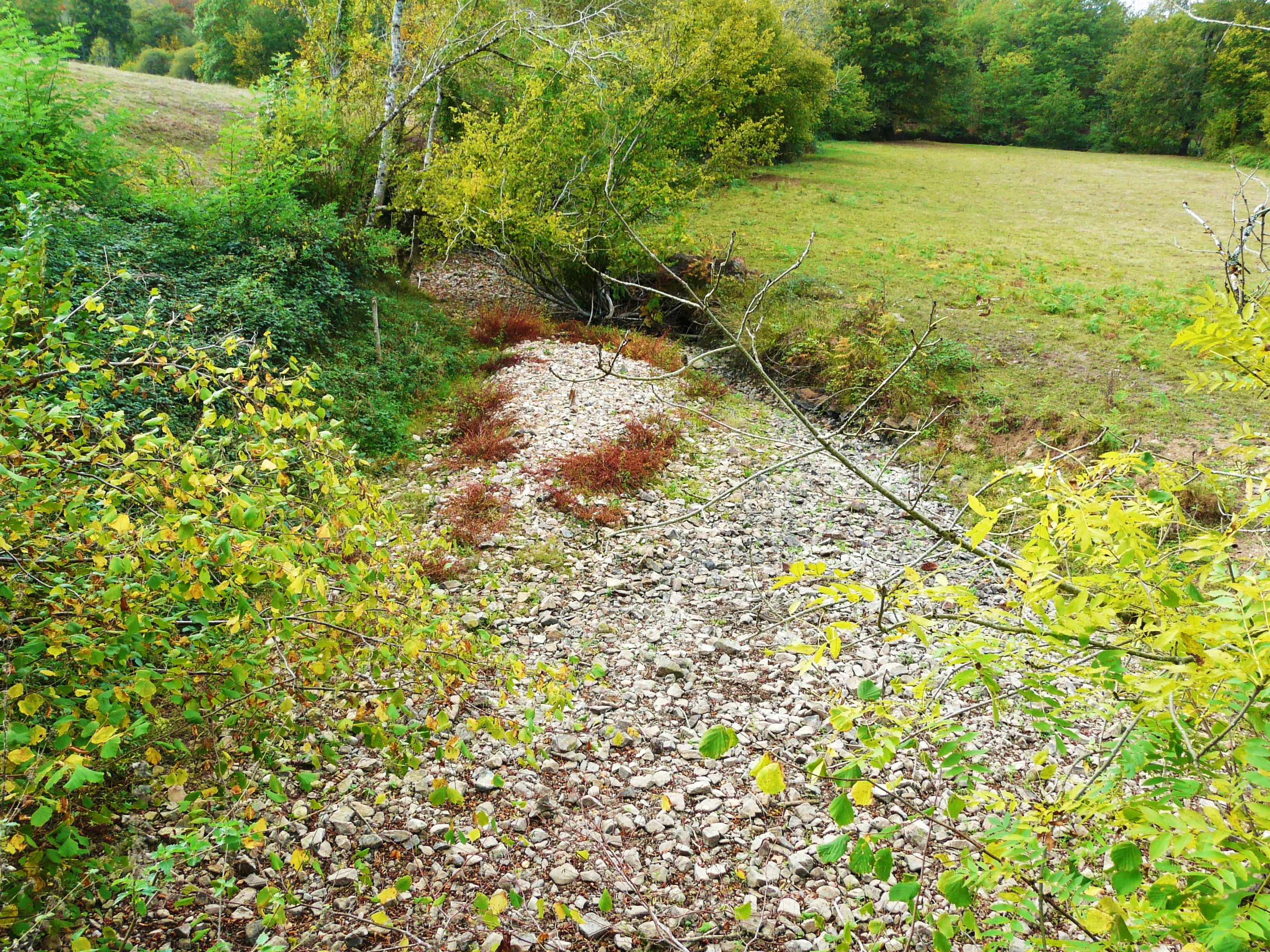
A dry, rocky stream bed surrounded by green vegetation and grass during a dry season.
The Renaudie stream bed during a dry period in Montbron.

Vallée de la Renaudie Regional Nature Reserve history and protected-area timeline

The site was first designated a voluntary nature reserve in 1998 following a deliberation on November 4 of that year, at the initiative of the local communes of Écuras, Montbron, and Rouzède. This earlier voluntary status reflected a grassroots desire to protect a stream valley whose ecological value was becoming increasingly apparent to local stakeholders.

In 2012, on February 13, the site was formally classified as a Regional Nature Reserve, marking a stronger and more durable form of protection under French law. Since then the reserve has been administered by the Conservatoire d'espaces naturels de Nouvelle-Aquitaine, an organization dedicated to managing natural spaces across the region. The reserve is also part of the Natura 2000 site FR5400408, Vallée de la Tardoire, linking its protection to a wider European ecological network.

Vallée de la Renaudie Regional Nature Reserve landscape and geographic character

The landscape of the Vallée de la Renaudie is shaped by the meeting of two contrasting geological substrates. To the north, limestone dominates, producing dry cliffs and open rocky faces such as those exposed at the former Boucu quarry. To the south, the terrain transitions into granitic formations, with their more acidic soils and different vegetation patterns. The reserve sits exactly on this boundary, making the valley a compact showcase of geological diversity.

The Renaudie stream itself is a small, often intermittent watercourse. In drier periods it can run partly or entirely dry, a feature captured by images of the streambed exposed downstream of Montbron. Where water does flow, it supports wet meadows, ponds, and dense riparian woodland. On the slopes and plateaus above the stream, the valley alternates between open meadows and mixed woodland, creating an enclosed, intimate scenery in which habitats shift quickly over short distances.

Despite covering only about 73 hectares, the valley stretches for about 6 kilometers, producing a long and narrow ribbon of protected land that follows the natural contour of the watercourse. The overall impression is one of a quiet, sheltered landscape, where woodland, rock, water, and meadow form a continuous ecological gradient.

Vallée de la Renaudie Regional Nature Reserve ecosystems, habitats, and plant life

Ecologically, the reserve's most defining characteristic is the convergence of limestone and granite influences in a single narrow valley. This geological interface translates directly into habitat diversity: dry calcareous cliffs sit beside acidic woodland, while riparian forest shades permanent wet zones that may alternate with stretches of dry streambed. Ponds and small waterbodies add further variety on the valley floor.

The flora reflects this mixture of substrates. More than 300 plant species have been recorded, including around 20 that are considered heritage species and 14 that appear on regional red lists. Notable plants include small mouse-ear hawkweed, linear-leaved St John's wort, and upright goosefoot, along with numerous wild orchids that thrive in the combination of meadow, woodland edge, and rocky outcrop.

Forested habitats and meadows make up the visible ecological backbone of the reserve. Riparian woodland lines much of the stream, while broader mixed woodland occupies the slopes. Between these wooded zones, open meadows and small clearings support a wide range of flowering plants, and by extension the insects and birds that depend on them. The overall ecological character is that of a transitional landscape, where multiple habitat types are packed into a very small spatial footprint.

Vallée de la Renaudie Regional Nature Reserve wildlife and species highlights

The valley's habitats support an impressive cross-section of wildlife for a site of its size. Approximately 49 mammal species have been recorded, occupying the woodland, meadow, and riparian zones, though specific large mammals are not emphasized in the available documentation. The reserve is, however, particularly notable for its birdlife, with more than 130 species recorded along the valley and its forested edges.

Among the characteristic birds are several woodland specialists, including the black woodpecker and the great spotted woodpecker. The stream itself attracts species tied closely to running water, such as the white-throated dipper, while cliff faces and rocky outcrops provide habitat for the wallcreeper, a species strongly associated with steep rock in this region. The kingfisher is also present, taking advantage of the fish life in the stream.

Amphibians are well represented, with 12 recorded species including the yellow-bellied toad, a species of significant conservation concern in France. Reptile diversity includes 8 species, among them the sand lizard. Invertebrates add another layer of ecological richness, with 53 butterfly species recorded, including the marsh fritillary, and 37 dragonfly species associated with the ponds and stretches of running water.

Vallée de la Renaudie Regional Nature Reserve conservation status and protection priorities

The principal conservation value of the Vallée de la Renaudie lies in its ability to concentrate a very wide range of habitats within a small protected area. Because the reserve sits at a geological interface between limestone and granite, it preserves ecological gradients that would normally be separated by much greater distances, allowing specialist species from both substrate types to coexist on a single site.

This ecological significance is recognised at multiple levels. The reserve is IUCN Category IV, reflecting its role in protecting specific habitats and species rather than a broader ecosystem. It also forms part of the Natura 2000 site FR5400408, Vallée de la Tardoire, aligning it with Europe's larger network of protected natural areas and ensuring that its management contributes to broader conservation goals for the Tardoire basin.

Management by the Conservatoire d'espaces naturels de Nouvelle-Aquitaine provides a stable institutional framework for ongoing protection. The reserve also serves an important pedagogical function, with its three themed trails allowing visitors to learn about the ecological, geological, and hydrological values that justify its protected status, helping build public support for the long-term preservation of the valley.

Culturally, the reserve is closely tied to the identity of the communes of Écuras, Montbron, and Rouzède, which initiated its original protection in 1998. The valley has long been part of the rural landscape of eastern Charente, and its conservation represents a locally rooted effort to maintain the natural character of the area in a region where small valleys like the Renaudie are defining features of the countryside.

Top sights and standout views in Vallée de la Renaudie Regional Nature Reserve

The reserve's strongest point of distinction is its extreme ecological density relative to its size: just 73 hectares of valley shelter more than 300 plant species, 49 mammal species, over 130 bird species, and a rich assemblage of amphibians, reptiles, butterflies, and dragonflies.

Equally notable is its geological character as a meeting point of limestone and granite terrain, reflected in dry cliffs, varied woodland, meadows, ponds, and riparian corridors concentrated along a 6 kilometer stretch of stream. The combination of protected status since 1998, dedicated management by the Conservatoire d'espaces naturels de Nouvelle-Aquitaine, and integration into the Natura 2000 Vallée de la Tardoire site makes it a small but ecologically significant stronghold in eastern Charente.

Best time to visit Vallée de la Renaudie Regional Nature Reserve

The climate of eastern Charente follows a temperate rhythm, with mild springs, warm summers, cool autumns, and relatively gentle winters. Late spring is generally the most rewarding period for visiting the reserve, when meadows are at their most floristically rich and wild orchids, woodland flowers, and many insects are active. Early summer also offers favorable conditions for observing dragonflies along the ponds and stretches of stream, and for hearing woodland birds in full song.

Autumn brings strong color to the riparian woodland and a different birdlife, with migrants and winter visitors supplementing the resident species. Because the Renaudie is an intermittent stream that can run dry in hotter months, visits outside the driest summer weeks tend to offer more dynamic hydrological scenery, with flowing water and fuller wetland conditions on the valley floor.
Monthly climate preview

Long-term representative temperature and precipitation averages across twelve recorded months

Climate Normals and Annual Weather Patterns at Réserve naturelle régionale de la vallée de la Renaudie

Representative coordinates record annual temperature swings from sub-zero winter minimums to warm summer maximums alongside steady daily precipitation rates. Analyzing complete monthly climate normals reveals detailed long-term averages for temperature and rainfall across the protected landscape.
Annual mean12 °C
4 °C21 °C
Jan
Feb
Mar
Apr10°
May15°
Jun18°
Jul21°
Aug21°
Sep17°
Oct13°
Nov
Dec
Warmest month
August

21.3 °C

Coolest month
January

4 °C

Wettest month
November

3 mm/day

Driest month
July

1.7 mm/day

Park location guide

Geography guide, regional context, and park location map for Vallée de la Renaudie Regional Nature Reserve

Vallée de la Renaudie Regional Nature Reserve park geography, regions, and map view in France

Understand where Vallée de la Renaudie Regional Nature Reserve sits in France through a broader geographic reading of the surrounding landscape, nearby location context, and its mapped position within the national park landscape.

How Vallée de la Renaudie Regional Nature Reserve fits into France

France is a unitary semi-presidential republic and one of the world's largest economies. It borders Belgium, Luxembourg, Germany, Switzerland, Italy, Monaco, Andorra, and Spain, with a maritime border to the United Kingdom. The country is known for its cultural influence, art, cuisine, and political history spanning centuries.

Wider geography shaping Vallée de la Renaudie Regional Nature Reserve in France

France is located in Western Europe. Metropolitan France extends from the Rhine to the Atlantic Ocean and from the Mediterranean Sea to the English Channel and North Sea. The country borders Belgium, Luxembourg, Germany, Switzerland, Italy, Monaco, Andorra, Spain, and has a maritime border with the United Kingdom.

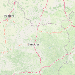
Map view of Vallée de la Renaudie Regional Nature Reserve

Use this park location map to pinpoint Vallée de la Renaudie Regional Nature Reserve in France, understand its exact geographic position, and read its mapped placement within the surrounding landscape more clearly.

Pigeon | © OpenStreetMap contributors

Location context for Vallée de la Renaudie Regional Nature Reserve

Nouvelle-Aquitaine

Visualizing the geological interface, habitats, and protected terrain of a unique river valley

Réserve naturelle régionale de la vallée de la Renaudie Photos and Landscape Scenery

Visual records capture the distinctive topography, riparian corridors, and contrasting geological substrates that define the protected landscape. Examining field photography helps reveal how limestone cliffs and granitic terrain converge across a compact valley floor to support diverse natural habitats.

A dry, rocky stream bed surrounded by green vegetation and grass during a dry season.

Park atlas

Compare surrounding regional protected landscapes and connected river valleys

Other Parks Near Réserve naturelle régionale de la vallée de la Renaudie

Browsing other protected areas near Réserve naturelle régionale de la vallée de la Renaudie reveals shared geological features and valley habitats across the region. Expanding the geographic comparison helps contextualize limestone formations and river corridors within broader regional conservation networks.
Nature reserveCharente
Mapped location lies within the park boundary#1 closest

South

Val de Tardoire Nature Reserve: Geography and Protected Area Mapping in Charente

A detailed river valley landscape in Nouvelle-Aquitaine, France.

This protected area centers on the Tardoire river valley, featuring a high density of wet meadows, broadleaf forests, and rocky escarpments. The site represents a crucial node for European-interest habitats and diverse fauna, offering an in-depth look at the natural terrain and ecological composition of the Charente department.

Area
31.49 km²
Established
1999
Relief
Upland
Climate
Temperate
Nature reserveNouvelle-Aquitaine
About 23 km away#2 closest

Southwest

Vallée de la Nizonne Nature Reserve: Mapped Geography and Protected Wetland Landscapes

A critical river corridor and Natura 2000 conservation zone in Nouvelle-Aquitaine.

Discover the geographic structure of the Vallée de la Nizonne, a protected area shaped by the flow of the Nizonne and Lizonne rivers. This landscape mosaic features peatlands, wet meadows, and alluvial forests that serve as a refuge for rare species. Gain insight into the regional terrain and conservation boundaries that define this important French wetland corridor.

Area
33.91 km²
Established
2016
Relief
Upland
Climate
Temperate
Protected areaNouvelle-Aquitaine
About 35 km away#3 closest

Southwest

Vallée de la Tude Protected Area: Regional Geography and Alluvial Landscape Map

Exploring the river valley networks of Nouvelle-Aquitaine

The Vallée de la Tude is a significant protected area located in the Charente department of southwestern France. This site features a series of wet meadows, lowland brooks, and woodland fragments that form an essential ecological network. Our atlas entry provides a detailed look at the geographic distribution and landscape composition of this unique alluvial valley.

Area
15.57 km²
Established
2006
Relief
Upland
Climate
Temperate
Nature reserveNouvelle-Aquitaine
About 36 km away#4 closest

East

Réserve naturelle régionale du réseau de landes atlantiques du Parc naturel régional Périgord-Limousin

A networked regional nature reserve in Nouvelle-Aquitaine.

This protected area serves as a critical network of Atlantic heathland sites embedded within the larger Périgord-Limousin Regional Natural Park. By conserving these scattered clearings of acidic soil and low vegetation, the reserve maintains a distinct biogeographic feature far from the French coast, offering a clear view into how regional authorities manage fragmented open habitats in the Haute-Vienne.

Area
0.409 km²
Established
2015
IUCN
IV
Scope
Terrestrial
Nature reserveNouvelle-Aquitaine
About 58 km away#5 closest

West

Vallée de l'Antenne: A Protected River Valley and Alluvial Landscape in Nouvelle-Aquitaine

Mapping riparian ecosystems and rare wetland habitats

Trace the course of the Antenne river as it meanders through a finely textured mosaic of ash and alder forests, poplar plantations, and floodplains. As a designated Natura 2000 site, this nature reserve acts as a critical refuge for biodiversity in western France, offering a textbook example of a low-energy river system that descends gently through the landscape of the Charente departments.

Area
12.08 km²
Established
1999
Relief
Lowland
Climate
Mediterranean
A soft watercolor painting of a wide, gently rolling landscape with green fields, forested hills in the distance, and native vegetation in the foreground.
Nature reserveHaute-Vienne
About 69 km away#6 closest

East

Lande de la Flotte et du Cluzeau: Geological Landscapes of Haute-Vienne, France

Nature reserve featuring rare serpentinite heathland habitats

Lande de la Flotte et du Cluzeau preserves a rare type of serpentine heathland on the Limousin plateau. By protecting stony outcrops that contrast with the local forest and farmland, this reserve maintains a significant botanical environment within Haute-Vienne, reflecting the complex metamorphic history of the region.

Area
132 km²
Established
1993
IUCN
IV
A soft watercolor painting of a natural landscape showing rolling green hills, a distant purple mountain range, and a calm body of water reflecting the light, with green foliage on the right bank.
Nature reserveNouvelle-Aquitaine
About 75 km away#7 closest

Northeast

Réserve naturelle régionale des Sauvages: Protected Landscape and Regional Geography

Mapped Habitat Mosaic in the Haute-Vienne of Nouvelle-Aquitaine

Discover the geographic composition of Réserve naturelle régionale des Sauvages, a protected nature reserve in France that integrates diverse habitats including heather-dominated moorland, peatland, beech forest, and historical ponds. This site serves as a key component of the regional conservation landscape within the Haute-Vienne.

Area
0.826 km²
Established
2015
IUCN
IV
Relief
Upland
Wildlife reserveNouvelle-Aquitaine
About 104 km away#8 closest

Southwest

Terres d'oiseaux Wildlife Reserve: Protected Estuarine Landscape in Nouvelle-Aquitaine

Migratory bird habitat and Gironde estuary geography

Terres d'oiseaux is a significant wildlife reserve positioned within the Blayais marshes of Nouvelle-Aquitaine. The site encompasses a diverse mosaic of estuarine wetlands, including reedbeds and open water, providing critical stopover habitat for migratory birds along the Atlantic flyway. Its geography represents a blend of tidal interaction and controlled natural management, essential for regional avian monitoring and ecological studies.

Area
1.2 km²
Established
2010
IUCN
IV
Relief
Lowland

Common questions about visiting, size, designation, and location context for Vallée de la Renaudie Regional Nature Reserve

Vallée de la Renaudie Regional Nature Reserve FAQs for park facts, access, geography, and protected area context

Find quick answers about Vallée de la Renaudie Regional Nature Reserve, including protected-area facts, park geography, trail and visitor context, and how the park fits into its surrounding country and regional landscape.
MoriAtlas Explorer

Continue Your Protected Areas Search Across the Global Atlas

Deepen your exploration by continuing the structured search for national parks and protected areas worldwide. Utilize the comprehensive filtering capabilities to compare different conservation landscapes and refine your understanding of global park geography. Discover more about the distribution and characteristics of protected natural areas.

Global natural geography