Why Wadi El Gemal National Park stands out
Wadi El Gemal is best known for its remarkable marine biodiversity and the juxtaposition of desert and sea environments. The park's coral reefs host approximately 450 species of coral, while more than 1,200 species of fish populate its waters. The southern mangrove forests represent the largest such ecosystem along the entire Red Sea. The park also contains significant archaeological remains from ancient Egyptian, Ptolemaic, and Roman periods, including the historic emerald mining site of Mons Smaragdus.
Wadi El Gemal National Park history and protected-area timeline
Wadi El Gemal National Park was formally established in 2003 as part of Egypt's expanding network of protected areas. The park's establishment reflected growing recognition of the Red Sea's ecological significance and the need to protect both marine and coastal terrestrial environments. The region has a long human history dating to ancient Egypt, with the area around Mons Smaragdus serving as a source of emeralds and other precious materials for millennia. Prehistoric rock art throughout the park provides evidence of even earlier human presence in this coastal desert environment.
Wadi El Gemal National Park landscape and geographic character
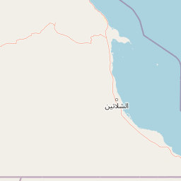
The park presents a striking contrast between its coastal and inland landscapes. The coastline alternates between semi-rocky shores and stretches of coarse to medium-grained sand, while the inland areas consist of the characteristic barren, rugged terrain of the Eastern Desert. The mangrove habitats are particularly extensive in the southern portion of the park, forming dense coastal forests that thrive in the intertidal zones. The five islands within the park add further landscape diversity, each offering distinct topographical and ecological characteristics.
Wadi El Gemal National Park ecosystems, habitats, and plant life
The marine environment of Wadi El Gemal supports one of the most diverse coral reef systems in the Red Sea region. The reefs feature approximately 450 species of coral alongside rich communities of cnidarians, giant clams, sponges, and crustaceans. Extensive sea grass beds in the coastal waters provide critical foraging habitat for endangered marine species. The mangrove forests in the southern park area represent the largest continuous mangrove ecosystem on the Red Sea, serving as nurseries for fish and crustaceans while stabilizing coastal sediments.
Wadi El Gemal National Park wildlife and species highlights
The marine waters of Wadi El Gemal support over 1,200 species of fish including the blue-spotted fantail ray, emperor angelfish, giant moray, parrotfish, and numerous others. Approximately one-fifth of the marine species present are endemic to the Red Sea region. Sea grass beds provide essential food sources for the endangered dugong and green turtle. The islands serve as breeding grounds for several bird species including the African spoonbill, Caspian tern, desert wheatear, striated heron, and western reef heron. The terrestrial desert environment supports specialized mammals including the aoudad or Barbary sheep, Dorcas gazelle, jerboa, and Nubian Ibex.
Wadi El Gemal National Park conservation status and protection priorities
Wadi El Gemal holds IUCN Category II protected area status, reflecting its significance for conservation of both marine and terrestrial biodiversity. The park protects approximately one-fifth of all marine species endemic to the Red Sea and greater Red Sea region. The mangrove ecosystems serve critical ecological functions including coastal protection, carbon sequestration, and habitat provision for juvenile marine species. The presence of endangered species such as the dugong and green turtle underscores the importance of the sea grass meadow conservation within the park boundaries.
Wadi El Gemal National Park cultural meaning and human context
The Wadi El Gemal region contains significant archaeological and historical evidence of human occupation spanning millennia. Prehistoric rock art found throughout the park provides evidence of early human presence in this coastal desert environment. The area was known to ancient Egyptians as a source of valuable minerals, with the Ptolemaic and Roman periods seeing active mining operations at Mons Smaragdus. These ancient emerald mining communities left behind small but historically significant settlements that remain within the park's boundaries.
Top sights and standout views in Wadi El Gemal National Park
The park's standout features include its exceptional coral reef biodiversity with 450 coral species, the extensive southern mangrove forests representing the largest Red Sea mangrove system, and the remarkable mixing of marine and desert environments within a single protected area. The five islands provide important bird breeding habitat while the sea grass meadows support endangered dugongs and green turtles. Archaeological sites including prehistoric rock art and ancient mining ruins add cultural depth to the natural landscape.
Best time to visit Wadi El Gemal National Park
The park can be visited year-round given Egypt's desert climate, though the cooler months from October through April typically offer more comfortable conditions for exploration. Summer months bring higher temperatures particularly in the inland desert areas, while the coastal marine environment remains accessible. Water visibility for diving and snorkeling is generally best during the summer and early autumn months when sea conditions are calmer.