Why Walyunga National Park stands out
Walyunga National Park is best known for its significant Noongar cultural heritage as a 6,000-year-old traditional meeting place, combined with its dramatic granite outcrop landscape in the Darling Range. The park's Walyunga Pool area along the Swan-Avon River provides a distinctive natural landmark, and the park serves as a venue for the annual Avon Descent whitewater event. The combination of cultural significance, accessible natural scenery just outside Perth, and the dramatic valley landscape with granite geology makes it notable among Western Australia's protected areas.
Walyunga National Park history and protected-area timeline
Walyunga National Park was established in 1970 as a protected area under Western Australian state governance. The park was created to preserve the significant natural and cultural values of the Darling Range valley area, including the unique geological features, native vegetation communities, and the important Noongar cultural heritage site. Management of the park falls under the Department of Environment and Conservation, which oversees protection and visitor services. The area's history extends far beyond its national park designation, with the Noongar people having used Walyunga as a meeting place for approximately 6,000 years, making it one of the longer-documented cultural landscapes in the Perth region. The park's name derives from the Noongar language, with Walyunga translating roughly to "Happy Place," reflecting the site's traditional significance as a gathering and meeting location for Aboriginal communities.
Walyunga National Park landscape and geographic character
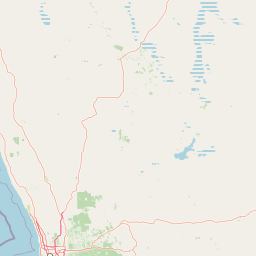
The physical landscape of Walyunga National Park is defined by its position in a steeply sided valley of the Darling Range, just behind the eastern edge of the Darling Scarp. Granite outcrops dominate the valley walls and occur throughout the park, creating bold rocky exposures and boulder-strewn terrain. Smaller areas of dolerite intrusions add geological variety to the granite-dominated substrate. The hilltops and ridgelines feature laterite capping, a characteristic of many Western Australian upland areas, which creates a distinctive red-soil surface layer contrasting with the grey granite below. The Swan-Avon River flows through the park in a generally northwesterly direction, cutting through the valley and creating the Walyunga Pool, a notable still-water area just downstream from where the Avon River becomes the Swan River. The valley floor supports riparian vegetation along the watercourse while the steeper slopes and ridgelines carry jarrah and other dry sclerophyll forest communities.
Walyunga National Park ecosystems, habitats, and plant life
The ecological character of Walyunga National Park reflects the Darling Range's Mediterranean-climate vegetation communities. The park supports a mixture of forest and woodland vegetation types adapted to the region, with jarrah forming a dominant tree species across much of the upland areas. Flooded gum occurs along the river corridor, providing a distinct riparian element to the vegetation. Understorey species include petrophile and hakea, which are characteristic of the Proteaceae family well-represented in southwest Australian flora. The diverse geology from granite, dolerite, and laterite creates microhabitat variation that supports plant community diversity. The river system provides aquatic habitat and connectivity through the landscape, while the granite outcrops create specialized rocky habitat niches for specialized species. The combination of valley bottom, slopes, and ridgeline habitats within a relatively small area contributes to the park's biodiversity value.
Walyunga National Park wildlife and species highlights
Walyunga National Park supports a variety of native wildlife species adapted to the Darling Range environment. Grey kangaroos are present throughout the park, often seen grazing in more open areas and along the valley floor. Birdlife is diverse, with galahs commonly encountered in flocks throughout the area, and magpies establishing territories across the park. Reptiles include goanna species, which can be seen basking on rocks and foraging through the area, and various gecko species sheltering in rocky crevices and tree hollows. The river corridor provides habitat for waterbirds and contributes to the overall biodiversity of the area. The mixture of forest, woodland, riparian, and rocky habitats supports a range of invertebrate, reptile, bird, and mammal species that characterize the Darling Range's native fauna.
Walyunga National Park conservation status and protection priorities
Walyunga National Park contributes to the conservation of Western Australia's natural heritage by protecting a representative sample of Darling Range valley landscape within the Perth region. The park preserves both the geological values associated with the granite outcrop terrain and the vegetation communities that have been extensively cleared in surrounding areas for agriculture and urban development. The protection of the Swan-Avon River corridor within the park maintains aquatic habitat connectivity and protects water quality within the catchment. The Noongar cultural heritage values, including the 6,000-year meeting place, are recognized and protected within the park framework, integrating cultural and natural conservation. The IUCN Category II designation reflects the park's primary purpose of ecosystem conservation while also providing for compatible visitor use and enjoyment.
Walyunga National Park cultural meaning and human context
Walyunga National Park holds significant cultural value as a traditional meeting place for the Noongar people, the Aboriginal people of the Perth region, with documented use extending back approximately 6,000 years. The Noongar name Walyunga translates roughly to "Happy Place," reflecting the site's role as a gathering location for community events, ceremonies, and social gatherings. This long history of Aboriginal use and connection to Country makes the park important for preserving Indigenous cultural heritage alongside its natural values. The landscape within the park remains connected to Noongar traditional knowledge and practices, though the specific historical uses and any contemporary cultural activities are not detailed in available sources. The cultural dimension adds depth to the park's significance beyond its geological and ecological values, representing the integration of Aboriginal land management and spiritual connection with the Australian landscape over millennia.
Top sights and standout views in Walyunga National Park
The combination of accessibility, natural scenery, and cultural heritage makes Walyunga National Park distinctive among Perth-region protected areas. Walyunga Pool along the Swan-Avon River provides a focal point for visitors seeking to experience the valley's waterways. The dramatic granite outcrops scattered throughout the valley create visual interest and provide habitat for specialized species. The park's role as a 6,000-year-old Noongar meeting place gives it cultural significance rare among Western Australian national parks. The annual Avon Descent event passing through the park's rapids brings recreational use and community engagement to the area. The visitor facilities including barbecue areas, parking, and toilets make the park accessible for families and day visitors while the trail network allows exploration of the valley and geological features.
Best time to visit Walyunga National Park
Walyunga National Park can be visited year-round given its proximity to Perth, though the Mediterranean climate of Western Australia influences the seasonal character of a visit. The cooler winter months from June to August typically bring more reliable rainfall and greener vegetation throughout the Darling Range, though some tracks may be muddier after rain. Summer months from December to February offer warmer conditions ideal for using the river areas, though the landscape tends to be drier and browner. Autumn and spring provide moderate temperatures and often pleasant visiting conditions. The park is accessible throughout the year for day visits, with the proximity to Perth making it suitable for quick escapes or longer afternoon outings. Visitors interested in wildlife observation may find early mornings and late afternoons more rewarding when animals are more active.