
Why Wasatch-Cache National Forest stands out
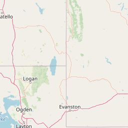
Wasatch-Cache National Forest is best known for its extensive high-mountain terrain along the Wasatch Range, its large network of designated wilderness areas, and its proximity to the major population centers of northern Utah. The forest includes portions of the High Uintas Wilderness, one of the largest wilderness areas in the region, as well as prominent Wasatch Front wildernesses such as Mount Olympus, Twin Peaks, and Lone Peak. It is also recognized for its role in protecting watersheds, its deep ties to the history of fur trapping in the Cache Valley region, and its importance as a year-round recreation destination for hiking, backpacking, skiing, and wildlife watching in the Intermountain West.
Wasatch-Cache National Forest history and protected-area timeline
Wasatch-Cache National Forest has its roots in the early conservation era of the twentieth century. The forest was formally established on August 16, 1906, during the early period of national forest designation in the western United States. Its creation brought together lands with distinct historical identities, including the Cache National Forest portion in northern Utah and southern Idaho and the Wasatch National Forest portion in northeastern Utah and southwestern Wyoming.
The name itself reflects the layered human history of the region. The word Wasatch comes from a Ute term referring to a low place in high mountains, while Cache derives from the French word meaning to hide. This second element refers to the fur trappers who were the first Europeans to explore and work the land, often using hidden stashes, or caches, to store their furs and supplies.
For most of its independent history, the forest was administered from headquarters in Salt Lake City. In August 2007, however, its management was combined with that of the Uinta National Forest, and the two were reorganized under the joint name Uinta-Wasatch-Cache National Forest. The merged forest operates from South Jordan, Utah, and integrates the Kamas Ranger District with the Heber Ranger District in Heber City. This consolidation increased the total managed area and reorganized some of the historic ranger districts, while preserving the underlying identity of the Wasatch-Cache lands.
Wasatch-Cache National Forest landscape and geographic character
The landscape of Wasatch-Cache National Forest is dominated by the rugged spine of the Wasatch Range and the broader northern Utah highlands. The terrain rises sharply from populated valleys along the Wasatch Front up through forested canyon country to exposed alpine ridges and summits. This dramatic elevation change within relatively short distances is one of the forest's defining geographic features.
Within the Cache portion of the forest, the landscape includes the mountains and canyons of northern Utah extending into the Bear River Range and the Bear Lake area of southeastern Idaho. The terrain here includes steep forested slopes, river-cut canyons, and broad high country that transitions toward the Wyoming border. The Wellsville Mountains and the Mount Naomi area contribute distinctive narrow ridgelines and sharply dissected terrain.
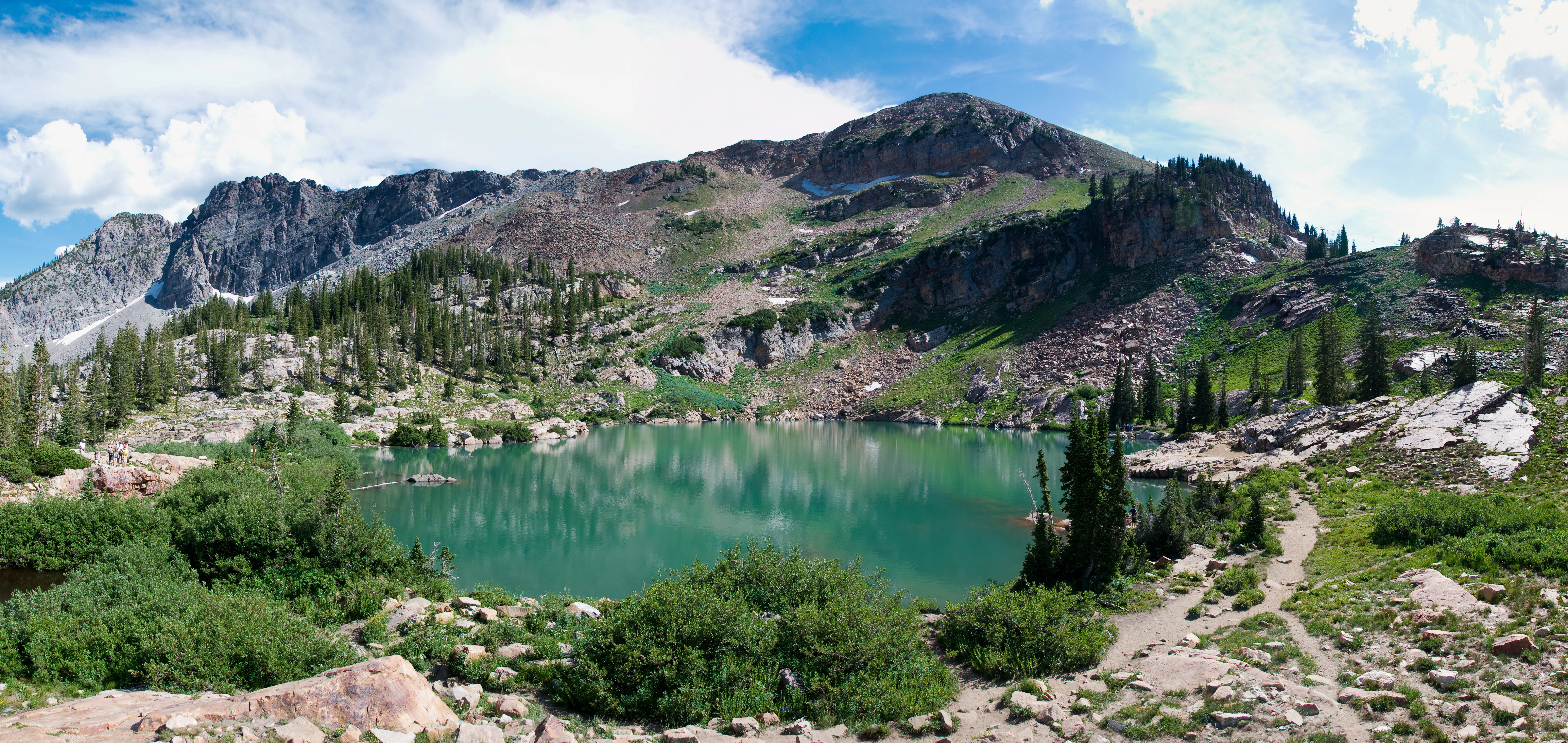
The Wasatch portion of the forest covers parts of the central and eastern Wasatch Mountains, including the prominent peaks visible from Salt Lake City such as the Mount Olympus, Twin Peaks, and Lone Peak areas. The terrain includes glaciated cirques, alpine lakes, subalpine forests, deep drainages, and high basins. Toward the east and north, the forest extends into the Uinta highlands, where broad, rolling high country and expansive alpine terrain create a notably different landscape character from the sharper Wasatch peaks.
Wasatch-Cache National Forest ecosystems, habitats, and plant life
The ecological character of Wasatch-Cache National Forest reflects its strong elevation gradient. Lower slopes support pinyon-juniper woodlands, mountain shrub communities, and Gambel oak, while mid-elevation zones are dominated by mixed conifer forests including Douglas fir, white fir, and Engelmann spruce. Higher elevations transition into lodgepole pine, subalpine fir, aspen groves, and open alpine tundra-like environments near the highest summits.
Riparian areas along mountain streams, lakes, and high meadows contribute important habitat diversity, supporting moisture-loving plants and serving as critical zones for wildlife. The forest's wilderness areas, which together cover roughly a quarter of the total acreage, protect some of the most intact plant communities in the region and maintain ecological processes with minimal human influence.
Seasonal snowpack plays a major ecological role across the forest, driving water availability, plant phenology, and wildlife behavior. The combination of varied topography, elevation, and moisture conditions supports a wide range of habitats within a relatively compact area, making the forest ecologically significant far beyond its geographic size.
Wasatch-Cache National Forest wildlife and species highlights
The varied elevations and habitats of Wasatch-Cache National Forest support a wide range of wildlife typical of the central Rocky Mountains and the Intermountain West. Large mammals such as mule deer, elk, and moose are present across many portions of the forest, particularly in the higher and more remote districts. The wilderness areas and backcountry zones of the High Uintas and the northern ranges provide important seasonal habitat for these species.
Predators and scavengers native to the region, including black bears, mountain lions, coyotes, and various hawks and eagles, are also associated with the forest. Cold-water streams and alpine lakes within the forest support native trout populations and add another dimension to the wildlife profile.
Birdlife in the forest reflects its elevation span, ranging from scrubland and foothill species in the lower elevations to high-country birds such as rosy-finches, Clark's nutcrackers, and various raptors in the alpine zones. The forest's mix of wilderness, riparian habitat, and extensive backcountry makes it an important area for wildlife viewing and ecological diversity in the northern Wasatch region.
Wasatch-Cache National Forest conservation status and protection priorities
Wasatch-Cache National Forest holds significant conservation value because of the habitat, watershed, and wilderness resources it protects. The forest serves as a major watershed protection area for northern Utah and southeastern Idaho, with its snowpack feeding rivers and reservoirs that supply municipal, agricultural, and ecological water needs downstream.
The forest's seven designated wilderness areas together cover roughly 309,000 acres and constitute a core conservation foundation within the broader landscape. These wildernesses preserve large blocks of relatively undisturbed habitat, protect long-term ecological processes, and maintain natural landscapes that would otherwise be vulnerable to development. High Uintas Wilderness, in particular, is one of the largest designated wildernesses in the region and contributes substantially to backcountry habitat conservation.
The forest also plays an important role in connecting protected landscapes within the northern Wasatch ecosystem. It buffers wildlife populations from expanding urban development along the Wasatch Front and provides migration corridors, seasonal range, and refugia for a variety of species. As part of the broader Uinta-Wasatch-Cache National Forest, its conservation role has expanded in scale and coordination.
Wasatch-Cache National Forest cultural meaning and human context
The cultural context of Wasatch-Cache National Forest is closely tied to both Indigenous heritage and the early European exploration of the region. The name Wasatch itself reflects Indigenous Ute language, referring to a low place in high mountains, while the Cache component derives from French-speaking fur trappers who used hidden stashes in the valleys to the north. This dual linguistic heritage captures the layered human history of the area, with Native presence predating European exploration by millennia.
The Cache Valley region has a long history as a crossroads for Indigenous peoples, early explorers, fur traders, Mormon pioneer settlement, and later agricultural and ranching communities. The forest continues to be intertwined with the cultural identity of northern Utah and southeastern Idaho, supporting traditional outdoor recreation, ranching uses on surrounding lands, and a strong regional ethic of public-land stewardship.
Top sights and standout views in Wasatch-Cache National Forest
Wasatch-Cache National Forest contains nearly 1.6 million acres of mountain and canyon country, with seven designated wilderness areas covering roughly a quarter of the forest. It anchors a major portion of the Wasatch Range, includes the High Uintas Wilderness in its northern reaches, and surrounds iconic Wasatch Front peaks such as Mount Olympus, Twin Peaks, and Lone Peak.
The forest is a primary outdoor recreation resource for northern Utah, supporting extensive trail networks, alpine lakes, popular ski areas, and accessible backcountry experiences within reach of major population centers. Its combined ecological, watershed, and wilderness values make it one of the most important national forest landscapes in the Intermountain West.
Best time to visit Wasatch-Cache National Forest
Wasatch-Cache National Forest can be visited throughout the year, with the experience shaped strongly by elevation and season. Summer is the most accessible time for the majority of the forest, when high-country trails, alpine lakes, and meadows are typically free of snow and ranger districts operate most fully. This season is well suited to hiking, backpacking, camping, wildlife watching, and exploring the wilderness areas.
Winter transforms much of the higher forest into a deep snow landscape, supporting skiing, snowshoeing, and snowplay in designated areas, particularly in the Wasatch Range portions near Salt Lake City. Spring and fall offer transitional conditions, with wildflower displays in meadows during the early summer melt and striking aspen and shrub color in autumn at mid-elevations. Visitors should generally expect snow to limit high-elevation access in the colder months and to find the most flexible conditions across the forest between late spring and mid-autumn.