Mori Atlas logo
Marine protected areaWest of Scotland Marine Protected Area

Explore the seafloor terrain of the Rockall Trough, seamounts, and continental slopes off Scotland

West of Scotland Marine Protected Area: Mapping Europe's Largest Deep Sea Conservation Zone

The West of Scotland Marine Protected Area spans a massive offshore region in the North Atlantic, encompassing a diverse array of submarine landscapes far from the Scottish coast. This atlas entry details the geography of the Rockall Trough, the elevated banks of George Bligh and Rockall, and the isolated Anton Dohrn and Rosemary Bank seamounts. Beyond its scale, the zone protects essential deep sea ecosystems, including cold water coral reefs and unique sponge aggregations.

marine protected areadeep-sea ecosystemscold-water coralsponge aggregationsseamountscontinental slope

West of Scotland Marine Protected Area

Marine protected area

Park overview

Structured park overview, official facts, and landscape profile for West of Scotland Marine Protected Area

West of Scotland Marine Protected Area park facts, protected area profile, and essential visitor context

Review the core facts for West of Scotland Marine Protected Area, including designation, size, terrain, visitor scale, habitats, and operating context in one park-focused overview.

About West of Scotland Marine Protected Area

The West of Scotland Marine Protected Area is a large-scale offshore conservation site in the North Atlantic, west of the Outer Hebrides, established by the Scottish Government in 2020. Covering more than 100,000 square kilometres, it dwarfs most other protected marine zones in Europe and represents a major step in the regional effort to safeguard deep-sea ecosystems in waters far beyond the sight of the Scottish mainland.

Unlike coastal or inshore marine reserves, this MPA is defined by its open-ocean character. Its territory extends from the edge of the continental shelf out into the deep Atlantic, encompassing a chain of contrasting seafloor environments within a single protected boundary. From east to west, it moves across the steep gradient of the continental slope, into the broad sediment plains of the Rockall Trough, and then upwards again across George Bligh Bank and the Rockall Bank. Each of these zones carries its own geological and ecological profile, contributing to a landscape of unusual complexity for a single designated area.

Among the most distinctive features are two isolated seamounts, Anton Dohrn and Rosemary Bank, which rise from the surrounding deep-sea floor. These structures create localized zones of enhanced productivity and have historically been associated with rich communities of fish, corals, and sponges. Their inclusion in the West of Scotland MPA recognizes their biological importance and the broader value of seamount ecosystems in the Northeast Atlantic.

The protected area is administered by Marine Scotland and is part of Scotland's wider network of Marine Protected Areas. It builds on earlier, smaller-scale protection, notably replacing the more limited Rosemary Bank MPA that previously covered just one of the seamounts. The current designation extends that protection across a much larger and more varied region, bringing together habitats that would otherwise be managed as separate ecological systems.

In practical terms, the MPA functions as a regulatory zone in which damaging activities are limited or controlled in order to preserve habitat structure, species populations, and the long-term ecological function of the area. While its remoteness places it beyond typical tourism, it is central to discussions about marine spatial planning, deep-sea biodiversity, and the role of large marine protected areas in international ocean governance.

Quick facts and research context for West of Scotland Marine Protected Area

The West of Scotland MPA covers more than 100,000 square kilometres of the North Atlantic, making it the largest marine protected area in Europe and one of the largest in the world by extent. It lies to the west of the Outer Hebrides and is managed by Marine Scotland on behalf of the Scottish Government.

Designated in 2020, the MPA replaced the earlier, much smaller Rosemary Bank MPA, consolidating protection across a far broader offshore region. Its boundaries incorporate continental slope, deep-sea plain, seamounts, and offshore banks, and it is formally recognized as a Marine Protected Area within Scotland's national network of marine conservation sites.

Protection and recognition

Examine documented marine conservation scope and recognition history

West of Scotland Marine Protected Area Protection Status and Recognition

West of Scotland Marine Protected Area holds a defined marine conservation scope within regional waters. Official protection metrics and formal designation records outline the governing framework established for the site.

Protection details

Protection scope
Marine
Park context

Deeper park guide and search-rich context for West of Scotland Marine Protected Area

West of Scotland Marine Protected Area history, landscape, wildlife, and travel context

Explore West of Scotland Marine Protected Area through its history, landscape character, ecosystems, wildlife, conservation priorities, cultural context, and seasonal travel timing in a structured park guide built for atlas discovery and search intent.

Why West of Scotland Marine Protected Area stands out

The West of Scotland MPA is most known for being the largest marine protected area in Europe, a designation that understates the ecological richness it contains. Its footprint includes some of the most varied deep-sea habitats in British waters, spanning the continental slope, the sediment-rich Rockall Trough, and isolated seamounts such as Anton Dohrn and Rosemary Bank that are known hotspots of marine biodiversity. The area has also gained recognition for its cold-water coral reefs and gardens, alongside extensive deep-sea sponge aggregations. These habitats are widely regarded as among the most ecologically valuable and physically fragile in the Northeast Atlantic, and their inclusion in a single, very large protected zone brings the West of Scotland MPA to international prominence for deep-sea conservation.

West of Scotland Marine Protected Area history and protected-area timeline

The West of Scotland Marine Protected Area was formally designated by the Scottish Government in 2020, representing the culmination of a broader shift toward large-scale offshore conservation in Scottish waters. Its creation was a deliberate expansion of marine protection in a region that had previously been only partly covered by conservation designations.

Before 2020, the most prominent protected marine site in this part of the Northeast Atlantic was the Rosemary Bank MPA, which focused almost entirely on one of the region's seamounts. The West of Scotland MPA effectively supersedes that earlier designation, replacing it with a far larger zone that incorporates Rosemary Bank itself alongside Anton Dohrn Seamount, the continental slope, the Rockall Trough, and the offshore banks of George Bligh and Rockall. In doing so, it unifies protection across a set of seascapes that had previously been considered separately for conservation purposes.

The designation reflects the growing recognition among marine scientists and policymakers that deep-sea habitats in the Northeast Atlantic, including cold-water coral reefs and sponge aggregations, require protection at a scale proportionate to their ecological importance. By establishing a zone of more than 100,000 square kilometres, the Scottish Government positioned the West of Scotland MPA as the largest marine protected area in Europe and a notable contribution to international marine conservation policy.

Management of the site is carried out by Marine Scotland, which operates the MPA as part of Scotland's national network of marine protected areas. While detailed operational history remains limited, the MPA is documented through Marine Scotland and the Joint Nature Conservation Committee, both of which maintain public information about its boundaries, features, and conservation objectives.

West of Scotland Marine Protected Area landscape and geographic character

The landscape of the West of Scotland Marine Protected Area is defined entirely by the seafloor, yet it is better understood as a chain of distinctive terrains than as a single uniform environment. The most easterly portion lies along the continental slope, where the seabed drops steeply away from the shallower shelf into the deep ocean. This gradient creates a sharp transition in depth, sediment type, and habitat character, and is recognised as one of the defining physical features of the MPA.

West of the slope lies the Rockall Trough, a broad basin dominated by soft sediment plains that stretch across much of the central MPA. The trough is more subdued topographically than the slope or the banks to the west, but it provides an essential background against which the steeper features of the region stand out. The trough acts as a deep corridor of open seabed framed on its seaward side by rising ground.

Further west, the seafloor climbs again into the George Bligh Bank and the Rockall Bank, two elevated features of the North Atlantic that bring the seabed closer to the surface than the surrounding trough. These banks create distinct benthic environments where currents interact with elevated terrain, often producing conditions favourable for filter-feeding species.

The most prominent topographic elements within the MPA are two isolated seamounts, Anton Dohrn and Rosemary Bank. Both rise sharply from the surrounding seafloor and stand apart visually and ecologically from the surrounding plains and slopes. Their vertical relief concentrates oceanographic processes such as internal wave generation and upwelling, and supports coral and sponge communities that are characteristic of seamount environments in the Northeast Atlantic. Together, slope, trough, banks, and seamounts give the MPA a varied seafloor topography rarely matched in a single European marine protected area.

West of Scotland Marine Protected Area ecosystems, habitats, and plant life

The West of Scotland Marine Protected Area encompasses a varied suite of marine ecosystems shaped by depth, substrate, and seafloor topography. Its habitats range from the steep, often rocky environments of the continental slope to the soft sediments of the Rockall Trough, and onward to the elevated, current-swept environments of the offshore banks and seamounts. This range of physical settings supports a correspondingly wide range of biological communities.

Among the most ecologically significant habitats are deep-sea sponge aggregations, which form dense biological structures on hard substrates in the deeper portions of the MPA. These aggregations are recognised as Vulnerable Marine Ecosystems in the Northeast Atlantic because of their slow growth and vulnerability to physical disturbance. Equally important are the cold-water coral reefs and gardens found in parts of the MPA, particularly in association with the seamounts and the more elevated portions of the banks and slope. Cold-water coral habitats are structurally complex environments that shelter many other species and play a central role in deep-sea biodiversity.

Beyond these benthic habitats, the MPA also encompasses open-water environments that support distinct ecological communities. The water column overlying the trough, banks, and seamounts hosts species that depend on the structural features below for feeding or reproduction, producing an ecological system in which seabed and water column are tightly linked.

The combined effect of slope, plain, bank, and seamount environments is an unusually high diversity of habitat types within a single protected boundary. This diversity gives the MPA a particular conservation value, because it allows protection to be extended across an interconnected ecological system rather than isolated patches of seafloor.

West of Scotland Marine Protected Area wildlife and species highlights

The wildlife of the West of Scotland Marine Protected Area is largely defined by its deep-sea character. The benthic communities supported by the MPA include dense aggregations of deep-sea sponges and cold-water corals such as Lophelia pertusa, which create three-dimensional habitat structures that host an array of associated invertebrates and small fish.

The MPA also specifically protects six species of deep-sea fish, recognising the importance of fish populations sustained by the seamount, slope, and bank environments. These species are the blue ling, the orange roughy, the leafscale gulper shark, the gulper shark, the Portuguese dogfish, and the round-nose grenadier. Together they represent a cross-section of the deep-sea fish community, from relatively elongate predators such as the gulper sharks to demersal species associated with seamounts and continental slopes.

While the MPA is remote from shore and rarely visited by casual observers, its waters form part of the wider marine ecosystem of the Northeast Atlantic. Mobile species, including seabirds, marine mammals, and pelagic fish, move through and beyond its boundaries, connecting the protected area ecologically with the seas of the wider North Atlantic. The MPA's role in protecting benthic habitats and deep-sea fish is therefore an important contribution to the broader biological richness of Scottish and North Atlantic waters.

West of Scotland Marine Protected Area conservation status and protection priorities

The West of Scotland Marine Protected Area is one of the most significant conservation designations in European waters, both in scale and in the habitats it protects. With an area exceeding 100,000 square kilometres, it represents a major commitment to preserving deep-sea ecosystems that are among the least understood and most vulnerable in the region.

Its conservation importance lies in the habitats it brings under protection. Cold-water coral reefs and gardens are recognised internationally as ecologically valuable and physically fragile, while deep-sea sponge aggregations are listed among the Vulnerable Marine Ecosystems of the Northeast Atlantic. By combining these habitats within a single regulatory boundary, the MPA addresses multiple high-conservation-value ecosystems simultaneously.

The designation also reflects the principle that effective marine protection often requires a broad spatial scale. Many of the habitats within the MPA, particularly those associated with the seamounts and offshore banks, depend on large-scale environmental conditions for their long-term persistence. The size of the West of Scotland MPA allows conservation measures to be applied across an area proportionate to these ecological processes.

Management responsibility lies with Marine Scotland, which oversees the MPA as part of Scotland's national system of Marine Protected Areas. The protective framework limits or regulates activities that could damage the seabed or its communities, with the explicit aim of preserving habitat structure, species populations, and ecological function over the long term.

Top sights and standout views in West of Scotland Marine Protected Area

The West of Scotland Marine Protected Area is notable above all for its sheer size, making it the largest marine protected area in Europe and one of the largest in the world. Its scale alone places it among the most ambitious marine conservation designations globally.

Within that scale, the MPA contains a remarkable variety of seafloor landscapes: continental slope, the Rockall Trough, George Bligh Bank, Rockall Bank, and the seamounts of Anton Dohrn and Rosemary Bank. These features are not just topographically distinct but ecologically different, supporting separate communities of deep-sea corals, sponges, and fish.

The combination of cold-water coral reefs and gardens, deep-sea sponge aggregations, and specifically protected deep-sea fish species makes the MPA a rare example of a single designation that simultaneously addresses several Vulnerable Marine Ecosystems. Managed by Marine Scotland as part of Scotland's MPA network, it represents both an ecological asset and a milestone in large-scale marine spatial planning.

Best time to visit West of Scotland Marine Protected Area

The West of Scotland Marine Protected Area lies far offshore and is not a destination for casual tourism; access is generally limited to research vessels and authorised operators. As a result, seasonal considerations are more relevant to research and survey work than to typical recreation. Sea conditions in the Northeast Atlantic west of the Outer Hebrides can be rough throughout the year, with storms and large swells common in autumn and winter.

For ecological and scientific interest, summer and early autumn tend to offer calmer conditions and longer daylight hours for survey work, though biological patterns in the MPA are dominated by the relatively stable deep-sea environment beneath the surface. The area's conservation significance, rather than any seasonal visitor experience, remains its primary focus.

Monthly climate preview

Long-term representative temperature and precipitation averages across the annual cycle

West of Scotland Marine Protected Area Climate Normals and Weather by Month

Recorded baseline measurements for West of Scotland Marine Protected Area reveal sustained annual temperature and precipitation shifts across the representative coordinate. Exploring the comprehensive monthly climate normals provides deeper context regarding long-term environmental patterns at this location.
Annual mean10 °C
8 °C13 °C
Jan
Feb
Mar
Apr
May
Jun11°
Jul13°
Aug13°
Sep12°
Oct11°
Nov
Dec
Warmest month
August

13.3 °C

Coolest month
February

7.6 °C

Wettest month
January

4.5 mm/day

Driest month
May

2.2 mm/day

Park location guide

Geography guide, regional context, and park location map for West of Scotland Marine Protected Area

West of Scotland Marine Protected Area park geography, regions, and map view in United Kingdom

Understand where West of Scotland Marine Protected Area sits in United Kingdom through a broader geographic reading of the surrounding landscape, nearby location context, and its mapped position within the national park landscape.

How West of Scotland Marine Protected Area fits into United Kingdom

The United Kingdom is a parliamentary constitutional monarchy located in northwestern Europe, consisting of four constituent countries: England, Scotland, Wales, and Northern Ireland. As a major global power with over 69 million residents, it maintains significant international influence in politics, economics, and culture.

Wider geography shaping West of Scotland Marine Protected Area in United Kingdom

The United Kingdom is an island nation located in northwestern Europe, surrounded by the Atlantic Ocean, North Sea, English Channel, Celtic Sea, and Irish Sea. It shares a land border with the Republic of Ireland to the west. The territory includes the island of Great Britain, the northeastern portion of Ireland, and most of the smaller British Isles islands.

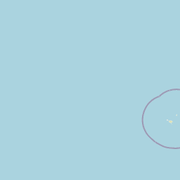
Map view of West of Scotland Marine Protected Area

Use this park location map to pinpoint West of Scotland Marine Protected Area in United Kingdom, understand its exact geographic position, and read its mapped placement within the surrounding landscape more clearly.

Pigeon | © OpenStreetMap contributors

Location context for West of Scotland Marine Protected Area

Scotland
Park atlas

Compare adjacent marine reserves and connected regional protected landscapes

Explore Other Parks Near West of Scotland Marine Protected Area

Browse related offshore conservation zones and surrounding marine habitats after reviewing West of Scotland Marine Protected Area. Comparative park exploration reveals broader regional biodiversity patterns across deep-sea ecosystems.
Marine protected areaScotland
About 24 km away#1 closest

South

Barra Fan and Hebrides Terrace Seamount Marine Protected Area: Scotland Deep-Sea Atlas

Geological survey of Scottish marine protected areas.

This marine protected area safeguards the Atlantic seabed through the conservation of two primary geological formations. The Barra Fan represents extensive submarine landslide activity, while the Hebrides Terrace Seamount provides a vertical volcanic anchor within the deep waters west of the Outer Hebrides. It serves as a vital study area for cold-water coral habitats and abyssal sediment processes occurring where the continental shelf meets the deep-sea trough.

Area
4,373 km²
Established
2014
Relief
Lowland
Climate
Temperate
A pale, minimalist watercolor painting showing gentle hills, a curved shoreline, and sparse grass against a white background.
Protected areaNa h-Eileanan Siar
About 101 km away#2 closest

East

Isle of Lewis Protected Area: Geography, Coastal Landscapes, and Highland Terrain

Mapped regional geography of the Outer Hebrides

The Isle of Lewis represents a significant protected landscape defined by its ancient geological roots and diverse coastal ecosystems. From the lime-rich machair grasslands of the west to the deeply indented sea lochs of the east, this area offers a unique perspective on the physical geography and inland peatland networks of the North Atlantic.

Area
1,770 km²
Visitors
219K annual
Relief
Mixed relief
Climate
Temperate
A watercolor painting showing a soft landscape featuring purple mountains in the background, a line of green evergreen trees, and a river winding through a grassy plain under a light sky.
Nature reserveOuter Hebrides
108 km away#3 closest

Southeast

Monach Islands Nature Reserve: Atlas Overview of Outer Hebrides Coastal Landscapes

Mapped protected areas and machair grassland geography

The Monach Islands consist of three main islands linked by tidal flats, creating a dynamic environment shaped by coastal erosion and maritime forces. As a protected nature reserve, the islands are vital for understanding rare machair habitats and the marine geomorphology of the Outer Hebrides, serving as a critical refuge for seabirds and thousands of breeding grey seals.

Area
5.981 km²
IUCN
IV
Relief
Lowland
Climate
Temperate
A soft watercolor illustration depicting a landscape of rolling green hills, a calm body of water, and sparse grassy vegetation.
Protected landscapeWestern Isles
About 136 km away#4 closest

Southeast

South Lewis, Harris and North Uist National Scenic Area Geography and Protected Lands

A diverse Scottish landscape of mountains and Atlantic coastline

Spanning from south-west Lewis through Harris to North Uist, this protected area features a striking blend of mountain glens, white sand machair beaches, and expansive peatlands. It serves as a flagship landscape for the Western Isles, characterized by its indented fjardic shorelines and remote maritime character that defines the northern Hebridean environment.

Area
2,024 km²
Established
1981
Relief
Mountain
Climate
Temperate
A wide watercolor illustration showing a mountain range in the distance, a valley, and green forests on either side, with soft pastel colors.
Protected landscapeHighland
About 159 km away#5 closest

East

North West Sutherland National Scenic Area: Mapping the Peaks and Coasts of Highland Scotland

Protected quartzite mountain landscapes and Atlantic coastal geography

This detailed overview of the North West Sutherland National Scenic Area maps the dramatic interplay between the white quartzite mountains of Foinaven and Arkle and the darker Lewisian gneiss that forms the underlying Highland landscape. The analysis provides deep insights into the region's knock and lochan topography, sea lochs, and the protected coastal habitats of Handa Island, anchoring the area within its broader Scottish geological context.

Area
266 km²
Established
1981
Relief
Mountain
Climate
Temperate
Protected landscapeHighland
About 163 km away#6 closest

East

Trotternish National Scenic Area: A Geographic Atlas of the Isle of Skye Protected Landscape

Basalt escarpments and geologic landmarks in the Scottish Highlands

Trotternish National Scenic Area features a long, continuous basalt escarpment that defines the spine of northern Skye. This protected landscape contains complex ridge formations, dramatic coastal cliffs, and a rich record of Jurassic geology. Learn about the physical geography, mapped extent, and natural terrain that make this region a key protected area within the Highland geography of Scotland.

Established
1981
Relief
Upland
Climate
Temperate
Access
Moderate access
Watercolor painting of a coastal landscape with distant mountains, a rocky shoreline, and light foreground vegetation on a white background.
Protected landscapeHighland
About 175 km away#7 closest

Southeast

Small Isles Protected Landscape: Atlas of the Highland Inner Hebrides Archipelago

Mapped terrain, volcanic geology, and coastal protected areas.

Delve into the geography of the Small Isles, a protected landscape encompassing Rùm, Eigg, Canna, and Muck. This atlas entry provides a structured look at the volcanic peaks, maritime skerries, and diverse land-stewardship boundaries that define this remote Scottish archipelago.

Area
472.35 km²
Established
1981
Relief
Mountain
Climate
Temperate
Protected landscapeHighland
About 201 km away#8 closest

East

Wester Ross National Scenic Area: Protected Highland Mountain and Coastal Landscape Atlas

Geographic mapping of the Northwest Highlands terrain

Wester Ross National Scenic Area spans vast stretches of the Northwest Highlands, characterized by towering Torridonian sandstone peaks and deeply carved sea lochs. This protected region integrates ancient Scots pine forests, glacial-carved glens, and complex coastal environments into one of the most recognizable geographic features of Scotland. The landscape serves as a vital record of geological heritage and high-latitude biodiversity within the Highland administrative region.

Area
1,634.58 km²
Established
1981
Visitors
70K annual
Relief
Mountain

Common questions about visiting, size, designation, and location context for West of Scotland Marine Protected Area

West of Scotland Marine Protected Area FAQs for park facts, access, geography, and protected area context

Find quick answers about West of Scotland Marine Protected Area, including protected-area facts, park geography, trail and visitor context, and how the park fits into its surrounding country and regional landscape.
MoriAtlas Explorer

Continue Your Protected Areas Search Across the Global Atlas

Deepen your exploration by continuing the structured search for national parks and protected areas worldwide. Utilize the comprehensive filtering capabilities to compare different conservation landscapes and refine your understanding of global park geography. Discover more about the distribution and characteristics of protected natural areas.

Global natural geography