

Mori Atlas logo
National parkWhite Mountains National Park

Understand the mapped boundaries and regional setting of this protected area.

White Mountains National Park: National Park Protected Landscape and Geographic Context in Queensland

White Mountains National Park stands as a key protected landscape within Queensland, Australia, offering a distinct geographic identity for exploration. This page provides detailed context on the park's protected area status and its place within the broader regional geography. Users can investigate the mapped outlines and understand how this national park contributes to the natural landscape context of northeastern Australia, ideal for atlas-based discovery and geographic understanding.

Desert UplandsSemi-arid mountainsQueensland national parksSandstone formationsRemote wildernessRocky plateaus

White Mountains National Park

National park

Park overview

Structured park overview, official facts, and landscape profile for White Mountains National Park

White Mountains National Park park facts, protected area profile, and essential visitor context

Review the core facts for White Mountains National Park, including designation, size, terrain, visitor scale, habitats, and operating context in one park-focused overview.

About White Mountains National Park

White Mountains National Park occupies a prominent position in Queensland's protected area estate as one of the few national parks preserving the unique desert uplands ecosystem of the White Mountains region. The park's location in the Desert Uplands bioregion places it within a broader landscape of semi-arid plains and low hills, making the mountainous terrain particularly distinctive. The ancient geological formations underlying the park date back hundreds of millions of years, with erosion having shaped the dramatic rock formations visible today. The combination of elevation, rocky substrates, and the presence of water-holding areas in gullies and valleys creates microhabitats that support vegetation communities quite different from the surrounding plains. Visitors to the park encounter a landscape of stark beauty where weathered cliffs, tors, and exposed rock faces dominate the ridgelines, while the valleys and lower slopes support more vegetated areas. The remote location of the park means that visitor numbers are relatively low compared to more accessible Queensland parks, preserving a sense of solitude and wilderness character.

Quick facts and research context for White Mountains National Park

White Mountains National Park protects an isolated mountain range in the Desert Uplands region of Queensland. The park was established in 1990 and covers 1,122 square kilometres of terrain featuring ancient sandstone formations, steep cliffs, and vegetated valleys. It lies approximately 140 kilometres southwest of Charters Towers and 80 kilometres northeast of Hughenden. The park is managed by the Queensland Parks and Wildlife Service and received a significant boundary extension in 2010 when 4,200 hectares were added on National Parks Day.

Protection and recognition

Tracing the official terrestrial conservation boundaries and designated management scope of the park.

Documented Protection Status and Legal Designation of White Mountains National Park

Factual research provides a clearer understanding of the terrestrial conservation frameworks and official designation status governing White Mountains National Park. Reviewing documented protection boundaries helps researchers and travelers map out the official legal scope of the surrounding mountain wilderness.

Protection details

Protection scope
Terrestrial
Transboundary protection
No
Park context

Deeper park guide and search-rich context for White Mountains National Park

White Mountains National Park history, landscape, wildlife, and travel context

Explore White Mountains National Park through its history, landscape character, ecosystems, wildlife, conservation priorities, cultural context, and seasonal travel timing in a structured park guide built for atlas discovery and search intent.

Why White Mountains National Park stands out

The White Mountains are known for their distinctive quartz sandstone and granite formations that rise abruptly from the surrounding flat plains, creating a dramatic sky-island landscape. The park protects one of the most significant arid-zone mountain ecosystems in Queensland, with vegetation communities adapted to the harsh, dry conditions including sparse eucalypt woodlands, tussel grass plains, and patches of brigalow. The area provides important habitat for a range of wildlife species suited to the semi-arid environment.

White Mountains National Park history and protected-area timeline

White Mountains National Park was formally established in 1990 when the Queensland Government declared the area a national park under the Nature Conservation Act. The creation of the park reflected growing recognition of the ecological and geological significance of Queensland's inland mountain ranges. A notable expansion occurred on National Parks Day in March 2010, when the Queensland State Government announced the addition of 4,200 hectares to the park's boundary, increasing the protected area's extent and enhancing the conservation of the mountain ecosystem. The park is managed by the Queensland Parks and Wildlife Service, which undertakes ongoing management activities including fire management, weed control, and visitor facility maintenance.

White Mountains National Park landscape and geographic character

The White Mountains landscape is defined by its rugged, ancient terrain that rises sharply from the surrounding flat plains of central Queensland. The geology is dominated by quartz sandstone and granite formations that have been sculpted by millions of years of erosion to create dramatic cliffs, rocky outcrops, tors, and steep-sided gullies. The ridgelines and plateaus provide panoramic views across the semi-arid landscape, while the sheltered valleys and lower slopes support more diverse vegetation. The terrain varies from exposed rock faces on the upper slopes to more vegetated areas where soil accumulation allows plant growth. The contrast between the dark rocky uplands and the green vegetation in the valleys creates a visually distinctive landscape unlike the typical flat terrain of the surrounding region.

White Mountains National Park ecosystems, habitats, and plant life

The park protects a complex of vegetation communities adapted to the semi-arid conditions of inland Queensland. The lower slopes and valleys support eucalypt woodlands, including species such as Queensland blue gum and ironbark, while the rocky ridges feature more sparse vegetation including tussock grasses and shrubs. The park lies within the Desert Uplands, a bioregion characterized by its mix of tropical and temperate species adapted to seasonal dry conditions. The isolated nature of the mountain range means that some species found here have developed unique adaptations or occur in isolated populations. The park's waterways and drainage lines provide important habitat for water-dependent species in this generally dry landscape.

White Mountains National Park wildlife and species highlights

The White Mountains National Park provides habitat for wildlife species adapted to semi-arid conditions. Reptiles are well-represented in the park, with various skink, gecko, and snake species occupying the rocky terrain and woodland areas. Birdlife includes species such as wedge-tailed eagles that soar above the ridgelines, as well as parrots, honeyeaters, and ground-dwelling birds that inhabit the woodlands and open areas. Mammals present in the region include various marsupials such as kangaroos and wallabies, as well as smaller mammals like bandicoots and possums that shelter in the Vegetated areas. The combination of rocky habitats and woodland provides diverse shelter and feeding opportunities for the park's fauna.

White Mountains National Park conservation status and protection priorities

White Mountains National Park plays an important role in conserving Queensland's desert uplands ecosystem, which faces pressures from pastoral development, mining, and changed fire regimes across the broader landscape. The protected area preserves a mountain environment that would otherwise be vulnerable to clearing or degradation. The park's declaration in 1990 and subsequent expansion in 2010 demonstrate ongoing commitment to protecting this unique landscape. The isolation of the White Mountains range means the park provides crucial refuge for species that depend on the specific habitat conditions found in the elevated, rocky terrain.

White Mountains National Park cultural meaning and human context

The White Mountains region has been part of the traditional country of Aboriginal peoples for thousands of years. The landscape holds cultural significance for local Indigenous communities, with the mountainous terrain and distinctive rock formations featuring in traditional stories and knowledge systems. The park lies within a broader region of central Queensland that contains numerous sites of Indigenous cultural importance, though specific details about the park's cultural heritage are limited in the available source material. European exploration of the White Mountains began in the 19th century as pastoralists moved into the region, with the area later becoming recognized for its conservation value.

Top sights and standout views in White Mountains National Park

The White Mountains offer visitors a rare opportunity to experience Queensland's desert mountain environment in a relatively unmodified state. The dramatic sandstone cliffs and rock formations provide excellent opportunities for photography and landscape appreciation, while the elevated positions offer sweeping views across the surrounding plains. The park's remote location ensures a wilderness experience with minimal infrastructure and few other visitors. The contrast between the stark ridgelines and the vegetated valleys creates a visually compelling landscape unlike typical semi-arid environments.

Best time to visit White Mountains National Park

The cooler months from April to September generally offer the most comfortable conditions for exploring White Mountains National Park, as summer temperatures in inland Queensland can be very hot. Winter nights can be cold, while summer often brings both extreme heat and the wet season rains that may affect access to some areas. The dry season from May through October typically provides more reliable access and comfortable daytime temperatures for walking and exploration. Visitors should be prepared for remote conditions with limited facilities and should carry adequate supplies including water, as the park has limited visitor infrastructure.
Monthly climate preview

Long-term representative monthly averages for temperature and precipitation patterns

White Mountains National Park Climate Normals and Annual Temperature Rhythm

Historical climatology data reveals a consistent annual rhythm of average temperatures and monthly precipitation recorded at representative park coordinates. Examining the complete twelve-month profile provides deeper insight into measured long-term climate variations across the protected terrain.
Annual mean22 °C
16 °C27 °C
Jan27°
Feb26°
Mar25°
Apr22°
May19°
Jun16°
Jul16°
Aug18°
Sep22°
Oct25°
Nov27°
Dec27°
Warmest month
December

27.4 °C

Coolest month
July

15.9 °C

Wettest month
January

4.8 mm/day

Driest month
September

0.3 mm/day

Park location guide

Geography guide, regional context, and park location map for White Mountains National Park

White Mountains National Park park geography, regions, and map view in Australia

Understand where White Mountains National Park sits in Australia through a broader geographic reading of the surrounding landscape, nearby location context, and its mapped position within the national park landscape.

How White Mountains National Park fits into Australia

Australia is a constitutional monarchy and federal parliamentary democracy comprising six states and ten territories. With a population of nearly 28 million, it is one of the world's most urbanised countries, with most people concentrated on the eastern seaboard. The country has a high Human Development Index and is known for its cultural diversity, ancient Aboriginal heritage, and unique wildlife.

Wider geography shaping White Mountains National Park in Australia

Australia occupies the entire Australian continent, the island of Tasmania, and numerous smaller islands. It is the world's flattest and driest inhabited continent, featuring vast deserts in the interior (the Outback), tropical rainforests along the eastern coast, and a coastline bordering the Indian and Pacific Oceans.

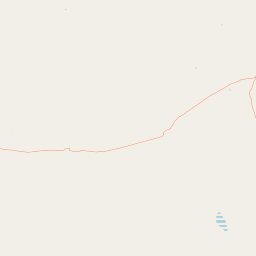
Map view of White Mountains National Park

Use this park location map to pinpoint White Mountains National Park in Australia, understand its exact geographic position, and read its mapped placement within the surrounding landscape more clearly.

Pigeon | © OpenStreetMap contributors

Location context for White Mountains National Park

Queensland
Park atlas

Trace Queensland's Distinct Arid Mountain Ecosystems and Connected Protected Landscapes

Discover More Protected Areas and National Parks Near White Mountains National Park

Browse national parks and protected areas geographically close to White Mountains National Park, highlighting Queensland's unique sandstone formations and semi-arid mountain terrain. Gain broader regional context by comparing White Mountains National Park with other conservation landscapes, understanding the spread of similar arid zone ecosystems.
National parkQueensland
About 29 km away#1 closest

West

Porcupine Gorge National Park: Protected Area Geography and Landscape Context in Queensland

Explore mapped boundaries of this Australian national park.

Porcupine Gorge National Park serves as a focal point for understanding protected landscapes within Queensland. This entry provides detailed geographic context, focusing on the park's mapped boundaries and its natural terrain. Discover its identity as a national park and its contribution to the regional geography of northeastern Australia, essential for any atlas-focused exploration.

Area
54.1 km²
Established
1970
IUCN
II
Relief
Mountain
National parkQueensland
About 54 km away#2 closest

Northeast

Great Basalt Wall National Park: Queensland National Park Protected Area and Geography Explorer

Mapped boundaries and regional landscape context.

Delve into the detailed protected landscape of Great Basalt Wall National Park, a designated national park situated in Queensland, Australia. This page provides insights into its specific geographic features and mapped boundaries, offering a foundational understanding for regional park discovery. Explore how this protected area fits into the broader natural landscape and atlas of Queensland.

Area
352 km²
Established
1987
IUCN
II
Relief
Upland
National parkQueensland
About 96 km away#3 closest

Northwest

Blackbraes National Park: National Park Atlas and Protected Landscape Exploration

Explore its mapped geography and regional context within Queensland.

Blackbraes National Park offers a distinct protected landscape within Queensland, Australia, inviting detailed atlas exploration. This page focuses on its specific geographic footprint and its mapped boundaries, providing structured data for understanding the park's place in the broader regional context. Discover the natural terrain and conservation significance of Blackbraes National Park, ideal for those seeking a deeper understanding of Australia's protected areas.

Area
520 km²
IUCN
II
Relief
Mixed relief
Access
Moderate access
National parkQueensland
About 107 km away#4 closest

South

Moorrinya National Park: Queensland Protected Landscape Exploration

Mapped boundaries and regional park geography.

Moorrinya National Park represents a distinct protected landscape within Queensland, Australia, offering valuable insights into the region's natural terrain and geographic distribution of conservation areas. This national park serves as a focal point for understanding local environmental context and the broader atlas of Australian protected lands. Delve into the mapped outlines and regional setting to grasp its unique ecological position.

Area
326.07 km²
Established
1993
IUCN
II
Scope
Terrestrial
National parkQueensland
About 158 km away#5 closest

Northeast

Dalrymple National Park: Queensland National Park Atlas and Protected Landscape

Explore mapped boundaries and regional park geography.

Dalrymple National Park stands as a distinct national park entity, offering valuable insights into Queensland's protected landscapes. This page serves as a gateway to understanding its specific geographic characteristics, mapped outlines, and its place within the structured atlas of Australia's natural areas. Discover the park's contribution to regional conservation and landscape context.

Area
16.6 km²
Established
1990
IUCN
II
Relief
Mixed relief
National parkQueensland
About 197 km away#6 closest

South

Forest Den National Park: Queensland's Protected Landscape and Geographic Atlas

Explore mapped boundaries and regional park geography.

Forest Den National Park stands as a distinct protected landscape within Queensland, Australia. This MoriAtlas entry provides detailed geographic context, focusing on the park's mapped boundaries and its position within the regional atlas. Discover the specific terrain and landscape characteristics that define this national park, aiding in structured geographic exploration and understanding its protected status within northeastern Australia.

Area
58.9 km²
Established
1991
IUCN
II
Relief
Upland
Watercolor illustration of rolling green hills, a winding river, and distant mountains with trees and grassy areas
National parkQueensland
About 204 km away#7 closest

Northeast

Paluma Range National Park: Queensland National Park Landscape & Geography

Explore protected area boundaries and regional context.

Paluma Range National Park represents a key protected landscape within Queensland, Australia, ideal for atlas-style exploration of its natural geography. Understanding this national park involves examining its mapped boundaries and appreciating its role in the regional geographic context of northeastern Australia. This entry serves as a primary point for discovering the park's protected status and its specific landscape identity within the vast Queensland region.

Area
172 km²
Established
1994
IUCN
II
Relief
Mountain
National parkQueensland
About 206 km away#8 closest

North

Girringun National Park: Queensland Protected Area Atlas and Geographic Exploration

Discover mapped terrain and natural landscapes within northeastern Australia.

Girringun National Park stands as a significant protected landscape within Queensland, Australia, contributing to the nation's network of conservation areas. This park offers a focused lens through which to examine the geography of northeastern Australia, providing insights into its mapped boundaries and natural terrain. Users can leverage this park detail page to understand its role within the broader regional atlas and explore its distinct protected-area identity.

Area
1,538 km²
Established
1994
Relief
Mountain
Climate
Tropical

Common questions about visiting, size, designation, and location context for White Mountains National Park

White Mountains National Park FAQs for park facts, access, geography, and protected area context

Find quick answers about White Mountains National Park, including protected-area facts, park geography, trail and visitor context, and how the park fits into its surrounding country and regional landscape.
MoriAtlas Explorer

Continue Your Protected Areas Search Across the Global Atlas

Deepen your exploration by continuing the structured search for national parks and protected areas worldwide. Utilize the comprehensive filtering capabilities to compare different conservation landscapes and refine your understanding of global park geography. Discover more about the distribution and characteristics of protected natural areas.

Global natural geography