
Mori Atlas logo
Nature reserveWörther Altrhein

Mapped wetland corridors, alluvial forest ecosystems, and protected avian habitats in the Rheinland-Pfalz landscape

Wörther Altrhein Nature Reserve: A Detailed Geographic Atlas of the Southern Upper Rhine Floodplain

(Vogelschutzgebiet Wörther Altrhein und Wörther Rheinhafen)

Wörther Altrhein represents a significant protected area within the southern Upper Rhine floodplain of Germany. This former Rhine river meander, transformed into a thriving wetland system, features a complex mosaic of reedbeds, alluvial forests, and shallow water zones. The area provides essential landscape context for understanding how historic river straightening interventions create modern biodiversity refuges and ecological corridors within Rheinland-Pfalz.

wetlandformer river armAltrheinUpper Rhine floodplainbird protection areaNatura 2000
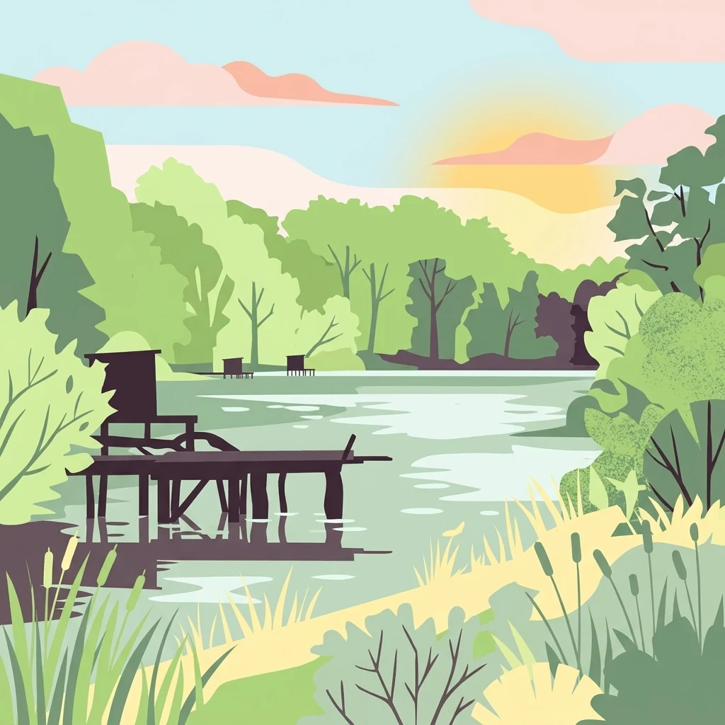
A stylized vector illustration of a quiet river arm surrounded by trees, with a wooden pier in the foreground and a setting sun in the background.

Wörther Altrhein

Nature reserve

Park overview

Structured park overview, official facts, and landscape profile for Wörther Altrhein

Wörther Altrhein park facts, protected area profile, and essential visitor context

Review the core facts for Wörther Altrhein, including designation, size, terrain, visitor scale, habitats, and operating context in one park-focused overview.

About Wörther Altrhein

Wörther Altrhein is a protected wetland area in the Upper Rhine floodplain of southwestern Germany, situated within the municipal territories of Wörth am Rhein and Jockgrim in Rhineland-Palatinate. The site takes its name from a former arm of the Rhine that once carried the main flow of the river before the major 19th-century channel straightening project transformed the Upper Rhine into the regulated, channelized waterway seen today. After the straightening, the abandoned meander slowly transitioned into a slow-moving, partly isolated water body lined by reeds, willows, and alluvial forest.

Today, the area functions primarily as a dedicated bird protection area (Vogelschutzgebiet), formally designated under the European Union's Natura 2000 network. It is also part of a larger cross-border landscape recognized as a Fauna-Flora-Habitat site, integrating conservation measures that span both German and French sides of the Rhine floodplain. The mix of open water, marshland, wet meadows, and softwood floodplain forest creates an unusually diverse habitat mosaic for an area otherwise embedded in a heavily used agricultural and industrial landscape.

Beyond its ecological value, the Wörther Altrhein is significant as a regional recreational and educational landscape. It sits just outside the town of Wörth am Rhein, close to the Rhine bridge linking the German side with Karlsruhe, and is easily reached for walking, cycling, and informal nature observation. Its proximity to the Wörth industrial harbor also creates an unusual juxtaposition, where shipping, freight handling, and protected wetland habitat stand within sight of one another. This setting gives the reserve a distinctive identity among the Rhine's nature conservation areas, blending human land use with long-term ecological recovery.

Quick facts and research context for Wörther Altrhein

Wörther Altrhein is a 240-hectare bird protection area located in the Landkreis Germersheim in Rhineland-Palatinate, Germany. It lies west of the active Rhine channel in the Upper Rhine floodplain between Wörth am Rhein, Jockgrim, and Neupotz, north of the Rhine bridge connecting Wörth with Karlsruhe. The site was designated under EU Natura 2000 legislation in 2004 and carries the site code DE6915402 (WDPA 555537854), reflecting its formal recognition as a habitat and species management area of international importance.

Protection and recognition

Documented terrestrial protection scope and international recognition data

Wörther Altrhein Protection Status and Official Designation Records

Wörther Altrhein holds documented terrestrial protection status within global conservation databases, reflecting established administrative boundaries. Official records compile management scope and international recognition sources to provide verified protected area facts.

Protection details

Protection scope
Terrestrial
Transboundary protection
No
WDPA ID
555537854
Park context

Deeper park guide and search-rich context for Wörther Altrhein

Wörther Altrhein history, landscape, wildlife, and travel context

Explore Wörther Altrhein through its history, landscape character, ecosystems, wildlife, conservation priorities, cultural context, and seasonal travel timing in a structured park guide built for atlas discovery and search intent.

Why Wörther Altrhein stands out

Wörther Altrhein is best known as one of the most ecologically valuable former Rhine channel systems in the southern Upper Rhine, recognized especially for its role as a protected wetland and bird habitat. The site has gained particular distinction through its combination of large-scale alluvial forest, reedbeds, and shallow water zones that support breeding and migratory waterbirds, including notable populations of white storks, kingfishers, dabbling ducks, and wintering gulls at the adjacent harbor. The area is also notable for demonstrating how the historic Rhine straightening of the 19th century created, somewhat paradoxically, some of the region's richest modern nature reserves. Cut-off river bends like the Wörther Altrhein have become refuges for amphibians, dragonflies, beavers, and rare plant communities that depend on the periodic hydrology of the active floodplain. This dual identity as both a former industrial river corridor and a contemporary biodiversity hotspot shapes the site's distinctive profile.
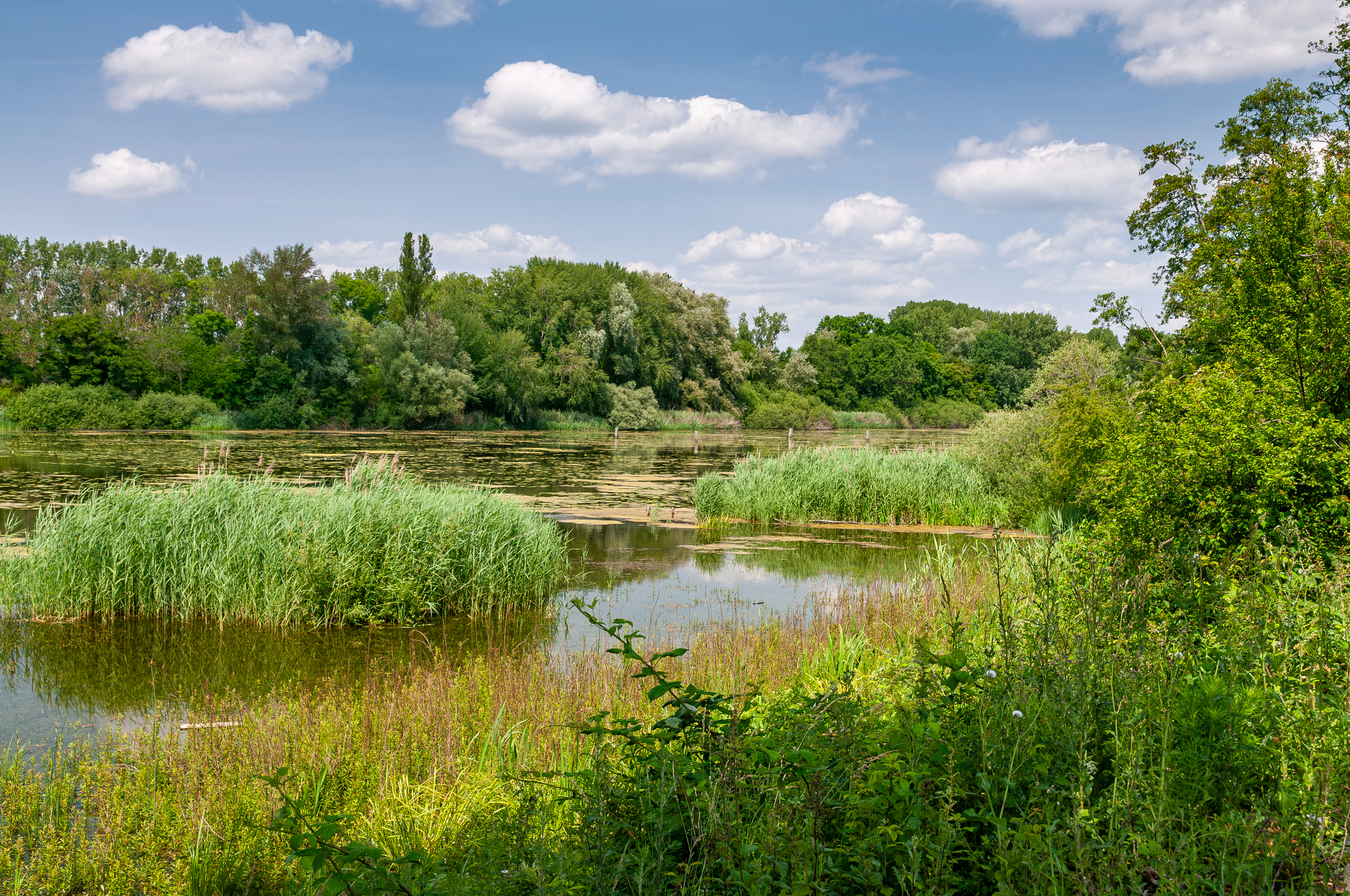
A peaceful landscape view of a river arm with calm water, clusters of green reeds and tall grasses in the foreground, and a dense, lush forest along the distant bank under a partly cloudy sky.
A view of the Wörther Altrhein, showcasing its characteristic wetland landscape with lush vegetation and calm water.

Wörther Altrhein history and protected-area timeline

The Wörther Altrhein originated as a natural section of the Rhine River that was cut off and transformed when the Upper Rhine was extensively straightened in the 19th century. As part of this large-scale engineering effort, the river was realigned into a more direct, regulated course for flood control and navigation, leaving behind a network of former river arms, the so-called Altrheine. The cut-off meander near Wörth am Rhein gradually filled with slow-moving water and developed into the wetland mosaic seen today.

In the modern era, the ecological value of these abandoned channels became increasingly recognized, leading to formal protection measures. The area received European nature conservation designation in 2004 as part of the Natura 2000 network, both as a bird protection area and as part of a broader habitat site. The designation codified the site's role as a habitat and species management area under IUCN Category IV, cementing its status as part of the EU-wide effort to safeguard wetland biodiversity along the Rhine corridor. Since then, ongoing renaturation efforts and environmental education programs have been aimed at maintaining or restoring the natural character of the river floodplain.

Wörther Altrhein landscape and geographic character

The Wörther Altrhein occupies a lowland position in the floodplain of the Upper Rhine, lying west of the river's main current between Wörth am Rhein in the south and Jockgrim and Neupotz further north. The landscape is shaped by its origins as an active river arm, and the meandering course still curves gently past the older district of Wörth before discharging into the Landeshafen, a small inland harbor.

The water level in the former channel is regulated through sluice gates, allowing a controlled connection with the main Rhine near river kilometer 363. This hydrological management maintains a stable mix of open water, shallow shoreline, and periodically flooded zones. Surrounding the water are flat expanses of alluvial forest, wet meadows, and reedbeds that blend almost seamlessly with the neighboring fields and developed areas.

The scenery is typical of the southern Upper Rhine: wide horizons, low willow and alder woods along the banks, and shallow reflective water surfaces interspersed with dense reed zones. A separate small lake known locally as the 'Adria' lies along the southern section near the automobile plant, and a former gravel pit further north, the Kiefer-Rathjens lake, now functions as a recreational bathing lake. Together, these features give the Wörther Altrhein an unexpectedly varied visual landscape within an otherwise flat and agricultural floodplain.
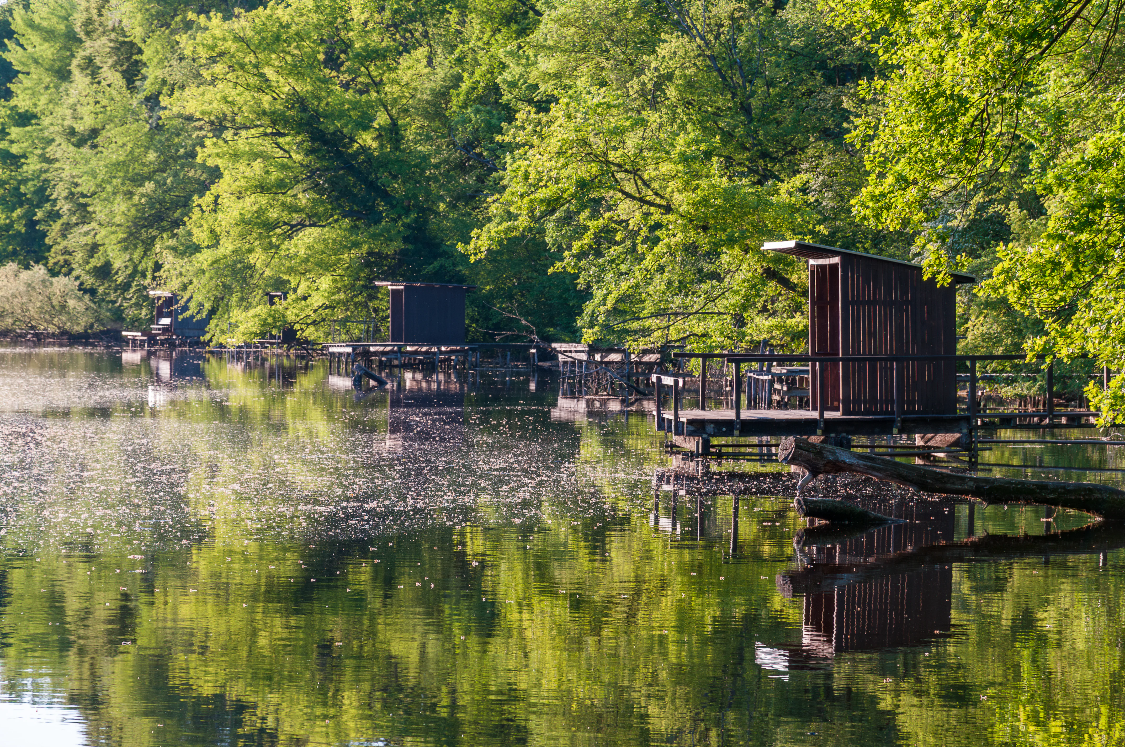
A row of wooden fisherman huts on platforms over a calm river surrounded by dense green trees.
Fisherman huts along the Wörther Altrhein river branch.

Wörther Altrhein ecosystems, habitats, and plant life

Wörther Altrhein forms part of one of the largest alluvial forest and wetland complexes along the southern Upper Rhine. Its habitats are shaped by periodic flooding and the slow, meandering hydrology typical of former river arms. The site supports a rich mosaic of reedbeds (Röhricht), dense stands of common reed, marshland, and softwood floodplain forest where silver willow, black alder, and other moisture-loving species dominate.

Ecologically, the area is highly significant because it preserves near-natural floodplain dynamics that have largely disappeared from other sections of the regulated Rhine. The shallow water areas and floating vegetation provide spawning and foraging habitat for amphibians and fish, while the surrounding wet meadows and alluvial woodland sustain insects, bats, and ground-nesting birds. Its integration into the broader Natura 2000 network means that the reserve contributes directly to European conservation goals for floodplain ecosystems.

The wetland also functions as a key stepping stone in a regional ecological network, connecting to neighboring protected areas such as the Hördter Rheinaue, the Rheinniederung Neuburg-Wörth, and the broader Pfälzische Rheinauen landscape protection zone. This connectivity strengthens the resilience of species populations across the Upper Rhine floodplain.
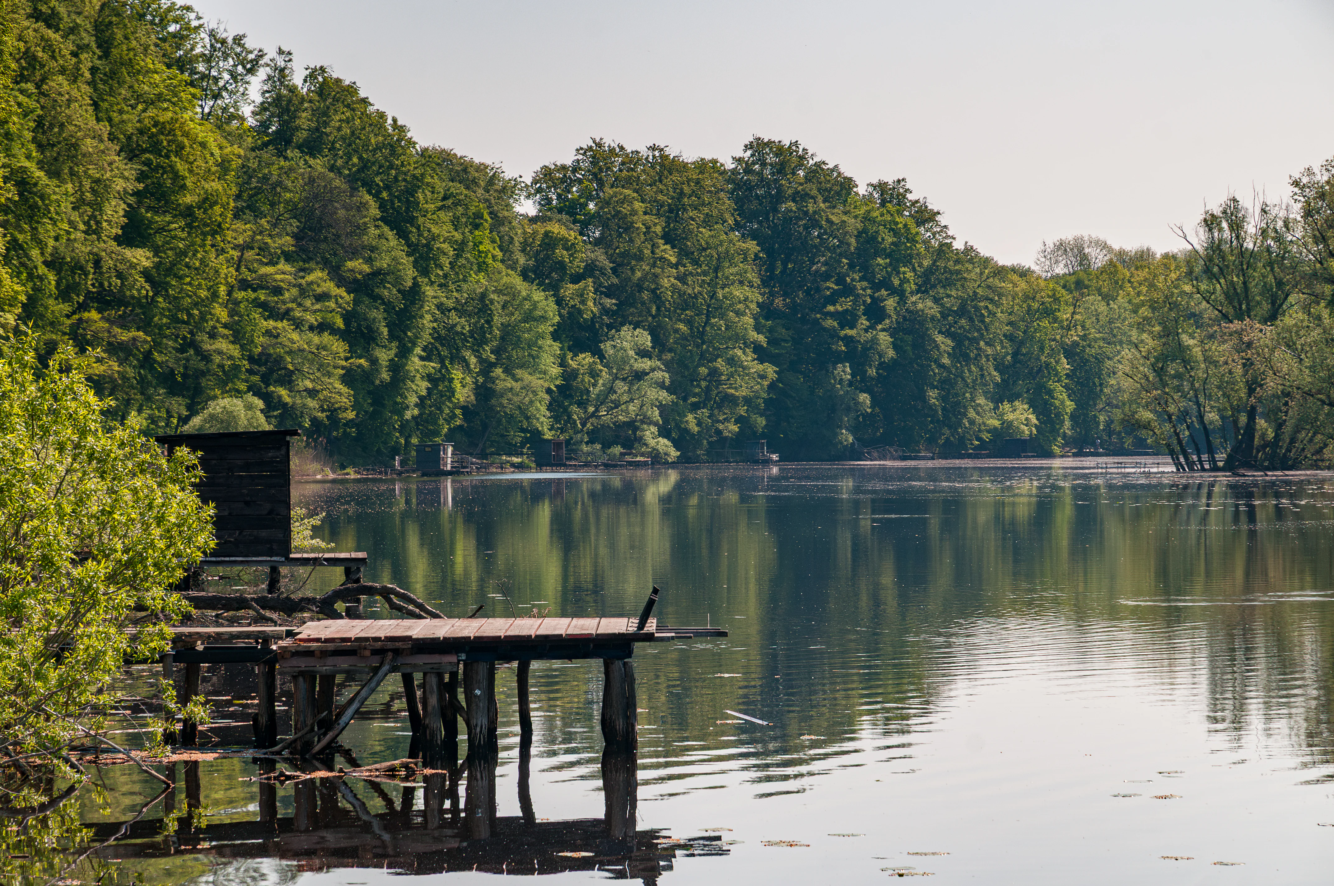
A calm river bordered by dense green trees with a wooden pier and small shed structure on the left side of the frame.
A peaceful morning view of the Altrhein river arm at Wörther Altrhein, featuring a wooden fishing pier and surrounding alluvial forest.

Wörther Altrhein wildlife and species highlights

The bird fauna of Wörther Altrhein is the most prominent feature of the reserve, reflecting its status as a dedicated bird protection area. The wetland is regionally important for diving and dabbling ducks, and supports nesting populations of rare reed-breeding species as well as threatened ducks such as the Eurasian teal and the gadwall. The adjacent Wörth harbor serves as a temporary roost for up to four gull species in significant numbers during parts of the year.

Among the more charismatic species, the white stork is a regular nesting presence and an iconic sight in the area, while the common kingfisher is widespread along the slow-moving channels and reed-fringed banks. Other notable fauna includes the Eurasian beaver, which has steadily recovered in the Upper Rhine floodplains and uses the abandoned meanders for shelter and feeding. The reserve is also a stronghold for amphibians, dragonflies, and a wide range of wetland-dependent insects.

The mix of open water, marshland, and alluvial woodland provides a year-round habitat mosaic. Migratory waterbirds use the area as a stopover and wintering site, while resident species benefit from the dense cover of softwood forest and the calm, sheltered water of the old river arm. This combination of resident and seasonal wildlife gives the Wörther Altrhein strong ecological value at both local and European scales.
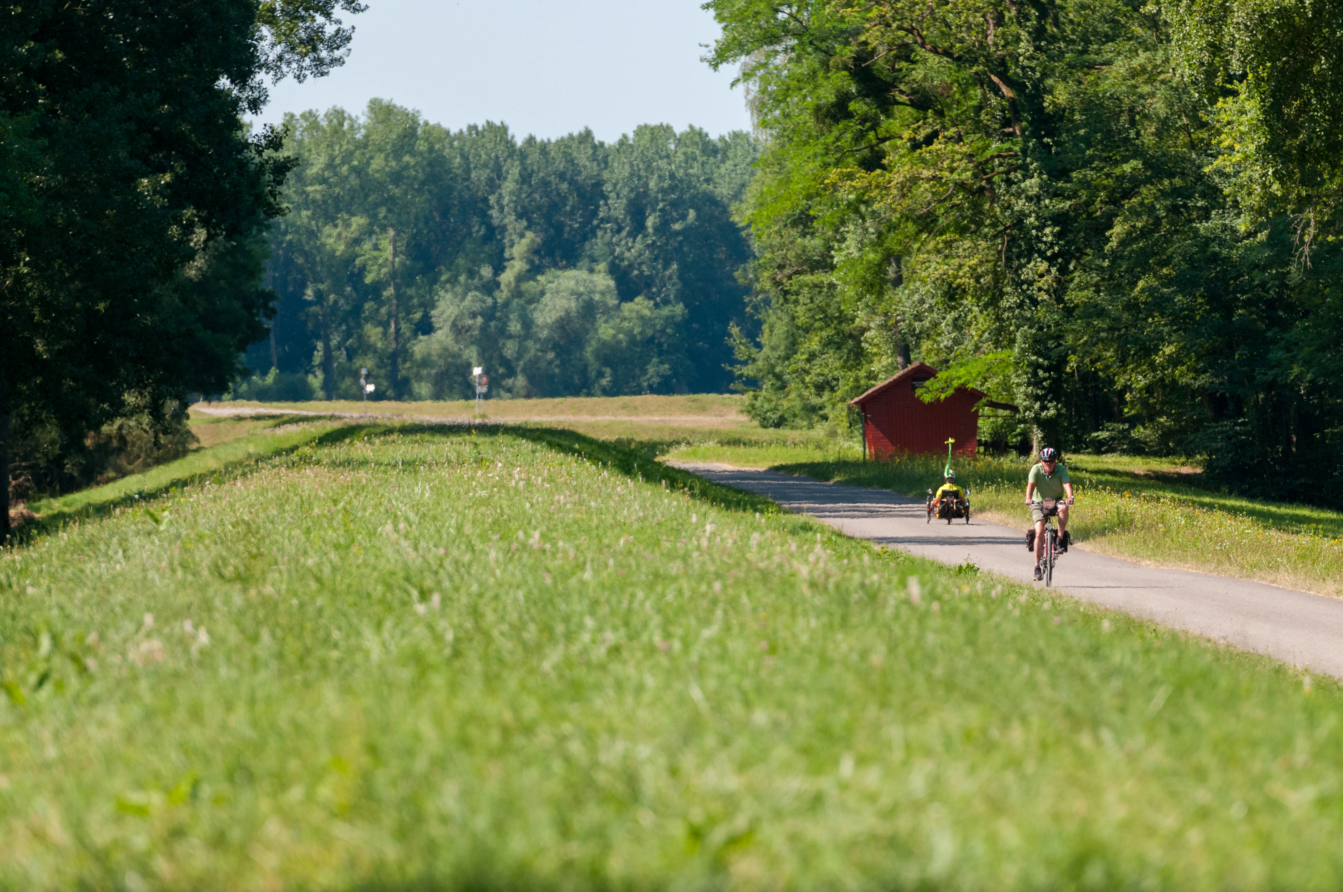
A person riding a bicycle on a paved trail atop a grassy levee with a small red hut and dense trees in the background.
A cyclist on the PAMINA-Rheinauen cycle path near the Wörther Altrhein, showcasing the park's accessible riverside trails.

Wörther Altrhein conservation status and protection priorities

Wörther Altrhein is fundamentally a conservation-driven landscape, protected both under German state law and through the European Union's Natura 2000 framework. Its formal designation as a Vogelschutzgebiet, or bird protection area, places it within a pan-European network aimed at safeguarding vulnerable bird species and their habitats. The site also forms part of an FFH (Fauna-Flora-Habitat) area, reinforcing its recognition as a priority site for non-avian wildlife and habitat types.

Conservation work focuses on maintaining and restoring the natural dynamics of the former river arm through active renaturation. This includes managing sluice gates to mimic natural water-level fluctuations, encouraging the regeneration of softwood floodplain forest, and protecting reedbeds from overuse. Environmental education initiatives, organized in cooperation with local groups such as BUND and NABU, aim to build public awareness of the reserve's ecological role.

The site also plays a strategic role in transboundary conservation. As part of the broader upper-Rhine floodplain ecosystem, it links with neighboring reserves in Germany and France, contributing to a connected network of protected wetland habitats. This integration is increasingly seen as vital in the face of climate-driven hydrological changes, invasive species pressure, and ongoing recreational use, all of which are acknowledged management challenges for the reserve.

Top sights and standout views in Wörther Altrhein

Wörther Altrhein stands out as a textbook example of how a 19th-century anthropogenic hydrological intervention, the straightening of the Upper Rhine, can give rise to one of the region's most important modern wetland reserves. Its combination of Natura 2000 and FFH designations places it within Europe's leading conservation frameworks, while its accessible location near Wörth am Rhein makes it a prominent destination for local recreation and environmental education.

The reserve's wildlife profile is distinctive: a working industrial harbor coexists with white stork nesting sites, kingfisher territories, and a recovering beaver population. This unusual proximity of commerce and conservation gives Wörther Altrhein a uniquely layered identity, both as a functioning piece of Rhine infrastructure and as a thriving refuge for wetland biodiversity in the southern Upper Rhine.
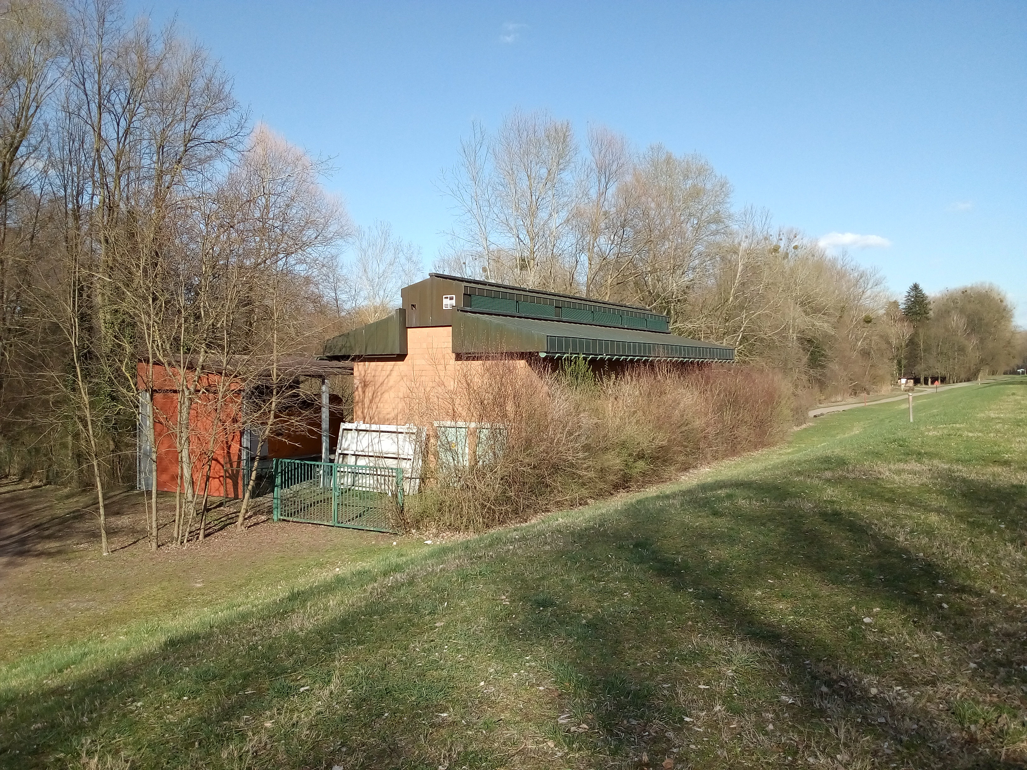

A brick pump station building with a green roof set near trees and a grassy embankment.
The pumping station located at the Wörther Altrhein area.
Monthly climate preview

Long-term representative temperature and precipitation averages for Wörther Altrhein

Wörther Altrhein Climate Normals and Annual Temperature Rhythm

Representative coordinate records show average temperatures ranging from winter minimums below freezing to summer highs approaching thirty-five degrees Celsius alongside steady year-round precipitation. Examining the complete monthly climate profile reveals detailed twelve-month variations across the protected landscape.
Annual mean10 °C
1 °C21 °C
Jan
Feb
Mar
Apr10°
May15°
Jun19°
Jul21°
Aug20°
Sep16°
Oct10°
Nov
Dec
Warmest month
July

20.9 °C

Coolest month
January

0.6 °C

Wettest month
May

2.3 mm/day

Driest month
April

1.5 mm/day

Park location guide

Geography guide, regional context, and park location map for Wörther Altrhein

Wörther Altrhein park geography, regions, and map view in Germany

Understand where Wörther Altrhein sits in Germany through a broader geographic reading of the surrounding landscape, nearby location context, and its mapped position within the national park landscape.

How Wörther Altrhein fits into Germany

Germany is a federal republic in Western and Central Europe with a population of over 83 million across sixteen constituent states. It is Europe's largest economy by nominal GDP and a major global exporter and importer. The capital is Berlin, and the country borders Denmark, Poland, Czech Republic, Austria, Switzerland, France, Luxembourg, Belgium, and the Netherlands.

Wider geography shaping Wörther Altrhein in Germany

Germany is located in Western and Central Europe, spanning 357,022 km². It borders Denmark to the north, Poland and the Czech Republic to the east, Austria and Switzerland to the south, and France, Luxembourg, Belgium, and the Netherlands to the west. The country has coastlines on the Baltic Sea and North Sea to the north, with the Alps located in the southern region.

Map view of Wörther Altrhein

Use this park location map to pinpoint Wörther Altrhein in Germany, understand its exact geographic position, and read its mapped placement within the surrounding landscape more clearly.

Pigeon | © OpenStreetMap contributors

Location context for Wörther Altrhein

Rheinland-Pfalz

Explore photographic records of floodplain forests, reedbeds, and protected habitats.

Wörther Altrhein Photos and Scenery: Visualizing the Upper Rhine Wetland

Visual documentation captures the evolving wetland character and alluvial terrain of Wörther Altrhein within the southern Upper Rhine floodplain. Photographic studies reveal the mosaic of open water, reed zones, and specialized habitats that define this protected river oxbow.

A peaceful landscape view of a river arm with calm water, clusters of green reeds and tall grasses in the foreground, and a dense, lush forest along the distant bank under a partly cloudy sky.

A white stork standing on a large stick nest built atop a tall, pruned tree trunk in a wetlands forest, with another smaller stork visible on a nearby branch.

A row of wooden fisherman huts on platforms over a calm river surrounded by dense green trees.

A calm river bordered by dense green trees with a wooden pier and small shed structure on the left side of the frame.

A person riding a bicycle on a paved trail atop a grassy levee with a small red hut and dense trees in the background.

A calm, still river branch reflecting the blue sky, surrounded by dense green forest, with a fallen tree trunk in the foreground and water lilies on the surface.

A brick pump station building with a green roof set near trees and a grassy embankment.

Park atlas

Compare adjacent wetland reserves and connected floodplain ecosystems across the region

Explore Protected Areas and Parks Near Wörther Altrhein in the Upper Rhine Valley

Browse neighboring protected landscapes and wetland reserves located near Wörther Altrhein in the Upper Rhine floodplain. Comparing these adjacent habitats reveals broader ecological patterns across regional river conservation zones.
A watercolor painting showing a soft, atmospheric landscape with a foreground of water and green grasses, a midground of trees, and purple mountains in the background under a pale yellow sky.
Nature reserveRhineland-Palatinate
Mapped location lies within the park boundary#1 closest

Southwest

Rheinniederung Neuburg-Wörth: A Protected Floodplain Landscape in Rhineland-Palatinate

An analysis of river meanders, oxbows, and floodplain forest geography

This nature reserve encompasses a 14.5 square kilometer corridor of the Upper Rhine, featuring a distinct topography of hardwood forests, wet meadows, and aquatic habitats. The site remains a focal point for understanding Rhine river dynamics and the conservation of rare floodplain ecosystems like the Wörther Altrhein.

Area
14.48 km²
Established
2004
Relief
Lowland
Climate
Temperate
Watercolor painting of a tranquil wetland landscape with soft green vegetation and a calm water body, reflecting the floodplain environment of the Rhine river.
Nature reserveLandkreis Germersheim
About 0.9 km away#2 closest

Northeast

Hördter Rheinaue Nature Reserve: Landscape and Geographic Context in Landkreis Germersheim

Examining the hydrology and floodplain forest of the German Rhine.

Hördter Rheinaue serves as a critical node in the Palatinate Rhine floodplains, preserving a vast mosaic of willow and poplar forests alongside stable hardwood stands. Analyze the mapped terrain shaped by centuries of river activity, including the meandering Michelsbach and associated oxbow systems that define this essential protected corridor in western Germany.

Area
8.18 km²
Established
1966
IUCN
IV
Relief
Lowland
A soft, light watercolor painting of a wetland scene with a winding river branch, reeds, and low-lying greenery under a hazy sky.
Nature reserveRheinland-Pfalz
About 2.1 km away#3 closest

Northeast

Neupotzer Altrhein Nature Reserve: A Detailed Map and Geographic Overview

Protected floodplain landscape in the Rheinland-Pfalz region.

The Neupotzer Altrhein reserve stands as a prominent example of Rhine floodplain recovery, featuring a diverse topography of slow-moving water channels, marshes, and softwood alluvial forests. Located in the Rheinland-Pfalz district of Germersheim, this protected area offers significant insight into the historical and natural shifts of the Rhine corridor, serving as a key refuge within the European Natura 2000 network.

Area
2.375 km²
Established
2000
IUCN
IV
Relief
Lowland
Soft watercolor painting of an oxbow lake landscape with green riverbanks, trees, and distant rolling hills against a pale sky.
Nature reserveRhineland-Palatinate
About 7.6 km away#4 closest

Northeast

Leimersheimer Altrhein Nature Reserve: Mapped Geography and Protected Area Context

A preserved Rhine oxbow ecosystem in Rhineland-Palatinate

Leimersheimer Altrhein represents a rare, enduring fragment of the historical Rhine floodplain. This site hosts vital waterbird populations within an enclosed water landscape, providing essential habitat connectivity in a heavily regulated river region. Gain insights into the specific terrain, boundary configurations, and riparian mosaic that define this protected nature reserve.

Area
15 km²
Established
2004
IUCN
IV
Watercolor painting showing layers of rolling green hills, dense tree lines, and distant purple mountain silhouettes under a soft sunset sky.
Nature reserveGermany
About 7.6 km away#5 closest

Southwest

Riedried Nature Reserve: A Detailed Geographic Atlas of Bienwald Protected Wetlands

Wetland ecosystems and forest geography in Germany

Riedried is a specialized nature reserve in the Germersheim district of Germany, recognized for its black alder swamp forest and embedded lowland peat bog. This site serves as a crucial protected landscape within the Rhine plain, illustrating how small, managed wetlands function as a mosaic of rare habitat types in an otherwise drier forest region.

Area
0.25 km²
Established
1984
Relief
Lowland
Scope
Terrestrial
A soft, watercolor painting of a wide landscape with a calm water body in the foreground, rolling green hills in the midground, and purple-toned distant mountains under a pale sky.
Nature reserveRhineland-Palatinate
About 12 km away#6 closest

West

Bruchbach-Otterbachniederung Nature Reserve: Regional Floodplain and Wetland Geography

Mapping protected floodplain habitats along the Upper Rhine.

Bruchbach-Otterbachniederung is a landmark nature reserve in Rhineland-Palatinate, anchoring a continuous corridor of floodplain habitat from Rheinzabern to the French border. This protected area preserves a rare mosaic of reed beds, tall herb communities, and near-natural streams, providing essential sanctuary for regional flora and fauna within the southern Rhine lowlands.

Area
15.432 km²
Established
1988
IUCN
V
Relief
Lowland
A watercolor landscape illustration showing a gently winding water feature through low-lying marshy vegetation with distant rolling hills.
Protected landscapeBaden-Württemberg
About 14 km away#7 closest

East

Füllbruch-Vokkenau Protected Landscape: Geographic Profile and Regional Map Context

Wetland mosaic and flood-retention geography in Baden-Württemberg

This protected landscape in Karlsruhe encompasses a distinct lowland floodplain forest, merging traditional orchard meadows with structured wet woodland terrain. The area is defined by its role in regional flood management for the Pfinz river, creating a unique intersection of protected natural habitat and active hydraulic infrastructure within the historical Kinzig-Murg lowland channel.

Area
4.313 km²
Established
1988
IUCN
V
A soft watercolor painting of a low-lying forest landscape with distant gentle hills and a stream in the foreground.
Protected landscapeRhineland-Palatinate
About 14 km away#8 closest

Southwest

Bienwald Protected Landscape: Geographic Atlas and Regional Forest Context

Lowland forest dynamics in southern Rhineland-Palatinate

Bienwald is a distinct protected landscape in western Germany, forming one of the largest contiguous lowland forest complexes. Its geography is shaped by sandy alluvial fans and impermeable sub-layers that drive seasonal flooding patterns, supporting a diverse network of over 300 mapped biotope types across its level, woodland-covered terrain.

Area
120 km²
Established
1987
IUCN
V
Relief
Lowland

Common questions about visiting, size, designation, and location context for Wörther Altrhein

Wörther Altrhein FAQs for park facts, access, geography, and protected area context

Find quick answers about Wörther Altrhein, including protected-area facts, park geography, trail and visitor context, and how the park fits into its surrounding country and regional landscape.
MoriAtlas Explorer

Continue Your Protected Areas Search Across the Global Atlas

Deepen your exploration by continuing the structured search for national parks and protected areas worldwide. Utilize the comprehensive filtering capabilities to compare different conservation landscapes and refine your understanding of global park geography. Discover more about the distribution and characteristics of protected natural areas.

Global natural geography