Mori Atlas logo
National parkYoboki National Park

Trace the mapped boundaries and natural terrain of this national park in Djibouti.

Yoboki National Park: Djibouti's Protected Landscape and Geographic Context

Yoboki National Park stands as a designated national park within Djibouti, offering a unique focal point for understanding protected landscapes and their geographic placement. This page provides an atlas-oriented view, highlighting the park's specific land area and its role within the broader context of Djibouti's Horn of Africa geography. Users can explore the park's mapped features and regional landscape context, gaining insight into its protected status and natural terrain.

national parkDjiboutiprotected areadesert landscapemountain terrainEastern Africa

Yoboki National Park

National park

Park overview

Structured park overview, official facts, and landscape profile for Yoboki National Park

Yoboki National Park park facts, protected area profile, and essential visitor context

Review the core facts for Yoboki National Park, including designation, size, terrain, visitor scale, habitats, and operating context in one park-focused overview.

About Yoboki National Park

Yoboki National Park represents Djibouti's commitment to preserving its natural heritage within the country's protected area network. Located in the southeastern region of the country, the park surrounds the town of Yoboki and encompasses a landscape of notable geographic diversity. The protected area spans elevations ranging from lower desert plains to elevated hilly terrain, creating a mosaic of habitats within its boundaries. Djibouti, though a small nation at the entrance to the Red Sea, maintains a system of protected areas that preserve its unique ecological character, and Yoboki contributes to this conservation framework by protecting the diverse landscapes found in its southeastern territory.

Quick facts and research context for Yoboki National Park

Yoboki National Park is located in the southeastern part of Djibouti, surrounding the town of Yoboki. The park spans terrain that includes both elevated hilly and mountainous areas in its eastern portions as well as plains, valleys, and desert landscapes in the western regions. The town of Yoboki itself was established in 1947 during the French colonial period as a military post office, giving the area a distinctive historical character. The park's ecosystem reflects the broader ecological diversity of Djibouti's coastal and inland environments.

Protection and recognition

Verifying terrestrial boundaries, formal designations, and global conservation registry status.

Documenting the Protected Area Designation and Scope of Yoboki National Park

Explorers can review the official terrestrial protection scope and administrative designations established for Yoboki National Park. Such structured park atlas details provide essential geographic context for understanding the regional conservation network and protected landscape boundaries.

Protection details

Protection scope
Terrestrial
Transboundary protection
No
Park context

Deeper park guide and search-rich context for Yoboki National Park

Yoboki National Park history, landscape, wildlife, and travel context

Explore Yoboki National Park through its history, landscape character, ecosystems, wildlife, conservation priorities, cultural context, and seasonal travel timing in a structured park guide built for atlas discovery and search intent.

Why Yoboki National Park stands out

Yoboki National Park is known for its geographic diversity, encompassing two distinct landscape types within a single protected area. The eastern sections of the park feature hills and mountainous terrain, while the western portions contain plains, valleys, and desert scenery. This contrast between highland and lowland environments creates a varied landscape that is characteristic of southeastern Djibouti.

Yoboki National Park history and protected-area timeline

The area surrounding Yoboki has historical significance tied to Djibouti's colonial period. The town of Yoboki was established in 1947 as a French military post office during the time when Djibouti was a French colony. This colonial origins distinguishes the area from many other parts of Djibouti, giving it a more recent human settlement history tied to French administrative and military presence in the territory. The establishment of the national park designation came later, as Djibouti developed its protected area system following independence.

Yoboki National Park landscape and geographic character

The landscape of Yoboki National Park is defined by a clear geographic division between its eastern and western sections. The eastern portions of the park feature hills and mountainous terrain, representing the higher elevations found in this part of Djibouti. In contrast, the western areas of the park consist of plains, valleys, and desert scenes, reflecting the more arid and low-lying character of much of Djibouti's interior. This topographic variation creates visual diversity within the protected area and supports different ecological communities depending on elevation and moisture availability.

Yoboki National Park ecosystems, habitats, and plant life

The ecosystem of Yoboki National Park reflects the diverse environmental conditions found across its geographic extent. The park encompasses both the higherelevation hill and mountain zones in the east and the lowerelevation plains, valleys, and desert environments in the west. This variety in topography and moisture patterns supports different vegetation communities and habitat types across the park's territory. The park contributes to the overall ecological diversity of Djibouti's protected areas by preserving this transition zone between highland and desert environments.

Yoboki National Park cultural meaning and human context

The cultural context of Yoboki National Park is closely tied to its colonial origins. The town of Yoboki was created in 1947 as a French military post office during the period of French colonization of Djibouti. This gives the park's surrounding area a relatively recent settlement history compared to other parts of Djibouti, with its establishment directly linked to French administrative and military presence in the territory. The combination of natural landscape preservation and this colonial heritage gives the area its distinctive character.

Top sights and standout views in Yoboki National Park

Yoboki National Park offers visitors the opportunity to experience two contrasting landscapes within a single protected area, from hilly and mountainous terrain in the east to plains, valleys, and desert scenery in the west. The park provides access to the southeastern region of Djibouti, an area relatively close to the border with Somalia and notable for its geographic diversity. The historical character of the area, rooted in its 1947 establishment as a French military post office, adds a cultural dimension to the natural landscape.

Monthly climate preview

Long-term representative point measurements and monthly climate patterns across the park coordinate

Yoboki National Park Climate Normals, Annual Temperature and Precipitation Rhythm

Representative coordinate data reveals sustained monthly temperature variations and measured precipitation cycles across Yoboki National Park from 1991 to 2020. Opening the complete monthly climate profile provides full access to detailed temperature ranges and precipitation averages for deeper geographic study.
Annual mean29 °C
24 °C35 °C
Jan24°
Feb26°
Mar27°
Apr29°
May32°
Jun35°
Jul33°
Aug32°
Sep32°
Oct29°
Nov26°
Dec24°
Warmest month
June

34.6 °C

Coolest month
January

24.4 °C

Wettest month
August

2.4 mm/day

Driest month
January

0.2 mm/day

Park location guide

Geography guide, regional context, and park location map for Yoboki National Park

Yoboki National Park park geography, regions, and map view in Djibouti

Understand where Yoboki National Park sits in Djibouti through a broader geographic reading of the surrounding landscape, nearby location context, and its mapped position within the national park landscape.

How Yoboki National Park fits into Djibouti

Djibouti is a small coastal country in the Horn of Africa, located along the Red Sea and Gulf of Aden. It gained independence from France in 1977 and serves as a key maritime hub and strategic military base location.

Wider geography shaping Yoboki National Park in Djibouti

Djibouti is situated in the Horn of Africa region of East Africa. It borders Somalia to the south, Ethiopia to the southwest, and Eritrea to the north, with coastline along the Red Sea and Gulf of Aden to the east. The terrain is mostly low-lying coastal desert, with some highlands in the southwest.

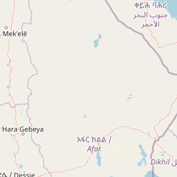
Map view of Yoboki National Park

Use this park location map to pinpoint Yoboki National Park in Djibouti, understand its exact geographic position, and read its mapped placement within the surrounding landscape more clearly.

Pigeon | © OpenStreetMap contributors
Park atlas

Explore adjacent protected landscapes and compare their unique geographic characteristics across Eastern Africa.

Discover Other National Parks and Protected Areas Near Yoboki National Park, Djibouti

Explore other national parks and protected areas in Djibouti and the broader Horn of Africa, expanding your geographic understanding beyond Yoboki National Park's diverse terrain. This comparison view helps trace the regional spread of conservation landscapes, mapping how distinct mountain, desert, and valley environments are protected across the region.
National parkTadjourah Region
About 71 km away#1 closest

Northeast

Day Forest National Park: Ancient Juniper Woodland and Protected Landscape in Djibouti

Discover a rare East African forest refuge with unique endemic species.

Day Forest National Park represents a critical ecological island within Djibouti's predominantly semi-desert geography. As the nation's oldest national park, it protects the largest remaining East African juniper forest, a vital sanctuary for species found nowhere else on Earth. Located in the Goda Mountains of the Tadjourah Region, its existence relies on rare localized rainfall, creating a distinctive mountainous forest environment that offers profound insights into protected landscape dynamics and regional biodiversity.

Area
15 km²
Established
1939
IUCN
II
Relief
Mountain
National parkAfar Region
About 119 km away#2 closest

West

Yangudi Rassa National Park: Protected Semi-Desert National Park in Afar Region

Mapped landscape and dryland ecosystems.

Yangudi Rassa National Park represents a critical protected area within Ethiopia's Afar Region, covering extensive semi-desert and grassland terrains. The park's geography is marked by Mount Yangudi and the broad Rassa Plains, with the Awash River shaping its riverine forests and marshes. This national park offers a unique insight into dryland ecosystems and their conservation, providing a distinct mapped landscape for geographic study and exploration.

Area
4,731 km²
Established
1969
IUCN
II
Relief
Mixed relief
National parkSomalia
About 348 km away#3 closest

Southeast

Ga'an Libah National Park: A National Park's Protected Landscape and Geographic Context

Explore its mapped boundaries and regional geography.

Ga'an Libah National Park, designated as a national park, offers a distinct focus on its protected landscape and geographic identity. This resource details the mapped extent and regional context of the park, contributing to a structured understanding of its natural terrain and protected area significance. Users can explore its specific geography and atlas positioning without travel planning details.

National parkEthiopia
About 349 km away#4 closest

Southwest

Awash National Park: Mapped Protected Boundaries and Ethiopian Regional Geography

Discover the protected landscape of this Ethiopian National Park.

Awash National Park represents a significant protected area within Ethiopia, offering a rich focus for geographic discovery. This page illuminates the park's specific mapped boundaries and its positioning within the surrounding regional geography. It serves as a detailed entry point for understanding the park's landscape character and its role as a national park in East Africa.

Area
850 km²
Established
1966
IUCN
II
Relief
Mixed relief
National parkAmhara Region
About 436 km away#5 closest

Northwest

Simien Mountains National Park: National Park Protected Landscape and Regional Geography

Explore Amhara Region's distinct mountain terrain and park boundaries.

Simien Mountains National Park serves as a key protected landscape within the Amhara Region of Ethiopia. This national park offers a distinct geographic identity, characterized by its unique terrain and mapped natural boundaries. Understanding this park provides valuable context for regional geography and the broader atlas of protected areas in northern Ethiopia.

Area
412 km²
Established
1969
IUCN
II
Visitors
26K annual
National parkEritrea
About 506 km away#6 closest

Northwest

Dahlak Marine National Park: Eritrea National Park Mapping and Protected Marine Landscape

Explore its Red Sea geography, coral ecosystems, and marine wildlife.

Delve into Dahlak Marine National Park, a premier protected marine area located off the coast of Eritrea. This national park preserves extensive coral reef formations, critical seabird nesting islands, and important mangrove zones within the Red Sea. It is renowned for supporting over 325 species of fish, providing sanctuary for nesting sea turtles, and being one of the few Red Sea locations where dugongs are found. The park's unique geography and marine biodiversity offer a compelling atlas-style exploration of protected landscapes in the Horn of Africa.

IUCN
II
Relief
Lowland
Access
Highly restricted
Scope
Marine
National parkArsi Zone
About 508 km away#7 closest

Southwest

Arsi Mountains National Park: Protected Ethiopian Highlands Landscape & Geography

Mapped protected terrain and endemic species habitat within the Arsi Zone.

Arsi Mountains National Park is a vast protected area celebrated for its significant biodiversity and distinctive Afro-alpine ecosystems. Situated in the Arsi Zone, this national park encompasses a dramatic mountain landscape central to the Ethiopian Highlands. It serves as a crucial refuge for endangered endemic species, including the mountain nyala and Ethiopian wolf, within its varied ecological zones and protected park boundaries, offering rich context for geographic exploration.

Area
10,876 km²
Established
2011
IUCN
II
Relief
Mountain
National parkBale Zone
About 546 km away#8 closest

Southwest

Bale Mountains National Park National Park: Explore Protected Landscape and Regional Geography

Mapped boundaries and natural terrain context for this Ethiopian park.

Delve into Bale Mountains National Park, a designated national park in Ethiopia's Bale Zone, focusing on its role as a vital protected landscape. This page offers detailed insights into the park's mapped boundaries and its contribution to the regional geography, providing a foundation for structured atlas exploration of protected areas and natural terrain. Understand the geographic significance and landscape identity of this key conservation entity within the broader context of Ethiopia's natural heritage.

Area
2,220 km²
Established
1970
IUCN
II
Relief
Mountain

Common questions about visiting, size, designation, and location context for Yoboki National Park

Yoboki National Park FAQs for park facts, access, geography, and protected area context

Find quick answers about Yoboki National Park, including protected-area facts, park geography, trail and visitor context, and how the park fits into its surrounding country and regional landscape.
MoriAtlas Explorer

Continue Your Protected Areas Search Across the Global Atlas

Deepen your exploration by continuing the structured search for national parks and protected areas worldwide. Utilize the comprehensive filtering capabilities to compare different conservation landscapes and refine your understanding of global park geography. Discover more about the distribution and characteristics of protected natural areas.

Global natural geography