
Mori Atlas logo
Protected landscapeŽelechovické paseky

A mosaic landscape of traditional meadows, dispersed woodland, and historical settlement patterns

Želechovické paseky Protected Landscape in the Carpathian Foothills of Zlín District

(Přírodní park Želechovické paseky)

Located on the southeastern outskirts of Zlín, the Želechovické paseky protected landscape spans over 1,000 hectares of diverse Carpathian foothill terrain. This area preserves a unique mosaic of meadows, orchards, and scattered forests shaped by historical land use. Its geography creates a vital ecological link between the urban edge of the Zlín District and the wider protected regions of the Vizovické vrchy.

natural parkMoravian CarpathiansWhite Carpathians foothillspaseky landscapemosaic landscapemeadows and pastures
A flat-style digital illustration depicting a meadow in the foreground leading toward a tall, flat-faced cliff or hill in the distance, framed by stylized trees on both sides under a sunset sky.

Želechovické paseky

Protected landscape

Park overview

Structured park overview, official facts, and landscape profile for Želechovické paseky Natural Park

Želechovické paseky Natural Park park facts, protected area profile, and essential visitor context

Review the core facts for Želechovické paseky Natural Park, including designation, size, terrain, visitor scale, habitats, and operating context in one park-focused overview.

About Želechovické paseky Natural Park

Želechovické paseky is a natural park (přírodní park) on the southeastern edge of Zlín, in the Zlín District of the Zlín Region in eastern Moravia. It encompasses approximately 1,048 hectares of terrain that falls within the cadastral areas of Kudlov, Jaroslavice, and Želechovice nad Dřevnicí, occupying the transitional zone between the Zlín basin and the rising foothills of the White Carpathians (Bílé Karpaty).

The defining feature of the park is not a single dramatic habitat but rather the landscape mosaic created by historic human use. The Czech word 'paseky' refers to forest clearings and the dispersed hamlets that grew along them; in this area, the 'pasekářský' style of settlement and land use shaped the terrain long before any formal protection was established. Fields, meadows, pastures, orchards, woodland patches, roads, and isolated cottages were arranged in patterns dictated by that tradition, producing an intricate alternation of open and wooded ground.

The park's boundaries follow a mix of infrastructure and natural features. The eastern boundary largely coincides with road III/49020, which is also the border of the larger Vizovické vrchy Natural Park. The Vidovka stream in Zelené údolí (Green Valley) and additional road segments form sections of the perimeter, while the southern border is partly defined by the Želechovice nad Dřevnicí / Provodov cadastral boundary and a forest path running between local localities Klenčov and Pindula, connecting to road II/490. The western edge follows road II/490, then continues northwest along a ridge path through the local places known as Vavrušky and the hill Ubica before returning to the Želechovice nad Dřevnicí built-up area.

Ecologically and culturally, Želechovické paseky belongs to the family of protected landscape mosaics typical of the Moravian Carpathians. While it is not a national park and does not aim to preserve wilderness, its status as a natural park is meant to maintain the character that nature, settlement history, and traditional land use together created. Local landmark views include the landscape visible from the Obůrky locality, wooded meadows, and old cottages such as the historic Sousedíkova chalupa. Sheep grazing remains part of current land use, continuing the pastoral pattern that defines the visual identity of the area.

Quick facts and research context for Želechovické paseky Natural Park

Želechovické paseky is a regional natural park in the Zlín Region of eastern Moravia, Czech Republic. It occupies about 1,048 hectares across the cadastral territories of Kudlov, Jaroslavice, and Želechovice nad Dřevnicí, on the southeastern outskirts of the city of Zlín. The area lies in the foothills of the White Carpathians, at the meeting point between upland forest landscapes and traditional Carpathian agricultural mosaic. Its eastern boundary adjoins the larger Vizovické vrchy Natural Park, forming part of a connected network of protected rural Carpathian landscapes in the region.

Protection and recognition

Documented management scope and conservation standing for Želechovické Paseky

Želechovické Paseky Protection Status and Terrestrial Conservation Data

Želechovické Paseky maintains a defined terrestrial protection status and administrative framework within conservation records. Structured records compile available designation history, management scope, and international recognition details.

Protection details

Protection scope
Terrestrial
Transboundary protection
No
Park context

Deeper park guide and search-rich context for Želechovické paseky Natural Park

Želechovické paseky Natural Park history, landscape, wildlife, and travel context

Explore Želechovické paseky Natural Park through its history, landscape character, ecosystems, wildlife, conservation priorities, cultural context, and seasonal travel timing in a structured park guide built for atlas discovery and search intent.

Why Želechovické paseky Natural Park stands out

Želechovické paseky is best known for its mosaic Carpathian landscape pattern, in which small meadows, pastures, and clusters of woodland alternate with traces of the traditional 'paseky' dispersed-settlement culture of the Moravian foothills. It is also notable for serving as a buffer and complement to the adjacent Vizovické vrchy Natural Park, together preserving the cultural and ecological continuity of the White Carpathian foothills east of Zlín.
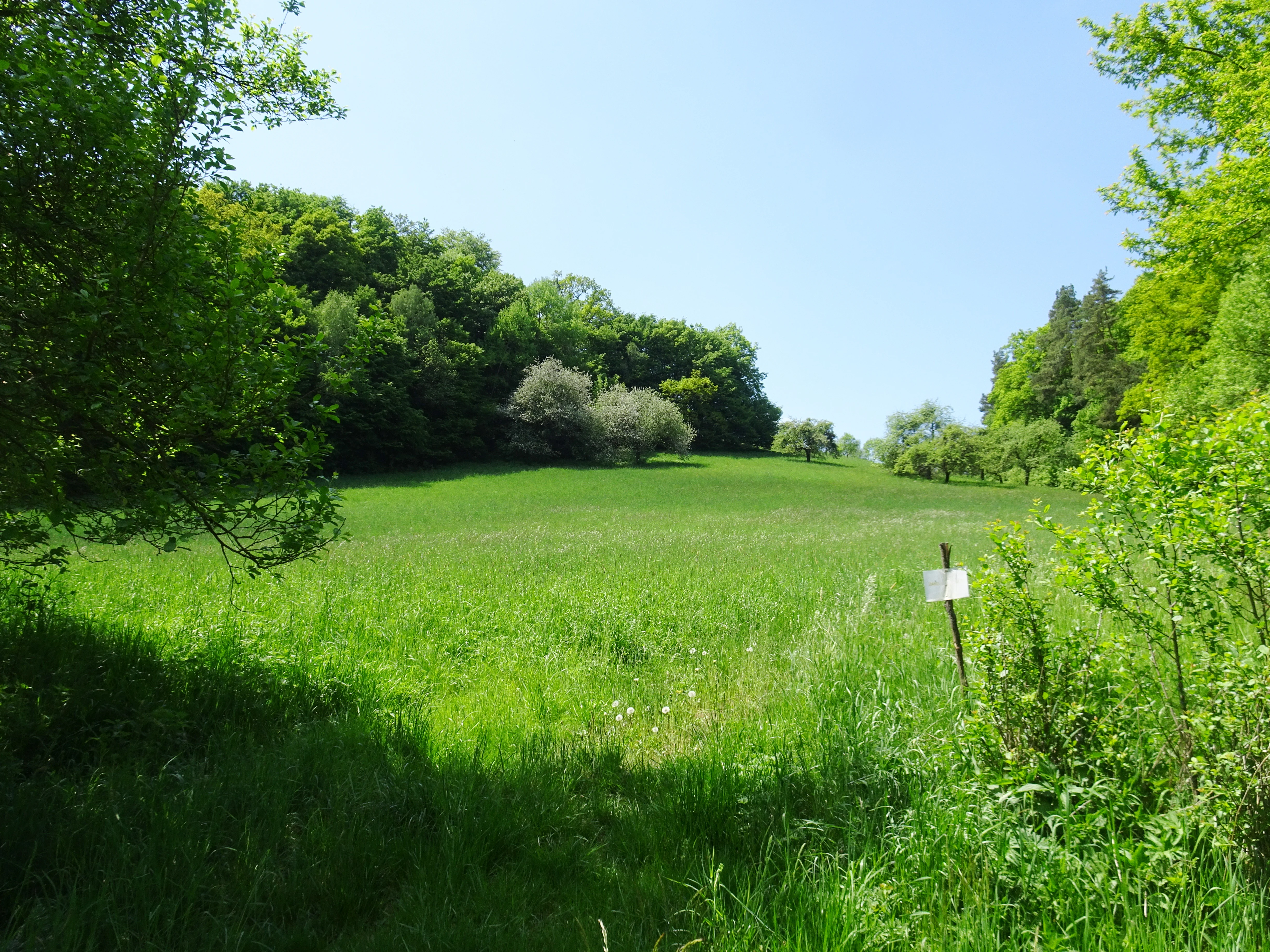
A wide, grassy meadow in spring, bordered by lush green deciduous trees and shrubs under a clear blue sky, with a small trail marker visible on a post.
A green meadow surrounded by forest in Zelechovicke paseky.

Želechovické paseky Natural Park history and protected-area timeline

The historical evolution of Želechovické paseky is inseparable from the broader pattern of Carpathian foothill colonization in eastern Moravia. For centuries, the area was shaped by the 'paseky' settlement and land-use tradition, in which settlers established small clearings within otherwise forested terrain, building dispersed hamlets and working the surrounding meadows and pastures rather than creating large consolidated villages.

Over time, this dispersed-settlement pattern produced the distinctive mosaic of roads, cottages, fields, meadows, woodland patches, and connecting paths that still defines the area. Old cottages such as the Sousedíkova chalupa document this longer settlement history, and the network of forest paths, ridge routes, and local lanes was built gradually as part of the everyday economy of these foothill communities.

The formal protection of the area as a přírodní park (natural park) reflects a regional recognition that this combined natural-cultural landscape has heritage value that would not be preserved by ordinary agricultural or forestry practice alone. The establishment of the park also positioned the territory as a complement to the larger Vizovické vrchy Natural Park immediately to its east, extending the protected mosaic of Carpathian foothill landscapes near Zlín.

Želechovické paseky Natural Park landscape and geographic character

The landscape of Želechovické paseky is shaped by the transition between lowland basin terrain around Zlín and the rising foothills of the White Carpathians. Elevations remain in the lower foothill range characteristic of the area east of the city, with hills such as Ubica forming visible anchor points along the park's northwestern ridge route.

The terrain is structured as an alternation of small valleys, ridge paths, and gently sloping ground. Small watercourses, including the Vidovka stream in the section of Zelené údolí (Green Valley), carve the eastern zone, while the central and western parts of the park are laced with historical forest paths linking local places such as Klenčov, Pindula, Vavrušky, and the Obůrky viewpoint area.

Visually, the landscape is dominated by its mosaic quality: no single large stand of continuous forest or single open plain dominates the scene. Instead, pastures, meadows, orchards, scattered woodland, lanes, and isolated cottages form an interwoven pattern. Long-distance views from elevated points such as Obůrky reveal this patchwork against the backdrop of the surrounding Carpathian foothills, while closer in, visitors encounter old wooden cottages, woodland edges, and the soft transitions between cultivated and natural ground that define the 'paseky' identity.
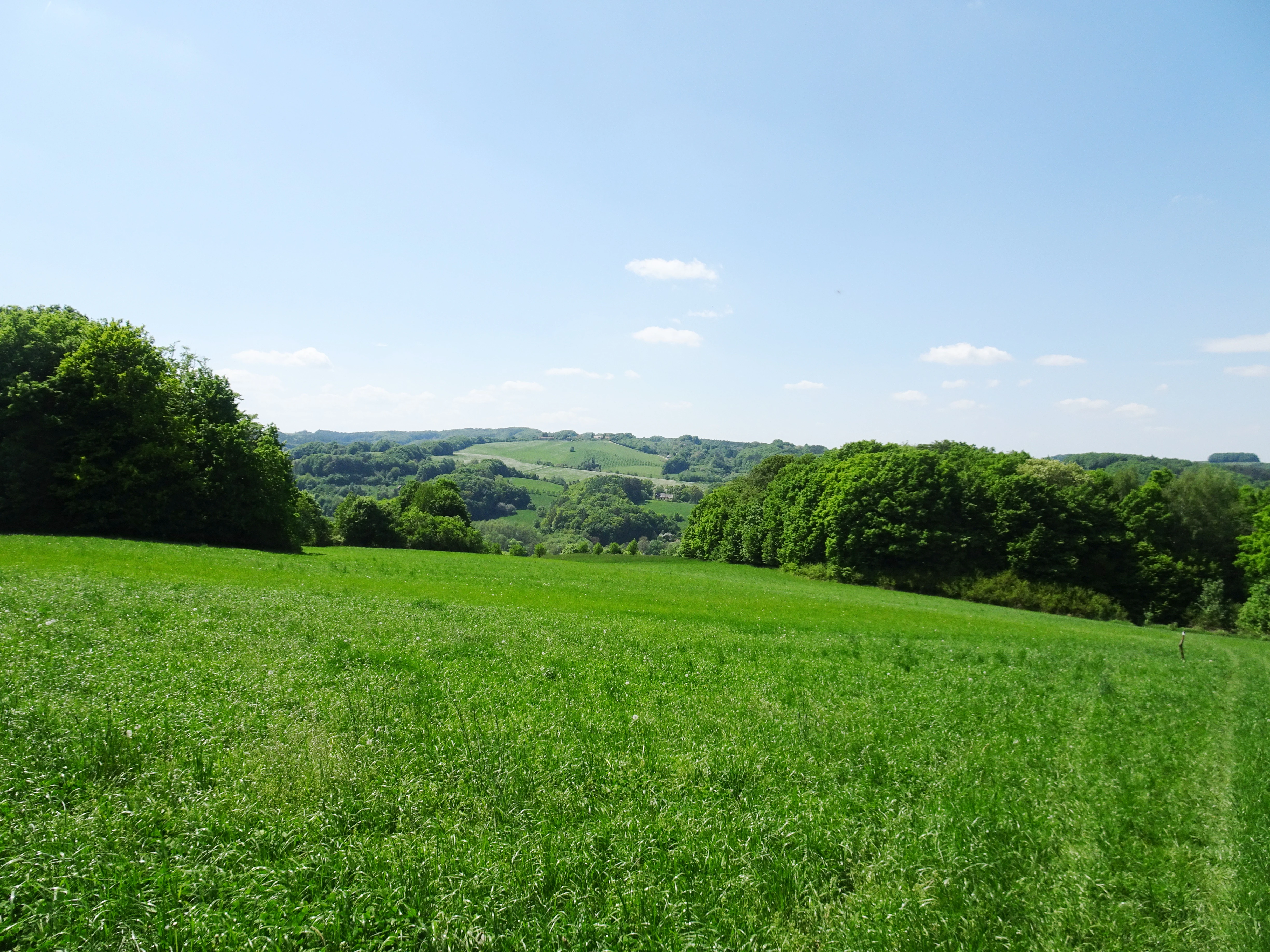
A wide view of a vibrant green meadow sloping down toward a valley, flanked by dense patches of deciduous forest under a clear blue sky.
Rolling green landscape of the Zelechovicke paseky protected area in Czechia.

Želechovické paseky Natural Park ecosystems, habitats, and plant life

Because Želechovické paseky is a regional natural park designed to preserve a cultural-natural mosaic rather than a single ecological unit, its nature is characterized by habitat diversity within a small area rather than by any one dominant ecosystem. Open meadow and pasture habitats, small woodland blocks, hedgerow-like transitions, orchard remnants, and stream valleys all occur within close proximity.

The habitats supported by this mosaic include species-rich meadows that depend on continued mowing or grazing, traditionally managed pastures where sheep - still present in the area - help maintain open ground, and woodland patches that act as ecological stepping stones between the larger forest blocks of the White Carpathians and Vizovické vrchy uplands. Stream corridors such as the Vidovka valley add riparian and moist-ground vegetation to the mix.

Ecologically, the park functions as a connective landscape element rather than a self-contained nature reserve. Its value lies in the continued coexistence of multiple habitat types in close proximity, which sustains a richer flora and fauna than any one of the constituent habitats could support in isolation, and which maintains habitat connectivity between the protected landscapes of the Zlín foothills.
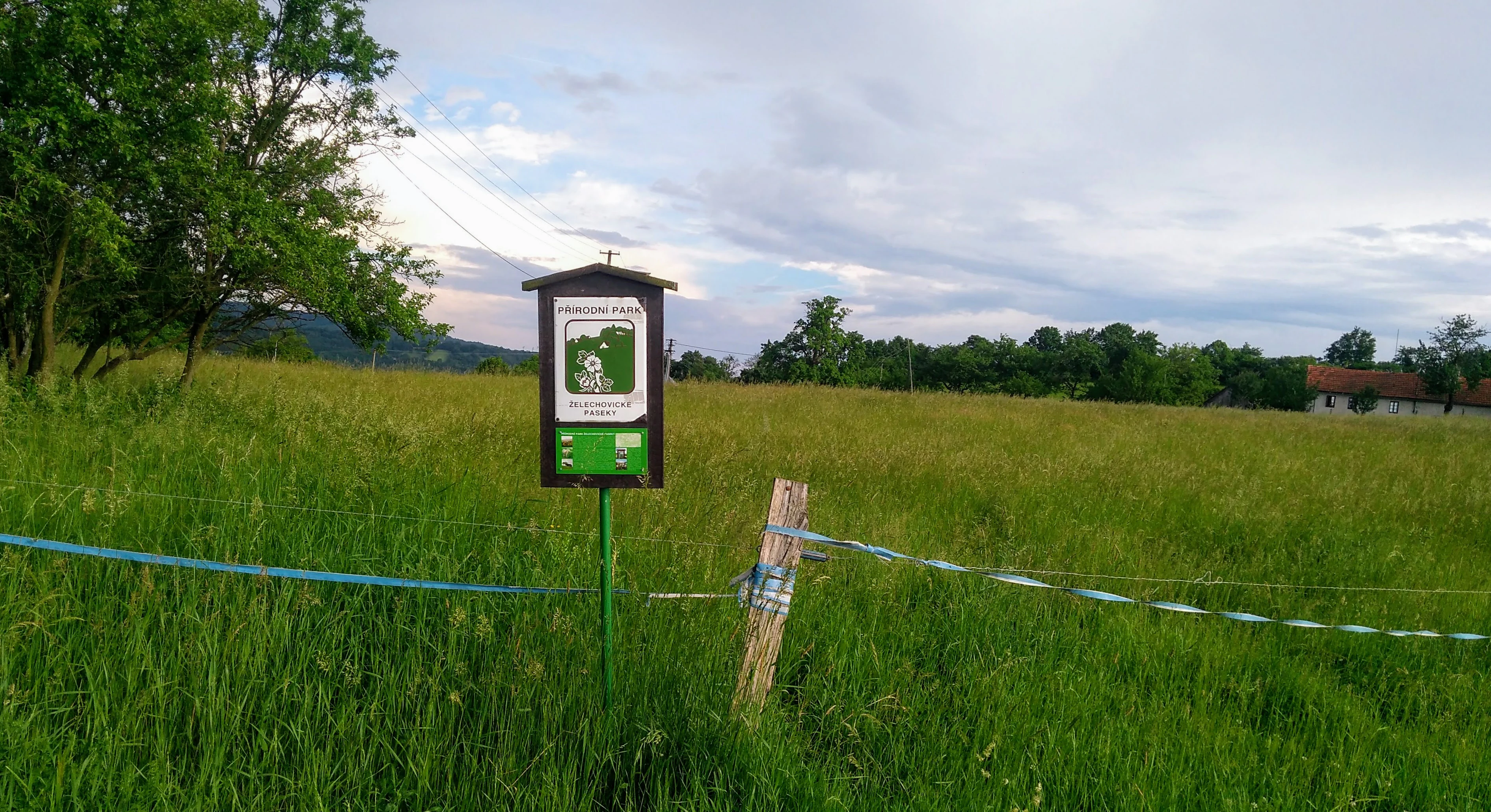
A green and white sign marking the nature park stands in a lush green meadow, with a makeshift fence and trees in the background under a cloudy sky.
A park identification sign in the meadows of Želechovické paseky.

Želechovické paseky Natural Park wildlife and species highlights

The wildlife profile of Želechovické paseky reflects the mosaic character of its habitats rather than focus on any single charismatic species. The mix of meadows, pastures, woodland, and stream corridors supports the typical fauna of Moravian Carpathian foothills, including small mammals, typical lowland-to-foothill bird communities, and a continuing pastoral presence through sheep husbandry on the area's meadows.

Birdlife benefits from the alternation of open and wooded ground, which provides nesting, feeding, and shelter conditions close together. Forest-edge species, agricultural-landscape birds, and stream-valley fauna can all be expected to occur within the relatively short distances characteristic of the park. The continuing traditional land use, including livestock grazing, helps maintain the open-ground conditions on which much of this wildlife depends.
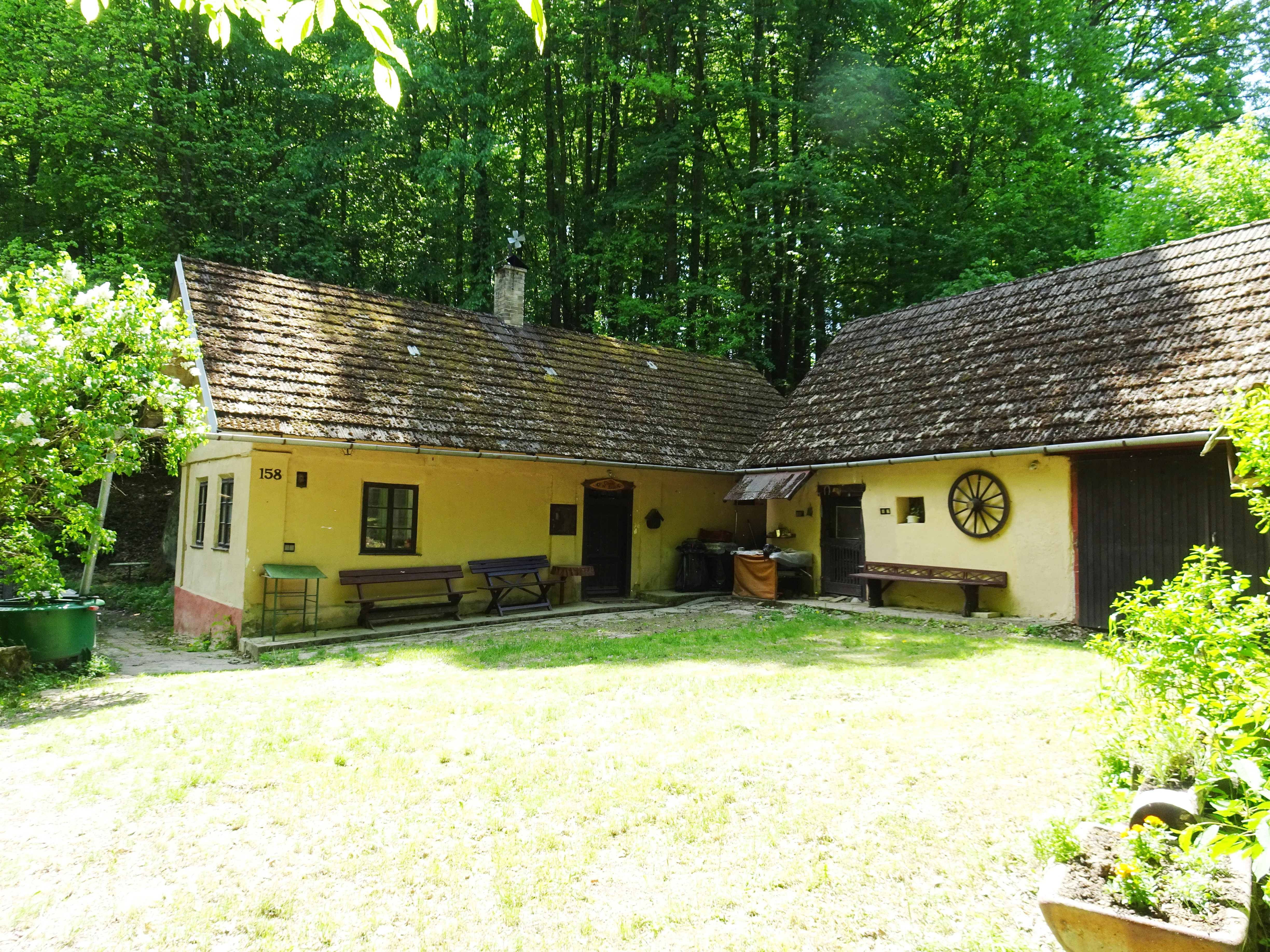
A rustic yellow historic cottage with a brown tiled roof and wooden wagon wheel decoration, situated in a green, wooded setting.
A historic cottage in the Zelechovicke paseky landscape area.

Želechovické paseky Natural Park conservation status and protection priorities

As a přírodní park (natural park), Želechovické paseky is a regionally designated protected landscape in the Czech system. Its conservation purpose is not the strict preservation of wilderness but the maintenance of the combined natural and cultural character of the area as it has evolved through the 'paseky' settlement tradition. The aim is to keep the mosaic of meadows, pastures, woodland, and dispersed settlement intact as a recognizable regional landscape type.

The park has clear ecological value as one element of a larger protected system east of Zlín. By adjoining the Vizovické vrchy Natural Park along its eastern boundary, it extends the continuity of protected foothill landscape and contributes to habitat connectivity in the White Carpathian transition zone. Its protected status also serves as a framework under which local land use - including continued grazing and traditional management of meadows and cottages - can continue in a form consistent with the area's ecological and visual identity.

Želechovické paseky Natural Park cultural meaning and human context

The cultural identity of Želechovické paseky is rooted in the 'paseky' dispersed-settlement tradition of the Moravian Carpathians. In this tradition, families cleared small sections of forest to build isolated homesteads and work the surrounding ground, producing a settlement pattern in which cottages and hamlets are scattered across the landscape rather than concentrated in compact villages. This pattern, combined with its associated economy of meadows, pastures, and small fields, is the core cultural feature of the area.

Surviving elements of this heritage include old wooden cottages such as the Sousedíkova chalupa, the network of forest paths and ridge roads connecting isolated localities, and the continuing practice of livestock grazing - notably sheep - on the park's meadows. These features link the park not only to Czech nature protection but to the broader regional identity of the Zlín district and the White Carpathian foothills, where rural Moravian heritage and natural landscape are tightly interwoven.

Top sights and standout views in Želechovické paseky Natural Park

A mosaic landscape of meadows, pastures, scattered woodland, and dispersed old cottages shaped by the traditional 'paseky' Carpathian settlement pattern.

Anchored in the foothills of the White Carpathians east of Zlín, with stream valleys, ridge paths, and viewpoints such as Obůrky offering characteristic foothill scenery.

Functioning as a connective landscape between the city of Zlín and the Vizovické vrchy Natural Park, joining a wider network of protected Carpathian foothill landscapes in the Zlín Region.

Best time to visit Želechovické paseky Natural Park

Želechovické paseky is best experienced when its mosaic character is most visible, that is, during the warmer months when meadows are green or in flower and pastures are actively grazed by sheep. Late spring and early summer typically offer the richest meadow aspect, while early autumn gives more open views from elevated points such as Obůrky as vegetation thins. In winter, the mosaic pattern becomes more skeletal, with woodland, bare meadows, and cottage clusters standing out against lowland mist or occasional snow.


Monthly climate preview

Measured monthly temperature ranges and precipitation patterns across the protected landscape

Želechovické paseky Climate Normals and Long Term Weather Rhythms

Long term data from 1991 to 2020 records documented shifts in average monthly temperatures and daily precipitation rates at a representative coordinate within Želechovické paseky. Examining the complete twelve month statistical profile reveals full variations in regional thermal conditions and precipitation distribution.
Annual mean9 °C
-3 °C20 °C
Jan-3°
Feb-1°
Mar
Apr
May14°
Jun18°
Jul20°
Aug20°
Sep15°
Oct
Nov
Dec-2°
Warmest month
July

20.3 °C

Coolest month
January

-3.4 °C

Wettest month
July

2.6 mm/day

Driest month
February

1.3 mm/day

Park location guide

Geography guide, regional context, and park location map for Želechovické paseky Natural Park

Želechovické paseky Natural Park park geography, regions, and map view in Czechia

Understand where Želechovické paseky Natural Park sits in Czechia through a broader geographic reading of the surrounding landscape, nearby location context, and its mapped position within the national park landscape.

How Želechovické paseky Natural Park fits into Czechia

Czech Republic is a landlocked Central European country with a population of approximately 10.9 million people. The nation was established as an independent state on January 1, 1993, following the dissolution of Czechoslovakia. Its capital and largest city is Prague, with other major urban centers including Brno, Ostrava, Plzeň, and Liberec.

Wider geography shaping Želechovické paseky Natural Park in Czechia

The Czech Republic is a landlocked country in Central Europe. It is bordered by Germany to the west, Austria to the south, Poland to the northeast, and Slovakia to the southeast. The landscape is predominantly hilly, with the territory covering 78,871 square kilometers.

Map view of Želechovické paseky Natural Park

Use this park location map to pinpoint Želechovické paseky Natural Park in Czechia, understand its exact geographic position, and read its mapped placement within the surrounding landscape more clearly.

Pigeon | © OpenStreetMap contributors

Location context for Želechovické paseky Natural Park

Zlín District

Explore the mosaic terrain, Carpathian foothills, and traditional protected landscapes of Želechovické paseky through detailed photography.

Visualizing Želechovické Paseky: Landscape Photos and Scenery

Examine comprehensive Želechovické paseky photos and imagery capturing the distinctive mosaic of meadows, scattered woodlands, and historical dispersed settlements across the White Carpathian foothills. Visual records provide deep insight into the terrain, stream valleys, and protected landscape character defining the Moravian border region.

A wide, grassy meadow in spring, bordered by lush green deciduous trees and shrubs under a clear blue sky, with a small trail marker visible on a post.

A flock of white sheep grazing on a green meadow in front of a dense forest.

A wide view of a vibrant green meadow sloping down toward a valley, flanked by dense patches of deciduous forest under a clear blue sky.

A green and white sign marking the nature park stands in a lush green meadow, with a makeshift fence and trees in the background under a cloudy sky.

A rustic yellow historic cottage with a brown tiled roof and wooden wagon wheel decoration, situated in a green, wooded setting.

Park atlas

Compare adjacent Moravian Carpathian terrain and connected regional foothill reserves.

Other Parks Near Zelechovicke Paseky and Surrounding Protected Landscapes

Browse protected areas and natural parks located near Zelechovicke Paseky to evaluate broader Moravian Carpathian terrain. Geographic comparison reveals how surrounding foothill reserves preserve connected regional landscapes and traditional valley settlement patterns.
A watercolor painting depicting a wide, soft-toned landscape with rolling green hills, a cluster of trees on a small rise, and forested areas in the background.
Natural monumentZlínský kraj
About 1.3 km away#1 closest

Northeast

Na želechovických pasekách Natural Monument: Geographic Context and Botanical Protected Area

Located in Zlínský kraj, eastern Moravia, Czech Republic.

Na želechovických pasekách represents a significant protected area within the Czech Republic. This small natural monument safeguards light-rich deciduous woodland slopes and serves as the sole known site for specific local flora. Explore the mapped terrain and environmental boundaries of this unique botanical site nested within the broader Vizovické vrchy natural park landscape.

Area
0.011 km²
Established
1949
IUCN
IV
Relief
Upland
Natural monumentZlín Region
About 5 km away#2 closest

Southwest

Uhliska Natural Monument: Protected Stream Valley Geography and Moravian Habitats

A diverse protected wetland and meadow mosaic in the Zlín Region.

The Uhliska natural monument protects a narrow, meandering valley corridor along the Černý potok stream in eastern Moravia. This high-value habitat mosaic features wet Cirsium meadows, broad-leaved dry grasslands, and ash alder gallery forests. The site provides a critical refuge for protected butterflies of European importance, serving as an exemplary model of small-scale landscape conservation in the Zlín Region.

Area
0.143 km²
Established
1991
IUCN
IV
Relief
Upland
Watercolor illustration of a lush, green landscape featuring rolling hills and grassy meadows under a pale sky.
Nature reserveZlín District
About 16 km away#3 closest

West

Na letišti Nature Reserve: Mapped Floodplain Landscapes in the Zlín District

A rare oxbow wetland refuge in Eastern Czechia

Located in the Zlín District, Na letišti is a protected natural monument formed from a regulated meander of the Morava River. This site functions as an isolated aquatic refuge, featuring a rich community of beetles and wetland flora that define the character of this lowland floodplain landscape within the Czech Republic.

Area
0.027 km²
Established
1956
IUCN
IV
Relief
Lowland
A soft watercolor painting depicting a gentle, hazy landscape with rolling hills, scattered patches of trees, and a winding path, rendered in light green, yellow, and peach tones against a white background.
Protected landscapeCzechia
About 22 km away#4 closest

North

Hostýnské vrchy Nature Park: Protected Landscape and Carpathian Foothill Geography

Forested ridge terrain across Zlín and Kroměříž districts

Hostýnské vrchy Nature Park represents a significant protected unit in the eastern Czech Republic, characterized by its deep forested ridges and open meadow clearings. As part of the outer Western Carpathians, the area supports diverse habitats including ancient beech and mixed forest stands alongside rare orchid populations. The landscape provides a clear window into the natural geography of central Moravia, with its intricate network of small watercourses and slopes.

Area
204 km²
Established
1989
Water
Minor water
Season
Year-round
A horizontal watercolor painting showing a green wetland area in the foreground with hills and coniferous trees in the background.
Natural monumentZlínský kraj
About 30 km away#5 closest

Northwest

Rameno Moravy Natural Monument: Protected Oxbow and Wetland Geography in Zlínský kraj

Mapping floodplain habitats and riverine natural monuments.

Rameno Moravy is a significant natural monument in the Czech Republic, encompassing a unique oxbow of the Morava River. The site provides a rare example of preserved still-water wetland habitats and diverse marsh communities within the lowland geography of the Zlínský kraj, standing out as a critical botanical site in the broader river basin.

Area
0.02 km²
Established
1995
IUCN
IV
Relief
Lowland
Natural monumentJihomoravský kraj
About 31 km away#6 closest

Southwest

Miliovy louky Natural Monument: South Moravia Protected Grassland Geography

Mapping the xerothermic steppe and meadow landscape

Miliovy louky is a protected natural monument located in the Jihomoravský kraj region, noted for its surviving patch of semi-natural dry steppe vegetation. This compact reserve offers a distinct look at the region's historical open terrain, providing a critical haven for dryland flora and butterfly species amidst a backdrop of managed agricultural farmland.

Area
0.084 km²
Established
2014
IUCN
IV
Relief
Upland
Natural monumentOlomouc Region
About 32 km away#7 closest

Northwest

Vlkoš - statek Natural Monument: Geography and Protected Area Context in the Olomouc Region

Small-scale conservation in the Morava river floodplain

Vlkoš - statek is a significant natural monument comprising a single farmhouse attic that serves as a vital summer refuge for protected bat species. Situated within the flat alluvial terrain of the Olomouc Region, this site highlights the role of anthropogenic structures as key ecological components of the surrounding lowland landscape.

Established
2013
IUCN
III
Relief
Lowland
Climate
Temperate
Watercolor painting of green rolling hills and small groves of trees, with a minimalist, airy style.
Nature reserveZlín Region
About 34 km away#8 closest

South

Mechnáčky Nature Reserve: Protected Meadow Biodiversity in the Zlín Region of the Czech Republic

Orchid-rich grasslands and managed Carpathian meadow landscapes

Mechnáčky represents an important nature reserve defined by its remnant flower-rich meadows and diverse invertebrate habitats. Situated in the Zlín Region, this site provides a focused look at the conservation of traditional Carpathian landscapes, including calcareous grasslands and spring-fed slopes that define the unique botanical character of this Czech protected area.

Area
0.109 km²
Established
1982
IUCN
IV
Relief
Upland

Common questions about visiting, size, designation, and location context for Želechovické paseky Natural Park

Želechovické paseky Natural Park FAQs for park facts, access, geography, and protected area context

Find quick answers about Želechovické paseky Natural Park, including protected-area facts, park geography, trail and visitor context, and how the park fits into its surrounding country and regional landscape.
MoriAtlas Explorer

Continue Your Protected Areas Search Across the Global Atlas

Deepen your exploration by continuing the structured search for national parks and protected areas worldwide. Utilize the comprehensive filtering capabilities to compare different conservation landscapes and refine your understanding of global park geography. Discover more about the distribution and characteristics of protected natural areas.

Global natural geography